Cancel

    Open app

    Search

    Berme Road Park

    3.0 (1 review)

    Berme Road Park Photos

    Recommended Reviews - Berme Road Park

    Your trust is our priority, so businesses can't pay to alter or remove their reviews. Learn more about reviews.
    Yelp app icon
    Browse more easily on the app
    Review Feed Illustration

    2 years ago

    Helpful 3
    Thanks 1
    Love this 6
    Oh no 0

    Verify this business for free

    People searched for Parks 701 times last month within 15 miles of this business.

    Verify this business

    VerKeerderkill Falls

    VerKeerderkill Falls

    4.6
    (12 reviews)
    3.2 mi

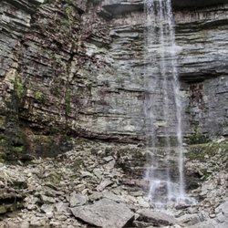
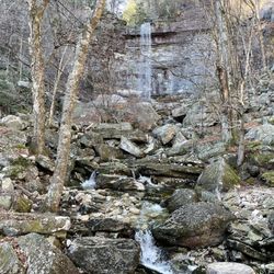
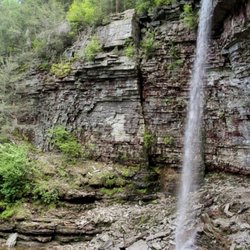
    This is a 6.8 mile (10.9 kilometers) moderately challenging hike (1,007 feet elevation gain) at…read moreMinnewaska State Park Preserve. Highlights of the trail are Sam's point, Ice cave and lastly Verkeerderkill falls. At Sam's point there are dramatic overlooks and spectacular cliff views, A photographer's paradise. Ice cave was amazing, we had to go through some crevices, my headlamp was very useful at those dark areas and footpath, I noticed remnants of ice inside even at the start of summer (that's when I did the hike), did a little rock scrambling outside the cave, there was an extraordinary ridge overlook at the end of the cave and a fantastic view from a large rock outcrop. The most challenging and strenuous part was the hike from the Ice cave to Verkeerderkill Falls - rocky, narrow, lengthy, uneven, wet, slippery, stream-like path, trekking poles and waterproof hiking boots was a big help to endure the trail. Verkeerderkill falls is a spectacle to see, there are a few ridges, escarpment, and ledge spots (somewhat perilous as all were near the drop-off) to rest and view the falls (I found a good spot facing the falls while hydrating, snacking and replenishing my energy). A solid day's workout, this is everything I could ask for from a great recreational, adventurous, stimulating hike with mother nature.

    Very interesting and fun hike. Me and my friends hiked for 5 hours total. We've visited the ice…read morecaves and the waterfalls . Didn't make it to the lake because it started to thunderstorm. The hike to the waterfall is long so pack a lot of water. Also if it didn't rain before , the waterfall will be very light. In general it's a perfect place to connect with nature and cool down inside the ice caves. P.s. you still can see big chunks of ice deep down in the caves.

    Photos
    VerKeerderkill Falls
    VerKeerderkill Falls
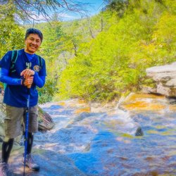
    I had an amazing hike today!

    See all

    I had an amazing hike today!
    Sam's Point Area

    Sam's Point Area

    4.7
    (44 reviews)
    3.2 mi

    Very cool visitor's center with a lot of info and taxidermied animals. If you are hiking,…read moredefinitely bring waterproof shoes or crocs in sport mode because the path to the waterfall crosses a stream. Unfortunately, there's no man made bridge over it on the way. I'd recommend wearing long pants even in the summer because there's a lot of bushes that may scratch your legs on the way. Seems like the paths through the woods are pretty narrow. Maybe I'll come another time when it's blueberry season. Amazing views, just don't fall off!

    Boyfriend and I wanted to come here for over a year now. Last year we went to a different spot of…read morethe Minnewaska, and the view did not disappoint. Since the parking lot isn't big (more or less 60 cars), you need to make a reservation to get in. And they are strict about this. We wanted to come in one time and they made us turn around. I am not sure if you need a reservation if you are visiting during the week, but you definitely need one for the weekend visit. Making a reservation is relatively easy. You go to the park's website (newyorkstateparks.reserveamerica.com) and just find or enter the park, or google this park and the top link should get you there directly. The reservation is $10 per car (plus tax/ optional donation). You can choose either 9am-2pm or 2pm-evening slot. My boyfriend is not an early riser, so I booked us the 2pm slot. I don't know how fast the reservations sell out, but I booked our slot 6 days in advance just in case. When you get there, you need show your reservation to the employees. I think it is until a certain hour, because when we were back from our hike and leaving around 430-5pm the employees guarding the entrance were gone. There is a building where you can get a free map and brochures, a little gift shop (pins for pin collectors and stickers), bathrooms, water refill area, and a big room full of facts about the area and a table with a topographic 3D map of the hikes. There is over 15miles of trails to hike available. The map is interactional, you press a button with a hike you're interested in and the map lights up with the path. Pretty cool! My boyfriend isn't an experienced hiker or does not like to hike all day as I.... so we choose the 3miles loop. The path wasn't paved, but it was smooth enough for strollers to go on. We started from the direction of Sam's point and continued by the water and cell phone towers back. Once you come in you are walking up (not very steep) path in a forrest. about half a mile I think you see the rock formation where people go on to see the view. We found some rocks below that formation and took some photos there. We were all alone, so it wasn't embarrassing to set up a tripod and take as many photos and as funny ones as we wanted. About another .2miles you go up to the official "Sam's Point" overview. It was semi crowded, so we were grateful we found a non populated spot a little below. Same view. Continuing you walk through the path and on both sides you have not so tall (maybe 8-12 feet) trees and other greenery. Everything has a placket, which labels the type of tree/ plant that grows nearby. There is an area with dead trees, which combined with some dark clouds that passed up at the same time - looked pretty eerie! Like from a spooky movie. Then you pass a body of water. We saw mama and baby ducks swimming past us. Then you just walk through other various sights, like forrest with a some ferns, forrest without them, passing by what is left of Berry Picker Cabins, and the cell phone towers, until you reach the exit. I am definitely coming back! My boyfriend and I been here for 2 years in a row, so we are probably going to make this our new annual trip. The view of the mountains is truly incredible, especially for someone living in the middle of NYC haha. It is always a great joy to get out and see something this amazing that nature formed. Loved every minute of it!

    Photos
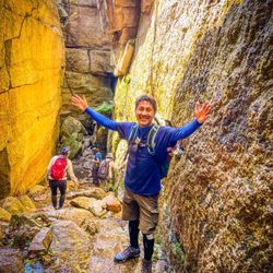
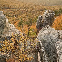
    My hiker's pose at Sam' Point.
    My hiker's pose at Sam' Point.
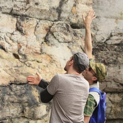
    Ice Caves | Instagram: @telephonesmoothie
    Ice Caves | Instagram: @telephonesmoothie
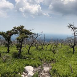
    The view!

    See all

    The view!
    Franklin D. Roosevelt Mid-Hudson Bridge

    Franklin D. Roosevelt Mid-Hudson Bridge

    4.2
    (10 reviews)
    2.0 mi

    There's something about the Mid-Hudson Bridge that stands out, and it's the structure, design, and…read morealso the LED lights at night. It's well supported and every time we've driven across it, we've never had any issues. The bridge only contains three lanes, and the middle lane is only served during rush hour in the morning (east) and in the late afternoon until the evening (west). During this time, a lot of traffic will occur especially when merging together from each side. Dealing with this procedure on a regular basis will eventually build in, and get the hang of it. The Ez-Pass is fully electronic now which will move things quicker when approaching eastbound. To end, there is a walkway on the side that's part of the Walkway Loop Trail. A great bridge with a lot of history and useful details.

    Everybody has their version of a "happy place." For me, that "happy place" has always been the…read moreHudson Valley. When I was a kid, my parents took regular trips up to the FDR homestead in Hyde Park (my late mother was a staunch Republican, but she was a big admirer of Eleanor Roosevelt), the Vanderbilt Mansion (as a kid, I used to think I'd like to live in just such a grand palace someday, with its breathtaking views of the Hudson River below and the mountainous landscapes beyond...well, maybe in another life!), West Point, and an antiques fair every October in Salisbury, CT. Even as a restless kid with a short attention span, I loved our car rides up there and thought of the region as the epitome of nature's majestic grandeur and calming, historic beauty-- as far as I'm concerned, if God does exist, he exists in the Hudson Valley (although the residents of the City of Poughkeepsie or the City of Newburgh might tend to disagree with me). When I was in grade school, we were close enough geographically to the area to enable our class to take field trips upstate, and we always came across this bridge. I never paid much attention to how we got to the bridge, but I remember vividly the slanting, sloping ride down from the tolls to the bridge itself. Years later, exploring the area as an adult, unsure of where I was going, I stumbled onto the Rt 9W entrance to the bridge, and was delighted at the old memories it immediately brought to mind. Taking that ride down from the tolls to the actual bridge as an adult brought back memories in the same way that listening to "The Night The Lights Went Out In Georgia" on the radio does. Talk about time machines! Its 1930 opening was attended by then-Governor, soon-to-be President Franklin Roosevelt (probably my favorite President, with apologies to Abe Lincoln, although I have to say I've just finished a biography on Ulysses Grant by Ron Chernow...which I highly recommend...that upped my admiration for that particular White House occupant appreciably...but again I digress...), and Eleanor, who cut the ribbon on the west side of the bridge (the wife of former Governor Al Smith...who lost his bid for the Presidency because of his Catholicism...cut the ribbon on the east side). It's probably wise to keep your attention focused on the road once you're on the bridge itself, but I've always been unable to keep from sneaking glances over at the glittering Hudson below, the train tracks snaking along beside it, the trees and foliage beyond (I used to take photographs at the Poughkeepsie Rural Cemetery on the east bank of the river, but you really can't see it from the bridge, even though you can clearly see the bridge from the cemetery). Reviewer Ruth H. of Milton mentions that caution is necessary if you take the exit off the bridge for Rt. 9 South, and I couldn't agree more. It's the only unpleasant aspect of the passage from Ulster to Dutchess County. If you take the exit at a time of day (or night) when traffic is relatively light (or your car has great acceleration), it's not especially dangerous. At other times, though...it's dangerous. Stress inducing, at the very least. Vehicles speeding south from the north will come bearing down on you with potentially disastrous results. She suggests continuing on to Market St., making a right, and following that route to a safer Rt. 9 exit. I've never gone that way, but I will the next time I find myself making a journey in the area. You can also go straight when you pass over the bridge, drive through the depressing urban blight of the City of Poughkeepsie (my apologies to the residents there, but that's how it struck me), and eventually enter the pastoral allure and spiritually restorative tranquility of Dutchess County's countryside-- i.e., my "Happy Place." Not just a bridge, for me...but memories. Good ones.

    Photos
    Franklin D. Roosevelt Mid-Hudson Bridge
    Franklin D. Roosevelt Mid-Hudson Bridge
    View of the Walk over the Hudson from the pedestrian path

    See all

    View of the Walk over the Hudson from the pedestrian path

    Berme Road Park - parks - Updated July 2026

    Loading...
    Loading...
    Loading...