Cancel

    Open app

    Search

    Big River Management Area

    4.3 (4 reviews)

    Big River Management Area Photos

    You might also consider

    More like Big River Management Area

    Recommended Reviews - Big River Management Area

    Your trust is our priority, so businesses can't pay to alter or remove their reviews. Learn more about reviews.
    Yelp app icon
    Browse more easily on the app
    Review Feed Illustration

    5 years ago

    Helpful 7
    Thanks 0
    Love this 8
    Oh no 0
    Photo of Ken C.
    135
    831
    3058

    4 years ago

    Helpful 7
    Thanks 0
    Love this 7
    Oh no 0

    6 years ago

    Helpful 5
    Thanks 0
    Love this 3
    Oh no 0

    6 years ago

    Helpful 3
    Thanks 0
    Love this 4
    Oh no 0

    Verify this business for free

    People searched for Hiking 1,055 times last month within 15 miles of this business.

    Verify this business

    Rhode Island Desert

    Rhode Island Desert

    4.7(3 reviews)
    0.9 mi

    This is one of those unsung RI landmarks. Way back when, there was brief talk of the new Patriots…read morestadium being built here. But alas, it's remained just a place to sled in the winter and walk around during the rest of the year. Really, not formal parking, just a handful of spots in a couple of openings. But it's a nice little getaway nonetheless.

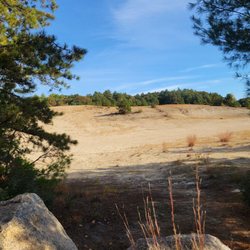
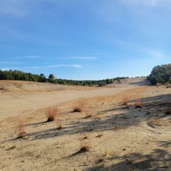
    I did not know the State of Rhode Island has it's very own Desert! Seriously, we have lived here…read morefor over a decade and I am just now finding this out? I have tried to locate exactly who is responsible for this land, checking with both the town West Greenwich town website, and the State of Rhode Island website, neither of which identifies itself as the care taker so I am unable to provide a web address for more information. That said, this place just wowed me. We lived in the actual desert at one time (AZ) and this spot is more like the dunes in SoCal than the high desert of Tucson. It's a bunch of sandy dunes undulating under the blue sky. Surrounded by woodlands, it's hidden from the road. A quick look up on the satellite map shows this is a spot for winter sledding. Sorry I missed that as a kid. First off, there are two locations: one is located on the north side of Division Street nestled between Division and Rt 95. The other is on the south side of Division Street, listed as the West Greenwich Sand Dunes. While exploring this area one bight autumn day, we came across a group of military personnel, practicing their 'jumping out of helicopter' skills. That was a very good time and there were quite a few people who brought their lawn chairs to enjoy the show, camera's in hand. We wandered around as best we could, trying to stay out of the way of the jumpers (they had targets on the ground they were supposed to land near, so this was pretty easy to do) and have returned again and again to explore more of this area and the surrounding Big River Management area woodlands. I'm sure this desert is part of said Big River Mgmt area of which you can easily find hiking information on line. The general area is popular with hikers, walkers, bikers and runners. Seriously, if you are a fan of the desert, are new to RI, or just never knew there was such a thing in this state, you have got to stop by some fine day and take a walk around. It's like being at the beach, minus the water.

    Photos
    Rhode Island Desert
    Rhode Island Desert
    Rhode Island Desert - Parachutes open, aiming for their target on the sand.

    See all

    Parachutes open, aiming for their target on the sand.

    Wickaboxet Wildlife Management Area - Fork in the road (trail)

    Wickaboxet Wildlife Management Area

    4.7(3 reviews)
    5.7 mi

    No more rattlesnakes…read more but still very cool Wickaboxet Management Area is a great hiking and nature trial that virtually nobody uses. I have been here many times in all weather and at all times of the year and seldom see any traces of people. I'm not sure why because this is a great place for a hike. The most interesting part of Wickaboxet is called Rattlesnake ledge. Perhaps at one time the place had lots of rattlesnakes but I've never seen any and I suspect they are long gone. The ledge does have lots of crevices and holes and you can easily understand why snakes would love this place. I have no compunction about crawling all over the rocks and ledges but I still try to avoid sticking my hands or head into any of the dark places. You never know if one of the snakes decided to stick around. The ledge is a great place to fool around although people do fall off on occasion. It can get slippery in snow and ice or in wet weather. Beside Rattlesnake Ledge Wickaboxet has lots of other cool things to see. If you look around you will see lots of pines trees of all different sizes. These were planted after the horrific forest fire in the 1950's that destroyed the entire area. The trees are doing well and most signs of the fire and now just a distant memory. Another cool thing to see is the remains of the old fire tower. Nothing but the cement legs are left and you have to look carefully to find it. Ironically it was destroyed in the great fire so I guess it didn't do it's job very well. The parking lot is pretty small but that doesn't matter because nobody goes here anyways. Wickaboxet isn't a very long hike, with climbing around the ledges and poking around the side trails you can do it in a couple of hours. But just checking out the views from the top of Rattlesnake Ledge makes it worthwhile. Just don't go sticking your hands into any of the holes. You never know what could still be living there.

    Great place. Lots of rocks. Rattlesnake ledge looks like a cool place to see but I'll have to do…read morethat on another trip. Lots of rocks and stone walls. Trails are pretty easy to follow. A couple of nice preserved cellar holes. Will be back soon.

    Photos
    Wickaboxet Wildlife Management Area - Woo-hoo.

    Woo-hoo.

    Wickaboxet Wildlife Management Area - Lots of ferns

    Lots of ferns

    Wickaboxet Wildlife Management Area - Rattlesnake Ledge

    See all

    Rattlesnake Ledge

    Sandy Acres Recreation Area - Viewing platform at the end of the boardwalk turn off.

    Sandy Acres Recreation Area

    4.5(4 reviews)
    3.6 mi

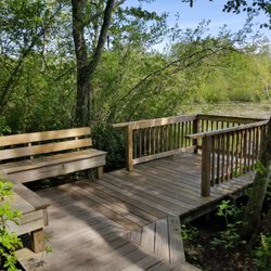
    This new parking area was installed about the same time as the new bridge on Sandy Bottom Rd. A…read moregravel parking area includes two handicapped parking spots and a trash bin. The path from parking into the wood has been washed out by rain and not easily traversed at this time, but doable for the sure footed. Once at the edge of the wood a boardwalk takes you over a wetland area. Turn at the intersection to a viewing platform over looking the pond. The boardwalk feeds out to pathways covered in mulch. These paths are not blazed in this area and criss-cross one another at a variety of angles. Some paths follow the edge of the pond and lead to a yellow blazed trail. One bench off the yellow trail over looks the pond. This trail connects with the Coventry Greenway. The area includes fields and glades. Plenty of dragonflies and other critters abound. It makes a nice walk on a sunny day providing plenty of dappled shade. Trails include roots and other small obstacles in places - depending on which trail you take. There are signs stating you must clean up after your furry companions. I saw two animal waste bags sitting on the edge of the trail. That is only half of the assignment! Those bags are intended to be tossed into the trash bin in the parking lot. Please don't leave your dog waste on the trail. Leave only foot prints. Your fellow hikers thank you.

    Food was good. Diner style menu. Service is good. Welcoming. Prices reasonable. We get breakfast…read morethere on weekends.

    Photos
    Sandy Acres Recreation Area - They have a bench to sit but I opted to sit on the dock

    They have a bench to sit but I opted to sit on the dock

    Sandy Acres Recreation Area - Love nature

    Love nature

    Sandy Acres Recreation Area

    See all

    Long Pond Nature Area - Long Pond

    Long Pond Nature Area

    4.9(9 reviews)
    14.2 mi

    So if you've ever seen the Wes Anderson movie "Moonrise Kingdom" - and you've hiked this trail to…read moreLong Pond - you'll recognize the scenery around the pond from the top of a massive glacial boulder. Regardless of its Hollywood connections (and my hats off to the camera crew and actors for getting up there!), this is quite the hiking area, though not for the faint-hearted. It does involve a bit of clambering up and down boulders, so be sure to bring a stout set of hiking boots or shoes ... and I'd recommend long pants to deal with the rocks and branches as you're more than likely to be finding yourself scooching down them on your butt at some points. (Yours truly wore only cross-trainers and boy did I regret it: I could not get any traction to summit that huge glacial formation and had to settle vicariously for the distant oohs and ahhs of wonderment from my wife and daughter). We started at the North Road trailhead for the main Narragansett Trail which is marked by yellow blazes but be aware (or beware?) that the turn-off to this spectacular view of the pond - while marked by a big red arrow on a rock - is an unmarked trail, so be sure to take mental pictures of the turns and forks so you don't get lost on the way back. But it sure is worth making this deviation! The main trial can be quite the hike and the opposite direction will take you into Connecticut if you so wish. There is supposed to be another unmarked trail opposite the one going to Long Pond which will take you to Ell Pond, but we weren't able to find the entrance to that trail from the main one - we're guessing probably because it's less traveled and maintained. In addition to Long pond, we were impressed by the large amount of rhododendrons in the forest - we promised ourselves to visit in the spring when they'd be blossoming as that must be a sight to see. This Narragansett Trail area is definitely worth repeat visits! Please note that there are no privys or running water at the trailhead - and parking areas are sparse.

    The Long Pond-Ell Pond Nature Area is a spectacular location to stretch your legs and take in some…read morefantastic views of rural Rhode Island. As an avid hiker in the White Mountains of New Hampshire... it was wonderful to find beauty in one's own backyard. It was a crisp Saturday afternoon that I found myself driving down a dirt road in Hopkinton to the Long Pond trailhead. The drive down North Road (aka Old Rockville Road) itself was even enjoyable. The narrow dirt road meandered through branches, heavy with yellowed leaves until the obvious intersection of a couple of cars with several pull offs. There is room for 2 cars at this trailhead, with a pull off for another 2 just before the small parking area. The trail is well-marked with yellow blazes on the trees. Be mindful of who is participating in this hike... it isn't quite simply a leisurely walk in the woods. There are many rock scrambles, some elevation gain, and quite a bit of maneuvering to go to and fro. As you head down the trail from the parking area I mentioned, you reach a crossroads of sorts. If you turn left you hike a short ways until you reach a very large rock formation. At the top is wonderful outlook onto Long Pond. It is a great place to lunch. If you turn right you head toward views of Ell Pond (I didn't go this way on my trip). If you head "straight" which is actually kind of towards the right as well you descend into a forested valley and towards other adventures in the area. The hike to this crossroads is quite manageable and a quick trip. The beauty of this area is that you can make your hike as long or as short as you'd like. It is not a loop so you can decide to turn back at any point and be quite aware of how far and long it will take you. Great in any season I am sure... Fall was perfect. Wish I had gone when there was a bit more foliage to look at but stunning none-the-less. Quiet, serene, a joy to visit. I will most certainly visit this area again and traverse more of its trails. Be sure to wear your blaze orange during hunting season, September to February generally. I'm not sure how much hunting is allowed in this area but I'd rather be safe than sorry!

    Photos
    Long Pond Nature Area - Perfect lunch spot with a view!

    Perfect lunch spot with a view!

    Long Pond Nature Area
    Long Pond Nature Area - Long Pond

    See all

    Long Pond

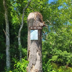
    Mount Tom Trail

    Mount Tom Trail

    4.3(6 reviews)
    6.7 mi

    Online it says it's permanently closed, but it's not. Nice trail, although I didn't go very far…read moredue to getting a little spooked by some bear scat on the trail What I did hike was well maintained and easily accessible.

    Go take a…read more hike Mount Tom is a well known hiking trail that is part of the Arcadia Wildlife Management Area. Like many of the trails in this part of Rhode Island it is maintained by the Appalachian Mountain Club and is well marked and easy to follow. Even though over 8,000 acres of woods in this area were destroyed by a devastating fire in 1951 the only evidence now of that horrible event are the numerous pines that were replanted over the years. Nature returned with a vengence. The entire trail is only a little over five miles but it crosses many other paths so you can walk all day in Arcadia if you desire. The hiking isn't difficult even though it does ramble up and down for most of it's length. Very few ruts, roots or loose rocks to trip you up and no extremely severe climbs, with a little care you can make good time on this path . Even though there are several nice places for distant views you never really know exactly when you get to the summit. It doesn't really matter because it's not very high, probably only around 500 feet or so and the woods are pretty thick. There are some nice cliffs and ledges and numerous rock formations but nothing dangerous or spooky unless you decide to do something really stupid. There are several parking areas but the most convenient is the Acadia Canoe Launch and Check Station. A huge sign marks the parking lot and there are plenty of parking spaces, nice bathrooms and even a pleasant brook to sit by after the hiking is done. The Mt Tom Trail might not be the highest or longest or most scenic hike in the state but it is one that I always find pleasant, entertaining and interesting.

    Photos
    Mount Tom Trail
    Mount Tom Trail - Bear scat?

    Bear scat?

    Mount Tom Trail

    See all

    Woodland Bmx - A winner

    Woodland Bmx

    5.0(1 review)
    3.6 mi

    Good filthy family fun…read more BMX racing has becoming more and more popular during the last decade and it's even become an official Olympic event. You see bezillions of BMX bikes everywhere and kids riding, doing crazy tricks and of course racing them, usually in very unsafe places in very unsafe ways. That's because they just aren't many places for people to competitively ride the BMX bikes in safe and supervised conditions. Fortunately there is a USA sanctioned facility in West Greenwich that will allow kids and even adults to race, ride and practice until they blow their lungs out. The track is open for practice on Thursday nights until dark and for racing on Saturdays mornings. This is real racing with different classes and categories and with the winners receiving points toward state and national rankings, getting nice trophies and most importantly receiving the accolades of their family and friends. The track is well maintained, has medical equipment and even has an electronic starting gate just like in motocross. The facility has a huge parking lot and many families and friends come to tailgate and cheer on their champions. Almost a picnic type atmosphere. BMX is becoming increasing popular and tracks like this serve a need for speed. The bikes were made to race and this is the place. A great sport and facility for families to get filthy together.

    From the owner: Woodland BMX racing facility in West Greenwitch, RI; sanctioned by USABMX.read more

    Photos
    Woodland Bmx
    Woodland Bmx - Stuff to buy

    Stuff to buy

    Woodland Bmx - Scruffy trouist at the track

    See all

    Scruffy trouist at the track

    Big River Management Area - hiking - Updated August 2026

    Loading...
    Loading...
    Loading...