Cancel

    Open app

    Search

    Mawney Pine Preserve

    5.0 (1 review)

    Mawney Pine Preserve Photos

    You might also consider

    Recommended Reviews - Mawney Pine Preserve

    Your trust is our priority, so businesses can't pay to alter or remove their reviews. Learn more about reviews.
    Yelp app icon
    Browse more easily on the app
    Review Feed Illustration

    10 months ago

    Helpful 0
    Thanks 0
    Love this 0
    Oh no 0

    Verify this business for free

    People searched for Hiking 1,579 times last month within 15 miles of this business.

    Verify this business

    Queen's River Nature Preserve - Queen's River

    Queen's River Nature Preserve

    4.5(2 reviews)
    5.1 mi

    Right next to the Veterans Memorial Cemetery is the Queen's River Nature Preserve. This beautiful…read moreset of trails will take you to the Queen's River - reputedly the cleanest river in Rhode island - and what a tranquil trek that is! In addition to the marked trails, there are some unmarked ones (but no worries, they are well-maintained and will take you back to the mapped ones) that are well worth exploring - the best one imo is one that follows the meandering river bank and will eventually hook you up with one of the marked paths, thus making a nice loop back to the trailhead. (One drawback of the "official" trails is that they don't really make a loop so you will end up traversing former ground that you covered.) There is space for several cars to park at the trailhead; an alternative is to park along the edge of the Veterans Cemetery nearest to the Preserve, slip between the bordering fence, and there you are, a mere hop-skip-and-jump from the trailhead!

    Trout laurel and…read moreXmas The Queen's River Nature Preserve is an almost 200 acre swatch of land that is centered around the Queen's River. This is considered one of the most pristine and cleanest river in the state and loaded with brook trout and all kinds of other types of critters. The trails meander through lots of woods, open fields and wet lands and has plenty of cool old trees as well as large areas of mountain laurel. The river is a whole lot smaller than I thought it would be but it is lovely and very, very cean and is one of those rivers that never warms up. Still freezing cold even in the summer. Queen's River isn't particularly well marked and you'll probably get lost but that's all right because you'll come out to a road of field that will guide you. There is lots of wild life including a wide variety of birds as well as lots and lots of deer. Just beware that bow hunting is allowed from Sept 15th through Jan 31 and at least 200 square inches of bright florescent orange is not only required by law but also good idea so you won't get shot in the arse by some over anxious bow hunter. Queen's River is a lovely and very, very clean place for a easy hike through a varied environment and some spirited soul even put up Xmas decorations on some of the blue spruce trees. Not many hills or difficult terrain but a great place to take your time and look, listen and smell what the river and woods has to offer.

    Photos
    Queen's River Nature Preserve - Lots of fishies in there, difficult to get a pic of them though.

    Lots of fishies in there, difficult to get a pic of them though.

    Queen's River Nature Preserve - A stately old (dead) tree along the main trail

    A stately old (dead) tree along the main trail

    Queen's River Nature Preserve - Along the unmarked trail following the river bank

    See all

    Along the unmarked trail following the river bank

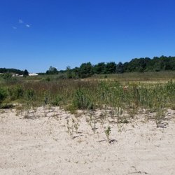
    Rhode Island Desert

    Rhode Island Desert

    4.7(3 reviews)
    4.8 mi

    This is one of those unsung RI landmarks. Way back when, there was brief talk of the new Patriots…read morestadium being built here. But alas, it's remained just a place to sled in the winter and walk around during the rest of the year. Really, not formal parking, just a handful of spots in a couple of openings. But it's a nice little getaway nonetheless.

    I did not know the State of Rhode Island has it's very own Desert! Seriously, we have lived here…read morefor over a decade and I am just now finding this out? I have tried to locate exactly who is responsible for this land, checking with both the town West Greenwich town website, and the State of Rhode Island website, neither of which identifies itself as the care taker so I am unable to provide a web address for more information. That said, this place just wowed me. We lived in the actual desert at one time (AZ) and this spot is more like the dunes in SoCal than the high desert of Tucson. It's a bunch of sandy dunes undulating under the blue sky. Surrounded by woodlands, it's hidden from the road. A quick look up on the satellite map shows this is a spot for winter sledding. Sorry I missed that as a kid. First off, there are two locations: one is located on the north side of Division Street nestled between Division and Rt 95. The other is on the south side of Division Street, listed as the West Greenwich Sand Dunes. While exploring this area one bight autumn day, we came across a group of military personnel, practicing their 'jumping out of helicopter' skills. That was a very good time and there were quite a few people who brought their lawn chairs to enjoy the show, camera's in hand. We wandered around as best we could, trying to stay out of the way of the jumpers (they had targets on the ground they were supposed to land near, so this was pretty easy to do) and have returned again and again to explore more of this area and the surrounding Big River Management area woodlands. I'm sure this desert is part of said Big River Mgmt area of which you can easily find hiking information on line. The general area is popular with hikers, walkers, bikers and runners. Seriously, if you are a fan of the desert, are new to RI, or just never knew there was such a thing in this state, you have got to stop by some fine day and take a walk around. It's like being at the beach, minus the water.

    Photos
    Rhode Island Desert
    Rhode Island Desert
    Rhode Island Desert - Parachutes open, aiming for their target on the sand.

    See all

    Parachutes open, aiming for their target on the sand.

    Briggs Boesch Farm

    Briggs Boesch Farm

    3.9(8 reviews)
    0.3 mi

    So don't let my 3-star rating put you off too much from visiting this place! If you're here for…read morethe Woodland Trail, you might be dismayed by having first to traverse a working farm with its attendant equipment, out-buildings, fencing, and compost piles (which is why I gave the overall experience 3-stars rather than 4) - but once you get into the trail proper, it's quite beautiful and peaceful. So peaceful in fact, that we had a thrilling encounter with a coywolf sunning itself on a large boulder! There was no danger to us - the coywolf was no doubt more wary of us than us of it (and was aware of us long before we saw it), but once it knew we spotted it, it leisurely got up and sauntered off without a backward glance. The Woodland Trail is fairly well-marked, has elegant beech trees scattered throughout, a babbling brook, and the loop can be completed in about 30-40 minutes at a moderate pace. A hidden gem in East Greenwich and my hat's off to the East Greenwich Land Trust for preserving both these woodlands and the working farm.

    A historic farmland where you can walk around for a 1.5 miles through pastures and woods. Pat's…read morePastured main farm is located here and you'll see their pigs, chickens, and ducks hanging out and grazing. From the parking lot/trailhead, we meandered past the farm and into the woods. The trail markings are easy to spot and the trails were clear and super easy to walk. No huge hills. Relatively flat. Good for little kids, probably not too great for strollers, though. Bring your dog as long as your pet is on a leash. We saw two other couples -- and, unfortunately two garter snakes as well -- and it was great to be out in the woods and fields by ourselves. Quiet and peaceful.

    Photos
    Briggs Boesch Farm
    Briggs Boesch Farm - A peaceful brook just off the Woodland Trail

    A peaceful brook just off the Woodland Trail

    Briggs Boesch Farm

    See all

    Big River Management Area - Parking for 3 or 4 vehicles by the roadside. Wear your Orange during hunting season!!!

    Big River Management Area

    4.3(4 reviews)
    5.6 mi

    Big River Management Area, is a Big Area! We have been on several of their trails, parking in a…read morevairety of places. It's a diverse area and one of our 'go to' spots for getting into nature. Our past few hikes have been around Carr Pond. We drive down Division Street, to Carr Pond Road, and park street side. There are a couple of parking lots, both before Carr Pond Road, and after. Just depends on how long you want your hike to last, and where you want to walk. There are DEM signs posted on a tree and obvious signs that cars have been parking in this particular spot on Carr Pond Road. The hike around the pond has taken just over 3 miles to well over 4.5 miles. We usually wander through the interconnecting trails as the mood strikes us. It is important, when taking a walk quite this long, that you DO bring a bottle or two of water per person. You will also appreciate bug spray. I have forgotten the bug spray, and although definitely 'do-able', not quite as enjoyable. This particular summer, we have had a lot of rain and mushrooms are everywhere along the trail. A few large puddles have developed along the trail that are full of small toads (I just love these cute little critters). The trails are very well maintained for the most part and it is easy to walk 'around' these low lying areas. A few less travelled paths are a bit over grown, but nothing that isn't easily navigable. The pond itself is large with a variety of areas where you can picnic (bug spray), meditate and just enjoy the serenity of the pond. There are also a number of old building foundations, dams, rock walls and a historical cemetary. We use a phone app to track our hikes as we do tend to wander and it's a good way to see when we are close to our pathway out. After a few visits, you begin to recognize where you are but the first couple of trips can be questionable. The change is altitude is minimal with a couple of paths that have a good 'up grade' (or down grade as the case may be). You do need quality footware here as the paths are a variety of gravelly, rocky, roots and dirt. It change from one type to another on any of the individual paths. The trails are color coded if you want to stick to just one. The path width can also chagee dramatically from four person wide to barely one person wide on any given trail. It's best to be prepared for all possibilities. Most of the path around Carr pond is in shade but if you wander into other areas of the BIg River Management Area, you may be in full sun for most of the walk, so plan to wear a hat, bring sunscreen, have water and maybe a snack. Most of all, Have Fun!

    Roomy and extensive trails that will loop you around two bodies of water - Carrs Pond and Tarbox…read morePond - but also many side trails that crisscross and branch off the main ones. If you're new to this preserve - as we were - better download the AllTrails app onto your smartphone as unfortunately, trail blazes are virtually non-existent and there's no map posted at the trailhead. But it is nice making your way to the two lily-covered ponds, though viewing them in the height of summer is tough with all the leaves and undergrowth. We intend to visit again in the fall (when the colors should be spectacular!) and early winter.

    Photos
    Big River Management Area - Butterfly habitat. Saw quite a few on our walk.

    Butterfly habitat. Saw quite a few on our walk.

    Big River Management Area - The RI desert. Well, part of it . . .

    The RI desert. Well, part of it . . .

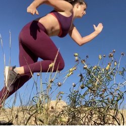
    Big River Management Area - Did some desert hills today as part of my workout!

    See all

    Did some desert hills today as part of my workout!

    Mawney Pine Preserve - hiking - Updated August 2026
    Loading...
    Loading...
    Loading...