
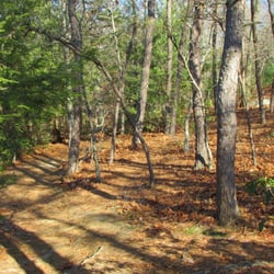
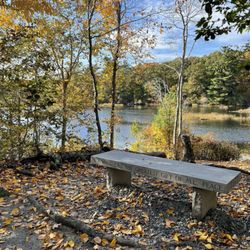
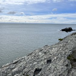
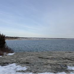
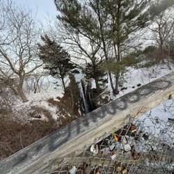
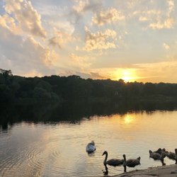
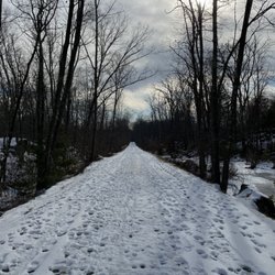
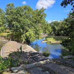
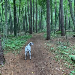
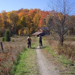
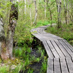
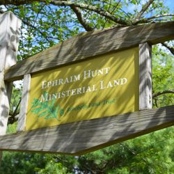
Birchwold Farm Conservation Area Photos


You might also consider
More like Birchwold Farm Conservation Area
Recommended Reviews - Birchwold Farm Conservation Area
Start your review...

7 years ago
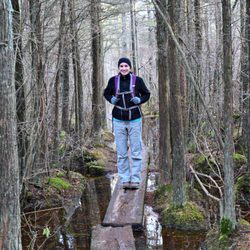
I hiked this for the first time this year and found trail markings missing and ended up on a road taking me far away from the trail. BE VERY COGNAZANT OF THE TRAIL I found myself on another trail with excellent marking, but leading me further away. The trailhead at Birchwald refers to only 2 markings - red and green. Within a mile those are gone. read more
2 years ago
10 years ago
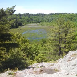
Discovered this lovely conservancy after a visit to Joe's Rock. I wish I knew this waa here long ago. I did not have more than 45 minutes before work to explore but I did enjoy the wide field that has many mowed paths tha I discovered were mowed by one man! I met his wife and her dog, Maisy on the trails. She saw that I was looking at my phone, puzzled and asked if I was geocaching. I was! She then took me right to the cache I was hunting for: one that she places in memory of her beloved dog, Cinnamon. I cannot wait to get back to this land!! read more
More info about Birchwold Farm Conservation Area
West St
Wrentham, MA 02093
Directions
Hours
Outdoor Amenities
You might also consider


Why does Yelp recommend reviews?
1 review that is not currently recommended
The reviews below are not factored into the business's overall star rating.
15 days ago
Birchwold Farm Conservation Area - hiking - Updated July 2026
Best of Wrentham
People found Birchwold Farm Conservation Area by searching for…
Walking Trails in Wrentham, MA
Places to Take Pictures in Wrentham, MA
Things to Do With Kids in Wrentham, MA
Dog Friendly Hiking Trails in Wrentham, MA
Free Things to Do in Wrentham, MA
Parks for Kids in Wrentham, MA
Off Road Trails in Wrentham, MA
Dog Walking Areas in Wrentham, MA
Running Trails in Wrentham, MA
Playgrounds for Kids in Wrentham, MA
Running Tracks Open to the Public in Wrentham, MA
Hiking With Kids in Wrentham, MA
Fun Things to Do in Wrentham, MA
Dog Friendly Places in Wrentham, MA
Trending Searches in Wrentham, MA
Blueberry Picking near Birchwold Farm Conservation Area
Boardwalk near Birchwold Farm Conservation Area
Cliff Jumping near Birchwold Farm Conservation Area
Day Trips near Birchwold Farm Conservation Area
Dog Friendly Beaches near Birchwold Farm Conservation Area
Free Things To Do With Kids near Birchwold Farm Conservation Area
Jet Ski Rental near Birchwold Farm Conservation Area
Kayak Rental near Birchwold Farm Conservation Area
Kids Activities Outdoor near Birchwold Farm Conservation Area
Lakes & Ponds near Birchwold Farm Conservation Area
Off Road Trails near Birchwold Farm Conservation Area
Outdoor Activities near Birchwold Farm Conservation Area
Outdoor Basketball Courts near Birchwold Farm Conservation Area
Parks For Picnics near Birchwold Farm Conservation Area
Peach Picking near Birchwold Farm Conservation Area
Places To Swim near Birchwold Farm Conservation Area
Places To Walk Around near Birchwold Farm Conservation Area
Pokemon Go near Birchwold Farm Conservation Area
Pool Day Pass near Birchwold Farm Conservation Area
Public Beaches near Birchwold Farm Conservation Area
Public Shower near Birchwold Farm Conservation Area
River Swimming near Birchwold Farm Conservation Area
River Tubing near Birchwold Farm Conservation Area
Rock Quarry near Birchwold Farm Conservation Area
Scenic Night View near Birchwold Farm Conservation Area
Scenic Overlook near Birchwold Farm Conservation Area
Secluded Spots near Birchwold Farm Conservation Area
Soccer Store near Birchwold Farm Conservation Area
Sunrise View near Birchwold Farm Conservation Area
Swimming Holes near Birchwold Farm Conservation Area
Swimming Lakes near Birchwold Farm Conservation Area
U Pick Farms near Birchwold Farm Conservation Area
Watch Sunset near Birchwold Farm Conservation Area
Water Parks For Kids near Birchwold Farm Conservation Area
Waterfalls And Swimming Holes near Birchwold Farm Conservation Area
Browse Nearby
BEST of Wrentham, Massachusetts Restaurants near Birchwold Farm Conservation Area
BEST of Wrentham, Massachusetts Coffee near Birchwold Farm Conservation Area
BEST of Wrentham, Massachusetts Things to Do near Birchwold Farm Conservation Area
BEST of Wrentham, Massachusetts Breakfast near Birchwold Farm Conservation Area
BEST of Wrentham, Massachusetts Wineries near Birchwold Farm Conservation Area
BEST of Wrentham, Massachusetts Campgrounds near Birchwold Farm Conservation Area
BEST of Wrentham, Massachusetts Thrift Stores near Birchwold Farm Conservation Area
Browse Brands
Related Searches in Wrentham, MA
Affordable Kayak Rental Services in Wrentham, Massachusetts
Best Dog Hiking Trails Around Wrentham, Massachusetts
Best Fishing Locations and Guides in Wrentham, Massachusetts
Best Off Leash Dog Parks in Wrentham, Massachusetts
Best Parks for Parties and Events in Wrentham, Massachusetts
Best Places for Horseback Riding in Wrentham, Massachusetts
Best Sightseeing Experiences Available in Wrentham, Massachusetts
Best Water Parks for Kids in Wrentham, Massachusetts
Best Waterfalls and Swimming Holes in Wrentham, Massachusetts
Check Out Great Playgrounds in Wrentham, Massachusetts
Check Out Off Road Trails in Wrentham, Massachusetts
Discover Baseball Fields Around Wrentham, Massachusetts
Discover Beautiful Garden Spots in Wrentham, Massachusetts
Discover Dog Friendly Trails to Explore in Wrentham, Massachusetts
Discover Fun Toddler Parks in Wrentham, Massachusetts for Your Little One
Discover Kid Friendly Hiking Trails in Wrentham, Massachusetts
Discover Lakes & Ponds to Explore in Wrentham, Massachusetts
Discover Popular Bike Trails in Wrentham, Massachusetts
Discover Scenic Mountain Bike Trails Near Wrentham, Massachusetts
Discover Soccer Fields in Wrentham, Massachusetts Near You
Discover Top Nature Parks to Visit in Wrentham, Massachusetts
Discover Top State Parks to Visit in Wrentham, Massachusetts
Discover a Hiking Trail in Wrentham, Massachusetts
Discover the Best Beaches in Wrentham, Massachusetts
Discover the Best Kids Park Spots in Wrentham, Massachusetts
Discover the Best Night Hike Trails in Wrentham, Massachusetts
Dog-Friendly Hikes With Dogs in Wrentham, Massachusetts
Enjoy Camping Adventures Around Wrentham, Massachusetts
Enjoy Kayaking Adventures in Wrentham, Massachusetts
Enjoy Off Leash Dog Hikes in Wrentham, Massachusetts
Enjoy Scenic Places to Walk in Wrentham, Massachusetts
Enjoy Tent Camping Spots Around Wrentham, Massachusetts
Enjoy a Beautiful Waterfall Hike in Wrentham, Massachusetts
Enjoy the Best Picnic Spots and Ideas in Wrentham, Massachusetts
Enjoy the Best Walking Path in Wrentham, Massachusetts
Enjoy the Best Walking Trails in Wrentham, Massachusetts
Explore Beautiful Parks and Green Spaces in Wrentham, Massachusetts
Explore Easy Hikes Perfect for All in Wrentham, Massachusetts
Explore Free Picnic Areas Around Wrentham, Massachusetts
Explore Fun Activities to Do in Wrentham, Massachusetts
Explore Parks With Pull Up Bars in Wrentham, Massachusetts
Explore Picnic Parks Near Wrentham, Massachusetts
Explore Popular Campgrounds Near Wrentham, Massachusetts
Explore Popular Dog Walking Trails in Wrentham, Massachusetts
Explore Popular Picnic Areas Around Wrentham, Massachusetts
Explore Popular RV Parks Around Wrentham, Massachusetts
Explore Popular State Park Destinations in Wrentham, Massachusetts
Explore Scenic Lakes to Visit in Wrentham, Massachusetts
Browse Articles
People who viewed Birchwold Farm Conservation Area also viewed
Blackstone River Bikeway
55 reviews
The Monastery Park
12 reviews
Chase Farm
56 reviews
Fort Nature Refuge
4 reviews
Blackall Family And Ballou Farm Preserve
1 review
Highland Park
1 review
Pulaski State Park & Recreational Area
1 review
Slater Memorial Park
43 reviews
Attilo Valati Nature Park
1 review
Burrillville Bike Path
1 review