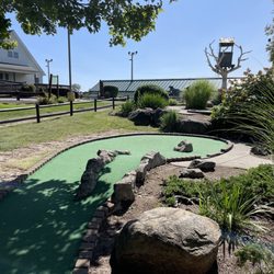
Blackstone River Bikeway Photos


More like Blackstone River Bikeway
Recommended Reviews - Blackstone River Bikeway
Start your review...

Reviews With Photos

Discovered this state park while walking on the train tracks. Beautiful scenery with an amazing bike path. Made me wish I had my bike to adventure further. Soon I'll have to take a trip back here. Apparently you can fish along the river too. Many historic sites along the path as well. The road is paved and taken care of. Ended up sitting by the bridge watching the river while I waited for my DMV appointment at AAA. What a hidden gem.

This is a beautiful well maintained walking and biking trail. It sits along the river run and charming backyards. The trail is quiet and has a few choice spots to stop for picnic lunch or photo op. We set off late in the afternoon for the first time on the bike way. There was a bit of high traffic and folks had a hard time staying to the right and left for easy walking and cycling. Thankfully no there were no run-ins. Will definitely venture here again in the next warm and sunny day in Rhode Island


Bike trail pros: mostly flat, very few street crossings, river and canal views, easy access points in Cumberland and Lincoln. Mile markers every half mile. Turtles, fish birds etc. Cons: the trail can be particularly busy between the Front Street in Lincoln parking lot and Route 116 in Cumberland on weekends. Poison ivy just off the trail. Graffiti on most signs and benches. Tip: walk on the left facing oncoming cyclists.

A view of things to come Rhode Island has quite a few bike paths but most of them are just truncated little bits of four or five miles. To be connected some day but as of now "works in progress". More suited for walking than biking. A great idea but one that is far from realized. I heard that Blackstone River now had an uninterrupted roll of more than ten miles so a bunch of friends and myself decided to check it out. We were pleasantly surprised. It's still a bit short for a bike but it has some absolutely gorgeous scenery and interesting views. Lots of bridges, old mills, waterfalls and rivers along the way. We saw a family of deer right next to the path and many different types of large birds. Even an ice cream shop or two. Blackstone is eventually going to run all the way to Worcester for a total one way length of almost fifty miles but right now the ten miles is pretty nice. Except for one small stretch, the pavement is in excellent condition but unfortunately it is pretty flat with few hills. Not nearly as crowded as the East Bay Path, Blackstone also didn't have the heterogeneous group of skaters, runners, older people with walkers and people trying to go warp nine on bikes that you frequently find on the East Bay path. This was mostly bikes, all moving along and with plenty of places to safely pass. A twenty mile round trip still isn't much for a bike but Blackstone is a beautiful and relaxing ride. it gives a tantalizing tease of what will be if the full length and connections are all realized.

Blackstone River Bikeway The Blackstone River Bikeway begins in Cumberland,RI There is a parking lot at the entrance to the former Lonsdale Drive In Theater. In fact the restored marque states, "NowPlaying, Blackstone River Bikeway". This collaboration between the RI Departments of Transportation and Environmental Management has resulted in 11.5 miles of continuous bike path being open to the public in Cumberland, Lincoln, and Woonsocket, RI. Beginning at the southern end, in Cumberland, the ride takes one over a scenic bridge within a mile of starting out. The bridge is a dedicated bike and walkway with no vehicular traffic. The Blackstone River Bikeway then meanders along following the historic Blackstone canal. Inspired by the success of the Erie Canal (begun in 1817) and prodded by the growth of textile manufacturing along the Blackstone River. The Blackstone Canal was built to link Central Massachusetts to the Atlantic via Providence, RI. Between 1828 and 1848. The canal used horse-drawn boats to carry freight and passengers between Worcester and Providence. The Blackstone River Bikeway provides one a feeling of being slightly more remote than does the East Bay Bike Path, though never wandering too far from residential areas, it provides long stretches uninterrupted by intersections and stop signs. Very nice indeed. From south (the Cumberland end) the Bikeway ends at the Rivers Edge Recreation Complex in Woonsocket, RI. Near to this end are public restrooms, and a small refreshment stand. The Blackstone River Bikeway is slightly more challenging, in regard to elevation, than the East Bay Bike Path. That said, it is not a difficult ride, and should be enjoyed by riders of all experience levels.

The Blackstone River Bikeway is a beautiful way to explore the Blackstone Valley, whether by bike or on foot and offers something for everyone to enjoy. We have done it both ways, mostly by bike. It is a beautiful green space that goes along rivers and small waterfalls, just lovely. With over 24 miles already constructed, the vision is for it to extend 48 miles from downtown Worcester, MA, to India Point Park in Providence, RI. From there, it connects with the existing East Bay Bike Path and continues to Bristol, RI, for additional 14.5 miles. When completed, the Blackstone River Bikeway will serve as an alternate mode of transportation for commuters as well as the region's premier recreational resource, connecting New England's second and third largest cities. read more


One of the prettiest, smoothest, easiest and most accessible bike paths if you live in northeast RI or nearby MA border towns. The bikeway (approx. 20 miles) runs from Woonsocket, through Cumberland into Lincoln along the Blackstone River through lots of greenery and passing by bridges, dams, old mill buildings and historic sites. Of course, there are plenty of ways to do shorter rides/runs/walks. My riding buddies and I especially enjoy getting on at Albion Street in Cumberland (limited parking though!) and riding towards Ashton Mill (Cumberland) and into Lincoln for either a 10- or 12-mile spin, depending on where we decide to turn back. We also like the stretch from Woonsocket to Albion (about 9 miles back and forth) that starts out by taking us by sunny soccer fields in The River's Edge Recreation area. No matter where you get on, the terrain is mainly flat and it's easy to keep a steady pace.Be on the lookout for turtles sunning themselves on fallen trees in the river as well as occasional deer. And expect plenty of friendly waves and nods from walkers, runners and bikers on your journey. The Lincoln and Woonsocket ends offer ample parking. read more


3 years ago
The Blackstone River Park put on a historic tour with an NPS guide, so my review is more for that than for the bike path. There is a parking lot at the Wilber House (open seasonally) and the guide described and showed the site of the original mill off of the river canal and then walked us over the multistate bridge to the Ashton Mill and pointed out the smokestacks of the factory-turned-lofts and the old residence of the factory workers. If possible, you should check park events because it gave some great local history of the site. It sounds like they have some tours on weekdays and weekends. If not on a tour, there are some informational signs but not much to look at and wouldn't take more than 10 minutes to read the signs. The interaction was definitely a great additional to learning about the site. read more

9 months ago
Discovered this state park while walking on the train tracks. Beautiful scenery with an amazing bike path. Made me wish I had my bike to adventure further. Soon I'll have to take a trip back here. Apparently you can fish along the river too. Many historic sites along the path as well. The road is paved and taken care of. Ended up sitting by the bridge watching the river while I waited for my DMV appointment at AAA. What a hidden gem. read more


This is a beautiful well maintained walking and biking trail. It sits along the river run and charming backyards. The trail is quiet and has a few choice spots to stop for picnic lunch or photo op. We set off late in the afternoon for the first time on the bike way. There was a bit of high traffic and folks had a hard time staying to the right and left for easy walking and cycling. Thankfully no there were no run-ins. Will definitely venture here again in the next warm and sunny day in Rhode Island read more


4 years ago
3 years ago
5 years ago
Well maintained, well marked bikeway with outstanding scenic views along old mill buildings, watery vistas, historic homes, and multiple parking areas along this RI corridor. read more

7 years ago
4 years ago
4 years ago
4 years ago
Perfect place to learn to skate. Beautiful scenery and path was perfect for the newbie skater I am. read more


7 years ago
Yes, as good as it gets, nice and level, pleasant folks, interesting history with signage and surviving mills. read more

 structure adjacent to one of the mills near the path. - Parks Near Me")
9 years ago
Bike trail pros: mostly flat, very few street crossings, river and canal views, easy access points in Cumberland and Lincoln. Mile markers every half mile. Turtles, fish birds etc. Cons: the trail can be particularly busy between the Front Street in Lincoln parking lot and Route 116 in Cumberland on weekends. Poison ivy just off the trail. Graffiti on most signs and benches. Tip: walk on the left facing oncoming cyclists. read more


17 years ago
A view of things to come Rhode Island has quite a few bike paths but most of them are just truncated little bits of four or five miles. To be connected some day but as of now "works in progress". More suited for walking than biking. A great idea but one that is far from realized. I heard that Blackstone River now had an uninterrupted roll of more than ten miles so a bunch of friends and myself decided to check it out. We were pleasantly surprised. It's still a bit short for a bike but it has some absolutely gorgeous scenery and interesting views. Lots of bridges, old mills, waterfalls and rivers along the way. We saw a family of deer right next to the path and many different types of large birds. Even an ice cream shop or two. Blackstone is eventually going to run all the way to Worcester for a total one way length of almost fifty miles but right now the ten miles is pretty nice. Except for one small stretch, the pavement is in excellent condition but unfortunately it is pretty flat with few hills. Not nearly as crowded as the East Bay Path, Blackstone also didn't have the heterogeneous group of skaters, runners, older people with walkers and people trying to go warp nine on bikes that you frequently find on the East Bay path. This was mostly bikes, all moving along and with plenty of places to safely pass. A twenty mile round trip still isn't much for a bike but Blackstone is a beautiful and relaxing ride. it gives a tantalizing tease of what will be if the full length and connections are all realized. read more


12 years ago
4 years ago
14 years ago
Blackstone River Bikeway The Blackstone River Bikeway begins in Cumberland,RI There is a parking lot at the entrance to the former Lonsdale Drive In Theater. In fact the restored marque states, "NowPlaying, Blackstone River Bikeway". This collaboration between the RI Departments of Transportation and Environmental Management has resulted in 11.5 miles of continuous bike path being open to the public in Cumberland, Lincoln, and Woonsocket, RI. Beginning at the southern end, in Cumberland, the ride takes one over a scenic bridge within a mile of starting out. The bridge is a dedicated bike and walkway with no vehicular traffic. The Blackstone River Bikeway then meanders along following the historic Blackstone canal. Inspired by the success of the Erie Canal (begun in 1817) and prodded by the growth of textile manufacturing along the Blackstone River. The Blackstone Canal was built to link Central Massachusetts to the Atlantic via Providence, RI. Between 1828 and 1848. The canal used horse-drawn boats to carry freight and passengers between Worcester and Providence. The Blackstone River Bikeway provides one a feeling of being slightly more remote than does the East Bay Bike Path, though never wandering too far from residential areas, it provides long stretches uninterrupted by intersections and stop signs. Very nice indeed. From south (the Cumberland end) the Bikeway ends at the Rivers Edge Recreation Complex in Woonsocket, RI. Near to this end are public restrooms, and a small refreshment stand. The Blackstone River Bikeway is slightly more challenging, in regard to elevation, than the East Bay Bike Path. That said, it is not a difficult ride, and should be enjoyed by riders of all experience levels. read more


I love this bike path! First ride of the year. I went about 15 miles. The path was really clean, no leftover winter debris. I took 1 star off for the bumps which are more in number this year than last. I do love the fact that most of them are marked with yellow paint though. I totally appreciate the warning! This bike path offers shady areas, has a couple of areas to sit near the water...and is a bit less congested on the weekend than the eastbay bike path is. I saw three turtles on my ride too! The best thing about this path is that there are very few intersections that you have to stop at. It's great to get outside and moving again. Try it out! read more


13 years ago
15 years ago
15 years ago
12 years ago
I run on this bike path often early in the morning but I've been at various hours. I love the scenery and the granite half-mile markers make it easy to keep track of my run. People generally follow the rules and pick up after their pets so the path is clean. I aspire to be a bike path connoisseur and try new ones when I travel but nothing has come close to this well-kept, beautiful path! Also, in the warmer months they have a bike safety patrol though I don't feel insecure running on this trail alone. read more


11 years ago
13 years ago
11 years ago
Everything about this bikeway is spectacular. The view is very pretty and cool! You can basically do anything here walk, rollerblade, bike, walk your dog. The only problem with the bikeway is there is some bumps on the Cumberland side of the bikeway near mendon rd. The kelly house is a great place to check out if you every pass by it on the bikeway. The mills have been turned into apartments and the waterfalls are cool to drive or walk by. Other than that this is a great place to take your family for bike riding and explore the views on the blackstone bikeway read more


8 years ago
17 years ago
Last year for work I stumbled across this path to get a picture of a bridge. This year I was able to get the bike on the back of the car and head up there to ride the path. I rode form Cumberland to Woonsocket and was amazed but the views. There were many creatures out too crossing our paths such as swans, ducks, turtles, and birds. It's a fairly easy ride with minor elevation changes. This path hugs the river to provide a relaxing atmosphere. The end in Woonsocket left something to be desired. People spoke of a "snack shack" and restrooms but all we found were remnants of an old mill building that had been demolished. Hopefully they can do something with that end but overall I would definitely recommend this path for a scenic ride. Lots of families were there and biking was not the only mode of transportation with many pedestrians and roller bladers also enjoying. Check this place out if you are looking for a good day activity. read more

Page 1 of 2
More info about Blackstone River Bikeway
Cumberland, RI 02863
Directions
(617) 973-7495
Call Now
Visit Website
http://www.blackstoneriverbikeway.com
Hours
Indoor Amenities
Outdoor Amenities
Ask the Community - Blackstone River Bikeway
Review Highlights - Blackstone River Bikeway


Why does Yelp recommend reviews?
Blackstone River Bikeway - parks - Updated June 2026
Best of Cumberland
People found Blackstone River Bikeway by searching for…
Things to Do in Cumberland, Rhode Island
Fishing in Cumberland, Rhode Island
Hiking Trails With Waterfalls in Cumberland, Rhode Island
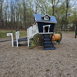
Playgrounds in Cumberland, Rhode Island
Dog Parks in Cumberland, Rhode Island
Skate Parks in Cumberland, Rhode Island
Public Running Track in Cumberland, Rhode Island
Places to Take Pictures in Cumberland, Rhode Island
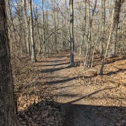
Walking Trails in Cumberland, Rhode Island
Dog Swimming in Cumberland, Rhode Island
Scenic Drive in Cumberland, Rhode Island
River Swimming in Cumberland, Rhode Island
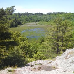
Scenic View in Cumberland, Rhode Island
Photo Spots in Cumberland, Rhode Island
Fishing Spots in Cumberland, Rhode Island
Secret Spots in Cumberland, Rhode Island
Scenic Overlook in Cumberland, Rhode Island
Parks for Kids in Cumberland, Rhode Island
Swimming Lakes in Cumberland, Rhode Island
Picnic Areas in Cumberland, Rhode Island
Bike Paths in Cumberland, Rhode Island
Great View Points at Night in Cumberland, Rhode Island
Make Out Spot in Cumberland, Rhode Island
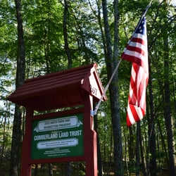
Landmarks & Historical Buildings in Cumberland, Rhode Island
Trending Searches in Cumberland, RI
Baseball Fields near Blackstone River Bikeway
Black Owned Nail Salons near Blackstone River Bikeway
Boardwalk near Blackstone River Bikeway
Boat Rental near Blackstone River Bikeway
Cliff Jumping near Blackstone River Bikeway
Day Trips near Blackstone River Bikeway
Dog Friendly Beaches near Blackstone River Bikeway
Dog Friendly Trails near Blackstone River Bikeway
Fishing Spots near Blackstone River Bikeway
Free Picnic Areas near Blackstone River Bikeway
Jet Ski Rental near Blackstone River Bikeway
Kayak Rental near Blackstone River Bikeway
Kids Activities Outdoor near Blackstone River Bikeway
Lakes near Blackstone River Bikeway
Lakes & Ponds near Blackstone River Bikeway
Off Road Trails near Blackstone River Bikeway
Outdoor Activities near Blackstone River Bikeway
Outdoor Basketball Courts near Blackstone River Bikeway
Paddle Boat Rentals near Blackstone River Bikeway
Places To Walk Around near Blackstone River Bikeway
Public Beaches near Blackstone River Bikeway
Public Pools near Blackstone River Bikeway
Public Shower near Blackstone River Bikeway
River Swimming near Blackstone River Bikeway
Rock Quarry near Blackstone River Bikeway
Scenic Overlook near Blackstone River Bikeway
Secluded Spots near Blackstone River Bikeway
Soccer Store near Blackstone River Bikeway
Splash Pad near Blackstone River Bikeway
Strawberry Picking near Blackstone River Bikeway
Sunbathing near Blackstone River Bikeway
Sunrise View near Blackstone River Bikeway
Swimming Holes near Blackstone River Bikeway
Swimming Lakes near Blackstone River Bikeway
Watch Sunset near Blackstone River Bikeway
Browse Nearby
BEST of Cumberland, Rhode Island Coffee near Blackstone River Bikeway
BEST of Cumberland, Rhode Island Restaurants near Blackstone River Bikeway
BEST of Cumberland, Rhode Island Things to Do near Blackstone River Bikeway
BEST of Cumberland, Rhode Island Playgrounds near Blackstone River Bikeway
BEST of Cumberland, Rhode Island Breakfast near Blackstone River Bikeway
BEST of Cumberland, Rhode Island Hiking near Blackstone River Bikeway
BEST of Cumberland, Rhode Island Sledding near Blackstone River Bikeway
Browse Brands
Related Searches in Cumberland, RI
Affordable Kayak Rental Services in Cumberland, Rhode Island
Best Fishing Locations and Guides in Cumberland, Rhode Island
Best Off Leash Dog Parks in Cumberland, Rhode Island
Best Parks for Parties and Events in Cumberland, Rhode Island
Best Places for Horseback Riding in Cumberland, Rhode Island
Best Places for Stunning Views in Cumberland, Rhode Island
Best Water Parks for Kids in Cumberland, Rhode Island
Check Out Great Playgrounds in Cumberland, Rhode Island
Check Out Off Road Trails in Cumberland, Rhode Island
Discover Baseball Fields Around Cumberland, Rhode Island
Discover Beautiful Garden Spots in Cumberland, Rhode Island
Discover Dog Friendly Trails to Explore in Cumberland, Rhode Island
Discover Fun Toddler Parks in Cumberland, Rhode Island for Your Little One
Discover Lakes & Ponds to Explore in Cumberland, Rhode Island
Discover Popular Photo Spots in Cumberland, Rhode Island
Discover Public Beaches to Visit in Cumberland, Rhode Island
Discover Scenic Mountain Bike Trails Near Cumberland, Rhode Island
Discover Soccer Fields in Cumberland, Rhode Island Near You
Discover a Hiking Trail in Cumberland, Rhode Island
Discover the Best Beaches in Cumberland, Rhode Island
Discover the Best Kids Park Spots in Cumberland, Rhode Island
Discover the Best Night Hike Trails in Cumberland, Rhode Island
Dog-Friendly Hikes With Dogs in Cumberland, Rhode Island
Enjoy Camping Adventures Around Cumberland, Rhode Island
Enjoy Exciting Mountain Biking Adventures in Cumberland, Rhode Island
Enjoy Kayaking Adventures in Cumberland, Rhode Island
Enjoy Tent Camping Spots Around Cumberland, Rhode Island
Enjoy Water Activities and Fun in Cumberland, Rhode Island
Enjoy the Best Picnic Spots and Ideas in Cumberland, Rhode Island
Enjoy the Best Walking Trails in Cumberland, Rhode Island
Exciting Cliff Jumping Spots in Cumberland, Rhode Island
Explore Beautiful Parks and Green Spaces in Cumberland, Rhode Island
Explore Easy Hikes Perfect for All in Cumberland, Rhode Island
Explore Family-Friendly Zoos and Wildlife in Cumberland, Rhode Island
Explore Free Picnic Areas Around Cumberland, Rhode Island
Explore Fun Activities to Do in Cumberland, Rhode Island
Explore Parks With Pull Up Bars in Cumberland, Rhode Island
Explore Popular Campgrounds Near Cumberland, Rhode Island
Explore Popular Picnic Areas Around Cumberland, Rhode Island
Explore Popular RV Parks Around Cumberland, Rhode Island
Explore Popular Scenic Views Near Cumberland, Rhode Island
Explore Scenic Lakes to Visit in Cumberland, Rhode Island
Explore Top Dog Parks in Cumberland, Rhode Island Near You
Explore Top Gyms in Cumberland, Rhode Island Now
Explore Top Water Parks in Cumberland, Rhode Island Today
Explore the Best Beach Spots in Cumberland, Rhode Island
Explore the Best Boating Spots in Cumberland, Rhode Island
Explore the Best Swimming Holes Around Cumberland, Rhode Island
Family Friendly Hiking With Kids in Cumberland, Rhode Island
Browse Articles
People who viewed Blackstone River Bikeway also viewed
The Monastery Park
12 reviews
Lincoln Woods State Park
87 reviews
Caratunk Wildlife Refuge
14 reviews
Connors Farm Conservation Area
9 reviews
Wolf Hill Forest Preserve
22 reviews
Mowry Conservation Area
7 reviews
Turner Reservior Loop
6 reviews
Joe's Rock
4 reviews
Snake Den State Park
8 reviews
Lime Rock Nature Preserve
12 reviews