Cancel

    Open app

    Search

    Bluff Trail

    4.0 (4 reviews)

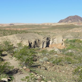
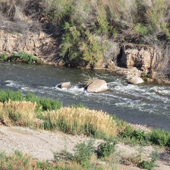
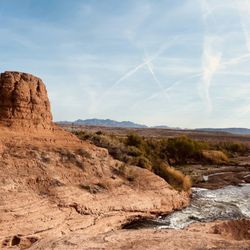
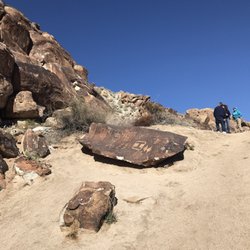
    Bluff Trail Photos

    Recommended Reviews - Bluff Trail

    Your trust is our priority, so businesses can't pay to alter or remove their reviews. Learn more about reviews.
    Yelp app icon
    Browse more easily on the app
    Review Feed Illustration
    Photo of Norm K.
    1425
    3298
    19874

    6 years ago

    Helpful 9
    Thanks 0
    Love this 7
    Oh no 0
    Photo of Daniel S.
    1439
    1694
    13825

    14 years ago

    Helpful 4
    Thanks 0
    Love this 4
    Oh no 0

    10 years ago

    Helpful 2
    Thanks 0
    Love this 1
    Oh no 0

    15 years ago

    Helpful 4
    Thanks 0
    Love this 1
    Oh no 0

    Verify this business for free

    People searched for Hiking 1,359 times last month within 15 miles of this business.

    Verify this business

    Shoreline Trail - One of the cool rock formations on the hike

    Shoreline Trail

    4.5(4 reviews)
    1.0 mi

    I hike part of the Shoreline Trail several times each winter when the temperatures permit. The…read moreShoreline Trail stretches from the former Las Vegas Bay boat launch area to the 3 Islands Overlook at 33 Hole about 2 miles south. When I hike this trail, it's because I'm hiking through what's known as White Owl Canyon and after going through some pipes to get to the old road, I return to the car by joining the Shoreline Trail about a mile from the parking area for 33 Hole and the 3 Islands Lookout. Some volunteers have done some nice work over the last couple of years by placing boulders along the trail so one knows where to go. This section has changed over the 7 years or so that I've been hiking the trail. The boulders work now because the level of the lake has fallen so much there's little danger that the trail will be covered by water and the rocks become useless. In fact, it has been very discouraging to watch the level of the lake drop so much that you now have to leave the trail to get to the edge of a stream that was once the lake. It is nice to see the water fowl and it's a pleasant hike when temperatures permit.

    YELP 365 CHALLENGE 2014-(313/365) "A Hiking We Will Go! "…read more Any time there's a chance to explore the outdoors, it's an automatic 5 stars for me. Add to that, a bunch of great people and our resident hike expert Norm leading the pack, you got yourself one heck of an excursion! There were 10 of us on this chilly morning and it was my first time inside the Lake Mead Area. The views here are so breathtaking, pictures and reviews don't do any justice...you gotta get out there and experience this yourself! This hike is about 3 miles and involves different elevations, a bit of rock scrambling, going through a few tunnels and a brief time inside owl canyon where we saw great rock formations, and even an owl who was guarding his/her huge nest nearby. there were also tons of clam shells scattered around and old Budweiser and Coors cans from the peel tab era. There also was a random wood frame kinda thing during our hike which made all of us clueless as to why anything was being constructed. After a short walk on the paved road way, we looped around and began the trek back to our cars along the rock formed trail taking in the awesome scenery and a last scramble up the same hill we first went down back to the parking lot. Thanks again Norm for another great hike, and we'll join you on the trail once again for your next hike! ALOHA!!! Shaka Meter: \uuu/ \uuu/ \uuu/ \uuu/ \uuu/ 5

    Photos
    Shoreline Trail - Inside the Tunnel. Up ahead .... Norm, Terri & Mel

    Inside the Tunnel. Up ahead .... Norm, Terri & Mel

    Shoreline Trail - Great short hike

    Great short hike

    Shoreline Trail

    See all

    Goldstrike Hot Springs - Forest service helicopter rescue in the gold strike canyon.

    Goldstrike Hot Springs

    4.8(126 reviews)
    10.0 mi

    This hike is not for dogs, and I wouldn't recommend small kids under 10. You have to go up and own…read moreropes, climb a lot of rocks. It is a part of willow beach. So I would recommend maybe meeting at the end of the trail if you HAVE to bring small kids or dogs. You would have to kayak or canoe from willow beach to the end of the trail. At willow beach they do have the equipment available for rent. This hike is long. It took me 4 hours to get to the end and back. There are 7 ropes you will have to go down and climb up to get back. We had to have young men help us up some of the rocks. Boost were needed, and assistance getting down the rocks.

    This was an incredible hike! 6 miles round trip, took us about 5 hours to complete!…read more The ropes were helpful throughout (climbing up was much easier then climbing down) however on some, the rocks were very slippery so I think metal stairs in place would be helpful and likely lead to less people getting injured or trapped! Also, it would be great if some trash bins could be placed throughout, this would go a long way in helping to keep this beautiful spot clean. I will definitely revisit again in the fall, recommend starting this hike at sunrise and when temps are 80 or below! Search and rescue teams were set up in the parking lot at around 12pm while we were making our way out, it was around 90 degrees and getting brutal so friendly word of caution, the temps can get extreme and also this is not a hike for children or dogs!!

    Photos
    Goldstrike Hot Springs
    Goldstrike Hot Springs - Parking lot to trail head. Free parking!

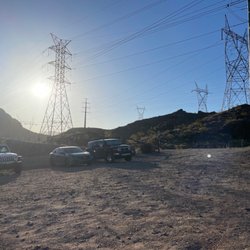
    Parking lot to trail head. Free parking!

    Goldstrike Hot Springs

    See all

    Anniversary Narrows Slot Canyon Hike

    Anniversary Narrows Slot Canyon Hike

    4.6(18 reviews)
    11.4 mi

    Great hike in Lake Mead. Once you see Mile marker 16 turn left into the dirt road. Take the road to…read moreOre Car Mine sign pass the sign and go about 400ft past Ore Car Sign to where the road ends. The last 200 Feet Hike in or back in with vehicle there is no turn around use a guide there is a 10ft drop at end of road from there walk into the wash to the right and travel the wash the side that narrows and walk .75 miles you will then begin Anniversary Narrows. When you enter off Marker 16 you will only see one small sign for Anniversary Narrows 4x4 makes it easier you can go by car just take it very slow. No cell service so do not get hurt out there.

    Epic hike! Only 45…read moremin from vegas to feel like your hiking in Antelope Canyon with a beautiful narrow slot canyon. Moderate hike definitely had some challenging areas but my legs are pretty strong from doing exercise classes so I took it slow and had a great experience. It rained in Vegas a few days prior to our hike, so the bowl of fire in the narrows was flooded about 3 feet. We took our shoes and socks off and slid our pants up and walked through it to get to the other side where the narrows begin. It was cold and unknown territory, but I'm so glad we did it because The rest of the hike was amazing.. Enter Lake Mead past the pay station and then turn left on North Shore Rd. Until you get to mile marker 16 take a left and follow the sign for Calville Wash until you see a fork in the road to the left is anniversary mine road. Keep left there. You don't wanna go to the right because it's deeper sand and without a 4 x 4 you may get stuck. So keep going left on anniversary mine Road it's a dirt road. You'll see some 2 WD parking shortly after being on that road but if you have a four-wheel-drive car, keep going down further until you see a wash. This will save you from having to walk further. From the 2WD point to the entrance of the narrows is 1.8 miles . You can't go any further into the wash because there's no way to get back up unless you have one of those big jumbo jeeps. Find some parking off the side of the road and walk into the wash, which is to the left. Follow the Wash for about a mile into the entrance of the narrows. There are several steep ledges throughout the hike and you'll see some spectacular hues of color throughout your time there.. once you reach the end of the narrows, you could keep going up to the top of the ridge and see an overlook of the narrows. There is also a mine that you can check out. We did not go any further than the end of the narrows, but plenty of other people were. We brought our two small dogs and everybody had a great time. Our friends from New York came with us and were deterred from the flooded fire bowl so they turned back and went to the car, but we continued on with our hike.

    Photos
    Anniversary Narrows Slot Canyon Hike
    Anniversary Narrows Slot Canyon Hike
    Anniversary Narrows Slot Canyon Hike

    See all

    Black Mountain Trail

    Black Mountain Trail

    4.8(50 reviews)
    17.1 mi

    7.1 mile hike. 3.5 one way and 3.5 back. Some say the hike…read moreis hard but I would say it's moderate until you hit the last 0.5 mile to the top. It's steep and you may have to climb just a little bit. Going down, just be careful and take your time. No shade, and can't imagine during the summer. Bring lots of water. Not crowded at all, and lots of parking as well, just no restroom. Great scenery with the top of the view, where you can see almost everything.

    This review is for trail number 404, which brings you to the peak of black mountain…read more To get to the trailhead just use the Shadow Canyon trailhead in your GPS. The trailhead is in the middle of a neighborhood. There's only about six parking spots, but people were parking on the street. It's almost a half mile on pavement until you actually start the trail. Just keep following the signs for markers 404. Once you get to 1.25 miles the trail will split. Keep going straight. Do not turn right onto marker 402. From here you will start noticing a big difference in the elevation. There are a lot of switchbacks. Be careful with your footing because there is a lot of loose rocks. It's a total of 3.6 miles to the very top. The last 3/4 of a mile gets pretty intense because you're going to have to actually climb up large rocks. You will lose sight of the flag pole that is at the top, but don't give up because when you least expect it you're at the top. The peak has 360° views of the Las Vegas strip, Henderson, Anthem, and you can even see the California/Nevada state line. There is a rock fort that you can sit in. There's an old military ammo box that other hikers left snacks in as well as a journal for you to submit an entry about your hike. It took me about 2 hours to ascend and 1.5 hours to descend. Difficulty was moderate to high.

    Photos
    Black Mountain Trail - Walking back

    Walking back

    Black Mountain Trail
    Black Mountain Trail - Sunsets are best at the top.

    See all

    Sunsets are best at the top.

    Valley of Fire State Park - Desert Beauty

    Valley of Fire State Park

    4.8(765 reviews)
    28.4 mi

    Valley of Fire State Park is one of the most breathtaking places I've ever visited. The bright red…read morerock formations almost look like you're on another planet, and every turn offers another incredible view. The scenic drive alone is worth the trip, but there are also plenty of great spots to stop, explore, and take photos. I especially enjoyed seeing the unique rock formations and the ancient petroglyphs. Everything was well maintained, and it was easy to spend several hours just taking in the scenery. If you're visiting the Las Vegas area, this is an absolute must see and well worth the drive. I would definitely come back again.

    Valley of Fire State Park was one of the highlights of our road trip. We drove in from Henderson…read moreand made it a stop along the way. There was a bit of a line of cars waiting to enter, but once inside, everything felt surprisingly uncrowded. One of the coolest surprises was seeing several bighorn sheep walking along the road. They were much bigger than I expected and fun to watch from a safe distance. The landscape here feels almost otherworldly. The vibrant red rock formations, unique shapes, and dramatic scenery make it feel like you're on another planet. We spent our time driving through the park, stopping at various viewpoints to explore and take photos. The visitor center is excellent, with a great gift shop, and very clean restrooms. It was quite warm during our visit, so be sure to bring plenty of water, especially if you plan to do any hiking. If you're anywhere near Las Vegas or Henderson, I highly recommend making time for Valley of Fire. The scenery is absolutely stunning and well worth the visit.

    Photos
    Valley of Fire State Park - A ram right off the side of the road

    A ram right off the side of the road

    Valley of Fire State Park - "Beehives"

    "Beehives"

    Valley of Fire State Park - Beautiful visitor center

    See all

    Beautiful visitor center

    Bluff Trail - hiking - Updated September 2026

    Loading...
    Loading...
    Loading...