Brushy Creek Regional Trail Photos


You might also consider


More like Brushy Creek Regional Trail
Recommended Reviews - Brushy Creek Regional Trail
Start your review...


Reviews With Photos


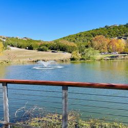
This is such a nice trail in Round Rock which I wasn't aware of but I'm so glad we came to check it out. There are several trails in this park but due to lack of time, we just walked around the lake itself. You have a beautiful view of the lake when you're walking along the trails plus paved out pathways which is great. You can go biking, fishing, running, walking, canoeing etc. They have parking around the trail which is great so no street parking unless the trail gets that busy (we came on a Sunday afternoon).


I love this trail! There are several parks attached to it along the way, each with their own personalities. Plus being able to hop on at different locations allows us to see different parts of the trail. There are tons of mountain bike trail varying in difficulty. If you are in a wheelchair, I'd recommend entering the trail at Brushy Creek Sports Park (park on the east side and take the sidewalk around the sports fields). The trail is well maintained and clean. There are big parking lots at each park. I love all the wildflowers along the path.


I really wanted to not like the Brushy Creek Regional Trail. Mostly because when I first came here, my running group dragged me here in the middle of summer when it was about 112 degrees.... But it's really well done, and what I wish the City of Austin would do with the area between Duval/Mopac and N. Lamar, along Walnut Creek. The Brushy Creek Regional Trail runs about seven miles, starting on one end from Twin Lakes Park at the YMCA on 183 in Cedar Park. It goes 2.25 miles, under 183A Toll and a somewhat isolated stretch before hitting the Brush Creek Sports Park, right before Parmer. In the next .75 miles, you'll then go under Parmer and then hit Brushy Creek Lake Park. Then every mile or so there is a different park: Champion Park, Olsen Meadows Park (no restrooms), and Creekside Park, before it ends between Great Oaks and Sam Bass. NOTE: If you are starting on the east side, just read the above paragraph backwards. After the first couple miles, most of the path consists of crushed stone/cinders (I've heard it called both). The rest is concrete, usually where necessary to reduce erosion, or where there are bridges. They seem to do a great job with maintaining the trail, as it's for the most part fairly wide, and free of uneven spots/holes. When the weather's right, it's suitable for runners at all levels, walkers, folks with jogging strollers, dog walkers (folks are really good at using their leashes), and cyclists (though some of them need to slow down near the narrower parts). I'd say the unpaved parts would be difficult on a scooter. Within each park are various perks: canoes, water features to play in, sports courts/fields of all varieties. Just check out each park if you are looking for something specific. I like that it's fairly shaded, and there is the occasional sounds of a babbling brook nearby. Occasionally, the path will branch off, providing direct access from neighborhoods. When not in a specific park, you may go a minute or so between passing other people. I've not been weirded out by this, though I've really only been mid-day on the weekend, or in the evening with a large group. I only wish there was more of a loop than just an out-and-back, but that's really my only issue with it. 4.6 stars


Great place for the family, for hiking, for biking, for walking your dog, for many different things. This is part of a chain of parks in the area. Wear good shoes when you come here as there are many trails to adventure on. The water makes it a bonus visit. Definitely one of our favorite freebie places to visit with our dog!


My wife and I just started walking on this trail. I love it! We park at the Twin Lakes YMCA and jump right on the paved trail. I like to go at night when it's cooler an hour before sundown. It's not too crowded at that time. Yesterday there was tons of blue bonnets, very cool. They smelled great, I need to bring a camera next time. There are animal prints running across the concrete every so often, not sure if those are some kind of marker? The trail is clean people do a good job picking up after their pets. There are stations with poop bags to make it easy. I have spotted a few deer crossing the trail, It has shady and sunny spots, an overall great scenic trail. There is a stinky part that quite a few people have mentioned. :-( You just have to hustle through it. Lol. I so wish I could bring my fresh fur baby with us, (he's not a people person) I'm positive he would enjoy it. The crowd is very diverse from runners, walkers, bikers, dog walkers, and families. It's a great safe beautiful place.
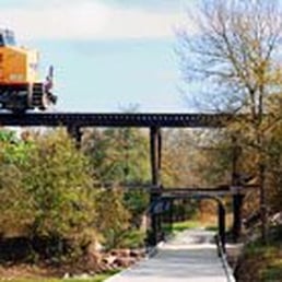

Sunny Days sweepin the clouds away... On my way to where the air is sweet... Can you tell me how to get, how to get to Brushy Creek?? OOOhhh I am sooo excited! I'd be waggin my tail too just like my babies when I took them out here Sunday a.m. Thanks to Carlos for drawing my attention to this little gem right by mi casa. Brand spankin new concrete "trail" extending from Cedar Park for 6+ miles to Round Rock, passing along the way a sports park with football/soccer fields, then the lake park with a good sized lake and picanic tables, then Champion park (which I have yet to see but sposedly has lots of fun stuff for kiddies). Great for runners, hikers, bird watchers, dog walkers and bikers. All along the path is alternately a creek and little ponds, ideal for my kiddos to get their feet wet (all 8 feet) or to just wallow in like my Barlo does. The sides of the trail are well maintained with fragrant cedar shavings and wildflowers and no poison ivy that I could see. And every 20 feet or so there's an animal track crossing the path in the concrete, from duck feet to dog pads. Too cute! Everyone we passed was super friendly with a "Good Morning" and courteous about sharing the path. Our end of the trail starts at the Twin Lakes YMCA where there is abundant parking and joy of joys for my golden, another nice sized pond with geese in it. My only regret is I forgot to bring a ball with me and I will never live down the expectant eyes he gave me at every turn. Rocks are just a poor substitute in the water. I have just one complaint and that is right at the beginning of the trail there's a wooden bridge over the creek and this whole area smells like, sorry there's just no better word for it, but it smells like dookie. We thought at first it was coming from the restrooms nearby but on our way back we felt it was coming from the stream itself, unfortunately where our dogs had just wallowed. I am hoping it was just a fluke and NOT that anything is dumped into that water. We swam our dogs in the Y lake just to be sure. But all in all it was a great day out with the kids!


I love having Brushy Creek Regional Trail near my house. There are so many different places to access the trail, (as it links up several parks) and the trail itself is incredibly diverse. I've walked many different portions during all four seasons and have always enjoyed the sights and sounds of the nature around me. On weekends, the trail can get really busy, and not all visitors are as courteous as most, so be forewarned. On a week day, like today, I visited and there was nary a person on the entire trail which made for a peaceful journey between the soccer fields and 183-A. I saw tons of bluebonnets, birds, and many trees are coming out with their new leaves. If you're looking for a nice peaceful place to take a bike ride or walk, Brushy Creek Regional Trail is one of the best places around. I'm reserving a star for the weekend crowding, and the lack of garbage cans along the trail between the soccer fields and 183-A.


I live right next to this place and everytime I go I swear there's something new to see or explore. It's got a ton of crap for kids. For grown ups, not so much... Only trails and pretty scenery for you to reflect about things going on in your life like regret and guilt. But don't let that stop ya checking out this nature park. Along the trail there is some sort of lake. It's got a cool little deck with a few methheads.. I mean fishermen.. You can stand on the dock and gawk at all the fat big houses and the pissed off rich people that hate seeing the likes of the poor.... Further down the trail are bridges with some history scribbling.. I didn't really read any of it.. It's kinda hard to do when you're drunk anyway. I was more impressed by the 1912-1920 exercise equipment they got for you to try.. Free of charge too I might add. After every quarter mile they have these big water coolers for people to use...again free of charge.. But during the week if you come by after 3, you can be sure it's gone.. One of these days I'm gonna fill those bad boys up with some cheap jug wine or maybe acid.. :) really throw some people off their game. ( I'm such an asshole for even thinking that) austinite's are very trusting people though. Jokes aside this park is a great place to bring your family, dog, even your sheep. Tons of trails to fit anyone's fancy. I kid you not they even have a satanic ritual rock circle trail... That's how I perceived it anyway. It may sound like I'm making fun of this place but I promise I'm not.. You will see my fat ass there at least twice a year.. kiddin, I go there daily. Can't get enough of the soccer moms and hard core cyclists. "LEFT" I got nothing else to say except check this place out! Good stuff..

Pros: - Well-planned - Public restrooms are spaced well (except maybe the westernmost 2.25 mile stretch but I appreciate that they even have public restrooms available - Crushed gravel to run/walk on - Lots of parking - Lots of party and sports facilities - Fish in water (saw people with fishing poles) Cons: - Too few people on the trail for me (but some people like solitude).


This place was beautiful. I went early on a Sunday morning and enjoyed seeing some people fishing, biking, and doing a photo shoot with their dog. I can't wait to come back with my dog and check out the trails. 10 out of 10 will go again.


One of the many trails I grew up on, walking, running and biking. This trail goes out to Round Rock and the whole circuit makes for a great workout.


Hike and Bike Trail at Brushy Creek Regional Park For those who enjoy nature at its finest, Brushy Creek Regional Trail also provides a natural habitat for native trees, vegetation, plants, wildflowers, and wildlife. Brushy Creek Sports Park This 54 acre park has it all! Baseball and Softball fields, Soccer, 9 Hole Disc Golf Course, Skateboard Park, Play Scape, Hiking and biking trails. The Skate Park is a Custom designed 15,000 Sq. ft. concrete in ground Skate Park, features a Mini Bowl, Large, Bowl and street course, which includes transitions, ledges, steps, rails and a volcano ramp. The 9 Hole Disc Golf Course length is 2901 ft. and is located next to the Basketball courts. http://brigittethompson.hubpages.com/hub/Things-to-do-in-Cedar-Park-TX-Brushy-Creek-Lake-Park-Walking-Hiking-Biking-Trails-Picnic-Family-Fishing-Canoe-Kayak-BBQ#


I love running on these trails! There are plenty of bathrooms and it has a nice nature view with water and a golf course.. Watch for falling golf balls! There are lots of deer and squirrels... The trail is safe and there are lots of runners and bikers daily! Lots of dog walkers too :)


A good place for outdoors activities. These include cycling, walking, running and taking pictures. The trails are wide and fairly easy to walk. They connect several parks where restrooms and parking are available. There are also playgrounds, picnic tables, tennis courts and even splash parks along the way. Dogs are also welcome. The dog stations are supplied with waste bags and trash cans. Additional benefits of coming here include fresh air, peace of mind, good aromas, wild life and beautiful sights. So if you need something to do, then stop by and get caught up In the fun. You could even meet a friend while getting a good dose of Vitamin D. read more


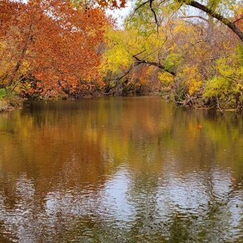


I absolutely love this trail. This trail is so extensive and pretty. This review is really for the portion of the trail in Round Rock that starts from AW Grimes and ends at Redbud Ln. I think it's important to download a map that outlines the whole trail. There are parts when you think it ends but it actually detours and continues. One of these parts is at Kenny Fort Blvd, the trail really goes an additional two miles east if you start at The Rabb House on AW Grimes. The doggo loves this trail and the shade it provides. There are some awesome benches to stop, rest and enjoy the sights and sounds of the creek. There are also plenty of poop bag stations and fountains along the way. I absolutely love these Round Rock trails and we visit often. Just be prepared for a crowd during the weekend. read more


2 years ago

8 years ago
This is such a nice trail in Round Rock which I wasn't aware of but I'm so glad we came to check it out. There are several trails in this park but due to lack of time, we just walked around the lake itself. You have a beautiful view of the lake when you're walking along the trails plus paved out pathways which is great. You can go biking, fishing, running, walking, canoeing etc. They have parking around the trail which is great so no street parking unless the trail gets that busy (we came on a Sunday afternoon). read more


7 years ago
I love this trail! There are several parks attached to it along the way, each with their own personalities. Plus being able to hop on at different locations allows us to see different parts of the trail. There are tons of mountain bike trail varying in difficulty. If you are in a wheelchair, I'd recommend entering the trail at Brushy Creek Sports Park (park on the east side and take the sidewalk around the sports fields). The trail is well maintained and clean. There are big parking lots at each park. I love all the wildflowers along the path. read more


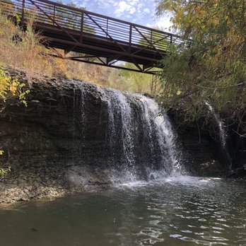


I really wanted to not like the Brushy Creek Regional Trail. Mostly because when I first came here, my running group dragged me here in the middle of summer when it was about 112 degrees.... But it's really well done, and what I wish the City of Austin would do with the area between Duval/Mopac and N. Lamar, along Walnut Creek. The Brushy Creek Regional Trail runs about seven miles, starting on one end from Twin Lakes Park at the YMCA on 183 in Cedar Park. It goes 2.25 miles, under 183A Toll and a somewhat isolated stretch before hitting the Brush Creek Sports Park, right before Parmer. In the next .75 miles, you'll then go under Parmer and then hit Brushy Creek Lake Park. Then every mile or so there is a different park: Champion Park, Olsen Meadows Park (no restrooms), and Creekside Park, before it ends between Great Oaks and Sam Bass. NOTE: If you are starting on the east side, just read the above paragraph backwards. After the first couple miles, most of the path consists of crushed stone/cinders (I've heard it called both). The rest is concrete, usually where necessary to reduce erosion, or where there are bridges. They seem to do a great job with maintaining the trail, as it's for the most part fairly wide, and free of uneven spots/holes. When the weather's right, it's suitable for runners at all levels, walkers, folks with jogging strollers, dog walkers (folks are really good at using their leashes), and cyclists (though some of them need to slow down near the narrower parts). I'd say the unpaved parts would be difficult on a scooter. Within each park are various perks: canoes, water features to play in, sports courts/fields of all varieties. Just check out each park if you are looking for something specific. I like that it's fairly shaded, and there is the occasional sounds of a babbling brook nearby. Occasionally, the path will branch off, providing direct access from neighborhoods. When not in a specific park, you may go a minute or so between passing other people. I've not been weirded out by this, though I've really only been mid-day on the weekend, or in the evening with a large group. I only wish there was more of a loop than just an out-and-back, but that's really my only issue with it. 4.6 stars read more


11 years ago

10 years ago
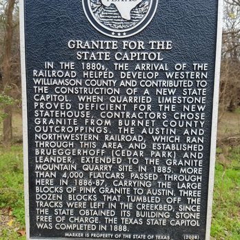
Great place for the family, for hiking, for biking, for walking your dog, for many different things. This is part of a chain of parks in the area. Wear good shoes when you come here as there are many trails to adventure on. The water makes it a bonus visit. Definitely one of our favorite freebie places to visit with our dog! read more


12 years ago
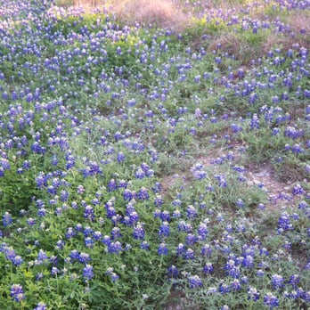
My wife and I just started walking on this trail. I love it! We park at the Twin Lakes YMCA and jump right on the paved trail. I like to go at night when it's cooler an hour before sundown. It's not too crowded at that time. Yesterday there was tons of blue bonnets, very cool. They smelled great, I need to bring a camera next time. There are animal prints running across the concrete every so often, not sure if those are some kind of marker? The trail is clean people do a good job picking up after their pets. There are stations with poop bags to make it easy. I have spotted a few deer crossing the trail, It has shady and sunny spots, an overall great scenic trail. There is a stinky part that quite a few people have mentioned. :-( You just have to hustle through it. Lol. I so wish I could bring my fresh fur baby with us, (he's not a people person) I'm positive he would enjoy it. The crowd is very diverse from runners, walkers, bikers, dog walkers, and families. It's a great safe beautiful place. read more



Sunny Days sweepin the clouds away... On my way to where the air is sweet... Can you tell me how to get, how to get to Brushy Creek?? OOOhhh I am sooo excited! I'd be waggin my tail too just like my babies when I took them out here Sunday a.m. Thanks to Carlos for drawing my attention to this little gem right by mi casa. Brand spankin new concrete "trail" extending from Cedar Park for 6+ miles to Round Rock, passing along the way a sports park with football/soccer fields, then the lake park with a good sized lake and picanic tables, then Champion park (which I have yet to see but sposedly has lots of fun stuff for kiddies). Great for runners, hikers, bird watchers, dog walkers and bikers. All along the path is alternately a creek and little ponds, ideal for my kiddos to get their feet wet (all 8 feet) or to just wallow in like my Barlo does. The sides of the trail are well maintained with fragrant cedar shavings and wildflowers and no poison ivy that I could see. And every 20 feet or so there's an animal track crossing the path in the concrete, from duck feet to dog pads. Too cute! Everyone we passed was super friendly with a "Good Morning" and courteous about sharing the path. Our end of the trail starts at the Twin Lakes YMCA where there is abundant parking and joy of joys for my golden, another nice sized pond with geese in it. My only regret is I forgot to bring a ball with me and I will never live down the expectant eyes he gave me at every turn. Rocks are just a poor substitute in the water. I have just one complaint and that is right at the beginning of the trail there's a wooden bridge over the creek and this whole area smells like, sorry there's just no better word for it, but it smells like dookie. We thought at first it was coming from the restrooms nearby but on our way back we felt it was coming from the stream itself, unfortunately where our dogs had just wallowed. I am hoping it was just a fluke and NOT that anything is dumped into that water. We swam our dogs in the Y lake just to be sure. But all in all it was a great day out with the kids! read more
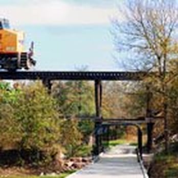

I love having Brushy Creek Regional Trail near my house. There are so many different places to access the trail, (as it links up several parks) and the trail itself is incredibly diverse. I've walked many different portions during all four seasons and have always enjoyed the sights and sounds of the nature around me. On weekends, the trail can get really busy, and not all visitors are as courteous as most, so be forewarned. On a week day, like today, I visited and there was nary a person on the entire trail which made for a peaceful journey between the soccer fields and 183-A. I saw tons of bluebonnets, birds, and many trees are coming out with their new leaves. If you're looking for a nice peaceful place to take a bike ride or walk, Brushy Creek Regional Trail is one of the best places around. I'm reserving a star for the weekend crowding, and the lack of garbage cans along the trail between the soccer fields and 183-A. read more


12 years ago
I live right next to this place and everytime I go I swear there's something new to see or explore. It's got a ton of crap for kids. For grown ups, not so much... Only trails and pretty scenery for you to reflect about things going on in your life like regret and guilt. But don't let that stop ya checking out this nature park. Along the trail there is some sort of lake. It's got a cool little deck with a few methheads.. I mean fishermen.. You can stand on the dock and gawk at all the fat big houses and the pissed off rich people that hate seeing the likes of the poor.... Further down the trail are bridges with some history scribbling.. I didn't really read any of it.. It's kinda hard to do when you're drunk anyway. I was more impressed by the 1912-1920 exercise equipment they got for you to try.. Free of charge too I might add. After every quarter mile they have these big water coolers for people to use...again free of charge.. But during the week if you come by after 3, you can be sure it's gone.. One of these days I'm gonna fill those bad boys up with some cheap jug wine or maybe acid.. :) really throw some people off their game. ( I'm such an asshole for even thinking that) austinite's are very trusting people though. Jokes aside this park is a great place to bring your family, dog, even your sheep. Tons of trails to fit anyone's fancy. I kid you not they even have a satanic ritual rock circle trail... That's how I perceived it anyway. It may sound like I'm making fun of this place but I promise I'm not.. You will see my fat ass there at least twice a year.. kiddin, I go there daily. Can't get enough of the soccer moms and hard core cyclists. "LEFT" I got nothing else to say except check this place out! Good stuff.. read more


Pros: - Well-planned - Public restrooms are spaced well (except maybe the westernmost 2.25 mile stretch but I appreciate that they even have public restrooms available - Crushed gravel to run/walk on - Lots of parking - Lots of party and sports facilities - Fish in water (saw people with fishing poles) Cons: - Too few people on the trail for me (but some people like solitude). read more


7 years ago
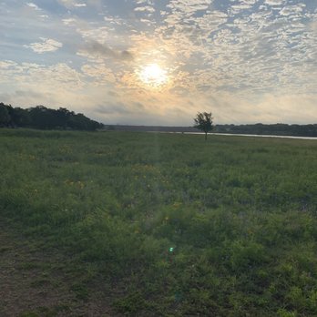
This place was beautiful. I went early on a Sunday morning and enjoyed seeing some people fishing, biking, and doing a photo shoot with their dog. I can't wait to come back with my dog and check out the trails. 10 out of 10 will go again. read more



13 years ago
Hike and Bike Trail at Brushy Creek Regional Park For those who enjoy nature at its finest, Brushy Creek Regional Trail also provides a natural habitat for native trees, vegetation, plants, wildflowers, and wildlife. Brushy Creek Sports Park This 54 acre park has it all! Baseball and Softball fields, Soccer, 9 Hole Disc Golf Course, Skateboard Park, Play Scape, Hiking and biking trails. The Skate Park is a Custom designed 15,000 Sq. ft. concrete in ground Skate Park, features a Mini Bowl, Large, Bowl and street course, which includes transitions, ledges, steps, rails and a volcano ramp. The 9 Hole Disc Golf Course length is 2901 ft. and is located next to the Basketball courts. http://brigittethompson.hubpages.com/hub/Things-to-do-in-Cedar-Park-TX-Brushy-Creek-Lake-Park-Walking-Hiking-Biking-Trails-Picnic-Family-Fishing-Canoe-Kayak-BBQ# read more


13 years ago
I love running on these trails! There are plenty of bathrooms and it has a nice nature view with water and a golf course.. Watch for falling golf balls! There are lots of deer and squirrels... The trail is safe and there are lots of runners and bikers daily! Lots of dog walkers too :) read more


I'm in Austin quite often and have ran this trail a few times. I'm an Ironman triathlete, so always looking for good spots for training runs when in a city other than home. This is definitely one of my favorite running trails anywhere. I like to start at the Twin Lakes Park at 2300 S. Bell Blvd in Cedar Park. From there, I run East along the trail. It's about 6.5 miles one way, so perfect for this morning's 10 miler. It has a nice mix of terrain. It's mostly concrete path, but has several parts that are DG to break up the pounding on the concrete. They also have a ton of single track if you'd prefer to do real trail running. There are a lot of mountain bike on the single track so be careful. It's mostly flat, but has enough elevation and scenery to keep it out of the boring category. It has a lot of trees, which provides good shade and for a February day, it's perfect for a mid-day run. I'd probably avoid that closer to the summer months. All in all, it's a great spot for a nice training run. It's clean, scenic, well marked and well maintained. read more


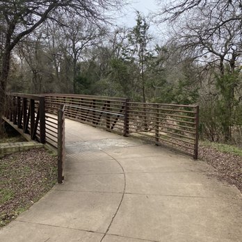


Great trail for walking, jogging or cycling. The scenery is great since it runs along brushy creek. There is a lot of wildlife, including ducks near the lake by the YMCA. The trail can get busy during peak times, but it really is a nice thing to have in the area. read more


6 years ago

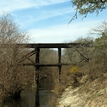
I've been holding off reviewing Brushy Creek Trail admittedly, for selfish reasons. Its SO perfect and not very crowded, I dread the day it gets as packed as some of the trails down in Austin. But the past couple months have seen the trail get busier and busier and I thought that I might post, not only a review, but some things for all of us trail users to keep in mind as we walk, run, bike, stroll, roller blade, etc. along. Just some things we can all do to make the trail a great experience for everyone. First of all, the traffic on the trail is just like the traffic on the road, please keep to the right. Slower traffic stays further right. Wandering all over the trail can actually be dangerous. If you are a parent with small children, please keep a hold of your kids. Toddlers can step out in front of faster moving traffic and cause accidents. The bikes get going pretty fast on the trail (I'll deal with that in a minute). The same goes for dog walkers. This is NOT AN OFF LEASH TRAIL. If you want your dog to be able to walk off leash with you, there are several excellent off leash trails in the Austin area. Please use one of them instead. No one on an off leash trail will mind if your dog runs up to greet them. Muddy paws, slobbery kisses, shedding, exuberant leaps of joy... all of that is welcomed on off leash trails. Not so on this trail. People on this trail have small children who may not want to be jumped on by dogs. Other dog walkers have taught their dogs that time on this trail is exercise time, not play time. If you want a social outing for your pet, please take them to a dog park! Loose dogs can cause bikers and roller bladers to loose control. Its common courtesy, keep your dog on a leash please! And dog walkers, as far as dog poo goes, here's the scoop (ha ha). There are no trash cans along this route except in the parks you pass. This means there may be a couple miles to carry the poop if you scoop it, so if you don't want to walk six miles with a ripe bag of poo in your hand, I get it. I don't think you should have to. The city needs to put more trash cans in if they want us to pick up the dog poop, but here's the deal; If your dog poops, do us all a favor and make sure its not directly on the trail (please for love of God cause that's just plain NASTY). If it is, bag it up and take it over, off the trail, way out of the way of people who may have to pass along the sides, and dump it, but DO NOT leave it in the bag!!! Nature has all sorts of little janitorial creatures who will dispose of dog poo in a relatively short period of time, but they can not do this if it is in a bag! What makes people think that putting the poo in a bag and then leaving the bag littering the side of the trail is a better alternative? I don't get it when people do that. Then I have to pass by all these little poop bags day in and day out for months, wondering why people are so dumb. As for the runners and bikers and roller bladers, there are things you all can do to help out too. Its not a race course. It is SO not worth the extra speed if you are the one that hits a little kid. Just think of that. Ugh! If you need to train at high speeds, go somewhere else where you are not endangering others. For Bikers a bell is a great way to let people know you are coming up behind them to pass. If you do not have a bell, it is only polite to call out "On your left," before you pass. It may save your ass as well as someone else's. Everyone who works out with earphones should keep the volume at a level where they can hear traffic coming up behind, that's just common sense. And two final notes for parents. First, this is probably not the right place to teach your child to ride a bike. Because other people are using this trail to work out, its really not safe to have a child who is not in good control of a bike. Please teach the kids at home and bring them out when they are confidently able to navigate around by themselves. Second, a lot of you seem to take walks together, and that's great. What is NOT great is when there are two or three of you, and several of you have those double-wide strollers, and all of you are talking and walking side by side stretched across the ENTIRE trail. Everyone in your path has to dive into the weeds or be mowed down. Know this, pushing a stroller does not excuse you from the laws of common courtesy. If your group takes up more than half the trail, SOMEONE in your group just has to be the bigger person who will fall back or sprint ahead in order to clear the left hand side of the trail and let others pass by. If everyone just does these few, simple things, the trail will be a wonderful experience for everyone, no matter how many people use it. read more




6 years ago


17 years ago

11 years ago
So glad I found this gem. Always looking for a nice place to run that I feel safe. There was enough people around but not overly crowded. Such a beautiful park. I will be back soon! read more


13 years ago

12 years ago


9 years ago

13 years ago

16 years ago

17 years ago
15 years ago
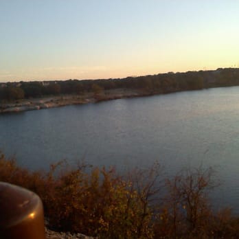
I rode this today and it was awesome there are several rest areas along the park and the View of the lake is amazing the trail itself is good for all types of bikes from road, hybrid, mountain bikes and the area that is isn't sidewalk is not too gravely. It has emergency phones along the route and water fountains and bathrooms. The inclines are not really too bad or too much and when your done you feel a sense of really accomplishing getting more fit! Great for beginner bikes I do recommend if you are passing pedestrians to say "on your right or on your left" for safety reasons. Over all this hike and bike trail is thumbs up and only has one pond that has a funny smell to it but other than that the view takes your breath away. read more




7 years ago
Page 1 of 2
More info about Brushy Creek Regional Trail
Brushy Creek Regional Trl
Cedar Park, TX 78613
Directions
Hours
Indoor Amenities
Outdoor Amenities
Ask the Community - Brushy Creek Regional Trail
Is there anywhere on the trail to get in water and swim/wade, like in the green belts?
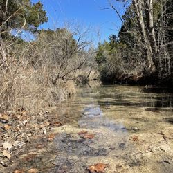
This isn't water that looks like anyone would want to get in!
What are the hours of the park/trail? Thinking of going late evenings?
Per the city website, the hours are "Half-hour before sunrise until 10 p.m. daily"…
Review Highlights - Brushy Creek Regional Trail
You might also consider















Why does Yelp recommend reviews?
3 reviews that are not currently recommended
The reviews below are not factored into the business's overall star rating.
12 years ago

15 years ago

Brushy Creek Regional Trail - hiking - Updated September 2026
Best of Cedar Park
People found Brushy Creek Regional Trail by searching for…
Places to Take Pictures in Cedar Park, TX
Fishing Spots in Cedar Park, TX
Hiking Trails With Waterfalls in Cedar Park, TX
Swimming Holes in Cedar Park, TX
Scenic Drive in Cedar Park, TX
Walking Trails in Cedar Park, TX
Scenic Overlook in Cedar Park, TX
Off Road Trails in Cedar Park, TX
Running Trails in Cedar Park, TX
Things to Do in Cedar Park, TX
River Swimming in Cedar Park, TX
Dinosaur Park in Cedar Park, TX
Walking Groups in Cedar Park, TX
Beautiful Views in Cedar Park, TX
Trending Searches in Cedar Park, TX
Apple Orchards near Brushy Creek Regional Trail
Apple Picking near Brushy Creek Regional Trail
Barbershop near Brushy Creek Regional Trail
Bike Shop near Brushy Creek Regional Trail
Casinos near Brushy Creek Regional Trail
Cliff Jumping near Brushy Creek Regional Trail
Consignment Shops near Brushy Creek Regional Trail
Cruising Spots near Brushy Creek Regional Trail
Dog Friendly Things To Do near Brushy Creek Regional Trail
Estheticians near Brushy Creek Regional Trail
Eyebrow Threading near Brushy Creek Regional Trail
Eyelash Extensions near Brushy Creek Regional Trail
Furniture Stores near Brushy Creek Regional Trail
Hiking Trails With Waterfalls near Brushy Creek Regional Trail
Kids Birthday Party near Brushy Creek Regional Trail
Lakes & Ponds near Brushy Creek Regional Trail
Makeup Artists near Brushy Creek Regional Trail
Middle Schools & High Schools near Brushy Creek Regional Trail
Off Road Trails near Brushy Creek Regional Trail
Parks near Brushy Creek Regional Trail
Picnic Areas near Brushy Creek Regional Trail
Places To Take Pictures near Brushy Creek Regional Trail
Public Shower near Brushy Creek Regional Trail
Rock Quarry near Brushy Creek Regional Trail
Scenic Night View near Brushy Creek Regional Trail
Scenic Overlook near Brushy Creek Regional Trail
Sunrise View near Brushy Creek Regional Trail
Swimming Holes near Brushy Creek Regional Trail
Browse Articles
Browse Nearby
BEST of Cedar Park, Texas Coffee near Brushy Creek Regional Trail
BEST of Cedar Park, Texas Things to Do near Brushy Creek Regional Trail
BEST of Cedar Park, Texas Restaurants near Brushy Creek Regional Trail
BEST of Cedar Park, Texas Photo Spots near Brushy Creek Regional Trail
BEST of Cedar Park, Texas Parks near Brushy Creek Regional Trail
BEST of Cedar Park, Texas Breakfast near Brushy Creek Regional Trail
Browse Brands
Related Searches in Cedar Park, TX
Affordable Kayak Rental Services in Cedar Park, Texas
Best Dog Hiking Trails Around Cedar Park, Texas
Best Fishing Locations and Guides in Cedar Park, Texas
Best Nature Trails for Hiking in Cedar Park, Texas
Best Places for Horseback Riding in Cedar Park, Texas
Best Sightseeing Experiences Available in Cedar Park, Texas
Best Waterfalls and Swimming Holes in Cedar Park, Texas
Check Out Off Road Trails in Cedar Park, Texas
Discover Dog Friendly Trails to Explore in Cedar Park, Texas
Discover Kid Friendly Hiking Trails in Cedar Park, Texas
Discover Popular Bike Trails in Cedar Park, Texas
Discover Walking Parks in Cedar Park, Texas Near You
Discover a Hiking Trail in Cedar Park, Texas
Discover the Best Night Hike Trails in Cedar Park, Texas
Dog-Friendly Hikes With Dogs in Cedar Park, Texas
Enjoy Camping Adventures Around Cedar Park, Texas
Enjoy Kayaking Adventures in Cedar Park, Texas
Enjoy Off Leash Dog Hikes in Cedar Park, Texas
Enjoy Scenic Places to Walk in Cedar Park, Texas
Enjoy Tent Camping Spots Around Cedar Park, Texas
Enjoy a Beautiful Waterfall Hike in Cedar Park, Texas
Enjoy the Best Walking Path in Cedar Park, Texas
Enjoy the Best Walking Trails in Cedar Park, Texas
Explore Beautiful Parks and Green Spaces in Cedar Park, Texas
Explore Easy Hikes Perfect for All in Cedar Park, Texas
Explore Fun Activities to Do in Cedar Park, Texas
Explore Popular Campgrounds Near Cedar Park, Texas
Explore Popular Dog Walking Trails in Cedar Park, Texas
Explore Top Dog Parks in Cedar Park, Texas Near You
Explore the Best Beach Spots in Cedar Park, Texas
Explore the Best Swimming Holes Around Cedar Park, Texas
Family Friendly Hiking With Kids in Cedar Park, Texas
Find Popular Ziplining Spots Around Cedar Park, Texas
Find Top-Rated Waterfalls in Cedar Park, Texas Now
Find the Best Parks for Picnics in Cedar Park, Texas
Hiking Trails With Waterfalls in Cedar Park, Texas
Off Leash Dog Hiking Trails in Cedar Park, Texas
Popular Fishing Spots to Explore in Cedar Park, Texas
Popular Outdoor Activities to Try in Cedar Park, Texas
Popular Picnic Spots to Visit in Cedar Park, Texas
Safe River Swimming Areas in Cedar Park, Texas
Safe and Fun Parks for Kids in Cedar Park, Texas
Top Hiking Trails to Explore in Cedar Park, Texas
Top Running Trails to Explore in Cedar Park, Texas
Top Swimming Lakes to Enjoy in Cedar Park, Texas
Top Swimming Spots and Pools in Cedar Park, Texas
Top-Rated Camping Sites in Cedar Park, Texas


