Cataloochee Trail Photos


More like Cataloochee Trail
Recommended Reviews - Cataloochee Trail
Start your review...

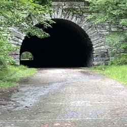
This marker is along the highway and adjacent to a boat ramp area, so there is a spot to pull over and park while you appreciate the beauty of the Lake Junaluska in the mountains and read the marker. It has the same text on both sides. It reads, "Cataloochee Trail. An old Indian path across mountains used by early settlers and in 1810 by Bishop Asbury. Trail passed nearby." The online essay has more information. "Cataloochee Trail, located in the Great Smoky Mountain National Park, served as a pathway for both Native Americans and European settlers over the Appalachian Mountains. The earliest extant mention of the trail appears in 1799, and refers to the Cataloochee as a "turnpike." By that point, the Cherokee had abandoned the region, and Col. Robert Love, a Revolutionary War veteran and land speculator, had purchased the land." This is marker number P-50 and it was erected by the North Carolina Department of Cultural Resources. [Review 1163 of 2024 - 3653 in North Carolina - 22186 overall] read more
More info about Cataloochee Trail


Cataloochee Trail - landmarks - Updated July 2026
Best of Waynesville
People found Cataloochee Trail by searching for…
Things to Do in Waynesville, NC
Scenic Overlook in Waynesville, NC
Abandoned Buildings in Waynesville, NC
Places to Take Pictures in Waynesville, NC
Scenic View in Waynesville, NC
Walking Trails in Waynesville, NC
Hiking Trails in Waynesville, NC
View Points in Waynesville, NC
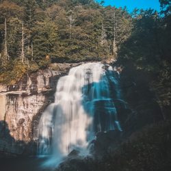
Waterfalls and Swimming Holes in Waynesville, NC
Photo Spots in Waynesville, NC
Historical Sites in Waynesville, NC
Tourist Attractions in Waynesville, NC
Hidden Gems in Waynesville, NC
Public Services & Government in Waynesville, NC
Field Trips in Waynesville, NC
Trending Searches in Waynesville, NC
Blueberry Picking near Cataloochee Trail
Boat Tours near Cataloochee Trail
Cliff Jumping near Cataloochee Trail
Day Trips near Cataloochee Trail
Free Picnic Areas near Cataloochee Trail
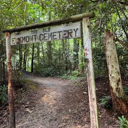
Historical Sites near Cataloochee Trail
Jet Ski Rental near Cataloochee Trail
Kayak Rental near Cataloochee Trail
Kids Activities Indoor near Cataloochee Trail
Landmarks & Historical Buildings near Cataloochee Trail
Lookout Points near Cataloochee Trail
Peach Picking near Cataloochee Trail
Places To Visit near Cataloochee Trail
Places To Walk Around near Cataloochee Trail
Public Art near Cataloochee Trail
River Swimming near Cataloochee Trail
River Tubing near Cataloochee Trail
Scenic Restaurants near Cataloochee Trail
Secluded Spots near Cataloochee Trail
Sightseeing near Cataloochee Trail
Small Venues & Event Spaces near Cataloochee Trail
Soccer Store near Cataloochee Trail
Swimming Holes near Cataloochee Trail
Swimming Lakes near Cataloochee Trail
Things To See near Cataloochee Trail
U Pick Farms near Cataloochee Trail
Browse Articles
Browse Nearby
BEST of Waynesville, North Carolina Restaurants near Cataloochee Trail
BEST of Waynesville, North Carolina Coffee near Cataloochee Trail
BEST of Waynesville, North Carolina Things to Do near Cataloochee Trail
BEST of Waynesville, North Carolina Breakfast near Cataloochee Trail
BEST of Waynesville, North Carolina Museums near Cataloochee Trail
BEST of Waynesville, North Carolina Photo Spots near Cataloochee Trail
BEST of Waynesville, North Carolina Ski Resorts near Cataloochee Trail
BEST of Waynesville, North Carolina Hotels near Cataloochee Trail
BEST of Waynesville, North Carolina Campgrounds near Cataloochee Trail
Browse Brands
Related Searches in Waynesville, NC
Best Lookout Points to Visit in Waynesville, North Carolina
Best Nature Trails for Hiking in Waynesville, North Carolina
Best Waterfalls and Swimming Holes in Waynesville, North Carolina
Book Engaging Historical Tours in Waynesville, North Carolina
Discover Charming Historic Homes in Waynesville, North Carolina
Discover Famous Monuments in Waynesville, North Carolina
Discover Lakes & Ponds to Explore in Waynesville, North Carolina
Discover Popular Landmarks in Waynesville, North Carolina
Discover Popular Photo Spots in Waynesville, North Carolina
Discover Top Points of Interest in Waynesville, North Carolina
Discover the Best Air Museum Exhibits in Waynesville, North Carolina
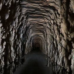
Discover the Best Caves to Explore in Waynesville, North Carolina
Discover the Best Interactive Museum in Waynesville, North Carolina
Discover the Best Military Museum in Waynesville, North Carolina
Enjoy the Best Walking Trails in Waynesville, North Carolina
Explore Beautiful Botanical Gardens in Waynesville, North Carolina
Explore Beautiful Castles and Landmarks in Waynesville, North Carolina
Explore Beautiful Parks and Green Spaces in Waynesville, North Carolina
Explore Free Things to Do Around Waynesville, North Carolina
Explore Fun Activities to Do in Waynesville, North Carolina
Explore Fun Field Trips in Waynesville, North Carolina
Explore Interactive Science Museums in Waynesville, North Carolina
Explore Nature Spots Around Waynesville, North Carolina
Explore Popular Scenic Overlook Points in Waynesville, North Carolina
Explore Popular Scenic Views Near Waynesville, North Carolina
Explore Secret Spots Worth Visiting in Waynesville, North Carolina
Explore Venues & Event Spaces in Waynesville, North Carolina
Explore the Rich History in Waynesville, North Carolina
Explore the Top Car Museum in Waynesville, North Carolina
Find Beautiful Views in Waynesville, North Carolina
Find Top Art Museums in Waynesville, North Carolina
Find the Best Bridge Spots in Waynesville, North Carolina
Find the Best Parks for Picnics in Waynesville, North Carolina
Great Things to See and Do in Waynesville, North Carolina
Must-See Tourist Attractions Around Waynesville, North Carolina
Plan a Scenic Drive Route Near Waynesville, North Carolina
Popular Places to Take Pictures in Waynesville, North Carolina
Popular Places to Walk Around in Waynesville, North Carolina
Popular Things to Do in Waynesville, North Carolina
Popular Things to See in Waynesville, North Carolina
Top Hiking Trails to Explore in Waynesville, North Carolina
Top Places to Visit in Waynesville, North Carolina for Sightseeing
Top-Rated Plantation Tours Near Waynesville, North Carolina
Tour Famous Lighthouses Located in Waynesville, North Carolina
Tour Popular Historical Sites in Waynesville, North Carolina
Visit Beautiful Gardens in Waynesville, North Carolina
Visit Popular Museums in Waynesville, North Carolina Now


