Cancel

    Open app

    Search

    No-Till Farming Historical Marker

    3.0 (1 review)

    No-Till Farming Historical Marker Photos

    More like No-Till Farming Historical Marker

    Recommended Reviews - No-Till Farming Historical Marker

    Your trust is our priority, so businesses can't pay to alter or remove their reviews. Learn more about reviews.
    Yelp app icon
    Browse more easily on the app
    Review Feed Illustration
    Photo of Bruce K.
    2415
    25967
    76265

    2 years ago

    Helpful 6
    Thanks 1
    Love this 2
    Oh no 0

    Verify this business for free

    Get access to customer & competitor insights.

    Verify this business

    Biltmore Estate - Ice cream was incredible!!

    Biltmore Estate

    4.0(1.6k reviews)
    22.1 mi
    $$$

    My husband and I almost skipped the Biltmore because we thought maybe too touristy, but that would…read morehave been a huge mistake because it ended up being one of my favorite stops in Asheville. I even found myself wishing we stayed at the Biltmore Inn so we could wake up and enjoy the beauty everyday in Asheville. We visited during Luminere, which is a new attraction where the Biltmore estate and gardens basically light up after 9pm. We got there a few hours earlier to enjoy the grounds, do some wine tasting (lines too long so just purchased some wine instead) and take in a beautiful sunset. It really is the most gorgeous place to watch a sunset. Luminere began with a light show that shared the history of the Biltmore Estate which i found pretty interesting. Then we walked thru the gardens, which was all lit up similar to what i've experienced at many botanical gardens during the holidays. It was a gorgeous night, a beautiful show and a great way to get our steps in. I think visiting the Biltmore any time of day would be special, but this was an extra fun way to see it!

    This had been on my bucket list a long time and while everyone has a different opinion of the tour,…read moreI LOVED every minute I was in there. Being a history and architectural enthusiast, along with being obsessed with this time period, it was amazing to walk through every room and envision what it was like during the time they lived there and marvel at the construction and invention. I highly suggest touring it if you haven't. NOTE: I hear Christmas is spectacular there!

    Photos
    Biltmore Estate - A hall way

    A hall way

    Biltmore Estate - A bedroom

    A bedroom

    Biltmore Estate - The hot dog was delicious

    See all

    The hot dog was delicious

    High Falls Covered Bridge - High Falls Covered Bridge, Cedar Mountain

    High Falls Covered Bridge

    5.0(2 reviews)
    34.4 mi

    Big thanks to Richard R. for adding this one that did not come up in the usual searches and yet, it…read morewas the main reason I passed through the DuPont Forest. I love bridges and I love covered bridges even more! And wow, thanks for the amazing writeup of all the drama on this property that was an eye-opener. I parked the van at the High Falls Trailhead (there are restrooms and even a wifi here!) and made my way along the trail to the bridge. It's about 0.75 of a mile on a path through the woods. I am apparently not as delicious as usual as I earned zero mosquito bites despite sweating a lot in the humidity. I'd call this walk "easy plus." The bridge itself is impressive and quite modern. And I would suggest not missing the nearby Falls though I was simply too tired and it was getting too late for me. I'll need to plan better next time! The walk back was much easier as I opted to take the gravel road that is easy and smooth, but only open for emergency vehicles and the forest rangers. I would rate the hike as "easy" for 0.6 miles though not wheelchairable. You can ask the rangers for access by vehicle for handicapped but they're only open regular hours. [Review 20030 overall - 3463 in North Carolina - 1005 of 2023.]

    High Falls Covered Bridge (also known as Buck Forest Covered Bridge) is one of my favorite bridges…read morein the Southern United States. It is a modern structure that has an interesting history. It is an example of the power of the people versus the dollar power of a developer. HISTORY In 1999, Sterling Diagnostic Imaging decided to sell their interest in the land that holds Triple Falls and High Falls, two of the most gorgeous waterfalls you will ever visit this side of the Mississippi. For reasons still unknown, the company decided to use an unusual bidding method by choosing to keep the bidding private and secretive. The State offered up a bid in efforts to save the land for public use, but Sterling announced a developer by the name of Jim Anthony won with a bid of 6.35 million. The developer initially announced in the Hendersonville Times News that he had no plans to develop the land, but instead wanted to use it as a private retreat. However, it soon became apparent Anthony was indeed planning a massive upscale gated community. The fact that the deed he purchased from Sterling Diagnostics stating the land could not be used for residential purposes at the Transylvania Courthouse did not seem to matter. It was later discovered the complex legal agreement between the two was unenforceable and the battle began between the state and Anthony. Anthony proceeded to begin building the roads and this gorgeous covered bridge as part of his planned community, but thankfully he was ultimately defeated. On October 23, 2000 Governor Jim Hunt and the Council of State unanimously voted to invoke eminent domain on the tract of land owned by developer Anthony. In many ways Anthony still won big, because the State paid him 24.5 million dollars in an out of court settlement. WOW! The Falls opened to the public on December 17, 2000. Since then, the entire 2200 acres has been integrated into Dupont State Forest. [History Reference: Romantic Asheville - "How Dupont State Forest was saved"] FINAL THOUGHTS Aside from being one of the most beautiful covered bridges you will ever see, it also is part of a trail system that includes arguably the most beautiful waterfalls in the South. If that is not enough of a reason to come here, let me give you movie fans one more reason. Many scenes from the 1st Hunger Games were filmed right here in this forest. The scene were Katniss finds Peeta camouflaged in the ground at the waterfall is located on the second tier of Triple Falls... just a half mile downstream of High Falls Covered Bridge. Movie scene: https://www.youtube.com/watch?v=UxvyMiwhJWw Year Built: 2000 Obvious materials: Wood, stone, concrete Spans over: Little River at the top of High Falls Location: Dupont State Forest @ Buck Forest Road

    Photos
    High Falls Covered Bridge - High Falls Covered Bridge, Cedar Mountain

    High Falls Covered Bridge, Cedar Mountain

    High Falls Covered Bridge - High Falls Covered Bridge, Cedar Mountain

    High Falls Covered Bridge, Cedar Mountain

    High Falls Covered Bridge - Lots of riders use the trails, so your chances of seeing a group on horseback is pretty good!

    See all

    Lots of riders use the trails, so your chances of seeing a group on horseback is pretty good!

    Kuwohi - Walk up the tower

    Kuwohi

    4.6(204 reviews)
    31.9 mi

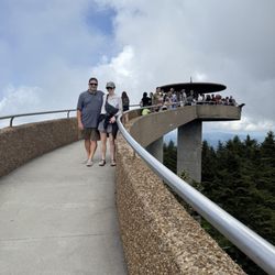
    At 6643 feet, Clingmans Dome, now known by its Cherokee name, Kuwohi, is the highest point in the…read moreGreat Smoky Mountains National Park. My visit to Kuwohi was a highlight of my visit to Great Smoky Mountains National Park. The drive up to the summit is breathtaking. There are several overlooks along the way to stop and enjoy the views. When we arrived, it was about 20 degrees colder than in Gatlinburg and it was very windy. Fortunately, we had dressed warm for the hike. The half mile trail is paved and accessible, however, the climb is straight up and was very difficult for some people. At the top of the trail we passed the Appalachian Trail. Then we found a fantastic Mid Century concrete spiral structure to climb. At the top, is an observation deck with placards describing the magnificent views of Tennessee and North Carolina. The modern observation deck was completed in 1960, replacing a wooden structure. Thomas Lanier Clingman was one of the early explorers that mapped the region in the 1850's. Kuwohi was (and still is) a sacred mountain of the Cherokee people. The mountain held Magic Lake that is believed to have healing powers for those who value the earth and its people. Parking permits are required to park in the large lot. Permits can be purchased on site for $5/day. Restroom facilities are available, but no running water. A nearby Visitors Center sells maps, shirts and other hiking gear. Kuwohi is a must visit on a trip to SMNP. Bring warm clothes (gloves, hat, etc). Cell tower reception is poor, so maps are helpful.

    This stop has been on my list for awhile, and I'm not really sure how I hadn't made it yet…read moreconsidering the amount of times I've road tripped to the Smokies... but here we are! Got to see a bear on the way coming from Oconaluftee, which meant the day was perfect no matter what else happened. The weather was a little rainy, scattered storms here and there, and the cloud cover wasn't great for a great view from the overlook, but.... The parking lot view was still excellent, and the overlook itself was cool to see, and there was a Passport stamp station and Visitor Center, loads of camp style restrooms, with plenty of parking, so, absolutely worth the stop!

    Photos
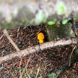
    Kuwohi - Mushrooms in sight

    Mushrooms in sight

    Kuwohi
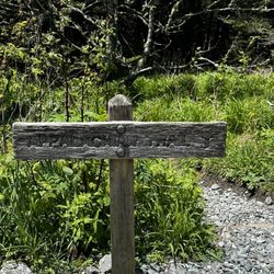
    Kuwohi - Trail sign along the path to the dome

    See all

    Trail sign along the path to the dome

    Alum Cave Trail - Alum Cave Trail to Mount LeConte | Instagram: @telephonesmoothie

    Alum Cave Trail

    4.9(41 reviews)
    29.1 mi

    Today was our second time back to Alum Cave Trail, and we did the 2.3 miles to Alum Cave Bluff and…read morethen turned back, for a total of 4.6 miles. You can go on for a total of five miles to reach Mt. Leconte, but since the weather was turning and it was starting to rain we cut our hike short. Like others, I suggest getting to this trail head early, as at 7:30 am half the parking lot was full!! We love this trail in particular for its endless water features, lots of scenic spots to take pictures, unique bridges, and the breathtaking view from the top. Even with the bad weather today, it was something spectacular watching the fog lift above the golden trees. If you haven't been, this trail is definitely worth your time and attention. You will want to wear some sturdy walking shoes for this one and maybe even bring a walking stick!!

    Gorgeous trail with diverse beauty. We did the medium length hike to the bluff and loved it. Once…read moreyou pass the cave the whole hike is pretty much going uphill so come prepared to get a workout in and wear proper shoes and bring some water. The views are great from the bluff and totally worth it. We came during the week around noon and parking lot was full so we had to park further out and walk about a half mile or so to the trail so be prepared for that or plan your time. Totally worth it! One of my favorite hikes that we did in the area. Loved being by the creek, the log crossings, the cave, the moss, the trees, and the Mountain Views. the scenery was so pretty. There is a bathroom on-site at the start of the trail in case you are wondering.

    Photos
    Alum Cave Trail
    Alum Cave Trail - Alum Cave Trail to Mount LeConte | Instagram: @telephonesmoothie

    Alum Cave Trail to Mount LeConte | Instagram: @telephonesmoothie

    Alum Cave Trail - Perfect day for an autumn scenery hike.

    See all

    Perfect day for an autumn scenery hike.

    Old Iron Bridge

    Old Iron Bridge

    4.5(2 reviews)
    42.8 mi

    First off the Old Iron Bridge is not a business but rather a scenic stop on the Chattooga river…read more The bridge crosses the river between Cashiers and Highlands and is located on a dirt forestry road. It is certainly worth the visit. The original poster here offers a great deal of information about this bridge.

    Do you ever see a landmark on Google Maps and wonder what it looks like in person? I do! I actually…read morespend hours when I'm bored traveling the world via Google Earth. It's how I find interesting things to do when I plan to be in a specific area either hiking or on vacation. ~~~ What makes this Old Iron Bridge special is its location over the mighty Chattooga River very early in the rivers journey. My guess is it's about 8 miles from where its headwaters begin @ Cashiers Lake. The Chattooga eventually becomes a much larger, wider and wild river as well as the defining squiggly boundary line between northeast Georgia and western South Carolina. This same river eventually bleeds into Lake Hartwell and soon after becomes the Savannah River, dumping all this fresh water into the Atlantic ocean. So, almost its entire journey defines South Carolina from Georgia, and it all begins very near this Old Iron Bridge. Call me a nerd if you want, but it simply fascinates me that I could possibly drop a note in a bottle from this bridge, and it has the potential of reaching Savannah, Georgia on a long journey 300+ miles away. Of course the bottle would have to survive the Class V crushing rapids + overcome multiple dams on the way to Savannah, but a fun thought nonetheless. Or what if you could drop a gallon of dye into the water that doesn't dissolve and track how long it takes to make it to the Atlantic? As a kid, I always has a fascination of how things work... like how far up does a helium filled party balloon travel and how many miles away will it be found? Coordinates: 35°00'57.5"N 83°07'34.8"W ~~~ [ WATERFALLS ] The most interesting highlight of this bridge is the waterfall below it! It's not a huge one (more of a large rapid in high water), but a thunderous spot in the river nonetheless as the southbound river takes a sharp turn east just past the bridge! I didn't know it until after I got home, but there was a spot on the other side of the river where I could have gotten a great pic of the falls, like this pic I found on pinterest: https://i.pinimg.com/originals/31/f6/fa/31f6fa1c47cfb5c0b57bc8417bea56aa.jpg My photos are from the opposite side of the bridge, which by the way, has a trail and a small parking area good for two cars. The trail leads down to the river and in a rainy period, you may also spot a LARGE 100'+ waterfall in the distance coming off the Chattooga Cliff on Bullpen Mountain. I only took the trail a short way to get a better pic of the distant waterfall, but it seems to follow the river north. ~~~ [ HISTORY ] Style: Pony truss bridge Status: Open to traffic Built: 1934 Length of largest span: 79.7 ft. Total length: 81.7 ft. Deck width: 11.8 ft. Also called Chattooga River Bridge Bull Pen Bridge Ammons Branch Bridge ~~~ [ FINAL THOUGHTS ] If you are a fan of bridges, this is a great one to add to your photo collection. Bull Pen Road is a nice wooded drive from Burrell's Ford Campground to Highlands, North Carolina. IF you are a fan of waterfalls, Kings Creek Fall and Spoonauger Falls are near the campground, and Secret Falls, Dry Falls as well as a high concentration of other named waterfalls are all near the Highlands! Enjoy 2020 / 8

    Photos
    Old Iron Bridge - Ye' Old Iron Bridge

    Ye' Old Iron Bridge

    Old Iron Bridge - View of the bend in the river from Old Iron Bridge on a high volume day!

    View of the bend in the river from Old Iron Bridge on a high volume day!

    Old Iron Bridge - View of the 2nd waterfall from near Old Iron Bridge on a high volume day!

    See all

    View of the 2nd waterfall from near Old Iron Bridge on a high volume day!

    The Flat Iron

    The Flat Iron

    4.0(5 reviews)
    21.4 mi

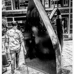
    Unique! Many cities have a standing piece of art or icon that easily lets you know where you are in…read morethe country! In New York it's the Charging Bull or the Statue of Liberty, in Chicago it's the giant silver bean or that crazy eyeball in Dallas/Fort Worth. For Asheville it's The Flat Iron, which is a not so obvious reference to the historic Flat Iron Building it stands beside. It also marks the entrance to the shop on Walls street such as Early Girl Eatery and often you will find street artists performing in front of it! On the day we visited we saw one of Asheville's most famous street performers by the name of Abby, the Spoon Lady along with Chris Rodrigues. See her story here: https://www.pbs.org/video/abby-the-spoon-lady-1cxpxe/ The Flat Iron, in my opinion, is special because of its simplicity. It matches the feel of Asheville which seems to have a natural & easy going pure feel to it, but has an iron or two in the fire. OR maybe, just maybe, it could also be for those who come to the city with a few kinks that need to be ironed out. I suspect a lot of people could use a good thorough press to smooth out some rough edges! 2018/82

    One day, this sculpture of an iron will make sense to me. Today is not that day. It is a seven foot…read moretall iron, painted black, on the corner of Wall Street and Battery Park Avenue. Yes, it's in front of the Flatiron Building. But that can't possibly be it. Or can it?

    Photos
    The Flat Iron - World Coffee at The Flat Iron Building in Asheville, NC

    World Coffee at The Flat Iron Building in Asheville, NC

    The Flat Iron - Black & White photography.  Wall Street  |  Asheville, NC

    Black & White photography. Wall Street | Asheville, NC

    The Flat Iron

    See all

    No-Till Farming Historical Marker - landmarks - Updated July 2026
    Loading...
    Loading...
    Loading...