Cancel

    Open app

    Search

    Cleveland-Lloyd Dinosaur Quarry

    3.8 (10 reviews)

    Cleveland-Lloyd Dinosaur Quarry Photos

    More like Cleveland-Lloyd Dinosaur Quarry

    Recommended Reviews - Cleveland-Lloyd Dinosaur Quarry

    Your trust is our priority, so businesses can't pay to alter or remove their reviews. Learn more about reviews.
    Yelp app icon
    Browse more easily on the app
    Review Feed Illustration

    Reviews With Photos

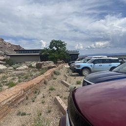
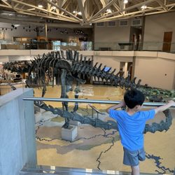
    Cleveland-Lloyd Dinosaur Quarry Visitor Center.

    Jurassic National Monument and the Cleveland-Lloyd Dinosaur Quarry are well worth the effort if you are the outdoor type. It is a bit off the beaten path and should be part of an adventure planned for the entire area. The facility is small but has a lot to offer including education, hiking, and wildlife watching. When you go here I would recommend you plan to spend the entire day in the area and experience as much as you can. Start at the Utah State Eastern Prehistoric museum in the city of Price and then adventure into the Cleveland-Lloyd Quarry and the surrounding area of the San Rafael Swell. There are ancient pictographs and petroglyphs in the Buckhorn Wash as well as hiking, biking, camping, and kayaking in the Swell and on Cedar Mountain. The Little Grand Canyon on the San Rafael river is a sight to behold. As you travel through the area you can see wildlife galore (if you know what to look for). Pronghorn, coyotes, reptiles, and birds are all around. Finish your day by stopping by the Museum of the San Rafael and then travel parts of the Old Spanish Trail. Come prepared with reliable transportation, water, and other necessities as this is a rural area. Distances between services can be quite spread out. Those who go only to the quarry as a side trip will be missing out on a lot. Stop and take in everything! If you listen the desert will speak.
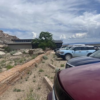
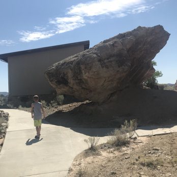
    View behind museum looking at dig buildings
    Mindi A.

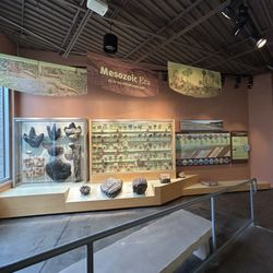
    Well we are glad we went but it's a haul! About 13 miles of dirt road driving with minimal signage so pay attention. The dirt road was in good shape when we visited. (A Monday morning in July) There are picnic tables with limited shade. Outhouses which were in quite good shape considering. Small informative museum. Several short 1-3 mile hikes. Bring water and a hat!! Hot out there. Outbuildings where active digging still happens but not on the day we visited. No gift shop or sales of food etc. it does cost to get in, not sure how much as we have a National parks pass.

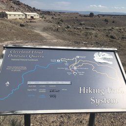
    Rock Walk Itinerary Page 1
    Jamie F.

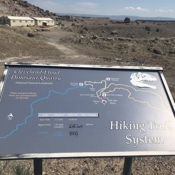
    This "monument" is WAY out of the way and NOT worth the detour. There are at least 13 miles of dirt roads and GPS was spotty. When we arrived, there was a VERY small building with a one room dinosaur exhibit. We did both hikes associated with the park, and we had to laugh - it is called the Rock Walk and that is really all you see - rocks. Oh wait, there was also brass cap survey marker (#3), lizards (#2), and a wash that becomes a stream when it rains (#9). Could not believe we made a long drive from Moab to Salt Lake City twice as long with this detour to nowhere!

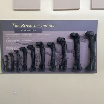
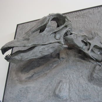
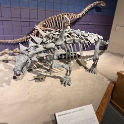
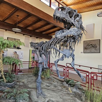
    Allosaurus skeleton

    See all

    1 year ago

    Helpful 2
    Thanks 0
    Love this 1
    Oh no 0

    3 months ago

    Very informative. What a great collection. Right in town so it was in our way through.

    Helpful 0
    Thanks 0
    Love this 0
    Oh no 0
    Photo of Sam S.
    493
    1862
    3339

    4 years ago

    Helpful 1
    Thanks 0
    Love this 3
    Oh no 0

    3 years ago

    Helpful 1
    Thanks 0
    Love this 0
    Oh no 0

    8 years ago

    Helpful 2
    Thanks 0
    Love this 2
    Oh no 0

    3 years ago

    Helpful 0
    Thanks 0
    Love this 0
    Oh no 0

    6 years ago

    Helpful 1
    Thanks 0
    Love this 1
    Oh no 0

    8 years ago

    Helpful 1
    Thanks 0
    Love this 0
    Oh no 0
    Photo of Geoff R.
    2
    235
    112

    12 years ago

    Helpful 2
    Thanks 0
    Love this 2
    Oh no 0

    7 years ago

    Helpful 1
    Thanks 0
    Love this 0
    Oh no 0

    Ask the Community - Cleveland-Lloyd Dinosaur Quarry

    Verify this business for free

    Get access to customer & competitor insights.

    Verify this business

    Fifth Water Hot Springs - Taken by me

    Fifth Water Hot Springs

    4.3(28 reviews)
    46.8 mi

    This is one of my favorite hikes. It's a long one, but extremely rewarding once you reach to the…read morefinal point. I enjoyed it because of the surrounding nature. I took my time doing the hike--listened to some music; noticed the different plants; took breaks; and then, took my headphones off to really soak in nature. It was so therapeutic. Once I reached the final point, I noticed it was quite packed when I went around fall season; and I'm not surprised. The weather was perfect to dip in the hot springs; and the colorful fall leaves made my experience extra vibrant. The water was clean; temperature of water varies depending on where you're sitting; and each area vary in size. As for someone who enjoys exploring and all the adventures, I decided to take my time to sit in each hot springs. Honestly, my favorite is the first one as the hiker approaches the start of hot springs. It's not big, but it's more secluded. It has a nice balance of shade and sunlight; little waterfalls; and some rocks to hop over and/or sit on. I felt as if it was part of my backyard, lol. I couldn't help but to take so much pictures. I'm definitely coming back again during the spring or summer to experience it differently.

    The concept of a natural hot springs is to go during colder months and expect to walk a lot to get…read morethere since it is natural and secluded. We didn't want to pay for a hot spring since the other ones were busy and the "natural" element is no longer there. However, we weren't as prepared as we thought we were. We visited this hot spring in late December which meant a lot of the roads leading there were closed due to the snow. We walked about 1 mile before reaching the trailhead. Once you reach a sign that points straight and right, take the right to cross the small bridge towards the side of the mountain. Our saving grace was google maps but it wasn't fully accurate at times. Remember that once you cross that bridge, the river should stay on your right until you reach the springs. This trek was TOUGH and feels like 10 miles (when it's only about 5) because of the hills and thick snow/ice. We did not have spikes or sticks to help so we had to rely on each other and our surroundings. It took about 2.5 hours going since we didn't stop and were going fairly quickly and this is coming from someone who does not hike regularly. There was a portion of the hike that was a uphill climb using a rope which was probably the scariest part for me because it was icy and not stable (hence why spikes would help). Once you near the springs, the smell of sulfur becomes strong and the river begins changing color from clear to blue. There are 2 spots that is on google maps, the first one was very busy but it was not the main attraction. We kept walking and got to the actual fifth water hot springs which was still kind of busy but enjoyable. We got into both the hot springs and the cold springs and it was a very cool experience. The hike back was much faster since we knew where we were going but still hard. If you want to challenge yourself to a hike with a cool and relaxing reward of being in the hot springs, I would recommend this hike! I'm sure it's easier when it's not snowy/icy but being in naturally hot pools while your surroundings are covered in snow is beautiful and I would do this again. Tips: -We forgot towels which was a rookie mistake so make sure to take some! -Remember to take off any jewelry prior to going/getting in the hot springs because the sulfur will tarnish it. -Wear thick socks to avoid frozen toes. -The hike itself was beautiful so remember to look up and enjoy the scenery instead of always looking down at the trail. -Start EARLY because it will take at least half a day to complete

    Photos
    Fifth Water Hot Springs
    Fifth Water Hot Springs
    Fifth Water Hot Springs

    See all

    Maple Canyon - Typical view of Maple Canyon from the deepest part of the canyon (next to the creek). - - Tom Brody

    Maple Canyon

    5.0(2 reviews)
    45.8 mi

    MY PHOTOGRAPHS. Attached are photos showing panoramic views of Maple Canyon, where I took these…read morephotos from either Vista Peak Loop Trail (located on southern slope of Maple Canyon) or from Ziele Creek Trail (located on northern slope of Maple Canyon). Also attached are photos of trees covered with an awesome evening gown consisting of bright green moss. In addition, attached is a photograph of my assistant, Strawberry Shortcake, standing next to a little waterfall in Ziele Creek. NAMES OF THE TRAILS AND THE CREEK. For orientation, I first describe the trail that runs from east-to-west and resides on the slope to the NORTH of Ziele Creek, and regarding the trail that runs from east-to-west and resides on the slope to the SOUTH of Ziele Creek. The trail to the north is Ziele Creek Trail, and the trail to the south is Garin Woods Trail. These two trails form a stringed bean-shaped loop trail with Ziele Creek running through the center of the stringed bean. I walked in dry parts of the streambed of Ziele Creek and, in this way, explored all of the areas within the stringed bean loop trail. A bridge is easy to find at the eastern tip of the stringed bean loop trail, but I was not able to find any bridge at the western tip of the stringed bean loop trail. STARTING YOUR HIKE. The views of Maple Canyon from trailhead (located at the end of Calhoun Street) and from the nearby parts of Vista Peak Loop Trail are magnificent. Part of my day's hike was also along Ziele Creek Trail, which is located on the northern slope above the creek. In some parts, Ziele Creek Trail is forty meters above the creek, and this provides a splendid view of the tree-covered center of Maple Canyon and of the little groves of deciduous trees that find a home in isolated spots of Maple Canyon. The lowest parts of the canyon takes the form of a shady forest, and the surrounding areas take the form of a vast field of light-colored dried grasses. For starting my hike, I used the trailhead located at the eastern terminus of Calhoun Road. I parked in the dirt at the side of the road. Starting from the trailhead at the end of Calhoun Road, after a couple of minutes hiking to the southeast on Vista Peak Loop Trail, I arrived at a fork in the trail, and I took the downhill fork. After a minute on this downhill path, there is another fork in the trail, where there is a choice between taking a higher elevation trail called Garin Woods Trail and a lower elevation trail, also called Garin Woods Trail. The lower elevation trail is located deep in the canyon, and about thirty feet above Ziele Creek. SCENERY IN THE SHADE. Ziele Creek resides at the lowest point in Maple Canyon. Ziele Creek flows from east to west. Garin Woods Trail provides a view of many ferns and of trees covered with bright green moss and, here and there, you can see Ziele Creek between the trees, where the creek is about thirty feet below Garin Woods Trail. After hiking eastwards for 30 minutes on Garin Woods Trail, I decided to go off-trail and hike down the slope, and then hike westwards in the stoney stream bed for about 30 minutes, taking photographs of parts of the creek that contained pools of water, and that contained a tiny waterfall. The map on mapcarta.com shows the part of Garin Woods Trail that is near the stream, and it also shows the part of Garin Woods Trail that is higher up on Vista Peak. Google maps completely disregards Garin Woods Trail, and it gives you the false impression that the only trail near Ziele Creek is the one called, Ziele Creek Trail. Google maps shows only the half of the stringed bean-shaped loop trail that runs parallel to and is close to the north bank of Ziele Creek. PARKING AREA WITH MANY MORE PARKING SPOTS. Park on Thorup Lane or on Ziele Creek Drive. Trailhead is where these two small streets meet each other. COMPLETING THE STRINGED-BEAN SHAPED LOOP TRAIL. On two occasions in January 2021, I hiked the entire stringed bean-shaped loop trail (described above). The following problem applies to the western end of the stringed bean-shaped loop trail. On both occasions, I was not able to find any bridge that allows you to get from the northern slope of Maple Canyon, and then over the creek, and to the southern slope of Maple Canyon. Instead of taking any trail that crossed the creek with a bridge, I hiked down the northern slope of Maple Canyon, jumped over a shallow part of the creek, and then left the creek area by crawling up the southern slope of Maple Canyon. Because the southern slope that rises above the creek is steep, I crawled up using an improvised zig-zag path. Actually, I walked up (I didn't crawl up) and I grabbed any available roots and nearby branches in order to pull myself up the steep slope. In this way, I easily got back to Garin Woods Trail, and from there returned to my parking spot at the end of Calhoun Street. I hope some that that I can find a bridge across this part of the creek.

    Photos
    Maple Canyon - View of Maple Canyon from Ziele Creek Trail on the northern slope above Maple Canyon. - - Tom Brody

    View of Maple Canyon from Ziele Creek Trail on the northern slope above Maple Canyon. - - Tom Brody

    Maple Canyon - Beautiful moss-covered cluster of trees on northern slope, several feet above the creek. - -Tom Brody

    Beautiful moss-covered cluster of trees on northern slope, several feet above the creek. - -Tom Brody

    Maple Canyon - My assistant, Strawberry Shortcake, standing at a little waterfall at Ziele Creek. - - Tom Brody

    See all

    My assistant, Strawberry Shortcake, standing at a little waterfall at Ziele Creek. - - Tom Brody

    Moonshine Arch - View to Steinaker Reservoir from part way up the trail

    Moonshine Arch

    3.8(6 reviews)
    94.1 mi

    The Arch is a relatively easy ~ 2 mile hike along OHV and foot trails and thus is very busy. It is…read morewell sign posted and the views of the Steinaker reservoir are nice. When we went a very large group of OHVs ( ~ 20) drove by on our way down blowing up a bunch of dust and we had to move off of the trail into the desert to let them pass so that spoiled the trip for us. There is only room for a couple of these vehicles at the top so no idea how they managed to park.

    7/22/2021 thursday arrived around 1030 am. this trail is…read moreon BLM property. there are no dog poop bags or facilities. there is also no shade on the trail. Take the turn at the blue sign marked moonshine arch. google maps took us into steinaker state park. its not there. follow the road and take a left. you will end up in a dirt parking lot. that is it. there is not any signage at the trail head. i would recommend turning on your all trails map when you go as there are several routes once you get on the trail not sure where they all go but several folks we encountered had gotten lost and it took them longer. and it was HOT. the arch was cool at the end and there is a cave you can sit in and cool off. The trail is all sand so be prepared for that. it does make it a little more challenging than a typical dirt trail.

    Photos
    Moonshine Arch - Moonshine Arch from the side

    Moonshine Arch from the side

    Moonshine Arch - Moonshine Arch

    Moonshine Arch

    Moonshine Arch - Exit left after about 1 mile north from steinaker state park, in the middle of the big curve (curve bends right)

    See all

    Exit left after about 1 mile north from steinaker state park, in the middle of the big curve (curve bends right)

    Goblin Valley State Park

    Goblin Valley State Park

    4.8(72 reviews)
    70.8 mi

    We took this as a side trip and we really should have given this more time. If you are thinking of…read morecoming here, I recommend looking at all the activities offered to see how much is here to do so you won't feel as though you missed out on some of what makes this park FUN! As for us, we ran around the valley, played hide and seek, marveled at how these "goblins" were made and just had a great adventure with the time we had.

    A triumph of both western topography and federalism. This is one of those awesome parks that would…read morein some ways be less special if it were "upgraded" to a national park. It's great the way it is. Just a few notes: -- the campsite is just amazing; you are nestled in among caves and washes, and your kids can merrily wander off "to the kids cave" or climb up onto a crest and watch the sunset or the rhythm of the campsite. They do have a shared bathroom with running water, which keeps the place just civilized enough for moderately experienced car campers. -- at the same time, this place is really remote. If you realize at campside that your propane stove doesn't work, you would have to drive an hour each way to Green River to get more. Instead, you will just have to figure out how to boil coffee and macaroni and cheese over a campfire. -- the stars. The city lights are far far far away, and the desert sky is clear, so you can see so so many stars. And if you sit and stare at them you see more. The only place I have ever seen so many stars in my life is standing on the side of the road outside Marfa, TX. -- two decades ago this was one of the first camping trips of my life, and it remains a special place in my heart.

    Photos
    Goblin Valley State Park
    Goblin Valley State Park - Close up of the Three Sisters.

    Close up of the Three Sisters.

    Goblin Valley State Park - The start of Valley 1. Valley of the Goblins basin has 3 total sections for you to explore however you want.

    See all

    The start of Valley 1. Valley of the Goblins basin has 3 total sections for you to explore however you want.

    Crystal Lake Trailhead - Reflection

    Crystal Lake Trailhead

    4.5(2 reviews)
    75.2 mi

    First off, note that this is sometimes called the Crystal Trailhead, and also referred to by the…read moreForest Service as Lakes Country Trail #066. The latter refers to a specific route, but we'll get to that. You will also see references to Notch Mountain Trail #081 and Clyde Lake Trail. We'll get to those, too. Oh, and while the following list of trails don't leave right from this trailhead, it's the most popular (and in some cases only) connections to North Fork Provo River Trail, Marjorie Lake Trail, Duck Lake Trail, Long Lake Loop Route Trail, and the Middle Fork Weber River Trail. It's all the same place, though -- this trailhead. Confused yet? Let's dive in. First things first, you've got to find the trailhead. To do that, get to Kamas and then travel up Highway 150 (The Mirror Lake Highway) about 25 miles until you see the signs to turn off for Trial Lake and Washington Lake. You'll turn north, pass Trial Lake, and at the signs, turn right and pass the Washington Lake Campground and continue on the dirt road (easily passable in all types of cars) for a few hundred yards until reaching the parking area. There is lots of parking, a few picnic tables, and vault toilets. In the busy summer months, this parking lot fills up fast on weekends. Like, fills WAY up. With all kinds of creative parking. I've watched over the last decade as it went from a somewhat busy spot to outright chaos on Saturdays. When it's full, they have overflow parking back down the road to the last junction and further west, but it will tack on almost 2/3 mile onto your hike each way. That's been a real bummer to see, and a nuisance when you just want to get out and hike and end up going over a mile on pavement because the main parking lot was full. But enough of the downsides of the popularity, let's dive into why so many people pick this hike. The reason, really, is that it's not just one hike, it's many. I will preface this with one giant note: GET A MAP. Seriously, the Forest Service has worked hard to make great trails and have a 2016 edition map that's very detailed and much more realistic that the USGS or other maps. Here, more than at any other trailhead, I've noticed that Forest Service maps are wildly different (and more accurate) than other versions. Below are the hikes that take off from this trailhead: Lakes Country Trail #066 This is one of three trails that have their terminus at the parking lot proper. This is the most popular, and it goes due west from the outer apex of the parking loop. It's signed and is the one that takes you to the northeastern shore of Crystal Lake. From there, it starts to rise and there's a turnoff to Clyde Lake (next paragraph), then past that you'll hit more switchbacks before cutting through a mountain pass with views of Mt. Watson. Then you traverse the rocks and have all kinds of decisions to make: you can peel off and go to the North Fork Provo River Trail which takes you towards Marjorie Lake and eventually allllll the way back down (nearly 10 miles) to the Highway, popping out about 3 miles below Soapstone. Or you can turn north on the Middle Fork Weber River Trail, but few do. There's another turn for Weir, Pot, and Duck Lakes (not shown on the maps) as well, but most people pass the Marjorie turnoff and press on to Long Lake. This aptly named, long, skinny lake is at around 2.5 miles in from the trailhead. It's a fine destination, but if you have the will, grit it out another mile and a half or so to Island Lake. It's gorgeous. From here, the Lakes Country Trail #066 goes on a bit, then ends at a junction with the Smith-Morehouse Trail and the Big Elk Lake Trail. Clyde Lake Trail Technically, you begin on the Lakes Country Trail #066, but only go a half mile or so before turning uphill to the right towards Clyde Lake. The Forest Service cut a new trail here in the last couple of years, so don't be confused by a sign in the old trail, with an arrow pointing away from what you think is that old trail. Now you pass Crystal Lake before turning off to Clyde, instead of turning off just before. It makes sense. This trail climbs up and delivers you to Cliff Lake, Watson Lake, and eventually Clyde, but most people veer east at Watson and go up to Wall Lake. This also isn't shown on the map, but makes a nice loop. Wall Lake/Notch Mountain Trail This trail also takes off from the Crystal Lake Trailhead. It bisects the Lily Lakes and runs right up the chute to Wall Lake. Then you can jog east and go past Hope Lake, turn back west and go right through a big notch in the mountain to overlook Lovenia Lake. The trail goes on north, downhill for miles before hitting the Main Fork Weber River Trail. Crysal Lake (South) Trail My own name for it, but you can take a short trail to the south shore of Crystal Lake. It leaves from the southwest end of the parking loop. This area is rife with lakes and hikes. I've kept some secrets. It gets heavy usage but is still so special. Be safe and enjoy!

    This trail head gives access to many, many different trails, many of which lead to spectacular…read morelakes. The trails around here aren't too difficult or strenuous, but they are breathtaking. I highly recommend for all levels!

    Photos
    Crystal Lake Trailhead - Some areas closed to camping

    Some areas closed to camping

    Crystal Lake Trailhead - Lake

    Lake

    Crystal Lake Trailhead - One of many lakes

    See all

    One of many lakes

    Cleveland-Lloyd Dinosaur Quarry - hiking - Updated September 2026

    Loading...
    Loading...
    Loading...