George B Parker Woodland Photos


You might also consider


More like George B Parker Woodland
Recommended Reviews - George B Parker Woodland
Start your review...


Reviews With Photos


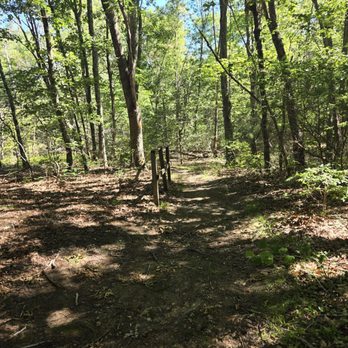
I love love love this trail. There are several small trails that connect- I like to park at lot number 1 because it has easier access to the blue loop and there's more parking spaces. I would say this trail is easy/ moderate depending on your fitness level and the time you have. The blue loop would make this a nice place to trail run as there are no steep inclines and the limited amount of rocks and tree stumps. I highly suggest this trail and have been here several times throughout the years. I've attached lots of pictures to let the trail- and it's views- speak for itself


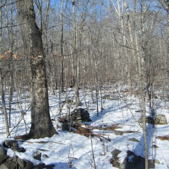
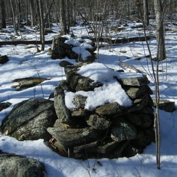
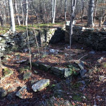
Hills walls stones and mysterious things The George B. Parker Woodland is a tract of land owned by the Audubon Society of Rhode Island. That means no hunting is allowed on the land so you can hike without wearing orange and without worrying about being nailed by an errant shotgun blast. The primary trial is a 7 to 8 mile loop that goes through fields, forest and up and down hills. Constantly undulating without any exceptionally difficult climbs. A few slippery places in the snow and ice but nothing dangerous or intimidating. Lots of different types of oak and hickory trees are everywhere and if you look closely you can even make out a few small, pathetic looking chestnut trees. The chestnuts were virtually eliminated throughout out the area by a devastating fungal disease many decades ago. This use to be farm land so stone walls are everywhere and foundations of old farm houses are apparent even in the snow. The stone walls are a bit odd because some go off for miles and others are just segments that stop suddenly. An old road also runs through the property and is still visible due to the once heavy use. This whole area once experienced heavy use and in addition to the farms and many buildings a charcoal processing site and saw mill were once here. Nothing remains of the sites but if you observe carefully you can see a few earthen mounds where they use to be. The whole area was once bustling with people and activity but for some reason was abandoned about 100 or so years ago. Some of the most interesting and mysterious objects along the trail are the stone cairns. Round or triangular stacks of stones about 4 to 6 feet high, there are about 100 of them placed in small groups in seemly random spots. Various explanations to explain them range from improbable ideas like the Vikings or Phoenicians left them here to the more likely conjecture that farmers were tired of making stone walls so they just stacked up intruding stones into the cairns. No one really knows and there is no one left to ask. One of the nicest and most interesting short hikes in Rhode Island. A great place all year round but exceptionally pleasant in the winter. A place where you can enjoy nature and see a lot of cool rocks.


What a gem. Parker's got it all - diverse scenery, historical landmarks, hills and valleys, easily navigable, proximity to Providence. And lots of rocks. Giant glacial rocks, small piles of rocks, inexplicably arranged large piles of rocks, rocks in a centuries-old farmhouse foundation, beautiful mossy rocks, rocks for sitting, rocks for tripping. We parked at Lot #1 and took the short Orange trail to the Coventry Blue loop. I don't know if it's like that MC Escher engraving where the guys seem to only be walking in a circle *up* stairs the whole way or what, but taking a left at the Blue trail and following clockwise felt like we were going downhill a lot more than going up. Three miles was just enough for a pleasing challenge but not exhausting. I imagine the stillness of a windless, gloomy, early spring day had something to do with it, but I find this hike to be particularly spooky, in a cool way. Not just all those rocks and snarly old and fallen trees, but most of the time you are far enough from roads that when you pause it is Completely. Silent. Maybe a bird or the faint trickle of the brook in the distance, but sometimes nothing at all. There were no maps at the kiosk but a sign that says you can download from the Audubon RI site. Here it is: http://www.asri.org/refuges/george-b.-parker-woodland.html


This is a peaceful place to walk and observe. There are two loops , one is . 5 mile and the other is 3I believe. There are no paved paths , but there are paths and wooden bridges where there is wetland. The parking lot situation is a bit confusing as I could only find one. Regardless, it is a nice place for a walk like hike. There are no pets allowed as it is a conservation. I believe it is part of the Audubon society.


Yowza, blue loop kicked our butts but no dogs allowed? C'mon. Boring scenery too besides a few bridges and a couple big rocks. It's a whole lot of stamina and not enough entertainment. I prefer places with a little more character. We used the main entrance by the house because the side entrance was closed. I wouldn't recommend it because I think starting in the middle would be a better time. We never did see that cellar everyone talks about.
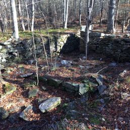

If you've done the seascapes and cliff walks, try this place (an Audubon wildlife refuge as well), as it will highlight the diversity of Rhode Island's landscapes and also provide a little bit of a more challenging hike. We did the blue-blazed Coventry trail loop and it takes you past (and over) some impressive glacial boulders, charming babbling brooks, and a bit of archaeology to boot! At a good pace, the deceptive-appearing trail length of 3 miles will indeed take the advertised 2 hours to complete as there are a number of rises and rocky outcroppings to negotiate. We went in late fall, which was actually nice for there was more sunlight coming through the bare trees and visibility was better (easier to see the forest AND the trees). Some particular highlights of this trail were the 200-year old remains of the Vaughn farm and various rock cairns. See if you can find the big white quartz rock popping up unexpectedly on the trail, so white and pure I actually thought it was a chunk of early snow fall!
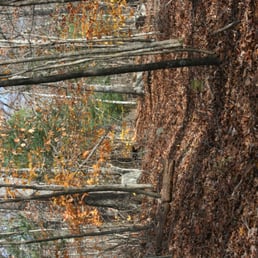

Drove by this a couple times in the winter, and now that's its warmed up decided to check it out. A nice little getaway, you have multiple paths to choose from upon initially entering. Both paths were slightly overgrown a little bit into them, otherwise though it was a great time. read more

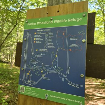

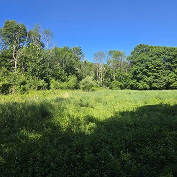
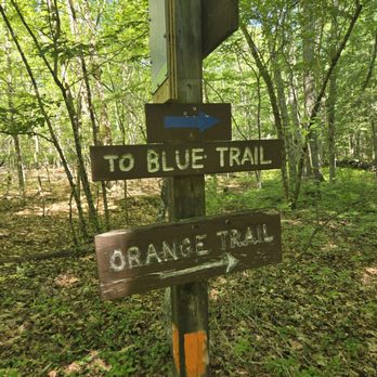


I don't do a lot of hiking in RI but this is one of the better trails I've found in the area in that it's a more challenging hike (no walk in the woods) and it's long enough to keep you entertained for a few hours. You're also mostly in nature and not seeing random homes and neighborhoods like some other trails. Definitely recommend high ankle hiking boots because there are a lot of roots and rocks so it's easy to twist an ankle. Would definitely not recommend sneakers. Trails are pretty well marked and the blue loop trail was great. Also very encouraging that we found very little litter- just one random orange peel and one water bottle top. Love that people respect the space. Look forward to returning here again! read more


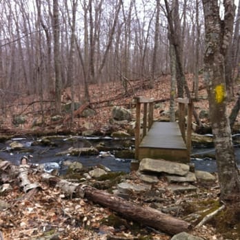
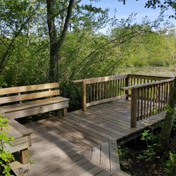
A great find! So close to home! The George B Parker Woodland Wildlife Refuge is owned and maintained by the Audobon Society of Rhode Island. With 7 miles of trail spread across 860 acres of land, this network of footpaths does not disappoint. Open from sunrise to sunset, you will find plenty of time to meander through these woods and take in the local terrain. Cairns, boardwalks, historic carriage roads, stonewalls, bedrock outcrops, babbling brooks, a 100-200 year old farmhouse foundation, and so much more awaits you on these trails. Paths are well marked with blue, orange, and yellow blazes along with signage both for trails and to point out a few of the interesting sights. The hills roll up and down so no matter which way you head, you'll get a bit of a workout in. Keep your eyes peeled and you might encounter some wildlife during your trek. A frog hopped along our path and towards the end, something much bigger (heard but not seen... most likely a deer). Peaceful and quiet. It's wonderful to take a break and hear nothing but the leaves rustling and the water flowing. Two parking lots available that connect to the trails on Maple Valley Road. Parking lot #1 is well-signed from the road. I'll definitely be back to check out parts of the trail I missed this time around. Note: no dogs, horses, or bikes allowed on trail. read more


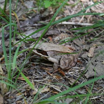

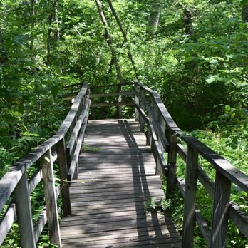
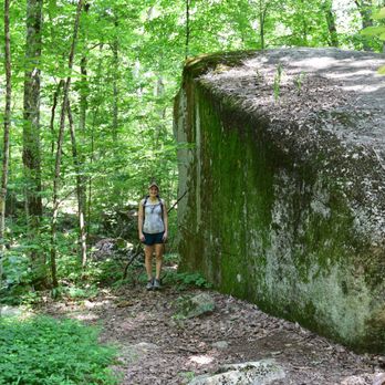


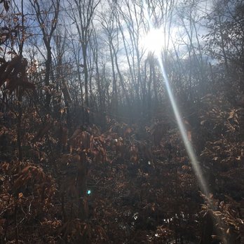
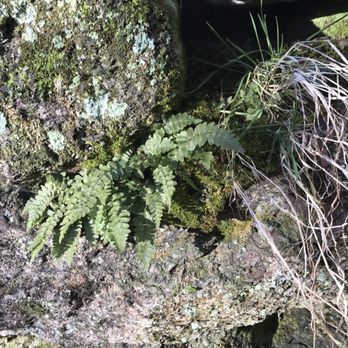
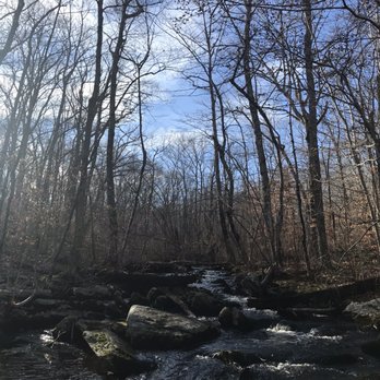
I love love love this trail. There are several small trails that connect- I like to park at lot number 1 because it has easier access to the blue loop and there's more parking spaces. I would say this trail is easy/ moderate depending on your fitness level and the time you have. The blue loop would make this a nice place to trail run as there are no steep inclines and the limited amount of rocks and tree stumps. I highly suggest this trail and have been here several times throughout the years. I've attached lots of pictures to let the trail- and it's views- speak for itself read more







5 years ago

17 years ago
Hills walls stones and mysterious things The George B. Parker Woodland is a tract of land owned by the Audubon Society of Rhode Island. That means no hunting is allowed on the land so you can hike without wearing orange and without worrying about being nailed by an errant shotgun blast. The primary trial is a 7 to 8 mile loop that goes through fields, forest and up and down hills. Constantly undulating without any exceptionally difficult climbs. A few slippery places in the snow and ice but nothing dangerous or intimidating. Lots of different types of oak and hickory trees are everywhere and if you look closely you can even make out a few small, pathetic looking chestnut trees. The chestnuts were virtually eliminated throughout out the area by a devastating fungal disease many decades ago. This use to be farm land so stone walls are everywhere and foundations of old farm houses are apparent even in the snow. The stone walls are a bit odd because some go off for miles and others are just segments that stop suddenly. An old road also runs through the property and is still visible due to the once heavy use. This whole area once experienced heavy use and in addition to the farms and many buildings a charcoal processing site and saw mill were once here. Nothing remains of the sites but if you observe carefully you can see a few earthen mounds where they use to be. The whole area was once bustling with people and activity but for some reason was abandoned about 100 or so years ago. Some of the most interesting and mysterious objects along the trail are the stone cairns. Round or triangular stacks of stones about 4 to 6 feet high, there are about 100 of them placed in small groups in seemly random spots. Various explanations to explain them range from improbable ideas like the Vikings or Phoenicians left them here to the more likely conjecture that farmers were tired of making stone walls so they just stacked up intruding stones into the cairns. No one really knows and there is no one left to ask. One of the nicest and most interesting short hikes in Rhode Island. A great place all year round but exceptionally pleasant in the winter. A place where you can enjoy nature and see a lot of cool rocks. read more




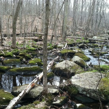
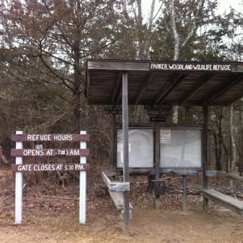
What a gem. Parker's got it all - diverse scenery, historical landmarks, hills and valleys, easily navigable, proximity to Providence. And lots of rocks. Giant glacial rocks, small piles of rocks, inexplicably arranged large piles of rocks, rocks in a centuries-old farmhouse foundation, beautiful mossy rocks, rocks for sitting, rocks for tripping. We parked at Lot #1 and took the short Orange trail to the Coventry Blue loop. I don't know if it's like that MC Escher engraving where the guys seem to only be walking in a circle *up* stairs the whole way or what, but taking a left at the Blue trail and following clockwise felt like we were going downhill a lot more than going up. Three miles was just enough for a pleasing challenge but not exhausting. I imagine the stillness of a windless, gloomy, early spring day had something to do with it, but I find this hike to be particularly spooky, in a cool way. Not just all those rocks and snarly old and fallen trees, but most of the time you are far enough from roads that when you pause it is Completely. Silent. Maybe a bird or the faint trickle of the brook in the distance, but sometimes nothing at all. There were no maps at the kiosk but a sign that says you can download from the Audubon RI site. Here it is: http://www.asri.org/refuges/george-b.-parker-woodland.html read more




7 years ago
This is a peaceful place to walk and observe. There are two loops , one is . 5 mile and the other is 3I believe. There are no paved paths , but there are paths and wooden bridges where there is wetland. The parking lot situation is a bit confusing as I could only find one. Regardless, it is a nice place for a walk like hike. There are no pets allowed as it is a conservation. I believe it is part of the Audubon society. read more


Yowza, blue loop kicked our butts but no dogs allowed? C'mon. Boring scenery too besides a few bridges and a couple big rocks. It's a whole lot of stamina and not enough entertainment. I prefer places with a little more character. We used the main entrance by the house because the side entrance was closed. I wouldn't recommend it because I think starting in the middle would be a better time. We never did see that cellar everyone talks about. read more





15 years ago


If you've done the seascapes and cliff walks, try this place (an Audubon wildlife refuge as well), as it will highlight the diversity of Rhode Island's landscapes and also provide a little bit of a more challenging hike. We did the blue-blazed Coventry trail loop and it takes you past (and over) some impressive glacial boulders, charming babbling brooks, and a bit of archaeology to boot! At a good pace, the deceptive-appearing trail length of 3 miles will indeed take the advertised 2 hours to complete as there are a number of rises and rocky outcroppings to negotiate. We went in late fall, which was actually nice for there was more sunlight coming through the bare trees and visibility was better (easier to see the forest AND the trees). Some particular highlights of this trail were the 200-year old remains of the Vaughn farm and various rock cairns. See if you can find the big white quartz rock popping up unexpectedly on the trail, so white and pure I actually thought it was a chunk of early snow fall! read more


14 years ago
Did this hike today, was a nice moderate hike...not a leisurely stroll but not strenuous either. We parked in lot #1 - took the orange trail and then did the coventry blue loop. It was about 3 miles and took about 2 hours to complete. Quite a bit of up and down and some spots were a little hard to follow because of all of the leaves and branch debris from superstorm Sandy. Definitely a great way to spend a couple of hours. read more


16 years ago

13 years ago

10 years ago

15 years ago
More info about George B Parker Woodland
1670 Maple Valley Rd
Coventry, RI 02816
Directions
(401) 295-8283
Call Now
Hours
Outdoor Amenities
Ask the Community - George B Parker Woodland
Review Highlights - George B Parker Woodland
You might also consider













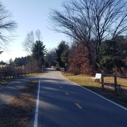


George B Parker Woodland - hiking - Updated September 2026
Best of Coventry
People found George B Parker Woodland by searching for…
Parks for Kids in Coventry, RI
Stairs Workout in Coventry, RI
Hiking Trails With Waterfalls in Coventry, RI
Mountain Bike Trails in Coventry, RI
Walking Trails in Coventry, RI
Dog Walking Areas in Coventry, RI
Off Road Trails in Coventry, RI
Stair Climbing in Coventry, RI
National Parks in Coventry, RI
Beautiful Views in Coventry, RI
Bird Sanctuary in Coventry, RI
Off Leash Dog Hiking Trails in Coventry, RI
Dog Friendly Trails in Coventry, RI
Places to Take Pictures in Coventry, RI
Trending Searches in Coventry, RI
Apple Orchards near George B Parker Woodland
Apple Picking near George B Parker Woodland
Archery near George B Parker Woodland
Barbershop near George B Parker Woodland
Baseball Fields near George B Parker Woodland
Bird Sanctuary near George B Parker Woodland
Blow Dry Bar near George B Parker Woodland
Cliff Jumping near George B Parker Woodland
Consignment Shops near George B Parker Woodland
Corn Maze near George B Parker Woodland
Dog Friendly Things To Do near George B Parker Woodland
Dog Parks near George B Parker Woodland
Dog Swimming near George B Parker Woodland
Eyebrow Threading near George B Parker Woodland
Eyelash Extensions near George B Parker Woodland
Hiking near George B Parker Woodland
Kids Birthday Party near George B Parker Woodland
Makeup Artists near George B Parker Woodland
Mens Suits near George B Parker Woodland
Off Road Trails near George B Parker Woodland
Parks near George B Parker Woodland
Photo Spots near George B Parker Woodland
Picnic Areas near George B Parker Woodland
Places To Take Pictures near George B Parker Woodland
Playgrounds near George B Parker Woodland
Private Schools near George B Parker Woodland
Public Running Track near George B Parker Woodland
Public Shower near George B Parker Woodland
Public Tennis Courts near George B Parker Woodland
River Swimming near George B Parker Woodland
Rock Quarry near George B Parker Woodland
Scenic Overlook near George B Parker Woodland
Sunrise View near George B Parker Woodland
Browse Nearby
Browse Brands
Related Searches in Coventry, RI
Affordable Kayak Rental Services in Coventry, Rhode Island
Best Dog Hiking Trails Around Coventry, Rhode Island
Best Fishing Locations and Guides in Coventry, Rhode Island
Best Off Leash Dog Parks in Coventry, Rhode Island
Best Parks for Parties and Events in Coventry, Rhode Island
Best Places for Horseback Riding in Coventry, Rhode Island
Best Sightseeing Experiences Available in Coventry, Rhode Island
Best Water Parks for Kids in Coventry, Rhode Island
Best Waterfalls and Swimming Holes in Coventry, Rhode Island
Check Out Great Playgrounds in Coventry, Rhode Island
Check Out Off Road Trails in Coventry, Rhode Island
Discover Baseball Fields Around Coventry, Rhode Island
Discover Dog Friendly Trails to Explore in Coventry, Rhode Island
Discover Fun Toddler Parks in Coventry, Rhode Island for Your Little One
Discover Kid Friendly Hiking Trails in Coventry, Rhode Island
Discover Lakes & Ponds to Explore in Coventry, Rhode Island
Discover Popular Bike Trails in Coventry, Rhode Island
Discover Scenic Mountain Bike Trails Near Coventry, Rhode Island
Discover Soccer Fields in Coventry, Rhode Island Near You
Discover Top Nature Parks to Visit in Coventry, Rhode Island
Discover Top State Parks to Visit in Coventry, Rhode Island
Discover a Hiking Trail in Coventry, Rhode Island
Discover the Best Beaches in Coventry, Rhode Island
Discover the Best Night Hike Trails in Coventry, Rhode Island
Dog-Friendly Hikes With Dogs in Coventry, Rhode Island
Enjoy Camping Adventures Around Coventry, Rhode Island
Enjoy Kayaking Adventures in Coventry, Rhode Island
Enjoy Off Leash Dog Hikes in Coventry, Rhode Island
Enjoy Tent Camping Spots Around Coventry, Rhode Island
Enjoy a Beautiful Waterfall Hike in Coventry, Rhode Island
Enjoy the Best Picnic Spots and Ideas in Coventry, Rhode Island
Enjoy the Best Walking Trails in Coventry, Rhode Island
Experience Stunning Sunset Views in Coventry, Rhode Island
Explore Beautiful Parks and Green Spaces in Coventry, Rhode Island
Explore Easy Hikes Perfect for All in Coventry, Rhode Island
Explore Family-Friendly Zoos and Wildlife in Coventry, Rhode Island
Explore Free Picnic Areas Around Coventry, Rhode Island
Explore Fun Activities to Do in Coventry, Rhode Island
Explore Parks With Pull Up Bars in Coventry, Rhode Island
Explore Popular Campgrounds Near Coventry, Rhode Island
Explore Popular Picnic Areas Around Coventry, Rhode Island
Explore Popular RV Parks Around Coventry, Rhode Island
Explore Scenic Lakes to Visit in Coventry, Rhode Island
Explore Top Dog Parks in Coventry, Rhode Island Near You
Explore Top Trampoline Parks in Coventry, Rhode Island
Explore Top Water Parks in Coventry, Rhode Island Today
Explore the Best Beach Spots in Coventry, Rhode Island
Explore the Best Swimming Holes Around Coventry, Rhode Island




