
Glen Canyon Dam Overlook Photos


You might also consider


More like Glen Canyon Dam Overlook
Recommended Reviews - Glen Canyon Dam Overlook
Start your review...


Reviews With Photos


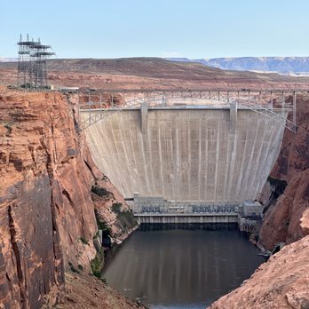
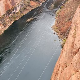
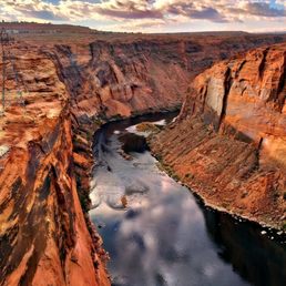
If you're heading over to Horseshoe Bend or the Carl Hayden Visitor Center, this is a neat little pitstop that captures a wonderful view of both the Glen Canyon Dam and the Colorado River. There's plenty of parking and a short little trail that will take you down to the overlook. The views are actually really stunning here, and it allows you to see the water flowing out of the dam and into the river, capturing a different point of view from the Glen Canyon Dam itself. While the dam is lovely, I have to say that the real stunner here is the Colorado River. The way that it literally parts the rocks and flows throw is so mesmerizing. It's worth the pitstop if you're in the area.


Most people usually like to head over to the nearby Horseshoe Bend overlook when visiting Page. But this overlook is just as cool to check out. You get a nice view of the Glen Canyon Dam and the natural scenery in front and behind it. You can access this overlook from the Dam Overlook Trailhead. There is a bit of a decent as you are walking on this short trail. They do have guard rails to help as you head down the uneven parts of the trail. Once at the overlook, there will be a covered viewing area that faces north toward the dam. To get to the trailhead, turn off of US Highway 89 onto Scenic View Road. There is a small parking lot that is free to park in. If you have some extra time, check out the visitor center and learn some history about the Glen Canyon Dam and Bridge and how they were constructed.


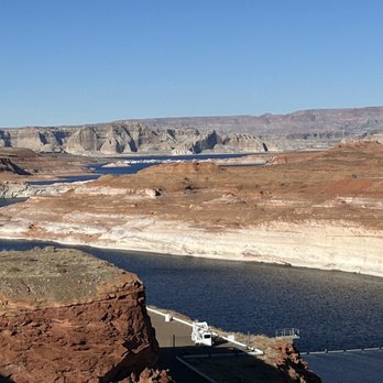
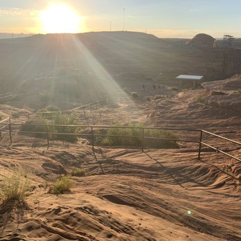
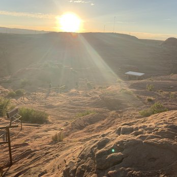
During my first visit to Page, I found this Glen Canyon Dam Overlook to be a hidden gem and worthwhile alternative to standing on top of the pedestrian bridge beside the Carl Hayden Visitor Center. Fast forward years later and returning to here at the overlook, I had an unfortunate 180 degree experience. Back when, no one knew about this under the radar viewpoint situated just outside downtown Page. You could come and go as you please and appreciate Glen Canyon Dam in the background. You could climb the rocks and take pictures however you preferred, pretty much...it was choose your own adventure. Now in this present day, they've built a small awning for tourists to stand under (which is irrelevant), but disappointingly, they've also installed a safeguard railing to act as a precautionary measure to discourage visitors from climbing and roaming freely for optimal photo opportunities. I felt sort of boxed in by the viewpoint railing. I believe your best moment for capturing yourself and Glen Canyon Dam within one frame is to snap a dreaded selfie, lol. But, selfie pictures can be a last resort option, hehehe. Reflecting back on my prior pictures (which is under..."Glen Canyon Dam"), being here at the overlook was better before Page started making unnecessary upgrades to its landmark attractions. In essence, the same goes for Horseshoe Bend. They've recently installed safety guard railings there as well to disallow opportunistic photographers to snap their most memorable instances. The most popular viewing sections along the rim's edge of Horseshoe Bend are blocked off. And yes I understand it works as a precaution, but Horseshoe Bend receives an eternity of more risk takers compared to here at Glen Canyon Dam Overlook. In total, this new railing blocking people from getting that perfect panoramic perspective of the dam put a damper on my return visit. Ultimately now, my new and improved suggestion for taking quality pictures is actually going back to the Carl Hayden Visitor Center!! Because...it too is newly refurbished and it's the one location where the experience has been enhanced in comparison to back when. If you walk behind the building at Carl Hayden, the surroundings can be special. Also, if you check out the sights from inside the VC, there are large viewing windows situated right above the dam. You could even take pics through the glass with Lake Powell's waters set in the distance. That's how clear the surroundings are now. Anyhow, here are extra Glen Canyon Dam Overlook notes... - I recommend coming in morning time. Late afternoon had shadows and the sun to contend with. - The left hand side of the observation point offers cool glances at the sweeping canyon walls high above the Colorado River. - It's a quick 5 minute walk from the parking lot to the vista point. - You need 20 or so minutes to hang out. It a quick roadside stop. In total, Glen Canyon Dam Overlook is not as fulfilling as it once was. Grrrr! Guard Railings = Frustrating, lol. Still, overall, it's not hard to come here for the views. It's free. And in general, it works for those folks exploring around the Page area.


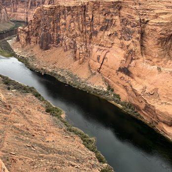
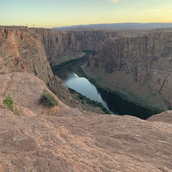
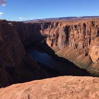
About a 5 minute drive out from the actual dam, you can get a great full frontal view of the dam head looking up river from this overlook. Look 180 degrees the other way from this spot (downstream) and you get gorgeous views of the blues and greens of the Colorado River and rock walls. To get to these views, you park at the top of the gorge (road level) and walk the path down to the cliff overview. Beware, the path is a mix of steps, large smooth groovy rocks in the ground, and sand, so make sure you have sneakers on - flip flops would not be ideal at all; the huge smooth rock surfaces get super hot in the blazing sun too, so keep that in mind. There's pipe railing along the path, but again, nothing shading it, so be very cautious when gripping so you don't burn your hands. Once you get down to the paved deck to look out tho, it's worth it. Pay attention to where you step so you don't slip and twist an ankle. Go out as far as you dare for great pictures; a wonderful spot to document your travels.


This was our second visit to Page, and I just can't believe we didn't find out about this overlook until now. It just goes to show how much there is to see and do around Page that is still hasn't received the recognition it deserves. Located at the end of Overlook Drive, you'll find a parking lot with limited parking. You can view the Dam from this area, but in order to get the best views, I'd suggest you head down the staircase to the right. Now, this staircase is not an option for everyone. There is a railing to hold on to, however, for the first leg of the descent, there are no stairs, the rock is very smooth and slippery, even when it's dry. I suggest you wear athletic closed toe shoes. My spouse thought he'd try to make the descent with flip flops, and he was embarrassed as he slipped down about two feet of the slope. He had to go back to the car and put on his sneakers before trying to go back down again. Lucky he wasn't hurt besides some minor scrapes, and a bruised ego. Once you reach the last leg of the descent, you will actually find some proper stairs. At the bottom, you will find a smooth rock surface and sand to walk on. Please watch your step as you walk around, as we witnessed an older man holding a camera slip on the rocks and fall straight on his face. He did get up, but he looked in pretty bad shape after his fall. Anyhow, the views of the dam are incredible. You can also peek over the edge to see the River below you. I was absolutely amazed at the sheer beauty surrounding us. You can only get these amazing views in Arizona. I love it! Best of all... the Glen Canyon Overlook is completely free. Yep, FREE! If you find yourself in Page, I highly recommend you check this out. Just remember, the descent to the bottom of the overlook is not for everyone due to the steep, smooth, slippery surface of the rocks. Highly Recommended!



1 month ago
*Short hike to a beautiful overlook where you can see the other side of the dam and the nightly Colorado River slicing through history *Surrounded by beautiful hues of red stone and gorgeous rock formations * Trail does include some steep stairs/ climbing- but there is a rail for support. But if you have health conditions- know your body limits. *Trail is sandy and rocky- wear supporting shoes because it's easy to slip or biff it * Hydrate and recreate safely and responsibly read more


24 days ago
This spot was a pleasant surprise when I came to Page, AZ on a road trip. I'd wanted to visit the Hoover dam near Las Vegas but it was too far off the path I was taking so I was glad I ended up at a big dam somewhere else anyway! There is a lookout point that is easy to reach in Page, about a 10-15 min drive away from the main shopping areas (like where the big Safeway is). There's plenty of free parking, and you can take a short (couple minutes) walk to the little overlook. There are some big rocks you can climb over to get a more direct view, or a little pagoda shaded area that directly faces the dam. I liked the view from the rocks because you can see the whole river too facing the dam and the bridge. It certainly does make you feel small, and is a testament to the best work of civil engineering! read more


6 months ago
Trail was downhill and sort of rocky. There was a railing for stability while traveling down. Mostly flat at the bottom. Great views all around!! read more


If you're heading over to Horseshoe Bend or the Carl Hayden Visitor Center, this is a neat little pitstop that captures a wonderful view of both the Glen Canyon Dam and the Colorado River. There's plenty of parking and a short little trail that will take you down to the overlook. The views are actually really stunning here, and it allows you to see the water flowing out of the dam and into the river, capturing a different point of view from the Glen Canyon Dam itself. While the dam is lovely, I have to say that the real stunner here is the Colorado River. The way that it literally parts the rocks and flows throw is so mesmerizing. It's worth the pitstop if you're in the area. read more


Most people usually like to head over to the nearby Horseshoe Bend overlook when visiting Page. But this overlook is just as cool to check out. You get a nice view of the Glen Canyon Dam and the natural scenery in front and behind it. You can access this overlook from the Dam Overlook Trailhead. There is a bit of a decent as you are walking on this short trail. They do have guard rails to help as you head down the uneven parts of the trail. Once at the overlook, there will be a covered viewing area that faces north toward the dam. To get to the trailhead, turn off of US Highway 89 onto Scenic View Road. There is a small parking lot that is free to park in. If you have some extra time, check out the visitor center and learn some history about the Glen Canyon Dam and Bridge and how they were constructed. read more



During my first visit to Page, I found this Glen Canyon Dam Overlook to be a hidden gem and worthwhile alternative to standing on top of the pedestrian bridge beside the Carl Hayden Visitor Center. Fast forward years later and returning to here at the overlook, I had an unfortunate 180 degree experience. Back when, no one knew about this under the radar viewpoint situated just outside downtown Page. You could come and go as you please and appreciate Glen Canyon Dam in the background. You could climb the rocks and take pictures however you preferred, pretty much...it was choose your own adventure. Now in this present day, they've built a small awning for tourists to stand under (which is irrelevant), but disappointingly, they've also installed a safeguard railing to act as a precautionary measure to discourage visitors from climbing and roaming freely for optimal photo opportunities. I felt sort of boxed in by the viewpoint railing. I believe your best moment for capturing yourself and Glen Canyon Dam within one frame is to snap a dreaded selfie, lol. But, selfie pictures can be a last resort option, hehehe. Reflecting back on my prior pictures (which is under..."Glen Canyon Dam"), being here at the overlook was better before Page started making unnecessary upgrades to its landmark attractions. In essence, the same goes for Horseshoe Bend. They've recently installed safety guard railings there as well to disallow opportunistic photographers to snap their most memorable instances. The most popular viewing sections along the rim's edge of Horseshoe Bend are blocked off. And yes I understand it works as a precaution, but Horseshoe Bend receives an eternity of more risk takers compared to here at Glen Canyon Dam Overlook. In total, this new railing blocking people from getting that perfect panoramic perspective of the dam put a damper on my return visit. Ultimately now, my new and improved suggestion for taking quality pictures is actually going back to the Carl Hayden Visitor Center!! Because...it too is newly refurbished and it's the one location where the experience has been enhanced in comparison to back when. If you walk behind the building at Carl Hayden, the surroundings can be special. Also, if you check out the sights from inside the VC, there are large viewing windows situated right above the dam. You could even take pics through the glass with Lake Powell's waters set in the distance. That's how clear the surroundings are now. Anyhow, here are extra Glen Canyon Dam Overlook notes... - I recommend coming in morning time. Late afternoon had shadows and the sun to contend with. - The left hand side of the observation point offers cool glances at the sweeping canyon walls high above the Colorado River. - It's a quick 5 minute walk from the parking lot to the vista point. - You need 20 or so minutes to hang out. It a quick roadside stop. In total, Glen Canyon Dam Overlook is not as fulfilling as it once was. Grrrr! Guard Railings = Frustrating, lol. Still, overall, it's not hard to come here for the views. It's free. And in general, it works for those folks exploring around the Page area. read more

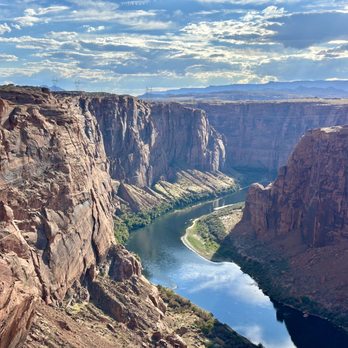


About a 5 minute drive out from the actual dam, you can get a great full frontal view of the dam head looking up river from this overlook. Look 180 degrees the other way from this spot (downstream) and you get gorgeous views of the blues and greens of the Colorado River and rock walls. To get to these views, you park at the top of the gorge (road level) and walk the path down to the cliff overview. Beware, the path is a mix of steps, large smooth groovy rocks in the ground, and sand, so make sure you have sneakers on - flip flops would not be ideal at all; the huge smooth rock surfaces get super hot in the blazing sun too, so keep that in mind. There's pipe railing along the path, but again, nothing shading it, so be very cautious when gripping so you don't burn your hands. Once you get down to the paved deck to look out tho, it's worth it. Pay attention to where you step so you don't slip and twist an ankle. Go out as far as you dare for great pictures; a wonderful spot to document your travels. read more


2 years ago
Both directions, on the side of the road, you can pull over just before or after crossing the bridge. There is no stopping on the bridge! You can park your vehicle and walk over the bridge. The view of the Dam is beautiful! I never got tired of seeing the Glen Canyon Dam! read more


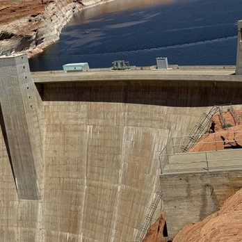


This stop has a great view of the Glen Canyon Dam and the canyon below! You can hike in this area for free. Coming down to the picnic table, there is a narrow, steep walk down that has railings, but the rocks are slippery. Proper shoes are a must! read more


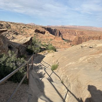

Nice views of the dam, good spot to watch a sunset too! Free parking, the walk down the stairs are a little slippery from the sand so wear some shoes with good grip. There are some rocks you can climb up to get a better view. read more



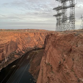

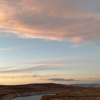

This was our second visit to Page, and I just can't believe we didn't find out about this overlook until now. It just goes to show how much there is to see and do around Page that is still hasn't received the recognition it deserves. Located at the end of Overlook Drive, you'll find a parking lot with limited parking. You can view the Dam from this area, but in order to get the best views, I'd suggest you head down the staircase to the right. Now, this staircase is not an option for everyone. There is a railing to hold on to, however, for the first leg of the descent, there are no stairs, the rock is very smooth and slippery, even when it's dry. I suggest you wear athletic closed toe shoes. My spouse thought he'd try to make the descent with flip flops, and he was embarrassed as he slipped down about two feet of the slope. He had to go back to the car and put on his sneakers before trying to go back down again. Lucky he wasn't hurt besides some minor scrapes, and a bruised ego. Once you reach the last leg of the descent, you will actually find some proper stairs. At the bottom, you will find a smooth rock surface and sand to walk on. Please watch your step as you walk around, as we witnessed an older man holding a camera slip on the rocks and fall straight on his face. He did get up, but he looked in pretty bad shape after his fall. Anyhow, the views of the dam are incredible. You can also peek over the edge to see the River below you. I was absolutely amazed at the sheer beauty surrounding us. You can only get these amazing views in Arizona. I love it! Best of all... the Glen Canyon Overlook is completely free. Yep, FREE! If you find yourself in Page, I highly recommend you check this out. Just remember, the descent to the bottom of the overlook is not for everyone due to the steep, smooth, slippery surface of the rocks. Highly Recommended! read more






3 years ago
A great place to awe at the natural and the man-made beauty that is the Dam. We went during November, so the crowds weren't a hassle; the summer might be a different story. Act accordingly! read more

2 years ago
Great view and rest spot. All of my family enjoyed spending time there. They have small gift shop too read more


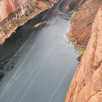
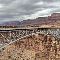
This is a great view atop the bridge and fun walking to the middle to get an amazing view (Pictured). The 4th biggest dam in the United States if I remember correctly, it is vertigo inducing just looking around the sides of it, seeing the piers that come out of the rock, and imagining yourself standing atop one of them. read more
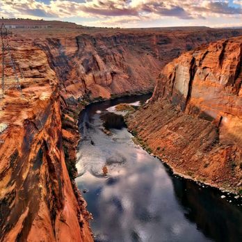

So this is a well marked quickie turn off right as you are entering the downtown area. It is located close to the dam. It does have some fairly steep stairs to traverse but there is a handrail. I would say it's not handicap accessible. Once you are down there, the view is pretty awesome. There is a wall to sit on or look over. There are also some benches so it's feasible to bring a picnic and enjoy the view. It's definitely worth a stop if the dam interests you. read more


3 years ago
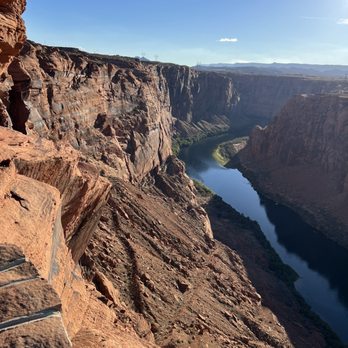
Great view of Glen Canyon Dam! There is a flight of stairs that can be a little bit of a hike (not wheelchair accessible) but leads to quite the view - once you've explored this spot, you can head on over to the Dam itself for souvenirs and a quick history lesson. read more


1 year ago

Picturesque point where the man-made and nature come together. We were looking for something to do in between lunch and our second canyon tour of the day. We had already been to Horseshoe Bend, so we were at a bit of a loss. But a quick google and internet search provided us the option of visiting this overlook. Also...it is free! So...count me in! It is much smaller than Horseshoe Bend, but that also means a smaller parking lot. So you may have to wait a few minutes or so for a parking spot to open up. And if you enjoy marveling at the ability of man to harness nature, alongside a spectacularly beautiful landscape....this spot has it all! I would say that particularly if you have mobility issues, or you don't want to do a 2-3 mile walk to get to the viewing overlook....here you are almost immediately there once you get out of the car. But there are rocks to climb on and around and different areas to hop and bop around. I love stuff like this, and I would therefore say this is absolutely worth a visit. Certainly worth the time and you laying your eyeballs on it. read more


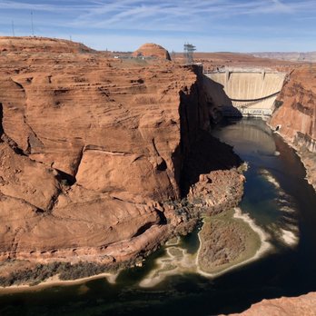


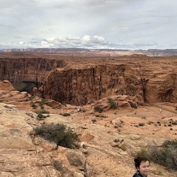
This is the ultimate way to view Glen Canyon Dam in all its entirety and you might think it's a bit far away, but the view you get is so great and you also get to appreciate a large, but in the grand scheme of things infinitesimally small stretch of the Colorado River. There is definitely an extremely rocky, relatively steep, but short path down to the actual overlook (please use the hand railing), but it's worth it. Roundtrip I think it's only a quarter of a mile. In fact, I don't even think you can get a good view of the dam (if at all) from the parking lot, so this is really the only option. Definitely not accessible to all, but definitely doable if you can walk/climb, and you should do it for the optimal overlook. Just be careful of your footing on the way down and back up as it's basically all scramble. There are really no steps except maybe 5 steps in the very beginning of the path. read more


3 years ago
Front row seats to a beautiful sunset. No entrance fee, just a beautiful view and a great spot for pictures. Wasn't crowded at all. read more

Well it's not the Hoover Dam, but it's a fun little stopover on your way through 89. We actually passed this twice. Pretty easy to park and get out of the car and check out the view. It's worth it, especially if you need to stretch your legs at that point. My only gripe is that there are fences along the rails so it makes picture taking very difficult. There's also signs everywhere warning folks not to throw things from the dam. Which means that tons of people have thrown things from the damn. Ugh people - this is why we can't have nice things! I didn't do the trail, but even if you don't it's a quick park, hop, and back into the car. You can do it in 5 minutes. There are no bathrooms or water fountains at the overlook though so be prepared. read more


A nice find! The scenic view is located behind Denny's and Wyndham Hotel. If heading South on State Route 89, turn right on Scenic View Drive. You'll see a parking lot on the right. There is no mile marker or sign of the place. But you'll see a rail guard that on the Southside if you walk few feet from the parking lot. The trail is steep and going down the canyon. It took me about 10 minutes to trek down. I wore sandals with good grip and it was fine. The ground formations are sandy and crinkled petrifiedd sand formations. Be careful and watch your steps. The ground is uneven. When I reached the scenic destination, it was amazing at 6 am in the morning. There is no one there at that time. The canyon looks like a mini version of the Grand Canyon. You can see the Glen Canyon Dam and bridge. There is a lot of opportunities to take pictures around. It's scary to stand or sit on the edge of the cliff. Always be careful and cautious when taking pictures edge of the cliffs. Remember it's a 1000 feet drop down! read more


3 years ago
Excellent views and fun for kids to climb/hike small areas. Short distance from main road and entrance. read more


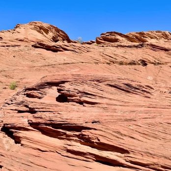

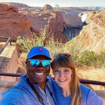

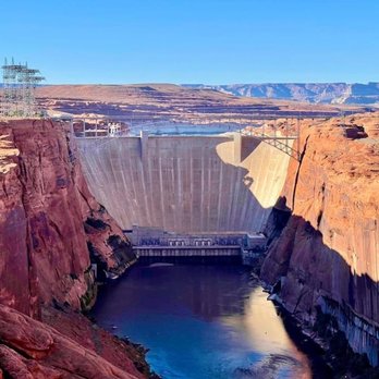


This is everything that Horseshoe Bend should be. Located 4 miles to the north, it's the less-famous cousin that is also less crowded, less physically demanding and less money (parking is free). Horseshoe Bend is definitely a bucket list-worthy destination, it's just unfortunately been ruined by its fame. This place still has an undiscovered feel to it. You can spend some time quietly appreciating the moment without being distracted by all of the crowds and the noise. The road leading to the overlook is located in the rear of Denny's off of Scenic View Rd. After you park you will walk down a stone staircase with a metal railing. There are multiple observation points where you can view both the backside of Glen Canyon Dam and the Colorado River within the deep canyon gorge. I recommend visiting at sunset when the weather is a little cooler. Parking is free and there are no bathrooms. I would definitely use good judgement when you visit since there any number of areas where you can easily fall to your death if you are not careful. Kids should be supervised closely. read more






2 years ago

Wow. I hate to write a review and have this overlook get over-crowded, but this really has a wonderful view! We came down here on a Sunday afternoon and nobody else was here. We got to sit on the rocks and view the canyon and the dam in quiet. It felt truly serene. I actually liked this place a lot more than horseshoe bend. You don't see the bend of the river, but you get to sit in a tranquil space which isn't overrun with people yet! read more


I have driven past this dam visitors center so many times and finally stopped with the kids so they could get a closer dam look. They have dam tours, dam educational exhibits and dam artifacts in the dam visitors center. The dam gift shop was full of dam souvenirs. The dam views were amazing and we had a great dam time! read more


4 years ago

4 years ago


7 years ago
I don't always post but I was really appreciative of Yelp and Trip Adviser during my Page, Arizona trip that I thought it would be good to give some reviews. My wife gave reviews for the bigger things, so I'm doing the smaller activities. This was out first activity and it was honestly great. Just a nice small place to view the damn with some trails. read more

7 years ago
Page 1 of 2
More info about Glen Canyon Dam Overlook
Scenic View Dr
Page, AZ 86040
Directions
Visit Website
http://damoverlook.com
Hours
Indoor Amenities
Outdoor Amenities
Glen Canyon Dam Overlook Reviews in Other Languages
Ask the Community - Glen Canyon Dam Overlook
Review Highlights - Glen Canyon Dam Overlook














Why does Yelp recommend reviews?


Glen Canyon Dam Overlook - landmarks - Updated July 2026
Best of Page
People found Glen Canyon Dam Overlook by searching for…
Trending Searches in Page, AZ
Boat Tours near Glen Canyon Dam Overlook
Cliff Jumping near Glen Canyon Dam Overlook
Jet Ski Rental near Glen Canyon Dam Overlook
Kayak Rental near Glen Canyon Dam Overlook
Lakes near Glen Canyon Dam Overlook
Landmarks & Historical Buildings near Glen Canyon Dam Overlook
Off Road Trails near Glen Canyon Dam Overlook
Paddle Board Rental near Glen Canyon Dam Overlook
Picnic Areas near Glen Canyon Dam Overlook
Places To Visit near Glen Canyon Dam Overlook
Public Shower near Glen Canyon Dam Overlook
Sunrise View near Glen Canyon Dam Overlook
Swimming Holes near Glen Canyon Dam Overlook
Swimming Lakes near Glen Canyon Dam Overlook
Things To Do On A Rainy Day near Glen Canyon Dam Overlook
Browse Articles
Browse Nearby
BEST of Page, Arizona Restaurants near Glen Canyon Dam Overlook
BEST of Page, Arizona Scenic View near Glen Canyon Dam Overlook
BEST of Page, Arizona Coffee near Glen Canyon Dam Overlook
BEST of Page, Arizona Museums near Glen Canyon Dam Overlook
BEST of Page, Arizona Things to Do near Glen Canyon Dam Overlook
BEST of Page, Arizona Breakfast near Glen Canyon Dam Overlook
BEST of Page, Arizona Visitor Centers near Glen Canyon Dam Overlook
BEST of Page, Arizona Hotels near Glen Canyon Dam Overlook
BEST of Page, Arizona Campgrounds near Glen Canyon Dam Overlook
Browse Brands
Related Searches in Page, AZ
Affordable Jet Ski Rental Options in Page, Arizona
Affordable Kayak Rental Services in Page, Arizona
Affordable Paddle Board Rental in Page, Arizona
Best Dog Hiking Trails Around Page, Arizona
Best Fishing Locations and Guides in Page, Arizona
Best Fun Things to Do in Page, Arizona
Best Lookout Points to Visit in Page, Arizona
Best Places for Horseback Riding in Page, Arizona
Best Things to Do on a Rainy Day in Page, Arizona
Book Engaging Historical Tours in Page, Arizona
Check Out Off Road Trails in Page, Arizona
Discover Charming Historic Homes in Page, Arizona
Discover Dog Friendly Trails to Explore in Page, Arizona
Discover Fun Things to Do Alone in Page, Arizona
Discover Historic Sites and Places in Page, Arizona
Discover Popular Landmarks in Page, Arizona
Discover Popular Photo Spots in Page, Arizona
Discover Top Boat Tours in Page, Arizona for All Ages
Discover a Hiking Trail in Page, Arizona
Discover the Best Beaches in Page, Arizona
Discover the Best Night Hike Trails in Page, Arizona
Dog-Friendly Hikes With Dogs in Page, Arizona
Enjoy Arts & Entertainment in Page, Arizona
Enjoy Camping Adventures Around Page, Arizona
Enjoy Exciting Mountain Biking Adventures in Page, Arizona
Enjoy Hiking Adventures in Page, Arizona
Enjoy Kayaking Adventures in Page, Arizona
Enjoy Off Leash Dog Hikes in Page, Arizona
Enjoy Tent Camping Spots Around Page, Arizona
Enjoy the Best Night View Spots in Page, Arizona
Enjoy the Best Walking Trails in Page, Arizona
Experience Stunning Sunset Views in Page, Arizona
Experience Thrilling White Water Rafting in Page, Arizona
Explore Beautiful Castles and Landmarks in Page, Arizona
Explore Beautiful Parks and Green Spaces in Page, Arizona
Explore Children's Museums Near Page, Arizona
Explore Easy Hikes Perfect for All in Page, Arizona
Explore Free Things to Do Around Page, Arizona
Explore Fun Activities to Do in Page, Arizona
Explore Popular Campgrounds Near Page, Arizona
Explore Popular RV Parks Around Page, Arizona
Explore Popular View Points Around Page, Arizona
Explore Top Art Galleries Located in Page, Arizona
Explore Top Things to Do at Night in Page, Arizona
Explore Venues & Event Spaces in Page, Arizona
Explore the Best Beach Spots in Page, Arizona


