The Wave at Coyote Buttes Photos


You might also consider


More like The Wave at Coyote Buttes
Recommended Reviews - The Wave at Coyote Buttes
Start your review...


Reviews With Photos


I had the chance to hike the Wave 6 years ago when they still sold 10 passes online for each day of the month. Everything is a lottery system now, either online or in person, for the 20 passes issued each day. Here's a link for the permits information and the link to apply. https://www.blm.gov/az/paria/index.cfm?usearea=CB The hike I did was 8 miles round trip but I did some exploring in the area to see other formations. For me, the trail is not difficult. It's simply a walk along some wonderful sandstone with a bit of an uphill climb. At the end, you need to walk up about 50 feet in elevation to get to the Wave itself. The formations here are simply stunning, It makes for great photography even for a point and shoot person like me. There are a couple of arches. I didn't hike to any of these because I had just gotten a cast off my arm and I didn't want another broken bone for awhile. Much of the way, you can just follow the steps of people who have gone before you. There's a trail of a kind across the sandstone. Sometimes, you'll have to hike across fine sand which is tiring. You won't see many people on this hike since only 20 people are allowed per day. This is a must do hike if you can get a permit. But, know your limitation and pick a better time of the year to go. Be aware that an elderly couple (she 68, he 70) died there this past week from dehydration and heat exhaustion. They had gotten one of the coveted permits at the lottery in person but they weren't prepared for the 100+ temperatures and didn't make it.


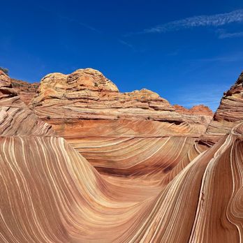
It's said that The Wave is one of the most photographed landscapes in the United States. That may be so, but the place is in a rugged area in the middle of nowhere -- in Arizona, halfway between Kanab, Utah, and Page, Arizona -- and only 20 people are allowed in by the lottery system. On a recent visit to the BLM office west of Big Water, Utah, that issues the permits, I watched a German couple almost cry because they didn't win a slot after three days of participation in the lottery system. They flew from Germany to Arizona just for this and they were going to return home heartbroken. Although many others didn't win a slot, I got lucky. I was so excited that I got little sleep. Before dawn the next day, I was on the road and at the trail head in no time. The BLM provided a good map and cairns along the way provided additional assistance for the tough, but pleasurable hike. I was the first to reach The Wave and it was overwhelming to stand in the middle of mounds of uninhibited, sloppy, pulled salt-water taffy landscape. I pulled out my camera and tripod immediately and started running and snapping photos like a lunatic. This place is pornographic in its splendor with the colors and stripes and curves that tattooed themselves into my eye sockets. This mad ecstasy went on for hours before I was exhausted, satisfied, and ready to go to sleep.
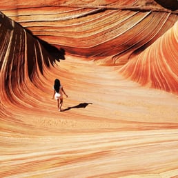

Every once in awhile, the moon turns blue, the stars align, and for a moment...Lady Luck looks your way. You've seen it. http://www.yelp.com/biz_photos/i1GSlBcNqY7cdvaGoiysBQ?select=smT_uJMdmWvwLUjZIBDcjQ In a photo or a portrait, one time or another, you've seen that stunning shot of a part of Mother Nature so unreal, so perfect in its wildest splendor that it took your breath away. They call it, The Wave. Located in Vermilion Cliffs National Park, at the border of Utah and Arizona, The Wave is one of the most beautiful geological formations in the world, and is thus, one of the most photographed landscapes ever. Due to its overwhelming popularity and the delicate nature of the rock formations, the area is limited to only 20 people PER DAY. What does this mean? Simply put, in order to see this natural phenomenon, you need to enter a lottery 4 months in advance for a chance to win a permit, or take your chances the day before a hike, at the ranger station, against a group of 50 or more people with the possibility of coming all the way there and going home with nada. They say that when the lottery is active, there are over 3000 entries. 1 in 3000 chances of getting a permit, and we won the lottery for it. Priceless. 6 people are allowed per permit, so when the good news came, I rounded up a group of good friends to accompany me on the trip of a lifetime. The Wave is located in an area of vast wilderness where there are NO TRAILS, and navigation was done using a GPS. The hike to The Wave is 6 miles round trip through desert heat, rough terrain, and sand dunes. Not for the faint of heart, this hike is definitely for the adventurous. Ah, The Wave...months of planning and preparation came down to that one moment. After hours of hiking, we had arrived. Slowly but eagerly, we stepped into its gallery, where millions of years of iron deposits twist and blend to create a rainbow of orange, pink, and red swirls. At that moment, Mother Nature truly took my breath away. It is said that, "Time is not measured by clocks, but by moments." Surely, those were the moments of fond memories and true adventure. They are the moments that would stay in our hearts and last for a lifetime.


This was by far the hardest backcountry permit I have applied for. It took me 5 or 6 attempts to finally win the lottery (it's a $5 fee every time you apply) and when the email came that I won, I really did feel like I won the lottery! I had finally figured out to go on the BLM website to apply for the permit at the end of the month, and it allows you to check the calendar and see how many people have applied for permits in particular days, so I picked 3 days that had the least amount of applicants, and it worked. The lottery process takes place 3 months ahead of time, they only allow 20 people per day, you can take a chance and show up to the BLM office in Kanab and try your luck with a walk thru permit. This hike is mostly flat, with some elevation gains thru some of the area, for the most part, it was easy. The red sand and red rocks made this hike hot, we did this October 30, and it was only 70 degrees out, but I got sunburnt and I worked up a sweat. How anyone could do this in the summer is beyond me. There is no shade and it gets to 110 degrees (not counting the extra heat the red rocks hold). If you have Vibrams, wear them. A large majority of the hike is sand, I ended up taking my shoes off and walking a mile or so barefoot (I had a ton of sand in my shoes, got tired of it). Bring lots of water. Lots. Snack, sunglasses, sunblock. BLM sent a very detailed map in the mail along with my permits, it included a road map to the trail head as well as a detailed map for the hike, that included pictures (many people get lost, GPS doesn't always work). This was great to check off the bucket list, but if you're not patient enough to go thru the lottery system, go to antelope canyon.
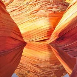

Even though everybody raves about visting the wave. I think a much better site is cottonwood cove in south coyote buttes. Not that the wave is not spectacular in itself. Its really in a small condensed area that most people are fooled into thinking its a big expansive area from the photos. So if you do not win the lottery to the wave don't dismay if you have 4-wheel drive go visit south coyote buttes you will be more than amply rewarded.


This was an amazing experience for a reasonably experienced hiker, though it is not one for people who want an easy hike. My photographs are by far some of my best ever. I loved the challenge of finding the Wave and some of the other locations around it like fatali's bone yard and the dinosaur tracks. This is an unmarked trail, though it's easy to find the Wave itself from foot prints in the sand. The rest of the sights require more to find. As such, you really should plan for this hike. I took a compass navigation class through REI, which was very helpful for finding my way around. I also bought a GPS device and saved the Google map for the area so I could access it and see my location even without service, which is spotty at best in the area. I also downloaded the GPS coordinates for everything I wanted to see and had a print out. Ooh, and i had the mail provided by BLM and a national geographic map of the area. And a few print outs of the satellite images for funsies. Most of my precautions for navigation ended up being redundant, but I'm so glad I took them. Why? Because even in October, it's hot. Really hot. Nearly 90, though it felt hotter because you're baking on brightly colored sandstone. The BLM permit correctly tells you to bring at least four liters (or one gallon) of water. We brought five liters and were only out from about 10 am to 4 pm. By the end, we would have been out of water had we not brought the extra liter. Please bring lots of water. There is usually no water to even purify within 16 miles of the Wave, although some times water collects in the Wave itself. But that's unreliable at best. The recommendation to bring water is not exaggerated. Also bring the standard first aid, pocket knife, head lamp, extra food, and space blanket just in case you get caught on a flash flood here. Or in case you get lost. Also, I recommend wearing long sleeves and pants. Nothing thick mind you. You will want to wear these things to cover up as much skin as you can. Dessert people, like many people on the Arab peninsula, Egypt, etc, wear such clothing to protect themselves from the sun. You should follow those practices here. You should also wear a hat and cover up your neck so you don't burn. And sunglasses are highly recommended because the sun is so bright. Otherwise, your eyes are likely to tear up and you'll trip on something because you're squinting. Finally, for those who complain about the lotto system, I can tell you that I whole heartedly agree with it, especially after going. The sandstone is fragile. The Wave would crumple if it had an onslaught of visitors. The Wave would also have been a less fun experience. You get to enjoy the Wave precisely because there aren't many people around. You actually get to take pictures alone in the Wave. You can enjoy the silence in the rest of the surroundings. Thank you BLM for being so strict. In sum, I highly recommend this hike for experienced hikers who can navigate by reading a map and using a compass. I also recommend honoring the lotto permit system. It's necessary to protect this special place and to keep the experience meaningful.

An absolute pain to get a permit for this location - only 20 permits are issued per day (10 online, 3 months in advance via lottery and 10 via a walk-in lottery, a day before the permit day/ hiking day). I finally won a walk-in permit in August 2020, and got a chance to check it out. Was as fabulous as I had imagined - I started early (before sunrise) and the early morning light was incredible. BTW, if you get a permit to go there, do not just go to 'The Wave' - there are other features next to it that are spectacular. A lot of folks just visit 'The Wave' and then head back - big mistake. I did a short video of all the attractions one can see in that area - check it out at https://youtu.be/EIdJHt_3a3w. If you get a chance to go to 'The Wave', you will not be disappointed. Fantastic place.
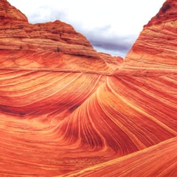

Just returned from my 3-day trip where I visited "the Wave." Amazing place to say the least. If you've never been there, let me break down to you how the process works. First, you'll need to get a permit to enter the trail and there are 2 different ways to get that permit: 1) enter an online lottery that's held once per month (for a date that's 4-months out) OR 2) physically show up at their Visitor Center in Kanab, Utah, for a chance to win a permit via a lottery for the next-day entry. Either way, it's a huge crapshoot whether you win it or not, good luck!! http://www.blm.gov/az/st/en/arolrsmain/paria/coyote_buttes/permits.html Once you get your permit, you'll drive out to the parking lot via a dirt road (about an 1 hr 10 min from Kanab), leave your permit on the dashboard, and hike an UNMARKED trail from the parking lot about 4-5 miles to "the Wave." You are provided with a map how to get there but it's fairly easy to get lost right at the very end of the trail so pay close attention to landmarks around you (especially on the way back so you can return safely!). One thing that most people didn't mention on Yelp yet, is the hike ITSELF to the Wave is absolutely STUNNING. In a way, the journey to the Wave is better than the Wave itself. I mean, it is THAT good of a scenic hike. I am a frequent hiker and I was blown away by the trail's beauty. The Wave itself is stunning too, albeit it's rather small comparing to what I imagined it would be. Some tips to consider: Go EARLY to beat the heat!! Leave by 7am so you can get to the parking lot by 8am and get to the Wave around 10-11am. Remember, you still have to come back too and it gets unbearably hot there. Also, bring multiple layers of clothing (we got caught in a nasty rainstorm on the way back so rain jacket is a must), drive a 4x4 car because the trail to the parking lot in a rainstom gets completely muddy and you won't be able to leave (we got stuck in a mud a few times!!), bring TONS of water with you, plus some snacks for energy boost), bring a backpack to carry all of your stuff AND good hiking shoes (not tennis shoes) because you'll be hiking a total of 8-10 miles, depending how fast or slow you get there. Overall, hiking to the Wave and back was the best hike of my life. Not even kidding. You WILL love it. It is THAT good. P.S. Finally, I do NOT recommend this, but... I never saw anybody checking my permit while parking my car OR hiking so.... I'm sure SOME people hike to the Wave REGARDLESS whether they get this ridiculously "hard-to-get" permit or not. Granted, you need to know how to find "the Wave" because it's a maze out there and very easy to get lost, especially if it's your first time there. Just an FYI.


Did the hike and overnight in Buckskin Gulch. Even if you don't win the lottery you can hike and see some amazing views of the SouthWest. You will not be disappointed. If you day hike fed go from Wire Pass trailhead which is far better than White House Trailhead. If you need to do some water crossings come prepared and speak to the park rangers.


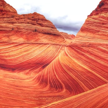
After years of trying to apply for a permit, our group finally got picked! Highly recommend hiking at least once. I wouldn't do it again though, mainly because of how hard it was to get a permit. We visited in April and the weather was fantastic. It was actually freezing in the morning but as the sun rose, it warmed up to the point where we would sweat a little when hiking. I can't even imagine doing this in the summer but if you win the lottery then, make sure everyone brings plenty of water. To get to the trailhead, I'd recommend having a high-clearance vehicle, especially if it just recently rained. The road off of the freeway becomes unpaved and there are some ditches that can be flooded. Download an offline map of the trail and area for when you lose service. It gets spotty but you'll find reception every now and then. At the beginning, there are a couple of vault toilets. The trail itself is difficult to follow without an offline map. There's only a handful of signs pointing in a general direction. And until the Wave, we were pretty much the only people around. Considering only about 60 people are approved each day, it wasn't surprising, and honestly, kind of nice to be alone in nature. The Wave was everything we hoped for. We had clear, blue skies and that contrast with the red and orange rocks was beautiful. It looked exactly like the Windows background! There was even a pond further up with a ton of tadpoles. Besides the Wave, there's other neat waypoints to stop by but because we were tired, we didn't try for many of them. The only one we went out of our way for was the dinosaur tracks but it was anti-climatic. They just looked like larger chicken feet prints. Despite this hike being only about 6 miles round trip, it took pretty much the entire day. We stopped a lot to take pictures but also the landscape was difficult to hike. Lots of sand to walk through and lots of weird inclines to walk across, which kept our feet, knees, and legs at weird angles. There might have been easier pathways but as I said earlier, there's no clear indications of a trail. There was also a BLM worker at the Wave asking for the permit holders. If you hike without one and get caught, you'll get slapped with some steep fines. Drones are also not allowed! read more


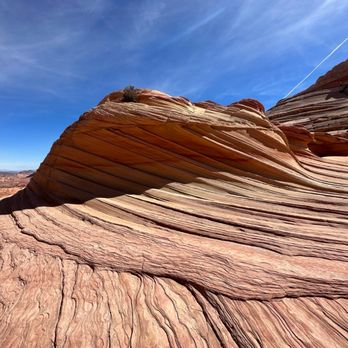


4 years ago
My friend won the online lottery for the permit 4 months in advance but after talking to the ranger, it seems that there's a good chance you can win the daily lottery since a lot of people cancel every day. It's easier if you have less people (like two people). Anyways, the orientation the day before was useful for weather and road conditions. The hike wasn't too bad, can be a bit steep in some parts but for the most part, not too much incline. It's moderate for the novice hiker but easy for an experienced hiker. For experienced hikers, probably can get to the Wave in 1 to 1.5 hours. For the inexperienced, it might take 2.5 to 3 hours. Either way, if you're planning to spend a lot of time at the Wave (some people take 2-3 hours for their extensive Instagram photoshoots haha), definitely go there early and spend all day there. I would definitely come back if I win the lottery! read more

Plenty of parking. Lottery base permit, gives you ample of time to register and make arrangements. There are rangers that check your reservation and we saw people getting turned away. Make sure you have a permit. The road is very rugged, having a 4wheeler will make it easier to get to the destination. Close to Page where you can visit Horse Bend and Antelope Canyon. read more


I had the chance to hike the Wave 6 years ago when they still sold 10 passes online for each day of the month. Everything is a lottery system now, either online or in person, for the 20 passes issued each day. Here's a link for the permits information and the link to apply. https://www.blm.gov/az/paria/index.cfm?usearea=CB The hike I did was 8 miles round trip but I did some exploring in the area to see other formations. For me, the trail is not difficult. It's simply a walk along some wonderful sandstone with a bit of an uphill climb. At the end, you need to walk up about 50 feet in elevation to get to the Wave itself. The formations here are simply stunning, It makes for great photography even for a point and shoot person like me. There are a couple of arches. I didn't hike to any of these because I had just gotten a cast off my arm and I didn't want another broken bone for awhile. Much of the way, you can just follow the steps of people who have gone before you. There's a trail of a kind across the sandstone. Sometimes, you'll have to hike across fine sand which is tiring. You won't see many people on this hike since only 20 people are allowed per day. This is a must do hike if you can get a permit. But, know your limitation and pick a better time of the year to go. Be aware that an elderly couple (she 68, he 70) died there this past week from dehydration and heat exhaustion. They had gotten one of the coveted permits at the lottery in person but they weren't prepared for the 100+ temperatures and didn't make it. read more

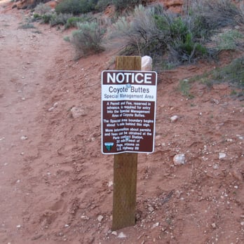


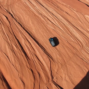
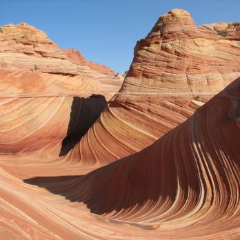


It's said that The Wave is one of the most photographed landscapes in the United States. That may be so, but the place is in a rugged area in the middle of nowhere -- in Arizona, halfway between Kanab, Utah, and Page, Arizona -- and only 20 people are allowed in by the lottery system. On a recent visit to the BLM office west of Big Water, Utah, that issues the permits, I watched a German couple almost cry because they didn't win a slot after three days of participation in the lottery system. They flew from Germany to Arizona just for this and they were going to return home heartbroken. Although many others didn't win a slot, I got lucky. I was so excited that I got little sleep. Before dawn the next day, I was on the road and at the trail head in no time. The BLM provided a good map and cairns along the way provided additional assistance for the tough, but pleasurable hike. I was the first to reach The Wave and it was overwhelming to stand in the middle of mounds of uninhibited, sloppy, pulled salt-water taffy landscape. I pulled out my camera and tripod immediately and started running and snapping photos like a lunatic. This place is pornographic in its splendor with the colors and stripes and curves that tattooed themselves into my eye sockets. This mad ecstasy went on for hours before I was exhausted, satisfied, and ready to go to sleep. read more




15 years ago
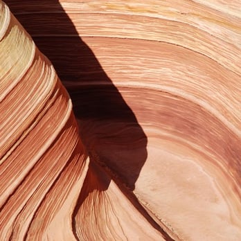
Every once in awhile, the moon turns blue, the stars align, and for a moment...Lady Luck looks your way. You've seen it. http://www.yelp.com/biz_photos/i1GSlBcNqY7cdvaGoiysBQ?select=smT_uJMdmWvwLUjZIBDcjQ In a photo or a portrait, one time or another, you've seen that stunning shot of a part of Mother Nature so unreal, so perfect in its wildest splendor that it took your breath away. They call it, The Wave. Located in Vermilion Cliffs National Park, at the border of Utah and Arizona, The Wave is one of the most beautiful geological formations in the world, and is thus, one of the most photographed landscapes ever. Due to its overwhelming popularity and the delicate nature of the rock formations, the area is limited to only 20 people PER DAY. What does this mean? Simply put, in order to see this natural phenomenon, you need to enter a lottery 4 months in advance for a chance to win a permit, or take your chances the day before a hike, at the ranger station, against a group of 50 or more people with the possibility of coming all the way there and going home with nada. They say that when the lottery is active, there are over 3000 entries. 1 in 3000 chances of getting a permit, and we won the lottery for it. Priceless. 6 people are allowed per permit, so when the good news came, I rounded up a group of good friends to accompany me on the trip of a lifetime. The Wave is located in an area of vast wilderness where there are NO TRAILS, and navigation was done using a GPS. The hike to The Wave is 6 miles round trip through desert heat, rough terrain, and sand dunes. Not for the faint of heart, this hike is definitely for the adventurous. Ah, The Wave...months of planning and preparation came down to that one moment. After hours of hiking, we had arrived. Slowly but eagerly, we stepped into its gallery, where millions of years of iron deposits twist and blend to create a rainbow of orange, pink, and red swirls. At that moment, Mother Nature truly took my breath away. It is said that, "Time is not measured by clocks, but by moments." Surely, those were the moments of fond memories and true adventure. They are the moments that would stay in our hearts and last for a lifetime. read more
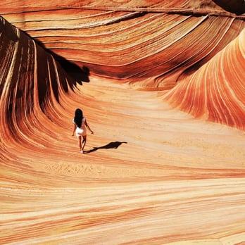


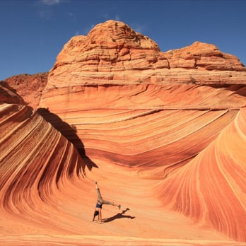

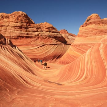


This was by far the hardest backcountry permit I have applied for. It took me 5 or 6 attempts to finally win the lottery (it's a $5 fee every time you apply) and when the email came that I won, I really did feel like I won the lottery! I had finally figured out to go on the BLM website to apply for the permit at the end of the month, and it allows you to check the calendar and see how many people have applied for permits in particular days, so I picked 3 days that had the least amount of applicants, and it worked. The lottery process takes place 3 months ahead of time, they only allow 20 people per day, you can take a chance and show up to the BLM office in Kanab and try your luck with a walk thru permit. This hike is mostly flat, with some elevation gains thru some of the area, for the most part, it was easy. The red sand and red rocks made this hike hot, we did this October 30, and it was only 70 degrees out, but I got sunburnt and I worked up a sweat. How anyone could do this in the summer is beyond me. There is no shade and it gets to 110 degrees (not counting the extra heat the red rocks hold). If you have Vibrams, wear them. A large majority of the hike is sand, I ended up taking my shoes off and walking a mile or so barefoot (I had a ton of sand in my shoes, got tired of it). Bring lots of water. Lots. Snack, sunglasses, sunblock. BLM sent a very detailed map in the mail along with my permits, it included a road map to the trail head as well as a detailed map for the hike, that included pictures (many people get lost, GPS doesn't always work). This was great to check off the bucket list, but if you're not patient enough to go thru the lottery system, go to antelope canyon. read more




17 years ago
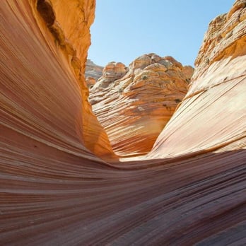
Even though everybody raves about visting the wave. I think a much better site is cottonwood cove in south coyote buttes. Not that the wave is not spectacular in itself. Its really in a small condensed area that most people are fooled into thinking its a big expansive area from the photos. So if you do not win the lottery to the wave don't dismay if you have 4-wheel drive go visit south coyote buttes you will be more than amply rewarded. read more


11 years ago
This was an amazing experience for a reasonably experienced hiker, though it is not one for people who want an easy hike. My photographs are by far some of my best ever. I loved the challenge of finding the Wave and some of the other locations around it like fatali's bone yard and the dinosaur tracks. This is an unmarked trail, though it's easy to find the Wave itself from foot prints in the sand. The rest of the sights require more to find. As such, you really should plan for this hike. I took a compass navigation class through REI, which was very helpful for finding my way around. I also bought a GPS device and saved the Google map for the area so I could access it and see my location even without service, which is spotty at best in the area. I also downloaded the GPS coordinates for everything I wanted to see and had a print out. Ooh, and i had the mail provided by BLM and a national geographic map of the area. And a few print outs of the satellite images for funsies. Most of my precautions for navigation ended up being redundant, but I'm so glad I took them. Why? Because even in October, it's hot. Really hot. Nearly 90, though it felt hotter because you're baking on brightly colored sandstone. The BLM permit correctly tells you to bring at least four liters (or one gallon) of water. We brought five liters and were only out from about 10 am to 4 pm. By the end, we would have been out of water had we not brought the extra liter. Please bring lots of water. There is usually no water to even purify within 16 miles of the Wave, although some times water collects in the Wave itself. But that's unreliable at best. The recommendation to bring water is not exaggerated. Also bring the standard first aid, pocket knife, head lamp, extra food, and space blanket just in case you get caught on a flash flood here. Or in case you get lost. Also, I recommend wearing long sleeves and pants. Nothing thick mind you. You will want to wear these things to cover up as much skin as you can. Dessert people, like many people on the Arab peninsula, Egypt, etc, wear such clothing to protect themselves from the sun. You should follow those practices here. You should also wear a hat and cover up your neck so you don't burn. And sunglasses are highly recommended because the sun is so bright. Otherwise, your eyes are likely to tear up and you'll trip on something because you're squinting. Finally, for those who complain about the lotto system, I can tell you that I whole heartedly agree with it, especially after going. The sandstone is fragile. The Wave would crumple if it had an onslaught of visitors. The Wave would also have been a less fun experience. You get to enjoy the Wave precisely because there aren't many people around. You actually get to take pictures alone in the Wave. You can enjoy the silence in the rest of the surroundings. Thank you BLM for being so strict. In sum, I highly recommend this hike for experienced hikers who can navigate by reading a map and using a compass. I also recommend honoring the lotto permit system. It's necessary to protect this special place and to keep the experience meaningful. read more


6 years ago
An absolute pain to get a permit for this location - only 20 permits are issued per day (10 online, 3 months in advance via lottery and 10 via a walk-in lottery, a day before the permit day/ hiking day). I finally won a walk-in permit in August 2020, and got a chance to check it out. Was as fabulous as I had imagined - I started early (before sunrise) and the early morning light was incredible. BTW, if you get a permit to go there, do not just go to 'The Wave' - there are other features next to it that are spectacular. A lot of folks just visit 'The Wave' and then head back - big mistake. I did a short video of all the attractions one can see in that area - check it out at https://youtu.be/EIdJHt_3a3w. If you get a chance to go to 'The Wave', you will not be disappointed. Fantastic place. read more


12 years ago
Just returned from my 3-day trip where I visited "the Wave." Amazing place to say the least. If you've never been there, let me break down to you how the process works. First, you'll need to get a permit to enter the trail and there are 2 different ways to get that permit: 1) enter an online lottery that's held once per month (for a date that's 4-months out) OR 2) physically show up at their Visitor Center in Kanab, Utah, for a chance to win a permit via a lottery for the next-day entry. Either way, it's a huge crapshoot whether you win it or not, good luck!! http://www.blm.gov/az/st/en/arolrsmain/paria/coyote_buttes/permits.html Once you get your permit, you'll drive out to the parking lot via a dirt road (about an 1 hr 10 min from Kanab), leave your permit on the dashboard, and hike an UNMARKED trail from the parking lot about 4-5 miles to "the Wave." You are provided with a map how to get there but it's fairly easy to get lost right at the very end of the trail so pay close attention to landmarks around you (especially on the way back so you can return safely!). One thing that most people didn't mention on Yelp yet, is the hike ITSELF to the Wave is absolutely STUNNING. In a way, the journey to the Wave is better than the Wave itself. I mean, it is THAT good of a scenic hike. I am a frequent hiker and I was blown away by the trail's beauty. The Wave itself is stunning too, albeit it's rather small comparing to what I imagined it would be. Some tips to consider: Go EARLY to beat the heat!! Leave by 7am so you can get to the parking lot by 8am and get to the Wave around 10-11am. Remember, you still have to come back too and it gets unbearably hot there. Also, bring multiple layers of clothing (we got caught in a nasty rainstorm on the way back so rain jacket is a must), drive a 4x4 car because the trail to the parking lot in a rainstom gets completely muddy and you won't be able to leave (we got stuck in a mud a few times!!), bring TONS of water with you, plus some snacks for energy boost), bring a backpack to carry all of your stuff AND good hiking shoes (not tennis shoes) because you'll be hiking a total of 8-10 miles, depending how fast or slow you get there. Overall, hiking to the Wave and back was the best hike of my life. Not even kidding. You WILL love it. It is THAT good. P.S. Finally, I do NOT recommend this, but... I never saw anybody checking my permit while parking my car OR hiking so.... I'm sure SOME people hike to the Wave REGARDLESS whether they get this ridiculously "hard-to-get" permit or not. Granted, you need to know how to find "the Wave" because it's a maze out there and very easy to get lost, especially if it's your first time there. Just an FYI. read more



8 years ago


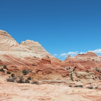


4 years ago

9 years ago
Did the hike and overnight in Buckskin Gulch. Even if you don't win the lottery you can hike and see some amazing views of the SouthWest. You will not be disappointed. If you day hike fed go from Wire Pass trailhead which is far better than White House Trailhead. If you need to do some water crossings come prepared and speak to the park rangers. read more


8 years ago
Amazing place!! It was the hardest hike of my life because I injured my lower back and ankle one week before going to The Wave. I hired a guide, I would never make it on my own. read more


11 years ago


18 years ago
6 years ago

13 years ago

11 years ago

10 years ago

11 years ago


13 years ago
16 years ago
14 years ago
More info about The Wave at Coyote Buttes
Marble Canyon, UT 86036
Directions
(435) 644-4600
Call Now
Hours
Indoor Amenities
Outdoor Amenities
Ask the Community - The Wave at Coyote Buttes
Review Highlights - The Wave at Coyote Buttes















Why does Yelp recommend reviews?
1 review that is not currently recommended
The reviews below are not factored into the business's overall star rating.

13 years ago


