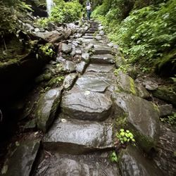
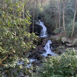
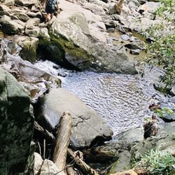
Greenbrier Grocery Photos


Business Info
You might also consider
More like Greenbrier Grocery
Recommended Reviews - Greenbrier Grocery
Start your review...

10 days ago
As a local content creator here in Gatlinburg i absolutely love Greenbrier Grocery store, Gatlinburg's oldest store too ! They're locally owned and amazing people too! If you're a fisherman, it's stocked with items you'll need as well ..Come say hi on Facebook The Gatlinburg Hussey read more


1 year ago
Best Mountain Honey in the Great Smoky Mountains. Great shop for all your camping needs including bundled firewood. read more


2 years ago
2 years ago
3 years ago
6 years ago
6 years ago
6 years ago
More info about Greenbrier Grocery
Ask the Community - Greenbrier Grocery
You might also consider


Why does Yelp recommend reviews?
Greenbrier Grocery - grocery - Updated June 2026
Best of Gatlinburg
People found Greenbrier Grocery by searching for…
Bait and Tackle Shop in Gatlinburg, Tennessee
Hunting & Fishing Supplies in Gatlinburg, Tennessee
Live Bait Shop in Gatlinburg, Tennessee
Things to Do in Gatlinburg, Tennessee
Shopping in Gatlinburg, Tennessee
Bait Shops in Gatlinburg, Tennessee
Fly Fishing Shop in Gatlinburg, Tennessee
Fishing Tackle Shop in Gatlinburg, Tennessee
Campgrounds in Gatlinburg, Tennessee
Trout in Gatlinburg, Tennessee
Parks in Gatlinburg, Tennessee
Waterfall in Gatlinburg, Tennessee
Trout Fishing in Gatlinburg, Tennessee
Fishing Spots in Gatlinburg, Tennessee
General Store in Gatlinburg, Tennessee
Free Air in Gatlinburg, Tennessee
Walking Trails in Gatlinburg, Tennessee
Running Trails in Gatlinburg, Tennessee
State Parks Camping in Gatlinburg, Tennessee
Hiking Trails in Gatlinburg, Tennessee
Fly Shop in Gatlinburg, Tennessee
Stores in Gatlinburg, Tennessee
Trending Searches in Gatlinburg, TN
Bags Of Ice near Greenbrier Grocery
Bait And Tackle Shop near Greenbrier Grocery
Black Owned Restaurants near Greenbrier Grocery
Bulk Food near Greenbrier Grocery
Cliff Jumping near Greenbrier Grocery
Convenience Stores 24 Hours near Greenbrier Grocery
Country Store near Greenbrier Grocery
Creeks near Greenbrier Grocery
Dog Friendly Trails near Greenbrier Grocery
Dole Whip near Greenbrier Grocery
Farm Stand near Greenbrier Grocery
Fishing Charter near Greenbrier Grocery
Fresh Produce near Greenbrier Grocery
Fried Clams near Greenbrier Grocery
Fruit And Vegetable Market near Greenbrier Grocery
General Store near Greenbrier Grocery
Ice Cream Truck near Greenbrier Grocery
Imported Food near Greenbrier Grocery
Italian Ice near Greenbrier Grocery
Lakes & Ponds near Greenbrier Grocery
Liquor Stores Open Late near Greenbrier Grocery
Lobster near Greenbrier Grocery
Mexican Meat Market near Greenbrier Grocery
Off Road Trails near Greenbrier Grocery
Outdoor Activities near Greenbrier Grocery
Picnic Spots near Greenbrier Grocery
Pontoon Boat Rentals near Greenbrier Grocery
Produce Market near Greenbrier Grocery
Public Shower near Greenbrier Grocery
Rock Quarry near Greenbrier Grocery
Scenic Drive near Greenbrier Grocery
Scenic Night View near Greenbrier Grocery
Scenic Overlook near Greenbrier Grocery
Secluded Spots near Greenbrier Grocery
Slushie near Greenbrier Grocery
Snow Cones near Greenbrier Grocery
Soft Serve near Greenbrier Grocery
Sports Bar With Tv near Greenbrier Grocery
Steamed Crabs near Greenbrier Grocery
Stores near Greenbrier Grocery
Sunrise View near Greenbrier Grocery
Sunset Cruise near Greenbrier Grocery
Supermarket near Greenbrier Grocery
Swimming Holes near Greenbrier Grocery
Watch Sunset near Greenbrier Grocery
Browse Nearby
BEST of Gatlinburg, Tennessee Coffee near Greenbrier Grocery
BEST of Gatlinburg, Tennessee Restaurants near Greenbrier Grocery
BEST of Gatlinburg, Tennessee Things to Do near Greenbrier Grocery
BEST of Gatlinburg, Tennessee Desserts near Greenbrier Grocery
BEST of Gatlinburg, Tennessee Pizza near Greenbrier Grocery
BEST of Gatlinburg, Tennessee Breakfast near Greenbrier Grocery
BEST of Gatlinburg, Tennessee Liquor Store near Greenbrier Grocery
BEST of Gatlinburg, Tennessee Shopping near Greenbrier Grocery
BEST of Gatlinburg, Tennessee Thrift Stores near Greenbrier Grocery
Browse Brands
Related Searches in Gatlinburg, TN
Affordable Fishing Rental Services in Gatlinburg, Tennessee
Affordable Jet Ski Rental Options in Gatlinburg, Tennessee
Affordable Kayak Rental Services in Gatlinburg, Tennessee
Affordable Paddle Board Rental in Gatlinburg, Tennessee
Best Fishing Locations and Guides in Gatlinburg, Tennessee
Best Fun Things to Do in Gatlinburg, Tennessee
Best Nature Trails for Hiking in Gatlinburg, Tennessee
Best Places for Horseback Riding in Gatlinburg, Tennessee
Best Places for Poke in Gatlinburg, Tennessee
Best Smoothie Spots and Cafes in Gatlinburg, Tennessee
Best Waterfalls and Swimming Holes in Gatlinburg, Tennessee
Book Top Fishing Trips in Gatlinburg, Tennessee Today
Browse Italian Grocery Stores Around Gatlinburg, Tennessee
Browse Local Meat Shops in Gatlinburg, Tennessee
Browse Middle Eastern Grocery Stores in Gatlinburg, Tennessee
Browse Organic Grocery Stores in Gatlinburg, Tennessee
Browse Popular Seafood Markets in Gatlinburg, Tennessee
Browse the Finest Cheese Shops Found in Gatlinburg, Tennessee
Buy Fresh Produce Near Gatlinburg, Tennessee
Buy Fresh Raw Milk From Trusted Sources in Gatlinburg, Tennessee
Buy Premium Beef Jerky Treats in Gatlinburg, Tennessee
Check Out Off Road Trails in Gatlinburg, Tennessee
Delicious Ice Cream Treats in Gatlinburg, Tennessee
Dine at Top Organic Restaurants in Gatlinburg, Tennessee
Discover Coffee & Tea Options in Gatlinburg, Tennessee
Discover Dog Friendly Trails to Explore in Gatlinburg, Tennessee
Discover Exciting Adventure Options in Gatlinburg, Tennessee
Discover Fun Activities to Do in Gatlinburg, Tennessee
Discover Health Markets Available in Gatlinburg, Tennessee
Discover Lakes & Ponds to Explore in Gatlinburg, Tennessee
Discover Scenic Mountain Bike Trails Near Gatlinburg, Tennessee
Discover Scenic Waterfall Spots in Gatlinburg, Tennessee
Discover Top Boat Tours in Gatlinburg, Tennessee for All Ages
Discover a Hiking Trail in Gatlinburg, Tennessee
Discover the Best Fishing Lake in Gatlinburg, Tennessee
Discover the Best Night Hike Trails in Gatlinburg, Tennessee
Discover the Best Running Track in Gatlinburg, Tennessee
Discover the Best Sushi Spots in Gatlinburg, Tennessee
Dog-Friendly Hikes With Dogs in Gatlinburg, Tennessee
Enjoy Camping Adventures Around Gatlinburg, Tennessee
Enjoy Exciting Mountain Biking Adventures in Gatlinburg, Tennessee
Enjoy Fishing Pier Spots in Gatlinburg, Tennessee With Scenic Views
Enjoy Fishing With Kids in Gatlinburg, Tennessee Safely
Enjoy Hiking Adventures in Gatlinburg, Tennessee
Enjoy Kayaking Adventures in Gatlinburg, Tennessee
Enjoy River Tubing Adventures in Gatlinburg, Tennessee
Enjoy Sailing Adventures in Gatlinburg, Tennessee
Enjoy Strawberry Picking Adventures in Gatlinburg, Tennessee
Browse Articles
People who viewed Greenbrier Grocery also viewed
A Walk in the Woods
38 reviews
Patriot Park
14 reviews
City of Sevierville Parks & Recreation
6 reviews
Little River Outfitters
12 reviews
$$
Walker Sisters Place
2 reviews
Abrams Falls Trailhead
5 reviews
Porters Creek Trail
2 reviews
Big Bear Rafting
61 reviews
Cades Cove Campground Store and Bike Rental
36 reviews
RideOn UTV Rentals
2 reviews