1. Gretna City Park

    1. Gretna City Park

    0

    Gretna, LA

    Cancel

    Open app

    Search

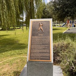
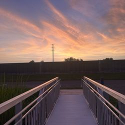
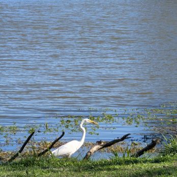
    Gretna City Park

    3.4 (8 reviews)

    Gretna City Park Photos

    Recommended Reviews - Gretna City Park

    Your trust is our priority, so businesses can't pay to alter or remove their reviews. Learn more about reviews.
    Yelp app icon
    Browse more easily on the app
    Review Feed Illustration

    Reviews With Photos

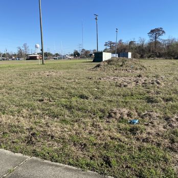
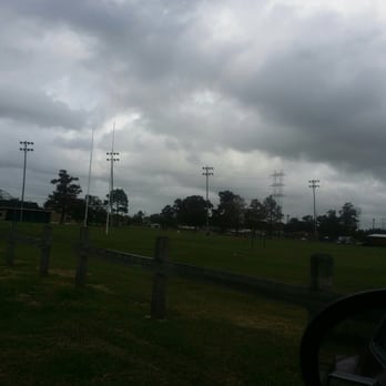
    Ummmm what is this? There are no trails to run on?
    Miekell T.

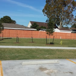
    Very misleading I dont know that other reviewer was talking about. This park has alot more potential.. I gave it 2 stars b/c it does have courts and fields..but thats all..no tracks to run or walk on..thats a problem...and no lights to support seeing when it gets dark if there were a trail. Its the south..I need to see my feet. NO ONE LIKES BEING BIT UNEXPECTEDLY..Get it together

    See all

    Photo of Mary H.
    96
    51
    111

    4 years ago

    Helpful 0
    Thanks 0
    Love this 0
    Oh no 0

    5 years ago

    Helpful 0
    Thanks 1
    Love this 1
    Oh no 0

    3 years ago

    Helpful 0
    Thanks 0
    Love this 0
    Oh no 0

    10 years ago

    Helpful 8
    Thanks 0
    Love this 5
    Oh no 0

    8 years ago

    Helpful 3
    Thanks 0
    Love this 2
    Oh no 1

    9 years ago

    Helpful 0
    Thanks 0
    Love this 0
    Oh no 0

    11 years ago

    Helpful 2
    Thanks 0
    Love this 0
    Oh no 0

    12 years ago

    Helpful 1
    Thanks 0
    Love this 0
    Oh no 0

    Ask the Community - Gretna City Park

    Verify this business for free

    People searched for Hiking 153 times last month within 15 miles of this business.

    Verify this business

    Jean Lafitte National Historic Park and Preserve

    Jean Lafitte National Historic Park and Preserve

    4.7(75 reviews)
    8.5 mi

    AN UNEXPECTED NEW ORLEANS ADVENTURE AND WE SAW THE GATORS!…read more We originally wanted to book a swamp tour, but unfortunately we were too late to get one for the day. I've been to New Orleans before, and seeing an alligator in its natural habitat was still on my bucket list, so we decided to take a ride out to Jean Lafitte National Historical Park and see what we could find. And baby... LO AND BEHOLD! Not long after we arrived, we came across some locals standing near the swamp taking pictures. We walked over and THERE IT WAS an alligator right there in the water! Bucket-list moment CHECKED! Now, here's where those locals became our best friends for the day! Do NOT go out there poking sticks in the water, trying to get an alligator to come closer for your picture! Thank God we ran into people who knew the area and gave us some much-needed knowledge. They explained just how quickly these animals can move and reminded us to keep a safe distance. Needless to say, we enjoyed our gator from WHERE WE WERE! The entire experience was beautiful because this wasn't a staged attraction we were able to see wildlife right there in its natural environment. The drive in was peaceful and beautiful, surrounded by woods and the sounds of nature. And then there were the SPIDERS! The spiderwebs throughout the area were absolutely incredible, but some of those spiders were bigger than a half-dollar! So keep your eyes OPEN while you're admiring the scenery! If you're visiting New Orleans and want a FREE, authentic nature experience, this is definitely worth checking out. Just remember: respect the wildlife, keep your distance, stay aware of your surroundings, and if you happen to run into a knowledgeable local LISTEN! We went looking for a swamp tour and ended up having our own little adventure instead. Beautiful scenery, nature at its best, giant spiders, local wisdom, and MY ALLIGATOR! Bucket list: CHECK! New Orleans owes me nothing!

    Arrived shortly after the Government shut-down during our 11K road-trip across America. We had…read morealready been disappointed at a couple stops that were completely closed due to shut-down. We were so happy to find the trails and boardwalk were open and our biggest surprise was to find that the Rangers/Staff was kind enough to set-out the Park Cancellation Stamp (very thoughtful during their stressful time). The bathrooms were also opened so greatly appreciated by myself and family. We walked the Boardwalk and was treated to the amazing beauty of a Moma Alligator with a pod of youngsters around her right off the boardwalk. What an amazing opportunity to see wildlife up close and in their natural environment. I was able to get some pictures (I have a 600M Lens) so at a distance. We did not bother them and they remained where they were at chillin. What a sight to see, one of the coolest yet of the wild side of National Parks.

    Photos
    Jean Lafitte National Historic Park and Preserve
    Jean Lafitte National Historic Park and Preserve
    Jean Lafitte National Historic Park and Preserve

    See all

    Tickfaw State Park - Entry to suspension bridge trail.

    Tickfaw State Park

    4.5(24 reviews)
    49.6 mi

    Nature center is nice and the trails are nice. !3 entry fee. Trail is closed off due to rebuilding…read moreafter the flood happened. It's after you get over the bridge that you will see the barricade.

    During our cross country road trip in the summer of 2022, we traveled with the truck and trailer…read morefrom Los Angeles to Key West and back. My wife booked a few nights in Tickfaw state park, sight unseen, to be more or less in the vicinity of New Orleans, a plantation tour, and a swamp boat tour that we had booked months in advance. As it turned out, we actually enjoyed this state park stay more than our visit to New Orleans! The state park entrance is actually at the back of a neighborhood of sorts, on a narrow two-lane road that cuts away from the highway at a weird angle. Once inside the park proper, visitors are treated to beautiful swamps, complete with cypress trees, Spanish moss, and all the critters you would expect to find here. The campground we enjoyed had full hook ups, a small wooden deck, and a long back-in pad for our trailer. There was also a resident raccoon who kept us honest about locking things up at night, and securing coolers and food. Tickfaw state park features long boardwalks with railings, that afford visitors beautiful hikes in different parts of the park through different kinds of trees and plants. Unfortunately, many of these were still damaged in the summer of 2022 from the previous year's Hurricane Ida that blew through southern Louisiana and surrounding areas. The only trail that was not affected by this was the one without a boardwalk, so we enjoyed a hike through beautiful pines that went down to the river. Despite most of the trails being closed and damaged, we still enjoyed ourselves here, and had a good time. In the evening, I enjoyed casting topwater lures in on the cypress knees and trees, and caught & released several big bowfin... A fish that is sort of a cross between a catfish a bass, and a pit bull I suppose. I'm not sure when we will be back through this part of the world, but Tickfaw State Park is definitely a place that I would stay again: off the beaten path but close enough to where you want to be, peaceful and quiet, and the kind of southern serene that helps a SoCal guy like me to slow down and enjoy life a little bit.

    Photos
    Tickfaw State Park - Uprooted tree from Hurricane Ida

    Uprooted tree from Hurricane Ida

    Tickfaw State Park
    Tickfaw State Park

    See all

    Big Branch Marsh - Boy Scout Road

    Big Branch Marsh - Boy Scout Road

    4.8(8 reviews)
    28.2 mi

    Great boardwalk trail over the marsh. It's a good way to see wildlife on the northshore on an easy…read morehike.

    "I went to the woods because I wished to live deliberately, to front only the essential facts of…read morelife, and see if I could not learn what it had to teach, and not, when I came to die, discover that I had not lived" ― Henry David Thoreau, Walden I have always felt like Thoreau knew what he was talking about when he wrote that. It's been some time since I've gone to live in the woods, but I do think one can accomplish a lot by taking a walk alone into the wilderness. The boardwalk in this section of the Big Branch Refuge is a great place to take such a walk. Located in between Slidell and Lacombe, this section of the national refuge is somewhat different than the other two areas. This spot in particular is a half mile boardwalk trail that runs from the pine forest to the swamp. The trail lets you see first hand how the forest has subsided over the years and become swamp. The remnants of dead pine trees that could no longer survive the excessive moisture dot the landscape. As the trail continues, you will end a large expanse of swamp and an incredible view. There is also more trails to hike, but on my most recent visit I was running out of daylight. This trail is popular, but I have found that more times than not, you will be the only hiker. On my most recent trip I encountered several groups on my hike back, but only one group was irritating enough that I wanted to push them into the swamp. When people are hiking and enjoying nature, hooping and hollering is not enjoyable to others. My hike though the wilderness was very enjoyable. For the first part of the hike all that could be heard was the wind and the birds. If you need to think, want to take photos, or just enjoy a walk through the woods, check this trail out.

    Photos
    Big Branch Marsh - Boy Scout Road
    Big Branch Marsh - Boy Scout Road - Beauty on a dreary day

    Beauty on a dreary day

    Big Branch Marsh - Boy Scout Road

    See all

    Bogue Chitto National Wildlife Refuge

    Bogue Chitto National Wildlife Refuge

    4.0(2 reviews)
    44.7 mi

    Nice little Park off the highway and easy to miss., turn around at next exit (we did)…read more Entrance near an industrial area, lots of trucks in and out. Nice parking area along the water, with some picnic tables. An information board located near entrance. Some people were just parked (maybe enjoying the view), a Ranger did drive thru. So the area is monitored. A decent trail with a nice boardwalk takes you into the refuge with views of the marsh and water. We were here mid-day so it was quiet. Some birds, and lots of turtles. On way out, net Blair (local birder) and we talked about sightings in area. He told me about a Kingfisher that hangs out over waterway off main road. The Kingfisher was right where he said it would be - we did not stop (lots of trucks) passing by. Nice to talk to locals, especially fellow bird enthusiasts. Worth a stop !!!

    Is the hustle and bustle of city life getting you down?…read more Do you find yourself becoming stressed from traffic? Do you need a break? If you answered yes to the above questions, I have just the thing to cure what ails you. What is this miraculous cure you ask? Dirt. That's right friends, good ole 100% American dirt. Get you some. I realize that the words posted above these may seem ridiculous, and for some it won't help, but for me, getting off the road and into nature helps me every time. The Bogue Chitto National Wildlife Refuge is one such place that I recommend you check out. This NWR is located off of the very last exit before Mississippi (Pearl River Turnaround). If you're heading from Louisiana, exit, turn left and drive down the first dirt road you encounter. There isn't really a very good sign, but you'll know it when you find it. As you first enter the NWR you will encounter a very cool railroad bridge. For many, this will be the coolest thing you see, but for me there is much more. The roads through the NWR are dirt and rock only. They are fairly well packed so four wheel drive is not necessary, but I would be reluctant to take a car back here if it is low slung. The roads run for many miles through the middle of the refuge and you are unlikely to encounter any other humans if you go during the week. If hiking is your thing, there are a few trails that I have yet to explore, but they do look promising for a brief nature hike. Each trail has its own parking area which is convenient since parking on the road wouldn't be ideal. The roads here seem to go on forever. I would guess that it took me nearly thirty minutes to drive the entirety of the main road. It ended up at a weird camp type residential area, finally dead ending at a very run down looking trailer. I haven't fully explored all of the roads yet, but it does seem to be a one way in, one way out situation. The hour or so I spent on my first trip invigorated me and I can't wait to go back.

    Photos
    Bogue Chitto National Wildlife Refuge
    Bogue Chitto National Wildlife Refuge - Ahinga

    Ahinga

    Bogue Chitto National Wildlife Refuge

    See all

    Desoto National Forest - Tuxachanie Trail POW Camp - The beaver dam and pond

    Desoto National Forest - Tuxachanie Trail POW Camp

    3.4(14 reviews)
    80.7 mi

    We stayed a week at the POW campsite. The trails were great. We'll marked and easy. The pons is…read morebeautiful with a beaver dam raising the level a little. I would recommend this site for a short boondocks stay. Now the drawbacks. No water , no dumpsite. No picnic tables or fire rings. My wife and I spent one day just picking up the garbage and the remains of homeless tents and garbage. Busy with hunters and campers.

    Years ago someone started the trend of the milestone review. Every 100 reviews, you're supposed to…read morereview something special. For my 1400th, I've chosen somewhere that was very special to me as a kid, but remains special as an adult. This review will be a little long winded so if that scares you off, go ahead and stop reading now. Back when I was a teenager my scout troop came here because it was the starting point of our backpacking trip on the Tuxachanie Trail. I was pretty much uninterested in history then, but when I learned the area once housed a WWII POW Camp, I was fascinated. Not much was left of the camp back then. It was just a few concrete bunkers that my juvenile mind thought were the remains of prison cells. It wasn't until much later that I realized they were the remains of ammo bunkers. My friends and I ran around like maniacs and climbed all over that bunkers. Had we known what was in store, we would have chosen to rest instead. The Tuxachanie Trail is 22 miles one way if you hike the whole thing. Most people start at the opposite end, but we started here as it is 13 miles to the nearest camping area. While on the trail we saw snakes, birds, trees, wildflowers and a whole lot of woodland scenery. I packed smart, but most of my friends did not. Those packs began to get mighty heavy around mile five. The memories of that hike are much more vivid, and in some cases funny, but for brevity sake, I will explain why it's still special today, and why I think you should visit this area. Despite the ominous sounding name, there really isn't much that would make you know this was once a POW camp for German soldiers. The aforementioned bunkers are still there, but now that I know what they were for, it isn't as frightening as when I thought they were prison cells. The area near the bunkers is a giant space that's been cleared of trees. Next to that area is a large and beautiful lake filled with water lilies, bullfrogs and small fish. The view from the shore was quite beautiful in particular the reflection of the surrounding forest and sky on the surface of the lake. The juxtaposition of the perfectly still water and the ever changing clouds was truly magnificent. Had it not been so sweltering hot, I could have stood there for hours. So for most people, this is where the review would end. But as you may have learned from my previous reviews, I am not most people. I noticed it as soon as I started driving away from the lake. There it was just calling to me. A good ole American dirt road and I just had to explore it. The road from the POW Camp is not for the faint of heart (car drivers). While it is mainly gravel and suitable for 2WD vehicles, it was rutted in some areas so higher clearance would help. The drive through the woods was peaceful and fairly uneventful. But the little trail I found off of the dirt road led me to paradise. I took that trail not knowing where it led or what was in store for me. It was blocked by a fallen tree, but it was no match for my well-equipped, yet stylish vehicle. I just put it in 4WD and climbed right over that thing. Hell Yeah! Enough of that badassery and back to the reason I mentioned the trail. The trail ended up leading to a different area of the lake that I had not seen before. This area was even more beautiful as it was filled with lilies as far as the eye could see. This is the area where I felt the most at peace. I felt fulfilled. I realize that will probably sound too touchy feely especially after I just mentioned the badassery of driving over a tree, but I am never happier than when I am out in the wilderness. Maybe it's all the time I spent in the woods as a kid. Maybe it's the fact that the woods let the hustle and bustle of everyday life seem like just a distant memory. Maybe it's something else. All I know is that being surrounded by trees is an experience every red blooded American should have, and one they should have regularly. Did I lose you? If not, thanks for reading.

    Photos
    Desoto National Forest - Tuxachanie Trail POW Camp
    Desoto National Forest - Tuxachanie Trail POW Camp - This is the stream along thr desoto trail

    This is the stream along thr desoto trail

    Desoto National Forest - Tuxachanie Trail POW Camp

    See all

    Tammany Trace - Koop Drive

    Tammany Trace

    4.3(21 reviews)
    36.3 mi

    As a starter this is the best maintained bike trail I've ever ridden. There virtually no ruts or…read morefrost heaves and the surface is smooth from end to end. I really enjoyed the ride from both ends once I got started. However, the signage to get on the main trail, whether starting in Slidell at the part on the Trailhead Center in Covington was abysmal. We came from Lexington, Kentucky just to ride on the trail and spent over half an hour on both ends getting onto the trail that took us to other end. The small sign upon leaving the park area in Slidell indicated we were "on the trail" but more signage was needed to indicate which way to go and turn to get on the trail to Covington. In Covington there had a great museum but the worker and the museum failed to give any indication that the beginning part of the trail was closed due to bridge repair. We only found out about the "detour" from a bike shop owner who gave good but complex directions about how to navigate the detour. Thirty minutes later after walking and asking for help did we finally get on the trail. There is no way that any agency responsible the trail can claim there isn't any money for signage. When you have a million plus dollar trail of this caliber you certainly have $50 to spend for small signs. Please get this corrected. People using the trail deserve better service.

    One of the best things this area has done in the past 20yrs is develop an old rail line into this…read morerunning/biking trail. The scenery is beautiful on this 28-mile long trail. The Trace has so much to offer for trail users of all ages. From the brewery and brew pub in Abita to the numerous playgrounds and parks that line the trail, you won't lack for things to see and do as you make your way from Covington to Slidell. And the trail is almost entirely flat and can even be ridden on a single speed bicycle with no problem. Of course it is also nice for walking, inline skating and jogging. Portions of the trail are also available for horseback riding but horses are not allowed to cross the Bayou Lacombe drawbridge. Many visitors to the Trace will access it from New Orleans. If you get hungry you can find great places to eat in Covington, Abita Springs, Mandeville, Lacombe, and Slidell. In between, you will see some beautiful Louisiana countryside and wildlife, especially in the Fontainebleau State Park and two different wildlife refuges. Some other helpful tips: Check out the Kid's Konnection playground. It is a very nice handicap-accessible playground for all the kids. Also no dogs are allowed anywhere on the Trace. Tammany Trace is the premier running/biking trail in the metro area!!

    Photos
    Tammany Trace - Play structure

    Play structure

    Tammany Trace - Gated entrance

    Gated entrance

    Tammany Trace - Food truck and seating

    See all

    Food truck and seating

    Gretna City Park - hiking - Updated September 2026

    Loading...
    Loading...
    Loading...