Hayward Regional Shoreline Photos


You might also consider


More like Hayward Regional Shoreline
Recommended Reviews - Hayward Regional Shoreline
Start your review...


Reviews With Photos


Shore Still the One 1841-acres of wetlands operated by the East Bay Regional Parks District. This park is very similar to Alviso Marina County Park in Alviso, and Don Edwards Bay National Wildlife Refuge in Fremont. All of the above parks are located along the edges of The Bay and feature flat, treeless levee pathways that meander thru the ecosystems. The Good: *Free! *Intreptetive Center with some cool art and displays. *Street Parking if you go to the Intreptetive Center entrance (4901 Breakwater Ave); twenty-car parking lot at the other entrance by Regional Park Office (3050 W Winton Ave); and twenty-six car lot at the parking lot by the Doody Plant (2639 Grant Ave). *Restrooms in the Center and in the parking lot, but none along the trails. *Great place for bird watching *Five miles of flat, easy trails that were in surprisingly good shape considering it had just rained a few days earlier. *Amazing views of The Bay, as one can easily see SF, the Bay Bridge, and Oakland from the trails. The Meh: *No dogs or horseback riding *No motorized vehicles on the trail The Ugly: *The south entrance by the Intreptetive Center is bordered by the freeway (Hwy 92 [aka The Dumbo]), which isn't terrible but I have a thing about noisy highways and nature. Next time we'll hit up one of the other entrances. Conclusion: Great place to get your steps whether you're young, old, or somewhere in-between.


What a beautiful place! We wanted to get our steps in and a little nature therapy. Perfect spot for that. The views were gorgeous with lots of birds to identify. There's a great loop that is about 3+ miles but it looked like there were more trails if you wanted something longer. Lots of bikers around--even people fishing. There was an interpretive center that was very active with staff and activities for kids. It also has rest rooms. Not sure the hours for that center but there were port-a-potties outside as well. There is no fee and we parked along the side of the center. We'll be back with bikes next time!
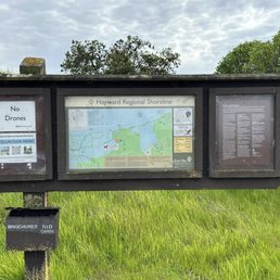

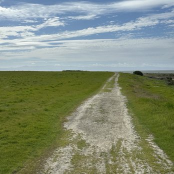
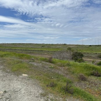
Hayward Regional Shoreline is a good hiking trail that doesn't really have much elevation in terms of climbing up and down the hills. Not really much going on here except that there's a shore once you reached to the end. There are other trails you can if you decide to walk more. It seems like the ocean stopped reaching the shore since I saw much muddy surface unless it's very rainy at some point. There's also parking too and surprisingly only me and two other cars where I parked at. There's a one-way spike strip and so becareful not to go the wrong way.


Beautiful trail by the bay. The water reflection is pretty, especially during the sunset. However, I recommend bringing bug spray in the summer. LOTS of bugs here that hang out by the marsh. The trail is very flat and easy to walk. Lots of families and dogs around here. Parking wasn't an issue during sunset at 7:45 PM. Just be careful of parking in the mud!


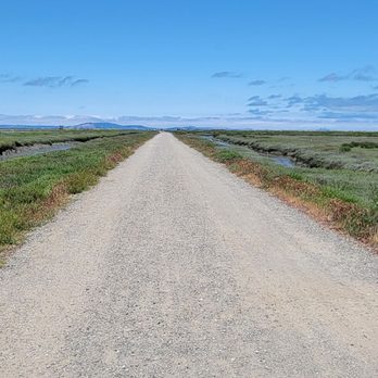
Quick take: perfect temperature This area has the best climate during the summer. It is a very comfortable temperature for even the fussiest Californian. Lots of people cycling, jogging, running, and walking. It doesn't get hot here so I am able to walk or run a farther distance. Today I walked the gravel path in vans. I don't recommend it since the soles are too thin. Definitely recommend wearing good running or walking shoes for the padding and support.
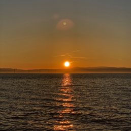

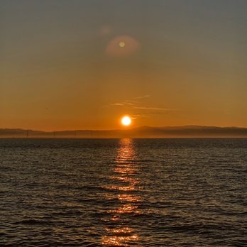
This is really one of the spots! I like going to the Hayward Regional Shoreline when I need a change of pace from the monotony of quarantine. It's right on the water, you get absolutely exquisite views, and there is a nice long path to walk or run or bike on. The key is to go during sunset so you can get a stellar view of the Bay. The path itself is super fun to utilize because it's right on the water and there are a series of bridges you use across various marshes. It's just a really beautiful place where you can take in the fresh air and get some quality exercise in at. I totally recommend coming here and visiting!


One of the best hikes in the east bay, this trail parallels the bay shoreline. This entrance is one of multiple on the same continuous trail. From here if you head north you can have dogs, but south is no dogs. Some of my favorite views with SF, Oakland airport and a plethora of nature. A bird watchers dream, various flocks stop here each season, hawks and falcons call it home. The plentiful ground squirrels provide enjoyment for people and canine alike. I've seen lots of folks fishing and it is a great trail for biking.


Peaceful place for walk, jog, or bike ride along bay marsh. Expansive views of bay, from SF to South Bay (Hayward is heart if bay right?). During low tide, you can see lots of birds feeding in mudflats - great for bird watchers. Trails all flat, gravel type heading north towards San Leandro. Free parking, park right outside gate (closes by 5pm).
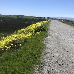

This address takes you to the right place! It says dead end but there are 2 parking areas. The one you see first is unofficial and actually has gates that open up to the off leash dog friendly side (See pic below). If you drive further in is the official parking lot where that is also a restroom. This area all you'll see is no dog signs. The dog friendly side we walked 3 miles out and back but you can definitely go out further. A good amount of people out enjoying the sun but not crowded at all. Most people had dogs on their leash and picked up their small dogs when they saw mine coming by. Loved being surrounded by water and even a glimpse of San Francisco skyline. My pup enjoyed chasing all the squirrels too! I also saw people bird watching? They had some hardcore cameras with the mega zoom lenses.


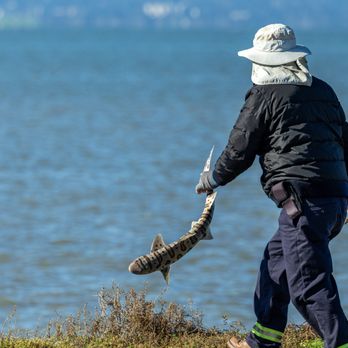
If you like to see swarms of migrating birds fly and land in coordinated formation over salt evaporation ponds, this is definitely the place for you. There are at least three ways to enter this picturesque marshland, and I've entered two of the ways - the first time on the longish, mostly paved walkway from San Leandro's Marina Park, the last time via a shorter dirt path from Winton Avenue in Hayward. Either way, you soon find yourself on the levees that hug the bayshore and criss-cross the marshes. Completely flat and mostly gravel, there are no trees to hide under, but the cool bay breezes provide constant refreshment while you're walking on the five miles of trails that are available over 1,800 acres. Dog walkers are restricted south of Winton Avenue due to the delicate ecosystem. Fishing is allowed with the proper license as I saw plenty of fishermen having a good time on the levees. But above all else are the hundreds of birds that fly and land in patterns that would make Busby Berkeley jealous. RELATED - Up for a hike? Here are the places around the Bay Area where I have trod: bit.ly/2OsCCsK
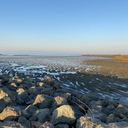

Early morning walk here is very pleasant! Barely anyone here on a Sunday early morning. The marsh was beautiful and had a lot of different type of birds. We were also talking about how the water was so still that it mirrors the sky. I'm not sure if this trail goes in a circle but we walked around 3 miles here. Also it was all flatland so no hills! Definitely a trail worth checking out! I am looking forward to coming here again.


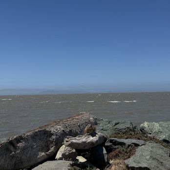
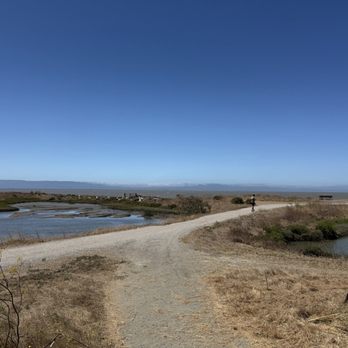

Easy to find, has multiple entrances and parking areas Parked at the very end where there is handicap parking, a restroom and water available to use Parked to see a pair of elderly couple walking, a family of 4 (two kids under 10 guessing) bike riding, many fishing and a few runners, so this place is for everyone The first half was pretty barren, was hoping to see a bit more, but once we get to the ocean side, beautiful and unobstructed You'll feel very refreshed, close to nature read more


Shore Still the One 1841-acres of wetlands operated by the East Bay Regional Parks District. This park is very similar to Alviso Marina County Park in Alviso, and Don Edwards Bay National Wildlife Refuge in Fremont. All of the above parks are located along the edges of The Bay and feature flat, treeless levee pathways that meander thru the ecosystems. The Good: *Free! *Intreptetive Center with some cool art and displays. *Street Parking if you go to the Intreptetive Center entrance (4901 Breakwater Ave); twenty-car parking lot at the other entrance by Regional Park Office (3050 W Winton Ave); and twenty-six car lot at the parking lot by the Doody Plant (2639 Grant Ave). *Restrooms in the Center and in the parking lot, but none along the trails. *Great place for bird watching *Five miles of flat, easy trails that were in surprisingly good shape considering it had just rained a few days earlier. *Amazing views of The Bay, as one can easily see SF, the Bay Bridge, and Oakland from the trails. The Meh: *No dogs or horseback riding *No motorized vehicles on the trail The Ugly: *The south entrance by the Intreptetive Center is bordered by the freeway (Hwy 92 [aka The Dumbo]), which isn't terrible but I have a thing about noisy highways and nature. Next time we'll hit up one of the other entrances. Conclusion: Great place to get your steps whether you're young, old, or somewhere in-between. read more




2 years ago
What a beautiful place! We wanted to get our steps in and a little nature therapy. Perfect spot for that. The views were gorgeous with lots of birds to identify. There's a great loop that is about 3+ miles but it looked like there were more trails if you wanted something longer. Lots of bikers around--even people fishing. There was an interpretive center that was very active with staff and activities for kids. It also has rest rooms. Not sure the hours for that center but there were port-a-potties outside as well. There is no fee and we parked along the side of the center. We'll be back with bikes next time! read more


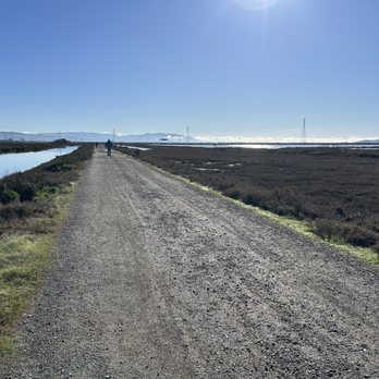
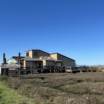

Hayward Regional Shoreline is a good hiking trail that doesn't really have much elevation in terms of climbing up and down the hills. Not really much going on here except that there's a shore once you reached to the end. There are other trails you can if you decide to walk more. It seems like the ocean stopped reaching the shore since I saw much muddy surface unless it's very rainy at some point. There's also parking too and surprisingly only me and two other cars where I parked at. There's a one-way spike strip and so becareful not to go the wrong way. read more




7 months ago

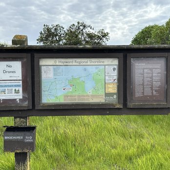
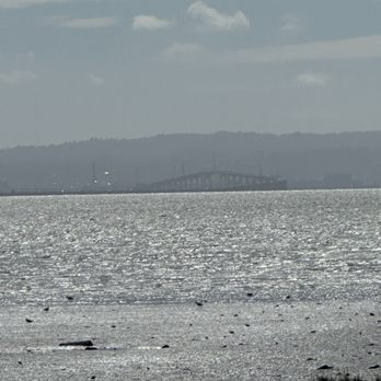
Beautiful trail by the bay. The water reflection is pretty, especially during the sunset. However, I recommend bringing bug spray in the summer. LOTS of bugs here that hang out by the marsh. The trail is very flat and easy to walk. Lots of families and dogs around here. Parking wasn't an issue during sunset at 7:45 PM. Just be careful of parking in the mud! read more


Quick take: perfect temperature This area has the best climate during the summer. It is a very comfortable temperature for even the fussiest Californian. Lots of people cycling, jogging, running, and walking. It doesn't get hot here so I am able to walk or run a farther distance. Today I walked the gravel path in vans. I don't recommend it since the soles are too thin. Definitely recommend wearing good running or walking shoes for the padding and support. read more



3 years ago

1 year ago


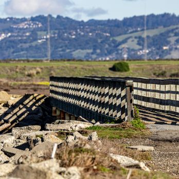
This is really one of the spots! I like going to the Hayward Regional Shoreline when I need a change of pace from the monotony of quarantine. It's right on the water, you get absolutely exquisite views, and there is a nice long path to walk or run or bike on. The key is to go during sunset so you can get a stellar view of the Bay. The path itself is super fun to utilize because it's right on the water and there are a series of bridges you use across various marshes. It's just a really beautiful place where you can take in the fresh air and get some quality exercise in at. I totally recommend coming here and visiting! read more

One of the best hikes in the east bay, this trail parallels the bay shoreline. This entrance is one of multiple on the same continuous trail. From here if you head north you can have dogs, but south is no dogs. Some of my favorite views with SF, Oakland airport and a plethora of nature. A bird watchers dream, various flocks stop here each season, hawks and falcons call it home. The plentiful ground squirrels provide enjoyment for people and canine alike. I've seen lots of folks fishing and it is a great trail for biking. read more

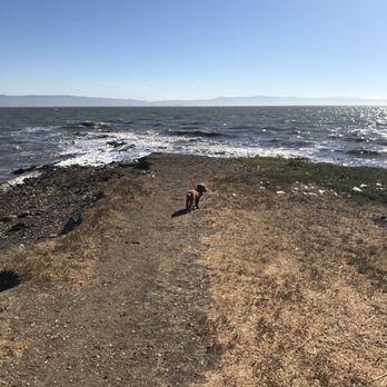

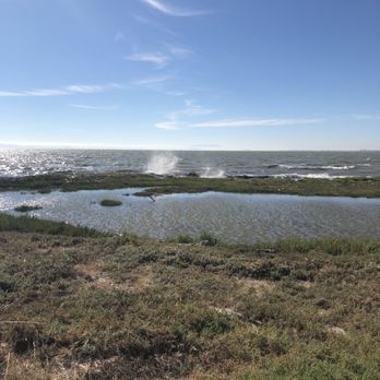


Peaceful place for walk, jog, or bike ride along bay marsh. Expansive views of bay, from SF to South Bay (Hayward is heart if bay right?). During low tide, you can see lots of birds feeding in mudflats - great for bird watchers. Trails all flat, gravel type heading north towards San Leandro. Free parking, park right outside gate (closes by 5pm). read more


This address takes you to the right place! It says dead end but there are 2 parking areas. The one you see first is unofficial and actually has gates that open up to the off leash dog friendly side (See pic below). If you drive further in is the official parking lot where that is also a restroom. This area all you'll see is no dog signs. The dog friendly side we walked 3 miles out and back but you can definitely go out further. A good amount of people out enjoying the sun but not crowded at all. Most people had dogs on their leash and picked up their small dogs when they saw mine coming by. Loved being surrounded by water and even a glimpse of San Francisco skyline. My pup enjoyed chasing all the squirrels too! I also saw people bird watching? They had some hardcore cameras with the mega zoom lenses. read more
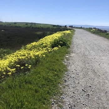


If you like to see swarms of migrating birds fly and land in coordinated formation over salt evaporation ponds, this is definitely the place for you. There are at least three ways to enter this picturesque marshland, and I've entered two of the ways - the first time on the longish, mostly paved walkway from San Leandro's Marina Park, the last time via a shorter dirt path from Winton Avenue in Hayward. Either way, you soon find yourself on the levees that hug the bayshore and criss-cross the marshes. Completely flat and mostly gravel, there are no trees to hide under, but the cool bay breezes provide constant refreshment while you're walking on the five miles of trails that are available over 1,800 acres. Dog walkers are restricted south of Winton Avenue due to the delicate ecosystem. Fishing is allowed with the proper license as I saw plenty of fishermen having a good time on the levees. But above all else are the hundreds of birds that fly and land in patterns that would make Busby Berkeley jealous. RELATED - Up for a hike? Here are the places around the Bay Area where I have trod: bit.ly/2OsCCsK read more





5 years ago

Early morning walk here is very pleasant! Barely anyone here on a Sunday early morning. The marsh was beautiful and had a lot of different type of birds. We were also talking about how the water was so still that it mirrors the sky. I'm not sure if this trail goes in a circle but we walked around 3 miles here. Also it was all flatland so no hills! Definitely a trail worth checking out! I am looking forward to coming here again. read more


We lived in Hayward/Union City our entire lifetime and didn't know such a great hidden gem existed so close to our home. Great trails and views of the bay from the East Bay vantage point. During clear skies you can see the Bay Bridge and the city. We usually come here after our work day and are able to catch the sunset; sometimes the color palette of the sky is picture worthy with pink/light blue hues. We never had an issue finding parking; its plentiful and free. One half on the right side allows dogs and the other half on the left side doesn't allow dogs. So we take the right path straight down to the waters and turn right that leads to a bridge along the waters. It's mostly flat and no hills to climb! On the shoreline you'll see broken glasses that have been weathered down by the waves; they're mostly not pointy and soft. Reminds me of Glass Beach in Fort Bragg that no longer have glasses, so Hayward Shoreline actually has more glasses! It's a great place to walk and social distance; sometimes its nearly empty and we would only see a handful of folks walking. I don't think much folks know such a great trail along the waters exists on the outskirts of Hayward. Not sure if dogs need to be kept on leash but I've seen many unleashed dogs. This is worrisome given some dogs do not react well with strangers. Our dog was a stray and have some anxiety/PTSD so we try our best to stay vigilant and ensure no dogs come near ours. Overall a great place to walk/jog/bike without the pain of crowds and lack of parking. read more


This is an awesome piece of serenity among over crowded hiking trails and other shorelines that look like tourist traps. This is another place I've been coming to for MANY moons now. I've been here at its most windy, I just got scorched, cherubs crying, water/waves blowing over the trails season...yeah, all the seasons and types of weather except snow...but there is a lot of salt in some areas that could fool you sometimes :) This is a pretty cool shoreline that runs from the San Mateo Bridge/Hayward Shoreline interpretive center entrance all the way through to the San Leandro Marina. There is plenty of room and trail ways to walk, jog, or ride your bike on...with views of the San Mateo Bridge, Oakland Harbour, and the City of San Francisco on a clear day...all at the same time from the same place :) You can take the trail along the shoreline, hike the trails inland, or hike through the waterways and marsh areas here. Some areas allow dogs, which Im almost against since there is always so much "Sh!t" to deal with here...all puns and none intended at the same time.#PickUpYourSh!t (PleaseAndThankYou) There is a lot of different wild life here. There are a few animals/insects here that stand out for me in particular. There can be the worst of mesquito swarms here at times that literally float after you no matter how windy it gets, they bite like teething babies and are wind gliders here! I have a very low tolerance for mosquitos. There are also snakes, and Hares here too...both harmless I believe. Wear appropriate shoes here as the terrain changes from gravel lined trails, several wooden bridges, rocks, sand, small hills and some grass. I still haven't figured out the appropriate shoes so I just make it happen. With some of the best views, dopest sunsets, tranquil trails, and cooler temperatures in the area I had to give 5 cheers! read more


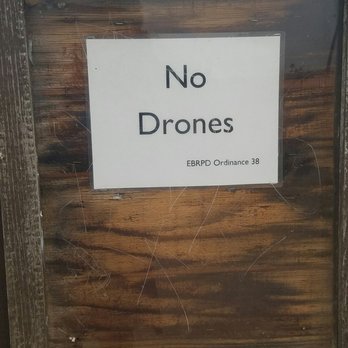

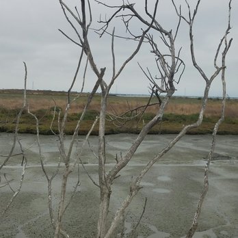

I've been walking these trails for years. One side doesn't allow dogs - perhaps because of the marshes. When you go this route, you can see the Dumbarton bridge. If you go on the other side, dogs are welcome. If you climb the hill, you get an awesome view of the Bay, Hayward, S.F. & San Leandro. They do have two out-house type bathrooms, which I've never used. And for all of us dog walkers, they provide pooper bags free of charge. I've never had any issues with derelicts. All the walkers, bikers, jogger and skaters have been friendly and courteous. There is no cost to park. And if you're walking your dog, she/he should be on a leash. read more


6 years ago

Very quiet and pretty park. Very nice veiw along the ocean. Interesting area with marsh. Good for hiking, running, and biking. For some reason, there are not many people on this trail or nearby town. So you can enjoy very nice quiet time. read more


8 years ago


4 years ago


6 years ago
My favorite place to go hike and de-stress. Also, great for taking pictures and practicing photography. I bring my siblings here to take get them out of the house and away from technology for a bit. People also bike around the area. read more


Exhausted your Bay Area outdoor bucket list? Want to check out a part of the East Bay that most people have probably never heard of? I got just the place: Hayward Regional Shoreline. My girlfriend and I recently made a spontaneous visit to the Hayward Shoreline and we both wholeheartedly agree that this is definitely one amazing spot to walk around. The views are gorgeous, the number of trails is endless, and best of all IT IS FREE! The Hayward Regional Shoreline is a stretch of marshland that goes along the eastern part of the San Francisco Bay. I really like this spot because of several reasons. First, it's SUPER EASY to get to. Even though this shoreline sounds far, it's actually maybe 2-3 miles from the 880 Nimitz Freeway. Like you literally exit off of Winton and go all the way down to the parking lot. How simple is that? Second, there's absolutely no entrance fee. I came across at least 2-3 different parking lots to choose from, and none of them required payment. Third, because this place is MASSIVE (as well as pretty secluded), there should be no issue with parking. If I had to choose a place in the Bay Area for a morning walk, I definitely wouldn't mind the Hayward Regional Shoreline. Here's why: -SCENERY: The first thing you will notice when you start exploring some of the trails at the Hayward Regional Shoreline is that much of the area is consisted of marshland. Some people may see this as disgusting (can come off as dirty), but I actually love the fact that you really can't find this anywhere else in the Bay Area (maybe near Palo Alto Baylands). And beyond that, the other things you see here are DROP DEAD GORGEOUS. If you walk far enough, you'll find several bridges that give you eye-popping views of the San Francisco skyline. If you like wildlife, there's plenty of birds and butterflies flying around for you to check out. And I heard that you might catch some foxes too! -SECLUSION: When my girlfriend and I stopped by, we saw at most like 10 people during the two hours we were there. I just love the fact that you can easily get as much privacy as you want at the Hayward Regional Shoreline. -REAXING: My favorite part has to be the different benches that are laid out along the shoreline. This gives you a great opportunity to just sit and enjoy the view. Add that to the fact that the shoreline is private city and you got yourself a one-way ticket to heaven. -EASY TRAILS: I just love the fact that the Hayward Regional Shoreline is super accessible for people of all levels of physical fitness. Virtually every part of the shoreline is flat, making it really easy to walk or run on. I may actually come back just to run here. All in all, I have to recommend the Hayward Regional Shoreline as one of THE PLACES to go in the Bay Area for an outdoor adventure. Sure, it's not as scenic as say the Marin Headlands, nor will it pose as much of a physical challenge as Alamere Falls. But there's just something so enticing about being able to take an easy walk along a scenic part of the Bay Area that few people have ever heard about. That, my friends, is what you get with the Hayward Regional Shoreline. Thus, I give this place an "omg, I'd travel 2 hours for this" rating. Have fun and prosper, read more

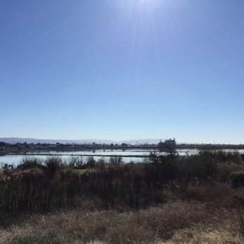


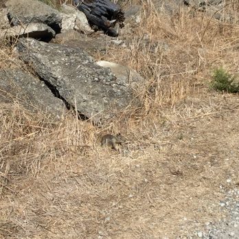

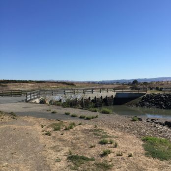

7 years ago
3 years ago

11 years ago
I've previously visited the Hayward Regional Shoreline, embarking from the Interpretive Center. On a lovely and unseasonably warm February day, this time, I met a friend at the Winton staging area with the goal of completing the 2.9 mile trail highlighted in this year's East Bay Regional Parks Trails Challenge. Driving westward through an industrial area on Winton, the road literally ends and you'll come upon ample parking. For the featured hike in the trails challenge, we went left towards Cog Marsh and did that full loop. Once away from the lot, you're absorbed in nature. Sweeping views of the bay greet you to the west, with plenty of marshland birds, bunnies and squirrels to observe everywhere along the trail. Today was particularly clear and bright, so views of San Francisco were in effect. Winds were calmer than my previous visits and the bay seemed bright and glassy. Wildflowers and green grass were abundant and in comparison to my visit last year, a welcome contrast from the previous drought ridden landscape. Lots of people on the trail-from kids on bikes, to walking families to runners and bird watchers. Hayward Shoreline is an unexpected treasure in this area and worth a visit if you're seeking a waterfront hike in the East Bay Regional park system. It's flat and easy, but stretches on and on. We extended our loop another mile or so by following the trail north toward San Leandro. Highly recommend a visit here for a unique Hayward and EBRPD experience. #3 2016 East Bay Regional Parks Trails Challenge Miles Hiked on trail: 2.9 Total Miles Hiked in Challenge: 6.05 read more


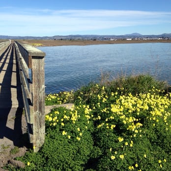


11 years ago
Would you like to become one with mother nature while working on your fitness? Well, look no further. Take the West Winton exit through the industrial area, past my favorite gated Indian Bazaar. Keep straight across the random train tracks, ALLLL the way to the remote dead end, you will find the beautiful and tranquil Hayward Regional Shoreline Park. Enjoy the FREE amenities: Spacious parking, fresh air, runners, bicyclists, dogs, nature, peace and quiet. Enter the marsh where a plethora of birds busily search for food, hang out, and fly free. Watch the super cute nosey gophers scamper into their rustic mansions. Allow your heart shakra a moment to appreciate the movement and sound of the waves moving in and out. Admire the breathtaking views, the City in the distance. Feel free to switch your course according to the trails. After a great workout, reward yourself at Panera Bread or shopping at Southland Mall. What are you waiting for?! Membership is FREE! All YOU have to do is share the trail with runners, joggers, and bicyclists! Become an unspoken member this weekend!!! read more
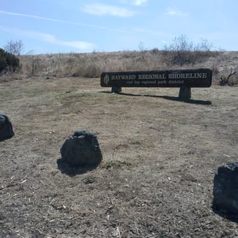


6 years ago
Page 1 of 2
More info about Hayward Regional Shoreline
3010 W Winton Ave
Hayward, CA 94545
Directions
(510) 783-1066
Call Now
Visit Website
https://www.ebparks.org/parks/hayward/
Hours
Indoor Amenities
Outdoor Amenities
Ask the Community - Hayward Regional Shoreline
Is this stroller friendly? Would you recommend walking with a 1 year old here?
We saw a dad with two kids in a stroller while hiking here, so it's definitely stroller-friendly.
Whats up with no dogs sign at park entrance if it states dogs allowed?
There are many nesting areas for endangered wildlife and birds. From the park's website "in order to protect wildlife, dogs are not allowed south of the West Winton Avenue flood control channel."
Review Highlights - Hayward Regional Shoreline
You might also consider

















Why does Yelp recommend reviews?


Hayward Regional Shoreline - hiking - Updated September 2026
Best of Hayward
People found Hayward Regional Shoreline by searching for…
Trending Searches in Hayward, CA
Apple Orchards near Hayward Regional Shoreline
Apple Picking near Hayward Regional Shoreline
Archery near Hayward Regional Shoreline
Barbershop near Hayward Regional Shoreline
Baseball Fields near Hayward Regional Shoreline
Beautiful Views near Hayward Regional Shoreline
Bird Sanctuary near Hayward Regional Shoreline
Blow Dry Bar near Hayward Regional Shoreline
Consignment Shops near Hayward Regional Shoreline
Corn Maze near Hayward Regional Shoreline
Dog Friendly Things To Do near Hayward Regional Shoreline
Dog Parks near Hayward Regional Shoreline
Dog Swimming near Hayward Regional Shoreline
Eyelash Extensions near Hayward Regional Shoreline
Hiking near Hayward Regional Shoreline
Hiking Trails near Hayward Regional Shoreline
Kids Birthday Party near Hayward Regional Shoreline
Makeup Artists near Hayward Regional Shoreline
Off Road Trails near Hayward Regional Shoreline
Parks near Hayward Regional Shoreline
Photo Spots near Hayward Regional Shoreline
Picnic Areas near Hayward Regional Shoreline
Places To Take Pictures near Hayward Regional Shoreline
Playgrounds near Hayward Regional Shoreline
Private Schools near Hayward Regional Shoreline
Public Running Track near Hayward Regional Shoreline
Public Shower near Hayward Regional Shoreline
Pumpkin Patches near Hayward Regional Shoreline
River Swimming near Hayward Regional Shoreline
Rock Quarry near Hayward Regional Shoreline
Scenic Night View near Hayward Regional Shoreline
Scenic Overlook near Hayward Regional Shoreline
Browse Nearby
BEST of Hayward, California Coffee near Hayward Regional Shoreline
BEST of Hayward, California Restaurants near Hayward Regional Shoreline
BEST of Hayward, California Things to Do near Hayward Regional Shoreline
BEST of Hayward, California Parks near Hayward Regional Shoreline
BEST of Hayward, California Breakfast near Hayward Regional Shoreline
BEST of Hayward, California Lakes near Hayward Regional Shoreline
BEST of Hayward, California Campgrounds near Hayward Regional Shoreline
Browse Brands
Related Searches in Hayward, CA
Best Dog Hiking Trails Around Hayward, California
Best Fishing Locations and Guides in Hayward, California
Best Nature Trails for Hiking in Hayward, California
Best Off Leash Dog Parks in Hayward, California
Best Parks for Parties and Events in Hayward, California
Best Places for Horseback Riding in Hayward, California
Best Sightseeing Experiences Available in Hayward, California
Best Water Parks for Kids in Hayward, California
Check Out Great Playgrounds in Hayward, California
Check Out Off Road Trails in Hayward, California
Discover Baseball Fields Around Hayward, California
Discover Dog Friendly Trails to Explore in Hayward, California
Discover Easy Hiking Trails Near Hayward, California
Discover Fun Toddler Parks in Hayward, California for Your Little One
Discover Kid Friendly Hiking Trails in Hayward, California
Discover Lakes & Ponds to Explore in Hayward, California
Discover Popular Bike Trails in Hayward, California
Discover Popular Photo Spots in Hayward, California
Discover Scenic Mountain Bike Trails Near Hayward, California
Discover Soccer Fields in Hayward, California Near You
Discover Top Nature Parks to Visit in Hayward, California
Discover Top State Parks to Visit in Hayward, California
Discover Walking Parks in Hayward, California Near You
Discover a Hiking Trail in Hayward, California
Discover the Best Beaches in Hayward, California
Discover the Best Kids Park Spots in Hayward, California
Discover the Best Night Hike Trails in Hayward, California
Dog-Friendly Hikes With Dogs in Hayward, California
Enjoy Camping Adventures Around Hayward, California
Enjoy Kayaking Adventures in Hayward, California
Enjoy Off Leash Dog Hikes in Hayward, California
Enjoy Scenic Places to Walk in Hayward, California
Enjoy a Beautiful Waterfall Hike in Hayward, California
Enjoy the Best Picnic Spots and Ideas in Hayward, California
Enjoy the Best Walking Path in Hayward, California
Enjoy the Best Walking Trails in Hayward, California
Explore Beautiful Parks and Green Spaces in Hayward, California
Explore Easy Hikes Perfect for All in Hayward, California
Explore Free Picnic Areas Around Hayward, California
Explore Fun Activities to Do in Hayward, California
Explore Parks With Pull Up Bars in Hayward, California
Explore Picnic Parks Near Hayward, California
Explore Popular Campgrounds Near Hayward, California
Explore Popular Dog Walking Trails in Hayward, California
Explore Popular Kids Parks Throughout Hayward, California
Explore Popular Picnic Areas Around Hayward, California
Explore Popular RV Parks Around Hayward, California


