Cancel

    Open app

    Search

    Hiwassee/Ocoee Scenic River State Park

    5.0 (7 reviews)
    Open 8:00 am - 4:30 pm

    Hiwassee/Ocoee Scenic River State Park Photos

    More like Hiwassee/Ocoee Scenic River State Park

    Recommended Reviews - Hiwassee/Ocoee Scenic River State Park

    Your trust is our priority, so businesses can't pay to alter or remove their reviews. Learn more about reviews.
    Yelp app icon
    Browse more easily on the app
    Review Feed Illustration

    1 year ago

    Business owner information

    Photo of TN State P.

    TN State P.

    Helpful 0
    Thanks 0
    Love this 0
    Oh no 0

    4 years ago

    Helpful 0
    Thanks 0
    Love this 0
    Oh no 0

    3 years ago

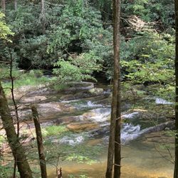
    Staff is first rate. Beautiful campground without utilities. Access to river. Great looking group camp area. We will return.
    Helpful 0
    Thanks 0
    Love this 0
    Oh no 0

    3 years ago

    Helpful 0
    Thanks 0
    Love this 0
    Oh no 0
    Photo of Topher G.
    31
    74
    12

    4 years ago

    Helpful 0
    Thanks 0
    Love this 0
    Oh no 0

    4 years ago

    Helpful 0
    Thanks 0
    Love this 0
    Oh no 1
    Photo of Chris C.
    33
    117
    53

    15 years ago

    Helpful 1
    Thanks 0
    Love this 1
    Oh no 0

    Ask the Community - Hiwassee/Ocoee Scenic River State Park

    Red Clay State Historic Park

    Red Clay State Historic Park

    4.9(18 reviews)
    28.1 mi

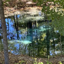
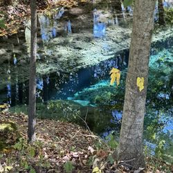
    I occasionally afford myself the luxury of visiting places without really knowing what to expect…read more This park just wasn't that clear to me in its purpose, but it became more so after arrival, with a visitor center focused on Native American history and identifying this as a Cherokee Nation headquarters. A spread of recreated buildings outside offers opportunities for perusal. The most aesthetically distinctive site is a large spring of the sort that seem more common in Kentucky than Tennessee, which evinces a robust blue color and empties into a clear stream. The spring itself is off-limits, but the stream is open for wading. All of these sites are within sight of the initial entrance, but a trek uphill reveals picnic areas, an amphitheater, and a couple of mile trail through the woods. Between the different elements of the park, it was easy to spend a couple of hours there, and best of all, it's free, though the gift shop warrants examination.

    Red Clay is not the type of state park that I would normally seek out. Why? It's not in the…read moremountains and the trails are tame. Nonetheless, something about it lured me in for a visit and I'm glad I ventured out here (on Indigenous People's Day coincidentally). Historically, it's really interesting that this was the last meeting site for the Cherokee tribe's council. The signs claim it is "where the Trail of Tears really began." I was really intrigued by the natural Spring called "the Blue Hole." I've never seen a spring that appears bright blue in a forest setting. Seeing this cool natural sight was pretty awesome. Also, I could just imagine the Cherokee using this spring water and being here hundreds of years before. Trail wise: Pretty flat and easy trails. It's not very challenging. But, it makes up for it because it's a calm place with beautiful forest. I loved walking around. Also, since this is small and off the beaten path, it's not crowded at all. Overall: highly recommended. Worth a visit!

    Photos
    Red Clay State Historic Park - Blue hole

    Blue hole

    Red Clay State Historic Park - Very blue water from natural spring

    Very blue water from natural spring

    Red Clay State Historic Park - Blue hole spring

    See all

    Blue hole spring

    Hiwassee Dam

    Hiwassee Dam

    4.7(3 reviews)
    20.7 mi

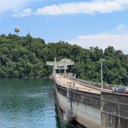
    The Hiwassee Dam is a little bit of a detour from Murphy, NC. But I highly recommend a stop. The…read moredam is hydroelectric and is remarkable to see just the size of it. You can drive over it too. I wasn't sure at the time if I could take a walk on it so I behaved myself this time. There appeared to be sidewalks on both sides in sections so I will do that next time. The dam is 307 feet high and holds 67 billion gallons of water. Hiwassee Lake is about 22 miles. The dam took 1600 men four years to build before being completed in 1940. At the time it cost $24 million to build. The dam generates enough electricity for 28,000 homes. The views are breathtaking here so if you are in the area this remarkable piece of work.

    If you're in the Murphy area, or planning a trip out to the falls, and enjoy being outdoors, be…read moresure to take a quick detour and venture into easily accessible Hiwassee. Surrounded by the Nantahala and Cherokee National Forests - This cozy and colorful park has a lot to offer, including a rich habitat for deer, wild turkey and other animals. Have your camera ready to snap memorable moments, scenery and wildlife. Built in the 1940's, the Hiwassee Dam is largely known to locals as 1 of 32 dams built & planned to provide flood control, navigation and electricity for the region. Today, this piece of history is known as one of the top 5 things to do/points of interest for those visiting Murphy. Upstream from Apalachia Reservoir, the river stretches for 22 miles northwest to southeast. The Pros: - Great for picnics. - Free and easy to locate parking. - The area features a day-use park that provides access to boating, fishing and paths for exploring the Hiwassee Reservoir and its tributaries. - The area is isolated and not overloaded with people/tourists (even during season). On most occasions you will find yourself alone and have this stunning area all to yourself. It's well suited for canoeing & rafting. - The dam is close to Cherokee, the falls and many of Murphy's other "must-see" areas. Prior to your trip, consider these tips: - Check out & research the weather conditions prior to making your plans to venture out onto the roads, or into the water. The reservoir comes from deep below the surface and the water temperature is super chilly, even in the summer. - Keep an eye out for snakes! - If it's summer, be sure to pack bug spray and sun screen. Fun Facts: - The dam is known as a historical landmark used by the Navy Bureau of Ordnance for torpedo testing into the deep water, and the isolation provided by its mountainous environs. - The dam is currently operational and still providing electricity today.

    Photos
    Hiwassee Dam
    Hiwassee Dam
    Hiwassee Dam

    See all

    Jacks River Falls - If you see this sign, you're on the right track to the falls

    Jacks River Falls

    3.5(6 reviews)
    21.9 mi

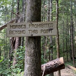
    If you know me by now, all you have to say is hike and I don't care about the where, the how long…read moreor how tough. Jacks River Falls is one such hike where you may want to know the where, how long and obviously how tough. Before I talk about the hike, let's get into the road to the hike. It's a lot of gravel road....I mean a LOT of gravel road, which made me and my honda accord a bit squeamish that a tire might get popped. Something a bit more hefty like a truck or a jeep would probably serve you better on the roads, but just your Joe average sedan can navigate to the parking lot also. Once you leave the parking lot across the road from the trail entrance, I have to say it's kinda a poorly marked trail. No official blaze markers, although good samaritans spray painted a few choice areas for people up for taking on this hike. Jacks River Falls, I hate to say it, is not a pretty hike. There are no grand vistas, or post card shots. No, you really are coming here for the hike or the actual waterfall, which IS worth the hike. I went along with Richard R, and we did stumble our way through the trail, taking a wrong turn a time or two, but ultimately getting ourselves back on track. Note that if you come to a fork in the trail and you see a couple of signs, one saying "Horses prohibited beyond this point". Go in the direction of that sign...that will take you to the top of the falls. The actual falls themselves were in fact beautiful. Powerful, loud, clear water, and a size that wasn't insignificant. It's a great place to get a lot of photos, or walk right up to the falls to get the water money shots. Like I eluded to earlier, you come out at the top of the falls and have to climb your way down to get in front of the water. Sadly, what goes in must come out, and so we had to do a bit of bouldering to get ourselves back on the main trail. Yep, there was more trail going away from the falls, but with the time of day, unfamiliarity of the falls and just our energy level, we did the safe thing and went back the way we came. Jacks River falls, in addition to not being the prettiest trail, also isn't very forgiving either. Clocking in officially at 9.1 miles, I'm skeptical of that because both of my pedometers listed over 11 miles. Sure, getting lost and a few steps here and there may increase the mileage, but not by that much. I'm mentioning all of this because while my legs are usually rock solid, my left leg cramped up and there was some concern about getting out before dark. We did make it out, but we both took a breather before we got the car moving down the several miles long gravel road and back to civilization. When I left Jacks River Falls, I was all set to give it 3 stars or less. But thinking back, as well as revisiting my photos and videos helps me focus my review. If we're talking about the actual water fall only, It's easily 5 stars. Combining the trail pulls it down a star. Combining the long drive pulls it down to a 3.5....but i'm rounding it up to 4. Beautiful waterfall, great work out of a hike, and if you're a waterfall hunter, it's definitely worth your time. Check it out!

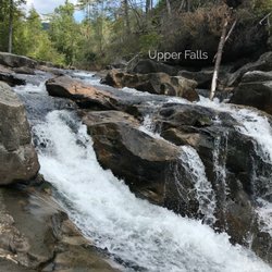
    Love the waterfall, but not the hike or the drive to the trailhead…read more THE SCENE There are several trails that lead to Jack's River Falls. We chose Beech Bottom Trail because it is the driest. All trails had previously been closed due to storm damage that occurred on July 21st, 2018, but Beech Bottom recently reopened on Saturday, September 22nd. It currently is one of the only hiking trails open to the falls. Jack's River Falls is among the best looking Georgia waterfalls in both volume and drama. It is a type of chute waterfall, which is when a large volume of water goes through a very narrow passage creating a very strong and thunderous waterfall current. You can hear the deep baritone voice of this waterfall as it rushes through the rock-like funnel. The roar of the water alone is worth staying here all day! It has been on my hiking bucket list for some time now and I'm so very happy to finally check it off my list. However, the gravel road leading to the trailhead is very long and not well marked. We lost our GPS signal 25 minutes prior to reaching the parking area, causing lots of anxiety and concern for if we were driving the right direction. I highly recommend bringing a map or atlas as backup. --- BEECH BOTTOM TRAIL GUIDE I found the trail to be slightly worrisome due to the lack of traditional trail blazes, but ever so often there was a lime-green paint mark on a tree or rock. Several times we were troubled as the trail either disappeared or split, particularly when it intersects with Jack's River Trail at the river. There were no signs here indicating which direction to turn to find the waterfall, which by the way turn RIGHT. After our hike we ate lunch at a local BBQ joint where the owner said it was one of his favorite places to hike, yet he was surprised we actually found the falls on our first try. NOTE: Beech Bottom Trail was once an old road, but it hasn't been maintained since the 1970's. It is for this reason the Ranger office says it has not been marked with blazes. I requested adding a directional sign at the trail intersection near the river. Hopefully they will see the value in that and do so in the near future. Once you turn right at the river, about a half mile downstream the trail will cross a tributary flowing into the main river. It will then continue along a stone ledge as the river begins to cascade at first, then tumble and rumble over larger drops in elevation before its final plunge over the main fall. You must scramble over several large boulders to continue along the trail. We accessed the base along a steep and jagged side trail that was highly questionable in terms of safety. I doubt it was created by the park authorities because it is quite dangerous and difficult climb down. It is very steep and not at all user friendly! Not sure where there was another trail to the base, so we risked it by staying low and holding on to shrub branches on the way down (just in case we slipped). The main falls are nearly impossible to see from the top of the trail, so if you want to great picture, climbing down is your only option. Jack's River Falls was a glorious sight and it spoke with a thunderous roar. Most of the area within 100 yards of the waterfall is granite, including the riverbed. The clear waters were shallow enough to easily walk to the center for a great head-on pic of the falls. On our visit the water was no deeper than knee high. Not sure how deep the pool is in front of the falls but I'm guessing it's about 8+ feet. The hillside above the falls seemed to be noticeably devoid of trees, which made me wonder if the storm that closed the trail back in July had been a tornado. The few trees still barely standing were completely stripped of their leaves and limbs. Still, it did not take away from the absolute beauty of this magnificent waterfall. I've currently hiked over 30 trails to Georgia waterfalls and historic dam ruins. Jack's River Falls is easily one of my Top 10 favorite waterfalls in the state. OVERALL TRAIL LENGTH - 9.1 miles round trip according to Alltrails (although we calculated 12 miles) OVERALL ELEVATION GAIN - 974 feet AMOUNT OF TIME SPEND ON OUR HIKE - 4.5 hours (2h:10m there + 30 minutes at the falls + 1h:50m back). --- FINAL THOUGHTS Jack's River Falls is worth the hike no matter which trail you take, but be forewarned; If you prefer trails with pretty views or lush underbrush, Beech Bottom Trail is NOT at all scenic. The only view until you reach the river 4 miles away will be of the deeply wooded Cohutta Wilderness! More adventurous hikers that don't mind a longer, wetter hike should explore the more challenging Jack's River Trail. The shortest trail to the falls seems to be the Horseshoe Bend Trail found at the end of Old Hwy 2. ENJOY!!! TIP - Many of the other trails are still closed as of the date of this review. It would be wise to call the Conasauga Ranger District prior to your visit. The number is (706) 695-6736. 2018/57

    Photos
    Jacks River Falls
    Jacks River Falls
    Jacks River Falls

    See all

    Hiwassee/Ocoee Scenic River State Park - parks - Updated September 2026

    Loading...
    Loading...
    Loading...