Mt Wilson Photos


You might also consider


More like Mt Wilson
Recommended Reviews - Mt Wilson
Start your review...


Reviews With Photos


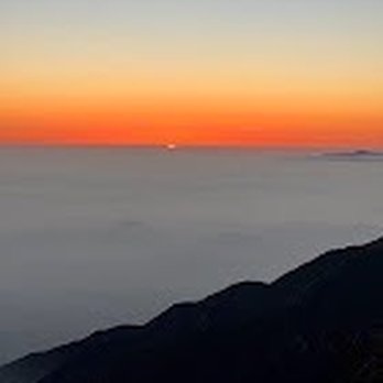
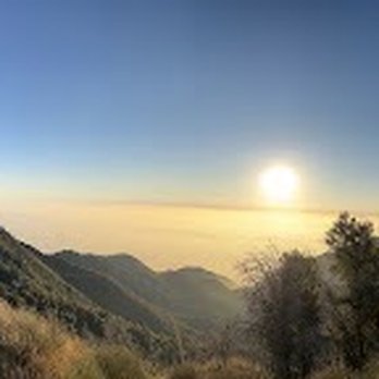
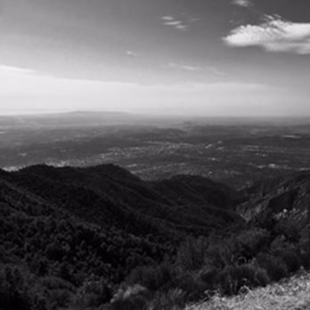
I have been wanting to share with our community a local spot that does not take too long to get to. It's a really nice ride and the pictures that I'm sharing its more beautiful in person. Mount Wilson has the Observatory, the hiking trails, clean restrooms and even a snack Bar .It's a very good place to relax for the afternoon and enjoy the view.We stopped to order some pastrami grinders, and had lunch up on the mountain. it's amazing how beautiful the SGV and the basin looks from above, especially above the cloud cover that's a whole different view. there's a huge parking space where you don't even have to get out of your car to see the view.


For my 500th review, it shall be Mt. Wilson! Mt. Wilson gives another dimension to the lives of Angelenos. I am not aware of another place that is so close to the city providing a challenging hike up an actual mountain, a scenic drive through mountains and forests, and of course chance to see and feel snow in the winter. While it's not the most beautiful nor the tallest mountain in the area and the observatory up there is... not very visitor friendly, I don't think you can ask for more for a place so close to a major metropolitan city that is LA; it's all about accessibility! There are several ways to get to (or attempt to get to) Mt. Wilson. You can: Drive up the 2, the scenic Angeles Crest Highway from La Canada Flintridge, and take Mt. WIlson Red Box Road. It's a pretty scenic and winding drive, about 20 miles from where the highway starts. Once you get to Mt. Wilson and want to park, you will be required to have the $5 Adventure Pass. You can buy this at the Cosmic Cafe by the observatory once you're up there. As for hiking, there are 3 ways to get up to Mt. Wilson. Hike up from the west, east, or straight up from below it. 1. The hike from the west starts in the Altadena/Pasadena area via Mt. Wilson Toll Road. Best bet would be to start at Eaton Canyon and take the Toll Road up past Henninger Flats to the top. While the Toll Road provides for a very wide and safe trail, this hike isn't as scenic or as interesting as the others. This hike is almost 10 miles from Eaton Canyon, so it's about a 20 mile round trip. Alternatively, you can start your hike at Bailey Canyon Park in Sierra Madre and hike up past Jones and Hastings Peaks to the Toll Road; this would be about a 16 mile round trip hike. 2. The hike from the east starts from the Chantry Flats area. You hike the Big Santa Anita Canyon and take Sturtevant trail to Mt. Wilson at the Upper Zion Trail junction which would take you to the observatory side of Mt. Wilson. You can then come down on the Mt. Wilson trail from the Skyline Park parking lot, and transfer to Upper Winter Creek at Manzanita Ridge. This hike is about 15 miles rountrip, and offers the best amount of shade and with great scenery and I would say is the easiest way to hike to the top of Mt. Wilson. 3. The last way is to hike up via Mt. Wilson trail, one of the oldest trails in the area that pretty much goes from the base to the top. It starts in the streets of Sierra Madre and is about 15 miles round trip, though it can feel slightly more if you transfer to the Toll Road at the end instead of staying on the Mt. Wilson Trail. This is a beautiful trail, without much shade at first and then gets better. The spaces are open and you can look out to the city in the distance unlike the Chantry Flats route where you are often surrounded by trees and canyons. This is a very popular trail and has some pretty heavy traffic for at least the first half of the trail. If you're driving up to Mt. Wilson during the winter, be mindful of the chain requirements and road closures when the conditions get bad; you can check the status online. Also, the Skyline Park (http://www.yelp.com/biz_photos/mount-wilson-observatory-mt-wilson-2?select=Xs0_1V6F34TNZFmiDytNuA#Xs0_1V6F34TNZFmiDytNuA) which is where the Cosmic Cafe and the observatory are located in closes during the winter so don't be a noob like me and hike up the mountain in the snow without bringing lunch expecting to eat at the cafe. They're closed from Dec. 1 to March 31 (http://www.yelp.com/biz_photos/mount-wilson-observatory-mt-wilson-2?select=Xs0_1V6F34TNZFmiDytNuA#7uJ05DgG-2triNXnDBstTQ).


OK.... I'm rating this a 5star, but I will have to say, this kicked my ass. I have been working up to this hike for some time. Training 2-3 times per week, I thought I was ready to hit the summit of this monsterous peak..... well boy oh boy, was I in for a surprise. In the midst of being treated for upper respiratory infection, it probably wasn't the best idea to schedule a hike on this given day... but that's what we nurses do. We ventured to the top via Chantry Flats. The hike is absolutely beautiful, lots of water along the way (you know we Californians get excited at the sight of water). The incline is steady, and sometimes treacherous, but it is doable. We hiked for approximately 6hours before getting to the top. We did have a quick stop at Sturtevant Camp, took some photos and swung on the swing before continuing on. It was very foggy or maybe we were in a cloud. Once we got to the top, most of us lost battery life of our phones, but in reality, they were just too cold and shut off on their own. We trekked Champagne with us to the top so that we could pop some bubbly to celebrate our victory march. Our hands were so cold, we barely could open our bottles. I'm definitely a novice hiker, as I took out my rain jacket and gloves from my backpack prior to the hike... knowing that I needed room for my gourmet cheeses, crackers, and champagne. Huge mistake. My hands were so cold, my head was too. It started to drizzle up there, again, unprepared and longing for my jacket that I left on the kitchen table. There is a cute little museum up at the top of Mount Wilson Observatory. Doors were open and we gladly went in. Great little place for history of this magnificent gem in our backyards. Cosmic Cafe was naturally closed as it was a weekday. Wonderful bathrooms with ice cold running water to wash your cold hands with. We took an alternate route down which met up with the trail that we started at. This hike is a must do if you live in the area. Even if you don't, give it a try.
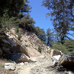

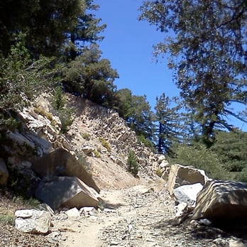
Mt Wilson is a nice destination for hikers, children, and people of all ages. It can be reached by vehicle or by hiking from one of the various, surrounding trails. There is a nice covered picnic area with a cafe that is open during the summer months. The actual observatory is about 1/2 mile further. Views here are nice but not as spectacular as I had imagined them to be. If you hike to reach this area, the views are better on the way up. Still, it's worth visiting at least once, especially if you are a Los Angeles resident.


I've hiked this mountain 5 times and it never gets easier! It's less painful every time but it's definitely a knee buster! I normally start from Chantry Flat and go on the Upper Creek trail towards Mt. Wilson. The people who frequent this mountain are mainly very friendly. There seems to be an old Korean hiking group that frequent this mountain very often. Today I hiked it by myself to see the snow on top of Mt. Wilson. As I got nearer to the top, the more cold it got! We were above the clouds and the view was amazing. As I was eating my breakfast/lunch/snack my fingers started to freeze because I forgot my gloves. I'll post some awesome photos from my hike today. It took me 8 hours but I'm a little sore from hiking Mt. Baldy on Friday. Also the snow made it a little hard to gain good footing hiking upwards, luckily I had hiking poles for balance and anti-slippage. I would recommend this to everyone! If you can't do a 16 mile hike just go half way or there are various other trails that you can do that loops around Chantry Flat. My video blog of my trip and the snow at the top: https://youtu.be/c9XJtQenptg


This hike kicks your ass. 7 miles pretty much uphill the whole way. Great scenary though. First two miles is unshaded and you're along about a 200ft cliff. The next two miles is much better, you're in the shade and there's a constant stream and some waterfalls off the side you can hear. The third leg is similar to the 2nd. The last leg to the top you're in the pine trees with some good views of smoggy pasadena to one side and the rest of the angeles forest to the other. The downside to this hike are the freakin' flies. From mile 2 through 7, they are all over you. I stopped for water and had about 30 buzzing all over, got bitten a few times (not really painful, just annoying). I even doused myself with 15% deet. Another guy on the trail had 40% deet and that didnt help either. On the way back I saw guys with full beekeeper head screens...hmm that would have been good. No mosquitos though. Best to do in the early morning, because on your way down nearing mile 13-14, its hot and no shade. One plus was a cool little waterfall on the way. That was a nice stopover to catch your breath.


I am the unabashed queen of the fuddy duddies. This review isn't about hiking or the observatory tour. This is for the lovely pavilion up top where one can just sit in the shade. My hubby & dog love nature walks and if it's do-able, I'll tag along. But the drive up was so twisty-turny that by the time we reached the top, I was pea-green. My head was spinning and my heart was palpitating. The altitude kicked my patootie. So I told him to just leave me there in the pavilion while they wandered around to Echo Rock and wherever. https://www.yelp.com/user_local_photos?select=tlWnMF3BooYxXos_svyPIQ&userid=Tuq59VSdqnCmotr_910JoQ Turned out that I had a nice time while hanging out there! Also, a lovely breeze helped me feel better. There's the Cosmic Cafe serving hot and cold food. https://www.yelp.com/user_local_photos?select=18ALoaLTddrItwt9KIw-6Q&userid=Tuq59VSdqnCmotr_910JoQ If I wasn't already queasy, I wouldn't have minded a bowl of chili or something. Picnic tables all around so that you could enjoy the views while eating. https://www.yelp.com/user_local_photos?select=ENF58u6yCnjnoxwznIyu-w&userid=Tuq59VSdqnCmotr_910JoQ Many people were making good use of the water-refilling station right next to the pavilion. https://www.yelp.com/user_local_photos?select=nnOYDLn-xd0bk_3iBbuKYg&userid=Tuq59VSdqnCmotr_910JoQ If you're going on the Observatory Tour, here's where you meet the guide. Tickets can be purchased at the cafe. https://www.yelp.com/user_local_photos?select=r2eg_8363BfWxZTnDIEWzA&userid=Tuq59VSdqnCmotr_910JoQ He happened to be there while I was sitting around and was telling some interesting stories. Too bad we had the dog with us. This guy was so entertaining, I would have liked to join the group. He was nice enough to tell me how to log into their wi-fi. (Settings. Cosmic Cafe) There's clean restrooms a but further up the path. It's dog-friendly, but you must keep them on a leash. Bring poop bags! Our dog apparently went crazy seeing all those trees and tried to mark every one of them. So, we all had fun up there. But in different ways. The ride down was better for me. Note: Don't forget to stop by one of the ranger stations to buy your $5 (National Forest Adventure) all-day parking pass. Passes can also be bought at the cafe.and then taken back to your car's dashboard. https://www.yelp.com/user_local_photos?select=_VGFq4-XqdMuAhrpt4ZSWQ&userid=Tuq59VSdqnCmotr_910JoQ


The views here are amazing on a clear day. I think this is the highest peak in the San Gabriel Mountains, and usually has local snow when it does snow in the winter. When our kids were little, we would bring them here and play in the snow. Also, there are huge telescopes about a quarter mile further, where you can see planetary alignment and star shows. There are special lectures, as I understand, and at night, the place is perfectly dark and away from City lights. I think the restaurant, Cosmic Cafe is only open until November 29th, so just a few more weeks of real food will be available up here. I was hoping to get a clear shot of the basin, but due to an inversion layer, I could not get a very clear shot to the ocean. I'll have to come up in the winter time I guess.


Wow is all I can say! The views are majestic. It's hard to believe that mountains of this size exist just mere miles from Los Angeles. Under the radar destination it is, I recommend this to anyone.


Mt Wilson was an amazing hike, utterly beautiful. The observatory at the top and the picture opportunities were fun. We hiked on a perfect weather day and enjoyed ice cream at Mother Moo Creamery at the bottom. Wonderful experience. Please come and create your own adventure. read more


+ Fun hike! Good exercise if - it weren't for the fires causing destruction. Mt Wilson trail is now in disrepair and inaccessible. No notice of when it'll reopen. - Before driving 1 hr up there, I searched online "mt wilson forecast" to check for road/trail closures. The websites don't mention any. I drive up there, turns out Mt Wilson is closed! D:{ + But thankfully Chantry Flat just 5min drive away is open. + Decent single restroom at the Mt Wilson trailhead. + There's a restaurant at Mt Wilson summit, near the Observatory haha . Moderate amount of shade on these trails. - Lots of flies on these trails trying to fly into my mouth. read more

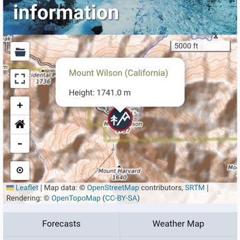

I was recently visiting Pasadena and this came up as something to do in the area. About a 40 minute drive from Colorado Ave in Pasadena. We decided to explore and give it a try. We made the drive up the windy mountain pass and were rewarded with snow, scenic views, and plenty of trees. Of course at the top is the Mt Wilson observatory for a fee. There are some hiking trails and plenty of people seemed to be taking advantage of them, even in the snow and cold. There is a large parking lot and just a few feet away it has spectacular views of the valley below, all the way to downtown Los Angeles and the nearby islands - probably the Channel islands or Catalina island or both. read more
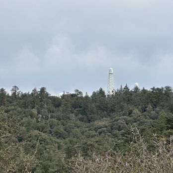


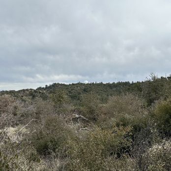


I have been wanting to share with our community a local spot that does not take too long to get to. It's a really nice ride and the pictures that I'm sharing its more beautiful in person. Mount Wilson has the Observatory, the hiking trails, clean restrooms and even a snack Bar .It's a very good place to relax for the afternoon and enjoy the view.We stopped to order some pastrami grinders, and had lunch up on the mountain. it's amazing how beautiful the SGV and the basin looks from above, especially above the cloud cover that's a whole different view. there's a huge parking space where you don't even have to get out of your car to see the view. read more





8 years ago

For my 500th review, it shall be Mt. Wilson! Mt. Wilson gives another dimension to the lives of Angelenos. I am not aware of another place that is so close to the city providing a challenging hike up an actual mountain, a scenic drive through mountains and forests, and of course chance to see and feel snow in the winter. While it's not the most beautiful nor the tallest mountain in the area and the observatory up there is... not very visitor friendly, I don't think you can ask for more for a place so close to a major metropolitan city that is LA; it's all about accessibility! There are several ways to get to (or attempt to get to) Mt. Wilson. You can: Drive up the 2, the scenic Angeles Crest Highway from La Canada Flintridge, and take Mt. WIlson Red Box Road. It's a pretty scenic and winding drive, about 20 miles from where the highway starts. Once you get to Mt. Wilson and want to park, you will be required to have the $5 Adventure Pass. You can buy this at the Cosmic Cafe by the observatory once you're up there. As for hiking, there are 3 ways to get up to Mt. Wilson. Hike up from the west, east, or straight up from below it. 1. The hike from the west starts in the Altadena/Pasadena area via Mt. Wilson Toll Road. Best bet would be to start at Eaton Canyon and take the Toll Road up past Henninger Flats to the top. While the Toll Road provides for a very wide and safe trail, this hike isn't as scenic or as interesting as the others. This hike is almost 10 miles from Eaton Canyon, so it's about a 20 mile round trip. Alternatively, you can start your hike at Bailey Canyon Park in Sierra Madre and hike up past Jones and Hastings Peaks to the Toll Road; this would be about a 16 mile round trip hike. 2. The hike from the east starts from the Chantry Flats area. You hike the Big Santa Anita Canyon and take Sturtevant trail to Mt. Wilson at the Upper Zion Trail junction which would take you to the observatory side of Mt. Wilson. You can then come down on the Mt. Wilson trail from the Skyline Park parking lot, and transfer to Upper Winter Creek at Manzanita Ridge. This hike is about 15 miles rountrip, and offers the best amount of shade and with great scenery and I would say is the easiest way to hike to the top of Mt. Wilson. 3. The last way is to hike up via Mt. Wilson trail, one of the oldest trails in the area that pretty much goes from the base to the top. It starts in the streets of Sierra Madre and is about 15 miles round trip, though it can feel slightly more if you transfer to the Toll Road at the end instead of staying on the Mt. Wilson Trail. This is a beautiful trail, without much shade at first and then gets better. The spaces are open and you can look out to the city in the distance unlike the Chantry Flats route where you are often surrounded by trees and canyons. This is a very popular trail and has some pretty heavy traffic for at least the first half of the trail. If you're driving up to Mt. Wilson during the winter, be mindful of the chain requirements and road closures when the conditions get bad; you can check the status online. Also, the Skyline Park (http://www.yelp.com/biz_photos/mount-wilson-observatory-mt-wilson-2?select=Xs0_1V6F34TNZFmiDytNuA#Xs0_1V6F34TNZFmiDytNuA) which is where the Cosmic Cafe and the observatory are located in closes during the winter so don't be a noob like me and hike up the mountain in the snow without bringing lunch expecting to eat at the cafe. They're closed from Dec. 1 to March 31 (http://www.yelp.com/biz_photos/mount-wilson-observatory-mt-wilson-2?select=Xs0_1V6F34TNZFmiDytNuA#7uJ05DgG-2triNXnDBstTQ). read more


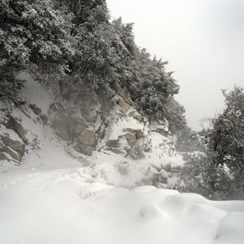


OK.... I'm rating this a 5star, but I will have to say, this kicked my ass. I have been working up to this hike for some time. Training 2-3 times per week, I thought I was ready to hit the summit of this monsterous peak..... well boy oh boy, was I in for a surprise. In the midst of being treated for upper respiratory infection, it probably wasn't the best idea to schedule a hike on this given day... but that's what we nurses do. We ventured to the top via Chantry Flats. The hike is absolutely beautiful, lots of water along the way (you know we Californians get excited at the sight of water). The incline is steady, and sometimes treacherous, but it is doable. We hiked for approximately 6hours before getting to the top. We did have a quick stop at Sturtevant Camp, took some photos and swung on the swing before continuing on. It was very foggy or maybe we were in a cloud. Once we got to the top, most of us lost battery life of our phones, but in reality, they were just too cold and shut off on their own. We trekked Champagne with us to the top so that we could pop some bubbly to celebrate our victory march. Our hands were so cold, we barely could open our bottles. I'm definitely a novice hiker, as I took out my rain jacket and gloves from my backpack prior to the hike... knowing that I needed room for my gourmet cheeses, crackers, and champagne. Huge mistake. My hands were so cold, my head was too. It started to drizzle up there, again, unprepared and longing for my jacket that I left on the kitchen table. There is a cute little museum up at the top of Mount Wilson Observatory. Doors were open and we gladly went in. Great little place for history of this magnificent gem in our backyards. Cosmic Cafe was naturally closed as it was a weekday. Wonderful bathrooms with ice cold running water to wash your cold hands with. We took an alternate route down which met up with the trail that we started at. This hike is a must do if you live in the area. Even if you don't, give it a try. read more


11 years ago
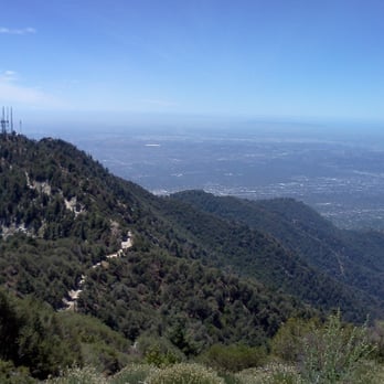
Mt Wilson is a nice destination for hikers, children, and people of all ages. It can be reached by vehicle or by hiking from one of the various, surrounding trails. There is a nice covered picnic area with a cafe that is open during the summer months. The actual observatory is about 1/2 mile further. Views here are nice but not as spectacular as I had imagined them to be. If you hike to reach this area, the views are better on the way up. Still, it's worth visiting at least once, especially if you are a Los Angeles resident. read more



11 years ago
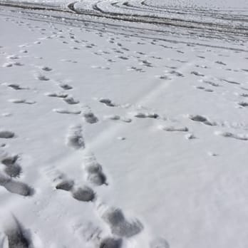
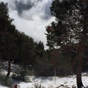
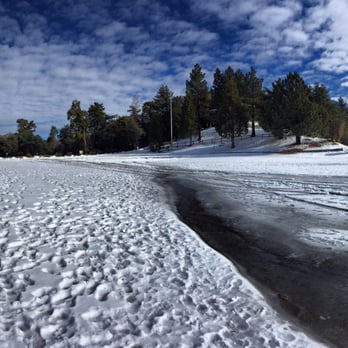
I've hiked this mountain 5 times and it never gets easier! It's less painful every time but it's definitely a knee buster! I normally start from Chantry Flat and go on the Upper Creek trail towards Mt. Wilson. The people who frequent this mountain are mainly very friendly. There seems to be an old Korean hiking group that frequent this mountain very often. Today I hiked it by myself to see the snow on top of Mt. Wilson. As I got nearer to the top, the more cold it got! We were above the clouds and the view was amazing. As I was eating my breakfast/lunch/snack my fingers started to freeze because I forgot my gloves. I'll post some awesome photos from my hike today. It took me 8 hours but I'm a little sore from hiking Mt. Baldy on Friday. Also the snow made it a little hard to gain good footing hiking upwards, luckily I had hiking poles for balance and anti-slippage. I would recommend this to everyone! If you can't do a 16 mile hike just go half way or there are various other trails that you can do that loops around Chantry Flat. My video blog of my trip and the snow at the top: https://youtu.be/c9XJtQenptg read more





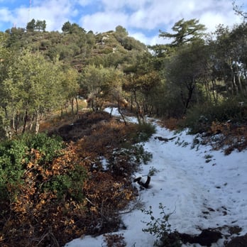

This hike kicks your ass. 7 miles pretty much uphill the whole way. Great scenary though. First two miles is unshaded and you're along about a 200ft cliff. The next two miles is much better, you're in the shade and there's a constant stream and some waterfalls off the side you can hear. The third leg is similar to the 2nd. The last leg to the top you're in the pine trees with some good views of smoggy pasadena to one side and the rest of the angeles forest to the other. The downside to this hike are the freakin' flies. From mile 2 through 7, they are all over you. I stopped for water and had about 30 buzzing all over, got bitten a few times (not really painful, just annoying). I even doused myself with 15% deet. Another guy on the trail had 40% deet and that didnt help either. On the way back I saw guys with full beekeeper head screens...hmm that would have been good. No mosquitos though. Best to do in the early morning, because on your way down nearing mile 13-14, its hot and no shade. One plus was a cool little waterfall on the way. That was a nice stopover to catch your breath. read more


10 years ago
I am the unabashed queen of the fuddy duddies. This review isn't about hiking or the observatory tour. This is for the lovely pavilion up top where one can just sit in the shade. My hubby & dog love nature walks and if it's do-able, I'll tag along. But the drive up was so twisty-turny that by the time we reached the top, I was pea-green. My head was spinning and my heart was palpitating. The altitude kicked my patootie. So I told him to just leave me there in the pavilion while they wandered around to Echo Rock and wherever. https://www.yelp.com/user_local_photos?select=tlWnMF3BooYxXos_svyPIQ&userid=Tuq59VSdqnCmotr_910JoQ Turned out that I had a nice time while hanging out there! Also, a lovely breeze helped me feel better. There's the Cosmic Cafe serving hot and cold food. https://www.yelp.com/user_local_photos?select=18ALoaLTddrItwt9KIw-6Q&userid=Tuq59VSdqnCmotr_910JoQ If I wasn't already queasy, I wouldn't have minded a bowl of chili or something. Picnic tables all around so that you could enjoy the views while eating. https://www.yelp.com/user_local_photos?select=ENF58u6yCnjnoxwznIyu-w&userid=Tuq59VSdqnCmotr_910JoQ Many people were making good use of the water-refilling station right next to the pavilion. https://www.yelp.com/user_local_photos?select=nnOYDLn-xd0bk_3iBbuKYg&userid=Tuq59VSdqnCmotr_910JoQ If you're going on the Observatory Tour, here's where you meet the guide. Tickets can be purchased at the cafe. https://www.yelp.com/user_local_photos?select=r2eg_8363BfWxZTnDIEWzA&userid=Tuq59VSdqnCmotr_910JoQ He happened to be there while I was sitting around and was telling some interesting stories. Too bad we had the dog with us. This guy was so entertaining, I would have liked to join the group. He was nice enough to tell me how to log into their wi-fi. (Settings. Cosmic Cafe) There's clean restrooms a but further up the path. It's dog-friendly, but you must keep them on a leash. Bring poop bags! Our dog apparently went crazy seeing all those trees and tried to mark every one of them. So, we all had fun up there. But in different ways. The ride down was better for me. Note: Don't forget to stop by one of the ranger stations to buy your $5 (National Forest Adventure) all-day parking pass. Passes can also be bought at the cafe.and then taken back to your car's dashboard. https://www.yelp.com/user_local_photos?select=_VGFq4-XqdMuAhrpt4ZSWQ&userid=Tuq59VSdqnCmotr_910JoQ read more

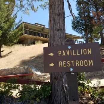


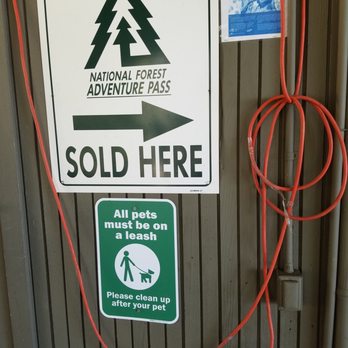
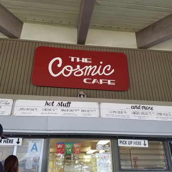


The views here are amazing on a clear day. I think this is the highest peak in the San Gabriel Mountains, and usually has local snow when it does snow in the winter. When our kids were little, we would bring them here and play in the snow. Also, there are huge telescopes about a quarter mile further, where you can see planetary alignment and star shows. There are special lectures, as I understand, and at night, the place is perfectly dark and away from City lights. I think the restaurant, Cosmic Cafe is only open until November 29th, so just a few more weeks of real food will be available up here. I was hoping to get a clear shot of the basin, but due to an inversion layer, I could not get a very clear shot to the ocean. I'll have to come up in the winter time I guess. read more


12 years ago

11 years ago
Wow is all I can say! The views are majestic. It's hard to believe that mountains of this size exist just mere miles from Los Angeles. Under the radar destination it is, I recommend this to anyone. read more


17 years ago

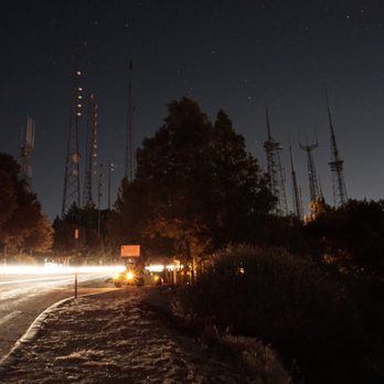
When I visited from Chicago my sister and her husband drove me to the summit. We drove at night in the dark. There were signs advising tires be chained. There were hairpin turns. It was icy. I got carsick. I saw LA at night, the blacked out spot that is Griffith Park, the black Pacific Ocean. My sister and her husband are rugged folks. They have hiked the 16 mile route and I think it made them stronger. read more


15 years ago

15 years ago

13 years ago

14 years ago

11 years ago

15 years ago

10 years ago
I love taking Angeles Crest Highway, Mt Wilson is basically the cherry on top! Amazing view at the top whether overcast and cloudy, daytime or at night to see the city light. Be cautious though, the road up is narrow and may have large fallen rocks. read more


12 years ago

12 years ago
More info about Mt Wilson
La Canada Flintridge, CA 91011
Directions
Hours
Outdoor Amenities
Ask the Community - Mt Wilson
Review Highlights - Mt Wilson
You might also consider








Why does Yelp recommend reviews?
1 review that is not currently recommended
The reviews below are not factored into the business's overall star rating.

14 years ago
Mt Wilson - hiking - Updated August 2026
Best of La Canada Flintridge
People found Mt Wilson by searching for…
Snow Play in La Canada Flintridge, CA
Meteor Shower in La Canada Flintridge, CA
Scenic Drives in La Canada Flintridge, CA
Camping Sites in La Canada Flintridge, CA
Things to Do in La Canada Flintridge, CA
Campgrounds in La Canada Flintridge, CA
Scenic Overlook in La Canada Flintridge, CA
Star Gazing in La Canada Flintridge, CA
Waterfall Hike in La Canada Flintridge, CA
Lookout Points in La Canada Flintridge, CA
Tours in La Canada Flintridge, CA
Camping Cabins in La Canada Flintridge, CA
Scenic View in La Canada Flintridge, CA
Parks in La Canada Flintridge, CA
Creeks in La Canada Flintridge, CA
Hiking Trails in La Canada Flintridge, CA
Free Campgrounds in La Canada Flintridge, CA
Off Road Trails in La Canada Flintridge, CA
Places to Walk in La Canada Flintridge, CA
Snow in La Canada Flintridge, CA
Hiking Club in La Canada Flintridge, CA
Views in La Canada Flintridge, CA
Browse Nearby
BEST of La Canada Flintridge, California Coffee near Mt Wilson
BEST of La Canada Flintridge, California Things to Do near Mt Wilson
BEST of La Canada Flintridge, California Restaurants near Mt Wilson
BEST of La Canada Flintridge, California Walking Trails near Mt Wilson
BEST of La Canada Flintridge, California Parks near Mt Wilson
BEST of La Canada Flintridge, California Breakfast near Mt Wilson
BEST of La Canada Flintridge, California Campgrounds near Mt Wilson
BEST of La Canada Flintridge, California Sledding near Mt Wilson
BEST of La Canada Flintridge, California Day Trips near Mt Wilson


