Josephine Peak Photos

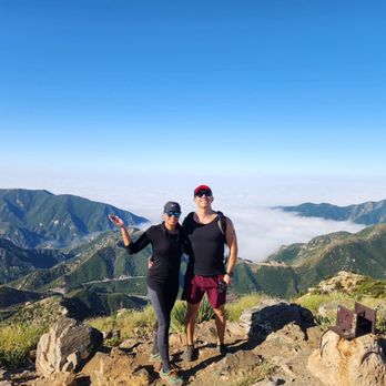
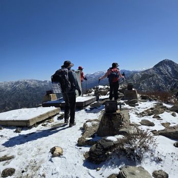

You might also consider


More like Josephine Peak
Recommended Reviews - Josephine Peak
Start your review...


Reviews With Photos


I've done this hike 3 times now. Twice via Colby Canyon and once from Clear Creek. Both options are a little over 8 miles but Colby is a bit steeper.Make sure to display your Adventure Pass parking permit.The first 2 miles are pretty steep and then you reach a saddle and the path to the right is the mountaineering route to Strawberry Peak and to the left will take you to Josephine. The next 2 miles is mostly flat or slight incline and this part of the trail is wider. Nice 360 views at the top.


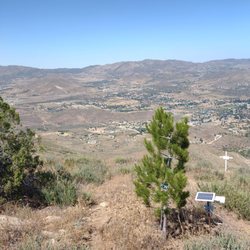
This is a nice 8 mile round trip hike with a 360 view at the summit. You can park near Clear Creek Fire Station or nearby Clear Creek Information Center, there are restrooms in the area. Display your adventure pass when parking here to avoid a ticket. NOTE: Restroom is closed due to Covid-19. You can find the start of the trail across from the Fire Station, walk past the yellow gate onto Josephine Peak Road. The hike up to Josephine Peak has a gradual incline, nothing steep so no trekking poles are needed unless you like using them. You can't get lost, stay on the Josephine Peak Road all the way to the top. At Josephine Saddle, there is a small trail going right towards Strawberry Peak, if you have time you can extend the adventure. Once you make it to the top, the views are awesome. There will be a small solar-powered building on the peak. Enjoy the view, then head back down the same way you hiked up. This is a popular location for trail runners and mountain biking. Alternative route, instead of starting at Clear Creek fire station area. You can start at Colby Canyon. If you want to hike a trail versus a service road. There is not a lot of shades, so be prepare to have sun block, hat and sunglasses if hiking mid afternoon. As always plan accordingly to the weather and have fun.i


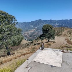
This review is for Josephine Peak via Colby Canyon Trail . It is more interesting and scenic than only taking the fire road. It is an out and back hike of about 8.3 miles with ~2,100' elevation gain/loss. The hike is heavily wooded early on. There are streams and lush greenery along the way. The trail has minimal rock under foot and is single file most of the way, until the last 0.5-1 mile, where it becomes and joins with the fire road to the peak. Most of the hike is on an incline, but the ascension is not that steep. You will recognize the peak when you see a small building surrounded by towers and solar panels. Views at the top are 360 degrees. DTLA can be seen on a clear day. tip - adventure pass needed parking - free lot on the side of the road


PEEKING ON JOSEPHINE'S PEAK!!! BACKGROUND: Named for Josephine Lippencott, wife of USGS surveyor Joseph Barlow Lippencott who used this elevation for a triangulation station (1894). He would later insure the city of Santa Barbara with a steady source of water by planning the Gibraltar Dam on the Santa Inez River (1903, completed 1921), and was later the Hydraulic Engineer of the Owens Valley Aqueduct (1919). He was also involved in the planning of the Angeles Crest Highway. STATS: Distance: 8 miles Trail conditions: Fire Road & single track Route: Up and back Elevation gain: All uphill to the top (1900' gain) Restroom: Porta potty at the info center ESSENTIALS: At least 2 liters of water Know your limits Comfy hiking shoes with good lugs Layered Clothing High protein food/snacks Electrolytes Camera Hat (optional) Sunscreen Trek poles (optional) OUR ROUTE: On a warm and sunny morning, me and The Crew headed up Angeles Forest Highway for an uphill climb to Josephine Peak. Parking on the side of the road just across from Clear Creek Visitors Center, we threw on our packs, adjusted our straps, stretched our trekking poles, and headed up a fire road that seemed to never end. There's really not much to say about this hike, it is a straightforward hike on an easy to follow fire road to the top. On your way up, if you start going down, you are going the wrong way. The biggest challenges are, hike is fully exposed to the elements, so if you hike it in the warmer months dress appropriately, wear sunscreen and a hat, as well as bring lots of water and electrolytes. The views going up are amazing and from the top, the 360 degree view is breathtaking, DISCLAIMER: Hiking is not something that can be taken lightly. It can be life-threatening as you see and hear on the news, people die or get lost all time. Please, if you are going to hike, never go alone and prepare for the worst, hope for the best. Remember when going for a hike, no matter how short you think it may be, always be prepared. Carry at least two liters of water for every five miles (more if the weather is warm), protein bar, nuts, and electrolytes. Wear sturdy lug sole shoes and protective clothing. Some areas the weather can change quicker than a fireman can put on his gear. It is also very important, always always always let a family member or friend know where you are going and when you expect to be back. Lastly, have fun when you hike it up. Review 100 Yelp 100+ Challenge 2015 #HIKEITUP #HIKING #ANF
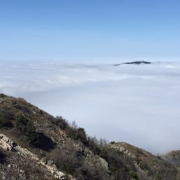

A well maintained access road up to radio masts at the top of the peak. The hike is just a little under 8 miles round trip. Once you pass the yellow vehicle gate at the bottom of the access road, then its just a case of following this road up. No chance to get lost or off trail. It can get a little chilly first thing in the morning, even if its warm down in LA. parking: there's only 15 mins parking at the ranger station at the junction, so instead park on the gravel area on the other side of the street. Theres a sign nearby the says that you need to display your adventure pass.


This is a pretty nice FIREWOOD hike up with amazing views all the way to the top. You get a 360 view of the entire angeles national forrest looking towards the city, strawberry peak and mt wilson. You can see everything. This is doable on a bike with climbing gears and definitely doable by foot. Its about 4 miles up and 4 miles down from clear creek ranger station where i recommend you park. Bring some water. It does get chilly in the shade. Im coming back!


I completed this hike in December and I really enjoyed it. It was very cold in the morning at 8am, approximately 38 degrees fahrenheit. It's a moderate hike that follows a fire road, so nothing too complicated. I didn't need hiking poles either. Highly recommended!

8 months ago

2 years ago
I was here on Saturday, June 8th. I arrived around 6am, parked in front of Clear Creek Fire Station, summited at 8am, and back to the car around 930am. It's an easy trail. Easy to follow. There are several parking spots. I do suggest arriving early for a parking spot. There is a restroom across from Clear Creek Fire Station. Vault restroom. There was no sign at the top of Josephine Peak (FYI). Overall, it was a nice and warm hike. Happy Hiking! read more


2 years ago
Nice incline hike. Started at 6:28 am got up at 8:18 am. After 8:30 a lot of people show up. I like that I had the summit to my self for 15 min. Saw a B2 bomber circling the park. This was before fires, Jan1st 2025 read more


I've done this hike 3 times now. Twice via Colby Canyon and once from Clear Creek. Both options are a little over 8 miles but Colby is a bit steeper.Make sure to display your Adventure Pass parking permit.The first 2 miles are pretty steep and then you reach a saddle and the path to the right is the mountaineering route to Strawberry Peak and to the left will take you to Josephine. The next 2 miles is mostly flat or slight incline and this part of the trail is wider. Nice 360 views at the top. read more


5 years ago


6 years ago
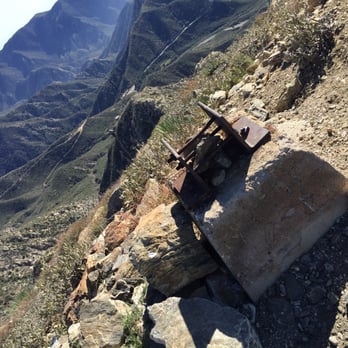
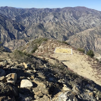
This is a nice 8 mile round trip hike with a 360 view at the summit. You can park near Clear Creek Fire Station or nearby Clear Creek Information Center, there are restrooms in the area. Display your adventure pass when parking here to avoid a ticket. NOTE: Restroom is closed due to Covid-19. You can find the start of the trail across from the Fire Station, walk past the yellow gate onto Josephine Peak Road. The hike up to Josephine Peak has a gradual incline, nothing steep so no trekking poles are needed unless you like using them. You can't get lost, stay on the Josephine Peak Road all the way to the top. At Josephine Saddle, there is a small trail going right towards Strawberry Peak, if you have time you can extend the adventure. Once you make it to the top, the views are awesome. There will be a small solar-powered building on the peak. Enjoy the view, then head back down the same way you hiked up. This is a popular location for trail runners and mountain biking. Alternative route, instead of starting at Clear Creek fire station area. You can start at Colby Canyon. If you want to hike a trail versus a service road. There is not a lot of shades, so be prepare to have sun block, hat and sunglasses if hiking mid afternoon. As always plan accordingly to the weather and have fun.i read more


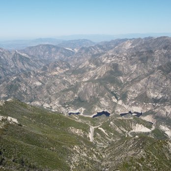


8 years ago
This review is for Josephine Peak via Colby Canyon Trail . It is more interesting and scenic than only taking the fire road. It is an out and back hike of about 8.3 miles with ~2,100' elevation gain/loss. The hike is heavily wooded early on. There are streams and lush greenery along the way. The trail has minimal rock under foot and is single file most of the way, until the last 0.5-1 mile, where it becomes and joins with the fire road to the peak. Most of the hike is on an incline, but the ascension is not that steep. You will recognize the peak when you see a small building surrounded by towers and solar panels. Views at the top are 360 degrees. DTLA can be seen on a clear day. tip - adventure pass needed parking - free lot on the side of the road read more


11 years ago
PEEKING ON JOSEPHINE'S PEAK!!! BACKGROUND: Named for Josephine Lippencott, wife of USGS surveyor Joseph Barlow Lippencott who used this elevation for a triangulation station (1894). He would later insure the city of Santa Barbara with a steady source of water by planning the Gibraltar Dam on the Santa Inez River (1903, completed 1921), and was later the Hydraulic Engineer of the Owens Valley Aqueduct (1919). He was also involved in the planning of the Angeles Crest Highway. STATS: Distance: 8 miles Trail conditions: Fire Road & single track Route: Up and back Elevation gain: All uphill to the top (1900' gain) Restroom: Porta potty at the info center ESSENTIALS: At least 2 liters of water Know your limits Comfy hiking shoes with good lugs Layered Clothing High protein food/snacks Electrolytes Camera Hat (optional) Sunscreen Trek poles (optional) OUR ROUTE: On a warm and sunny morning, me and The Crew headed up Angeles Forest Highway for an uphill climb to Josephine Peak. Parking on the side of the road just across from Clear Creek Visitors Center, we threw on our packs, adjusted our straps, stretched our trekking poles, and headed up a fire road that seemed to never end. There's really not much to say about this hike, it is a straightforward hike on an easy to follow fire road to the top. On your way up, if you start going down, you are going the wrong way. The biggest challenges are, hike is fully exposed to the elements, so if you hike it in the warmer months dress appropriately, wear sunscreen and a hat, as well as bring lots of water and electrolytes. The views going up are amazing and from the top, the 360 degree view is breathtaking, DISCLAIMER: Hiking is not something that can be taken lightly. It can be life-threatening as you see and hear on the news, people die or get lost all time. Please, if you are going to hike, never go alone and prepare for the worst, hope for the best. Remember when going for a hike, no matter how short you think it may be, always be prepared. Carry at least two liters of water for every five miles (more if the weather is warm), protein bar, nuts, and electrolytes. Wear sturdy lug sole shoes and protective clothing. Some areas the weather can change quicker than a fireman can put on his gear. It is also very important, always always always let a family member or friend know where you are going and when you expect to be back. Lastly, have fun when you hike it up. Review 100 Yelp 100+ Challenge 2015 #HIKEITUP #HIKING #ANF read more


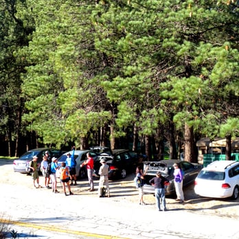


A well maintained access road up to radio masts at the top of the peak. The hike is just a little under 8 miles round trip. Once you pass the yellow vehicle gate at the bottom of the access road, then its just a case of following this road up. No chance to get lost or off trail. It can get a little chilly first thing in the morning, even if its warm down in LA. parking: there's only 15 mins parking at the ranger station at the junction, so instead park on the gravel area on the other side of the street. Theres a sign nearby the says that you need to display your adventure pass. read more
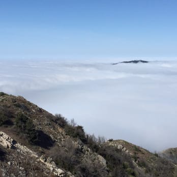


This is a pretty nice FIREWOOD hike up with amazing views all the way to the top. You get a 360 view of the entire angeles national forrest looking towards the city, strawberry peak and mt wilson. You can see everything. This is doable on a bike with climbing gears and definitely doable by foot. Its about 4 miles up and 4 miles down from clear creek ranger station where i recommend you park. Bring some water. It does get chilly in the shade. Im coming back! read more

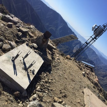



8 years ago
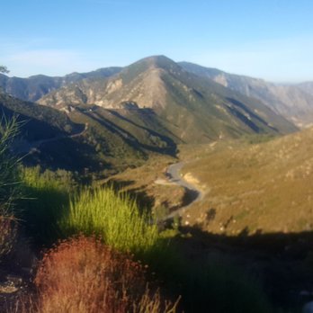
I completed this hike in December and I really enjoyed it. It was very cold in the morning at 8am, approximately 38 degrees fahrenheit. It's a moderate hike that follows a fire road, so nothing too complicated. I didn't need hiking poles either. Highly recommended! read more




9 years ago
More info about Josephine Peak
Josephine Peak Rd
Palmdale, CA 93550
Directions
Hours
Outdoor Amenities
Josephine Peak Reviews in Other Languages
Ask the Community - Josephine Peak
Review Highlights - Josephine Peak
You might also consider




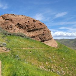
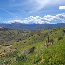
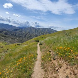


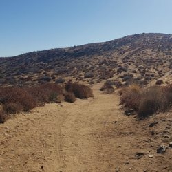














Josephine Peak - hiking - Updated August 2026
Best of Palmdale
People found Josephine Peak by searching for…
Dirt Bike Trails in Palmdale, CA
National Parks in Palmdale, CA
Visitor Centers in Palmdale, CA
Mountain Bike Trails in Palmdale, CA
Running Trails in Palmdale, CA
Off Road Trails in Palmdale, CA
Dog Friendly Hiking Trails in Palmdale, CA
Stroller Friendly Hikes in Palmdale, CA
Lookout Points in Palmdale, CA
Trending Searches in Palmdale, CA
Cliff Jumping near Josephine Peak
Consignment Shops near Josephine Peak
Cruising Spots near Josephine Peak
Dog Friendly Things To Do near Josephine Peak
Ear Piercing near Josephine Peak
Eyebrow Threading near Josephine Peak
Flower Fields near Josephine Peak
Hair Braiding near Josephine Peak
Kids Haircut near Josephine Peak
Permanent Makeup near Josephine Peak
Picnic Areas near Josephine Peak
Preschools near Josephine Peak
Public Golf Courses near Josephine Peak
Rock Quarry near Josephine Peak
Running Trails near Josephine Peak
Scenic Night View near Josephine Peak
Scenic Overlook near Josephine Peak
Sunrise View near Josephine Peak
Swimming Holes near Josephine Peak
Trading Card Shops near Josephine Peak
Used Furniture Stores near Josephine Peak
Browse Articles
Browse Nearby
Browse Brands
Related Searches in Palmdale, CA
Best Dog Hiking Trails Around Palmdale, California
Best Fishing Locations and Guides in Palmdale, California
Best Nature Trails for Hiking in Palmdale, California
Best Places for Horseback Riding in Palmdale, California
Best Sightseeing Experiences Available in Palmdale, California
Check Out Off Road Trails in Palmdale, California
Discover Dog Friendly Trails to Explore in Palmdale, California
Discover Easy Hiking Trails Near Palmdale, California
Discover Kid Friendly Hiking Trails in Palmdale, California
Discover Popular Bike Trails in Palmdale, California
Discover Scenic Mountain Bike Trails Near Palmdale, California
Discover Walking Parks in Palmdale, California Near You
Discover a Hiking Trail in Palmdale, California
Discover the Best Night Hike Trails in Palmdale, California
Discover the Best Running Track in Palmdale, California
Dog-Friendly Hikes With Dogs in Palmdale, California
Enjoy Camping Adventures Around Palmdale, California
Enjoy Kayaking Adventures in Palmdale, California
Enjoy Off Leash Dog Hikes in Palmdale, California
Enjoy Scenic Places to Walk in Palmdale, California
Enjoy Tent Camping Spots Around Palmdale, California
Enjoy a Beautiful Waterfall Hike in Palmdale, California
Enjoy the Best Walking Path in Palmdale, California
Enjoy the Best Walking Trails in Palmdale, California
Explore Beautiful Parks and Green Spaces in Palmdale, California
Explore Easy Hikes Perfect for All in Palmdale, California
Explore Fun Activities to Do in Palmdale, California
Explore Picnic Parks Near Palmdale, California
Explore Popular Campgrounds Near Palmdale, California
Explore Top Dog Parks in Palmdale, California Near You
Family Friendly Hiking With Kids in Palmdale, California
Find Parks and Recreation Activities in Palmdale, California
Find Top Dog Friendly Parks to Visit in Palmdale, California
Find Top-Rated Waterfalls in Palmdale, California Now
Find the Best Parks for Picnics in Palmdale, California
Hiking Trails With Waterfalls in Palmdale, California
Off Leash Dog Hiking Trails in Palmdale, California
Popular Outdoor Activities to Try in Palmdale, California
Popular Picnic Spots to Visit in Palmdale, California
Popular Waterfall Hiking Trails in Palmdale, California
Safe River Swimming Areas in Palmdale, California
Safe and Fun Parks for Kids in Palmdale, California
Top Hiking Trails to Explore in Palmdale, California
Top Playgrounds for Kids to Enjoy in Palmdale, California
Top Running Trails to Explore in Palmdale, California
Top Swimming Lakes to Enjoy in Palmdale, California
Top-Rated Camping Sites in Palmdale, California


