Las Virgenes Canyon Photos




You might also consider


More like Las Virgenes Canyon
Recommended Reviews - Las Virgenes Canyon
Start your review...


Reviews With Photos
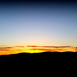

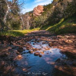
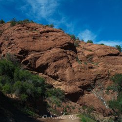
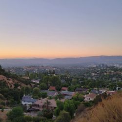
MID-WEEK TREK The huge parkland is part of a critical ecological linkage and wildlife corridor between the Santa Monica Mountains and the ranges to the north. Rolling hills studded with valley oaks, sycamore-lined canyon bottoms, miles of potential trails, and vistas of unspoiled California landscapes are now part of a parkland legacy. Diverse habitats and endangered species such as the California red-legged frog, the San Fernando Valley spineflower, and the Southwestern willow flycatcher are now permanently protected. The ranch encompasses headwaters of Malibu Creek which flows to Santa Monica Bay and supports one of the few populations of Southern steelhead trout. Historical reports indicate the fish may have traveled unimpeded upstream to streams on the Ahmanson Ranch. Distance-6.5 miles R/T Elevation Gain-A bit over 1200ft Time: 4-4.5 hours Trek: Loop Trail Trail: Mostly Fire Road, some single-track Rating: Intermediate Keep your eyes open for: Off road bikers and equestrians WARNING: Snakes, ticks, bobcats OUR ROUTE: Since weekends only happen once a week, The Crew gets a bit antsy, I led The Crew on a midweek hike in this area. We set out at the northern end of Las Virgenes Rd., where we followed a well-traveled trail with sagebrush and valley oaks as it's décor and views of rolling hills monopolize the landscape. We followed the trail to the Cheseboro Ridge Trail, which winds up a steep hillside, but once at the top you'll see that it was all worth it. A 360 degree of Malibu Creek State Park, Stokes Canyon, Saddle Peak, Goat Buttes, and Lady Face Mountain. If you time it correctly, as we did, this is a great place to watch the sun set. To complete the loop, we continued on the Cheseboro Ridge Trail down the other side of mountain, with much of the same décor and landscape, eventually turning on our headlamps. SHORT & SWEET: This area has a spider's web of trails with numerous trailheads. Since the 2005 fire, newer trails have been created. Most of the trails are smooth single-track trails with many switchbacks to soften the blow of the ascents and descents. It would take many, many days, miles, and hours to do hike every trail in this area, making this a great place to get away from it all for a couple hours. DISCLAIMER: Hiking is not something that can be taken lightly. It can be life-threatening as you see and hear on the news, people die or get lost all time. Please, if you are going to hike, never go alone and prepare for the worst, hope for the best. Remember when going for a hike, no matter how short you think it may be, always be prepared. Carry at least two liters of water for every five miles (more if the weather is warm), protein bar, nuts, and electrolytes. Wear sturdy lug sole shoes and protective clothing. Some areas the weather can change quicker than a firefighter can put on his gear. It is also very important, always always always let a family member or friend know where you are going and when you expect to be back. Lastly, have fun when you hike it up.


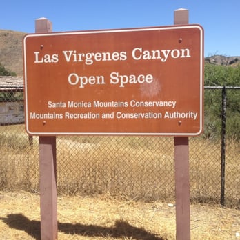
This hike is off the exit of Las Virgenes Road on the 101 freeway. You may park your car on the dirt sidewalk or you may park next to the Malibu apartments. This trail has access to the victory trail and chesboro trail. The longest round trip I been on this trail is 8 miles, I'm sure you may go a longer distant. It has lots on uphill!! So be prepare to has your water and hat on. This place is great for hiking and/or mountain bikes. I totally recommend this place, never crowded.


11 months ago

5 years ago

7 years ago

10 years ago
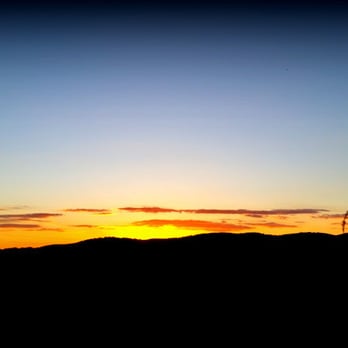
MID-WEEK TREK The huge parkland is part of a critical ecological linkage and wildlife corridor between the Santa Monica Mountains and the ranges to the north. Rolling hills studded with valley oaks, sycamore-lined canyon bottoms, miles of potential trails, and vistas of unspoiled California landscapes are now part of a parkland legacy. Diverse habitats and endangered species such as the California red-legged frog, the San Fernando Valley spineflower, and the Southwestern willow flycatcher are now permanently protected. The ranch encompasses headwaters of Malibu Creek which flows to Santa Monica Bay and supports one of the few populations of Southern steelhead trout. Historical reports indicate the fish may have traveled unimpeded upstream to streams on the Ahmanson Ranch. Distance-6.5 miles R/T Elevation Gain-A bit over 1200ft Time: 4-4.5 hours Trek: Loop Trail Trail: Mostly Fire Road, some single-track Rating: Intermediate Keep your eyes open for: Off road bikers and equestrians WARNING: Snakes, ticks, bobcats OUR ROUTE: Since weekends only happen once a week, The Crew gets a bit antsy, I led The Crew on a midweek hike in this area. We set out at the northern end of Las Virgenes Rd., where we followed a well-traveled trail with sagebrush and valley oaks as it's décor and views of rolling hills monopolize the landscape. We followed the trail to the Cheseboro Ridge Trail, which winds up a steep hillside, but once at the top you'll see that it was all worth it. A 360 degree of Malibu Creek State Park, Stokes Canyon, Saddle Peak, Goat Buttes, and Lady Face Mountain. If you time it correctly, as we did, this is a great place to watch the sun set. To complete the loop, we continued on the Cheseboro Ridge Trail down the other side of mountain, with much of the same décor and landscape, eventually turning on our headlamps. SHORT & SWEET: This area has a spider's web of trails with numerous trailheads. Since the 2005 fire, newer trails have been created. Most of the trails are smooth single-track trails with many switchbacks to soften the blow of the ascents and descents. It would take many, many days, miles, and hours to do hike every trail in this area, making this a great place to get away from it all for a couple hours. DISCLAIMER: Hiking is not something that can be taken lightly. It can be life-threatening as you see and hear on the news, people die or get lost all time. Please, if you are going to hike, never go alone and prepare for the worst, hope for the best. Remember when going for a hike, no matter how short you think it may be, always be prepared. Carry at least two liters of water for every five miles (more if the weather is warm), protein bar, nuts, and electrolytes. Wear sturdy lug sole shoes and protective clothing. Some areas the weather can change quicker than a firefighter can put on his gear. It is also very important, always always always let a family member or friend know where you are going and when you expect to be back. Lastly, have fun when you hike it up. read more


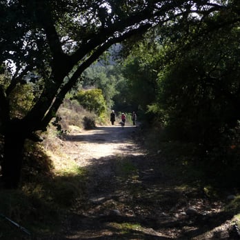


This hike is off the exit of Las Virgenes Road on the 101 freeway. You may park your car on the dirt sidewalk or you may park next to the Malibu apartments. This trail has access to the victory trail and chesboro trail. The longest round trip I been on this trail is 8 miles, I'm sure you may go a longer distant. It has lots on uphill!! So be prepare to has your water and hat on. This place is great for hiking and/or mountain bikes. I totally recommend this place, never crowded. read more


14 years ago

10 years ago
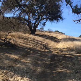
This is a great intermediate level hiking trail I have found, close to my home in the West Valley, near Woodland Hills, Calabasas, and Agoura. Right off the #Hollywood freeway, at the Las Vírgenes / Malibu Canyon #exit, make a right and you will see several trailheads for this canyon on your left. There's a FIRE department nearby so have no fear; if you find yourself lost while hiking: there is some help relatively nearby. That being said: don't #hike without friends knowing where you've gone. Carry plenty of water for the trek, plus a few snacks, and make sure you mark your steps. Based on what I've read from other hikers and what I've seen from my couple of #hikes at this site, yes: there are plenty of trails to take you all through these Santa Monica Mountains. Once I discover the names of the plants, trees & wildlife, I will share them so you will learn how to spot some beautiful sights out here. read more



9 years ago
More info about Las Virgenes Canyon
5952 Las Virgenes Rd
Calabasas, CA 91302
Directions
Hours
Outdoor Amenities
Ask the Community - Las Virgenes Canyon
You might also consider








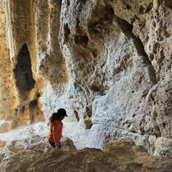






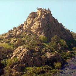


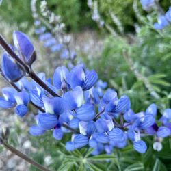


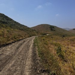
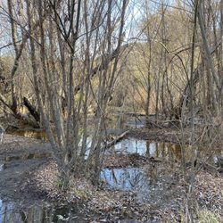


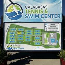






Las Virgenes Canyon - parks - Updated August 2026
Best of Calabasas
People found Las Virgenes Canyon by searching for…
Fishing Spots in Calabasas, CA
Hiking Trails in Calabasas, CA
Beautiful Views in Calabasas, CA
Fishing With Kids in Calabasas, CA
Off Road Trails in Calabasas, CA
Hiking Groups in Calabasas, CA
Running Trails in Calabasas, CA
Walking Trails in Calabasas, CA
Things to Do for Kids in Calabasas, CA
Dog Friendly Hiking Trails in Calabasas, CA
Natural Hot Springs in Calabasas, CA
Places to Walk Around in Calabasas, CA
Trending Searches in Calabasas, CA
Antiques near Las Virgenes Canyon
Barbershop For Men near Las Virgenes Canyon
Beautiful Views near Las Virgenes Canyon
Cliff Jumping near Las Virgenes Canyon
Consignment Shops near Las Virgenes Canyon
Cruising Spots near Las Virgenes Canyon
Dog Friendly Beaches near Las Virgenes Canyon
Dog Friendly Things To Do near Las Virgenes Canyon
Dog Friendly Trails near Las Virgenes Canyon
Ear Piercing near Las Virgenes Canyon
Fishing Spots near Las Virgenes Canyon
Free Picnic Areas near Las Virgenes Canyon
Kids Haircut near Las Virgenes Canyon
Lookout Points near Las Virgenes Canyon
Meteor Shower near Las Virgenes Canyon
Mini Golf near Las Virgenes Canyon
Nature Trails near Las Virgenes Canyon
Night Hike near Las Virgenes Canyon
Off Road Trails near Las Virgenes Canyon
Outdoor Activities near Las Virgenes Canyon
Parks near Las Virgenes Canyon
Pedicure near Las Virgenes Canyon
Permanent Makeup near Las Virgenes Canyon
Picnic Areas near Las Virgenes Canyon
Picnic Spots near Las Virgenes Canyon
Places To Take Pictures near Las Virgenes Canyon
Playgrounds near Las Virgenes Canyon
Preschools near Las Virgenes Canyon
Public Golf Courses near Las Virgenes Canyon
Public Pools near Las Virgenes Canyon
Public Running Track near Las Virgenes Canyon
River Swimming near Las Virgenes Canyon
Rock Quarry near Las Virgenes Canyon
Scenic Night View near Las Virgenes Canyon
Scenic Overlook near Las Virgenes Canyon
Shopping Malls near Las Virgenes Canyon
Star Gazing near Las Virgenes Canyon
Sunrise View near Las Virgenes Canyon
Swimming Holes near Las Virgenes Canyon
Things To Do With Kids near Las Virgenes Canyon
Trading Card Shops near Las Virgenes Canyon
Uniforms near Las Virgenes Canyon
Used Furniture Stores near Las Virgenes Canyon
Volleyball Courts near Las Virgenes Canyon
Watch Sunset near Las Virgenes Canyon
Browse Nearby
BEST of Calabasas, California Coffee near Las Virgenes Canyon
BEST of Calabasas, California Playgrounds near Las Virgenes Canyon
BEST of Calabasas, California Restaurants near Las Virgenes Canyon
BEST of Calabasas, California Things to Do near Las Virgenes Canyon
BEST of Calabasas, California Breakfast near Las Virgenes Canyon
BEST of Calabasas, California Campgrounds near Las Virgenes Canyon
BEST of Calabasas, California Picnic Areas near Las Virgenes Canyon
Browse Brands
Related Searches in Calabasas, CA
Affordable Bike Repair Services in Calabasas, California
Affordable Cheap Bike Tune Up Services in Calabasas, California
Affordable Kayak Rental Services in Calabasas, California
Best Dirt Bike Riding Spots in Calabasas, California
Best Dog Hiking Trails Around Calabasas, California
Best Electric Bike Rental Services in Calabasas, California
Best Fishing Locations and Guides in Calabasas, California
Best Nature Trails for Hiking in Calabasas, California
Best Off Leash Dog Parks in Calabasas, California
Best Parks for Parties and Events in Calabasas, California
Best Places for Horseback Riding in Calabasas, California
Best Sightseeing Experiences Available in Calabasas, California
Best Sledding Spots and Fun in Calabasas, California
Best Water Parks for Kids in Calabasas, California
Check Out Great Playgrounds in Calabasas, California
Check Out Off Road Trails in Calabasas, California
Convenient Bike Sharing Programs in Calabasas, California
Discover Baseball Fields Around Calabasas, California
Discover Dog Friendly Trails to Explore in Calabasas, California
Discover Easy Hiking Trails Near Calabasas, California
Discover Fun Toddler Parks in Calabasas, California for Your Little One
Discover Kid Friendly Hiking Trails in Calabasas, California
Discover Lakes & Ponds to Explore in Calabasas, California
Discover Popular Bike Tours in Calabasas, California
Discover Popular Bike Trails in Calabasas, California
Discover Scenic Bike Paths in Calabasas, California
Discover Scenic Mountain Bike Trails Near Calabasas, California
Discover Soccer Fields in Calabasas, California Near You
Discover Top Nature Parks to Visit in Calabasas, California
Discover Top State Parks to Visit in Calabasas, California
Discover Walking Parks in Calabasas, California Near You
Discover a Hiking Trail in Calabasas, California
Discover the Best Kids Park Spots in Calabasas, California
Discover the Best Night Hike Trails in Calabasas, California
Dog-Friendly Hikes With Dogs in Calabasas, California
Enjoy Biking Adventures Around Calabasas, California
Enjoy Camping Adventures Around Calabasas, California
Enjoy Hiking Adventures in Calabasas, California
Enjoy Kayaking Adventures in Calabasas, California
Enjoy Off Leash Dog Hikes in Calabasas, California
Enjoy Scenic Dirt Bike Trails Around Calabasas, California
Enjoy Scenic Places to Walk in Calabasas, California
Enjoy Tent Camping Spots Around Calabasas, California
Enjoy a Beautiful Waterfall Hike in Calabasas, California
Enjoy the Best Picnic Spots and Ideas in Calabasas, California
Enjoy the Best Walking Path in Calabasas, California


