Cave of Munits Photos



You might also consider


More like Cave of Munits
Recommended Reviews - Cave of Munits
Start your review...


Reviews With Photos


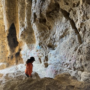
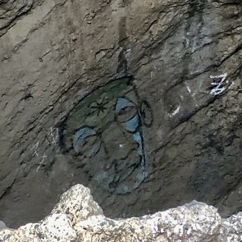
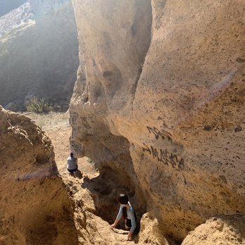
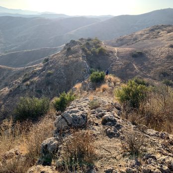
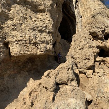
See the ad-hoc hiking trail map & legend photo I made for a rough idea of how easy/difficult the hike is along the way and for a rough visual of the path of entrance/exit to/from the cave. It's almost not possible to come back down the same way you climbed into the cave (way too steep) unless you're a good climber and have long enough legs. Fortunately there is a path out of the cave that goes around the mountain and down. 2 hours total trip for us with kids from parking the car on the streets to climbing into and out of the cave and back to the car. For this hike, It's essential to never wear shorts and crucial to wear shoes with good traction. 4.5 Star. Overall. Hidden gem. Scary hike up and down the cave if you're not equipped and ill prepared. Good workout and fun hike if you can handle some near-straight-up rock climbing experience. Great for adults & children who can handle heights, challenges, and adventure. Not so great for the faint of heart. You can't back out once you're up the cave. Doable hike for the average Joe with proper gears and determination. Takeaways: * First time here, and no one hiking ahead of us to ask questions, no hiking trail map/guide visible in and around the cave itself. Like everyone already said, the path towards the mountain/cave was fairly easy, but once you reach the bottom of the entrance to the cave - it becomes almost straight up, like vertical rock climbing ---- not recommended if you're not wearing the proper shoes without tread or grip -- you could get stuck up there and unable to get down. Many slippery pebbles, rocks, and loose dirt and gravel on the way down. Could really slide and fall with serious injuries. My daughter wore converse to go climbing (terrible choice) and her face streamed with tears the whole way up into the cave and out of the cave from the lack of grip her shoes had and the countless near slip and falls all along the way. But she toughed it out while climbing up the cave (it's even harder to come back down the way you entered, not even an option) and out the cave to the eventual path towards the right side of the cave. I exchanged one of my shoes with hers so she at least has one foot with good grip to climb down the mountain. LOTS of near slips. The proper shoes are essential! * There are what appears to be man-made holes to grip your way up the cave, however the distance of each grip or step may not be easy to find or for everyone to reach depending on your height. For amateurs or first-timers, Best to have people hiking with you to help each other out. * Wear a backpack on both shoulders to carry any essentials rather than a side bag or needing to hold on to a water bottle with a hand. You WILL need both hands available to climb up the cave for some stretches of the way. Keep your trash to yourself in your backpack please. Can't believe people actually took the effort to climb the cave and spray painted graffiti at numerous places. Someone really should get the graffiti removed. Not sure where to report. * Lots of thorns and thistles along the way up/down the path in dry seasons. You will get scratched up if you wear shorts and it's no fun. Even with long pants on, many of our hands were splintered while heading down the cave from parting aside the tall bushes. Some sections down the cave were a little steep too; my daughter's long jeans got ripped up from the rocks while sliding down steep sections she couldn't handle. * As bad as it sounds, it was an awesome hike and I'd do it again if I feel like a little challenge, now without the fear of not knowing the path out (and definitely not climbing back down the original way up). There seems to be more than one path out and the paths are not very visible. Just lots of climbing on rocks over rocks to higher grounds in hopes of finding a path down. * DO NOT follow the GPS to the north side of El Scorpion Park towards Bell Creek park onto Bell Cyn Rd - You'll reach a gated private community with a guard that will turn you around the way you came. Total waste of mileage. * Park at the southeast side at El Scorpion Canyon Park on the street of Sunset Ridge Ct / Vanowen St. The trail entrance (El Escorpion Trail) starts right there and will lead you to the Cave of Munits. * Beautiful views all along the trail, inside the cave, and from on top of the mountain after exiting the cave.
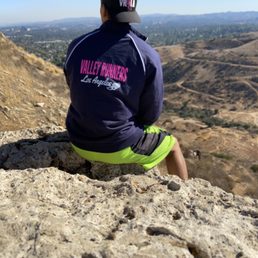

Oh boy, I thought the All Trails app was mistaking calling what's pretty much a 2 mile hike "hard" but depending on which way you take to get here this can be a challenging journey. When you come in from the El Scorpion trail entrance and just take the straight path to the cave and back it's not so bad. If you decided to climb out and to the top of the cave or go up Castle Peak when you first enter El Scorpion trail be prepaid for this hike to take you a while. Going up and back down either the top of the cave or Castle peak is pretty challenging because it's a steep climb, and there are lots of loose rocks that you can easily slip and fall on if you're not careful. The hike is a cool little adventure, my advise would be to bring some trek poles just incase to keep you balanced, or just take your time when coming back down. Inside, around, and even at the top of the cave you can get some really cool pictures. At the top of castle peak you'll get a nice view of the valley. Definitely a good local hike to check out at least once.


In November, a group of adventurers and I went to one posh place, the hidden gem of Los Angeles - the cave of munits (cave of the moons) A shaman from the Chumash Indian tribe lived in this cave. Various ceremonies and rituals were held here, and here this shaman was expected to die violently after he killed the son of the leader of the tribe. Until now, it is believed that this beautiful cave is a holy place for the Chumash tribe. The trail is absolutely free and takes only 20 minutes to walk from the parking lot to the cave. This is approximately 1.7 miles walk. The cave seems to be hidden in the rocks, so I recommend that you familiarize yourself with the map and the video on YouTube on how to find it. To get inside the cave, one had to climb a few meters up the rocks. It was not so hard, as the edges of the rocks had depressions that you could easily catch on. In the cave we made a small photo shoot and brewed hot black tea. There was silence inside, but then this strange silence was broken by pigeons, which, it turns out, nest there. Further, you can go upstairs and see the entire El Scorpio Valley, which we did. Further, after the cave, we climbed to the very top of Castle peak, where the city and the hills of this park were visible on the palms, and then we calmly went down to the parking lot and drove home satisfied. My rating is 10 out of 10


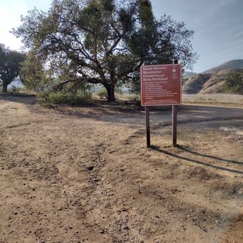
Wow wow wow!!! Seriously, what an experience. I love trying out new hiking places in LA and I enjoyed this one a lot. I don't have anything place to compare it to because there isn't one like it. It's not really a hike, but more like a walk that becomes a rock climb. It is so worth it. You enter the El Scorpion Park and when you see the Santa Monica Mountains sign turn right and keep going towards the mountain. This is trail is not kid-friendly and only for those who are mobile. I went by myself and thankfully I made it out without any injuries. Do be careful when your climbing in and out of the cave. Total distance about 1.75 and about 45 minutes.


It's a beautiful place to go with multiple trails The cave is peaceful and nice to sit and watch the sunset


Great hike and beautiful. I will definitely recommend to others to go here! I went with a group and it was a great hike. I really enjoyed it


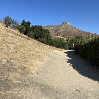
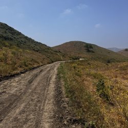
My boyfriend and I were looking for a hike in the LA area and we came across, Cave of Muntis. We did some quick researching and decided to check it out and we're so glad we decided to go - absolutely amazing experience! Location and Parking: The yelp directions will take you right to the entrance of the trail. When you're at the light waiting to make a left, keep going. You'll come across a little store plaza to the right, keep driving up and you'll notice the start to the residential neighborhood. You will see a sign that says "El Scorpion Canyon Park" and you can park anywhere in that area, for free. We came on a Sunday afternoon and found plenty of parking. Getting to Cave: Enter the trail and stick to the left all the way until you reach a sign that says "Santa Monica Mountains". When you reach this sign, go to the right and this trail will lead you to the cave. There was a bit of a wait to get inside because the route into the trail is a bit challenging. I would suggest wearing long sleeves/pants as it's easy to get scratched up with all the climbing this hike entails. We decided to explore and climb to the left of the cave and to our surprise we ended up on top of the cave. The hike itself to the cave is short but there is so much more you can do if you're looking for adventure! I would caution that this may not be the most kid friendly hike. Overall an amazing experience, we ran into some very friendly hikers and will definitely be coming back for round 2! If you're not looking to climb, there is also beautiful trails that don't require climbing for those that have kiddos/pets.


One of the gems of the Valley. After spending so much of our time indoors, sometimes its needed to be in touch with your body and center the soul. This particular trek was a great reset for the heart. The wonders and scale of the caves is a must for anyone who needs to getaway, to settle one's thoughts. Incredible greenery and the hills are picturesque. A beautiful place!


The Caves of Munits is a nice local hike located in the West Valley at El Scorpio State Park. It's a short 1.7 mile hike that fairly flat to begin with until you reach the steep climb up to the actual caves. Once you reach the caves, you have the option of climbing into the caves doing a little rock scrambling. If you're not adapt to rock climbing, I would probably pass on this part of the hike, but it is set up in a way where you shouldn't have any problems, especially if you have a strong upper body. Once in the caves, you can keep heading up and come out on the other side. At that point, you have the option to loop back down the hills, but use caution as it is a little rocky and steep. You if feel incline to do so, you can continue onto Castle Peak, but that decent from Castle Peak is no joke so if you're not adapt to hiking I would take a pass on that. If you do decide to take the loop, it'll take you back down to where you started your original ascend and then you'll head back the way you came. It's a nice quick hike in a residential neighborhood. If you want a longer loop, park at the end of Victory Blvd. and take the Victory Trailhead up to the caves and that will add about another 1.5 miles to the hike for a good workout.


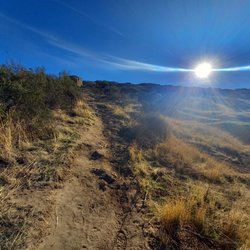
Definitely worth the climb the view is amazing...Bring plenty of water and a snack. Im scared of heights and im not a rock climber and i made it to the top. I seen 1 rattle snake caused me a heart attack but didnt attack my chocolatey skin thank god....Will return and take the trail backwards it loops around so you dont have to back trace your steps....Plenty of street parking come early if you want to catch the sun shine into the cave.


Parking is by the street which is plenty , it starts from the left , just walk on the left eventually you will see a board after a mile you will go to the right for the cave or continue straight . You will see a big cave opening , best is to go inside and from there you can continue to go up the mountain , you will feel to skip the cave opening and keep going right up the mountain but the path is better for getting down from outside

Brought my 6 year old with me. We're all for The rock climbing. The walk to the cave wasn't long at all. I would recommend if taking children to bring long sleeves & pants so they don't get rough scrapes. Very hands on so don't take too much stuff to carry. I have a Chrome cadet bag . I even took a leash & hooked it on to my cadet bag to help lower my son down on some spots. (I'm short) lol. Didn't go further than the first cave but I'm sure there is more.


Pretty great those caves are amazing. I just wish people wouldn't tag the mf rocks. Tag a building but leave earth alone.


7 months ago
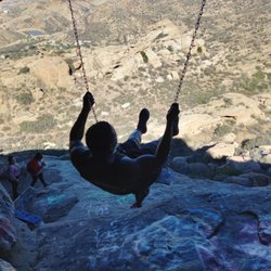
Beautiful hike. The hike is about 2 miles roundtrip. To get inside the cave, you have to rock climb using a rope. Wear shoes with a good grip. Parking is residential. There re no bathrooms. read more



Doesn't look like much when you see from afar. It is just like a rock formation. But it is a cave though. Climbing up is a challenge as well as coming down. Easy trail going to and from the cave from the main road. Watch out for loose soil though. Fun hike. read more


See the ad-hoc hiking trail map & legend photo I made for a rough idea of how easy/difficult the hike is along the way and for a rough visual of the path of entrance/exit to/from the cave. It's almost not possible to come back down the same way you climbed into the cave (way too steep) unless you're a good climber and have long enough legs. Fortunately there is a path out of the cave that goes around the mountain and down. 2 hours total trip for us with kids from parking the car on the streets to climbing into and out of the cave and back to the car. For this hike, It's essential to never wear shorts and crucial to wear shoes with good traction. 4.5 Star. Overall. Hidden gem. Scary hike up and down the cave if you're not equipped and ill prepared. Good workout and fun hike if you can handle some near-straight-up rock climbing experience. Great for adults & children who can handle heights, challenges, and adventure. Not so great for the faint of heart. You can't back out once you're up the cave. Doable hike for the average Joe with proper gears and determination. Takeaways: * First time here, and no one hiking ahead of us to ask questions, no hiking trail map/guide visible in and around the cave itself. Like everyone already said, the path towards the mountain/cave was fairly easy, but once you reach the bottom of the entrance to the cave - it becomes almost straight up, like vertical rock climbing ---- not recommended if you're not wearing the proper shoes without tread or grip -- you could get stuck up there and unable to get down. Many slippery pebbles, rocks, and loose dirt and gravel on the way down. Could really slide and fall with serious injuries. My daughter wore converse to go climbing (terrible choice) and her face streamed with tears the whole way up into the cave and out of the cave from the lack of grip her shoes had and the countless near slip and falls all along the way. But she toughed it out while climbing up the cave (it's even harder to come back down the way you entered, not even an option) and out the cave to the eventual path towards the right side of the cave. I exchanged one of my shoes with hers so she at least has one foot with good grip to climb down the mountain. LOTS of near slips. The proper shoes are essential! * There are what appears to be man-made holes to grip your way up the cave, however the distance of each grip or step may not be easy to find or for everyone to reach depending on your height. For amateurs or first-timers, Best to have people hiking with you to help each other out. * Wear a backpack on both shoulders to carry any essentials rather than a side bag or needing to hold on to a water bottle with a hand. You WILL need both hands available to climb up the cave for some stretches of the way. Keep your trash to yourself in your backpack please. Can't believe people actually took the effort to climb the cave and spray painted graffiti at numerous places. Someone really should get the graffiti removed. Not sure where to report. * Lots of thorns and thistles along the way up/down the path in dry seasons. You will get scratched up if you wear shorts and it's no fun. Even with long pants on, many of our hands were splintered while heading down the cave from parting aside the tall bushes. Some sections down the cave were a little steep too; my daughter's long jeans got ripped up from the rocks while sliding down steep sections she couldn't handle. * As bad as it sounds, it was an awesome hike and I'd do it again if I feel like a little challenge, now without the fear of not knowing the path out (and definitely not climbing back down the original way up). There seems to be more than one path out and the paths are not very visible. Just lots of climbing on rocks over rocks to higher grounds in hopes of finding a path down. * DO NOT follow the GPS to the north side of El Scorpion Park towards Bell Creek park onto Bell Cyn Rd - You'll reach a gated private community with a guard that will turn you around the way you came. Total waste of mileage. * Park at the southeast side at El Scorpion Canyon Park on the street of Sunset Ridge Ct / Vanowen St. The trail entrance (El Escorpion Trail) starts right there and will lead you to the Cave of Munits. * Beautiful views all along the trail, inside the cave, and from on top of the mountain after exiting the cave. read more

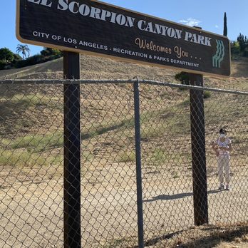
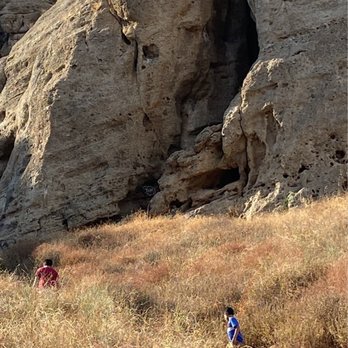


Oh boy, I thought the All Trails app was mistaking calling what's pretty much a 2 mile hike "hard" but depending on which way you take to get here this can be a challenging journey. When you come in from the El Scorpion trail entrance and just take the straight path to the cave and back it's not so bad. If you decided to climb out and to the top of the cave or go up Castle Peak when you first enter El Scorpion trail be prepaid for this hike to take you a while. Going up and back down either the top of the cave or Castle peak is pretty challenging because it's a steep climb, and there are lots of loose rocks that you can easily slip and fall on if you're not careful. The hike is a cool little adventure, my advise would be to bring some trek poles just incase to keep you balanced, or just take your time when coming back down. Inside, around, and even at the top of the cave you can get some really cool pictures. At the top of castle peak you'll get a nice view of the valley. Definitely a good local hike to check out at least once. read more
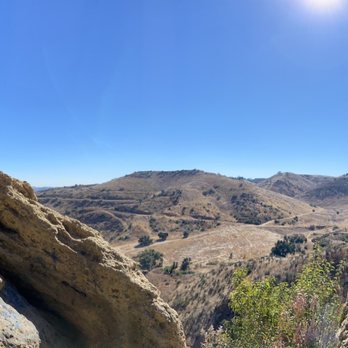


1 year ago

4 years ago
In November, a group of adventurers and I went to one posh place, the hidden gem of Los Angeles - the cave of munits (cave of the moons) A shaman from the Chumash Indian tribe lived in this cave. Various ceremonies and rituals were held here, and here this shaman was expected to die violently after he killed the son of the leader of the tribe. Until now, it is believed that this beautiful cave is a holy place for the Chumash tribe. The trail is absolutely free and takes only 20 minutes to walk from the parking lot to the cave. This is approximately 1.7 miles walk. The cave seems to be hidden in the rocks, so I recommend that you familiarize yourself with the map and the video on YouTube on how to find it. To get inside the cave, one had to climb a few meters up the rocks. It was not so hard, as the edges of the rocks had depressions that you could easily catch on. In the cave we made a small photo shoot and brewed hot black tea. There was silence inside, but then this strange silence was broken by pigeons, which, it turns out, nest there. Further, you can go upstairs and see the entire El Scorpio Valley, which we did. Further, after the cave, we climbed to the very top of Castle peak, where the city and the hills of this park were visible on the palms, and then we calmly went down to the parking lot and drove home satisfied. My rating is 10 out of 10 read more


Wow wow wow!!! Seriously, what an experience. I love trying out new hiking places in LA and I enjoyed this one a lot. I don't have anything place to compare it to because there isn't one like it. It's not really a hike, but more like a walk that becomes a rock climb. It is so worth it. You enter the El Scorpion Park and when you see the Santa Monica Mountains sign turn right and keep going towards the mountain. This is trail is not kid-friendly and only for those who are mobile. I went by myself and thankfully I made it out without any injuries. Do be careful when your climbing in and out of the cave. Total distance about 1.75 and about 45 minutes. read more


4 years ago
It's a beautiful place to go with multiple trails The cave is peaceful and nice to sit and watch the sunset read more


2 years ago
Great hike and beautiful. I will definitely recommend to others to go here! I went with a group and it was a great hike. I really enjoyed it read more


4 years ago
My boyfriend and I were looking for a hike in the LA area and we came across, Cave of Muntis. We did some quick researching and decided to check it out and we're so glad we decided to go - absolutely amazing experience! Location and Parking: The yelp directions will take you right to the entrance of the trail. When you're at the light waiting to make a left, keep going. You'll come across a little store plaza to the right, keep driving up and you'll notice the start to the residential neighborhood. You will see a sign that says "El Scorpion Canyon Park" and you can park anywhere in that area, for free. We came on a Sunday afternoon and found plenty of parking. Getting to Cave: Enter the trail and stick to the left all the way until you reach a sign that says "Santa Monica Mountains". When you reach this sign, go to the right and this trail will lead you to the cave. There was a bit of a wait to get inside because the route into the trail is a bit challenging. I would suggest wearing long sleeves/pants as it's easy to get scratched up with all the climbing this hike entails. We decided to explore and climb to the left of the cave and to our surprise we ended up on top of the cave. The hike itself to the cave is short but there is so much more you can do if you're looking for adventure! I would caution that this may not be the most kid friendly hike. Overall an amazing experience, we ran into some very friendly hikers and will definitely be coming back for round 2! If you're not looking to climb, there is also beautiful trails that don't require climbing for those that have kiddos/pets. read more


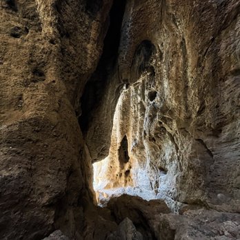


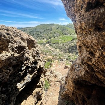


One of the gems of the Valley. After spending so much of our time indoors, sometimes its needed to be in touch with your body and center the soul. This particular trek was a great reset for the heart. The wonders and scale of the caves is a must for anyone who needs to getaway, to settle one's thoughts. Incredible greenery and the hills are picturesque. A beautiful place! read more


3 years ago
The Caves of Munits is a nice local hike located in the West Valley at El Scorpio State Park. It's a short 1.7 mile hike that fairly flat to begin with until you reach the steep climb up to the actual caves. Once you reach the caves, you have the option of climbing into the caves doing a little rock scrambling. If you're not adapt to rock climbing, I would probably pass on this part of the hike, but it is set up in a way where you shouldn't have any problems, especially if you have a strong upper body. Once in the caves, you can keep heading up and come out on the other side. At that point, you have the option to loop back down the hills, but use caution as it is a little rocky and steep. You if feel incline to do so, you can continue onto Castle Peak, but that decent from Castle Peak is no joke so if you're not adapt to hiking I would take a pass on that. If you do decide to take the loop, it'll take you back down to where you started your original ascend and then you'll head back the way you came. It's a nice quick hike in a residential neighborhood. If you want a longer loop, park at the end of Victory Blvd. and take the Victory Trailhead up to the caves and that will add about another 1.5 miles to the hike for a good workout. read more


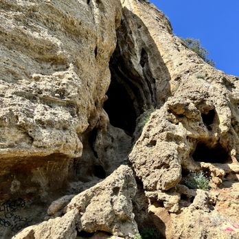


Definitely worth the climb the view is amazing...Bring plenty of water and a snack. Im scared of heights and im not a rock climber and i made it to the top. I seen 1 rattle snake caused me a heart attack but didnt attack my chocolatey skin thank god....Will return and take the trail backwards it loops around so you dont have to back trace your steps....Plenty of street parking come early if you want to catch the sun shine into the cave. read more



4 years ago

6 years ago
Parking is by the street which is plenty , it starts from the left , just walk on the left eventually you will see a board after a mile you will go to the right for the cave or continue straight . You will see a big cave opening , best is to go inside and from there you can continue to go up the mountain , you will feel to skip the cave opening and keep going right up the mountain but the path is better for getting down from outside read more



5 years ago
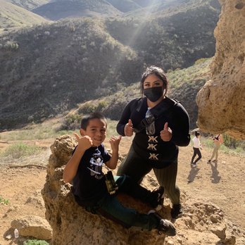
Brought my 6 year old with me. We're all for The rock climbing. The walk to the cave wasn't long at all. I would recommend if taking children to bring long sleeves & pants so they don't get rough scrapes. Very hands on so don't take too much stuff to carry. I have a Chrome cadet bag . I even took a leash & hooked it on to my cadet bag to help lower my son down on some spots. (I'm short) lol. Didn't go further than the first cave but I'm sure there is more. read more



5 years ago
Pretty great those caves are amazing. I just wish people wouldn't tag the mf rocks. Tag a building but leave earth alone. read more


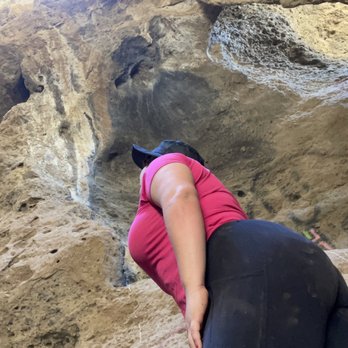
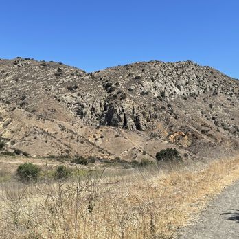
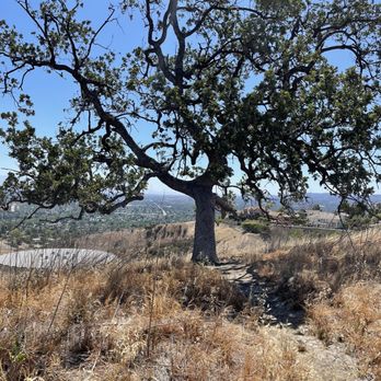

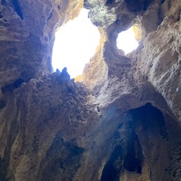
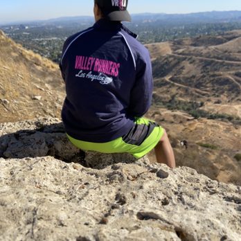
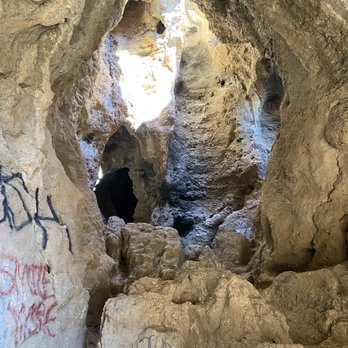
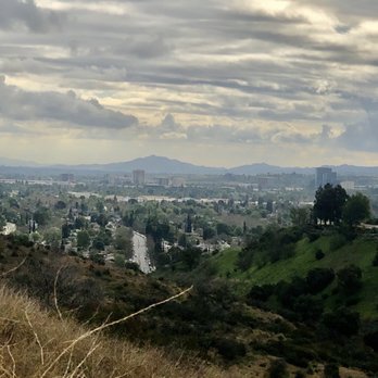
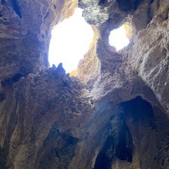
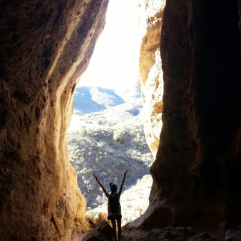
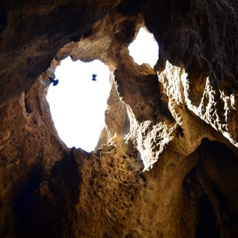
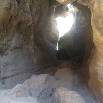
A short and sweet hike that may or may not satisfy your sense of adventure. Simply park on the street and start walking. The entire loop is less than 2.5 miles and it offers a somewhat challenging climb to the cave, followed by some spectacular view of the San Fernando valley in all its glory. No need for ropes or gloves either. Just a good pair of shoes and long pants are highly recommended. You will be climbing and scraping your knees as you approach the entrance. Whats cool about the cave: The cave interior is frickin' awesome! So many holes in the ceiling create the formations of natural sky light. The whole thing is like something out of a sci-fi or pirate movie (probably depends on your imagination & mood). The light also helps when you're moving forward with your exploration. Whats not so cool about the cave: Clearly these caves have been visited thousands of times and sadly not by the most responsible individuals. When climbing you will encounter many shards of broken glass and garbage. C'mon people! FYI: If you're going soon, know that there was an active bee hive near by at the top of the cave as you exit it. I didn't mess with them when they were close...no one was stung in our group. So if you go, try not to slip and cut yourself...or swat at a bee and piss it off. It'll ruin the fun. Sure Id go back. Its one more free thing to do in LA! read more


Why doesn't this place get more reviews?! How sad! Anyways, parking was easy. You have to go through the gates and walk the trail until you see the sign then turn right to get to the cave! It took about 30 minutes or less. Haha I'm glad I got to explore this cave. It is very rocky so be careful. Make sure to wear those shoes with grips. Hiking shoes preferrably. I had a hard time climbing because I was afraid of heights but that's not going to stop me from doing what I love! It is worth it at the end. Just believe in yourself! There's such an amazing view you won't want to miss. My friends and I spent like 2 hours taking pictures and enjoying the view. Eeeep just a side note. Make sure to pack light. You really don't need a whole lot of stuff. I kind of over packed and it's not a really good thing to carry a huge backpack! Also, we went off trail and tried to explore the mountain more. So we climbed the mountain to see where it lead us. We were trying to get to Castle Peak from Cave of Munits but we weren't sure if that's the correct way to go about it. After struggling to get to the top of the mountain, we decided to go back down. It was too dangerous and risky to keep going. I kept on sliding because going down is the challenging part. Just be extra careful. Don't get hurt! P.S. There are bats here?! read more


Got lost here, remember to make a left at the light! Parking is easy peasy, along the side of the road. It takes less than a mile to get to the cave. Lovely cave with a lovely view. Be careful of all the pigeons and the pigeon poop while you're climbing on the rocks! For all you adventurous people: Climb out of the cave, but don't stop there. Continue to climb over the mountain and over several mountains. There is Castle Peak (the first mountain you see where you parked your car)! It's a scary hike for people afraid of heights, but a great experience. Makes this trail harder and more fun. Off trail is always fun! read more


8 years ago
So good we went two weekends in a row! Can't wait to go in the spring when the fields surrounding are green. What a special place. The cave was easy to get to. Harder was once inside climbing up to the outside "roof" of the cave but I did it! Lots of families and kids. Just a delightful hike! read more


5 years ago
Short hike and beautiful view. Great spot for couples, family and friends. Recommend! You can just park in the neighborhood and I love the neighborhood there read more



8 years ago
This was totally worth the extra half hour it took to find this place. First I used navigation. Wrong. It took me down this road which led to a gated community, which the guard gave me directions to go back to Valley Circle and Victory. Ended up at another different park. Wrong, again. So I read some reviews and tried to get to El Scorpion Park (which is on Vanowen and Valley Circle). You can park on the street near the plaza with the music store and walk from there. You're gunna walk down the path until you'll see a sign that reads "Santa Monica...". Go right down the path from there. The cave is big and beautiful and a little daunting to climb up, but there's an easier way down if you go up to the top. Pigeons flying sounded pretty cool and echoey in the cave itself. Definitely coming here again! read more
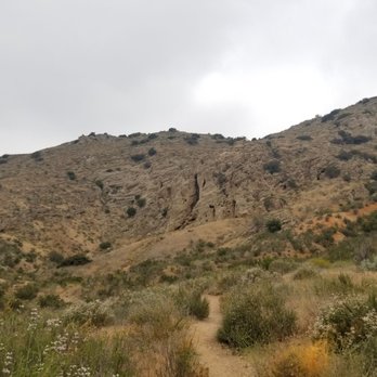


Awesome short hike, with a rough climb through the cave. If you head west on Vanowen, then it will eventually curve north into a residential street. Immediately after it curves the entrance to the El Escorpion Park is on the left. Go through there. Go on the trail and keep left. After a bit you'll see posts, like you see in a parking lot. Make a right there at the fork. The trail gets more narrow, but just follow it until you see the entrance. The trail there starts to rise in elevation. Climbing through the cave requires good shoes and dexterity. NOT for young kids. Keep climbing and eventually you'll come out making a clockwise type circle. read more


9 years ago
Looking for more than just a casual hike, and want a serious adventure while still staying close to home? Then this is the place to be. In addition to the number of regular trails sprawled throughout the park, the true gem is the cavern hidden within the mountains. This journey is not for the mild hearted. You will be faced with steep inclines, towering climbs (though no equipment is required), jagged rocks, slippery declines with shifting dirt and rocks, and many dangerous trenches and holes. Caution is certainly required, so watch your step! Once in the cave, you have three options: You can exit the way you came, or you can continue through the cave out of the top and take one of two routes. Supposedly there is a trail that leads right back down to the cave entrance, or you can do what we did and continue the climb up on a rigorous "trail" that leads to the top of the mountain and back down. I say "trail" because it is mildly blazed and you can easily lose track of the right direction. That is where the real challenge and tough terrain comes in to play. If you are short on time, have pets or kids, or are not prepared or dressed for a challenge, I don't recommend the third option. Additional warnings: Be sure to go early in the day so that you have enough sunlight for the entire 2-3 mile hike. You will need to know where you're stepping to avoid any unfortunate accidents. Large maps of the area can be found at the start of the trail, but afterwards navigation is mostly up to you, with few trail markers. Parking: Parking at Victory Trailhead costs $3 per car, but free street parking can be found right outside the entry gate. read more


7 years ago


4 years ago

6 years ago
Fun little hike to the Cave. If you make through the cave you can take a more strenuous hike the the summit of Castle Ridge. Nice trails if you are into Mountain Biking as well. Some graffiti in the cave though. Not a big deal. Overall lots of fun read more


9 years ago
Went hiking here a few times already and it is seriously an awesome hidden gem in the valley. The fact that it is located so close to the valley (just down Vanowen!) and that the views inside of the cave are so unique make this place a real treat. I've never had trouble finding street parking in the neighborhood, so that's nice. You can enter the trail through a gate and just follow the trail until you see some signs and make a right to approach the cave. It is also a very short hike, so if you don't have a lot of time or are not in the greatest physical shape it's still doable. I would recommend having good shoes with some good grip to make the hike a little more manageable. You can get up in free runs but it would definitely be easier with hiking shoes. Also if you're afraid of heights or climbing some rocks it might be a little scary, but as long as you set your hands and feet it's not too bad! The view is worth it!! read more



9 years ago
A great little hike to this magical cave;However to gain entrance is a challenge. Please do not bring pets and children on this hike. Also, be prepared by wearing pants to protect your knees and gloves for your hands. In addition, you will definite need upper body strength. Please do not destroy this by setting fires and leaving trash. It was pretty clean when I made my visit, but I read reviews of trash and other items left behind.. Thanks and enjoy nature read more


10 years ago
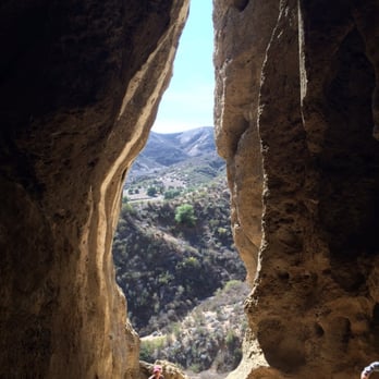
The trail leading to the Cave of Munits is an easy-moderate hike on the all sandy, rocky, and non-shady path... approximately three miles. *NO restroom, water fountain, or trash bin. *Recommend good tread shoes; flashlight, climbing gloves, water. The Cave is a magnificent sight from afar and even more so when you're standing at the base looking up! Enjoy the view from here, or... ...Walk up the steep terrain... The cathedral-like cavern is eerily cool, with scattered sunlight peeping through the crevices. The interior walls extend further into seemingly endlessness. Once up and through the chimney-like cavern, you can view the vast grassland and the city of Angels from the distance. Breathtaking image... "Life's a climb, but the view is great..." read more


7 years ago
This hike deserves 5 stars for its short distance and beautiful cave. Meaning for those who aren't really the hiking type it's really not a challenge to get there. The most difficult part is the climb to the entrance of the cave. Once inside, enjoy the beauty of the cave that Mother Nature has to offer. read more
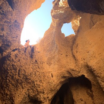


The Cave of Munits, also referred to as Shaman's Cave and the Bat Cave, is a fun and easy to access vertical cave located in Upper Las Virgenes Canyon Open Space Preserve in El Escorpion Park. It is considered a "chimney cave" since it has an opening on its ceiling that allows you to a see the sky. For 10,000 years Chumash and Tongva Indians inhabited the surrounding lands and they told stories that involved the Cave. According to one of the stories, the Cave was once home to a very powerful Shaman named Munit. Shamans would enter into a trance or an altered state of consciousness in order to communicate with spirits to foresee future events or to diagnose and treat an illness. As the legend goes, Shaman Munit was killed by the talons of an eagle after he murdered the son of a politically important chief. The cave is supposedly haunted with his spirit. The Cave of Munits is located within El Escorpion Park in the Upper Las Virgines Canyon Open Space Preserve. The hike to the cave is 2.1 mile loop. After you hike for almost a mile you'll come across a fence. Pass through the fence and take the right fork, and head towards rocky mountain on the north side of the canyon. You should eventually be able to see the opening of the cave. To get to El Escorpion Park from L.A. head North/West on the 101 and take exit 29 for Valley Circle Blvd. Go north on Valley Circle Blvd until you reach Vanowen St. Take a left on Vanowen and you will see a trail on your left. You can park on the street for free. read more



4 years ago
Page 1 of 3
More info about Cave of Munits
24501 W Vanowen St
West Hills, CA 91307
Directions
Hours
Outdoor Amenities
Ask the Community - Cave of Munits
Is this trail open?
Yes it is open. I have just been there yesterday (10/18/2021)
Is this stroller friendly?
It is, until you take the path to the Cave. Maybe 1/4 mile hike to the cave is not stroller accessible. Small kids will not be able to access the cave based on the complexity of climbing into the cave. There is a smaller type cave on other side of…
Is this hike kid friendly?
The actual hike is but heading into to front part of the cave can be difficult for a small child. I would recommend the child to be at least 9yrs of age. Going into the cave will prove difficult for them. Most adults I saw there were unable to climb…
Are dogs allowed?
Yes but not very dog friendly, lots of vertical climbs up the cave and I saw a snake in the cave when I last went so I took my dog out of the cave immediately.
Review Highlights - Cave of Munits
You might also consider














Why does Yelp recommend reviews?
4 reviews that are not currently recommended
The reviews below are not factored into the business's overall star rating.

11 years ago

10 years ago

3 years ago

7 years ago
Cave of Munits - hiking - Updated August 2026
Best of West Hills
People found Cave of Munits by searching for…
Things to Do in West Hills, CA
Hiking Trails in West Hills, CA
Places to Take Pictures in West Hills, CA
Beautiful Views in West Hills, CA
Secret Spots in West Hills, CA
Scenic Spots in West Hills, CA
Walking Trails in West Hills, CA
Scenic Drive in West Hills, CA
Flower Field in West Hills, CA
Rock Climbing in West Hills, CA
Hiking Groups in West Hills, CA
Off Road Trails in West Hills, CA
Waterfall Hike in West Hills, CA
Hiking Trails Kid Friendly in West Hills, CA
Natural Hot Springs in West Hills, CA
Running Trails in West Hills, CA
Browse Nearby
BEST of West Hills, California Restaurants near Cave of Munits
BEST of West Hills, California Coffee near Cave of Munits
BEST of West Hills, California Things to Do near Cave of Munits
BEST of West Hills, California Parks near Cave of Munits
BEST of West Hills, California Campgrounds near Cave of Munits
BEST of West Hills, California Breakfast near Cave of Munits


