Calabasas Hidden Stairs Photos


You might also consider


More like Calabasas Hidden Stairs
Recommended Reviews - Calabasas Hidden Stairs
Start your review...


Reviews With Photos


This is certainly a must for folks who are outdoor fitness enthusiasts! My Camarillo resident high school BFF found this place and it was a highlight of my SoCal visit to see her. We only went up and down once, but there were others using the stairs for training purposes. Maybe had the weather been a tad cooler, we would have dared a 2nd trip. Slightly off the freeway, past car dealerships, park and hike in. Parking appeared limited. Bring water!


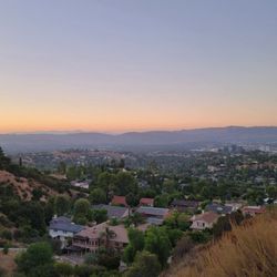
The Calabasas Hidden Stairs is such a great hike if you want something scenic but still a solid workout. The stairs definitely get your heart rate up, and the views at the top are completely worth it--rolling green hills, open sky, and that calm Calabasas energy. One important tip: Google Maps and Apple Maps won't take you directly there. If it's your first time, definitely look it up on YouTube--the video directions make it much easier to find. Perfect for a morning workout, a quick fitness challenge, or a peaceful hike with views. Short, effective, and truly a hidden gem.


The name may imply that these stairs are hidden and hard to find: but if you ask any local they know these stairs! Not hidden at all and well traveled! The trailhead is off Calabasas parkway just past the Audi dealership. There is some street parking. Just be careful to read signs and obviously don't park in the red zone. Also hide valuables! It's a short walk to the stairs! During the summer the ground is super hard which is good for footing but in winter you could experience loose soil or mud to the stairs. When there is loose dirt, you may see a rope to help you down and help- how thoughtful! As mentioned the stairs are well used. Best to go early morning in summer before sun is out and still foggy to stay cool. You will find you are not alone in this adventure of climbing 375 steps! The test is how many times you can do it in a row! During our adventure we saw deer. The deer was busy munching. Fellow walkers said they have seen cats, so be on the lookout for wildlife! Happy climbing!


If you're looking for a 30 minute workout on the stairs, this is the place to go, especially if you're a local. Parking is on the side street. I would recommend going early so you find space to park your car. My calves were so sore the next day. It had beautiful views and a little short trail. Bring a friend or go alone. It is a definite must see!
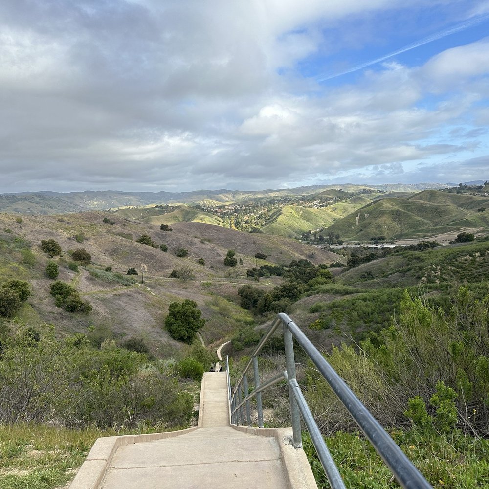

375 steps of the Hidden Stairs is a great workout with a nice scenic view at the top as your reward. Showoffs went up and down multiple times. Me and my #1 lady did not! One thing apparent were the beautiful people on the trail being so friendly. Forget the apps or the dating scene. The Calabasas Stairs is the place to meet people! You walk a 0.6 mile trail before getting to the Stairs. The trail is uneven and narrow in some sections. You'll see rabbits and gophers and occasional deer. To get to the Stairs, drive on Calabasas Avenue and go past the car dealerships. When the road curves right, go straight and drive until the road ends. Park on the street. Most likely, you'll see other cars parked. Our GPS took us to the top of the hill. If your GPS does that, don't believe it!


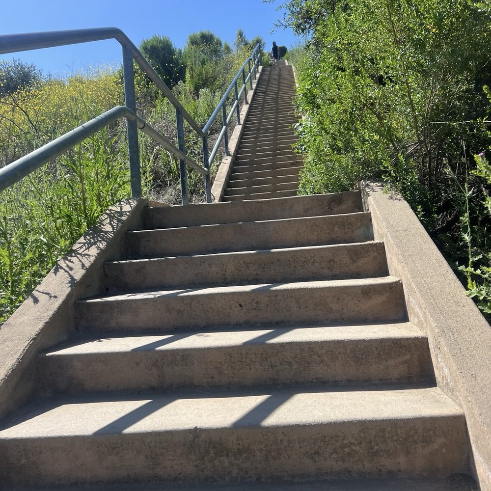
Spent the New Year's Day hiking here. One star off for the confusing pathway leading to the bottom of the stairs. Stay on the left trail going down that will lead you to the paved pathway to the bottom of the stairs. The hike going to the stairs was also narrow, barely room for 2-way foot traffic. The steps on the stairs were not steep so it was very doable and every 50 or so steps there are break spots. Parking is on the side of the road, just make sure you read the signs and avoid parking on the red area.


such a great way to start your day! The views are beautiful and it's a nice way to move your body and sweat. Parking can be a pain


I enjoy these steps about three or four times a week. I have made it to six rounds and goal is to do ten. Good leg work out.


The trail to the stairs can be slippery. Wear shoes that have good grip for this. I wore running shoes, but was very slow going down hill. Be cautious of wild life!


Yelp Duchess of this place as of 11/4/2020! HA! For a great, quick outdoor workout, get it done at the Calabasas Hidden Stairs. Occasional scent of urine along the path, but that doesn't stop me from getting my workout in. Daylight savings time is killing my outdoor workouts -UGH! It's pitch black out here past 5PM, so bring a headlamp or flashlight. There are 376 steps one-way, so if there is enough sunlight, I try to get in 5X each way. Dirt trail to the stairs is easy peasy -wear good athletic shoes. When you start hiking from the trailhead, follow the path that turns right. Free parking near the trailhead. No critters or rattlesnakes, the times I've been ...doesn't mean they aren't there. Always be safe and on alert. Stay safe and healthy (mind, body and soul) out there :) Lastly, LEAVE NO TRACE -take your trash, basura with you cochinos!


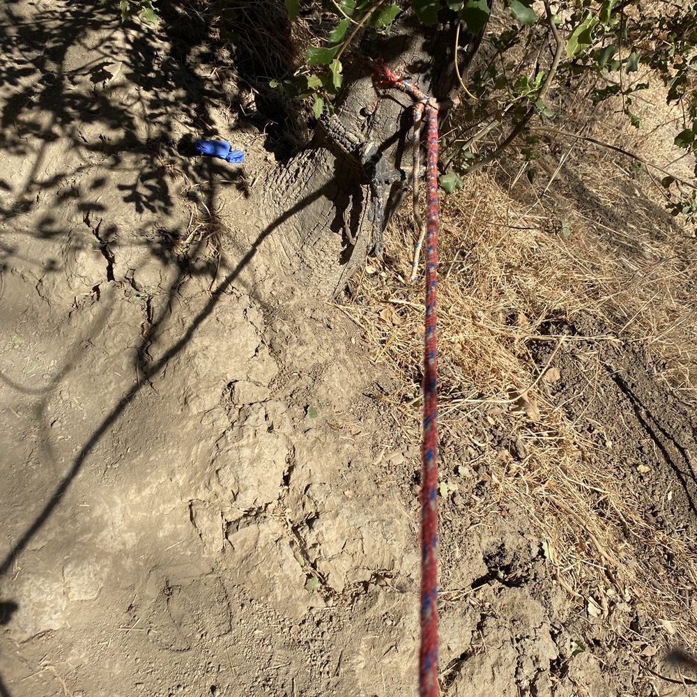
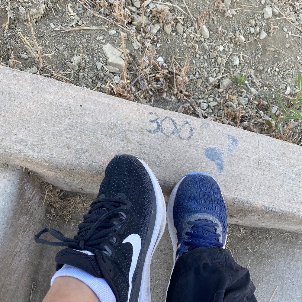
We absolutely loved this hike/stairs combo trail! Visited back in late September as part of the #localadventurechallenge and it was so fun! It's easy to find, right off the highway and the gps apps recognize it if you just plug the name in. Also, the entrance is just off the street on the right and there's plenty of street parking (free). The trail entrance is paved and obvious. There's a small chain across it but it's open - it's just to keep cars out. Follow the paved path off to the left and it's just over a 1/2 mile hike to get to the stairs, some paved, some not. There's a very steep hill and a small creek you have to cross right at tue bottom of the stairs to get to them - it's pretty darn steep and dusty so be sure to wear shoes with some good traction. There's also a rope tied to the tree to help you up and down if you need it - I had my regular tennis shoes on and definitely had to use the rope on the way back up lol! There are a total of 376 stairs with platforms in between in case you need to rest. Someone was nice enough to mark the numbers occasionally along the climb so that's co! There's also some really gorgeous views from the top. It's good fun!


5 months ago
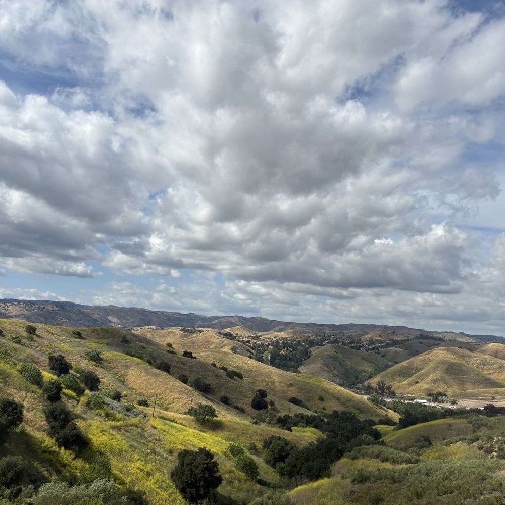
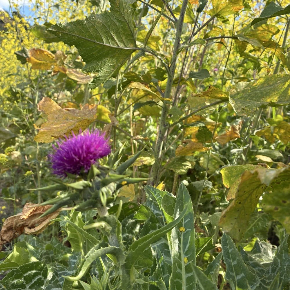
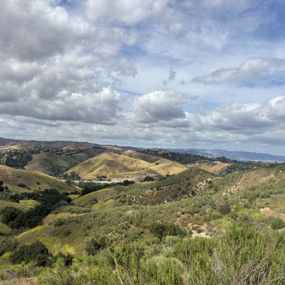
Hey everyone it's the light skin dragon coming to you live and directly from today's adventures! I was feeling depressed about not seeing or speaking to my daughter, my cars engine is broken and will cost me 5000, and not being able to go to class this week because of my situation! I told myself I will take the bus and come to see Mother Nature. While I was on my fast in January I booked marked these stair here so god spoke to me today and so I went. I needed to see the green, get fresh air and just get back into my own zone because of the funk I've been in. Being here help me think of good times I've been to stairs, or on a trails I've been on. People I've gone on hikes with or even loved ones for their first time. The views got me out of my own mind and really gave me clarity of where I should be and where I'm heading. God reveals all and have me see things which I appreciate the good and the bad. And it really shows me I need to be where I need to be. I am willing to take more adventures soon with the bus and just humbling myself as a post I posted on social media about me remaining with an open heart to see what life has to offer now. Light skin dragon blasting off looking for another place to calm my nerves, and remain at peace which this area honestly brought and it was hard to find taking the bus and walking haha read more






5 months ago

6 months ago
On February 15, 2026, the forecast called for outdoor adventure weather in the Valley, so we decided to hike to the CALABASAS HIDDEN STAIRS. At 10am, the landscape was vibrant green, the air was crisp, and the blue sky was scattered with cloud coverage to provide us with shade during the trek. The dirt trail was dry, not muddy. In some areas the width of the trail could only accommodate a single file lane, but it was still very pleasant hike to the hidden staircase. There are 9 flights of stairs, which comprise of 377 steps to the fence. Many people would climb the stairs multiple times! The round trip is about 1.3 miles, which took us about 45 minutes. Could be longer if you climb the stairs more than once, or connect to another trail such as the Bark Park trail. We did see a handful of dogs and their owners. This neighborhood trail can easily be a regular workout, especially in the Fall through Spring. I imagine it would be scorching hot in the summer. Stay observant...could be snakes and mountain lions in the area! Parking is available along the curb on Calabasas Rd. read more
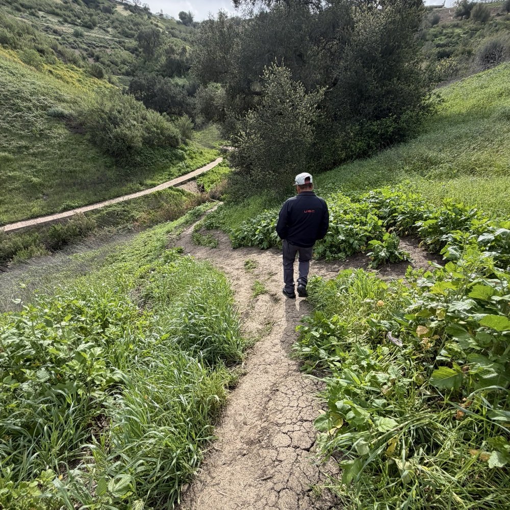


This is certainly a must for folks who are outdoor fitness enthusiasts! My Camarillo resident high school BFF found this place and it was a highlight of my SoCal visit to see her. We only went up and down once, but there were others using the stairs for training purposes. Maybe had the weather been a tad cooler, we would have dared a 2nd trip. Slightly off the freeway, past car dealerships, park and hike in. Parking appeared limited. Bring water! read more


6 months ago
The Calabasas Hidden Stairs is such a great hike if you want something scenic but still a solid workout. The stairs definitely get your heart rate up, and the views at the top are completely worth it--rolling green hills, open sky, and that calm Calabasas energy. One important tip: Google Maps and Apple Maps won't take you directly there. If it's your first time, definitely look it up on YouTube--the video directions make it much easier to find. Perfect for a morning workout, a quick fitness challenge, or a peaceful hike with views. Short, effective, and truly a hidden gem. read more


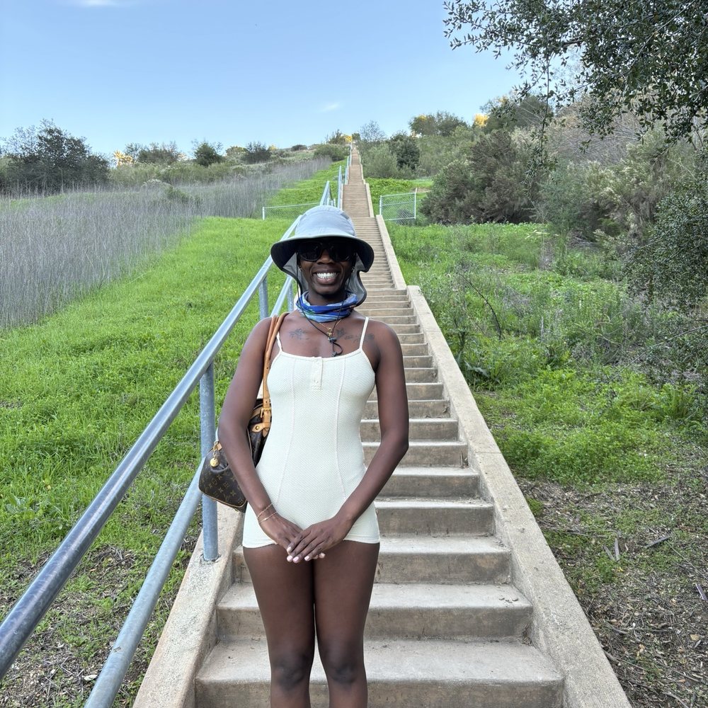


The name may imply that these stairs are hidden and hard to find: but if you ask any local they know these stairs! Not hidden at all and well traveled! The trailhead is off Calabasas parkway just past the Audi dealership. There is some street parking. Just be careful to read signs and obviously don't park in the red zone. Also hide valuables! It's a short walk to the stairs! During the summer the ground is super hard which is good for footing but in winter you could experience loose soil or mud to the stairs. When there is loose dirt, you may see a rope to help you down and help- how thoughtful! As mentioned the stairs are well used. Best to go early morning in summer before sun is out and still foggy to stay cool. You will find you are not alone in this adventure of climbing 375 steps! The test is how many times you can do it in a row! During our adventure we saw deer. The deer was busy munching. Fellow walkers said they have seen cats, so be on the lookout for wildlife! Happy climbing! read more


1 year ago
If you're looking for a 30 minute workout on the stairs, this is the place to go, especially if you're a local. Parking is on the side street. I would recommend going early so you find space to park your car. My calves were so sore the next day. It had beautiful views and a little short trail. Bring a friend or go alone. It is a definite must see! read more

5 months ago

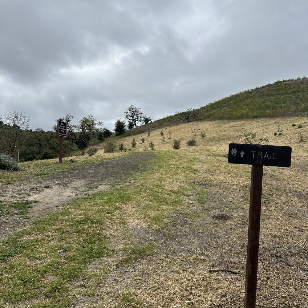
375 steps of the Hidden Stairs is a great workout with a nice scenic view at the top as your reward. Showoffs went up and down multiple times. Me and my #1 lady did not! One thing apparent were the beautiful people on the trail being so friendly. Forget the apps or the dating scene. The Calabasas Stairs is the place to meet people! You walk a 0.6 mile trail before getting to the Stairs. The trail is uneven and narrow in some sections. You'll see rabbits and gophers and occasional deer. To get to the Stairs, drive on Calabasas Avenue and go past the car dealerships. When the road curves right, go straight and drive until the road ends. Park on the street. Most likely, you'll see other cars parked. Our GPS took us to the top of the hill. If your GPS does that, don't believe it! read more


3 years ago
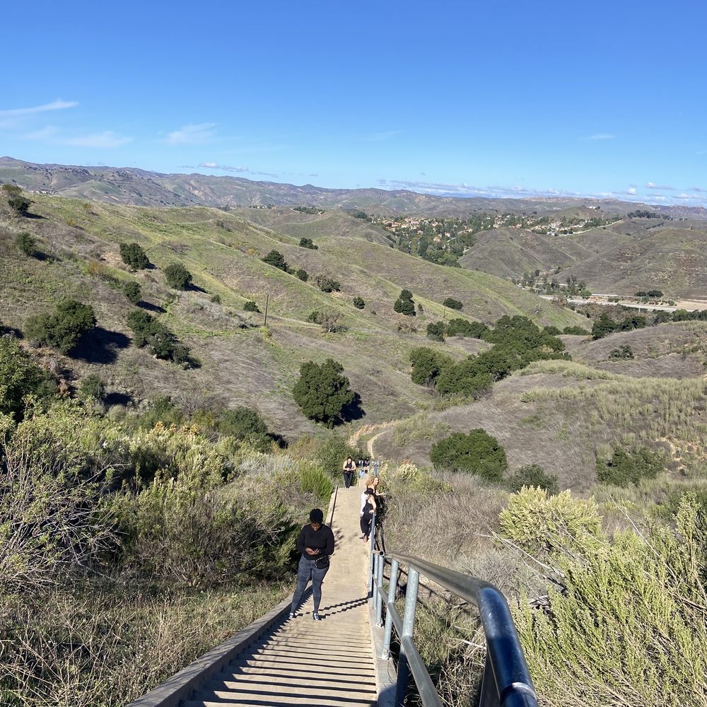
Spent the New Year's Day hiking here. One star off for the confusing pathway leading to the bottom of the stairs. Stay on the left trail going down that will lead you to the paved pathway to the bottom of the stairs. The hike going to the stairs was also narrow, barely room for 2-way foot traffic. The steps on the stairs were not steep so it was very doable and every 50 or so steps there are break spots. Parking is on the side of the road, just make sure you read the signs and avoid parking on the red area. read more



10 months ago

11 months ago



1 year ago

2 years ago
I enjoy these steps about three or four times a week. I have made it to six rounds and goal is to do ten. Good leg work out. read more

2 years ago
The trail to the stairs can be slippery. Wear shoes that have good grip for this. I wore running shoes, but was very slow going down hill. Be cautious of wild life! read more

2 years ago

Yelp Duchess of this place as of 11/4/2020! HA! For a great, quick outdoor workout, get it done at the Calabasas Hidden Stairs. Occasional scent of urine along the path, but that doesn't stop me from getting my workout in. Daylight savings time is killing my outdoor workouts -UGH! It's pitch black out here past 5PM, so bring a headlamp or flashlight. There are 376 steps one-way, so if there is enough sunlight, I try to get in 5X each way. Dirt trail to the stairs is easy peasy -wear good athletic shoes. When you start hiking from the trailhead, follow the path that turns right. Free parking near the trailhead. No critters or rattlesnakes, the times I've been ...doesn't mean they aren't there. Always be safe and on alert. Stay safe and healthy (mind, body and soul) out there :) Lastly, LEAVE NO TRACE -take your trash, basura with you cochinos! read more


6 years ago

We absolutely loved this hike/stairs combo trail! Visited back in late September as part of the #localadventurechallenge and it was so fun! It's easy to find, right off the highway and the gps apps recognize it if you just plug the name in. Also, the entrance is just off the street on the right and there's plenty of street parking (free). The trail entrance is paved and obvious. There's a small chain across it but it's open - it's just to keep cars out. Follow the paved path off to the left and it's just over a 1/2 mile hike to get to the stairs, some paved, some not. There's a very steep hill and a small creek you have to cross right at tue bottom of the stairs to get to them - it's pretty darn steep and dusty so be sure to wear shoes with some good traction. There's also a rope tied to the tree to help you up and down if you need it - I had my regular tennis shoes on and definitely had to use the rope on the way back up lol! There are a total of 376 stairs with platforms in between in case you need to rest. Someone was nice enough to mark the numbers occasionally along the climb so that's co! There's also some really gorgeous views from the top. It's good fun! read more






4 years ago
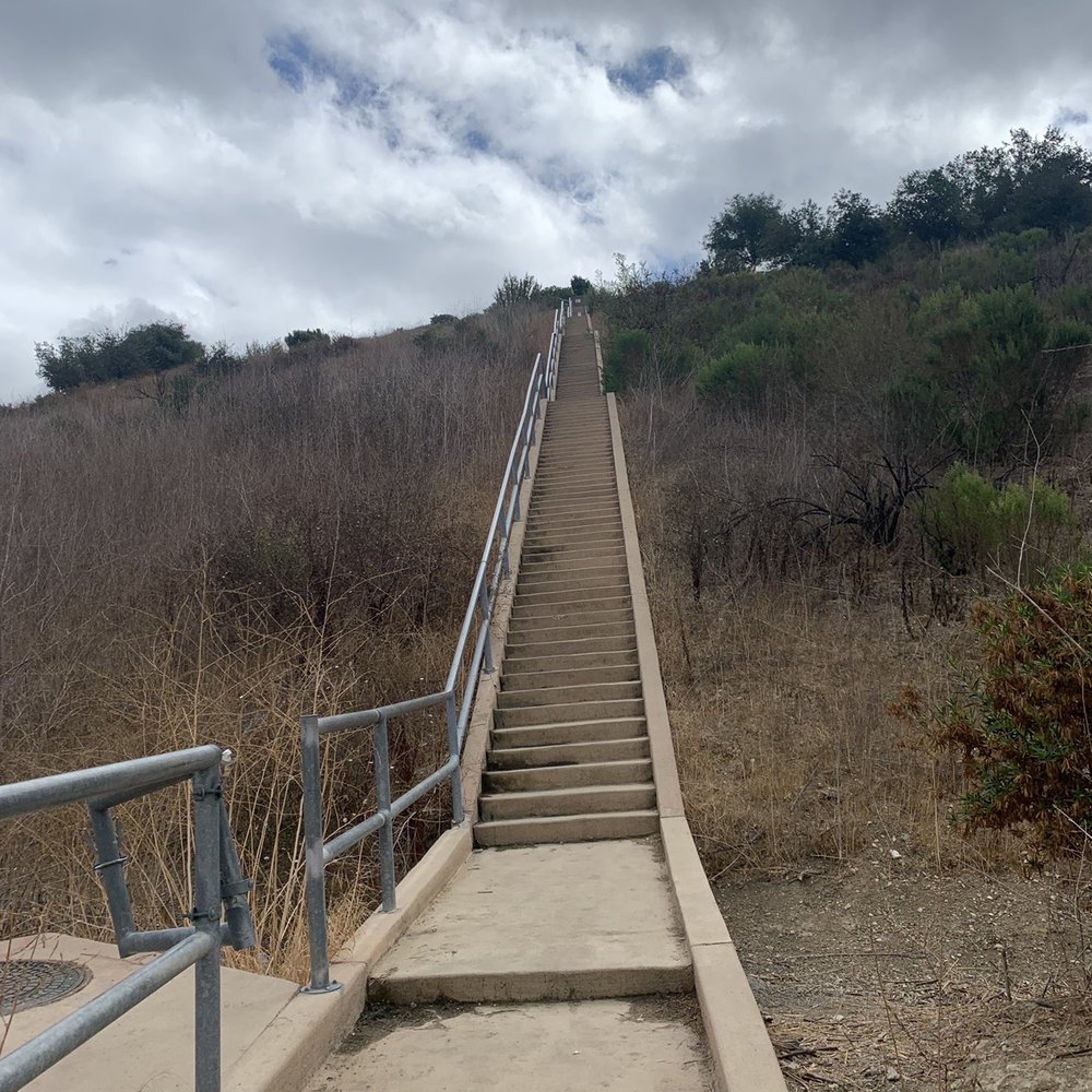
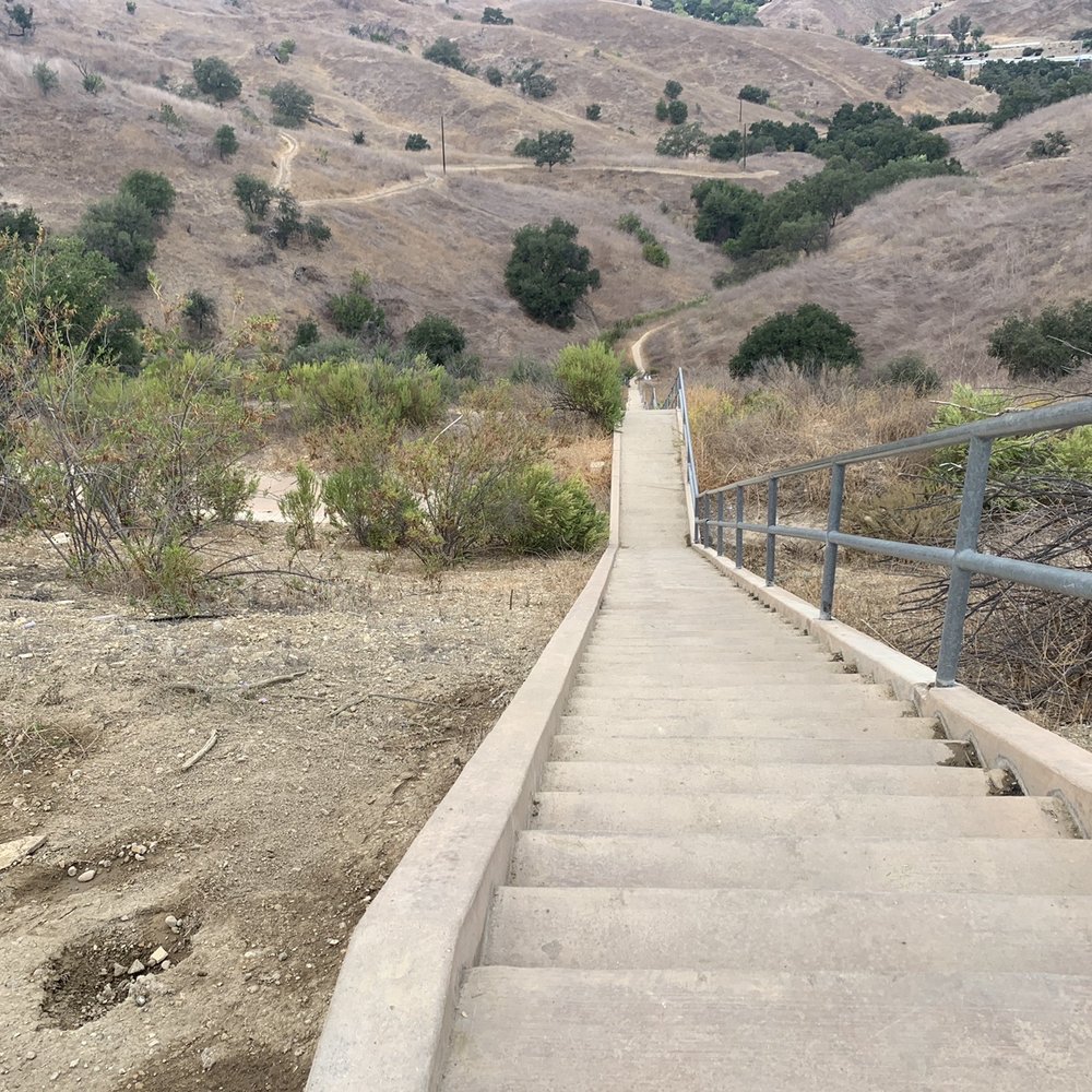
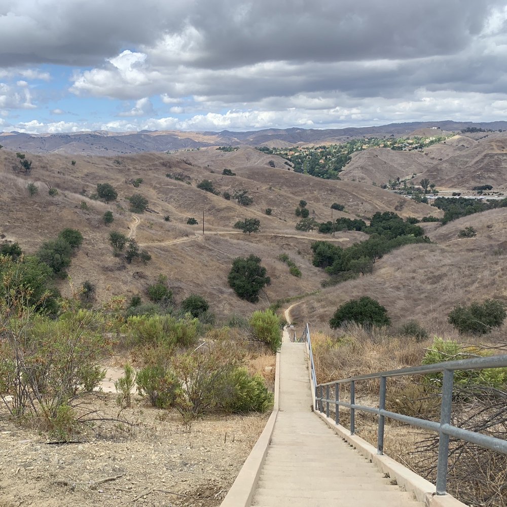
It was hard to find as google maps wants to take you to the entrance of a gated community . we tried day one and failed but day 2 we found it with much success . find the coordinates through the trailhead app. make sure you are on calabasas road and not parkway. you will basically hit a dead end street turn around and park! pretty sure ted danson helped us at the base of the trail it's a nice 15-20 minute hike, very hilly but nice little jaunt to the steps . 373 steps but it was totally worth it ! bring water . gorgeous views ! read more





2 years ago

5 years ago
This a Los Angeles get away in Los Angeles. Definitely not your typical Hollywood hike / stairs trails. It is quiet - not a lot of people on a clear beautiful day amazing 360 views. You will get a workout trekking up 375 steps. It's a fun experience. Bring water, a cap/hat and comfortable shoes. I recommend later afternoon because you get the orange lighting against the mountains. It takes about 45 mins. Even the drive from Los Angeles to Calabasas is worth it. Have fun - Enjoy Peace Love Be A Proud American read more


4 years ago
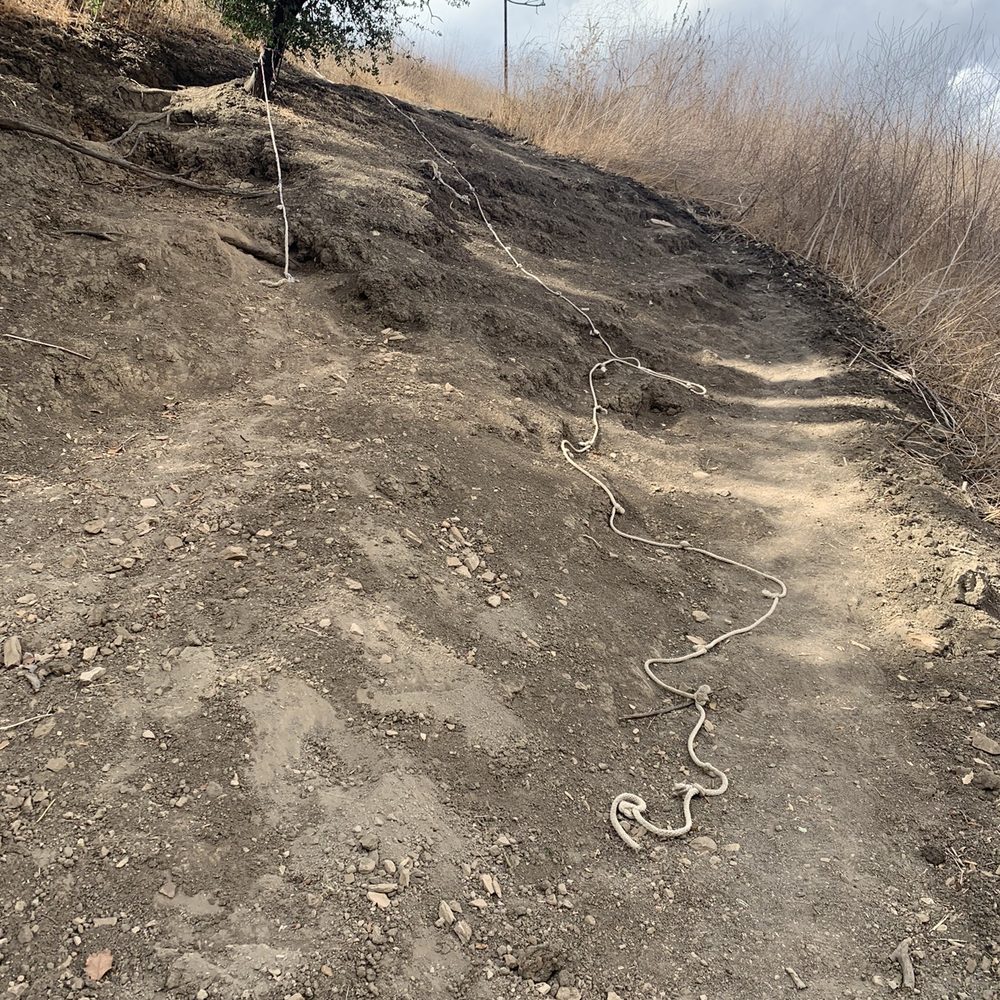
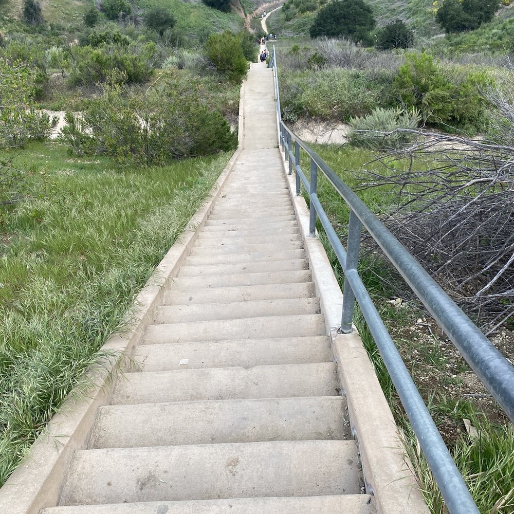
Moderately easy hike! Keep in mind there is no designated "parking lot" but it seems hikers have no problem parking by the side of the road, neither did I. Seems more daunting than it really is, you can complete the hike well under an hour. There is a steep-ish part getting to the stairs but there's a rope to help with balance. Overall really fun! Your legs will feel it while taking in the great view! read more

2 years ago
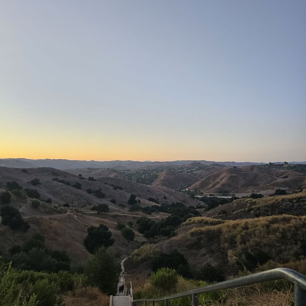
First time visiting. It's a bit of a hike to get there. I brought one 24 oz bottle of Electrolyte drink and that was enough for me. Took 50 mins from when we got there and back to the car. Went almost at sundown. It was great!! read more




5 years ago
I'm going to make this short and simple. Tips: - DO use the Yelp address. You might end up at the exclusive gated community if you just type in "Calabasas Hidden Stairs" on Google - Bring PLENTY OF WATER. The trail to the stairs has little to no shade. It's going to be scorching hot to do this in the middle of summer - As a seasonal beginner hiker (someone who hikes only during spring to early summer), the trail going to hidden stairs was EASY. You will come across a steep descent on the way to the stairs so be prepared. I saw kids doing it so it should be FINE but I know it can be a little challenging for some people. - All Trails note this as MODERATE difficulty with about 2.2mile hike - PARKING is LIMITED. Either you come early or late in the afternoon. - It's definitely SHORTER than the Baldwin Hills Overlook by Culver City - It can get BUSY as a lot of people love to do their cardio on the stairs so be CONSIDERATE - I took my 20lb corgi puppy here and I didn't have any problems with snake or poisonous plants. In my opinion, it is DOG FRIENDLY BUT BE CAUTIOUS. It is the outdoors and this is a home for a lot of wild animals just like most of the hiking trails. read more


6 years ago
Came here on a Wednesday afternoon and got a quick little workout in. Parking wasn't hard to find, however I was nervous about getting a ticket or even getting my car towed because of the reviews... Luckily both of those situations didn't happen. At first it was a bit difficult finding the stairs because there's this dirt trail you would need to travel on first. We found out how to get to the stairs through a different website, I think my sister found the directions on hikespeak.com? Please don't quote me on that. However the dirt trail itself wasn't crowded, we passed about 2 people walking to the stairs. When when got to the stairs itself, it wasn't bad as well there were probably 5 people on there, but then again we went on a Tuesday afternoon around 2pm. I can see how this place can get crowded pretty quickly as parking is sparse and the trail/stairs are pretty narrow. The views were pretty but during this time of year (January), the surroundings looked pretty dry and very different from the photos filled with green hills you'd see on the other yelp reviews/ instagram. Pretty cool spot to work out at if you're in the area but I honestly don't think its worth the drive if you'd have to travel from far. Have fun ! read more


3 years ago
Really really enjoyed the stairs themselves! Such a great workout! Very lowkey and enjoyable! Such a great view at the top of the stairs as well! Parking was very easy. What I did not enjoy at all was the hike leading up to get to the stairs! Not sure if there's more than one route but the path I took was terrible. It super narrow and in the middle of tall grass. I honestly felt like I was in a safari or a corn maze. It was hard to tell if I was going the right way or not. Very confusing and not enjoyable at all! It would be amazing if they cut the grass down. If there's a better path to take someone please let me know! read more


We tried these stairs today and boy was it a good work out It was pretty hot so didn't get to do a longer hike but you can definitely make it more challenging as there are connecting trails. Free parking right by the entrance and a nice loopy trail to get to the stairs. Definitely worth checking out if your in the area and looking for a bit of a challenge. read more


4 years ago
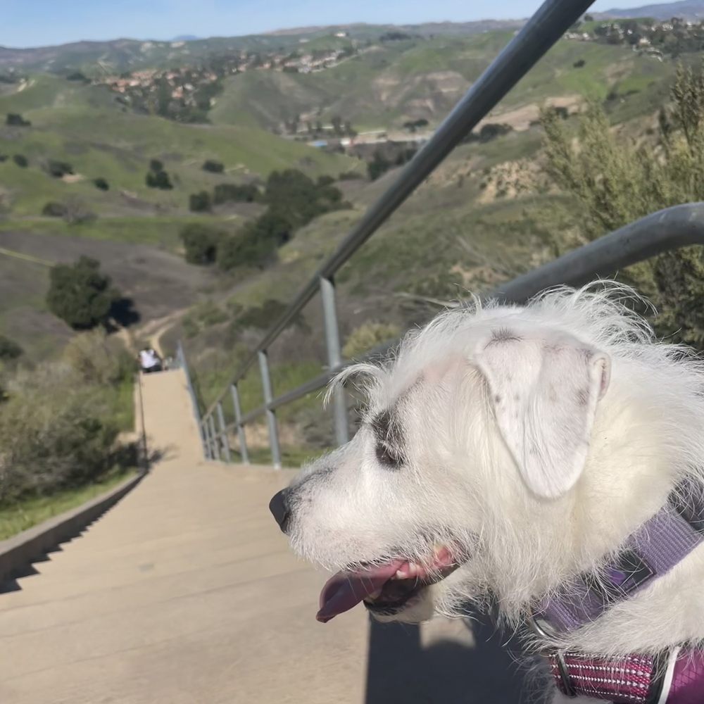
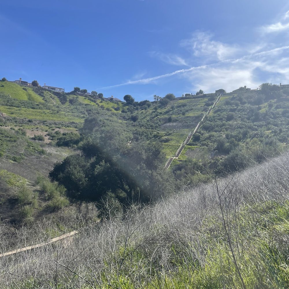
Dog friendly hike, about 1.5 miles. Seem short but going up was a killer workout. If your dog is out of shape like mine, expect a few breaks. Nonetheless, we enjoyed every bit of it, it was a beautiful day out. read more


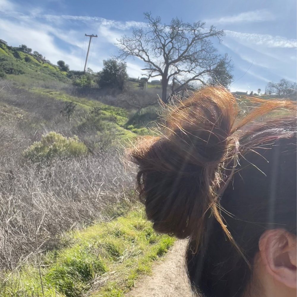

6 years ago
I absolutely love this hidden gem. The location is somewhat safe I would say (of course i do advise to lock your car and keep belongings in your trunk regardless) but it is a nice short hike to the staircase. PLEASE DON'T LITTER! I always advise people on the stairs to bring a trash bag and hang it by the fence because TOO many times I have been coming to these stairs and see trash all over. How sad. Please please please do not litter! You see trash pick it up and instead of throwing/leaving your trash, bring it back to your car with you. My advice: bring a trash bag to this location and hang it by the fence for people to use as well. That is what I do. Enjoy :) read more


6 years ago
These are my favorite stairs. They are not rugged. They are not crowded. They are evenly spaced. They are challenging. They are wide enough for people to pass without contact. People are not aggressive. Parking is good. Plenty of places to rest through out the staircase. I am happy to have learned of this place and will be back. If you despise Runyon Canyon Stairs, like me and like Culver City Stairs and Echo Park Stairs you will likely love these. read more

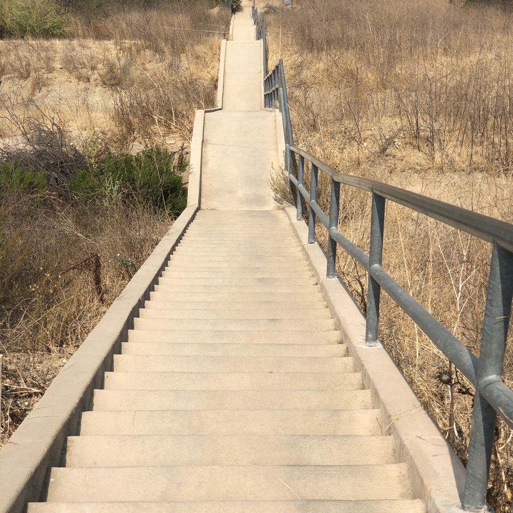

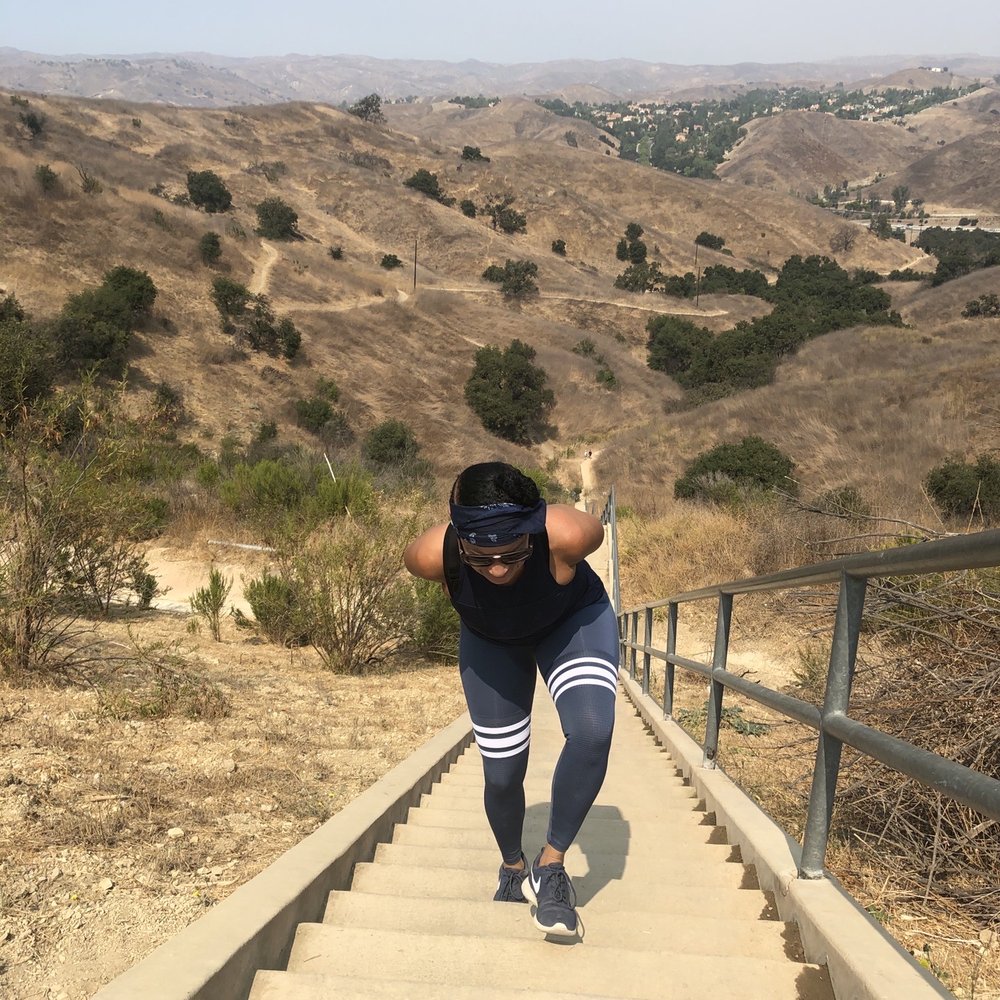

I went on Sunday morning. My friend and I got there somewhat early so we were able to find parking about a quarter of a mile up from the trail entrance. I would recommend going earlier in the morning, if you want to get good parking. The trail leading up to the stairs is relatively tame, with a couple of steep gravelly areas. You might even see deer on the hillside! Of course the stairs are the highlight. Going up once or twice will definitely get your heart rate up. More than that will make for a solid cardio workout. I recommend bringing lots of water for this hike. I went on a relatively cloudy day, but I can see how a sunnier day can get very hot. read more


4 years ago
3rd time coming here. Just wear sturdy shoes for hiking because going its hiking on the dirt to the stairs, but its all worth it. read more

Page 1 of 3
More info about Calabasas Hidden Stairs
Calabasas, CA 91302
Directions
Hours
Indoor Amenities
Outdoor Amenities
Ask the Community - Calabasas Hidden Stairs
How long would it take from start to finish?
Depending on your fitness level, easily under an hour. However, people go and up and down the stairs a few time for an extra workout.
Is it still open and does it get crowded?
Yes it is open Tatevik, and crowded too! But there is other ways to go in the same place . I always use my mask and don't touch anything
Is this open during COVID?
Yes a few weeks go. A few of us went hiking & went up the stairs recently.
What time does it close?
I'm guessing the same time it opens 😳 There are no posted hours of operation.
I spent and hour trying to find these stairs, my navigation kept trying to take me thru gates communities. I also went past the Audi dealership and was told it's close by but no luck....can someone give me better directions? Thanks?
After you pass the dealership there is a dead end street where you can park your car. You actually have to hike your way up to the stairs. There is a trail you follow to get to them.
Review Highlights - Calabasas Hidden Stairs
You might also consider































Why does Yelp recommend reviews?
4 reviews that are not currently recommended
The reviews below are not factored into the business's overall star rating.
4 years ago

4 months ago

9 years ago

8 years ago
Calabasas Hidden Stairs - hiking - Updated August 2026
Best of Calabasas
People found Calabasas Hidden Stairs by searching for…
Hiking Trails in Calabasas, CA
Beautiful Views in Calabasas, CA
Places to Take Pictures in Calabasas, CA
Stairs Workout in Calabasas, CA
Running Trails in Calabasas, CA
Walking Trails in Calabasas, CA
Hiking Groups in Calabasas, CA
Stair Climbing in Calabasas, CA
Tourist Attractions in Calabasas, CA
Scenic Overlook in Calabasas, CA
Celebrity Sightings in Calabasas, CA
Lookout Points in Calabasas, CA
Running Stairs in Calabasas, CA
Trending Searches in Calabasas, CA
Antiques near Calabasas Hidden Stairs
Barbershop For Men near Calabasas Hidden Stairs
Bird Sanctuary near Calabasas Hidden Stairs
Cliff Jumping near Calabasas Hidden Stairs
Consignment Shops near Calabasas Hidden Stairs
Cruising Spots near Calabasas Hidden Stairs
Dog Friendly Things To Do near Calabasas Hidden Stairs
Ear Piercing near Calabasas Hidden Stairs
Eyebrow Threading near Calabasas Hidden Stairs
Kids Haircut near Calabasas Hidden Stairs
Lakes near Calabasas Hidden Stairs
Meteor Shower near Calabasas Hidden Stairs
Mini Golf near Calabasas Hidden Stairs
Parks near Calabasas Hidden Stairs
Pedicure near Calabasas Hidden Stairs
Permanent Makeup near Calabasas Hidden Stairs
Picnic Areas near Calabasas Hidden Stairs
Preschools near Calabasas Hidden Stairs
Public Golf Courses near Calabasas Hidden Stairs
Public Pools near Calabasas Hidden Stairs
Rock Quarry near Calabasas Hidden Stairs
Scenic Night View near Calabasas Hidden Stairs
Shopping Malls near Calabasas Hidden Stairs
Stargazing near Calabasas Hidden Stairs
Sunrise View near Calabasas Hidden Stairs
Swimming Holes near Calabasas Hidden Stairs
Trading Card Shops near Calabasas Hidden Stairs
Used Furniture Stores near Calabasas Hidden Stairs
Browse Articles
Browse Nearby
BEST of Calabasas, California Coffee near Calabasas Hidden Stairs
BEST of Calabasas, California Restaurants near Calabasas Hidden Stairs
BEST of Calabasas, California Things to Do near Calabasas Hidden Stairs
BEST of Calabasas, California Breakfast near Calabasas Hidden Stairs
BEST of Calabasas, California Walking Trails near Calabasas Hidden Stairs
BEST of Calabasas, California Campgrounds near Calabasas Hidden Stairs
BEST of Calabasas, California Parks near Calabasas Hidden Stairs
BEST of Calabasas, California Caves near Calabasas Hidden Stairs
BEST of Calabasas, California Sightseeing near Calabasas Hidden Stairs
Browse Brands
Related Searches in Calabasas, CA
Best Dog Hiking Trails Around Calabasas, California
Best Fishing Locations and Guides in Calabasas, California
Best Nature Trails for Hiking in Calabasas, California
Best Places for Horseback Riding in Calabasas, California
Best Sightseeing Experiences Available in Calabasas, California
Check Out Off Road Trails in Calabasas, California
Discover Dog Friendly Trails to Explore in Calabasas, California
Discover Easy Hiking Trails Near Calabasas, California
Discover Kid Friendly Hiking Trails in Calabasas, California
Discover Popular Bike Trails in Calabasas, California
Discover Scenic Mountain Bike Trails Near Calabasas, California
Discover Walking Parks in Calabasas, California Near You
Discover a Hiking Trail in Calabasas, California
Discover the Best Night Hike Trails in Calabasas, California
Dog-Friendly Hikes With Dogs in Calabasas, California
Enjoy Camping Adventures Around Calabasas, California
Enjoy Kayaking Adventures in Calabasas, California
Enjoy Off Leash Dog Hikes in Calabasas, California
Enjoy Scenic Places to Walk in Calabasas, California
Enjoy Tent Camping Spots Around Calabasas, California
Enjoy a Beautiful Waterfall Hike in Calabasas, California
Enjoy the Best Walking Path in Calabasas, California
Enjoy the Best Walking Trails in Calabasas, California
Explore Beautiful Parks and Green Spaces in Calabasas, California
Explore Easy Hikes Perfect for All in Calabasas, California
Explore Fun Activities to Do in Calabasas, California
Explore Popular Campgrounds Near Calabasas, California
Explore Popular Dog Walking Trails in Calabasas, California
Explore Top Dog Parks in Calabasas, California Near You
Explore the Best Beach Spots in Calabasas, California
Family Friendly Hiking With Kids in Calabasas, California
Find Parks and Recreation Activities in Calabasas, California
Find Top-Rated Waterfalls in Calabasas, California Now
Find the Best Parks for Picnics in Calabasas, California
Hiking Trails With Waterfalls in Calabasas, California
Off Leash Dog Hiking Trails in Calabasas, California
Popular Outdoor Activities to Try in Calabasas, California
Popular Picnic Spots to Visit in Calabasas, California
Popular Waterfall Hiking Trails in Calabasas, California
Safe River Swimming Areas in Calabasas, California
Safe and Fun Parks for Kids in Calabasas, California
Top Hiking Trails to Explore in Calabasas, California
Top Playgrounds for Kids to Enjoy in Calabasas, California
Top Running Trails to Explore in Calabasas, California
Top Swimming Lakes to Enjoy in Calabasas, California
Top Swimming Spots and Pools in Calabasas, California
Top-Rated Camping Sites in Calabasas, California


