Cancel

    Open app

    Search

    Low Gap Trail

    5.0 (2 reviews)

    Low Gap Trail Photos

    You might also consider

    Recommended Reviews - Low Gap Trail

    Your trust is our priority, so businesses can't pay to alter or remove their reviews. Learn more about reviews.
    Yelp app icon
    Browse more easily on the app
    Review Feed Illustration

    4 years ago

    Helpful 5
    Thanks 0
    Love this 3
    Oh no 0

    4 years ago

    Helpful 0
    Thanks 0
    Love this 0
    Oh no 0

    Verify this business for free

    People searched for Hiking 398 times last month within 15 miles of this business.

    Verify this business

    Baskins Creek Falls Trailhead - Small parking area

    Baskins Creek Falls Trailhead

    3.7(6 reviews)
    16.0 mi

    We started out great with a black bear up the hill from us most of the trail on the way to the…read morewaterfall was not strenuous, there are a lot of roots in the path so don't trip!! Along with the bear we saw several turkey, squirrels, chipmunks and a rabbit so not a bad day for wildlife spotting! The fall is peaceful and nice but not a big one. We spent a few mins there and headed back out. Remember this is a "in & out" trail. The majority of the way back is incline walking a little tough at times. There is a trail off the main path to an old graveyard, we trigger way up a hill to see it. If your already tired at that point I don't recommend it. There a few places with great Mountain Views.

    Baskins Creek Falls is a cool little waterfall that was said to have been commonly used as an…read moreoutdoor shower by the early settlers. The trail is kinda tricky to follow, so here are easy-to-follow hiking instructions. It may be difficult to get internet reception, so I would suggest you print these instructions and bring then with you: PARKING Find the trailhead by turning right onto Roaring Fork Motor Nature Trail (from Cherokee Orchard Road). Parking for the trailhead will be about 150 yards on the left. It's tiny, barely enough for two cars. However, this is not a popular trail like the others, so there may be room when you arrive. Otherwise, you can park off Cherokee Orchard and walk the 150 yards to the trailhead. THE HIKE While researching this hike, several websites listed this hike as easy and all downhill. That is incorrect. For the first 1/3 of a mile it's all uphill. About the time you get clear views of the nearby mountains the descent to the waterfall begins. Near the one mile you will cross a small creek. There is NO log bridge provided, so be careful when crossing over the loose stones and downed trees. The trail will begin to descent a little more rapidly past a cave-like stone outcrop. Next you will come to a split in the trail. To the left is a sign leading you towards a cemetery. Keep right to remain on the trail to the falls. Again you will cross a small creek and soon after arrive at a second split in the trail. Go left here for your final descent to the falls. This section of the trail is the steepest drop in elevation and definitely one of the trickiest to navigate. If you have small children, it would be a good idea to assist them here. When you round your final corner of the trail, the waterfall will be in plain view. Although total height of the falls seems to vary between websites, I think it's at least 45'. Length: 3 Miles round trip Total Elevation Gain: 953 Feet Trail Difficulty Rating: Moderate (I personally WOULD NOT recommend this trail for the elderly or children under the age of 6). FINAL THOUGHTS While the hike to the falls may be ranked on trail guides as easy, I'm not so sure they are considering the return hike back! It's a real booger of a hike in reverse. I need a rest break more than once! A beautiful small waterfall to be sure, but not in the same ranks of other nearby waterfalls like Grotto, Hen Wallow, Laurel or the two Mac Daddies of all Gatlinburg waterfall hikes.... Abram & Ramsey Cascades (8.5 miles round trip). Now if you'll excuse me, I'm going to take a nap! I'm worn out!

    Photos
    Baskins Creek Falls Trailhead
    Baskins Creek Falls Trailhead - Small cave along trail

    Small cave along trail

    Baskins Creek Falls Trailhead

    See all

    Great Smoky Mountains National Park - Mushroom

    Great Smoky Mountains National Park

    4.7(430 reviews)
    19.0 mi

    Stunning. The Great…read moreSmoky Mountains National Park officially ties with Yosemite as my two favorite national parks in the US. I love everything about this beautiful area of our country. We were there in early spring and enjoyed stunning weather, blooming wild flowers, and bear sightings a-plenty. We also were there when the dogwoods were blooming and there are dogwood trees throughout the park--it was stunning. We enjoyed driving around the park, hiking, and stopping at various points of interest. We were also able to take an accessible hike up a paved trail to the highest point in the park, which was amazing. My eyes seriously just could not get enough of all the gorgeous nature to be enjoyed here. Top notch. Get to it!

    Great Smoky Mountain National Park has been on my bucket list for many years. I was hoping that…read morespring break would be down season at the Park, but the Park was busy!!! We had a fabulous visit to this vast natural wonder. We learned that Park is the largest natural habitat in the continental U.S. The signature "smoky" appearance of the mountains is caused by an evaporation of organic rich moisture released by the vegetation within the Park. We started our visit by stopping at the visitors center to pick up a parking permit ($5/day) and maps ($1). I was glad we picked up maps because there is very little internet connectivity in the park, so we lost our navigation tools. The leaves were not on the trees yet (April) so we had magnificent uninterrupted views of the mountains and skylines. Spring wild flowers were in bloom. And we actually saw a mother bear with two cubs crossing the road. Each day during our visit we explored a different part of the park. We hiked to waterfalls and enjoyed scenic overlooks. We enjoyed exploring historic cabins and cemeteries. Popular sites were crowded and sometimes we had to wait for parking. Plan to arrive early. The park is filled with parking areas to pull off and enjoy the views or hike. Rest areas are available at many of the major sites. Leased dogs are only allowed in camping and parking areas and on two of the many trails. Bring good walking shoes, a hiking stick is helpful, water and sun glasses. You probably need to bring snacks, but keep those secure from wildlife.

    Photos
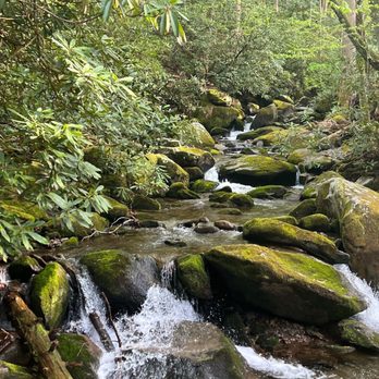
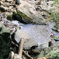
    Great Smoky Mountains National Park - Babbling brooks

    Babbling brooks

    Great Smoky Mountains National Park
    Great Smoky Mountains National Park - Sugarlands Visitor Center

    See all

    Sugarlands Visitor Center

    Low Gap Trail - hiking - Updated May 2026

    Loading...
    Loading...
    Loading...