Baskins Creek Falls Trailhead Photos


You might also consider


More like Baskins Creek Falls Trailhead
Recommended Reviews - Baskins Creek Falls Trailhead
Start your review...


Reviews With Photos


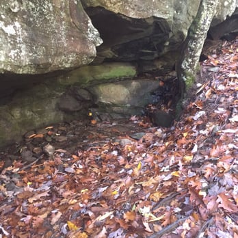
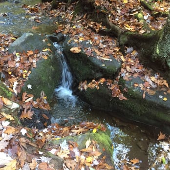
I haven't done very much hiking in my life. I grew up in the mountains, but the trails my parents took my to as a kid were apparently quite easy because I was under the impression the hiking was just walking in the woods. While visiting Gatlinburg I knew I wanted to really experience the Smoky Mountains, especially in the fall foliage, so I did quite a bit of research to find a fun hiking trail that wouldn't be too difficult but also had some fun nature elements. I settled on the Baskins Creek Falls trail because of the promise of waterfalls, and because it was noted that there was also an old cemetery along the trial. I love creepy old cemeteries. The trail was rated a 4.91 on the hiking trail difficulty scale. This equates to an "easy" hike suitable for children and the elderly according to my research. Apparently I am not in nearly as good shape as I thought I was because I would not call this trail easy at all...but fun, and worth it. We arrived around 9am. The trail is located inside Great Smoky Mountains National Park and you can get to it driving along a one long one way loop that winds through the portion of the park. There are numerous trailheads along the way, some with a decent amount of parking, while this one really only has enough room for a handful of cars, so getting there early benefitted us. We began the three mile trek along the Roaring Fork Motor Nature Trail. The trail is pretty well defined (I did have fears of losing my way and having to live off the land, which I assure you wouldn't go well for me) and started off as a relatively leisurely stroll with some mild hills that lead us to some amazing mountain views. Then things got tricky. The trail began a sharp slope down, and with the fall leaves along the trail it become quite slippery in spots (I fell twice :-(...maybe don't wear your oldest worn out running shoes and have something with some traction). Honestly though, despite my falls I was still having a great time. We encountered a few small caves and the trail followed a cute babbling brook for awhile. There were a few areas along the trail where crossing the stream was necessary, but with no bridge present you must navigate across using the rocks peeking out of the water...I felt like Pocahontas. About a mile and a third in we came to a sign with one fork leading to the falls and another leading to the cemetery. I will note that this was probably the longest 1.3 miles of my life. I can walk a mile in probably 12 minutes, but this mile took more like a half hour....and we were moving the whole time. We opted to head up to the cemetary to satisfy my fascination with creepy things. Located at the top of quite a steep slope I have no idea how people were getting bodies up here in the early 1900's because this was a tricky trek. The cemetery is very cool and definitely worth seeing. The grave stones are very old and worn so much that you really can't make out what they say, but some researching after the fact most of the graves belong to members of the Ogle family, who were the first settlers of the area. There is one child's grave in the cemetery which has a new tombstone that I think was added much later once the history of the grave was established. After the cemetery we navigated our way back to the trail and opted to head back rather than go to the falls (we were REALLY tired and we knew that we would see plenty of waterfalls on the drive out...from the car lol). The trip back is rough! Remember when I mentioned those sharp slopes down on the way in? Well it turns out you have to get up them on the return route. I had to stop quite a few times just to catch my breath (hiking is NOT just walking). Around this time I realized I had lost my sunglasses (probably one of the times I fell)...as luck would have it we ran in to an older woman on the trail who just happened to have found my sunglasses...people are so nice. When we finally got back to the car my fit bit had logged 89 floors! Normally I would say that I didn't believe it because sometimes altitude can mess up the fit bit floors counter, but honestly, I really do think we did the equivalent of that many floors. I would like to have a word with whoever came up with the ratings scale for hiking trails and discuss with them what the word "easy" means. The hike while difficult was fun and the views of the Smokies are breathtaking. Despite the steep climbs, and though I don't have any frame of reference because we were too tired to try any other trails, i highly recommend this one...if for no other reason, because it's the only trail i researched that had a cemetery.


5 years ago
We started out great with a black bear up the hill from us most of the trail on the way to the waterfall was not strenuous, there are a lot of roots in the path so don't trip!! Along with the bear we saw several turkey, squirrels, chipmunks and a rabbit so not a bad day for wildlife spotting! The fall is peaceful and nice but not a big one. We spent a few mins there and headed back out. Remember this is a "in & out" trail. The majority of the way back is incline walking a little tough at times. There is a trail off the main path to an old graveyard, we trigger way up a hill to see it. If your already tired at that point I don't recommend it. There a few places with great Mountain Views. read more


12 years ago
Baskins Creek Falls is a cool little waterfall that was said to have been commonly used as an outdoor shower by the early settlers. The trail is kinda tricky to follow, so here are easy-to-follow hiking instructions. It may be difficult to get internet reception, so I would suggest you print these instructions and bring then with you: PARKING Find the trailhead by turning right onto Roaring Fork Motor Nature Trail (from Cherokee Orchard Road). Parking for the trailhead will be about 150 yards on the left. It's tiny, barely enough for two cars. However, this is not a popular trail like the others, so there may be room when you arrive. Otherwise, you can park off Cherokee Orchard and walk the 150 yards to the trailhead. THE HIKE While researching this hike, several websites listed this hike as easy and all downhill. That is incorrect. For the first 1/3 of a mile it's all uphill. About the time you get clear views of the nearby mountains the descent to the waterfall begins. Near the one mile you will cross a small creek. There is NO log bridge provided, so be careful when crossing over the loose stones and downed trees. The trail will begin to descent a little more rapidly past a cave-like stone outcrop. Next you will come to a split in the trail. To the left is a sign leading you towards a cemetery. Keep right to remain on the trail to the falls. Again you will cross a small creek and soon after arrive at a second split in the trail. Go left here for your final descent to the falls. This section of the trail is the steepest drop in elevation and definitely one of the trickiest to navigate. If you have small children, it would be a good idea to assist them here. When you round your final corner of the trail, the waterfall will be in plain view. Although total height of the falls seems to vary between websites, I think it's at least 45'. Length: 3 Miles round trip Total Elevation Gain: 953 Feet Trail Difficulty Rating: Moderate (I personally WOULD NOT recommend this trail for the elderly or children under the age of 6). FINAL THOUGHTS While the hike to the falls may be ranked on trail guides as easy, I'm not so sure they are considering the return hike back! It's a real booger of a hike in reverse. I need a rest break more than once! A beautiful small waterfall to be sure, but not in the same ranks of other nearby waterfalls like Grotto, Hen Wallow, Laurel or the two Mac Daddies of all Gatlinburg waterfall hikes.... Abram & Ramsey Cascades (8.5 miles round trip). Now if you'll excuse me, I'm going to take a nap! I'm worn out! read more


7 years ago

11 years ago
I haven't done very much hiking in my life. I grew up in the mountains, but the trails my parents took my to as a kid were apparently quite easy because I was under the impression the hiking was just walking in the woods. While visiting Gatlinburg I knew I wanted to really experience the Smoky Mountains, especially in the fall foliage, so I did quite a bit of research to find a fun hiking trail that wouldn't be too difficult but also had some fun nature elements. I settled on the Baskins Creek Falls trail because of the promise of waterfalls, and because it was noted that there was also an old cemetery along the trial. I love creepy old cemeteries. The trail was rated a 4.91 on the hiking trail difficulty scale. This equates to an "easy" hike suitable for children and the elderly according to my research. Apparently I am not in nearly as good shape as I thought I was because I would not call this trail easy at all...but fun, and worth it. We arrived around 9am. The trail is located inside Great Smoky Mountains National Park and you can get to it driving along a one long one way loop that winds through the portion of the park. There are numerous trailheads along the way, some with a decent amount of parking, while this one really only has enough room for a handful of cars, so getting there early benefitted us. We began the three mile trek along the Roaring Fork Motor Nature Trail. The trail is pretty well defined (I did have fears of losing my way and having to live off the land, which I assure you wouldn't go well for me) and started off as a relatively leisurely stroll with some mild hills that lead us to some amazing mountain views. Then things got tricky. The trail began a sharp slope down, and with the fall leaves along the trail it become quite slippery in spots (I fell twice :-(...maybe don't wear your oldest worn out running shoes and have something with some traction). Honestly though, despite my falls I was still having a great time. We encountered a few small caves and the trail followed a cute babbling brook for awhile. There were a few areas along the trail where crossing the stream was necessary, but with no bridge present you must navigate across using the rocks peeking out of the water...I felt like Pocahontas. About a mile and a third in we came to a sign with one fork leading to the falls and another leading to the cemetery. I will note that this was probably the longest 1.3 miles of my life. I can walk a mile in probably 12 minutes, but this mile took more like a half hour....and we were moving the whole time. We opted to head up to the cemetary to satisfy my fascination with creepy things. Located at the top of quite a steep slope I have no idea how people were getting bodies up here in the early 1900's because this was a tricky trek. The cemetery is very cool and definitely worth seeing. The grave stones are very old and worn so much that you really can't make out what they say, but some researching after the fact most of the graves belong to members of the Ogle family, who were the first settlers of the area. There is one child's grave in the cemetery which has a new tombstone that I think was added much later once the history of the grave was established. After the cemetery we navigated our way back to the trail and opted to head back rather than go to the falls (we were REALLY tired and we knew that we would see plenty of waterfalls on the drive out...from the car lol). The trip back is rough! Remember when I mentioned those sharp slopes down on the way in? Well it turns out you have to get up them on the return route. I had to stop quite a few times just to catch my breath (hiking is NOT just walking). Around this time I realized I had lost my sunglasses (probably one of the times I fell)...as luck would have it we ran in to an older woman on the trail who just happened to have found my sunglasses...people are so nice. When we finally got back to the car my fit bit had logged 89 floors! Normally I would say that I didn't believe it because sometimes altitude can mess up the fit bit floors counter, but honestly, I really do think we did the equivalent of that many floors. I would like to have a word with whoever came up with the ratings scale for hiking trails and discuss with them what the word "easy" means. The hike while difficult was fun and the views of the Smokies are breathtaking. Despite the steep climbs, and though I don't have any frame of reference because we were too tired to try any other trails, i highly recommend this one...if for no other reason, because it's the only trail i researched that had a cemetery. read more




10 years ago
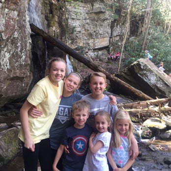
So, I am giving this hike 4 stars because it really was a lovely waterfall and hike. HOWEVER it is NOT easy. My family looked up "family friendly hikes in Gatlinburg" and this is the only one that really fit what we were looking for because it was "easy" yet not paved, plus we would be rewarded with the Baskins Creek Falls after our efforts. Finding the trail was quite easy...and it was a gorgeous drive through the Great Smokey Mountains National Forest. We were literally able to park right by the start of the trail during one of the busiest times of year. Here's where things get sticky. As we started our hike (uphill) my sister actually commented "well at least we know it will be all downhill on the way back!" Well, my friends, I don't know how a trail can actually be uphill both ways but believe me that's what it is! As we continued along and saw hikers coming the opposite direction I began to feel totally Ill-prepared. I saw bear whistles, huge water-laden backpacks, professional titanium hiking poles, legit hiking boots, well thought out protein snacks, etc. We had 2 water bottles, 3 packs of cheese crackers, and some fruit snacks!! (For the 10 of us) AND 3 five year olds...one of which was wearing Keds!! But, onward we went. When we reached the sign for the cemetery, we were told it wasn't too much longer so we decided to power on. (Under 3 or 4 fallen trees, mud, water, and ALOT of rocks and roots). We finally reached our destination and the falls really are lovely! The kids had a great time playing on the rocks AND eating the meager nourishment we brought them. :)Then, we began our ascent back into civilization. I don't want to brag, but I have to say, as a whole our group is pretty fit compared to the average American. There were 4 adults...who all work out regularly...two of which OWN a Crossfit gym. 3 kids, all active, 11-13, and 3 five year olds. Well my God by the time we came out of there you would have thought the 10 of us were contestants on The Biggest Loser the way we were huffing and puffing, crying (in the case of the five year olds) and complaining!! It was embarrassing!! Plus we were totally dehydrated from the lack of water! (But, in our defense it was only 3 miles!!) Bottom line is: 1. Hike and view really is great 2. NOT "family friendly" unless your family consists only of people between the ages of 11 and up with NO health or mobility issues 3. Your physical fitness is NOT as good as you think Honestly though it provided us with great memories and a lot of laughs!! We really did have a great time. read more




8 years ago
More info about Baskins Creek Falls Trailhead
Roaring Fork Motor Nature Trl
Gatlinburg, TN 37738
Directions
Hours
Outdoor Amenities
Ask the Community - Baskins Creek Falls Trailhead
You might also consider





























Baskins Creek Falls Trailhead - hiking - Updated August 2026
Best of Gatlinburg
People found Baskins Creek Falls Trailhead by searching for…
Swimming Holes in Gatlinburg, TN
Hiking Trails With Waterfalls in Gatlinburg, TN
Off Road Trails in Gatlinburg, TN
Running Trails in Gatlinburg, TN
Walking Trails in Gatlinburg, TN
Public Shower in Gatlinburg, TN
Hiking Trails Kid Friendly in Gatlinburg, TN
Natural Hot Springs in Gatlinburg, TN
Beautiful Views in Gatlinburg, TN
Things to Do in Gatlinburg, TN
National Parks in Gatlinburg, TN
Trending Searches in Gatlinburg, TN
Baseball Card Shop near Baskins Creek Falls Trailhead
Bird Sanctuary near Baskins Creek Falls Trailhead
Cinema near Baskins Creek Falls Trailhead
Cliff Jumping near Baskins Creek Falls Trailhead
Cruising Spots near Baskins Creek Falls Trailhead
Dog Friendly Things To Do near Baskins Creek Falls Trailhead
Ear Piercing near Baskins Creek Falls Trailhead
Flower Fields near Baskins Creek Falls Trailhead
Hair Stylists near Baskins Creek Falls Trailhead
Kids Haircut near Baskins Creek Falls Trailhead
Lakes near Baskins Creek Falls Trailhead
Movie Theatre near Baskins Creek Falls Trailhead
Parks near Baskins Creek Falls Trailhead
Peach Picking near Baskins Creek Falls Trailhead
Picnic Areas near Baskins Creek Falls Trailhead
Rock Quarry near Baskins Creek Falls Trailhead
Scenic Drive near Baskins Creek Falls Trailhead
Scenic Night View near Baskins Creek Falls Trailhead
Shopping Malls near Baskins Creek Falls Trailhead
Souvenir Shops near Baskins Creek Falls Trailhead
Sports Card Shops near Baskins Creek Falls Trailhead
Sunrise View near Baskins Creek Falls Trailhead
Swimming Holes near Baskins Creek Falls Trailhead
Trading Card Shops near Baskins Creek Falls Trailhead
Uniforms near Baskins Creek Falls Trailhead
Used Book Stores near Baskins Creek Falls Trailhead
Browse Articles
Browse Nearby
BEST of Gatlinburg, Tennessee Coffee near Baskins Creek Falls Trailhead
BEST of Gatlinburg, Tennessee Things to Do near Baskins Creek Falls Trailhead
BEST of Gatlinburg, Tennessee Restaurants near Baskins Creek Falls Trailhead
BEST of Gatlinburg, Tennessee Breakfast near Baskins Creek Falls Trailhead
BEST of Gatlinburg, Tennessee Shopping near Baskins Creek Falls Trailhead
Browse Brands
Related Searches in Gatlinburg, TN
Affordable Kayak Rental Services in Gatlinburg, Tennessee
Best Dog Hiking Trails Around Gatlinburg, Tennessee
Best Fishing Locations and Guides in Gatlinburg, Tennessee
Best Places for Horseback Riding in Gatlinburg, Tennessee
Best Sightseeing Experiences Available in Gatlinburg, Tennessee
Best Waterfalls and Swimming Holes in Gatlinburg, Tennessee
Check Out Off Road Trails in Gatlinburg, Tennessee
Discover Dog Friendly Trails to Explore in Gatlinburg, Tennessee
Discover Kid Friendly Hiking Trails in Gatlinburg, Tennessee
Discover Popular Bike Trails in Gatlinburg, Tennessee
Discover Scenic Mountain Bike Trails Near Gatlinburg, Tennessee
Discover a Hiking Trail in Gatlinburg, Tennessee
Discover the Best Night Hike Trails in Gatlinburg, Tennessee
Dog-Friendly Hikes With Dogs in Gatlinburg, Tennessee
Enjoy Camping Adventures Around Gatlinburg, Tennessee
Enjoy Kayaking Adventures in Gatlinburg, Tennessee
Enjoy Off Leash Dog Hikes in Gatlinburg, Tennessee
Enjoy Scenic Places to Walk in Gatlinburg, Tennessee
Enjoy Tent Camping Spots Around Gatlinburg, Tennessee
Enjoy a Beautiful Waterfall Hike in Gatlinburg, Tennessee
Enjoy the Best Walking Trails in Gatlinburg, Tennessee
Explore Beautiful Parks and Green Spaces in Gatlinburg, Tennessee
Explore Easy Hikes Perfect for All in Gatlinburg, Tennessee
Explore Fun Activities to Do in Gatlinburg, Tennessee
Explore Popular Campgrounds Near Gatlinburg, Tennessee
Explore Top Dog Parks in Gatlinburg, Tennessee Near You
Explore the Best Swimming Holes Around Gatlinburg, Tennessee
Family Friendly Hiking With Kids in Gatlinburg, Tennessee
Find Cozy Camping Cabins in Gatlinburg, Tennessee
Find Popular Ziplining Spots Around Gatlinburg, Tennessee
Find Top Dog Friendly Parks to Visit in Gatlinburg, Tennessee
Find Top-Rated Waterfalls in Gatlinburg, Tennessee Now
Find the Best Parks for Picnics in Gatlinburg, Tennessee
Hiking Trails With Waterfalls in Gatlinburg, Tennessee
Off Leash Dog Hiking Trails in Gatlinburg, Tennessee
Plan a Scenic Drive Route Near Gatlinburg, Tennessee
Popular Outdoor Activities to Try in Gatlinburg, Tennessee
Popular Picnic Spots to Visit in Gatlinburg, Tennessee
Safe and Fun Parks for Kids in Gatlinburg, Tennessee
Top Hiking Trails to Explore in Gatlinburg, Tennessee
Top Paddleboarding Activities in Gatlinburg, Tennessee
Top Playgrounds for Kids to Enjoy in Gatlinburg, Tennessee
Top Running Trails to Explore in Gatlinburg, Tennessee
Top Swimming Lakes to Enjoy in Gatlinburg, Tennessee
Top Swimming Spots and Pools in Gatlinburg, Tennessee
Top-Rated Camping Sites in Gatlinburg, Tennessee


