Marian Bear Memorial Park Photos



You might also consider


More like Marian Bear Memorial Park
Recommended Reviews - Marian Bear Memorial Park
Start your review...


Reviews With Photos

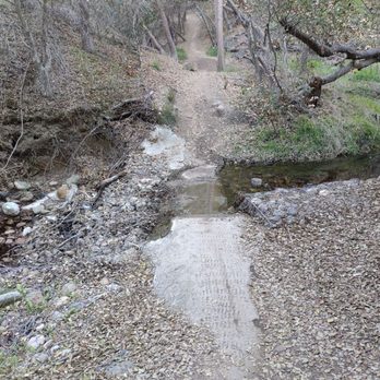
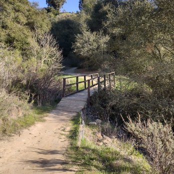
I took a short hike in the middle of this recent humid summer weather (by San Diego standards). Marian Bear Memorial Park straddles the lower edge of SR-52 starting at Regents Rd. You can go eastbound on the trail for about a mile one-way to Genesee Ave or westwards until you hit I-5. It's quite flat in either direction, and there is a creek that runs parallel to SR-52. I chose to just do the eastern route for a brisk walk to stretch out my legs. The parking below the south side of SR-52 was plentiful. There were numerous large potholes that made the drive into the lot very, very bumpy. With plenty of shade along parts of the trek, I encountered several dog walkers. It's definitely a fido friendly place for walking. I didn't notice any illicit activity during my stroll, but I can envision how such a situation could arise. Overall, this is an okay neighborhood "park" for some light exercise.


Haven't been back to this trail in a a long while. My pops and 2 boys made it out today and it was just so nice.. aside from the part where my pops flew into a bush trapped and my youngest running to his aid it was a swell day. Ps.. keep a close eye on your elderly who believe they can still do the things the roe grandkids can... anyhow I'm pretty sure the swelling will go down and and my kids and old man will have some forever memories.... Plus I have some on tape should they happen to forget. Anyhow the level of difficulty is fate to medium, watch out for other bike trailers the paths are slim in some areas. Remember to use your left and rights and ALWAYS!! Pick up after your nasty disgusting selves! Seriously a handful of ppl including us picking up trash. This is why we can't have nice more free things!


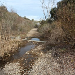
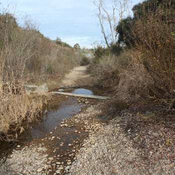
Convenient and easy to reach trail that I frequent. The trail is varied with trees and fair amount of shade. Downside is that it runs along the 52 freeway, so it's a bit noisy. Also, after the recent rains the creek is still fairly full, so you might have a problem doing the whole length of the trail. And the grass is tall and overgrown, so you might want to wear pants as a precaution against ticks.


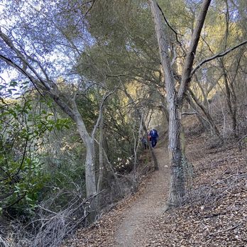
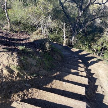
Easy mostly flat trail hike. Trail head at a cul-de-sac and descend short steep stairs. initial forest-type canopy over the wide dirt trail alongside a little creek with ponds, until coming out into the main broad hiking trail in the center of San Clemente Canyon/Marion Bear Park.Many huge sycamores and oaks in this City open-space park with a wide main trail and small stream with some ponds that may have minnows and some orange crawdads. the Trail can become redundant. You can extend your hike to four miles by combining trails. Watch for a cyclists.


We made our way over to Marian Bear Memorial Park after finding out another hike wasn't dog friendly. There are a lot of different trails you can take but several of them end up in dead ends along the creek. It's a pretty flat, easy hike which was great to take our 1 year old puppy on. The trail we went on didn't seem to loop back to the parking lot so we had to turn around and walk back the same trail we came from. In addition, the trails don't seem to be well marked, and there are a lot of forks where it's unclear where they will lead to (some taking you to dead ends or paths impossible to continue on). There are a lot of lizards and rabbits you see along the path and there's a lot of greenery. One thing to note is that there's a lot of poison oak around the park as well as rattlesnakes. Overall, decent hike but nothing too special or scenic about it.


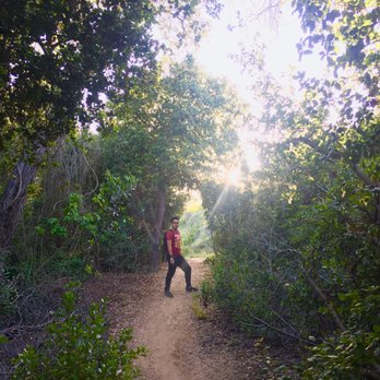
WOW! I finally got the chance to go to my neighborhood park. Honestly, I REALLY want to like this park. I loved the different narrow paths weaving across from one side of the park to the other and the diversity of different plants and sights along the way that you can discover on your hike... but this park needs some serious maintenance. Unfortunately, there are some problems that I just cannot overlook in this nice neighborhood park. 1) There a good amount of trash in this park. 2) Though I mentioned there are different trails to take, some of them take you to some... suspicious places. Adventure is out there- but when it involves a gnarled up wire fence or a standing pool you can slip into, I think a little more security is important to keep in mind. 3) OMG... I didn't discover this until a few weeks later... but there is A LOT of Poison Oak in this park. HIKE. WITH. CAUTION. My skin is raised in this itchy, blistering rash, and it has not gone away yet!!! All in all, if you decide to go to this park, really stick to the trails that are a lot wider, and stay away from any suspicious looking bushes or trees. There are some lovely sights out there, with plenty of beautiful flowers and trees. But, you don't want to take a nasty souvenir home in the form of a itchy rash either!


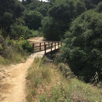
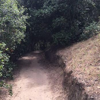
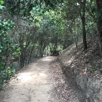
What a gorgeous and well taken care of park! Tons of paths to lose yourself on but not enough to actually get lost. Seems like the thing to do here is mountain biking and I so wish I had one cause it looks like so much fun! There's two clear paths you can take from the the parking lot off Clairemont headed west. One is more shaded and the other is full sun. Shade on the left. Plenty of trash cans at the entrance so don't forget to bring your trash out!

I decided to go for a hike somewhere not too far from me and picked Marian Bear. It seemed like a good location and had plenty of geocaches on the trail, but one thing I should have done beforehand is read the Yelp reviews... The trails themselves are so-so. Some are shaded with trees and go over creeks, but for the majority of the hike you're just out in the open. The proximity of the freeway and cars everywhere you look deters from the nature-like atmosphere and just doesn't feel right. It's a good place for a quick hike or a bike ride, but not somewhere you would go to enjoy nature. Plus, the constant sudden sounds of birds, rattlesnakes, rabbits, and very possibly humans lurking in the bushes is pretty disturbing at times. Which brings me to my next point... This is one shady ass place! My encounter started as I was walking along one of the trails and I spotted a guy in sunglasses (it was a cloudy day) standing by the creek as if he was waiting for a drug deal to go down. As I continued walking, his eyes were locked on me and he even began following me for a while. If that wasn't enough to freak me out, the same guy slowly followed me in his car as I was crossing under the Regent St. bridge. I signaled for him to pass me, thinking I was just blocking the road for him, but he insisted I keep walking. After he finally passed me, he did so very slowly and just kept staring at me. No wonder this place has "Phone Patrol" signs everywhere that tell you to report suspicious activity. Only once I got home did I read the reviews and figure out how this place is notorious for illegal activity. Definitely not coming back here ever again...


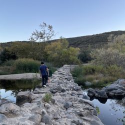
My boyfriend and I were looking for a nice hike to explore SD with my dog, Cody. I loved how this trail was mostly shaded and had open areas for Cody to roam. He had some trouble in the parts of the road that were made of stone but otherwise was fine. Once you park (small parking lot that fits about 20 cars), the trail is shaded and bigger but the further you walk, the skinnier the paths get with less shade. There wasn't too many people today (Monday, July 3rd), only a couple of people and some bikers. And the total hike took about 1 hr 25 min. We basically went as far as we could then walked the same trail back (it doesn't loop back to the parking lot). But this trail had many forks so you could end up somewhere completely different from where we ended. Beautiful flowers, no small rivers during this time, and some wildlife (saw a bunny!) Overall, a good easy hike!
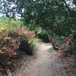

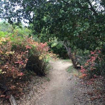
I usually don't leave reviews but this page could use a few more. I parked on the east side of the park and as one reviewer noted, there were several parked cars with guys in them just hanging out in the parking lot. I unfortunately had to use the facilities because I drank too much coffee prior to getting there. As I approached the bathroom I could hear a slapping, rhythmic sound (kinda like flesh on flesh). I remembered that I had read in a review about this place being some kind of homosexual hook up spot. All i gotta say to that is that it very well could be. Nobody bothered me and I didn't physically see any butt sex going on so its all good. I proceeded to take my two very small children to the other side of the park cause I was advised it was more scenic. I had them in a double off roading jogging stroller. We hiked about a mile west. There was only one spot where it was too steep for the jogging stroller and both there and back I was assisted by other park goers in carrying my double jogger up the stairs. It was a very scenic little hike with some magnificent old twisty oaks and intermittent carpets of bright red flowers. The canopy was nice as it was a sunny day. It was a good short hike for getting back out after having two kids and mostly stroller accessible. I'll post some pics.


I must say that I am a little shocked by all the negative comments that I have read here and, frankly, I'm glad that I didn't read them beforehand or I likely would have not made it to this trail. This is a new find for me and I love it! :) I volunteer for a pit bull rescue and took one of the boarded pit mixes for a trail run twice this week, late afternoon. I can count on one hand how many people we encountered, all runners like us. I not once saw any "gay sexual activity" taking place, nor drug deals nor shady looking people loitering in the parking lot. Not once did I feel unsafe. And sure, there is some freeway noise, but it's right off the freeway. What did you expect? I'm thinking most people here are just "trolling". Don't believe the negativity and give this trail a try. :)


I came here alone, on a whim, in silly shoes, and had an absolute blast. (To be fair, my gauge of a good time is the number of awesome pictures I'm able to take.) This is one of those rare places in San Diego where you're NOT bumping into people on a weekend. On my two-hour hike I saw exactly 5 people, and at no point was I concerned for my personal safety. (This would indeed be a great place for the homeless to camp out, but a.) I didn't see any, and b.) the wealthy scare me much more than do the homeless.) The only reason I don't give this gem 5 stars is because of traffic noise. The park hugs a highway though - no one should be surprised that they can HEAR the highway.


Pretty flat... Meh. Met up with some people here... If you want to just get a little fresh air and some steps in, this could work but it's not strenuous by any means... Saw a bunch of guys on mountain bikes... Maybe that's the best way to enjoy this trail system.. read more


1 year ago
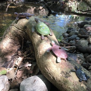
I love coming to this park and exploring the trails. Been going here for years now and I've never seen any sketchy activity. Great brisk afternoon hike. PARK SECRET: Be on the lookout for the family of "turtles" going across a small tree branch along the creek. They're been in the same spot on the east side of Genesse for at least 10 years now. Whenever I visit, I always check to see if they're still there. read more

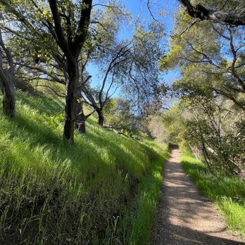
We entered through the Biltmore Trailhead to connect to the main walkways. I've always driven by this area on the 52 but never imagined that it would be such an open space. Of course, it's not filled with nature sounds since it's so close to the freeway but, especially after rain, the hills are covered in vibrant greens and some wildflowers too! There's even a river that flows along the 52 and you can branch off from the main path to explore the banks. Unfortunately, the water looks disgusting and I would highly advise against going in. Most of the path is fairly flat and the small amount of inclines on the trail are pretty short. I was surprised to see as many people as we did. I don't know how crowded it can get but it looks like there are some regular joggers and dog walkers here. At the time of visit, we had just experienced a series of storms so the river was actually high enough where you couldn't complete the whole thing without stepping in it. read more

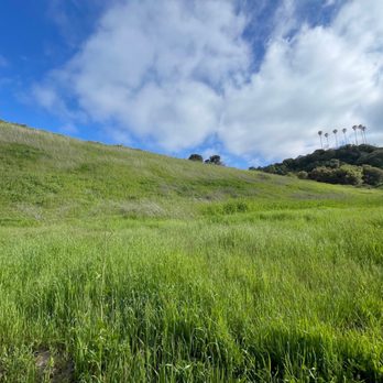


I took a short hike in the middle of this recent humid summer weather (by San Diego standards). Marian Bear Memorial Park straddles the lower edge of SR-52 starting at Regents Rd. You can go eastbound on the trail for about a mile one-way to Genesee Ave or westwards until you hit I-5. It's quite flat in either direction, and there is a creek that runs parallel to SR-52. I chose to just do the eastern route for a brisk walk to stretch out my legs. The parking below the south side of SR-52 was plentiful. There were numerous large potholes that made the drive into the lot very, very bumpy. With plenty of shade along parts of the trek, I encountered several dog walkers. It's definitely a fido friendly place for walking. I didn't notice any illicit activity during my stroll, but I can envision how such a situation could arise. Overall, this is an okay neighborhood "park" for some light exercise. read more





2 years ago
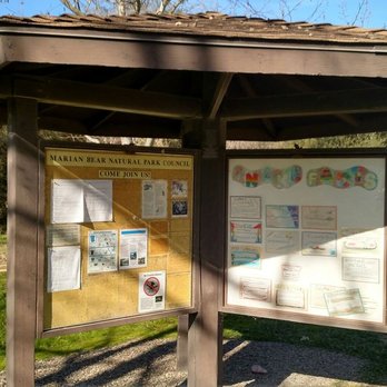
Haven't been back to this trail in a a long while. My pops and 2 boys made it out today and it was just so nice.. aside from the part where my pops flew into a bush trapped and my youngest running to his aid it was a swell day. Ps.. keep a close eye on your elderly who believe they can still do the things the roe grandkids can... anyhow I'm pretty sure the swelling will go down and and my kids and old man will have some forever memories.... Plus I have some on tape should they happen to forget. Anyhow the level of difficulty is fate to medium, watch out for other bike trailers the paths are slim in some areas. Remember to use your left and rights and ALWAYS!! Pick up after your nasty disgusting selves! Seriously a handful of ppl including us picking up trash. This is why we can't have nice more free things! read more


1 year ago

3 years ago
Convenient and easy to reach trail that I frequent. The trail is varied with trees and fair amount of shade. Downside is that it runs along the 52 freeway, so it's a bit noisy. Also, after the recent rains the creek is still fairly full, so you might have a problem doing the whole length of the trail. And the grass is tall and overgrown, so you might want to wear pants as a precaution against ticks. read more


Easy mostly flat trail hike. Trail head at a cul-de-sac and descend short steep stairs. initial forest-type canopy over the wide dirt trail alongside a little creek with ponds, until coming out into the main broad hiking trail in the center of San Clemente Canyon/Marion Bear Park.Many huge sycamores and oaks in this City open-space park with a wide main trail and small stream with some ponds that may have minnows and some orange crawdads. the Trail can become redundant. You can extend your hike to four miles by combining trails. Watch for a cyclists. read more




7 years ago
We made our way over to Marian Bear Memorial Park after finding out another hike wasn't dog friendly. There are a lot of different trails you can take but several of them end up in dead ends along the creek. It's a pretty flat, easy hike which was great to take our 1 year old puppy on. The trail we went on didn't seem to loop back to the parking lot so we had to turn around and walk back the same trail we came from. In addition, the trails don't seem to be well marked, and there are a lot of forks where it's unclear where they will lead to (some taking you to dead ends or paths impossible to continue on). There are a lot of lizards and rabbits you see along the path and there's a lot of greenery. One thing to note is that there's a lot of poison oak around the park as well as rattlesnakes. Overall, decent hike but nothing too special or scenic about it. read more

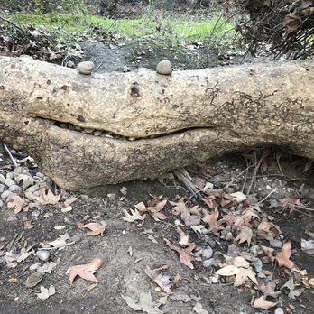


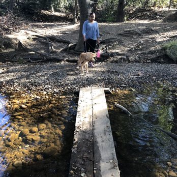

WOW! I finally got the chance to go to my neighborhood park. Honestly, I REALLY want to like this park. I loved the different narrow paths weaving across from one side of the park to the other and the diversity of different plants and sights along the way that you can discover on your hike... but this park needs some serious maintenance. Unfortunately, there are some problems that I just cannot overlook in this nice neighborhood park. 1) There a good amount of trash in this park. 2) Though I mentioned there are different trails to take, some of them take you to some... suspicious places. Adventure is out there- but when it involves a gnarled up wire fence or a standing pool you can slip into, I think a little more security is important to keep in mind. 3) OMG... I didn't discover this until a few weeks later... but there is A LOT of Poison Oak in this park. HIKE. WITH. CAUTION. My skin is raised in this itchy, blistering rash, and it has not gone away yet!!! All in all, if you decide to go to this park, really stick to the trails that are a lot wider, and stay away from any suspicious looking bushes or trees. There are some lovely sights out there, with plenty of beautiful flowers and trees. But, you don't want to take a nasty souvenir home in the form of a itchy rash either! read more



3 years ago
2 years ago


What a gorgeous and well taken care of park! Tons of paths to lose yourself on but not enough to actually get lost. Seems like the thing to do here is mountain biking and I so wish I had one cause it looks like so much fun! There's two clear paths you can take from the the parking lot off Clairemont headed west. One is more shaded and the other is full sun. Shade on the left. Plenty of trash cans at the entrance so don't forget to bring your trash out! read more





6 years ago
6 years ago

15 years ago
I decided to go for a hike somewhere not too far from me and picked Marian Bear. It seemed like a good location and had plenty of geocaches on the trail, but one thing I should have done beforehand is read the Yelp reviews... The trails themselves are so-so. Some are shaded with trees and go over creeks, but for the majority of the hike you're just out in the open. The proximity of the freeway and cars everywhere you look deters from the nature-like atmosphere and just doesn't feel right. It's a good place for a quick hike or a bike ride, but not somewhere you would go to enjoy nature. Plus, the constant sudden sounds of birds, rattlesnakes, rabbits, and very possibly humans lurking in the bushes is pretty disturbing at times. Which brings me to my next point... This is one shady ass place! My encounter started as I was walking along one of the trails and I spotted a guy in sunglasses (it was a cloudy day) standing by the creek as if he was waiting for a drug deal to go down. As I continued walking, his eyes were locked on me and he even began following me for a while. If that wasn't enough to freak me out, the same guy slowly followed me in his car as I was crossing under the Regent St. bridge. I signaled for him to pass me, thinking I was just blocking the road for him, but he insisted I keep walking. After he finally passed me, he did so very slowly and just kept staring at me. No wonder this place has "Phone Patrol" signs everywhere that tell you to report suspicious activity. Only once I got home did I read the reviews and figure out how this place is notorious for illegal activity. Definitely not coming back here ever again... read more


9 years ago
My boyfriend and I were looking for a nice hike to explore SD with my dog, Cody. I loved how this trail was mostly shaded and had open areas for Cody to roam. He had some trouble in the parts of the road that were made of stone but otherwise was fine. Once you park (small parking lot that fits about 20 cars), the trail is shaded and bigger but the further you walk, the skinnier the paths get with less shade. There wasn't too many people today (Monday, July 3rd), only a couple of people and some bikers. And the total hike took about 1 hr 25 min. We basically went as far as we could then walked the same trail back (it doesn't loop back to the parking lot). But this trail had many forks so you could end up somewhere completely different from where we ended. Beautiful flowers, no small rivers during this time, and some wildlife (saw a bunny!) Overall, a good easy hike! read more


11 years ago
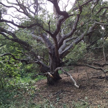
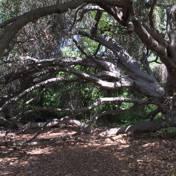
I usually don't leave reviews but this page could use a few more. I parked on the east side of the park and as one reviewer noted, there were several parked cars with guys in them just hanging out in the parking lot. I unfortunately had to use the facilities because I drank too much coffee prior to getting there. As I approached the bathroom I could hear a slapping, rhythmic sound (kinda like flesh on flesh). I remembered that I had read in a review about this place being some kind of homosexual hook up spot. All i gotta say to that is that it very well could be. Nobody bothered me and I didn't physically see any butt sex going on so its all good. I proceeded to take my two very small children to the other side of the park cause I was advised it was more scenic. I had them in a double off roading jogging stroller. We hiked about a mile west. There was only one spot where it was too steep for the jogging stroller and both there and back I was assisted by other park goers in carrying my double jogger up the stairs. It was a very scenic little hike with some magnificent old twisty oaks and intermittent carpets of bright red flowers. The canopy was nice as it was a sunny day. It was a good short hike for getting back out after having two kids and mostly stroller accessible. I'll post some pics. read more





11 years ago
I must say that I am a little shocked by all the negative comments that I have read here and, frankly, I'm glad that I didn't read them beforehand or I likely would have not made it to this trail. This is a new find for me and I love it! :) I volunteer for a pit bull rescue and took one of the boarded pit mixes for a trail run twice this week, late afternoon. I can count on one hand how many people we encountered, all runners like us. I not once saw any "gay sexual activity" taking place, nor drug deals nor shady looking people loitering in the parking lot. Not once did I feel unsafe. And sure, there is some freeway noise, but it's right off the freeway. What did you expect? I'm thinking most people here are just "trolling". Don't believe the negativity and give this trail a try. :) read more


12 years ago
I came here alone, on a whim, in silly shoes, and had an absolute blast. (To be fair, my gauge of a good time is the number of awesome pictures I'm able to take.) This is one of those rare places in San Diego where you're NOT bumping into people on a weekend. On my two-hour hike I saw exactly 5 people, and at no point was I concerned for my personal safety. (This would indeed be a great place for the homeless to camp out, but a.) I didn't see any, and b.) the wealthy scare me much more than do the homeless.) The only reason I don't give this gem 5 stars is because of traffic noise. The park hugs a highway though - no one should be surprised that they can HEAR the highway. read more


11 years ago
I went on a hike this trail twice so far. It is loud but it has good scenery. Not crowded. The first time I went on a hike alone during the weekday. I didn't know anything about weird activities have been going on at this place. I did see a white car slowly following to my direction while I was walking across the parking lot near Regents, but I started walking faster and the car drove away. The second time, I was with my boyfriend on the late Saturday morning to afternoon. At the same parking lot and near by roads, we saw many suspicious cars driving around and parked. A very creepy big old guy parked his van at the corner of the lot. He was standing next to his van and staring at us while we were hiking. After an hour later, when we passed the lot again, he was still same spot but this time, he was sitting inside of his van, in the back seat but the doors are wide open like welcoming someone, again staring at us as we were walking passed. Many other suspicious cars were just driving around the parking lot and they were talking on the phone. After I came home I read reviews here, it all made senses! I never go on this trail alone again. There should be a warning sign for new people like me. read more


7 years ago
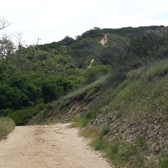
Lovely hike. Take heed of the signs warning about rattlesnakes and keep your dogs on leash. read more



7 years ago
Only dry brush throughout the entire hike. Nice breezes but that's about it. The hike was muddy, but it had rained about a week ago. Also, the highway is right there. Overall good if you want a short quick place to walk, but if you are looking for a scenic hike, not the place for you! read more


7 years ago
6 years ago

9 years ago
4 years ago

11 years ago
I was a little skeptical of this trail after reading some of the reviews... I decided to go anyway. I figured if anything looked sketchy I would just leave. When I got there, I saw a creepy guy just sitting in his truck. I kept driving further down the lot. After I saw a couple hikers, mountain bikers and a family-- I decided to go on my run. Great running trail! You are away from all the traffic and people. The city could clean it up a bit better but good run. read more


10 years ago
I remember going here as a kid in the 80's, but I hadn't been back as an adult because of the negative reviews I'd seen regarding the transients, drug activity, and "hook-ups." Last weekend my husband and I finally decided to give it a chance. We entered the trail at the Genesee lot and hiked east. I didn't notice anything too shady in the parking lot. There was a van parked next to the bathrooms that was clearly being lived in. A woman was tinkering in the back with the door open. Maybe it's the bigger lot off Regents Rd. that has more questionable activity. That is in the west direction, which I didn't explore. The trail runs parallel to Route 52, but to me, still felt worlds away from the city. It may be a different experience depending which part of the trail you are on and the direction you are heading. It was cloudy, with a chance of rain, so there weren't many others out on the trail that day. We did pass a few joggers, cyclists, dog walkers, and even a young couple with a kitten on a leash. A couple women were hiking/jogging alone. Because of the reputation of this place, I am not sure I would feel comfortable doing so unless the trail was busy. The trail is well maintained and traveled, but lined with poison oak. It is level and not strenuous, but there are side trails (undesignated?) that offer a little challenge. Cobb Trail detours to a steep stairway up to a housing development on Cobb Dr. that would be good for working the glutes. It's a mixture of canopy and full sun. I'll be back to explore westward, and update my review, if necessary. read more


9 years ago

6 years ago
Fun hike for the kids. We walked though creeks, with lots of trees to keep you cool while hiking! read more


9 years ago
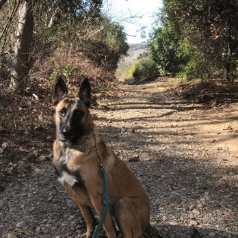
Marian Bear Park is a great place to hike with your pup (on-leash) if you are looking for an easy hike. When you first arrive you will notice there is a trail on the left and also one on the right. The one on the left has better scenery and has a few small hills. The trail on the right is better for people looking for a flat hike. My dog absolutely loved this place! The parking situation is pretty simple... lots of space to park. read more



9 years ago
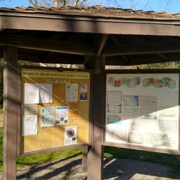
I'm always up for hiking a new trail, hiked here over the weekend with my family. Parts of the trail are really enjoyable, but it's definitely not serene since you can hear the freeway the entire time. I don't see much trash and was paying attention since another reviewer mentioned that. The info board at the trail head was beat up, broken plastic and had very little info. Trails are not well marked and we got a little lost, ended up hiking for 5 miles which was not the plan with our 6 year old in tow. Wouldn't return, but glad we checked it out. read more


11 years ago

Page 1 of 2
More info about Marian Bear Memorial Park
5544 Regents Rd
San Diego, CA 92117
University City, Clairemont
Directions
Hours
Outdoor Amenities
Ask the Community - Marian Bear Memorial Park
Review Highlights - Marian Bear Memorial Park
You might also consider



















Why does Yelp recommend reviews?
13 reviews that are not currently recommended
The reviews below are not factored into the business's overall star rating.
12 years ago

12 years ago

13 years ago

7 years ago
17 years ago

2 years ago

15 years ago
7 years ago

17 years ago
13 years ago
15 years ago

15 years ago

11 years ago
Marian Bear Memorial Park - hiking - Updated September 2026
Best of San Diego
People found Marian Bear Memorial Park by searching for…
Secluded Spots in San Diego, CA
Hiking Trails in San Diego, CA
River Swimming in San Diego, CA
Running Trails in San Diego, CA
Lookout Points in San Diego, CA
Waterfall Hike in San Diego, CA
Camping Sites in San Diego, CA
Stairs Workout in San Diego, CA
Scenic Overlook in San Diego, CA
Fishing Spots in San Diego, CA
Dog Friendly Hiking Trails in San Diego, CA
Lakes & Ponds in San Diego, CA
Stroller Walk in San Diego, CA
Urban Exploration in San Diego, CA
Hiking With Kids in San Diego, CA
Trending Searches in San Diego, CA
Apple Orchards near Marian Bear Memorial Park
Apple Picking near Marian Bear Memorial Park
Archery near Marian Bear Memorial Park
Baseball Fields near Marian Bear Memorial Park
Beautiful Views near Marian Bear Memorial Park
Bike Shop near Marian Bear Memorial Park
Blow Dry Bar near Marian Bear Memorial Park
Casinos near Marian Bear Memorial Park
Cliff Jumping near Marian Bear Memorial Park
Consignment Shops near Marian Bear Memorial Park
Dog Friendly Things To Do near Marian Bear Memorial Park
Dog Parks near Marian Bear Memorial Park
Dog Swimming near Marian Bear Memorial Park
Eyebrow Threading near Marian Bear Memorial Park
Eyelash Extensions near Marian Bear Memorial Park
Hiking Trails near Marian Bear Memorial Park
Kids Birthday Party near Marian Bear Memorial Park
Makeup Artists near Marian Bear Memorial Park
Nail Technicians near Marian Bear Memorial Park
Off Road Trails near Marian Bear Memorial Park
Parks near Marian Bear Memorial Park
Photo Spots near Marian Bear Memorial Park
Picnic Areas near Marian Bear Memorial Park
Places To Take Pictures near Marian Bear Memorial Park
Playgrounds near Marian Bear Memorial Park
Private Schools near Marian Bear Memorial Park
Public Running Track near Marian Bear Memorial Park
Public Shower near Marian Bear Memorial Park
River Swimming near Marian Bear Memorial Park
Rock Quarry near Marian Bear Memorial Park
Running Trails near Marian Bear Memorial Park
Scenic Night View near Marian Bear Memorial Park
Scenic Overlook near Marian Bear Memorial Park
Star Gazing near Marian Bear Memorial Park
Sunrise View near Marian Bear Memorial Park
Teeth Whitening near Marian Bear Memorial Park
Tennis Courts near Marian Bear Memorial Park
Browse Nearby
BEST of San Diego, California Coffee near Marian Bear Memorial Park
BEST of San Diego, California Restaurants near Marian Bear Memorial Park
BEST of San Diego, California Breakfast near Marian Bear Memorial Park
BEST of San Diego, California Things to Do near Marian Bear Memorial Park
BEST of San Diego, California Walking Trails near Marian Bear Memorial Park
BEST of San Diego, California Parks near Marian Bear Memorial Park
BEST of San Diego, California Campgrounds near Marian Bear Memorial Park
BEST of San Diego, California Sightseeing near Marian Bear Memorial Park
BEST of San Diego, California Airport near Marian Bear Memorial Park
Browse Brands
Related Searches in San Diego, CA
Affordable Kayak Rental Services in San Diego, California
Best Dog Hiking Trails Around San Diego, California
Best Fishing Locations and Guides in San Diego, California
Best Nature Trails for Hiking in San Diego, California
Best Off Leash Dog Parks in San Diego, California
Best Parks for Parties and Events in San Diego, California
Best Places for Horseback Riding in San Diego, California
Best Sightseeing Experiences Available in San Diego, California
Best Water Parks for Kids in San Diego, California
Check Out Great Playgrounds in San Diego, California
Check Out Off Road Trails in San Diego, California
Discover Baseball Fields Around San Diego, California
Discover Dog Friendly Trails to Explore in San Diego, California
Discover Easy Hiking Trails Near San Diego, California
Discover Fun Toddler Parks in San Diego, California for Your Little One
Discover Kid Friendly Hiking Trails in San Diego, California
Discover Lakes & Ponds to Explore in San Diego, California
Discover Popular Bike Trails in San Diego, California
Discover Scenic Mountain Bike Trails Near San Diego, California
Discover Soccer Fields in San Diego, California Near You
Discover Top Nature Parks to Visit in San Diego, California
Discover Top State Parks to Visit in San Diego, California
Discover Walking Parks in San Diego, California Near You
Discover a Hiking Trail in San Diego, California
Discover the Best Beaches in San Diego, California
Discover the Best Kids Park Spots in San Diego, California
Discover the Best Night Hike Trails in San Diego, California
Dog-Friendly Hikes With Dogs in San Diego, California
Enjoy Camping Adventures Around San Diego, California
Enjoy Kayaking Adventures in San Diego, California
Enjoy Off Leash Dog Hikes in San Diego, California
Enjoy Scenic Places to Walk in San Diego, California
Enjoy Tent Camping Spots Around San Diego, California
Enjoy a Beautiful Waterfall Hike in San Diego, California
Enjoy the Best Picnic Spots and Ideas in San Diego, California
Enjoy the Best Walking Path in San Diego, California
Enjoy the Best Walking Trails in San Diego, California
Explore Beautiful Parks and Green Spaces in San Diego, California
Explore Easy Hikes Perfect for All in San Diego, California
Explore Free Picnic Areas Around San Diego, California
Explore Fun Activities to Do in San Diego, California
Explore Parks With Pull Up Bars in San Diego, California
Explore Picnic Parks Near San Diego, California
Explore Popular Campgrounds Near San Diego, California
Explore Popular Kids Parks Throughout San Diego, California
Explore Popular Picnic Areas Around San Diego, California
Explore Popular RV Parks Around San Diego, California


