Matt Davis-Steep Ravine Loop Photos


You might also consider


More like Matt Davis-Steep Ravine Loop
Recommended Reviews - Matt Davis-Steep Ravine Loop
Start your review...


Reviews With Photos


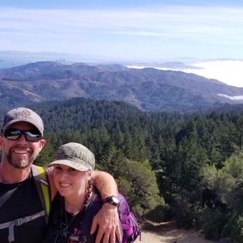
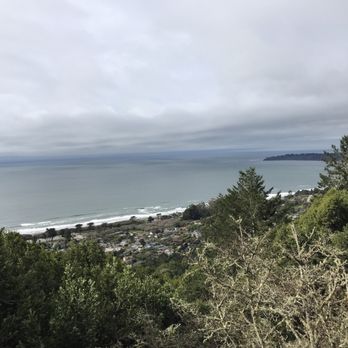
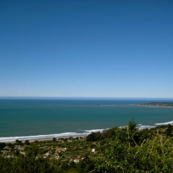
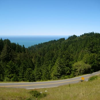
Great hike and a great trail! It's like you're in a different world. It's cold in the morning but once you start walking you'll regret having a jacket on so make sure to bring a backpack to put your jacket in. Don't forget to bring water as well. You'll be amaze with how many people forget to bring water then realize that they are thirsty and need some. This is a trail that you just kind of take in and appreciate. You not only get to walk through the Redwoods but you get a beautiful view of the ocean as well.
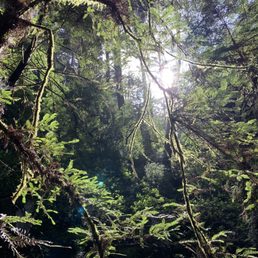

One of my favorite hikes in the bay! There's a nice stream as you hike through the green forest and a mini waterfall. You can easily spend the day hiking the many trails they have. The steep ravine is steep but the view is worth it! Parking is limited so come early!


I love this hike so much! It's everything I love about living here found on the trails; redwoods, ocean views, wild flowers, incredible climbing trails to the top of that big beautiful mountain, mossy wonderland tucked amongst babbling creeks and waterfalls. It's a wallop of a hike that is challenging but oh so worth it. On a beautiful day you can see out over the Bay Area/marin headlands vistas. Rain or shine it is fabulous and worth every drop of sweat earned as you are burning up those trails. I can't say enough good things other than it's not for the faint of heart but it's worth the burn. A few notes to share; pick up after your doggy, trail etiquette is to step aside allowing hikers coming up the right of way, remember we are all out there to enjoy it together so smile to your fellow trailblazers! Just get out there and hit it and be prepared to feel incredible once your done! You'll have earned it.
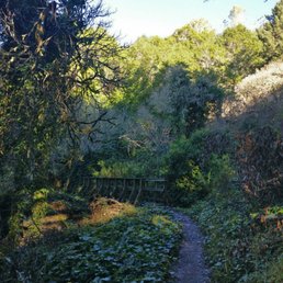

Looking for a loop with some variation? This is it! Like so many others, I used the bahiker guide and highly recommend it. I stopped by the Pantoll Ranger Station first to pay the $8 permit fee (supporting my parks even if I didn't park there), then headed up to park at Belvedere to start at the Matt Davis Trail. Matt Davis Trail: Your soundtrack is flowing water as you encounter switchbacks and pretty gradual inclines with some stairs. The first part is shaded with towering trees, the next half is an open space trek through the mountain side with an ocean view. As you continue on, you'll descend into the shaded forest area again until you emerge at Pantoll Station. To the right of the station you'll descend into a Redwood Canyon as you travel down Steep Ravine Trail. This part was my favorite! Towering redwoods, mini waterfalls, ducking under tree trunks, and climbing down the 14 rung ladder made it feel like nature's playground! You'll emerge out of the woods and cross a street to continue on to Dipsea (at which point I wondered if I was lost, but fear not!). Dipsea offers an open space dirt trail that brings you a breathtaking view of the ocean and mountains as you descend toward Stinson Beach. You'll follow it all the way down until BAM you are popped back out to the street. Look to the right and you'll find Belvedere, but I highly suggest walking toward the beach and grabbing lunch at Siren Canteen (tacos and a milkshake post hike? You deserve it!). The whole loop took me a little less than 3.5 hours with plenty of stops for pictures/veering off to the side for runner to pass (a marathon was in progress). Definitely coming back, maybe trying from the Dipsea side next time. Oh! If you're early enough, I also recommend parking at Pantoll and doing Steep Ravine-Dipsea-Matt Davis. That way you can use the bathroom and pick up a trail map while you're at it.

An experience without regrets. If it wasn't for peer pressure, I would've have been up for the hike. I knew it wouldn't be easy, but super worth it. The view up there is spectacular! After awhile though, everything started getting easier as the hike progressed. Going up is obviously the challenge. Going down seemed super fast and easy. We managed to find parking on a street where the fire station is located. You can't miss it. It's free parking, but be courteous as it is a residential neighborhood after all.


This was a great hike! The whole 6ish mile loop took us about 3 hours, so it's a good half day activity. There's good variety in terrain as well, there's some open grass area as well as more steep wooded areas. The 10ft ladder also makes for a fun photo op!


Unseasonably warm and perfect on this 7 mile moderate loop yesterday. Awesome, charmed views of SF, Stinson, ocean, and Point Reyes. Loads of people out, taking max advantage of the outlier warm winter day. Love looking at the different hills. This loop affords good mix-up of ecology and fauna. We had a picnic lunch where Matt Davis meets the Coastal Trail. Great private spot for eating, not a lot of foot traffic. Need something to sit on because of all the brambles and pokies. We opted for the bun-stinging, steeeeeeeep veer to the left to get up there. Burn, baby burn!!!! Awesome time... Nature allure and verdant hushed vistas, steps to shape the glutes and lotsa cardio time. About 3-4 hours to complete loop. Pigged out in town afterward....Happy 2014!!!
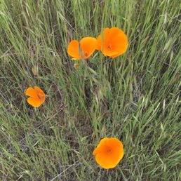

The Matt Davis-Steep Ravine Loop is the quintessential California hike. Woodlands, Redwoods, ocean views, meadows and waterfalls all await you on this moderate to challenging Mt. Tamalpais hike. As others have suggested the best way to embark on the trail is by parking in Stinson Beach on Belvedere Ave. That gets the toughest uphill portion done first (the beginning of the Matt Davis Trail is a steep and steady upward climb.) I learned this the hard way when the first time I did the loop, I parked at Pantoll Campground, hiked down the Steep Ravine Trail to the Dipsea Trail and then had to climb up the Matt Davis Trail halfway through the hike, when my legs were already jelly from the Steep Ravine climb down. The second time I embarked on this loop I had every intention of starting in Stinson Beach but learned that there was an event happening that day-the Miwok 100K which started and ended near the fire station. Parking was tough to find and the road near the trail was closed off. That brought me back to Pantoll for parking, but this time I did the loop in reverse. If you cross Panoramic Highway and go a few yards up the hill, you will see the trail head for the Matt Davis Trail. It starts out through forest land with a pretty flat grade. You will then open up to meadows and hillsides with sweeping views of the coast and Stinson Beach. During the spring, wildflowers abound and this is a lovely stretch of trail. Follow the signs for the downward climb towards Stinson Beach. Although you are going downhill, it still can be a bit rough on the knees. You need to have careful footing (lots of roots) and balance. The climb down through forest is still enjoyable with streams and small waterfalls towards the bottom in winter/spring as well as some views of the coast peeking through the trees. Once at the bottom, make a left and walk past the firehouse and you will see the signs pointing to the Dipsea Trail. This is now the uphill and tougher part of your hike, if you choose to do the loop in this direction. It's not a steep climb and having the ocean breeze nearby helps. You will wind through coastal scrub up the Dipsea and then veering left at the top you will see the signs for Steep Ravine trail which will take you back to Pantoll. The Steep Ravine part of the hike is my favorite. Even on warmer days you have the cool canopy of redwoods throughout this trail. On an early May Saturday, there were still a few small waterfalls and the stream was running nicely. This part of the hike is quite scenic, with redwoods, footbridges and even the infamous ladder (which honestly, isn't so bad.) The climb out of Steep Ravine is short but can be tough if your legs are already tired. Still, the scenery helps you forget most that and it's good to know you are nearly done. One of these days I hope to start the loop as it's intended-up the Matt Davis section from Stinson Beach, but, the other two options I've tried from Pantoll aren't that bad. My fitness tracker puts the whole loop at about 6.8 miles and while there are some tricky parts in terms of footing (rocks, roots, etc) and some steep climbs, it's not an impossible hike for anyone who has a regular fitness and hiking routine. One of my favorite Bay Area hikes!


If you ask me if I like to hike, I would definitely tell you YES. But if you asked me *where* I've hiked, I'd be hard-pressed to give you a list of the hikes I've been on. Truth be told, I've only been on a few, but I really do enjoy hiking and would like to do more. WHY WE CHOSE THIS TRAIL: The variety of landscape and scenery you get on this hike is pretty awesome. You get the forest, the redwoods, the babbling brooks, mini waterfalls, wide open grassy fields and then of course, the spectacular view of the ocean! Online instructions told us to "drive to the Stinson Beach Parking lot. Park there, and take a shuttle bus up the hill to the Pan Toll Ranger Station." That was the plan. Somehow our GPS was confused and the signage wasn't quite enough to get us to the parking lot. But that was perfect because we ended up at the Pan Toll Ranger Station which is ultimately where we wanted to be - and we didn't have to board a bus! Set your GPS for Pan Toll Ranger Station. Park there. Walk down, and then back up! If you are prone to getting car/bus sick, beware. These roads will make you nauseous in a minute. Be prepared w/Dramamine or whatever you do for prevention. This hike is a huge U-turn. Going down it's the MATT DAVIS TRAIL. Coming up it's the STEEP RAVINE TRAIL. We got a simple guide map from the Ranger Station. The hike is roughly 6 miles - there's nothing really steep or difficult despite the name of the trail! Younger kids could easily do this with their parents. The start of the MATT DAVIS TRAIL is literally in front of the Ranger's station. It's 3 miles down the hill. Then you cross to the left of the Fire Station at the bottom and you'll see the pathway entrance for the ascent marked "Steep Ravine Trail". If you have time, you can check out Stinson Beach (we didn't because of time) but sounds fun. It's pretty straight-forward and there is a bit of signage to encourage you along the way. Going down took us 2.5 hours, taking our sweet time. And coming back up took a bit less, about 2 hours. We started at 1:00 which is a bit late, but it worked out perfectly to get us back at 5:30. There was plenty of parking but normally, from what I read in other reviews, the lot is full during peak season. We went on a weekday and it was cloudy, so we pretty much had the trail all to ourselves which was awesome. I highly recommend going on a off-day like that to avoid the crowd. The lack of people def heightened the experience. I haven't been on many hikes, but this one was literally perfect in every way. 6 easy miles, a variety of fantastic landscape and scenery, and didn't cost us a dime! I'm reading other reviews that said they paid an $8 parking permit at the Ranger Station. We didn't. I'm not sure how we evaded that fee, but that's how it happened for us. I got a map from the ranger and he saw us park, but I didn't see a sign for parking fees and he never asked us for $. Maybe they only collect during a certain season?? On the Yelp scale - this hike is a 5 out of 5 stars! HIGHLY recommend!


I feel bad giving this place four stars when the scenery and the various challenges/levels of hikes here are TOTALLY worth 5 stars! I just hated the parking situation here! Coming from the South Bay, it's pretty difficult enough finding a time for my girlfriends and I to do weekend hikes together. So our plan to hike Mt. Tam was a scheduling miracle to begin with! We decided to hike the Matt Davis/Steep Ravine Trail because of its "intermediate" intensity...meaning that it wasn't too easy, nor did it take 8 hours to hike. We planned to start out hike around 11AM, but it was more like noon when we actually started the hike on a Saturday morning. When you arrive, GET HERE BEFORE 11AM or you'll have to park on the narrow side lanes that remind me of the windy roads to campgrounds. The main place that people park is at Pan Toll Station, if you're starting on the Mt. Tam side, not the Stinson Beach side. And NO, it's not the small cluster of parked cars you pass when you finally see the sign that says Mount Tamalpais, keep going down the one-lane windy street until you see signs for Pan Toll Station up ahead. The whole hike actually took us about 5 hours, with driving/parking and lunching when we got to Stinson Beach area. As an active and healthy person, I didn't find this loop to be challenging at all. My friends were a good range of health levels, but we were all affected by the allergies and left with sniffles and stuffed noses. The day after the hike, I only felt a little sore in my booty, but my friends also mentioned calves and hips. It's not a difficult hike at all, but be prepared with water and a hat if you're going in Spring/Summer. The weather was superb on the Saturday we hiked...and there was a good range of hikers that day from old-skool couples with their hiking gear (LEGIT) to a pack of young teenage boys who looked like they were enjoying a day with nature. At some points, we also saw crazy intense runners trail running! Props to those people. I'd totally hike this loop again in the future, but I heard the 8-hour Mt. Tam ascent is one for the books. I look forward to doing that one!


Everything you hope for a best trail/hike experience is here. A lot of things already said here. This is a 5 star rating for sure. Will add some things less said. 1. Bahiker and alltrails map for loop is pretty accurate to follow. 2. Park after reaching at 32 Belvedere Ave. Roadside parking good enough. Trail starts from DO NOT ENTER sign (see pic) 3. Most effort is for first 1.5-2 miles while on matt davis trail. Once you see green pastures, trail becomes easier. 4. Best part (for me) of trail was in between pantoll station and dipsea trail. Waterfalls and shades with lower inclines makes it best to explore and take pics. 5. Dont worry about losing your way. There are no seperate tracks and wherever they are, trail signs are aplenty to guide. 6. Total 3 hours for moderate pace hiker, would say 4 hours with meal and rest breaks.


What a lovely hiking loop! I would say this loop be easy to moderate. Any hiking noob would enjoy it no doubt! It's not too steep but it's not straight up flat either so prepare for some burn to yo glutes, quads, and calves. Although I really enjoyed the Matt Davis-steep ravine loop, finding it was quite a challenge! Best idea is to drive to Stinson beach. I made the mistake of navigating directly by clicking from the address on this Yelp page (I know, I'm a noob). It took us to the middle of a very windy road in the mountain along the coast. I get motion sickness easily, especially car sick. And low and behold, I got car sick from those very sharp turns! My friend and I almost gave up and turned back around but I am very glad we kept continuing the road to a small town called Stinson beach. We had read a guide on how to find the start of the trail online the night before but neither of us actually studied it. Ya know what I mean? We really just skimmed it which was another bad idea because we were lost as hell. Anyway, we parked near a park at Stinson beach to figure out where the hell were we gonna get our hike on. I had screenshot the directions beforehand and so, I pulled it up on my phone to check. The website was on bahiker.com (pretty sure other yelpers have also cited this source. It's very useful). It mentioned the start being behind a fire station. We remembered driving past one before making our way to the park so we decided to walk towards that way and go from there. If you google this loop, you'll for sure find this awesome guide but here is my not-so-detailed directions. I strongly recommend you refer to the original guide. Walk past the fire station, up to the do not enter sign. Don't feel like a bad ass for entering it. It's actually telling cars not to enter. Head to the right after and bam! You'll be right at the foot of the Matt Davis loop. The trail is pretty obvious from there. Most of this trail will be in the redwoods along a creek. None of this part was really dangerous. Be prepared to cross over tiny streams of the creek though. You'll get sick of the woods. You might probably pray to be out of the woods. Oh, don't you worry. After seeing some woods ;) , Matt Davis will take you to some flatland consisting of plain green grass. This part doesn't last long. You'll be back in the wood right when you start to miss it. The trail eventually ends back at the ranger station, which is basically the home base where all the trails start/end (depending on where you begin). Take some time to unleash your inner beast at the bathrooms before making your way to the steep ravine & dip sea trail. Steep ravine trail was pretty fun. There is a ghetto ladder that you have to go down. And most of the trail is just downhill. The steep ravine trail transitions into the dip sea trail. The dip sea trail takes you along the coast. Breathe in that fresh sea salt air while you can. This trail eventually lead you to some street called the panoramic highway, about half a mile from the fire station. Just make your way to there by carefully walking on the side of the road in the bike lane. *note: this is where you feel like a bad ass. All in all, this loop was on point. Will come again once I miss those redwoods ;)


Just wanted to highlight this hike. It's a nice, non-challenging hike, and good for people of all levels. Put 32 Belvedere Ave, Stinson Beach, CA into your GPS. It will take you to a road that loops around the main road in Stinson Beach. You can park anywhere on the side of this road and the trailhead also starts on this road. Take Matt Davis trail to Steep Ravine Trail to Dipsea trail. Most of the hike at the beginning is shaded. Then you come out to the hills that have a couple of steep areas. You then go back to the forest in this little tunnel formed by the trees. Theres are couple of ladders for you to cross. In one part of the loop (about half-way) you have to walk across the road and there's a rest area and restrooms. Lastly, you come out to some hills that overlook the entire beach!! It took us about 3 hours to complete. We were moving at a brisk pace, but also stopped for I minute to take a snack and restroom break. Highly recommended! My only warning is that it's gonna be foggy this summer (as always), so you may not have an awesome view of the beach :/


The loop is about 7.5 miles and 3.5 hrs. All Trails says 6.7 but mine was longer. I've heard the counterclockwise version is easier. I loved this trail for all the shade and ferns it had. It was truly magical and exuded good energy from the forest. The part after Panoramic Highway (Dipsea Trai)l before you hit the Steep Ravine Trail is very sunny and you can see out to the ocean. It kinda reminded me of Southern California. This part can get quite hot on a cloudless hot day but the rest of the trail is very shaded. It goes past the famous Steep Ravine waterfall stairs. This is one of those trails that is very nice and peaceful during the week but the weekends can get crowded and you'll get a different experience. I'd highly recommend the weekdays if you can swing it. read more


3 years ago
Amazing 4 hour trail! We started at Stinson beach and had a blast! It starts quite steep but still manageable with the steps on the trail as you gain elevation. Great views as you're going up and we experienced some small pockets of sprinkles due to the fog roaming around. Not too many wet areas but we did come across some muddier patches. Pretty solid moderate trail. It can feel hard in the beginning but it gets better. I felt really hydrated with all the moisture around me. It's mostly shaded so that helps as well. Highly recommend! read more

My favorite Marin hiking trail thus far! The Matt Davis-Steep Ravine loop combines a challenging ridge trail through rolling hills with coastal views alongside a breathtaking jaunt through a majestic Redwood forest. When I tell you that this hike has ev-er-y-thang.... bay-beh, I ain't lyin' to ya! It's the perfect mix of incline + rolling hills + Redwood groves + coastal views. Heaven is really what this trail should be called. Whether you start your trek from Stinson Beach or from the Dipsea steps, get ready for a heart pumper. I honestly feel like starting from Stinson Beach is a bit more challenging, but those Dipsea stairs are no joke either! From Stinson Beach, it's a 3.6 mile uphill battle to the top of Pantoll Campground. It's mostly shaded until you reach the last half mile where the trail turns into a ridge through the hills. On the way up the Matt Davis trail, you'll go through several switchbacks but most of the trail is shaded by pretty groves of trees. Pantoll Campground is the halfway mark. From here, you can actually connect to several other trails and parks (Muir Woods, Mount Tamalpais, etc). BUT... it would behoove you not to finish the most enchanting portions of this trail loop; the Steep Ravine trail. Yes ladies and gents; this is why you wanna hike this loop. The Steep Ravine trail is simply ravishing. You'll basically be deep within a meadow filled with the most lusciously green foliage and the most gorgeous Redwood trees. It literally feels like something out of a movie. So damn beautiful! Plus, the sound of the creek is so peaceful. You might not ever want to leave. And I can't forgot about the infamous ladder! Do climb down that bad boy with caution, and DO take several pictures of that beauty. It's like the trail landmark, if you will. And alas, you'll reach those Dipsea stairs! Well, that's if you start from Stinson Beach (which I highly recommend). This way, you can take in the stunning coastal views on your way back down to the start of the trail. And voila! You've made it through this incredible 9 mile loop trail. Doesn't it sound like a dream?! Well, it truly is a dream to hike it. At least I think so. And after you tackle this baby yourself, I'm sure you'll feel like it's a dream hike too. read more


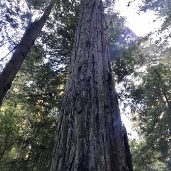

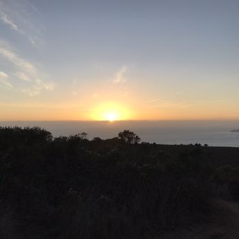


Great hike and a great trail! It's like you're in a different world. It's cold in the morning but once you start walking you'll regret having a jacket on so make sure to bring a backpack to put your jacket in. Don't forget to bring water as well. You'll be amaze with how many people forget to bring water then realize that they are thirsty and need some. This is a trail that you just kind of take in and appreciate. You not only get to walk through the Redwoods but you get a beautiful view of the ocean as well. read more


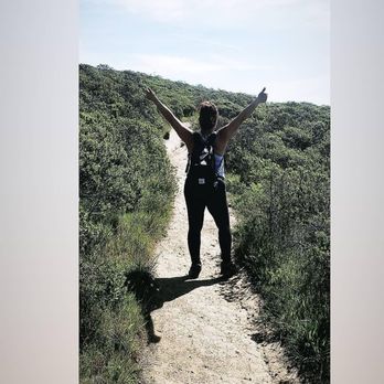

One of my favorite hikes in the bay! There's a nice stream as you hike through the green forest and a mini waterfall. You can easily spend the day hiking the many trails they have. The steep ravine is steep but the view is worth it! Parking is limited so come early! read more
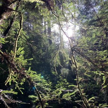


I love this hike so much! It's everything I love about living here found on the trails; redwoods, ocean views, wild flowers, incredible climbing trails to the top of that big beautiful mountain, mossy wonderland tucked amongst babbling creeks and waterfalls. It's a wallop of a hike that is challenging but oh so worth it. On a beautiful day you can see out over the Bay Area/marin headlands vistas. Rain or shine it is fabulous and worth every drop of sweat earned as you are burning up those trails. I can't say enough good things other than it's not for the faint of heart but it's worth the burn. A few notes to share; pick up after your doggy, trail etiquette is to step aside allowing hikers coming up the right of way, remember we are all out there to enjoy it together so smile to your fellow trailblazers! Just get out there and hit it and be prepared to feel incredible once your done! You'll have earned it. read more




9 years ago
Looking for a loop with some variation? This is it! Like so many others, I used the bahiker guide and highly recommend it. I stopped by the Pantoll Ranger Station first to pay the $8 permit fee (supporting my parks even if I didn't park there), then headed up to park at Belvedere to start at the Matt Davis Trail. Matt Davis Trail: Your soundtrack is flowing water as you encounter switchbacks and pretty gradual inclines with some stairs. The first part is shaded with towering trees, the next half is an open space trek through the mountain side with an ocean view. As you continue on, you'll descend into the shaded forest area again until you emerge at Pantoll Station. To the right of the station you'll descend into a Redwood Canyon as you travel down Steep Ravine Trail. This part was my favorite! Towering redwoods, mini waterfalls, ducking under tree trunks, and climbing down the 14 rung ladder made it feel like nature's playground! You'll emerge out of the woods and cross a street to continue on to Dipsea (at which point I wondered if I was lost, but fear not!). Dipsea offers an open space dirt trail that brings you a breathtaking view of the ocean and mountains as you descend toward Stinson Beach. You'll follow it all the way down until BAM you are popped back out to the street. Look to the right and you'll find Belvedere, but I highly suggest walking toward the beach and grabbing lunch at Siren Canteen (tacos and a milkshake post hike? You deserve it!). The whole loop took me a little less than 3.5 hours with plenty of stops for pictures/veering off to the side for runner to pass (a marathon was in progress). Definitely coming back, maybe trying from the Dipsea side next time. Oh! If you're early enough, I also recommend parking at Pantoll and doing Steep Ravine-Dipsea-Matt Davis. That way you can use the bathroom and pick up a trail map while you're at it. read more
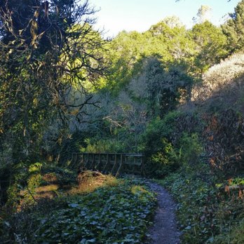


An experience without regrets. If it wasn't for peer pressure, I would've have been up for the hike. I knew it wouldn't be easy, but super worth it. The view up there is spectacular! After awhile though, everything started getting easier as the hike progressed. Going up is obviously the challenge. Going down seemed super fast and easy. We managed to find parking on a street where the fire station is located. You can't miss it. It's free parking, but be courteous as it is a residential neighborhood after all. read more


This was a great hike! The whole 6ish mile loop took us about 3 hours, so it's a good half day activity. There's good variety in terrain as well, there's some open grass area as well as more steep wooded areas. The 10ft ladder also makes for a fun photo op! read more


Unseasonably warm and perfect on this 7 mile moderate loop yesterday. Awesome, charmed views of SF, Stinson, ocean, and Point Reyes. Loads of people out, taking max advantage of the outlier warm winter day. Love looking at the different hills. This loop affords good mix-up of ecology and fauna. We had a picnic lunch where Matt Davis meets the Coastal Trail. Great private spot for eating, not a lot of foot traffic. Need something to sit on because of all the brambles and pokies. We opted for the bun-stinging, steeeeeeeep veer to the left to get up there. Burn, baby burn!!!! Awesome time... Nature allure and verdant hushed vistas, steps to shape the glutes and lotsa cardio time. About 3-4 hours to complete loop. Pigged out in town afterward....Happy 2014!!! read more


5 years ago

8 years ago
The Matt Davis-Steep Ravine Loop is the quintessential California hike. Woodlands, Redwoods, ocean views, meadows and waterfalls all await you on this moderate to challenging Mt. Tamalpais hike. As others have suggested the best way to embark on the trail is by parking in Stinson Beach on Belvedere Ave. That gets the toughest uphill portion done first (the beginning of the Matt Davis Trail is a steep and steady upward climb.) I learned this the hard way when the first time I did the loop, I parked at Pantoll Campground, hiked down the Steep Ravine Trail to the Dipsea Trail and then had to climb up the Matt Davis Trail halfway through the hike, when my legs were already jelly from the Steep Ravine climb down. The second time I embarked on this loop I had every intention of starting in Stinson Beach but learned that there was an event happening that day-the Miwok 100K which started and ended near the fire station. Parking was tough to find and the road near the trail was closed off. That brought me back to Pantoll for parking, but this time I did the loop in reverse. If you cross Panoramic Highway and go a few yards up the hill, you will see the trail head for the Matt Davis Trail. It starts out through forest land with a pretty flat grade. You will then open up to meadows and hillsides with sweeping views of the coast and Stinson Beach. During the spring, wildflowers abound and this is a lovely stretch of trail. Follow the signs for the downward climb towards Stinson Beach. Although you are going downhill, it still can be a bit rough on the knees. You need to have careful footing (lots of roots) and balance. The climb down through forest is still enjoyable with streams and small waterfalls towards the bottom in winter/spring as well as some views of the coast peeking through the trees. Once at the bottom, make a left and walk past the firehouse and you will see the signs pointing to the Dipsea Trail. This is now the uphill and tougher part of your hike, if you choose to do the loop in this direction. It's not a steep climb and having the ocean breeze nearby helps. You will wind through coastal scrub up the Dipsea and then veering left at the top you will see the signs for Steep Ravine trail which will take you back to Pantoll. The Steep Ravine part of the hike is my favorite. Even on warmer days you have the cool canopy of redwoods throughout this trail. On an early May Saturday, there were still a few small waterfalls and the stream was running nicely. This part of the hike is quite scenic, with redwoods, footbridges and even the infamous ladder (which honestly, isn't so bad.) The climb out of Steep Ravine is short but can be tough if your legs are already tired. Still, the scenery helps you forget most that and it's good to know you are nearly done. One of these days I hope to start the loop as it's intended-up the Matt Davis section from Stinson Beach, but, the other two options I've tried from Pantoll aren't that bad. My fitness tracker puts the whole loop at about 6.8 miles and while there are some tricky parts in terms of footing (rocks, roots, etc) and some steep climbs, it's not an impossible hike for anyone who has a regular fitness and hiking routine. One of my favorite Bay Area hikes! read more
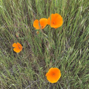


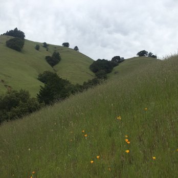


If you ask me if I like to hike, I would definitely tell you YES. But if you asked me *where* I've hiked, I'd be hard-pressed to give you a list of the hikes I've been on. Truth be told, I've only been on a few, but I really do enjoy hiking and would like to do more. WHY WE CHOSE THIS TRAIL: The variety of landscape and scenery you get on this hike is pretty awesome. You get the forest, the redwoods, the babbling brooks, mini waterfalls, wide open grassy fields and then of course, the spectacular view of the ocean! Online instructions told us to "drive to the Stinson Beach Parking lot. Park there, and take a shuttle bus up the hill to the Pan Toll Ranger Station." That was the plan. Somehow our GPS was confused and the signage wasn't quite enough to get us to the parking lot. But that was perfect because we ended up at the Pan Toll Ranger Station which is ultimately where we wanted to be - and we didn't have to board a bus! Set your GPS for Pan Toll Ranger Station. Park there. Walk down, and then back up! If you are prone to getting car/bus sick, beware. These roads will make you nauseous in a minute. Be prepared w/Dramamine or whatever you do for prevention. This hike is a huge U-turn. Going down it's the MATT DAVIS TRAIL. Coming up it's the STEEP RAVINE TRAIL. We got a simple guide map from the Ranger Station. The hike is roughly 6 miles - there's nothing really steep or difficult despite the name of the trail! Younger kids could easily do this with their parents. The start of the MATT DAVIS TRAIL is literally in front of the Ranger's station. It's 3 miles down the hill. Then you cross to the left of the Fire Station at the bottom and you'll see the pathway entrance for the ascent marked "Steep Ravine Trail". If you have time, you can check out Stinson Beach (we didn't because of time) but sounds fun. It's pretty straight-forward and there is a bit of signage to encourage you along the way. Going down took us 2.5 hours, taking our sweet time. And coming back up took a bit less, about 2 hours. We started at 1:00 which is a bit late, but it worked out perfectly to get us back at 5:30. There was plenty of parking but normally, from what I read in other reviews, the lot is full during peak season. We went on a weekday and it was cloudy, so we pretty much had the trail all to ourselves which was awesome. I highly recommend going on a off-day like that to avoid the crowd. The lack of people def heightened the experience. I haven't been on many hikes, but this one was literally perfect in every way. 6 easy miles, a variety of fantastic landscape and scenery, and didn't cost us a dime! I'm reading other reviews that said they paid an $8 parking permit at the Ranger Station. We didn't. I'm not sure how we evaded that fee, but that's how it happened for us. I got a map from the ranger and he saw us park, but I didn't see a sign for parking fees and he never asked us for $. Maybe they only collect during a certain season?? On the Yelp scale - this hike is a 5 out of 5 stars! HIGHLY recommend! read more


I feel bad giving this place four stars when the scenery and the various challenges/levels of hikes here are TOTALLY worth 5 stars! I just hated the parking situation here! Coming from the South Bay, it's pretty difficult enough finding a time for my girlfriends and I to do weekend hikes together. So our plan to hike Mt. Tam was a scheduling miracle to begin with! We decided to hike the Matt Davis/Steep Ravine Trail because of its "intermediate" intensity...meaning that it wasn't too easy, nor did it take 8 hours to hike. We planned to start out hike around 11AM, but it was more like noon when we actually started the hike on a Saturday morning. When you arrive, GET HERE BEFORE 11AM or you'll have to park on the narrow side lanes that remind me of the windy roads to campgrounds. The main place that people park is at Pan Toll Station, if you're starting on the Mt. Tam side, not the Stinson Beach side. And NO, it's not the small cluster of parked cars you pass when you finally see the sign that says Mount Tamalpais, keep going down the one-lane windy street until you see signs for Pan Toll Station up ahead. The whole hike actually took us about 5 hours, with driving/parking and lunching when we got to Stinson Beach area. As an active and healthy person, I didn't find this loop to be challenging at all. My friends were a good range of health levels, but we were all affected by the allergies and left with sniffles and stuffed noses. The day after the hike, I only felt a little sore in my booty, but my friends also mentioned calves and hips. It's not a difficult hike at all, but be prepared with water and a hat if you're going in Spring/Summer. The weather was superb on the Saturday we hiked...and there was a good range of hikers that day from old-skool couples with their hiking gear (LEGIT) to a pack of young teenage boys who looked like they were enjoying a day with nature. At some points, we also saw crazy intense runners trail running! Props to those people. I'd totally hike this loop again in the future, but I heard the 8-hour Mt. Tam ascent is one for the books. I look forward to doing that one! read more

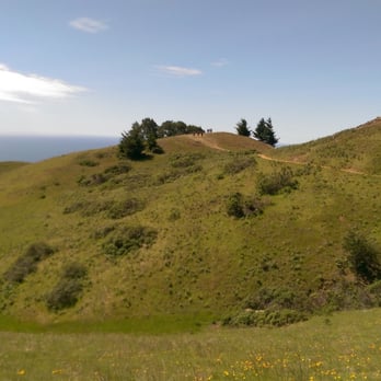
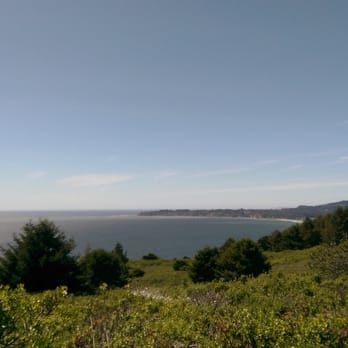


9 years ago
Everything you hope for a best trail/hike experience is here. A lot of things already said here. This is a 5 star rating for sure. Will add some things less said. 1. Bahiker and alltrails map for loop is pretty accurate to follow. 2. Park after reaching at 32 Belvedere Ave. Roadside parking good enough. Trail starts from DO NOT ENTER sign (see pic) 3. Most effort is for first 1.5-2 miles while on matt davis trail. Once you see green pastures, trail becomes easier. 4. Best part (for me) of trail was in between pantoll station and dipsea trail. Waterfalls and shades with lower inclines makes it best to explore and take pics. 5. Dont worry about losing your way. There are no seperate tracks and wherever they are, trail signs are aplenty to guide. 6. Total 3 hours for moderate pace hiker, would say 4 hours with meal and rest breaks. read more

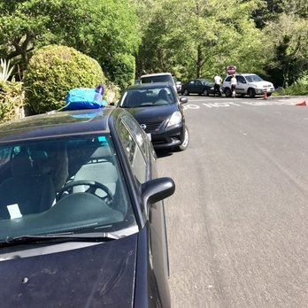
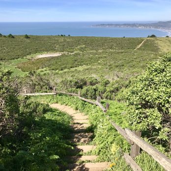
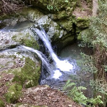

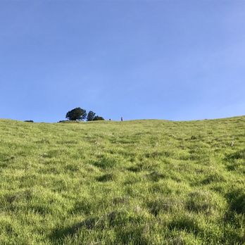


What a lovely hiking loop! I would say this loop be easy to moderate. Any hiking noob would enjoy it no doubt! It's not too steep but it's not straight up flat either so prepare for some burn to yo glutes, quads, and calves. Although I really enjoyed the Matt Davis-steep ravine loop, finding it was quite a challenge! Best idea is to drive to Stinson beach. I made the mistake of navigating directly by clicking from the address on this Yelp page (I know, I'm a noob). It took us to the middle of a very windy road in the mountain along the coast. I get motion sickness easily, especially car sick. And low and behold, I got car sick from those very sharp turns! My friend and I almost gave up and turned back around but I am very glad we kept continuing the road to a small town called Stinson beach. We had read a guide on how to find the start of the trail online the night before but neither of us actually studied it. Ya know what I mean? We really just skimmed it which was another bad idea because we were lost as hell. Anyway, we parked near a park at Stinson beach to figure out where the hell were we gonna get our hike on. I had screenshot the directions beforehand and so, I pulled it up on my phone to check. The website was on bahiker.com (pretty sure other yelpers have also cited this source. It's very useful). It mentioned the start being behind a fire station. We remembered driving past one before making our way to the park so we decided to walk towards that way and go from there. If you google this loop, you'll for sure find this awesome guide but here is my not-so-detailed directions. I strongly recommend you refer to the original guide. Walk past the fire station, up to the do not enter sign. Don't feel like a bad ass for entering it. It's actually telling cars not to enter. Head to the right after and bam! You'll be right at the foot of the Matt Davis loop. The trail is pretty obvious from there. Most of this trail will be in the redwoods along a creek. None of this part was really dangerous. Be prepared to cross over tiny streams of the creek though. You'll get sick of the woods. You might probably pray to be out of the woods. Oh, don't you worry. After seeing some woods ;) , Matt Davis will take you to some flatland consisting of plain green grass. This part doesn't last long. You'll be back in the wood right when you start to miss it. The trail eventually ends back at the ranger station, which is basically the home base where all the trails start/end (depending on where you begin). Take some time to unleash your inner beast at the bathrooms before making your way to the steep ravine & dip sea trail. Steep ravine trail was pretty fun. There is a ghetto ladder that you have to go down. And most of the trail is just downhill. The steep ravine trail transitions into the dip sea trail. The dip sea trail takes you along the coast. Breathe in that fresh sea salt air while you can. This trail eventually lead you to some street called the panoramic highway, about half a mile from the fire station. Just make your way to there by carefully walking on the side of the road in the bike lane. *note: this is where you feel like a bad ass. All in all, this loop was on point. Will come again once I miss those redwoods ;) read more


10 years ago
Just wanted to highlight this hike. It's a nice, non-challenging hike, and good for people of all levels. Put 32 Belvedere Ave, Stinson Beach, CA into your GPS. It will take you to a road that loops around the main road in Stinson Beach. You can park anywhere on the side of this road and the trailhead also starts on this road. Take Matt Davis trail to Steep Ravine Trail to Dipsea trail. Most of the hike at the beginning is shaded. Then you come out to the hills that have a couple of steep areas. You then go back to the forest in this little tunnel formed by the trees. Theres are couple of ladders for you to cross. In one part of the loop (about half-way) you have to walk across the road and there's a rest area and restrooms. Lastly, you come out to some hills that overlook the entire beach!! It took us about 3 hours to complete. We were moving at a brisk pace, but also stopped for I minute to take a snack and restroom break. Highly recommended! My only warning is that it's gonna be foggy this summer (as always), so you may not have an awesome view of the beach :/ read more


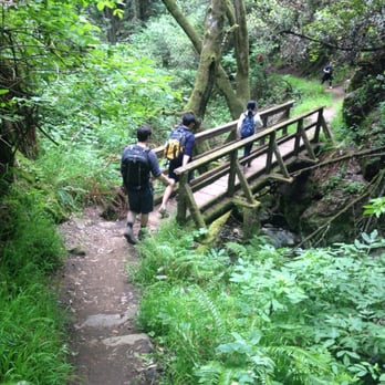


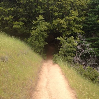


I've been wanting to do this specific loop for the longest and finally completed the Matt Davis to Steep Ravine loop thanks to all the advice on here. I entered 32 Belvedere Ave, Stinson Beach, CA 94970 into the GPS which takes you right at the Fire Station, but any street parking nearby will do. I hiked this with my bf and two of my friends, we started early by 9:45 on a Saturday so we were able to find street parking easily across from the Fire Station. When going up Belvedere with the Community Center on your right, the Matt Davis trail will start straight ahead passed the Do Not Enter road sign. I did a lot of research prior to the hike so I was expecting this way to go through a lot of incline and stairs for the first 2 miles...people were not joking! That got our heart rate up right away and had us breaking a sweat within 15-20 mins of the hike. Great thigh/glutes work out tho! On the BA Hiker guide that some people including myself referenced (http://www.bahiker.com/northbayhikes/stinson.html), he goes into very specific details about unsigned junctions. I wouldn't worry too much about them because the turns are obvious when it comes to staying on the trail. After the moderately strenuous incline and numerous stairs on the first 2 miles of the hike, the trail opens up to the grasslands/mountain slopes exposing you to the sun at a more flat and easy pace. Before going back into the canopy of trees, there'll be a view look out area to your right. If it's you're first time doing this hike, I'd recommend taking a quick break to enjoy the view. You'll be able to see the ocean and from a far distance, Sutro Tower and even the SF city skyline if it's clear of fog. At this point there'll be a little less than a mile left before hitting the Pan Toll station. Once we got there, we took our lunch break and used the restrooms. There was a picnic area, but after a few minutes of taking our sandwiches, grapes and crackers out, the bees started to surround us so I wouldn't advise sitting up there. The restrooms are well kept so make sure to use em before starting again! When facing the bathrooms, the Steep Ravine trail will be to your right. This half of the trail was a lot more crowded than Matt Davis, but the majority of it was downhill which was a treat after the first half. About a mile into the trail, you will hit the 10 ft wooden ladder going down. It's a bummer that the drought prevents a nice waterfall cascading down next to it. This portion of the hike seemed a lot more lush with more boulders, creeks, bridges, Alice in Wonderland rabbit hole trees, tree stumps to limbo under and since we're lower, the redwoods and other trees feel a lot taller. We might have missed a turn somewhere so unfortunately, the last 1.3 mile for us was on the highway which was pretty dangerous, but funny at the same time. Luckily we made it back to our car near the Fire Station within a little less than 4 hours. 7.3 miles accomplished! Overall a great challenging hike with rewarding sceneries and views that I would like to do again. Come prepared with plenty of water, layered clothing, sunscreen, snacks, and a lunch! read more



13 years ago
Absolutely gorgeous hike! A good variety - in the woods with lots of redwoods and vegetation on the Steep Ravine, and great coastal views and viewpoints to stop for a bite on the Matt Davis. We hiked roundtrip Stinson Beach to Dipsea Trail to Steep Ravine to Pan Toll Ranger Station to Matt Davis and back to the start. We stopped under a big tree in our return trip on the Matt Davis trail where we had an expansive view if the ocean, set up a hammock, and had some snacks. At a leisurely pace with breaks, the trip totaled about 4 hours. Moderate in difficulty. Steep up and downhill back (tough on the knees though, I must say, for the last 3 miles or so back). Would definitely do this hike again, any season. Stinson Beach has a cute tiny town with cafés for your post hike grub. The beach is also close to the trailhead. Loved it! read more


Mt. Tam looms in Marin, viewable from many points in the Bay Area. I'm amazed at how quickly you can escape here to serenity from the hectic city life, and surprised by how many people don't realize it or take full advantage of it. Really, it's cheaper than therapy. There are dozens of routes you can take on Mt. Tam, but this loop is a classic. I've done a number of trail races here, but have never taken the time to slow down and appreciate the beauty that this mountain has to offer. We started at Stinson Beach (which doesn't charge for parking), and anticipated on doing the highly recommended hike beginning at Matt Davis and taking Steep Ravine back from Pantoll, but even with The Trails of Mt. Tam map in hand, I couldn't find the starting point for the life of me. (It's across the street, just south of the Stinson parking lot, right by the Community Center on Belvedere - see bahiker.com.) We looped in the opposite direction instead. You still get views of the Beach on the return trip, but it's early on, and you're further inland. I think starting on Steep Ravine, you get the hard part out of the way first and enjoy an easy way back on Matt Davis (or, maybe I'm just making excuses for being directionally challenged). The scenery can change from one moment to the next. One minute, you're in the lush enchanted forest, crossing a bridge over the stream; the next minute, you're on single track pressed against the rolling hills, overlooking the ocean. You won't get spectacular views of the Bay (for that, head to the East Peak), but it is never boring. The loop was easier than I thought it would be--even for 7 miles and 1500' of elevation change. Granted, I'm fairly active, but unless you're a total couch potato, the grades should be manageable. There are a lot of stairs, which help with the ascent/descent. The hillsides are well-manicured, but as with any trail excursion, watch your step. There are many fallen trees across Steep Ravine. Rocky areas are few; I wore the Five Finger shoes (i.e., flats), and had no trouble navigating the terrain in them. Bring a jacket (and gloves), just in case, as the wind can be vicious on the hills. Even on sunny days the temperature drop feels considerable once you're back in the shade. Take the dizzying ride back on Hwy 1 and refuel at Tony Tutto Pizza in Mill Valley. Your body will thank you. read more


11 years ago
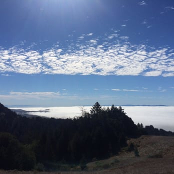
Perfect hike. One of my favorites that I could do again and again! We started at the Matt Davis trailhead (Belvedere and Laurel) or you can hang a right at the Stinson Beach fire station and you'll see the trailhead clearly marked. Not going to lie, the first 4 miles of this hike are tough. All ascent, lots of steps--we were breathing hard and sweating and are in pretty good shape already. Once you reach the top, the views are pretty amazing. We were literally ABOVE the clouds. Great photo ops. The descent was a lot easier and we enjoyed the leisurely final 3 miles through Steep Ravine and the end of the Dip Sea trail. We stopped at the ranger station a little over 4 miles in and had lunch. The bathroom facilities were nice enough and we found a rock with some shade for a quick break before picking up the steep-ravine trail. Love this hike! Definitely do it! read more


I was lucky enough I was walking down Steep Ravine because if I were walking up, I would be weighed down by my cumbersome backpacking backpack. That was when I first visited the Steep Ravine trail which was in 2012. I have been hiking throughout Marin since I was five but this was the first time my footsteps would mark the Steep Ravine canyon. It was less steep at the bottom since I came down via the Dipsea trail, not the upper part of the Steep Ravine trail which is supposed to be extra steep and is where there's a ladder for climbing down the trail. I was happy it was a bit slower because my backpack's weight was pretty annoying. We took a turn to the right, went up a bit and cheered when we saw Stinson Beach just a bit further from us. I quickly learned that the walk from Steep Ravine to Stinson along the Dipsea trail is much longer than it looks and has more descents than you may think. The views however, are quite spectacular! It was not foggy out so I saw Stinson and the lack of people on it (this hike was in the winter,) but felt excited to be getting closer to my goal. Now onto the other half of the loop. I've been on the Matt Davis trail once before. It was in 2007 when I went along with some not so intrepid hikers. This time though, we were in the fog and once we started descending, it was into the steep canyon filled with Douglas Firs. I was not weighed down my backpack although one of my fellow hikers was. He had brought along a backpack on wheels and in it he had a Dictionary. Yes, a Dictionary, not food or even a hiking book. This hike was a bit more free wheeling though, we jumped up to reach logs, we ran down the trail at parts and played football once we hit the beach. We also stopped at Table Rock and could have been more careful about rattlesnakes because apparently they love the rock. Overall, the Matt Davis Steep Ravine loop is a bit steep but pretty scenic. Make sure to get ready for a long day and bring those hiking shoes! It's a fun trail. read more


12 years ago
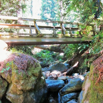
Best hike in the bay area in my opinion. Diverse ecosystems. Pine forests, fog, ferns, creeks, latters, bridges, Redwoods, open grass lands, and views. Here is some advice......start at stinson beach and go up the Matt Davis trail. It will take about 1 HR 45 min to pantoll ranger station. Fill up with water there at the half way mark and have lumch. Then about an 1.5 hours down steep ravine and dipsea to stinson beach. You will be happy you didn't go up steep ravine. And can enjoy it more going down. read more

10 years ago
Gorgeous in assorted flavors. Though I've only been twice, the Dipsea - Steep Ravine - Matt Davis Trail is one of my top favorite hikes of all time. Followed the 6.5 mile route on EveryTrail (you'll have to search manually - "Steep Ravine via Matt Davis, Mt Tamalpais") and takes about 4 hours in total. Coming from someone who isn't exactly in shape, I can also say it's not too difficult. PARKING/CROWD: Went this past Saturday morning 10am, a day after getting ~1/4" of rain. Traffic sucked due to people trying to commute to Muir Woods. But the area wasn't too crowded; we parked in Stinson Beach, near Parkside Cafe on Arenal Ave. DIPSEA TRAIL: The trailhead begins at Stinson Beach's firehouse. It starts out as steps at a moderate slope, but gets increasingly difficult going up. The area is pretty open, with not much to obstruct a peaceful view of Bolinas Bay and the sea. STEEP RAVINE TRAIL: Venturing into the woods! The beginning of this is easily my favorite part of the hike. Tall-as-giant redwoods, dinosaur bite-sized leaves, overturned moss-covered trees, the running and falling water from Webb Creek - it feels as if you're in a jungle (at least, my idea of one). Because of the incredible shade the trees provided, it was a bit chilly and dim, but more importantly, added to magicalness of the place. MATT DAVIS TRAIL: This trail is speckled by tons of various trees and redwood trees to provide cover, as well as a grassy hillside coated with a beautiful blanket of golden poppies. We stopped at some points to admire the streams and views. Toward the end, the trail zigzags back and forth, and each turn feels similar to the last. At one point, we asked "Didn't we pass by here already?" FIN!: Once we returned back to Stinson Beach's cute little town, we grabbed a bite at Siren Canteen. Eating burgers and fries is amazing after that long of a hike. It had gotten clearly busier around 2pm. We strolled alongside Stinson Beach and would've loved to stayed longer had it not been so windy. read more


9 years ago


16 years ago


13 years ago


17 years ago

By far, one of the most scenic & fun hikes we've done. Even better, we were able to hike it on a crystal clear sunny day, so we were able to soak in the beauty this place has to offer. You get a little bit of everything on this hike. You get the beautiful scenery along the pacific coast, along with the forest/trees, terrain, jungle, gravel, bridges, stairs/ladders, mini waterfalls, shade as well as open fields. Just forewarning...there are mountain lions and rattle snakes, but lucky for us, we didn't encounter any. Signs are posted for your safety. This trail was very well maintained/groomed & hiker friendly, and i didn't see one piece of litter, which is awesome. Pack a light camel back and bring some snacks with you. I would park at stinson beach, or at the lot next to the community center/fire station, as that is where you will end up, and you can chill at the beach and have a picnic afterwards! read more






I am pretty new to the Bay Area so this was my first time exploring Marin. I don't like to travel far outside the few mile radius of SF or pay any tolls to exit the city, but it was finally time to venture out. After plenty of research and people raving about this place, I finally decided to trek all the way here for my first hike in Marin. Here is a good address for the GPS: Stinson beach Fire Station 32 Belvedere Ave, Stinson Beach, CA 94970. It takes nearly 50 minutes to get here from the city. The last thirty minutes is a one lane, windy road all the way to Stinson beach. It can get a bit scary winding up especially trying to past the bikers. When you get there, plenty of room to park on the roads nearby or the parking lot near the beach. No fee! The Matt Davis trail is on Belvedere. The entrance is on the side of the fire station across from the bed and breakfast hotel. The trail is spacious, very well kept and easy to follow. The scenery is so beautiful. It's nice to get away and be in nature! The first two miles are pretty deadly. Mostly incline with lots of stairs. The trail levels out for the next two miles. The trail is mostly shady except for a few stints in the open sunny grassland (meadow?). Four miles in, you'll finally make it to the Pan Toll Ranger campground. Perfect time to take a bathroom break. The trail continues across from the bathroom at the Dipsea/Steep Ravine trail. From there it is supposed to be 2.6 miles (lies!) to Stinson beach. One mile in you will see the infamous 10 ft ladder. There's plenty of photo opportunities throughout the trail. Huge branches to climb above, trees to walk through and small streams throughout the trail. There are lots of tree trunks to climb under, bridges to cross, stairs to climb and rocks to jump over to really keep the trail entertaining and fun. The second half of the trail is mostly downhill. So here we are over six miles in and super excited that we are wrapping up the trail. Not! We see signs that we are still 1.4 miles away. What?! Eight miles later, we finally make it back. Wow! I was feeling pretty beat but so proud that we hiked for so long. I'd say the hike is between 7.5-8 miles long depending on where you parked. Prior to this hike, I had never hiked more than 4 miles in total. I'd say it is a moderate hike and doable if you're at least some what active. I think I wouldn't have made it if this was my first few times hiking. I do have to say my body was tired and sore the next day. Alternatively, you can start the loop the opposite way. Rather than starting at Matt Davis, you can start at the Dipsea trail which is on the 1 route on the side of the fire station. I'd say going this way might be slightly less challenging which could be a great thing. There are plenty of restaurants and cafes to stop by after to eat up all the calories you just burned. We stopped by the beach for a bit to relax, stretch and have some snacks. Overall, this was such a fun and challenging hike! I would definitely recommend this hike to anyone who loves a good workout, fresh air and beautiful scenery. read more


16 years ago

12 years ago
I absolutely love this hike! I have done it with my family, my boyfriend, and friends and I never get sick of it. My mom never wants to do the full hike, but she will go maybe 1.5 miles in and turn around and she still loves it. The full hike is about 6.5 miles and it normally takes us close to three hours to finish it. We enjoy the hike though and seem to stop for a bunch of pictures. About midway through the hike you end up at a campsite where there is a public restroom that you can use (no soap though). After the campsite, you turn around but go back a different route. One of my favorite things about this hike is the changing scenery. You start off going up a beautiful golden hill with a nice bath overlooking the ocean. Always have to stop and turn around and normally take some pictures here. Then it looks like you are going to walk into the forest from the Princess Bride. When you get inside, it is absolutely beautiful with moss and ferns growing everywhere. You will feel a need to stop and take more pictures. You go up a fairly steep walk (elevation gain of about 1,900 ft) for a couple of miles through the forest until you get to the campsite. There is a good train, but a lot of roots that you walk over and good shoes should be worn. After the campsite, you curve back down around going through another forest that looks different than the other. We always talk about how easy a mountain lion could get us because they can just pounce right down on us. We don't really see too many people when we are walking this part and you want to make sure that you don't get stuck here when it is dark. I know from experience that it is pretty scary. Then you come to some beautiful rolling hills overlooking the ocean. Again, you will want to bust out the camera. After the hills, you go back into the forest and weave down. The views and vegetation on this hike are amazing and it is a good workout. Love it! You end up right about the same spot that you started over by Stinson Beach. We often stop and say hello to the ocean before we head home. Now I want to go hiking! read more


Page 1 of 3
More info about Matt Davis-Steep Ravine Loop
Stinson Beach Trailhead
Mt. Tamalpais State Park
Stinson Beach, CA 94970
Directions
Visit Website
http://www.bahiker.com/northbayhikes/stinson.html
Hours
Indoor Amenities
Outdoor Amenities
Ask the Community - Matt Davis-Steep Ravine Loop
What's the easiest way to do this? It's for me, my girlfriend, and her 8yr old son
Set your GPS for Pan Toll Ranger Station. Park there. Walk down, and then back up! This hike is a…
Review Highlights - Matt Davis-Steep Ravine Loop
You might also consider


















Why does Yelp recommend reviews?
1 review that is not currently recommended
The reviews below are not factored into the business's overall star rating.

9 years ago
Matt Davis-Steep Ravine Loop - hiking - Updated September 2026
Best of Stinson Beach
People found Matt Davis-Steep Ravine Loop by searching for…
Dog Friendly Hiking Trails in Stinson Beach, CA
Waterfall Hike in Stinson Beach, CA
Easy Hikes in Stinson Beach, CA
Campgrounds in Stinson Beach, CA
Waterfalls in Stinson Beach, CA
Redwood Trees in Stinson Beach, CA
Things to Do in Stinson Beach, CA
Hiking Trails in Stinson Beach, CA
Scenic View in Stinson Beach, CA
Rock Climbing in Stinson Beach, CA
Watch Sunset in Stinson Beach, CA
Fishing Spots in Stinson Beach, CA
Natural Hot Springs in Stinson Beach, CA
Dog Friendly Beaches in Stinson Beach, CA
Hiking With Kids in Stinson Beach, CA
Free Parking in Stinson Beach, CA
Hammock Park in Stinson Beach, CA
Camping Cabins in Stinson Beach, CA
Trending Searches in Stinson Beach, CA
Archery near Matt Davis-Steep Ravine Loop
Barbershop For Men near Matt Davis-Steep Ravine Loop
Bike Shop near Matt Davis-Steep Ravine Loop
Bird Sanctuary near Matt Davis-Steep Ravine Loop
Casinos near Matt Davis-Steep Ravine Loop
Cliff Jumping near Matt Davis-Steep Ravine Loop
Consignment Shops near Matt Davis-Steep Ravine Loop
Cruising Spots near Matt Davis-Steep Ravine Loop
Dog Friendly Things To Do near Matt Davis-Steep Ravine Loop
Ear Piercing near Matt Davis-Steep Ravine Loop
Eyebrow Threading near Matt Davis-Steep Ravine Loop
Flower Fields near Matt Davis-Steep Ravine Loop
Hair Braiding near Matt Davis-Steep Ravine Loop
Kids Haircut near Matt Davis-Steep Ravine Loop
Lakes near Matt Davis-Steep Ravine Loop
Lookout Points near Matt Davis-Steep Ravine Loop
Parks near Matt Davis-Steep Ravine Loop
Picnic Areas near Matt Davis-Steep Ravine Loop
Preschools near Matt Davis-Steep Ravine Loop
Private Schools near Matt Davis-Steep Ravine Loop
Public Golf Courses near Matt Davis-Steep Ravine Loop
Rock Quarry near Matt Davis-Steep Ravine Loop
Scenic Night View near Matt Davis-Steep Ravine Loop
Scenic Overlook near Matt Davis-Steep Ravine Loop
Sunrise View near Matt Davis-Steep Ravine Loop
Swimming Holes near Matt Davis-Steep Ravine Loop
Trading Card Shops near Matt Davis-Steep Ravine Loop
Uniforms near Matt Davis-Steep Ravine Loop
Browse Articles
Browse Nearby
BEST of Stinson Beach, California Coffee near Matt Davis-Steep Ravine Loop
BEST of Stinson Beach, California Restaurants near Matt Davis-Steep Ravine Loop
BEST of Stinson Beach, California Things to Do near Matt Davis-Steep Ravine Loop
BEST of Stinson Beach, California Parks near Matt Davis-Steep Ravine Loop
BEST of Stinson Beach, California Breakfast near Matt Davis-Steep Ravine Loop
BEST of Stinson Beach, California Walking Trails near Matt Davis-Steep Ravine Loop
BEST of Stinson Beach, California Campgrounds near Matt Davis-Steep Ravine Loop
BEST of Stinson Beach, California Lodging near Matt Davis-Steep Ravine Loop
BEST of Stinson Beach, California Motel near Matt Davis-Steep Ravine Loop
Browse Brands
Related Searches in Stinson Beach, CA
Affordable Kayak Rental Services in Stinson Beach, California
Best Dog Hiking Trails Around Stinson Beach, California
Best Fishing Locations and Guides in Stinson Beach, California
Best Nature Trails for Hiking in Stinson Beach, California
Best Places for Horseback Riding in Stinson Beach, California
Best Sightseeing Experiences Available in Stinson Beach, California
Check Out Off Road Trails in Stinson Beach, California
Discover Dog Friendly Trails to Explore in Stinson Beach, California
Discover Easy Hiking Trails Near Stinson Beach, California
Discover Kid Friendly Hiking Trails in Stinson Beach, California
Discover Popular Bike Trails in Stinson Beach, California
Discover a Hiking Trail in Stinson Beach, California
Discover the Best Night Hike Trails in Stinson Beach, California
Dog-Friendly Hikes With Dogs in Stinson Beach, California
Enjoy Camping Adventures Around Stinson Beach, California
Enjoy Kayaking Adventures in Stinson Beach, California
Enjoy Off Leash Dog Hikes in Stinson Beach, California
Enjoy Scenic Places to Walk in Stinson Beach, California
Enjoy a Beautiful Waterfall Hike in Stinson Beach, California
Enjoy the Best Walking Path in Stinson Beach, California
Enjoy the Best Walking Trails in Stinson Beach, California
Explore Easy Hikes Perfect for All in Stinson Beach, California
Explore Fun Activities to Do in Stinson Beach, California
Explore Popular Campgrounds Near Stinson Beach, California
Explore Popular Dog Walking Trails in Stinson Beach, California
Explore Top Dog Parks in Stinson Beach, California Near You
Explore the Best Beach Spots in Stinson Beach, California
Explore the Best Swimming Holes Around Stinson Beach, California
Family Friendly Hiking With Kids in Stinson Beach, California
Find Beautiful Views in Stinson Beach, California
Find Cozy Camping Cabins in Stinson Beach, California
Find Top Dog Swimming Spots in Stinson Beach, California
Find Top-Rated Waterfalls in Stinson Beach, California Now
Find the Best Parks for Picnics in Stinson Beach, California
Find the Best Scenic View Locations in Stinson Beach, California
Hiking Trails With Waterfalls in Stinson Beach, California
Off Leash Dog Hiking Trails in Stinson Beach, California
Plan a Scenic Drive Route Near Stinson Beach, California
Popular Outdoor Activities to Try in Stinson Beach, California
Popular Picnic Spots to Visit in Stinson Beach, California
Popular Waterfall Hiking Trails in Stinson Beach, California
Safe and Fun Parks for Kids in Stinson Beach, California
Top Hiking Trails to Explore in Stinson Beach, California
Top Playgrounds for Kids to Enjoy in Stinson Beach, California
Top Running Trails to Explore in Stinson Beach, California
Top Swimming Lakes to Enjoy in Stinson Beach, California
Top Swimming Spots and Pools in Stinson Beach, California
Top Things to Do With Kids in Stinson Beach, California
Walk Dog Friendly Hiking Trails in Stinson Beach, California
Walk the Best Paved Walking Trails in Stinson Beach, California


