McAllister County Park Photos


You might also consider
More like McAllister County Park
Recommended Reviews - McAllister County Park
Start your review...

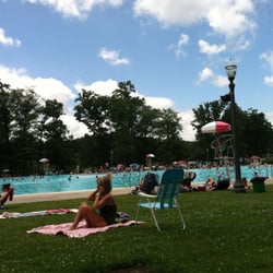
Reviews With Photos


A hidden secret beyond the village of Belle Terre, McAlister park is true gem. Quiet, perfectly round and peaceful laguna is surrounded by sandy dunes, and is a point of weekend attraction for many yachts and ships of all shapes and sizes. With occasional road travelers like us mixed in. Beach is wild, and varies from sand to gravel to small stones, but if you cross the hight dune, you will end up on almost empty clean sandy beach where you can relax, get some tan going or have picnic (please clean up after yourself, tho). From the top of the dune, you can enjoy panoramic view of the laguna, and the beach - beautiful! Parking space is limited, come early.


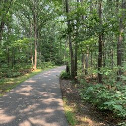
I absolutely love this little gem. I have been going here to walk my dogs for two years now. It's a great walk and absolutely stunning views. Every time I go I walk 5 miles. (4.97 miles) to be exact. I walk around the inlet and sand dunes and through the town of belle terre to get back to my car. All the while taking in the gorgeous view.

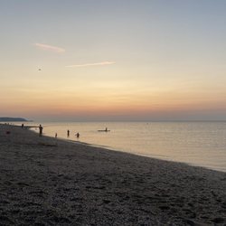
My hubby, kiddo and I visited this beach to try and catch the sunset. We made it in time but we were unable to see the Sen setting form our position. In any case, it's a beautiful beach with beautiful views, and it's very serene. I'm sure if we could have gotten to the beach a bit earlier and wandered, we would have been able to find the perfect spot to enjoy the sunset. The area that we entered the beach, is at the end of a fairly long drive through a wooded area that borders residential homes. There is a very small parking lot located right at the entrance to the beach. I'm sure you would have to arrive pretty early in the day to score a spot. There are police that monitor the area so don't think that you would be able to illegally park and not get a ticket. There was an officer stationed near the lot and when we couldn't find a spot, we just politely asked if we could temporarily park so we could catch the sunset and then leave. He obliged and said it was fine. Despite not catching the sun setting, it was a nice little impromptu side trip before heading back home. I definitely want to venture here again next summer and see if we can catch the elusive sunset from this beach. read more


2 years ago
Pirates Cove, Port Jefferson Located just a few miles from Stony Brook University ( my alma mater ), is Pirate's cove, in Mccalister park. I'd highly recommend coming here for a picnic. There are sandy dunes and pristine, crystal clear waters. The water is almost as clear as the one's in the Bahamas! This place definitely has less foot traffic than the beaches in the area. Its also a fantastic backdrop for aesthetic pictures. There are also many seafood eateries in the area. Get here early because there are limited parking spots! read more


3 years ago
Nice beach, but limited parking makes it hard to visit. They are super strict here and you have to park in one of the five designated spots otherwise you will get a ticket. read more
6 years ago
This place is a vacation while close to home. With beautiful dunes it's a secret hidden little cove to chill out. Boats come in and anchor in for the day. Definitely a place you can explore more than once. read more


3 years ago
A hidden secret beyond the village of Belle Terre, McAlister park is true gem. Quiet, perfectly round and peaceful laguna is surrounded by sandy dunes, and is a point of weekend attraction for many yachts and ships of all shapes and sizes. With occasional road travelers like us mixed in. Beach is wild, and varies from sand to gravel to small stones, but if you cross the hight dune, you will end up on almost empty clean sandy beach where you can relax, get some tan going or have picnic (please clean up after yourself, tho). From the top of the dune, you can enjoy panoramic view of the laguna, and the beach - beautiful! Parking space is limited, come early. read more


6 years ago
6 years ago
10 years ago
10 years ago
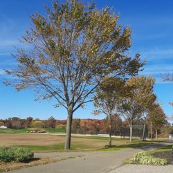
I visited on a cold December afternoon, I want to come back on nicer afternoon, It could be a great picnic destination. read more


11 years ago
I absolutely love this little gem. I have been going here to walk my dogs for two years now. It's a great walk and absolutely stunning views. Every time I go I walk 5 miles. (4.97 miles) to be exact. I walk around the inlet and sand dunes and through the town of belle terre to get back to my car. All the while taking in the gorgeous view. read more

6 years ago
8 years ago
9 years ago
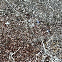
If you've ever been robbed, stabbed, molested, or burglarized and afterwards wondered where the police were when you needed them, know that they were probably here cruising, loitering, and idling in this incredibly wealthy, cozy neighborhood. Not far from the park there's a parking lot for beach access but it is for residents only. And police cars, ostensibly. The lot was empty except for two police cars enjoying the view. Situated just two miles away from quaint Port Jefferson town, views at McAllister County Park are gorgeous and similar to scenic Sunken Meadow. Just not as easily accessible. The water looks a little cleaner too, glistening and blue-green even on a brisk November day. read more


10 years ago
More info about McAllister County Park
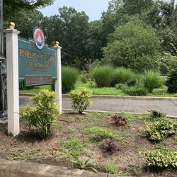
200 Cliff Rd
Port Jefferson, NY 11777
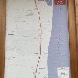
Directions
Hours
Outdoor Amenities
Ask the Community - McAllister County Park
Review Highlights - McAllister County Park
You might also consider


Why does Yelp recommend reviews?
1 review that is not currently recommended
The reviews below are not factored into the business's overall star rating.
8 months ago
McAllister County Park - parks - Updated June 2026
Best of Port Jefferson
People found McAllister County Park by searching for…
Beaches in Port Jefferson, New York
Things to Do in Port Jefferson, New York
Secret Spots in Port Jefferson, New York
Watch Sunset in Port Jefferson, New York
Scenic View in Port Jefferson, New York
Places to Take Pictures in Port Jefferson, New York
Sunrise View in Port Jefferson, New York
Picnic Spots in Port Jefferson, New York
Attractions in Port Jefferson, New York
Walking Trails in Port Jefferson, New York
Sand Dunes in Port Jefferson, New York
Sunset View in Port Jefferson, New York
Water Parks in Port Jefferson, New York
Public Beaches in Port Jefferson, New York
Secluded Spots in Port Jefferson, New York
Romantic Views in Port Jefferson, New York
Playgrounds in Port Jefferson, New York
Free Parking in Port Jefferson, New York
Scenic Drive in Port Jefferson, New York
Parks for Kids in Port Jefferson, New York
Running Trails in Port Jefferson, New York
Outdoor Gym in Port Jefferson, New York
Trending Searches in Port Jefferson, NY
Baseball Fields near McAllister County Park
Beaches near McAllister County Park
Black Owned Nail Salons near McAllister County Park
Boardwalk near McAllister County Park
Boat Rental near McAllister County Park
Cliff Jumping near McAllister County Park
Day Trips near McAllister County Park
Dog Friendly Beaches near McAllister County Park
Fishing Spots near McAllister County Park
Free Kids Activities near McAllister County Park
Jet Ski Rental near McAllister County Park
Lakes near McAllister County Park
Outdoor Basketball Courts near McAllister County Park
Paddle Boat Rentals near McAllister County Park
Parks With Pull Up Bars near McAllister County Park
Pick Your Own Farms near McAllister County Park
Public Beaches near McAllister County Park
River Swimming near McAllister County Park
Soccer Store near McAllister County Park
Splash Pad near McAllister County Park
Strawberry Picking near McAllister County Park
Swimming Holes near McAllister County Park
Swimming Lakes near McAllister County Park
Swimming Pools near McAllister County Park
Watch Sunset near McAllister County Park
Browse Articles
Browse Nearby
BEST of Port Jefferson, New York Restaurants near McAllister County Park
BEST of Port Jefferson, New York Coffee near McAllister County Park
BEST of Port Jefferson, New York Things to Do near McAllister County Park
BEST of Port Jefferson, New York Beaches near McAllister County Park
BEST of Port Jefferson, New York Breakfast near McAllister County Park
Browse Brands
Related Searches in Port Jefferson, NY
Best Parks for Parties and Events in Port Jefferson, New York
Best Water Parks for Kids in Port Jefferson, New York
Check Out Great Playgrounds in Port Jefferson, New York
Discover Baseball Fields Around Port Jefferson, New York
Discover Free Parking Options in Port Jefferson, New York
Discover Popular Photo Spots in Port Jefferson, New York
Discover Public Beaches to Visit in Port Jefferson, New York
Discover Soccer Fields in Port Jefferson, New York Near You
Discover Top Nature Parks to Visit in Port Jefferson, New York
Discover the Best Beaches in Port Jefferson, New York
Enjoy the Best Picnic Spots and Ideas in Port Jefferson, New York
Enjoy the Best Walking Trails in Port Jefferson, New York
Explore Beautiful Botanical Gardens in Port Jefferson, New York
Explore Family-Friendly Zoos and Wildlife in Port Jefferson, New York
Explore Free Picnic Areas Around Port Jefferson, New York
Explore Fun Activities to Do in Port Jefferson, New York
Explore Parks With Pull Up Bars in Port Jefferson, New York
Explore Popular Campgrounds Near Port Jefferson, New York
Explore Popular Picnic Areas Around Port Jefferson, New York
Explore Popular RV Parks Around Port Jefferson, New York
Explore Popular Recreation Centers Around Port Jefferson, New York
Explore Scenic Lakes to Visit in Port Jefferson, New York
Explore Secret Spots Worth Visiting in Port Jefferson, New York
Explore Top Dog Parks in Port Jefferson, New York Near You
Explore Top Gyms in Port Jefferson, New York Now
Explore Top Water Parks in Port Jefferson, New York Today
Find Beautiful Views in Port Jefferson, New York
Find Public Tennis Courts in Port Jefferson, New York
Find Top Skate Parks in Port Jefferson, New York for All Skill Levels
Find Top Skating Rinks in Port Jefferson, New York for All Ages
Find a Park With BBQ Pits in Port Jefferson, New York
Find the Best Parks BBQ Grills in Port Jefferson, New York
Find the Best Parks for Picnics in Port Jefferson, New York
Find the Best Swimming Pools in Port Jefferson, New York Today
Have Fun at a Splash Pad in Port Jefferson, New York
Indoor Playgrounds to Explore in Port Jefferson, New York
Locate Tennis Courts Around Port Jefferson, New York
Must-See Tourist Attractions Around Port Jefferson, New York
Parks With Basketball Courts for Games in Port Jefferson, New York
Picnic Areas With BBQ Pits Available in Port Jefferson, New York
Popular Fishing Spots to Explore in Port Jefferson, New York
Popular Kids Activities in Port Jefferson, New York
Popular Outdoor Activities to Try in Port Jefferson, New York
Popular Places to Take Pictures in Port Jefferson, New York
Top Hiking Trails to Explore in Port Jefferson, New York
Top Running Trails to Explore in Port Jefferson, New York
Top Swimming Lakes to Enjoy in Port Jefferson, New York
Top Things to Do With Kids in Port Jefferson, New York
Top-Rated Basketball Courts to Play at in Port Jefferson, New York
People who viewed McAllister County Park also viewed
Pavilion at Sunken Meadow
113 reviews
Avalon Nature Preserve
92 reviews
Cordwood Park
7 reviews
David Weld Sanctuary
5 reviews
West Meadow Beach
43 reviews
Caumsett State Historic Park Preserve
109 reviews
Fleets Cove Beach
4 reviews
Asharoken Beach
5 reviews
Hallock State Park Preserve
5 reviews
Kalers Pond Park
3 reviews