Moffett Bay Trail Photos


You might also consider
More like Moffett Bay Trail
Recommended Reviews - Moffett Bay Trail
Start your review...

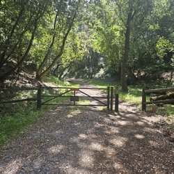
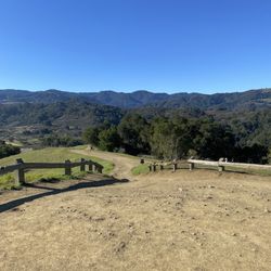
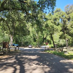
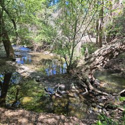
I'd recommend anyone to go here. Even for a walk, trail run, trail bike ride or just to walk up the hill for the views. I have been going here for years now and enjoy bringing family here to enjoy the scenery or just to get some exercise out doors. read more


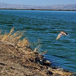
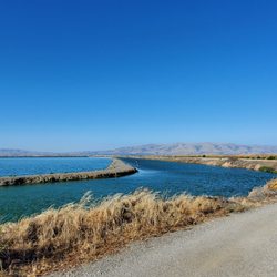
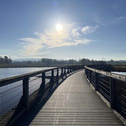
The "Moffett Bay Trail" is 97% representative of all the trails throughout the Bay Area. [The remaining 3% are the yet-to-be-improved (AWS) or connected/segregated trails.] I have thoroughly enjoyed the segregated status of a well-maintained/relatively smooth/wide gravel track just above sea level. It is SO NICE to not be on busy city streets, though sometimes there can be a bit of congestion with other trail users. And the weather is pretty darn nice--I compare it very favorably to the slightly superior "International Ft. Hancock - Las Cruces I-10 Bicycle Bypass" (in the not-quite-a-mile/~1.6 kms high "¡Hidden Gem of the World, Crossroads of North America, anchored by El Paso, Cd. Juárez y Las Cruces!"); the former in the rain shadow of the Santa Cruz Mountains, the latter in the Northern Chihuahua Desert. I highly recommend it for a long level route, connecting Stevens Creek Trail/Mountain View with Caribbean Drive/Sunnyvale. I've cycled it in both directions, and actually saw an unmarked dirigible overhead, sailing around Southbay, practicing navigation/maneuvers before landing back in the super-secret Lockheed-Martin/Moffett base/Google complex. ¡So interesting, and definitely has my coveted "iWheel of Approval!" read more


SO out on the trail today and from a distance spotted a C-5 Galaxy. The tail flash was easily visible and it clearly was from nearby Travis AFB in Fairfield. Ive posted Galaxy pics before but this one was on the far edge of the runway right up next to the trail. I was only able to get a few pics off before being hassled by the security schmucks. Not wanting to have to spend time explaining myself to LEO's and despite being on a public trail I decided to continue on my ride. Just a bit of advice. If your going to load classified satellite payloads do it from a part of the base that IS NOT right by the public trail. I decided to continue on my ride but before I left I was able to make a few observations and ask around with some aviation types (Thanks Zaphod for filling in the gaps) to figure out what they were doing: It appeared that this was one of 2 C-5's that had been reconfigure to transport large space type cargo. Originally designated the C-5C and have since been modified to the M standard but lack the upper deck. Doing some digging, NROL-71 (National Reconnaissance Office Launch #71) is scheduled to launch on September 18th at Vandenberg AFB on a Delta V Heavy. its rumored to be a Keyhole-11 Satellite. Its kind of the like the Hubble Space telescope but pointing down at the Earth and weights 19 tons. Its highly likely that the bird was built at Lockheed martin located on the base or Space Systems Loral and its being loaded tonight to fly to Vandenberg to be fitted on the booster. There appeared to be a surveying device or laser type surveying device in the cargo bay (hard to make out in the pic). If you look closely you can see someone standing in the cargo bay. Its a cool shot because the nose is up and you can see its open all the way through They were setting up lights so its going to be a night load. An RV, a couple of forklifts, and a construction style trailer was also located around the C-5. Pretty cool. If it was not so far out, I would be tempted to return with my DSLR and get some more pics. read more


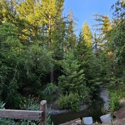
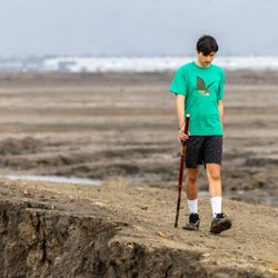
Located near the southern most part San Francisco Bay and bordering Moffett Field's giant historical hangars that used to house zeppelin sized blimps. Take the trails out on the sloughs where Bay water lazily laps the wetlands steps away from water. It is peaceful with an occasional jogger or bicyclist. If you turn back around toward the massive Moffett Field hangars and you can see helicopters or other flying machines take off every once in a while. NASA also has me of its facilities here. Pretty damn cool. read more


2 years ago
More info about Moffett Bay Trail
54 Moffett Field Bay Trl
Sunnyvale, CA 94089
Directions
Hours
Outdoor Amenities
You might also consider


Moffett Bay Trail - hiking - Updated June 2026
Best of Sunnyvale
People found Moffett Bay Trail by searching for…
Trending Searches in Sunnyvale, CA
Beaches near Moffett Bay Trail
Black Owned Nail Salons near Moffett Bay Trail
Boat Rental near Moffett Bay Trail
Bounce House Rentals near Moffett Bay Trail
Cliff Jumping near Moffett Bay Trail
Dog Friendly Things To Do near Moffett Bay Trail
Flower Fields near Moffett Bay Trail
Jet Ski Rental near Moffett Bay Trail
Movie Theatre near Moffett Bay Trail
Outdoor Activities near Moffett Bay Trail
Pick Your Own Farms near Moffett Bay Trail
Picnic Areas near Moffett Bay Trail
Public Pools near Moffett Bay Trail
Rock Quarry near Moffett Bay Trail
Running Trails near Moffett Bay Trail
Scenic Drive near Moffett Bay Trail
Secluded Spots near Moffett Bay Trail
Splash Pad near Moffett Bay Trail
Strawberry Picking near Moffett Bay Trail
Summer Camps near Moffett Bay Trail
Sunrise View near Moffett Bay Trail
Swimming Holes near Moffett Bay Trail
Swimming Lakes near Moffett Bay Trail
Swimming Pools near Moffett Bay Trail
Watch Sunset near Moffett Bay Trail
Browse Articles
Browse Nearby
BEST of Sunnyvale, California Coffee near Moffett Bay Trail
BEST of Sunnyvale, California Restaurants near Moffett Bay Trail
BEST of Sunnyvale, California Things to Do near Moffett Bay Trail
BEST of Sunnyvale, California Walking Trails near Moffett Bay Trail
BEST of Sunnyvale, California Parks near Moffett Bay Trail
BEST of Sunnyvale, California Breakfast near Moffett Bay Trail
BEST of Sunnyvale, California Hot Springs near Moffett Bay Trail
BEST of Sunnyvale, California Campgrounds near Moffett Bay Trail
BEST of Sunnyvale, California Sightseeing near Moffett Bay Trail
Browse Brands
Related Searches in Sunnyvale, CA
Affordable Kayak Rental Services in Sunnyvale, California
Best Fishing Locations and Guides in Sunnyvale, California
Best Nature Trails for Hiking in Sunnyvale, California
Best Places for Horseback Riding in Sunnyvale, California
Check Out Off Road Trails in Sunnyvale, California
Discover Dog Friendly Trails to Explore in Sunnyvale, California
Discover Kid Friendly Hiking Trails in Sunnyvale, California
Discover Scenic Hiking Trails in Sunnyvale, California
Discover Scenic Mountain Bike Trails Near Sunnyvale, California
Discover Scenic Waterfall Spots in Sunnyvale, California
Discover Walking Parks in Sunnyvale, California Near You
Discover a Hiking Trail in Sunnyvale, California
Discover the Best Night Hike Trails in Sunnyvale, California
Dog-Friendly Hikes With Dogs in Sunnyvale, California
Enjoy Camping Adventures Around Sunnyvale, California
Enjoy Exciting Mountain Biking Adventures in Sunnyvale, California
Enjoy Kayaking Adventures in Sunnyvale, California
Enjoy Tent Camping Spots Around Sunnyvale, California
Enjoy a Beautiful Waterfall Hike in Sunnyvale, California
Enjoy a Peaceful Nature Walk in Sunnyvale, California
Enjoy the Best Walking Path in Sunnyvale, California
Enjoy the Best Walking Trails in Sunnyvale, California
Exciting Cliff Jumping Spots in Sunnyvale, California
Experience Thrilling White Water Rafting in Sunnyvale, California
Explore Beautiful Parks and Green Spaces in Sunnyvale, California
Explore Easy Hikes Perfect for All in Sunnyvale, California
Explore Fun Activities to Do in Sunnyvale, California
Explore Popular Campgrounds Near Sunnyvale, California
Explore the Best Beach Spots in Sunnyvale, California
Explore the Best Boating Spots in Sunnyvale, California
Explore the Best Trail Options in Sunnyvale, California
Family Friendly Hiking With Kids in Sunnyvale, California
Find Popular Ziplining Spots Around Sunnyvale, California
Find the Best Parks for Picnics in Sunnyvale, California
Find the Best Scenic View Locations in Sunnyvale, California
Great Places to Walk in Sunnyvale, California
Hike the Popular Waterfall Trail in Sunnyvale, California
Hiking Trails With Waterfalls in Sunnyvale, California
Off Leash Dog Hiking Trails in Sunnyvale, California
Plan a Scenic Drive Route Near Sunnyvale, California
Popular Outdoor Activities to Try in Sunnyvale, California
Popular Picnic Spots to Visit in Sunnyvale, California
Safe River Swimming Areas in Sunnyvale, California
Safe and Fun Parks for Kids in Sunnyvale, California
Top Climbing Spots and Gyms in Sunnyvale, California
Top Paddleboarding Activities in Sunnyvale, California
Top Running Trails to Explore in Sunnyvale, California
Top Swimming Spots and Pools in Sunnyvale, California
People who viewed Moffett Bay Trail also viewed
Stevens Creek Trail
94 reviews
PG&E Trail
21 reviews
Hetch Hetchy Trail
4 reviews
Midpeninsula Regional Open Space District
23 reviews
Maisie's Peak
10 reviews
Mora Trail
7 reviews
Permanente Creek Trail
7 reviews
Dumbarton Bridge Vista Point and Trail
2 reviews
Skyline Trail
6 reviews
Ravenswood Open Space Preserve
14 reviews