PG&E Trail Photos


You might also consider


More like PG&E Trail
Recommended Reviews - PG&E Trail
Start your review...


Reviews With Photos

I'm glad I tried this PG&E trail (Cupertino). Granted, the name is deterring. I came a little late in the day, 2 hours from closing on Saturday. I parked in the 1st parking spot I could find (you can see a pic of a map of where I was parked). There were other parking lots nearby. All parking lots were paved and wide enough. Parking was labeled as full, but I drove into that lot and parked anyways since several parking spots were visibly open. I couldn't find anyone to pay, so I didn't worry about it. There's a toilet at the parking lot. I observed that the trails are for all levels. It was seamless to find beginner level trails; if one looked strenuous from afar, I followed a different trail that wasn't straight up steep slopes. Nice trees (some redwoods), clean land w/less brush (less trip hazards), no unhoused individual(s)l observed, no litter laying around. Cute forest creatures, no mosquitos (first week of April 2025). I saw a power line trail, but didn't take it and didn't see it again. So the power lines weren't in my face . It's not that it was crowded; it's that there were many people walking on an extremely wide walkway in just a few choice areas. NOT crowded when I went. 5 out of 5 stars imo.


I had the same idea as the other 3 million people living in Silicon Valley to get out into nature this weekend and go for a hike. This trail is located on the outskirts of Cupertino about 5 minutes away from civilization so it is very accessible and was completely mobbed this Saturday. There are a lot of different parking lots (we saw 5) that can access this hike and when we got there at 4pm they were all completely full. We had to pull over and pray someone finishing up would be leaving. This trail is not open to dogs. Equestrian riders are allowed on the trail but we didn't see any. We did see a lot of horse poop though so just watch your step. The ground was a bit wetter this time of year but it wasn't muddy, just hard packed clay that could be slippery in some areas. There is a lot of wildlife to be seen. We saw a couple bunnies, some industrious mice among the tall grasses, about 5 deer in total, and a lot of wild turkeys walking along the trail...sometimes across it! I wonder why they crossed the road. The chicken may know. The trail sometimes splits into a biking path and a pedestrian path but no one seemed to really care which was which - it was just flooded with people. This trail is listed as moderate on AllTrails but it's really easy trail. It is about 4.5 miles though which I think might be considered longer. While it definitely wouldn't be fun pushing a stroller on this trail, a child that is steady on their feet could definitely do it and I saw a few people with wagons. My gripe was how busy and loud it was...the distinct buzzing of the power lines, lots of children screaming and running down narrow trails, a family actually heading a soccer ball on the trail over people hiking, etc... We must have passed over 100 people on this trail. It was kind of a chore dodging runners and having to risk the poison oak to get out of the way of oblivious people. Perhaps everyone was trying to get some reprieve from the city by coming out to the park but I would avoid it for now if you don't like crowds.


My legs are literally short! Just finished this hike for the first time and it was legit so rough! But so worth it. It's beautiful! Parking sucks specially due to covid since they blocked everything but wow this is very challenging! They have different turning points in case you don't want to challenge yourself as much or they have a 10 mile point. I did the 10 mile and wow, yeah I'm in pain!


The Upper High Meadow Trail is located within the Rancho San Antonio Open Preserve. The trail is part of a multi mile loop. Its northernmost points connect to the PG&E Trail and the Black Mountain Trail Connector. The Trail is essentially the same dirt road as the PG&E Trail, however, it is in worse repair in spots. Portions of the trail are quite steep and suffers from erosion so it can be rutted. For much of the trail, it tracks along the opposite side of the PG&E Trail. It offers fanatic views of the valley between them a and the mountains. You can get Bay Views here and there as well. The trail ends at an observation areas and several trails connect off of it. It does require a bit of effort in either direction to get to the trail so I'm not sure its the best for small children and there are no services for the length of the trail. As with the PG&E Trail, you should have good shoes and sock, as well as ample water and snacks. If you do the whole loop from the parking lot it can be over 8 miles so plan accordingly. Trail: Dirt road Suitable For: Hiking Services: None, Length: 1.7 miles Elevation Gain: Greater or less than than 700 feet depending on direction


If you get here before 7a on a weekend/holiday, you should be able to get a parking spot. Various lengths of trails. Here is a video of the trail to Black Mountain Summit: https://youtu.be/oHO72ZDyeyU Not too much shade, most parts have enough space for social distance hiking.


Very peaceful leisurely sunset hike during the week day. There was still lots of people but plenty of parking. I recommend going there during the week day evening for a lovely sunset stroll.


1 year ago
From 1-10(10 the most difficult, I would rate this 4-5. It was our first time here and we got invited by our friends who love hiking and does it regularly. We got here at 8 am but had to wait for some friends so we got to start at 9. We did 6.2 miles for almost 4 hrs including 2- 10 minute breaks. I loved this place because first it was clean and has a lot of shaded areas as well. Then at the end of our hike, there were a lot of nice view spots. They have a small farm and garden where you can see some cows, goats with their kids, and hens. They are all soo cute and feels good to just watch them. We even saw a pig and it was so big and fat! Lol! We saw this part of the park because we started on the other side of the trail which was really great! It was rewarding to see them after a long hike. Then there's a lot of picnic table too next to the farm and they're all shaded so it's nice to see and know they have those. Maybe next time we'll bring some food and just have a picnic there after the hike. You can also park and enter to start walking from this side where the garden and farm is and go the other way around. There were a lot of parking spaces too(lower level) but if you come in late, you will need to park on the upper level which is a little further walk before you get to the starting point of the trail. Not sure when are we going back here coz its like 45 minutes from where we live plus we always try new trails every time we go. I highly recommend this place so go check it out! read more
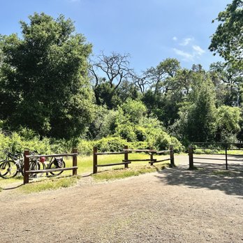


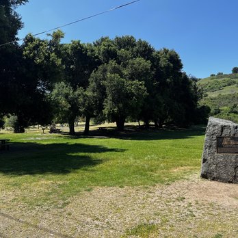

PG&E trail is the perfect place for hikers of all levels. Most hikers can opt for the Deer hollow farm where they can find goats, sheep, cows, chickens, roosters, pigs, rabbits, and cats. Or they can hike the various trails that range from 2-8 miles. One tip is to come early as parking fills up quickly! read more


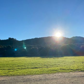


Pretty awesome trails. You can find the different routes online and adjust as needed for distance and difficulty. The trail itself is very well-kept and generally accessible for handicap or wagons, until you start going uphill. I recommend closely studying the maps before getting on these trails, because there are a lot of options depending on if you want to climb up, hike there and back, or go on some loops. Expect little to no places to rest if you are climbing the trail with increase in elevation. I would prepare food, water, shovel, and outdoor toiletry items just in case. However, for more casual hiking, you can probably just walk through the small valley at the eastern end of the park. Bug spray recommended during hot days. Have fun and be safe! read more


1 year ago
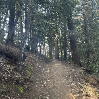
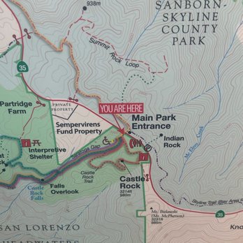
I'm glad I tried this PG&E trail (Cupertino). Granted, the name is deterring. I came a little late in the day, 2 hours from closing on Saturday. I parked in the 1st parking spot I could find (you can see a pic of a map of where I was parked). There were other parking lots nearby. All parking lots were paved and wide enough. Parking was labeled as full, but I drove into that lot and parked anyways since several parking spots were visibly open. I couldn't find anyone to pay, so I didn't worry about it. There's a toilet at the parking lot. I observed that the trails are for all levels. It was seamless to find beginner level trails; if one looked strenuous from afar, I followed a different trail that wasn't straight up steep slopes. Nice trees (some redwoods), clean land w/less brush (less trip hazards), no unhoused individual(s)l observed, no litter laying around. Cute forest creatures, no mosquitos (first week of April 2025). I saw a power line trail, but didn't take it and didn't see it again. So the power lines weren't in my face . It's not that it was crowded; it's that there were many people walking on an extremely wide walkway in just a few choice areas. NOT crowded when I went. 5 out of 5 stars imo. read more





2 years ago

6 years ago
I had the same idea as the other 3 million people living in Silicon Valley to get out into nature this weekend and go for a hike. This trail is located on the outskirts of Cupertino about 5 minutes away from civilization so it is very accessible and was completely mobbed this Saturday. There are a lot of different parking lots (we saw 5) that can access this hike and when we got there at 4pm they were all completely full. We had to pull over and pray someone finishing up would be leaving. This trail is not open to dogs. Equestrian riders are allowed on the trail but we didn't see any. We did see a lot of horse poop though so just watch your step. The ground was a bit wetter this time of year but it wasn't muddy, just hard packed clay that could be slippery in some areas. There is a lot of wildlife to be seen. We saw a couple bunnies, some industrious mice among the tall grasses, about 5 deer in total, and a lot of wild turkeys walking along the trail...sometimes across it! I wonder why they crossed the road. The chicken may know. The trail sometimes splits into a biking path and a pedestrian path but no one seemed to really care which was which - it was just flooded with people. This trail is listed as moderate on AllTrails but it's really easy trail. It is about 4.5 miles though which I think might be considered longer. While it definitely wouldn't be fun pushing a stroller on this trail, a child that is steady on their feet could definitely do it and I saw a few people with wagons. My gripe was how busy and loud it was...the distinct buzzing of the power lines, lots of children screaming and running down narrow trails, a family actually heading a soccer ball on the trail over people hiking, etc... We must have passed over 100 people on this trail. It was kind of a chore dodging runners and having to risk the poison oak to get out of the way of oblivious people. Perhaps everyone was trying to get some reprieve from the city by coming out to the park but I would avoid it for now if you don't like crowds. read more


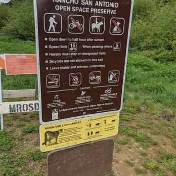

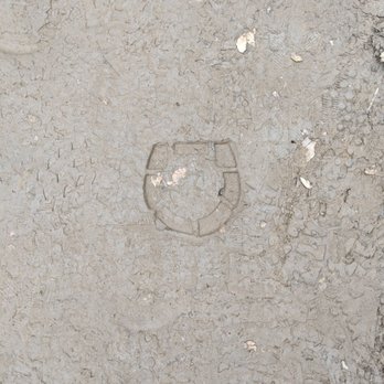
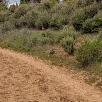

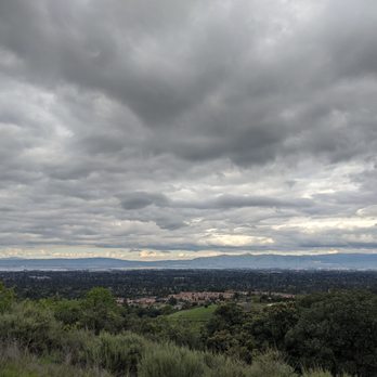


My legs are literally short! Just finished this hike for the first time and it was legit so rough! But so worth it. It's beautiful! Parking sucks specially due to covid since they blocked everything but wow this is very challenging! They have different turning points in case you don't want to challenge yourself as much or they have a 10 mile point. I did the 10 mile and wow, yeah I'm in pain! read more


4 years ago

The Upper High Meadow Trail is located within the Rancho San Antonio Open Preserve. The trail is part of a multi mile loop. Its northernmost points connect to the PG&E Trail and the Black Mountain Trail Connector. The Trail is essentially the same dirt road as the PG&E Trail, however, it is in worse repair in spots. Portions of the trail are quite steep and suffers from erosion so it can be rutted. For much of the trail, it tracks along the opposite side of the PG&E Trail. It offers fanatic views of the valley between them a and the mountains. You can get Bay Views here and there as well. The trail ends at an observation areas and several trails connect off of it. It does require a bit of effort in either direction to get to the trail so I'm not sure its the best for small children and there are no services for the length of the trail. As with the PG&E Trail, you should have good shoes and sock, as well as ample water and snacks. If you do the whole loop from the parking lot it can be over 8 miles so plan accordingly. Trail: Dirt road Suitable For: Hiking Services: None, Length: 1.7 miles Elevation Gain: Greater or less than than 700 feet depending on direction read more


6 years ago
If you get here before 7a on a weekend/holiday, you should be able to get a parking spot. Various lengths of trails. Here is a video of the trail to Black Mountain Summit: https://youtu.be/oHO72ZDyeyU Not too much shade, most parts have enough space for social distance hiking. read more


4 years ago
Very peaceful leisurely sunset hike during the week day. There was still lots of people but plenty of parking. I recommend going there during the week day evening for a lovely sunset stroll. read more


5 years ago


7 years ago
8 years ago
7 years ago



8 years ago
7 years ago
8 years ago
More info about PG&E Trail
Ask the Community - PG&E Trail
Review Highlights - PG&E Trail
You might also consider


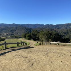
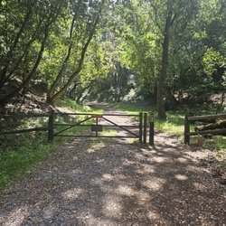


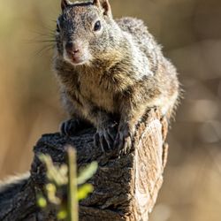
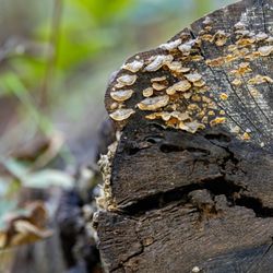


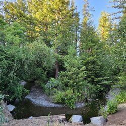
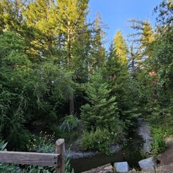
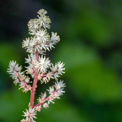


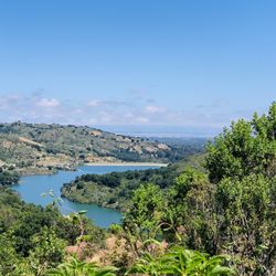
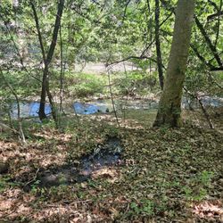
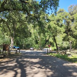
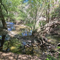





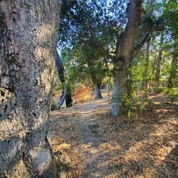


PG&E Trail - hiking - Updated September 2026
Best of Cupertino
People found PG&E Trail by searching for…
Hiking Trails in Cupertino, CA
Dog Friendly Hiking Trails in Cupertino, CA
Redwood Trees in Cupertino, CA
Walking Trails in Cupertino, CA
Walking Groups in Cupertino, CA
Great View Points for Sunset in Cupertino, CA
Running Trails in Cupertino, CA
Stroller Friendly Hikes in Cupertino, CA
Waterfall Hike in Cupertino, CA
Trending Searches in Cupertino, CA
Apple Orchards near PG&E Trail
Bird Sanctuary near PG&E Trail
Consignment Shops near PG&E Trail
Cruising Spots near PG&E Trail
Dog Friendly Things To Do near PG&E Trail
Eyebrow Threading near PG&E Trail
Public Golf Courses near PG&E Trail
Running Trails near PG&E Trail
Scenic Night View near PG&E Trail
Scenic Overlook near PG&E Trail
Swimming Holes near PG&E Trail
Trading Card Shops near PG&E Trail
Browse Articles
Browse Nearby
BEST of Cupertino, California Coffee near PG&E Trail
BEST of Cupertino, California Things to Do near PG&E Trail
BEST of Cupertino, California Restaurants near PG&E Trail
BEST of Cupertino, California Walking Trails near PG&E Trail
BEST of Cupertino, California Parks near PG&E Trail
BEST of Cupertino, California Breakfast near PG&E Trail
Browse Brands
Related Searches in Cupertino, CA
Affordable Kayak Rental Services in Cupertino, California
Best Dog Hiking Trails Around Cupertino, California
Best Fishing Locations and Guides in Cupertino, California
Best Nature Trails for Hiking in Cupertino, California
Best Places for Horseback Riding in Cupertino, California
Check Out Off Road Trails in Cupertino, California
Discover Dog Friendly Trails to Explore in Cupertino, California
Discover Easy Hiking Trails Near Cupertino, California
Discover Kid Friendly Hiking Trails in Cupertino, California
Discover Popular Bike Trails in Cupertino, California
Discover Scenic Mountain Bike Trails Near Cupertino, California
Discover Walking Parks in Cupertino, California Near You
Discover a Hiking Trail in Cupertino, California
Discover the Best Night Hike Trails in Cupertino, California
Dog-Friendly Hikes With Dogs in Cupertino, California
Enjoy Camping Adventures Around Cupertino, California
Enjoy Kayaking Adventures in Cupertino, California
Enjoy Off Leash Dog Hikes in Cupertino, California
Enjoy Scenic Places to Walk in Cupertino, California
Enjoy Tent Camping Spots Around Cupertino, California
Enjoy a Beautiful Waterfall Hike in Cupertino, California
Enjoy the Best Walking Path in Cupertino, California
Enjoy the Best Walking Trails in Cupertino, California
Explore Beautiful Parks and Green Spaces in Cupertino, California
Explore Easy Hikes Perfect for All in Cupertino, California
Explore Fun Activities to Do in Cupertino, California
Explore Popular Campgrounds Near Cupertino, California
Explore Popular Dog Walking Trails in Cupertino, California
Explore Top Dog Parks in Cupertino, California Near You
Explore the Best Beach Spots in Cupertino, California
Family Friendly Hiking With Kids in Cupertino, California
Find Parks and Recreation Activities in Cupertino, California
Find Top Dog Friendly Parks to Visit in Cupertino, California
Find Top-Rated Waterfalls in Cupertino, California Now
Find the Best Parks for Picnics in Cupertino, California
Hiking Trails With Waterfalls in Cupertino, California
Off Leash Dog Hiking Trails in Cupertino, California
Popular Outdoor Activities to Try in Cupertino, California
Popular Picnic Spots to Visit in Cupertino, California
Popular Waterfall Hiking Trails in Cupertino, California
Safe River Swimming Areas in Cupertino, California
Safe and Fun Parks for Kids in Cupertino, California
Top Hiking Trails to Explore in Cupertino, California
Top Playgrounds for Kids to Enjoy in Cupertino, California
Top Running Trails to Explore in Cupertino, California
Top Swimming Lakes to Enjoy in Cupertino, California
Top Swimming Spots and Pools in Cupertino, California
Top-Rated Camping Sites in Cupertino, California


