Maisie's Peak Photos


You might also consider


More like Maisie's Peak
Recommended Reviews - Maisie's Peak
Start your review...


Reviews With Photos


When encountering people riding horses on the trails, it's important to be mindful and considerate. Horses can be easily spooked, which can lead to serious and even deadly accidents. For the safety of everyone, please ensure that your dogs are kept on a leash and your children are supervised at all times. Unfortunately, I witnessed a terrifying incident last week where a child chased me and my horse with a tree branch while screaming. My horse became extremely frightened and began to bolt at 45 miles per hour. We were on a narrow road, and the situation could have led to a fatal fall into the nearby creek. Horses are prey animals and are not used to sudden movements or loud noises. If you encounter a horse while biking, it's best to slow down and talk to the rider before passing, especially if you're moving at high speed. This will help the horse understand that you are not a threat. It's also crucial that you prevent your dogs from chasing horses, as a kick from a horse can be fatal for a dog. Please refrain from bringing an umbrella on the trail, as this could also spook the horses. As equestrians, we always aim to be respectful of other trail users. We don't chase after your children or dogs, and we always yield to bikers when necessary. We don't aim to make anyone feel scared or intimidated on the trails, and we ask that you extend the same courtesy for everyone's safety. Sharing trails with bikers and people is an important aspect of outdoor recreation, especially for those who enjoy hiking and horseback riding. However, not everyone is aware of the best practices for sharing these trails safely and respectfully. That's why it's important to make sure that everyone who uses these trails has at least a basic understanding of how to share the trails with others. One way to achieve this is by making it mandatory for individuals to complete a short online course before obtaining a license for trail use. This course could cover topics such as trail etiquette, safety guidelines, and tips for sharing the trail with other users. For none horse people in particular, it's important to understand that horses can be easily spooked by sudden movements and loud noises. This means that bikers and other hikers should approach horses slowly and calmly, and give them plenty of space to pass by. By taking these simple steps to educate trail users, we can help ensure that everyone can enjoy the great outdoors safely and responsibly.


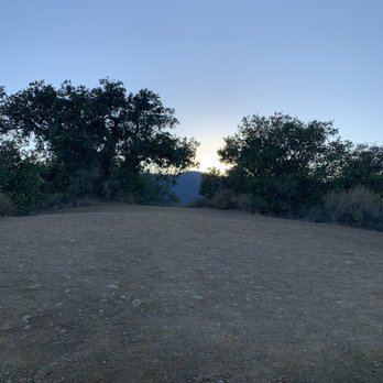
This is a nicely shaded trails with lush greens around. The best place to park is outside the golf club or inside Parker ranch community on the left once you enter the community. The trail starts next to a house and it's quite small entry so don't miss out. I started around 4 pm and made to the peak by sunset and was able to see this amazing view of the South Bay. In between the hike, you might also see a horse ranch, which was closed right now due to covid. Nob hill is also just 0.2 mile detour on the trail so you can do that as well. Its a good trail with shade and constant view of the South Bay, so you won't get bored even if hiking alone.


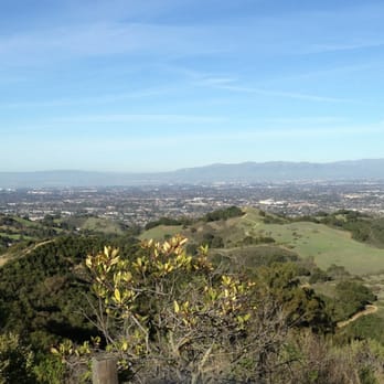
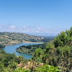
Fremont Older Open Space Preserve (http://www.yelp.com/biz/fremont-older-open-space-preserve-saratoga) has a good amount of inclines such that a good workout is practically guaranteed. So while you're here, you might as well hike a little bit more up to Maisie's Peak, the highest point in the park. The 0.2 mile path leading to the peak is at the intersection of Coyote Ridge Trail and Vista Loop Trail. At 1180 feet, Maisie's Peak offers a sweeping view of the cityscape, though part of the view is obscured by nearby hills. To the northeast in the distance, you can make out the San Jose skyline. And to the north is Moffett Airfield in Mountain View. Beyond that, parts of East Bay are visible across the San Francisco Bay. The best times to come here are either early in the morning when a layer of fog still covers the city, or in the evening when the sun is going down on the city. Otherwise during mid-day, in my opinion, the view of the city is too drab and the thin, hazy layer of smog is just a reminder of what you'll be breathing when you head back home.


I had no idea that individual peaks in our local parks had their very own Yelp page! Like other Yelpers have said-Maisie's Peak is the highest peak in the Fremont Older Open Space Preserve. It is 0.2 miles up. It makes for a very tough uphill sprint or hike. Running up and down this peak a few times and you sure will work up a nice sweat. If you choose to hike, make sure you watch out for bikers. The wide open trails and the nice inclines through Fremont Older makes this a popular spot for bike rides. I have been almost run over by a bike on more than one occasion. The views of this peak are amazing. Make sure you come on a day that is not cloudy or hazy and you will be able to see the bay for miles on end.
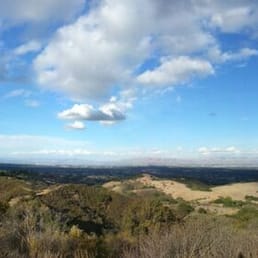

I am surprise I have not reviewed about Maisie's Peak. My favorite first stop for water and snacks. If you doing mountain biking, this is the best short uphill climb. It is 20-25 minutes ride from parking at Prospect. When coming down, make sure you slow down since the ranger hide with the speed radar gun.

1 year ago
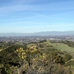
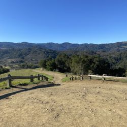
About a 30 minute walk from the Prospect parking lot, on the easy side, hiking along several connecting trails, including Cora Older, Hayfield, and Coyote Ridge Trail. Very little shade up there, but pretty views. For the "highest point of the park", it doesn't seem very high, but maybe that's due to the gradual climb. We enjoyed our trek to this viewpoint, while exploring the Fremont Older Open Space Preserve on a beautiful sunny afternoon. read more


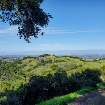


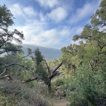


I don't know what Maisie's peak is and neither did the park ranger I spoke to. However, I did park where Yelp said where this was located and had a glorious hike this past weekend. It was an eventful trip including seeing an amorous couple getting busy along the trail. Get a room people! All good, just make sure no kids are around. read more


3 years ago
When encountering people riding horses on the trails, it's important to be mindful and considerate. Horses can be easily spooked, which can lead to serious and even deadly accidents. For the safety of everyone, please ensure that your dogs are kept on a leash and your children are supervised at all times. Unfortunately, I witnessed a terrifying incident last week where a child chased me and my horse with a tree branch while screaming. My horse became extremely frightened and began to bolt at 45 miles per hour. We were on a narrow road, and the situation could have led to a fatal fall into the nearby creek. Horses are prey animals and are not used to sudden movements or loud noises. If you encounter a horse while biking, it's best to slow down and talk to the rider before passing, especially if you're moving at high speed. This will help the horse understand that you are not a threat. It's also crucial that you prevent your dogs from chasing horses, as a kick from a horse can be fatal for a dog. Please refrain from bringing an umbrella on the trail, as this could also spook the horses. As equestrians, we always aim to be respectful of other trail users. We don't chase after your children or dogs, and we always yield to bikers when necessary. We don't aim to make anyone feel scared or intimidated on the trails, and we ask that you extend the same courtesy for everyone's safety. Sharing trails with bikers and people is an important aspect of outdoor recreation, especially for those who enjoy hiking and horseback riding. However, not everyone is aware of the best practices for sharing these trails safely and respectfully. That's why it's important to make sure that everyone who uses these trails has at least a basic understanding of how to share the trails with others. One way to achieve this is by making it mandatory for individuals to complete a short online course before obtaining a license for trail use. This course could cover topics such as trail etiquette, safety guidelines, and tips for sharing the trail with other users. For none horse people in particular, it's important to understand that horses can be easily spooked by sudden movements and loud noises. This means that bikers and other hikers should approach horses slowly and calmly, and give them plenty of space to pass by. By taking these simple steps to educate trail users, we can help ensure that everyone can enjoy the great outdoors safely and responsibly. read more


This is a nicely shaded trails with lush greens around. The best place to park is outside the golf club or inside Parker ranch community on the left once you enter the community. The trail starts next to a house and it's quite small entry so don't miss out. I started around 4 pm and made to the peak by sunset and was able to see this amazing view of the South Bay. In between the hike, you might also see a horse ranch, which was closed right now due to covid. Nob hill is also just 0.2 mile detour on the trail so you can do that as well. Its a good trail with shade and constant view of the South Bay, so you won't get bored even if hiking alone. read more




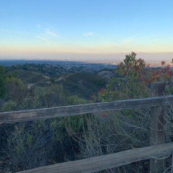

Fremont Older Open Space Preserve (http://www.yelp.com/biz/fremont-older-open-space-preserve-saratoga) has a good amount of inclines such that a good workout is practically guaranteed. So while you're here, you might as well hike a little bit more up to Maisie's Peak, the highest point in the park. The 0.2 mile path leading to the peak is at the intersection of Coyote Ridge Trail and Vista Loop Trail. At 1180 feet, Maisie's Peak offers a sweeping view of the cityscape, though part of the view is obscured by nearby hills. To the northeast in the distance, you can make out the San Jose skyline. And to the north is Moffett Airfield in Mountain View. Beyond that, parts of East Bay are visible across the San Francisco Bay. The best times to come here are either early in the morning when a layer of fog still covers the city, or in the evening when the sun is going down on the city. Otherwise during mid-day, in my opinion, the view of the city is too drab and the thin, hazy layer of smog is just a reminder of what you'll be breathing when you head back home. read more


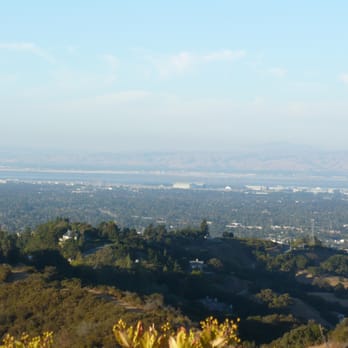

I had no idea that individual peaks in our local parks had their very own Yelp page! Like other Yelpers have said-Maisie's Peak is the highest peak in the Fremont Older Open Space Preserve. It is 0.2 miles up. It makes for a very tough uphill sprint or hike. Running up and down this peak a few times and you sure will work up a nice sweat. If you choose to hike, make sure you watch out for bikers. The wide open trails and the nice inclines through Fremont Older makes this a popular spot for bike rides. I have been almost run over by a bike on more than one occasion. The views of this peak are amazing. Make sure you come on a day that is not cloudy or hazy and you will be able to see the bay for miles on end. read more


I am surprise I have not reviewed about Maisie's Peak. My favorite first stop for water and snacks. If you doing mountain biking, this is the best short uphill climb. It is 20-25 minutes ride from parking at Prospect. When coming down, make sure you slow down since the ranger hide with the speed radar gun. read more

14 years ago
Fremont older is a great place to bike especially it has many spots with great view of the valley. Masie's peak is definitely one of them. The parking space is small though especially during peak hour on weekends or afterwork hours. read more

More info about Maisie's Peak
Coyote Ridge Trl
Saratoga, CA 95070
Directions
Hours
Outdoor Amenities
Ask the Community - Maisie's Peak
Review Highlights - Maisie's Peak
You might also consider














Why does Yelp recommend reviews?
1 review that is not currently recommended
The reviews below are not factored into the business's overall star rating.

12 years ago
Maisie's Peak - hiking - Updated September 2026
Best of Saratoga
People found Maisie's Peak by searching for…
Trending Searches in Saratoga, CA
Apple Orchards near Maisie's Peak
Apple Picking near Maisie's Peak
Bird Sanctuary near Maisie's Peak
Cliff Jumping near Maisie's Peak
Consignment Shops near Maisie's Peak
Cruising Spots near Maisie's Peak
Dog Friendly Things To Do near Maisie's Peak
Dog Swimming near Maisie's Peak
Ear Piercing near Maisie's Peak
Eyebrow Threading near Maisie's Peak
Eyelash Extensions near Maisie's Peak
Furniture Stores near Maisie's Peak
Kids Haircut near Maisie's Peak
Picnic Areas near Maisie's Peak
Private Schools near Maisie's Peak
Public Shower near Maisie's Peak
Rock Quarry near Maisie's Peak
Scenic Night View near Maisie's Peak
Scenic Overlook near Maisie's Peak
Star Gazing near Maisie's Peak
Sunrise View near Maisie's Peak
Browse Articles
Browse Nearby
BEST of Saratoga, California Coffee near Maisie's Peak
BEST of Saratoga, California Restaurants near Maisie's Peak
BEST of Saratoga, California Things to Do near Maisie's Peak
BEST of Saratoga, California Walking Trails near Maisie's Peak
BEST of Saratoga, California Parks near Maisie's Peak
Browse Brands
Related Searches in Saratoga, CA
Affordable Kayak Rental Services in Saratoga, California
Best Dog Hiking Trails Around Saratoga, California
Best Fishing Locations and Guides in Saratoga, California
Best Nature Trails for Hiking in Saratoga, California
Best Places for Horseback Riding in Saratoga, California
Best Sightseeing Experiences Available in Saratoga, California
Check Out Off Road Trails in Saratoga, California
Discover Dog Friendly Trails to Explore in Saratoga, California
Discover Easy Hiking Trails Near Saratoga, California
Discover Kid Friendly Hiking Trails in Saratoga, California
Discover Popular Bike Trails in Saratoga, California
Discover Walking Parks in Saratoga, California Near You
Discover a Hiking Trail in Saratoga, California
Discover the Best Night Hike Trails in Saratoga, California
Dog-Friendly Hikes With Dogs in Saratoga, California
Enjoy Camping Adventures Around Saratoga, California
Enjoy Kayaking Adventures in Saratoga, California
Enjoy Off Leash Dog Hikes in Saratoga, California
Enjoy Scenic Places to Walk in Saratoga, California
Enjoy Tent Camping Spots Around Saratoga, California
Enjoy a Beautiful Waterfall Hike in Saratoga, California
Enjoy the Best Walking Path in Saratoga, California
Enjoy the Best Walking Trails in Saratoga, California
Explore Beautiful Parks and Green Spaces in Saratoga, California
Explore Easy Hikes Perfect for All in Saratoga, California
Explore Fun Activities to Do in Saratoga, California
Explore Popular Campgrounds Near Saratoga, California
Explore Popular Dog Walking Trails in Saratoga, California
Explore Top Dog Parks in Saratoga, California Near You
Explore the Best Beach Spots in Saratoga, California
Family Friendly Hiking With Kids in Saratoga, California
Find Parks and Recreation Activities in Saratoga, California
Find Top Dog Friendly Parks to Visit in Saratoga, California
Find Top-Rated Waterfalls in Saratoga, California Now
Find the Best Parks for Picnics in Saratoga, California
Hiking Trails With Waterfalls in Saratoga, California
Off Leash Dog Hiking Trails in Saratoga, California
Popular Outdoor Activities to Try in Saratoga, California
Popular Picnic Spots to Visit in Saratoga, California
Popular Waterfall Hiking Trails in Saratoga, California
Safe River Swimming Areas in Saratoga, California
Safe and Fun Parks for Kids in Saratoga, California
Top Hiking Trails to Explore in Saratoga, California
Top Playgrounds for Kids to Enjoy in Saratoga, California
Top Running Trails to Explore in Saratoga, California
Top Swimming Lakes to Enjoy in Saratoga, California
Top Swimming Spots and Pools in Saratoga, California
Top-Rated Camping Sites in Saratoga, California


