Monte Bello Open Space Preserve Photos


You might also consider


More like Monte Bello Open Space Preserve
Recommended Reviews - Monte Bello Open Space Preserve
Start your review...


Reviews With Photos


Decent hike! Wanted to find a new trail to hike Saturday mornings, so drove at around 9am to find 7 miles of windy, narrow roads to get to this preserve. If I could go back in time I'd save myself from suffering that. JK, the drive wasn't that bad, but beware for bikers as there were many in that narrow road so maneuvering through was a tad bit difficult but luckily there weren't that many cars on the other side. Parking seemed quite small - but luckily found a small spot to squeeze my car in. After a minute of stretching, we walked along Stevens Creek trail to get to Canyon trail (about 0.5 miles). The view was incredible! Usually I'd hike to get to the top, but here you actually start at the top. The initial .5 miles to canyon road was easy - mostly flat or downhill roads with views of the mountains / photos I've included. Afterward you get to the "meat" of the hike - where there's a lot of trees but also a lot of sunshine. It was 71 degrees sunny today and I couldn't survive with a jacket on. So be careful and where sunscreen because the sun felt so close, even with trees around! 3-4 miles in and it was a lot of flat/downhill roads, took about an hour. Going back, now that was the hard part. It was mainly all uphill roads which I wasn't used to because I was used to struggling in the first 2ish hours of a hike and smooth sailing going down back to your car. Here it was pretty smooth the first 2 hours, but was pretty challenging going back to my car! I don't think it's as bad as Rancho San Antonio Preserve, and the view is a lot better in my opinion, but the fact that getting to my car had to be done going uphill was something else. Anyway, would I go back? 8 mile drive for 25-30 minutes of windy/narrow roads? Not sure if worth for the views given, but why not! Great for a first time experience though :)


Beautiful hike. Moderate difficulty. Not that crowded in mid August. The road to the hiking trailhead is winding. Some parts of the right side trails are shaded.


With so many gorgeous preserves in this area, I'm sorry to say this is one of my least favorite. Very crowded. Almost no shade and straight up about 1000 feet. Not even a marker at the top of Black Mountain. Lots of rocks and very dry despite the winter season. The highlight was seeing three deer. Getting there is quite tough taking Page Mill for a long time on a very windy road. I actually got the last parking spot at 12:30 PM on a Saturday. Bring lots of sunscreen and water.
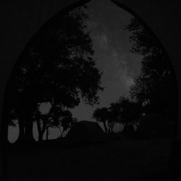

Thanks to a helpful hint from the Peninsula Open Space Trust, I discovered an amazing destination for night photography and stargazing in the Bay Area without driving to the middle of nowhere! The Black Mountain Backpack camp in Monte Bello is high enough to get you above the fog and pollution in the Bay Area, and the lack of population centers gives you a clear view of the galactic core of the Milky Way right from camp and the adjacent field!! The campground is quite spacious and comfortable, and with only a maximum of five groups camping including one larger group, the campground is very calm and peaceful. It's about a 2 mile hike to get up to the camp, and if you're packing all your gear it can get quite sweaty! But once you're there you won't regret it. There are perfect sunsets from the hill just before the camp and the stargazing at night is simply incredible. Note that there are no fires or potable water at this camp, but there is a pit toilet and a water spigot that you can filter to get clean water. I was able to reserve the campsite for a Saturday evening with about two months notice on the Midpeninsula open space district website. If you are looking for a really unique experience or to test out your Astro photography skills, this is a great location to do so.


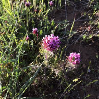
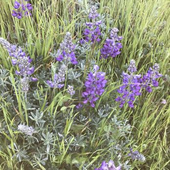
Park 3 of 4 we did Sun 4/30/17. Started at Russian Ridge, then Coal Creek, then Monte Bello, last park was Skyline Ridge. Some hills that are moderate. Some wildflowers. Saw some lizards. Saw a field of owls clovers and a few two-eyed violets. Had a nice hike.


As usual, another gem of a park from Mid-Peninsula Open Space District! Parking lot is large (with additional parking across the street) with a pit toilet. It's a hot spot for mountain bikers (especially when all trails are open), hikers, bird watchers, and photographers. If you can make the hike out to Black Mountain peak, you get a wonderful view of the south bay area. This is also where you can connect to Rancho San Antonio Park. Mostly I wanted to write this review to post some photos of snow in this park from a few weeks ago. Please please please keep in mind this park is rarely cold like that and usually very warm due to being in a shallow sort of valley so bring plenty of water and don't be surprised if it is warmer than the cities below.


Where is this place? Palo Alto? Cupertino? Los Altos? La Honda? Los Gatos? If you ask Google Maps, different parts of the preserve fall within different city limits! I don't think it's clear to Google, nor to anybody else. GETTING THERE: ------------------------- Getting to Monte Bello requires driving a few miles on windy Page Mill Road, but like all good things that have to be worked for, it's worth it! If the beautiful scenery here doesn't evoke some feelings of joy in your heart, God help you. The parking lot is on the south side of Page Mill, opposite from the lot for Los Trancos Open Space Preserve. You'll know you're there when you see this sign: http://www.yelp.com/biz_photos/monte-bello-open-space-preserve-palo-alto?select=oRek1zxauAj9SEzWajFFtQ#oRek1zxauAj9SEzWajFFtQ Monte Bello's lot holds a decent amount of cars, about twice as many as Los Tranco's lot. A pit toilet (outhouse) can be found in Monte Bello's lot. Running water is absent. TRAILS: ------------------------- The elevation is relatively high already (you'll realize that as you're driving up Page Mill), so the trail inclines aren't too steep here. There isn't really a loop that will take you all around the entire preserve. Instead, the Canyon Trail runs down the center of the preserve with, you guessed it, canyon walls on both sides. This trail runs 4.8 miles before becoming Stevens Canyon Road. Alternatively, following the Bella Vista Trail or the Indian Creek Trail will take you to the Black Mountain Backpack Camp (http://www.yelp.com/biz/black-mountain-backpack-camp-los-altos), where there are a few small camp sites, a pit toilet and even a working payphone! From the camp, you can continue along Monte Bello Road to reach the summit of Black Mountain, where you'll find some unique rocks and a not-so-spectacular view (http://www.yelp.com/biz_photos/monte-bello-open-space-preserve-palo-alto?select=znrDCotX1kbVDA3ce_6h2Q#znrDCotX1kbVDA3ce_6h2Q). If you head north along the Black Mountain Trail, you'll reach Rancho San Antonio. Don't you love how all these preserves are inter-connected? GOOD VIEWS: ------------------------- So where are the good views? The Indian Creek Trail looks out over the canyon, providing a nice view (http://www.yelp.com/biz_photos/monte-bello-open-space-preserve-palo-alto?select=NttJvk_5ZQqf_jRg2iqlMA#NttJvk_5ZQqf_jRg2iqlMA) that gets better as you keep climbing (what a great motivator!). The view from the Bella Vista Trail isn't too bad, either. But the best view is probably right near the start of the hike (http://www.yelp.com/biz_photos/monte-bello-open-space-preserve-palo-alto?select=R5B4O5X-BPHAJumbjd56Tw#R5B4O5X-BPHAJumbjd56Tw), where the Stevens Creek Nature Trail and the Canyon Trail diverge. From here, you're looking straight down the middle of the downward-sloping canyon. Great place for a photo op. Just bring a jacket and a hat during the winter, because it can get quite windy and chilly!


I came here on a cold Saturday to go hiking with some friends. The weather forecast was around 48-55 degrees with little to no sun. We did some stretches to help us warm up for the hike. We started off at the parking lot which is the beginning of the trail. We took the Canyon Trail and hiked about 5 miles. The trail starts off incline half way into the loop and then decline with some incline for the rest of the loop. I don't exercise often nor am I good with walking incline, but I found this trail to be very moderate for beginners! We took several breaks to catch our breaths. It was really windy in open areas, so we were freezing as we were walking along the trail. Two of my friend's baseball caps even flew off of their heads because of how windy it was. There were a lot of mountain bikers biking through the trail. I think we only passed by 2-4 people that weren't biking. The view on the trail was really nice, though the view would look nicer if there was more sun. We took about 3 hours to finish the trail due to our many breaks. Usually, I get really sore for walking more than 2 miles, but I didn't feel sore at all. I really enjoyed this trail and think that I would come back here during the spring time, when the weather is warmer. NOTES: -There's a parking lot, but the parking space is limited, so come early. -There's a unisex restroom in parking lot, but no sink and only hand sanitizer. -There's at least one bench along the trail. -We couldn't find a trash bin in the parking lot/trail, so keep your trash in your car or with you. -There's no drinking water fountain, so make sure to bring your own water bottles. -There are no outhouses along the trail, so make sure you pee at the parking lot or you'll have to pee along the trail. -The trail is pretty smooth, so you don't have to lunge over big rocks. -Please layer up with a hat, face mask/scarf, jackets, pants, and comfortable shorts if you plan to hike during in the cold! -Watch out for lots of poop on the trail.


Peaceful, away from the crowd and cars. Open space for easy trails into the fields and nature. Well marked trail paths, mostly dirt roads spaced apart to accommodate two people. Wildflowers aplenty along the trail. Not much steep elevation gain and not hard to do at all. Easy trail although no water fountains or trash cans visible at beginning or on the way. A lone mobile toilet at the parking lot. Come here early. You can park on side of road or in the dirt parking lot(Space for 20-25 vehicles). Although it wasn't open till 7am in the morning when I arrived.


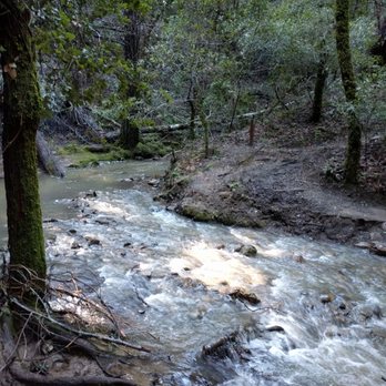
Beautiful scenery for a 3 mile loop trail (follow the Stevens Creek trail). I followed a recommendation on strollerhikes.com and let me tell you this.. it isn't really compatible for stroller so bring a good baby carrier. At some point we had to cross screen by foot with the baby in the back carrier and it got pretty middy as well. Our friends managed to push their city mini stroller through the whole trail but it is definitely NOT recommended. They carried the stroller and the bassinet across the stream, in a way some people just won't be able to. If you are without babies it's a truly beautiful not too difficult trail. We ended our trip in the Alpine Inn BBQ (cool spot on a sunny day, sit in the back yard)


This Open Space Preserve has loads of different trails and environments to explore. Did a 6-mile loop and was able to see creeks, forests and the rolling hills. However, this is more of a nice stroll, rather than steep inclines. If you're looking for a walk through nature, this is a great place. It's not very crowded either.
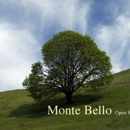

The World According to Noelle ~Allergic Girl's Guide to Life~ "Allergy Girl- The Unexpected Hiker." Noelle W. http://www.youtube.com/watch?v=-CZRudxD-NQ Directions From 280 North -Exit Page Mill Road. -Turn left onto Page Mill Road. -Drive about seven miles. -Destination on left hand side of road. -Parking lot small (best to carpool) -One Portable Restroom (no sink for hand washing). Destination: Black Mountain We took a Sunday Hike. We were in rather large group. The journey commenced around 11:15 a.m. It was a bright, sunny and rather warm day. It started at a rather fast clip our hike, until my asthma kicked into play. We slowed down and the rest of the group went ahead. There was some small spots of shade but a good portion of the way to Black Mountain was trekked in the glorious California Sunshine. I was prepared- wearing a dry fit shirt, shorts, a baseball cap, sunblock, hair in pony tail, bottle of HOH in hand. We trekked: Canyon Trail Bella Vista Trail Old Ranch Trail Indian Creek Trail Monte Bello Road A word to the wise- use the portable restrooms at Old Ranch Trail before going to Indian Creek Trail. Its an extremely steep incline to Black Mountain. We reached Black Mountain and met up with our group. We sat on some rocks and ate our lunch. After lunch we admired the view of the San Francisco Bay albeit a tad hazy. The elevation at Black Mountain is around 2,800 feet. There were a few group photos taken and we made our journey back to the parking lot. We trekked: Monte Bello Road Indian Creek Trail Canyon Trail I was elated that Indian Creek Trail was downhill at the start and a good portion of it was in the shade. Do note- there are no trees on Black Mountain ((thus no shade)). Towards the end of Indian Creek Trail there were extremely steep inclinations ((seriously not for the faint of heart)). Along the entire hike I slightly slipped every now and then, but somehow caught my balance. I was wearing leather walking/tennis shoes (new balance)- which was not good because my soles were smooth. I highly recommend wearing hiking shoes - hiking or tennis like with a sole that can properly grip the different trail surfaces. Not being an expert hiker I was learning much on this journey. The last portion of Indian Trail and the entire Canyon Trail was extremely difficult for me- due to the steep incline and my asthma. My friend was extremely kind and patient making sure we rested so I could catch my breath. Halfway through Indian Trail we spotted a family of deer- a truly beautiful site to see. Canyon Trail lacked any shade- but there were a few benches where we rested along the way. The landscape on Canyon Trail is dry tall grass and we spotted the occasional California Poppy. The tall grass reminded me of Willa Cather's book "My Antonia". There was a point in this hike where I was getting the chills, feeling dizzy and looking pale- which were signs of dehydration. Obviously, I didn't drink enough water before my hike and what water I did have was drunk exceptional fast due to the hot weather. Perhaps hiking during the time when the sun's rays are the hottest didn't help. He told me next time- we can hike in the morning when its cooler (his friend organized this hike). 45 minutes into the hike we almost turned around. I didn't want to turn around. I wanted to challenge myself. I couldn't have met the challenge without my friend patiently hiking with me. We didn't plan the hike, nor the way we came back to the parking lot. It was extremely challenging- Canyon Trail. The trail markers on the way back were not written very well and at times confusing. When hiking this trail be sure to have a print out of the Monte Bello Open Space Preserve. Sprint and Verizon cell phones do not get reception in most of the Open Space Preserve. Essentials for people hiking to Black Mountain - Good hiking shoes, lots of water, a hat, sunblock. Note that the trails to Black Mountain and back are challenging. Taking Indian Creek Trail to Canyon Trail is more difficult than going back via Old Ranch Trail and Bella Vista Trail. Next time I will definitely bring my asthma inhaler and reapply sunblock! I survived the steep, a little over six mile hike- that's attributed to a little determination and my good friend =) by my side! Noelle's Notes Extremely Beautiful Views of the Bay and natural open space preserve. Noelle's Post Secerts Sans the sauce =) lol.


Monte Bello OSP is one of several open space preserves that hug the top of the Santa Cruz range without reaching too far down into the valley below. (Minimum elevation is 1600 feet). Other parks of this type include Russian Ridge, Long Ridge, and Skyline OSP. The major feature in this park is Black Mountain, the tallest peak in the immediate area at 2812 ft above sea level; and featuring 360 degree views (and more than a few radio antennae). To get here from the Rancho San Antonio side, it's a 2500 foot climb and at least a ten mile round trip. From Monte Bello OSP, however, it's only a 700 foot climb and a 5 mile round trip. So next time someone says they "climbed Black Mountain", ask them this: "The hard way, or the easy way?" The preserve itself encompasses a long upland valley and ridge. The valley is forested, mostly mixed deciduous and conifer, whereas the ridge is exposed grassland and scrub, punctuated by live oaks; There aren't as many redwoods as some other OSPs in the area. (Interesting factoid: This high valley is the source of Stevens Creek, which eventually travels down through Cupertino, Sunnyvale and Mountain View before emptying into the bay near Moffet field). In my opinion, the main downside of Monte Bello is the scarcity of trails for it's size. The preserve itself is very large - 3400 acres. But there are only two main trails stretching down the length the park; one on the ridge top (Monte Bello Road and Waterwheel Trail) and one on the valley floor (Canyon Trail). Both of these trails head southeast from the main parking area and then each reaches a dead end at a road. These trails never meet, nor are there spur trails that connect them (nor do roads connect them). It's a damn shame for those of us who prefer long loop hikes; and it would be such a straightforward fix (the trails get within 0.5 miles of each other) The northwest corner of the park does offer several loop hikes, but these are less than 4 miles total, even when you get creative; they can get a little longer if you include the summit of Black Mtn. My favorite trail on this side of the park is the Nature Trail, which passes through the deepest part of the forest and skirts the very upper reaches of Stevens Creek. A good trail to check out with kids; it's close to the parking lot and has signs explaining natural features. All in all, Monte Bello is an average OSP for the Santa Cruz mountains. The lack of long loops keeps it from being on my regular rotation (hiking or mountain biking). But it's nice to visit once in a while, especially if clear skies make the Black Mtn views worth the climb up. Hike Spot Checklist: -- Parking: A large dirt lot plus a little roadside parking -- Bathrooms: Yes; single pit toilet at main entrance -- Potable water: No -- Maps provided: Yes, at parking lot -- Highlights: Views from Black Mountain My Peninsula Hike Collection is here: (https://www.yelp.com/collection/qBI6U6Lz9LJQjnGjFW6ubg)


3 years ago
"Beautiful Mountain" Yes, indeed! PSA: No dogs allowed - I had to leave mine at home. It's ok, you can enjoy this one alone! Take the drive! Yes, the road is windy and please slow for cyclists on your way up. Come along, sing a song. Dancing feet, magical retreat. Bring a friend or brave alone, it'll be worthwhile - 2, 4, or 7 miles! Our small group hiked the 7 mile loop, and had many photos stops along the way. Our leisure hike took approximately 4.5 hours. We spotted a tarantula early on the trail, other hiking groups, a backpacking group, bikers in groups and a few solo peeps. Shaded Hike & Open Space Sunny Hike: If you're wanting a shaded hike, start on the White Oak Trail located to the right of the Monte Bello parking. If you begin your hike on Bella Vista Trail, it's more of an open space with direct sunlight. Start early and enjoy! =) read more


Monte Bello is a hidden treasure for the Mid-Peninsula area. Funny thing, though. For being hidden, it's sure well known. To get there, you drive seven miles up a narrow, windy road. You're wondering if there's anything here besides big houses on tree-filled hills. Make a sharp left at Foothills Park - oops, never mind, you don't live in PA, you can't drive in here. More driving, more driving . . . and you finally get there, only to find a spacious parking lot crammed with cars. Here's why I gave it five stars: At first, it looks like typical landscape on this part of the Peninsula. But then I went down the narrow Stevens Creek Nature Trail. And ended up in a deep, dark forest with a babbling brook, pretty wildflowers, romantic bridges, and interpretive signs to explain what you're gazing at. If you felt like you got away from it all by driving up Page Mill Road, now you *really* feel like you're away from it all. Monte Bello also has a few peaks to climb up, and a backpacking camp. I'm itching to come back to try these out. I was not here long enough to really appreciate Monte Bello, but I saw enough to appreciate it a LOT. I had written about Russian Ridge that it's part of a conglomerate of Mid-Peninsula Open Space Preserves that gives you a few days of outback hiking. Monte Bello is part of that conglomerate, which combines with Los Trancos (and Foothills Park, but don't tell anyone, shhhh) to give you even more wandering. And bring a lunch, because you'll be so mesmerized that you may forget to leave and get food. read more


5 years ago
This is a great spot for hiking during the day and astrophotography at night, which requires a free permit. Just apply online and print out the permit to bring with you. There are usually a few groups with telescopes or cameras, but not very crowded. People are friendly. The light pollution is not too bad for the Bay Area. You'll have planes crossing semi-frequently at high altitudes, making for interesting trails in long exposures. read more


Decent hike! Wanted to find a new trail to hike Saturday mornings, so drove at around 9am to find 7 miles of windy, narrow roads to get to this preserve. If I could go back in time I'd save myself from suffering that. JK, the drive wasn't that bad, but beware for bikers as there were many in that narrow road so maneuvering through was a tad bit difficult but luckily there weren't that many cars on the other side. Parking seemed quite small - but luckily found a small spot to squeeze my car in. After a minute of stretching, we walked along Stevens Creek trail to get to Canyon trail (about 0.5 miles). The view was incredible! Usually I'd hike to get to the top, but here you actually start at the top. The initial .5 miles to canyon road was easy - mostly flat or downhill roads with views of the mountains / photos I've included. Afterward you get to the "meat" of the hike - where there's a lot of trees but also a lot of sunshine. It was 71 degrees sunny today and I couldn't survive with a jacket on. So be careful and where sunscreen because the sun felt so close, even with trees around! 3-4 miles in and it was a lot of flat/downhill roads, took about an hour. Going back, now that was the hard part. It was mainly all uphill roads which I wasn't used to because I was used to struggling in the first 2ish hours of a hike and smooth sailing going down back to your car. Here it was pretty smooth the first 2 hours, but was pretty challenging going back to my car! I don't think it's as bad as Rancho San Antonio Preserve, and the view is a lot better in my opinion, but the fact that getting to my car had to be done going uphill was something else. Anyway, would I go back? 8 mile drive for 25-30 minutes of windy/narrow roads? Not sure if worth for the views given, but why not! Great for a first time experience though :) read more


7 years ago

4 years ago
Beautiful hike. Moderate difficulty. Not that crowded in mid August. The road to the hiking trailhead is winding. Some parts of the right side trails are shaded. read more


With so many gorgeous preserves in this area, I'm sorry to say this is one of my least favorite. Very crowded. Almost no shade and straight up about 1000 feet. Not even a marker at the top of Black Mountain. Lots of rocks and very dry despite the winter season. The highlight was seeing three deer. Getting there is quite tough taking Page Mill for a long time on a very windy road. I actually got the last parking spot at 12:30 PM on a Saturday. Bring lots of sunscreen and water. read more


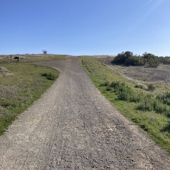


Thanks to a helpful hint from the Peninsula Open Space Trust, I discovered an amazing destination for night photography and stargazing in the Bay Area without driving to the middle of nowhere! The Black Mountain Backpack camp in Monte Bello is high enough to get you above the fog and pollution in the Bay Area, and the lack of population centers gives you a clear view of the galactic core of the Milky Way right from camp and the adjacent field!! The campground is quite spacious and comfortable, and with only a maximum of five groups camping including one larger group, the campground is very calm and peaceful. It's about a 2 mile hike to get up to the camp, and if you're packing all your gear it can get quite sweaty! But once you're there you won't regret it. There are perfect sunsets from the hill just before the camp and the stargazing at night is simply incredible. Note that there are no fires or potable water at this camp, but there is a pit toilet and a water spigot that you can filter to get clean water. I was able to reserve the campsite for a Saturday evening with about two months notice on the Midpeninsula open space district website. If you are looking for a really unique experience or to test out your Astro photography skills, this is a great location to do so. read more
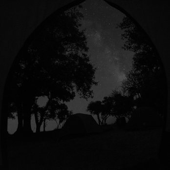


Park 3 of 4 we did Sun 4/30/17. Started at Russian Ridge, then Coal Creek, then Monte Bello, last park was Skyline Ridge. Some hills that are moderate. Some wildflowers. Saw some lizards. Saw a field of owls clovers and a few two-eyed violets. Had a nice hike. read more


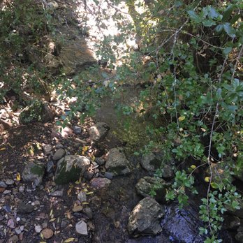

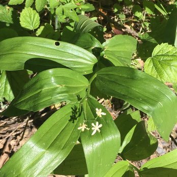


7 years ago
As usual, another gem of a park from Mid-Peninsula Open Space District! Parking lot is large (with additional parking across the street) with a pit toilet. It's a hot spot for mountain bikers (especially when all trails are open), hikers, bird watchers, and photographers. If you can make the hike out to Black Mountain peak, you get a wonderful view of the south bay area. This is also where you can connect to Rancho San Antonio Park. Mostly I wanted to write this review to post some photos of snow in this park from a few weeks ago. Please please please keep in mind this park is rarely cold like that and usually very warm due to being in a shallow sort of valley so bring plenty of water and don't be surprised if it is warmer than the cities below. read more


Where is this place? Palo Alto? Cupertino? Los Altos? La Honda? Los Gatos? If you ask Google Maps, different parts of the preserve fall within different city limits! I don't think it's clear to Google, nor to anybody else. GETTING THERE: ------------------------- Getting to Monte Bello requires driving a few miles on windy Page Mill Road, but like all good things that have to be worked for, it's worth it! If the beautiful scenery here doesn't evoke some feelings of joy in your heart, God help you. The parking lot is on the south side of Page Mill, opposite from the lot for Los Trancos Open Space Preserve. You'll know you're there when you see this sign: http://www.yelp.com/biz_photos/monte-bello-open-space-preserve-palo-alto?select=oRek1zxauAj9SEzWajFFtQ#oRek1zxauAj9SEzWajFFtQ Monte Bello's lot holds a decent amount of cars, about twice as many as Los Tranco's lot. A pit toilet (outhouse) can be found in Monte Bello's lot. Running water is absent. TRAILS: ------------------------- The elevation is relatively high already (you'll realize that as you're driving up Page Mill), so the trail inclines aren't too steep here. There isn't really a loop that will take you all around the entire preserve. Instead, the Canyon Trail runs down the center of the preserve with, you guessed it, canyon walls on both sides. This trail runs 4.8 miles before becoming Stevens Canyon Road. Alternatively, following the Bella Vista Trail or the Indian Creek Trail will take you to the Black Mountain Backpack Camp (http://www.yelp.com/biz/black-mountain-backpack-camp-los-altos), where there are a few small camp sites, a pit toilet and even a working payphone! From the camp, you can continue along Monte Bello Road to reach the summit of Black Mountain, where you'll find some unique rocks and a not-so-spectacular view (http://www.yelp.com/biz_photos/monte-bello-open-space-preserve-palo-alto?select=znrDCotX1kbVDA3ce_6h2Q#znrDCotX1kbVDA3ce_6h2Q). If you head north along the Black Mountain Trail, you'll reach Rancho San Antonio. Don't you love how all these preserves are inter-connected? GOOD VIEWS: ------------------------- So where are the good views? The Indian Creek Trail looks out over the canyon, providing a nice view (http://www.yelp.com/biz_photos/monte-bello-open-space-preserve-palo-alto?select=NttJvk_5ZQqf_jRg2iqlMA#NttJvk_5ZQqf_jRg2iqlMA) that gets better as you keep climbing (what a great motivator!). The view from the Bella Vista Trail isn't too bad, either. But the best view is probably right near the start of the hike (http://www.yelp.com/biz_photos/monte-bello-open-space-preserve-palo-alto?select=R5B4O5X-BPHAJumbjd56Tw#R5B4O5X-BPHAJumbjd56Tw), where the Stevens Creek Nature Trail and the Canyon Trail diverge. From here, you're looking straight down the middle of the downward-sloping canyon. Great place for a photo op. Just bring a jacket and a hat during the winter, because it can get quite windy and chilly! read more

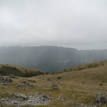


I came here on a cold Saturday to go hiking with some friends. The weather forecast was around 48-55 degrees with little to no sun. We did some stretches to help us warm up for the hike. We started off at the parking lot which is the beginning of the trail. We took the Canyon Trail and hiked about 5 miles. The trail starts off incline half way into the loop and then decline with some incline for the rest of the loop. I don't exercise often nor am I good with walking incline, but I found this trail to be very moderate for beginners! We took several breaks to catch our breaths. It was really windy in open areas, so we were freezing as we were walking along the trail. Two of my friend's baseball caps even flew off of their heads because of how windy it was. There were a lot of mountain bikers biking through the trail. I think we only passed by 2-4 people that weren't biking. The view on the trail was really nice, though the view would look nicer if there was more sun. We took about 3 hours to finish the trail due to our many breaks. Usually, I get really sore for walking more than 2 miles, but I didn't feel sore at all. I really enjoyed this trail and think that I would come back here during the spring time, when the weather is warmer. NOTES: -There's a parking lot, but the parking space is limited, so come early. -There's a unisex restroom in parking lot, but no sink and only hand sanitizer. -There's at least one bench along the trail. -We couldn't find a trash bin in the parking lot/trail, so keep your trash in your car or with you. -There's no drinking water fountain, so make sure to bring your own water bottles. -There are no outhouses along the trail, so make sure you pee at the parking lot or you'll have to pee along the trail. -The trail is pretty smooth, so you don't have to lunge over big rocks. -Please layer up with a hat, face mask/scarf, jackets, pants, and comfortable shorts if you plan to hike during in the cold! -Watch out for lots of poop on the trail. read more



6 years ago

9 years ago
Peaceful, away from the crowd and cars. Open space for easy trails into the fields and nature. Well marked trail paths, mostly dirt roads spaced apart to accommodate two people. Wildflowers aplenty along the trail. Not much steep elevation gain and not hard to do at all. Easy trail although no water fountains or trash cans visible at beginning or on the way. A lone mobile toilet at the parking lot. Come here early. You can park on side of road or in the dirt parking lot(Space for 20-25 vehicles). Although it wasn't open till 7am in the morning when I arrived. read more



10 years ago
Beautiful scenery for a 3 mile loop trail (follow the Stevens Creek trail). I followed a recommendation on strollerhikes.com and let me tell you this.. it isn't really compatible for stroller so bring a good baby carrier. At some point we had to cross screen by foot with the baby in the back carrier and it got pretty middy as well. Our friends managed to push their city mini stroller through the whole trail but it is definitely NOT recommended. They carried the stroller and the bassinet across the stream, in a way some people just won't be able to. If you are without babies it's a truly beautiful not too difficult trail. We ended our trip in the Alpine Inn BBQ (cool spot on a sunny day, sit in the back yard) read more





This Open Space Preserve has loads of different trails and environments to explore. Did a 6-mile loop and was able to see creeks, forests and the rolling hills. However, this is more of a nice stroll, rather than steep inclines. If you're looking for a walk through nature, this is a great place. It's not very crowded either. read more


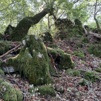

The World According to Noelle ~Allergic Girl's Guide to Life~ "Allergy Girl- The Unexpected Hiker." Noelle W. http://www.youtube.com/watch?v=-CZRudxD-NQ Directions From 280 North -Exit Page Mill Road. -Turn left onto Page Mill Road. -Drive about seven miles. -Destination on left hand side of road. -Parking lot small (best to carpool) -One Portable Restroom (no sink for hand washing). Destination: Black Mountain We took a Sunday Hike. We were in rather large group. The journey commenced around 11:15 a.m. It was a bright, sunny and rather warm day. It started at a rather fast clip our hike, until my asthma kicked into play. We slowed down and the rest of the group went ahead. There was some small spots of shade but a good portion of the way to Black Mountain was trekked in the glorious California Sunshine. I was prepared- wearing a dry fit shirt, shorts, a baseball cap, sunblock, hair in pony tail, bottle of HOH in hand. We trekked: Canyon Trail Bella Vista Trail Old Ranch Trail Indian Creek Trail Monte Bello Road A word to the wise- use the portable restrooms at Old Ranch Trail before going to Indian Creek Trail. Its an extremely steep incline to Black Mountain. We reached Black Mountain and met up with our group. We sat on some rocks and ate our lunch. After lunch we admired the view of the San Francisco Bay albeit a tad hazy. The elevation at Black Mountain is around 2,800 feet. There were a few group photos taken and we made our journey back to the parking lot. We trekked: Monte Bello Road Indian Creek Trail Canyon Trail I was elated that Indian Creek Trail was downhill at the start and a good portion of it was in the shade. Do note- there are no trees on Black Mountain ((thus no shade)). Towards the end of Indian Creek Trail there were extremely steep inclinations ((seriously not for the faint of heart)). Along the entire hike I slightly slipped every now and then, but somehow caught my balance. I was wearing leather walking/tennis shoes (new balance)- which was not good because my soles were smooth. I highly recommend wearing hiking shoes - hiking or tennis like with a sole that can properly grip the different trail surfaces. Not being an expert hiker I was learning much on this journey. The last portion of Indian Trail and the entire Canyon Trail was extremely difficult for me- due to the steep incline and my asthma. My friend was extremely kind and patient making sure we rested so I could catch my breath. Halfway through Indian Trail we spotted a family of deer- a truly beautiful site to see. Canyon Trail lacked any shade- but there were a few benches where we rested along the way. The landscape on Canyon Trail is dry tall grass and we spotted the occasional California Poppy. The tall grass reminded me of Willa Cather's book "My Antonia". There was a point in this hike where I was getting the chills, feeling dizzy and looking pale- which were signs of dehydration. Obviously, I didn't drink enough water before my hike and what water I did have was drunk exceptional fast due to the hot weather. Perhaps hiking during the time when the sun's rays are the hottest didn't help. He told me next time- we can hike in the morning when its cooler (his friend organized this hike). 45 minutes into the hike we almost turned around. I didn't want to turn around. I wanted to challenge myself. I couldn't have met the challenge without my friend patiently hiking with me. We didn't plan the hike, nor the way we came back to the parking lot. It was extremely challenging- Canyon Trail. The trail markers on the way back were not written very well and at times confusing. When hiking this trail be sure to have a print out of the Monte Bello Open Space Preserve. Sprint and Verizon cell phones do not get reception in most of the Open Space Preserve. Essentials for people hiking to Black Mountain - Good hiking shoes, lots of water, a hat, sunblock. Note that the trails to Black Mountain and back are challenging. Taking Indian Creek Trail to Canyon Trail is more difficult than going back via Old Ranch Trail and Bella Vista Trail. Next time I will definitely bring my asthma inhaler and reapply sunblock! I survived the steep, a little over six mile hike- that's attributed to a little determination and my good friend =) by my side! Noelle's Notes Extremely Beautiful Views of the Bay and natural open space preserve. Noelle's Post Secerts Sans the sauce =) lol. read more

Monte Bello OSP is one of several open space preserves that hug the top of the Santa Cruz range without reaching too far down into the valley below. (Minimum elevation is 1600 feet). Other parks of this type include Russian Ridge, Long Ridge, and Skyline OSP. The major feature in this park is Black Mountain, the tallest peak in the immediate area at 2812 ft above sea level; and featuring 360 degree views (and more than a few radio antennae). To get here from the Rancho San Antonio side, it's a 2500 foot climb and at least a ten mile round trip. From Monte Bello OSP, however, it's only a 700 foot climb and a 5 mile round trip. So next time someone says they "climbed Black Mountain", ask them this: "The hard way, or the easy way?" The preserve itself encompasses a long upland valley and ridge. The valley is forested, mostly mixed deciduous and conifer, whereas the ridge is exposed grassland and scrub, punctuated by live oaks; There aren't as many redwoods as some other OSPs in the area. (Interesting factoid: This high valley is the source of Stevens Creek, which eventually travels down through Cupertino, Sunnyvale and Mountain View before emptying into the bay near Moffet field). In my opinion, the main downside of Monte Bello is the scarcity of trails for it's size. The preserve itself is very large - 3400 acres. But there are only two main trails stretching down the length the park; one on the ridge top (Monte Bello Road and Waterwheel Trail) and one on the valley floor (Canyon Trail). Both of these trails head southeast from the main parking area and then each reaches a dead end at a road. These trails never meet, nor are there spur trails that connect them (nor do roads connect them). It's a damn shame for those of us who prefer long loop hikes; and it would be such a straightforward fix (the trails get within 0.5 miles of each other) The northwest corner of the park does offer several loop hikes, but these are less than 4 miles total, even when you get creative; they can get a little longer if you include the summit of Black Mtn. My favorite trail on this side of the park is the Nature Trail, which passes through the deepest part of the forest and skirts the very upper reaches of Stevens Creek. A good trail to check out with kids; it's close to the parking lot and has signs explaining natural features. All in all, Monte Bello is an average OSP for the Santa Cruz mountains. The lack of long loops keeps it from being on my regular rotation (hiking or mountain biking). But it's nice to visit once in a while, especially if clear skies make the Black Mtn views worth the climb up. Hike Spot Checklist: -- Parking: A large dirt lot plus a little roadside parking -- Bathrooms: Yes; single pit toilet at main entrance -- Potable water: No -- Maps provided: Yes, at parking lot -- Highlights: Views from Black Mountain My Peninsula Hike Collection is here: (https://www.yelp.com/collection/qBI6U6Lz9LJQjnGjFW6ubg) read more


If you are looking to do a 2~3 hours hike, here is a good one at the Monte Bello Open Space Preserve This is a 6.5 mile loop hike. The preserve map can be found here: http://bit.ly/UcXmID - Start from the trailhead on to White Oak Trail. - At 2 miles following the trail signs for Stevens Creek Nature Trail and Canyon Trail. - At 2.9 miles turn right and head south on Canyon Trail. - At 3.1 miles,turn left at the Indian Creek Trail junction. This is where you will climb for about 750 feet and can be quite grueling on a hot summer day. - At 4.1 miles, turn left following the signs to the backpack camp. - At 4.2 miles, turn left when the path ends at a T junction - At 4.3 miles, take the Old Ranch Trail. - At 4.9 miles, take the Bella Vista Trail. - At 5.7 miles, Bella Vista Trail ends and turn right on the Canyon Trail - At 5.9 miles, take the trail signed "to Monte Bello Parking Lot". - At 6.2 miles, Stevens Creek Nature Trail heads back down into the canyon. continue straight, back to the parking lot. The toughest segment of the hike is a one mile steady ascent on Indian Creek Trail. Total elevation change is about 1000 feet. Preserve elevation ranges from about 1800 to 2800 feet. This hike begins at about 2200 feet, drops to 1800 feet, climbs to 2680 feet, then descends back to the trailhead. To get here from Interstate 280, exit Page Mill Road. Drive west on Page Mill for about 7 miles up the narrow winding road to the preserve entrance on the left side of the road. read more

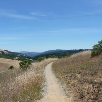
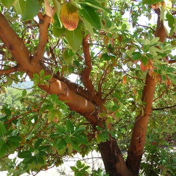


10 years ago
First thing first, the address isn't correct, use Google Map to search for Monte Bello and use that address (or 37.3099° N, 122.1547° W). If you end up at Foothill Park, continue driving for 7 miles and Monte Bello will be on your left Part of the five South Skyline Region Preserves: Coal Creek OSP, Los Trancos OSP, Montel Bello OSP, Russian Ridge OSP and Skyline Ridge OSP The parking lot is big and dusty. There are there main trails: Canyon Trail, White Oak Trail and Steven Creeks Trail. I did a mini loop, started with Steven Creeks Trail to Canyon Trail, roughly 4 miles. You can do the same with White Oak Trail. Canyon Trail is wide, flat and paved, there are even chairs on the side of the trail to rest. Steven Creeks trail is a nature hike, you will be going through the forest, and there are a lot of bugs in the midday, so spray yourself with some bug sprays (I got few bug bites) Overall, it is a bit out of the way to hike and it isn't very long, But you can make it longer if you don't mind overlaying certain path. BUT, I really enjoyed the hike, the view is outstanding read more


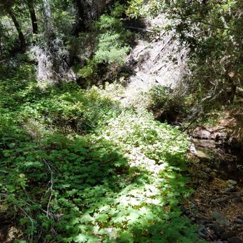

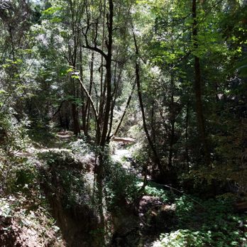
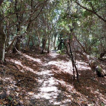

16 years ago
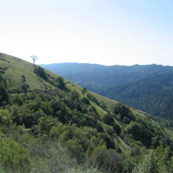
I hiked here once in early spring two years ago and don't quite remember all the fine details by now. I was not yelping back then. Luckily I took some photos. All that I can recall was that it was a very pleasant hike. The beautiful Santa Cruz mountain range presented us with grand vistas of the bay and of the preserve itself. We hiked leisurely for about five or six hours, starting from the parking lot all the way to the top of Black Mountain and back. We descended from the parking lot to the valley below which was cool and shady. As we left the valley and ascended toward Black Mountain, it got steeper and steeper and there was little or no shade for quite some time. Thus, a hat and plenty of water were essential to keep it a pleasant hike. The spring weather was chilly and hazy in the morning. Gradually the sky turned sunny blue and it became pleasantly warm as we were climbing up. I imagine it can be quite hot in the summer and fall when there is no fog. I will update with more detail later if I can jog my memory. Noelle did a great job writing a much more informative review than this one. There is also another Monte Bello entry in yelp with a few more reviews. (http://www.yelp.com/biz/monte-bello-open-space-preserve-la-honda). In the mean time I let my photos do the rest of my Yelping :-) read more

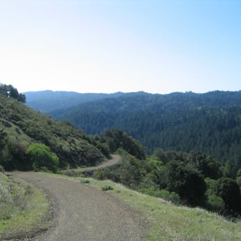




8 years ago
The address here on yelp is incorrect, direct yourself instead to Monte Bello Open Space Preserve - Parking and it takes you exactly where you need to be. The drive up is daunting, it is quite literally the definition of switchbacks! Very narrow road and around 6-7 miles up at around 20 miles per hour so it takes a bit and a lot of careful driving! Also watch out for the cyclists and impatient drivers. Other than that, it is a gorgeous and secluded Preserve high in the Santa Cruz mountain range with several trails. Per recommendation here I took the Stevens Creek trail which is about 3 miles as a loop. This is a moderate terrain with elevation so be prepared. read more

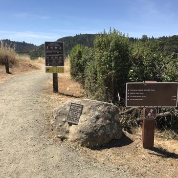


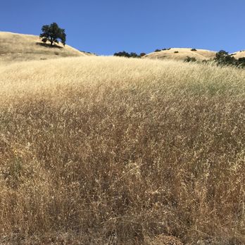


Gorgeous views and well kept trails. We took the trail on the left from the parking lot (on the way to vista point trail). Didn't get all the way to the top but the hike was easy to moderate--good for kids or beginners but challenging going up and narrow at times. Didn't see any wildflowers on 3/24/19 but still a nice hike. The drive up is a bit scary, I wouldn't go too late or near dark because it's very windy and the locals drive fast. Lots of bikes too so we had to be very careful not to get too close to the edge on the narrow road. read more


15 years ago

4 years ago

18 years ago


17 years ago


17 years ago

11 years ago

12 years ago
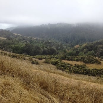
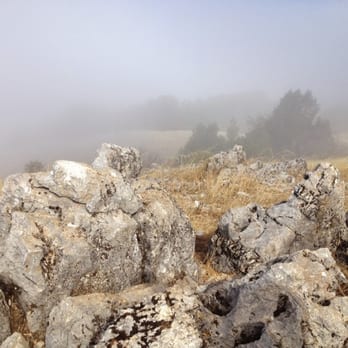
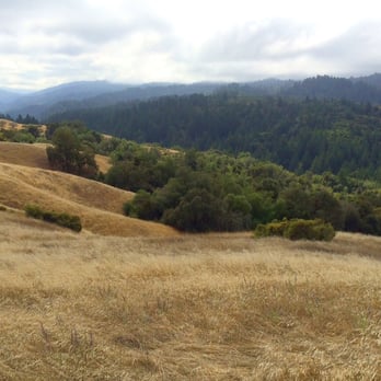
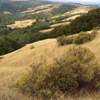
We did a 2.5 hour round-trip hike up to Black Mountain starting from the Page Mill parking lot. It was thick fog on the way up but the trail had beautiful views with the landscape fading in and out of the mist. On the way back (the same route) the fog cleared and we could see beautiful scenery throughout. The route we took starts at a higher altitude and goes along the ridge so it is an easy to moderate hike. Please look this up on a map before starting out. The parking lot is on the south side of Page Mill and has a pit toilet. Start at the trail that goes out of the southern tip of the parking lot and bear left/east toward Stevens Creek Nature trail. Great view at this spot. Then do the Canyon Trail, Bella Vista Trail, Old Ranch Trail and follow signs to the camp. Toilet here too. From the camp follow signs for Monte Bello Rd trail which takes you to the top of Black Mountain. read more




18 years ago
Page 1 of 2
More info about Monte Bello Open Space Preserve
4185 Page Mill Rd
Palo Alto, CA 94022
Directions
(650) 691-1200
Call Now
Visit Website
http://www.openspace.org/preserves/pr_monte_bello.asp
Hours
Indoor Amenities
Outdoor Amenities
Ask the Community - Monte Bello Open Space Preserve
Review Highlights - Monte Bello Open Space Preserve
You might also consider













Why does Yelp recommend reviews?


Monte Bello Open Space Preserve - hiking - Updated August 2026
Best of Palo Alto
People found Monte Bello Open Space Preserve by searching for…
Trending Searches in Palo Alto, CA
Barbershop For Men near Monte Bello Open Space Preserve
Cinema near Monte Bello Open Space Preserve
Cliff Jumping near Monte Bello Open Space Preserve
Cruising Spots near Monte Bello Open Space Preserve
Dog Friendly Beaches near Monte Bello Open Space Preserve
Dog Friendly Things To Do near Monte Bello Open Space Preserve
Ear Piercing near Monte Bello Open Space Preserve
Fishing Spots near Monte Bello Open Space Preserve
Fun Things To Do With Kids near Monte Bello Open Space Preserve
Kids Haircut near Monte Bello Open Space Preserve
Lakes near Monte Bello Open Space Preserve
Lookout Points near Monte Bello Open Space Preserve
Meteor Shower near Monte Bello Open Space Preserve
Mini Golf near Monte Bello Open Space Preserve
Movie Theatre near Monte Bello Open Space Preserve
Parks near Monte Bello Open Space Preserve
Peach Picking near Monte Bello Open Space Preserve
Pedicure near Monte Bello Open Space Preserve
Picnic Areas near Monte Bello Open Space Preserve
Places To Take Pictures near Monte Bello Open Space Preserve
Playgrounds near Monte Bello Open Space Preserve
Preschools near Monte Bello Open Space Preserve
Public Beaches near Monte Bello Open Space Preserve
Public Pools near Monte Bello Open Space Preserve
Public Running Track near Monte Bello Open Space Preserve
Rock Quarry near Monte Bello Open Space Preserve
Scenic Night View near Monte Bello Open Space Preserve
Shopping Malls near Monte Bello Open Space Preserve
Souvenir Shops near Monte Bello Open Space Preserve
Star Gazing near Monte Bello Open Space Preserve
Stargazing near Monte Bello Open Space Preserve
Sunrise View near Monte Bello Open Space Preserve
Swimming Holes near Monte Bello Open Space Preserve
Trading Card Shops near Monte Bello Open Space Preserve
Uniforms near Monte Bello Open Space Preserve
Used Furniture Stores near Monte Bello Open Space Preserve
Browse Nearby
BEST of Palo Alto, California Coffee near Monte Bello Open Space Preserve
BEST of Palo Alto, California Restaurants near Monte Bello Open Space Preserve
BEST of Palo Alto, California Things to Do near Monte Bello Open Space Preserve
BEST of Palo Alto, California Walking Trails near Monte Bello Open Space Preserve
BEST of Palo Alto, California Parks near Monte Bello Open Space Preserve
BEST of Palo Alto, California Breakfast near Monte Bello Open Space Preserve
BEST of Palo Alto, California Campgrounds near Monte Bello Open Space Preserve
BEST of Palo Alto, California Taxis near Monte Bello Open Space Preserve
BEST of Palo Alto, California Motel near Monte Bello Open Space Preserve
Browse Brands
Related Searches in Palo Alto, CA
Best Dog Hiking Trails Around Palo Alto, California
Best Fishing Locations and Guides in Palo Alto, California
Best Nature Trails for Hiking in Palo Alto, California
Best Off Leash Dog Parks in Palo Alto, California
Best Parks for Parties and Events in Palo Alto, California
Best Places for Horseback Riding in Palo Alto, California
Best Sightseeing Experiences Available in Palo Alto, California
Best Water Parks for Kids in Palo Alto, California
Check Out Great Playgrounds in Palo Alto, California
Check Out Off Road Trails in Palo Alto, California
Discover Baseball Fields Around Palo Alto, California
Discover Dog Friendly Trails to Explore in Palo Alto, California
Discover Easy Hiking Trails Near Palo Alto, California
Discover Fun Toddler Parks in Palo Alto, California for Your Little One
Discover Kid Friendly Hiking Trails in Palo Alto, California
Discover Lakes & Ponds to Explore in Palo Alto, California
Discover Popular Bike Trails in Palo Alto, California
Discover Popular Photo Spots in Palo Alto, California
Discover Soccer Fields in Palo Alto, California Near You
Discover Top Nature Parks to Visit in Palo Alto, California
Discover Top State Parks to Visit in Palo Alto, California
Discover Walking Parks in Palo Alto, California Near You
Discover a Hiking Trail in Palo Alto, California
Discover the Best Beaches in Palo Alto, California
Discover the Best Kids Park Spots in Palo Alto, California
Discover the Best Night Hike Trails in Palo Alto, California
Dog-Friendly Hikes With Dogs in Palo Alto, California
Enjoy Camping Adventures Around Palo Alto, California
Enjoy Kayaking Adventures in Palo Alto, California
Enjoy Off Leash Dog Hikes in Palo Alto, California
Enjoy Scenic Places to Walk in Palo Alto, California
Enjoy a Beautiful Waterfall Hike in Palo Alto, California
Enjoy the Best Picnic Spots and Ideas in Palo Alto, California
Enjoy the Best Walking Path in Palo Alto, California
Enjoy the Best Walking Trails in Palo Alto, California
Explore Beautiful Parks and Green Spaces in Palo Alto, California
Explore Easy Hikes Perfect for All in Palo Alto, California
Explore Free Picnic Areas Around Palo Alto, California
Explore Fun Activities to Do in Palo Alto, California
Explore Parks With Pull Up Bars in Palo Alto, California
Explore Picnic Parks Near Palo Alto, California
Explore Popular Campgrounds Near Palo Alto, California
Explore Popular Dog Walking Trails in Palo Alto, California
Explore Popular Kids Parks Throughout Palo Alto, California
Explore Popular Picnic Areas Around Palo Alto, California
Explore Popular RV Parks Around Palo Alto, California
Explore Scenic Lakes to Visit in Palo Alto, California


