Mojave Desert Photos


You might also consider
More like Mojave Desert
Recommended Reviews - Mojave Desert
Start your review...

Reviews With Photos
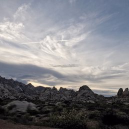
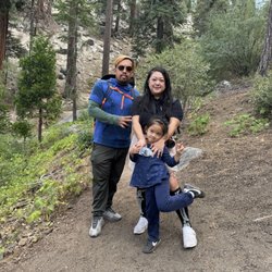
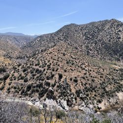
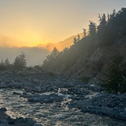
We very much enjoyed our journey through Mojave while traveling from Las Vegas to Joshua Tree National Park! This desert is found mostly in Nevada and California and stretches up a bit up into Utah and down to Arizona near Havasu. Highways that cross the Mojave are Interstate 15, Interstate 40, U.S. Route 95, U.S. Route 395 and California State Route 58. Mojave is one of extremes. You can experience trekking 200 plus miles below sea level at the hottest place in North America, Death Valley, to rising about 12,000 ft at Charleston Peak. Temps in the winter are comfortable in the 70's, but can soar to 120 plus degrees in the summer!! It was 109 degrees when we visited later in the day in August. Plan accordingly! Always have gallons of water and a full tank of gas. The Mojave has many different recreation area and parks within its borders. It also has many deserted towns left from the gold and silver mining days as well as abandoned places along Old Route 66 aka Route 40. The roads and landscape were completely desolate. We were the only ones on the road for miles and miles! It was awesome! My little one even ran around au naturale because, well, she could. What a thrill! We made many stops to explore, look for rattles and roadrunners which I didn't realize were actually an animal, not just something depicted in a cartoon. Mojave is home to over 40 different wildlife species. You never know what you'll see here! We also stopped to take some photos with Joshua Trees which strictly grow in this area. I didn't realized we would be seeing them before actually entering the park of the same name. It was a great taste of things to come for us! Despite the high temps, we opened the windows, blasted music and enjoyed the sun setting in our own private oasis. It was so memorable and something we all recommend doing if you're in the area!

2 years ago
The majestic Mojave Desert, overflowing with places to explore. It begs you to visit it, one of the most beautiful places in the world. read more


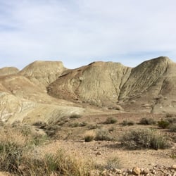
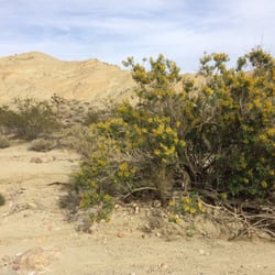
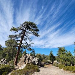
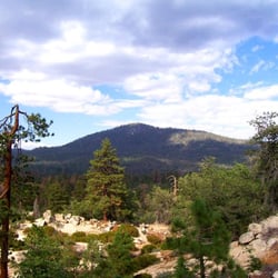
It happens to be a desert. It features things you expect to find in a desert: it gets hot and there's a whole lot of nothing. That is just a matter of opinion for some people. It actually has a whole lot besides nothing. There's a lot of natural beauty here as well as kitschy tourist attractions like candy stores and an oversized thermometer. It takes up pretty much the entire area of San Bernardino County. It's a very large county that's different from what most people think of California. Most people think of beaches and Hollywood. In fact, there actually are a few lakes here. They're just dry, really just flat areas of land. It's accessible mostly by I-15, which runs through several small cities. The best known might be Barstow, which is the halfway point between LA and Vegas. It's the best place to stop for gas if you're going north because it's the cheapest. The town of Yermo has the popular tourist stop EddieWorld. It's a store filled with candy. They have lots of other useless items. It gets hottest around Baker. There's even a large thermometer. You should get prepared before driving through the desert. Be sure to have food and water in case you have car problems. Several cars were pulled over with steaming engines along I-15 the one time. read more


9 years ago
We very much enjoyed our journey through Mojave while traveling from Las Vegas to Joshua Tree National Park! This desert is found mostly in Nevada and California and stretches up a bit up into Utah and down to Arizona near Havasu. Highways that cross the Mojave are Interstate 15, Interstate 40, U.S. Route 95, U.S. Route 395 and California State Route 58. Mojave is one of extremes. You can experience trekking 200 plus miles below sea level at the hottest place in North America, Death Valley, to rising about 12,000 ft at Charleston Peak. Temps in the winter are comfortable in the 70's, but can soar to 120 plus degrees in the summer!! It was 109 degrees when we visited later in the day in August. Plan accordingly! Always have gallons of water and a full tank of gas. The Mojave has many different recreation area and parks within its borders. It also has many deserted towns left from the gold and silver mining days as well as abandoned places along Old Route 66 aka Route 40. The roads and landscape were completely desolate. We were the only ones on the road for miles and miles! It was awesome! My little one even ran around au naturale because, well, she could. What a thrill! We made many stops to explore, look for rattles and roadrunners which I didn't realize were actually an animal, not just something depicted in a cartoon. Mojave is home to over 40 different wildlife species. You never know what you'll see here! We also stopped to take some photos with Joshua Trees which strictly grow in this area. I didn't realized we would be seeing them before actually entering the park of the same name. It was a great taste of things to come for us! Despite the high temps, we opened the windows, blasted music and enjoyed the sun setting in our own private oasis. It was so memorable and something we all recommend doing if you're in the area! read more


7 years ago
8 years ago
More info about Mojave Desert
Barstow Fwy
Newberry Springs, CA 92365
Directions
Hours
Outdoor Amenities
Ask the Community - Mojave Desert
You might also consider


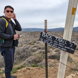


Mojave Desert - hiking - Updated July 2026
Best of Newberry Springs
People found Mojave Desert by searching for…
Lakes in Newberry Springs, California
Beaches in Newberry Springs, California
Parks in Newberry Springs, California
Tourist Attractions in Newberry Springs, California
Things to Do in Newberry Springs, California
Attractions in Newberry Springs, California
Hiking Trails in Newberry Springs, California
Watch Sunset in Newberry Springs, California
Playgrounds in Newberry Springs, California
Swimming Lakes in Newberry Springs, California
Running Trails in Newberry Springs, California
Off Road Trails in Newberry Springs, California
Secret Spots in Newberry Springs, California
Abandoned Places in Newberry Springs, California
Sunset View in Newberry Springs, California
Walking Trails in Newberry Springs, California
Lakes & Ponds in Newberry Springs, California
Sightseeing in Newberry Springs, California
Parks and Recreation in Newberry Springs, California
Nature in Newberry Springs, California
Views in Newberry Springs, California
Must See in Newberry Springs, California
Browse Nearby
BEST of Newberry Springs, California Coffee near Mojave Desert
BEST of Newberry Springs, California Restaurants near Mojave Desert
BEST of Newberry Springs, California Things to Do near Mojave Desert
BEST of Newberry Springs, California Breakfast near Mojave Desert
BEST of Newberry Springs, California Thrift Stores near Mojave Desert
Browse Brands
Browse Articles
People who viewed Mojave Desert also viewed
Pisgah Crater
3 reviews
Barstow Centennial Park
5 reviews
Calico Ghost Town
557 reviews
Dana Park
2 reviews
Lake Jodie
2 reviews
Camping-San Bernardino County Regional Parks
4 reviews
Dumont Dunes
7 reviews
El Mirage Dry Lake - OHV Recreation Area
1 review
Wild West Off Road Adventures
5 reviews
Motion Dance Center
2 reviews