
Rainbow Basin Natural Area Photos


You might also consider


More like Rainbow Basin Natural Area
Recommended Reviews - Rainbow Basin Natural Area
Start your review...


Reviews With Photos


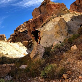
Excellent place to go hike and explore and if you're into camping, their facilities are well maintained. The location is just far enough to be a good day trip (from LA), but far enough to feel adventurous. Even if you're coming from nearby Barstow, it's isolated enough to block out the world. Some reviews of the trails online takes about trails that were non-existent in spots, but if you consider yourself a hiker those "nonexistent" trails will stick out to you like neon; if you're not an avid hiker, you can still easily find your way. The best way is to download the AllTrails app and use this "Rainbow Basin Loop" guide for a good 9-mile hike: https://www.alltrails.com/trail/us/california/rainbow-basin-loop Some people also complain about lack of colors, but if you go on a sunny day and use those eyeballs in your head, the colors are right their in front of you. I'm sure a light rain would POP them even more, but you don't want to be In these canyons during a rainstorm because of the obvious signs (and dangers) of flash floods. The slot canyons are cool and WIDE, definitely not a true slot canyon where you have to strategically contort your body through, but rugged and fun and beautiful. You'll enjoy your trip out to Rainbow Basin.


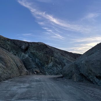
Absolutely gorgeous drive through a beautiful canyon. The colors are stunning. Photos do not do them justice. Reminded me a bit of the drive through Artists Pallette at Death Valley. The rainbow in the name refers to 2 different areas where the rock is layered in arches. Hence the rainbow look. The entrance to Rainbow Basin is off Irwin Road. Irwin Road is a bit creepy - lots of crosses lining the road. A quick google search brings up lots of references to paranormal activity. It's a pretty long bumpy road, 5-6 miles, out to the Canyon. The Canyon drive is 3-1/2 miles. When you come off the one way stretch, it isn't signposted. You want to turn right to head back to the main road and exit There are quite a few places to pull over during the drive. And 1 official parking lot half way through the drive. So ample opportunities to get out of the car, walk around, take pictures.


Gorgeous basin, well worth the stop on a road trip up Hwy 395. And dog friendly! Just beware, the terrain is a little rocky (nothing too extreme) although my hiking companion scratched the insides of her paws from scrambling on the rocks. Getting there required driving on a dirt road for about 3-4 miles, narrow at some parts, but we were able to do it just fine with a Honda Accord. Once you reach the camp ground, park all the way to the end of the site (past the playground equipment) as the trailhead starts at the end. I loved it there, so quiet and away from the city, you couldn't hear ANYTHING except the wind. You can also camp here if you wish. Very interesting rock formations, and it's fun walking down a narrow former riverbed, surrounded by rocks. We stopped at about 1.7 miles, because after that we would have had to do some minor rock climbing (which just seemed too difficult to do with the dog). Definitely worth the stop if you are a hiker/nature lover/have dog traveling companion. No Pokestops, not that you will find a cell signal here anyway.


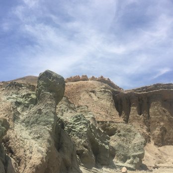
Extremely beautiful area!! Similar to the painted hills in Oregon, this rural wonder is a must if you're near Barstow. The road is a little ways off but there's helpful signage once you've typed in the location. The winding and rolling road has many spots to stop and get out of the car to look at the gorgeous rock formations. Peak sunset spot and view is right by the destroyed green piano and then the loop takes you back out to the main road. We came in December and we were all alone !! While it may not be as grand as the Grand Canyon the multi colored rocks and stacks are similarly beautiful here and the opportunity to get closer is even better. Practice leave no trace and be aware of your surroundings as the rocks can look quite precarious. read more

A trip to Rainbow Basin will make you feel like you're on a different planet. It's a unique drive on a one-way unpaved road through some of the most striking geological formations I've ever seen. As other Yelpers have said, the photos don't do justice to the subtle variations in color that you'll see. Visiting in spring, lots of wildflowers and the Joshua trees were in bloom as well. Tips: Make sure your car is in good condition and take water. I made the drive in just a regular car with no 4-wheel drive and I was fine but check road conditions first. It's free! Don't forget to charge your phone and take your real camera. read more


Excellent place to go hike and explore and if you're into camping, their facilities are well maintained. The location is just far enough to be a good day trip (from LA), but far enough to feel adventurous. Even if you're coming from nearby Barstow, it's isolated enough to block out the world. Some reviews of the trails online takes about trails that were non-existent in spots, but if you consider yourself a hiker those "nonexistent" trails will stick out to you like neon; if you're not an avid hiker, you can still easily find your way. The best way is to download the AllTrails app and use this "Rainbow Basin Loop" guide for a good 9-mile hike: https://www.alltrails.com/trail/us/california/rainbow-basin-loop Some people also complain about lack of colors, but if you go on a sunny day and use those eyeballs in your head, the colors are right their in front of you. I'm sure a light rain would POP them even more, but you don't want to be In these canyons during a rainstorm because of the obvious signs (and dangers) of flash floods. The slot canyons are cool and WIDE, definitely not a true slot canyon where you have to strategically contort your body through, but rugged and fun and beautiful. You'll enjoy your trip out to Rainbow Basin. read more


8 years ago
Absolutely gorgeous drive through a beautiful canyon. The colors are stunning. Photos do not do them justice. Reminded me a bit of the drive through Artists Pallette at Death Valley. The rainbow in the name refers to 2 different areas where the rock is layered in arches. Hence the rainbow look. The entrance to Rainbow Basin is off Irwin Road. Irwin Road is a bit creepy - lots of crosses lining the road. A quick google search brings up lots of references to paranormal activity. It's a pretty long bumpy road, 5-6 miles, out to the Canyon. The Canyon drive is 3-1/2 miles. When you come off the one way stretch, it isn't signposted. You want to turn right to head back to the main road and exit There are quite a few places to pull over during the drive. And 1 official parking lot half way through the drive. So ample opportunities to get out of the car, walk around, take pictures. read more


10 years ago
Gorgeous basin, well worth the stop on a road trip up Hwy 395. And dog friendly! Just beware, the terrain is a little rocky (nothing too extreme) although my hiking companion scratched the insides of her paws from scrambling on the rocks. Getting there required driving on a dirt road for about 3-4 miles, narrow at some parts, but we were able to do it just fine with a Honda Accord. Once you reach the camp ground, park all the way to the end of the site (past the playground equipment) as the trailhead starts at the end. I loved it there, so quiet and away from the city, you couldn't hear ANYTHING except the wind. You can also camp here if you wish. Very interesting rock formations, and it's fun walking down a narrow former riverbed, surrounded by rocks. We stopped at about 1.7 miles, because after that we would have had to do some minor rock climbing (which just seemed too difficult to do with the dog). Definitely worth the stop if you are a hiker/nature lover/have dog traveling companion. No Pokestops, not that you will find a cell signal here anyway. read more


9 years ago

9 years ago
We drove out to Calico to spend some time & left there very disappointed. We saw that this was close, so we drove over. It was amazing & an easy drive in my SUV. I would definitely recommend this to anyone that drives through the Barstow area. There were so many things to look at & you can do the drive through the preserve in about an hour. Will definitely be back read more




12 years ago

10 years ago
More info about Rainbow Basin Natural Area
Fossil Bed Rd
Barstow, CA 92311
Directions
(760) 252-6000
Call Now
Hours
Outdoor Amenities
Ask the Community - Rainbow Basin Natural Area
Review Highlights - Rainbow Basin Natural Area
You might also consider













Why does Yelp recommend reviews?
1 review that is not currently recommended
The reviews below are not factored into the business's overall star rating.
4 years ago
Rainbow Basin Natural Area - hiking - Updated September 2026
Best of Barstow
People found Rainbow Basin Natural Area by searching for…
Trending Searches in Barstow, CA
Apple Orchards near Rainbow Basin Natural Area
Apple Picking near Rainbow Basin Natural Area
Barbers near Rainbow Basin Natural Area
Bike Shop near Rainbow Basin Natural Area
Casinos near Rainbow Basin Natural Area
Consignment Shops near Rainbow Basin Natural Area
Cruising Spots near Rainbow Basin Natural Area
Dog Friendly Things To Do near Rainbow Basin Natural Area
Ear Piercing near Rainbow Basin Natural Area
Eyebrow Threading near Rainbow Basin Natural Area
Eyelash Extensions near Rainbow Basin Natural Area
Hair Braiding near Rainbow Basin Natural Area
Hiking near Rainbow Basin Natural Area
Kids Haircut near Rainbow Basin Natural Area
Lookout Points near Rainbow Basin Natural Area
Parks near Rainbow Basin Natural Area
Picnic Areas near Rainbow Basin Natural Area
Preschools near Rainbow Basin Natural Area
Private Schools near Rainbow Basin Natural Area
Public Shower near Rainbow Basin Natural Area
Rock Quarry near Rainbow Basin Natural Area
Scenic Night View near Rainbow Basin Natural Area
Scenic Overlook near Rainbow Basin Natural Area
Star Gazing near Rainbow Basin Natural Area
Sunrise View near Rainbow Basin Natural Area
Trading Card Shops near Rainbow Basin Natural Area
Browse Brands
Related Searches in Barstow, CA
Best Dog Hiking Trails Around Barstow, California
Best Fishing Locations and Guides in Barstow, California
Best Places for Horseback Riding in Barstow, California
Best Waterfalls and Swimming Holes in Barstow, California
Check Out Off Road Trails in Barstow, California
Discover Dog Friendly Trails to Explore in Barstow, California
Discover Kid Friendly Hiking Trails in Barstow, California
Discover Popular Bike Trails in Barstow, California
Discover a Hiking Trail in Barstow, California
Discover the Best Fishing Lake in Barstow, California
Discover the Best Night Hike Trails in Barstow, California
Dog-Friendly Hikes With Dogs in Barstow, California
Enjoy Camping Adventures Around Barstow, California
Enjoy Off Leash Dog Hikes in Barstow, California
Enjoy Scenic Places to Walk in Barstow, California
Enjoy a Beautiful Waterfall Hike in Barstow, California
Enjoy the Best Walking Trails in Barstow, California
Explore Beautiful Parks and Green Spaces in Barstow, California
Explore Easy Hikes Perfect for All in Barstow, California
Explore Fun Activities to Do in Barstow, California
Explore Popular Campgrounds Near Barstow, California
Explore Scenic Lakes to Visit in Barstow, California
Explore Top Dog Parks in Barstow, California Near You
Explore Top Water Parks in Barstow, California Today
Explore the Best Beach Spots in Barstow, California
Explore the Best Swimming Holes Around Barstow, California
Family Friendly Hiking With Kids in Barstow, California
Find Beautiful Views in Barstow, California
Find Cozy Camping Cabins in Barstow, California
Find Popular Ziplining Spots Around Barstow, California
Find Top-Rated Waterfalls in Barstow, California Now
Find the Best Parks for Picnics in Barstow, California
Find the Best Playgrounds to Visit in Barstow, California
Hiking Trails With Waterfalls in Barstow, California
Off Leash Dog Hiking Trails in Barstow, California
Popular Fishing Spots to Explore in Barstow, California
Popular Outdoor Activities to Try in Barstow, California
Safe River Swimming Areas in Barstow, California
Safe and Fun Parks for Kids in Barstow, California
Top Dog Friendly Things to Do in Barstow, California
Top Hiking Trails to Explore in Barstow, California
Top Playgrounds for Kids to Enjoy in Barstow, California
Top Running Trails to Explore in Barstow, California
Top Swimming Lakes to Enjoy in Barstow, California
Top Swimming Spots and Pools in Barstow, California
Top Things to Do With Kids in Barstow, California
Top-Rated Camping Sites in Barstow, California


