1. Monon High Bridge Trail

    1. Monon High Bridge Trail

    0

    Delphi, IN

    Cancel

    Open app

    Search

    Monon High Bridge Trail

    3.5 (2 reviews)

    Monon High Bridge Trail Photos

    You might also consider

    More like Monon High Bridge Trail

    Recommended Reviews - Monon High Bridge Trail

    Your trust is our priority, so businesses can't pay to alter or remove their reviews. Learn more about reviews.
    Yelp app icon
    Browse more easily on the app
    Review Feed Illustration

    2 months ago

    Helpful 0
    Thanks 0
    Love this 0
    Oh no 0

    8 years ago

    Helpful 9
    Thanks 3
    Love this 3
    Oh no 0

    Verify this business for free

    People searched for Parks 246 times last month within 15 miles of this business.

    Verify this business

    Wabash Heritage Trail - Zoey enjoying exploring and sniffing

    Wabash Heritage Trail

    3.9(7 reviews)
    17.8 mi

    The best trail for running in the West Lafayette/Lafayette area. On the southernmost point, you can…read morepark at Fort Ouiatenon, take the sidewalk 3/4s of a mile to the trailhead then follow the dirt path along the Wabash River up to the pedestrian bridge, where you can cross over to the Lafayette side or continue up a bit more on paved surface toward a small park, restaurants and the edge of Purdue's campus. If you head over to the Lafayette side, the trail continues on paved surface for a while before returning to a dirt surface and concludes at the Tippecanoe Battlefield Park in Battle Ground, roughly 13 miles from Fort O. The trail is mostly flat and runnable from start to finish. After heavy rains, the river regularly floods the southern part of the trail.

    The Wabash Heritage Trail is 13 miles long making it a perfect training ground for a mini marathon…read more However, today we were exploring nature with our granddaughter. We started on the north end at Battleground Memorial. At the head of the trail is a sweet little nature center (Wah-ba-shik-a Nature Center) filled with descriptions of wildlife and fauna that are native to the area. My granddaughter was delighted to see the big white owl that greeted us at the door. The volunteer at the Center was welcoming and admission was free. They had maps for the trail that you can take. There are also special programs offered throughout the year. The trail starts and Battleground and extends all the way to Fort Ouiatenon. We only toured a couple miles along a creek that eventually meets the Wabash River. The trail is mulch covered and easy to navigate by foot. It would be difficult to maneuver a stroller or wheelchair onto the trail. The trail is lined with very large sycamores, oaks, walnuts and other trees native to the area. Some of the trees were at least 300 years older. The creek is clear and suitable for a little stomping. There are occasional benches along the trail as well as informational markers. There were also picnic tables and a water fountain at the trail head. We did not see any restroom facilities, but there were probably some in the Battle Ground Museum. The hike is quiet during the week. You can enjoy the sounds of birds and squirrels. I can imagine how beautiful the trail is when the leaves are changing color. There is some highway traffic noise as you get closer to the highway. The trail does not loop, so you have to backtrack to return to your car. There was plenty of parking at the Memorial. The map indicated that there were about five parking lots along the trail. We enjoyed the hike and will return to do a different section soon. I highly recommend.

    Photos
    Wabash Heritage Trail
    Wabash Heritage Trail - The Snowy owl at the nature center.

    The Snowy owl at the nature center.

    Wabash Heritage Trail - The creek along the head of the trail.

    See all

    The creek along the head of the trail.

    Portland Arch Nature Preserve

    Portland Arch Nature Preserve

    4.6(8 reviews)
    44.2 mi

    Unless you are a skilled hiker, I recommend going to this beautiful nature preserve when the…read moreweather has been dry. There is about 90 feet of elevation change on the 0.8 mile loop that can be a bit slippery if you pick a time when mud/rain can be a problem. I only explored the north end trail during my visit. After parking in a shaded lot, I went into the park where I had a choice of left or right. The right side has a steeper descent than the left. Fortunately, there is a hand rail for stability. I figured it easier to go down the steep side than up, so I stayed on the right hand path. There is a fairly level area before you reach the "stairs". The stairs are mostly natural, so they aren't evenly spaced. Just keep focused and you should be alright. Once the trail reaches the bottom of the gorge, there are places where elevated paths keep your feet from trekking through the mud. Depending upon how much rain has fallen, you may get some mud, but my feet stayed dry the entire loop. At the base, there are deep ravines where the trees catch the sunlight and light up in brilliant yellow greens. The rocks are layered and take on a rusty color that can make for some great photos. The highlight of the loop is finding the "arch" through the ridge of rock. It was just a bit taller than my head (I would say most folks won't need to duck going through.) After that, you will start working your way back. Although I traveled the same distance up, it was gradual and not nearly as challenging as climbing steps. I didn't see much wildlife there, but there were squirrels and butterflies that showed themselves. I like a short hike that features a destination and great scenes along the way. If you like that too, then seek out this park. Review #2840
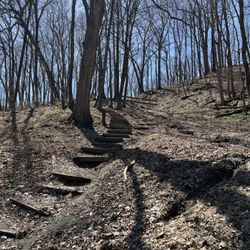
    Great trail among beautiful landforms. It's a nice hike that makes for a good day trip along with…read moreWilliamsport Falls, Attica, and the courthouse murals on Covington.

    Photos
    Portland Arch Nature Preserve - Portland Arch trail

    Portland Arch trail

    Portland Arch Nature Preserve - Halfway down the ravine - rugged

    Halfway down the ravine - rugged

    Portland Arch Nature Preserve - Portland Arch trail

    See all

    Portland Arch trail

    Prophetstown State Park - Scenic overlook just above where the Tippecanoe River joins the Wabash.

    Prophetstown State Park

    4.3(31 reviews)
    11.9 mi

    Grounds are very clean. Campground Hosts are quite good at making guests feel less than welcome…read more We are 2 highly educated professionals who had 2 highly educated and productive friends come to eat dinner one of our 3 nights here. Staff (hosts, in particular) couldn't have been much more deplorable to us about it. We understand the policy, but there's a common decency to enforcing it in one's volunteer role (wearing a DNR hat). We're not loud. We respect other people, nature, and the place. Yet, there's 40' pushers with a jeep and 2 motorcycles who apparently don't have to abide by the same rules. When our guests did leave, the hosts thanked them for leaving loudly as they drove by. The campground was more than half empty, mind you. Sadly, we will think twice about returning if there are other options. If management values people coming here to camp on their vacation time, a close inspection of customer service might be a great way to approach that goal.

    We came to Prophetstown State Park in the hope of continuing our Battle of Tippicanoe experience…read more I had assumed that there would be some historical memorial to the Indian settlement that had once been here - unfortunately other than a very small recreated Indian village there was nothing. This was extremely disappointing and it certainly isn't worth the entry free to just see the three mock Indiana buildings they have here. Assuming however that you agent coming here to see Indian related memorials, then this park is very cool. There are trails to hike - a working farm to visit - playgrounds to play in. Whatever you would normally expect in a State Park. So like anything else - do your research before arriving. I unfortunately did not.

    Photos
    Prophetstown State Park - Nice firepits with moveable grates

    Nice firepits with moveable grates

    Prophetstown State Park - You must pitch your tent on the gravel pad.

    You must pitch your tent on the gravel pad.

    Prophetstown State Park - My campsite.

    See all

    My campsite.

    Falls Creek Gorge - the path is narrow, only one person wide

    Falls Creek Gorge

    4.0(2 reviews)
    39.0 mi

    The Falls Creek Gorge is one of those places that if you go at the right time and/or have the right…read moreclothing/gear, you get a nice experience. Maybe even some great photos, too! The entire trek from parking lot to the potholes, then the mini waterfall, and then back the way you came to your car, is less than a mile. So, if you pack your car accordingly with a change of shoes or water shoes, you may not mind getting your feet wet if the water level is higher than when I went. Know that once you climb down a short stairway, you will most likely have to cross a slightly sloped rock area where water flows over it. I wasn't worried about getting my shoes wet (it was only about 1/4 inch deep) but because of the possibility of slipping and taking a hard fall onto the rock and sliding into the creek. The creek wasn't deep either, but rock is a lot harder than my bones, so I was careful as I crossed the area to the stairs that lead sharply up to the rest of the trail. I was fortunate that the water level was low and easily crossed to a spot where I could stand at creek level to view the potholes. The eddying current of the creek has worn a series of potholes in the river bed than make for a great audio experience hearing the water flow through them. The trail is steep at points and is narrow most of the way as you can get views from above the potholes and the creek. If you continue on the trail, it leads back to a mini waterfall that is only a couple feet high, but because of the setting and the sound, I found I was very pleased I went the extra distance to view it. I understand that the experience can be completely different after a heavy rain or in the winter when ice covers much of the creek. My advice is to know your own skill level at handling flowing water and ice before you undertake this park when the conditions are more challenging. Review #2843

    Sign, sign, everywhere a sign. This attraction was one of only two in Williamsport that enticed us…read moreto drive here from Indy. The gorge itself was splendid but upon our return to our vehicle we were welcomed by the local anti-economic development committee (the local police force) trying to scare us away. Weird. Oh well, enjoyed the trip anyway.

    Photos
    Falls Creek Gorge - Fall Creek heading towards the potholes

    Fall Creek heading towards the potholes

    Falls Creek Gorge - View from the trail of the mini waterfall

    View from the trail of the mini waterfall

    Falls Creek Gorge - Although it's only a couple feet high, it can be heard from a fair distance and is worth the short hike

    See all

    Although it's only a couple feet high, it can be heard from a fair distance and is worth the short hike

    Strawtown Koteewi Park - 8/22/21

    Strawtown Koteewi Park

    4.6(18 reviews)
    49.0 mi

    Pronounced as KO-TAY-WEE which means "fire" and possibly "prairie" in the Miami-Peoria language…read more Located in Hamilton county. The park is unique. This place offers the following: Aerial Adventure trails, Archery Range & Pro shop, Bike trails, Canoe launch, Equestrian center & trail, Fishing, Green space, Hiking trails, Natural History center, Nature trail, Prairie, Sport and target archery. The park encompasses 800 acres with 8 miles of multi use trails and 3 miles of white river. The restored Native American village was pretty neat to see how they lived. I had many pix and unable to post as my pix didn't transfer to new phone. =(

    Another great park in Hamilton County!…read more Strawtown Koteewi Park is one of the more unique parks that I've visited in Indiana, as it has multiple Native American structures outside to explore. This is a really neat park to visit with kids, because they can go in and out of the huts, climb in and out of the archeology excavation site, and just have a good time learning about how people used to live on the land before we came along. There is also a very cool visitor's center with artifacts and treasures from a time long past, like a life-sized dugout canoe, animal skeletons, pottery shards, tools and weapons, and lots more. I took a foraging class here this summer, and it was really great learning about the edible plants that are on the park property. Best of all, it was free! But the class was so good that I would have paid for it. Different classes happen all year long, and many of them are free or very little cost. This park is actually very large, and there are different sections where you can hike, go zip lining and horseback riding. The zip lining and horseback riding areas are seasonal, so they're not open all year long.

    Photos
    Strawtown Koteewi Park - 8/22/21

    8/22/21

    Strawtown Koteewi Park - 8/22/21

    8/22/21

    Strawtown Koteewi Park - 8/22/21

    See all

    8/22/21

    Flat Fork Creek Park - Flat Fork Creek Park

    Flat Fork Creek Park

    4.6(45 reviews)
    61.3 mi

    I was a little bit nervous about signing up to do a 3k event in November, however, the opportunity…read morepresented itself and I knew I'd be able to visit a park I'd never been to before. Flat Fork Creek Park is part of Fishers Parks. Located at 101st and Cyntheanne Road, Flat Fork Creek Park offers just over 60 acres of relaxing fun for just about everyone in the family including a good amount of ADA accessibility. First off, you'll get a 60-foot sledding hill here. That's good to know as we inch toward winter. It's the tallest point in Hamilton County. There's also a 1.25 mile progressive mountain bike course that offers features for both mountain biking newbies and those with more experience. There's a beautiful fishing pond - state license required except for those 17 and under. Nearly 20 acres in the park are reforestation areas and there's a shelter with picnic tables that can be rented. Okay, that accessibility I mentioned? The 3k I did was a relatively small group, though it was centered around disability and had several disabled participants. The park includes an ADA accessible treehouse, a paved multi-use trail, and a boardwalk (I would note that while the boardwalk is, indeed, accessible, you do want to be a tad careful due to the side of the boardwalk that do offer a bit of a drop-off). You know what I think is really cool? They've created a ramp here so that even those with mobility issues can get to the top of the sledding hill - in most parks, that's an afterthought. As a side note, Fishers has won awards for their inclusion work and this park really shows it. This is really just a lovely park. You're not going to find a playground or other frequent park features, however, this beautiful park does a nice job of including everyone and weaving together nature with fun park adventures. This was my first time here. It won't be my last.

    I recently discovered this park and have gone back a few times now. It's a beautiful park with a…read moregreat walking path, trail and hill. I love taking my dog here for a walk or going alone just to watch the sun set. The park is spacious and clean and overall a great experience. If it were closer to me I'd probably go daily.

    Photos
    Flat Fork Creek Park - Treehouse vantage point

    Treehouse vantage point

    Flat Fork Creek Park
    Flat Fork Creek Park - Observation deck

    See all

    Observation deck

    Monon High Bridge Trail - parks - Updated July 2026

    Loading...
    Loading...
    Loading...