Cancel

    Open app

    Search

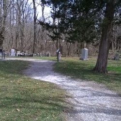
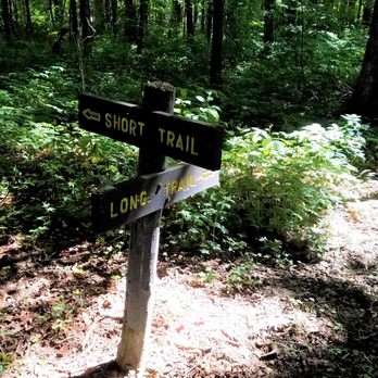
    Bryan Woods Nature Preserve

    3.5 (4 reviews)

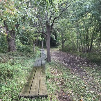
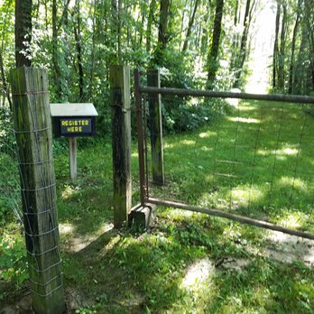
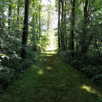
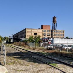
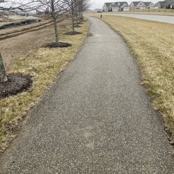
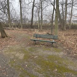
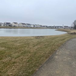
    Bryan Woods Nature Preserve Photos

    You might also consider

    Recommended Reviews - Bryan Woods Nature Preserve

    Your trust is our priority, so businesses can't pay to alter or remove their reviews. Learn more about reviews.
    Yelp app icon
    Browse more easily on the app
    Review Feed Illustration

    5 years ago

    Helpful 1
    Thanks 0
    Love this 0
    Oh no 0

    3 years ago

    Helpful 0
    Thanks 0
    Love this 0
    Oh no 0
    Photo of Ken N.
    668
    3984
    21554

    8 years ago

    Helpful 0
    Thanks 0
    Love this 0
    Oh no 0

    7 years ago

    Helpful 1
    Thanks 0
    Love this 0
    Oh no 0

    Verify this business for free

    People searched for Parks 193 times last month within 15 miles of this business.

    Verify this business

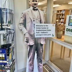
    Prophetstown State Park - Visitor center

    Prophetstown State Park

    4.3(33 reviews)
    16.5 mi

    How can you hate on a state park? It's like hating on a flower: It exists simply to bring pleasure…read moreto those around it. So, for that reason, Prophetstown State Park gets five stars from me, dawg. The visitor center is not much to see, though, to be honest. There are some displays, and a little area for young kids to play. But it's basically a one-room joint with a small parking lot. And I mean small! I think there are maybe a few parking spaces. This is a place to visit if you have questions or need a brochure, but I wouldn't plan on staying long. The rest of the park is very spread out, so you'll want to drive or bike around. There's an aquatic center that was closed when I visited, and also an interactive museum called The Farm at Prophetstown within the property. There is also a playground, a memorial to indigenous tribes of the area, and lots of walking paths. You can get a lot of steps in here at this park, mostly because there are lots of trails, but also because everything is so spread apart.

    This is a calm beautiful and peaceful park. There's something for everyone from campgrounds,…read morefishing lake, biking trails, hiking trails and water slides for kids with playgrounds and other activities too. The campground was full when I went in today, possibly with end of summer and Labor Day weekend. The signage was pretty clear and there was plenty of directions. I hiked trails 2 and the loop, small trail in terms of width but well maintained. Lots of flies and bugs but that's to do with the weather though it was beautiful today. There's an entry fee although I didn't pay as I had my state park pass.
    Photos
    Prophetstown State Park - Visitor center

    Visitor center

    Prophetstown State Park - Playground

    Playground

    Prophetstown State Park - Visitor center

    See all

    Visitor center

    Sugar Creek Nature Park

    Sugar Creek Nature Park

    4.5(2 reviews)
    26.6 mi

    Very nice nature park. Loop trail is easy walking. Great place to take the kids or the dog for a…read morewalk. Several access points for fishing along the trail and near the bridge.

    Just north of Crawfordsville on US-231 is a nature park with a wooded hike and lots of bench/tables…read morealong the path. The majority of the trail parallels the river, including the bend for the last third of the trail. Near the entrance are several board displays including a map and information about the wildlife in the area. The trail starts on the left of the parking lot and loops around a small pond to cover the majority of the park to the right. Most of the paths are dirt, though parts are sandy (near the bend) and rocky. Decent footing for walking, but not so good for jogging since there can be muddy stretches and uneven surfaces. Near the bend, the trail opens up to a "beach" area across from an old power plant. The river has a small dam that creates a murmuring that is relaxing. Fishing is allowed, but there are signs posted that the fish may not be healthy for eating. Sadly, after the rounding of the bend where the trail passes under US-231, a "camp" for homeless blocked the path. I didn't see anyone there, but felt uncomfortable going beyond that point. On the trail back, I found a bypass along the front of the park where the tall grasses had been cut straight to the parking lot. Overall, the park was a decent hike, but could use some attention. I kept running into cobwebs through the wooded area, so I wonder how much use the trail gets. Also, the trail got hard to follow beyond the bend. I wasn't sure if I was to continue along the river or if there was some woodland path that was obscured from view. Note: Access to the park is only available from the north bound lanes of US-231 near the Elston Park Softball Complex. Review #966

    Photos
    Sugar Creek Nature Park
    Sugar Creek Nature Park
    Sugar Creek Nature Park

    See all

    Monon High Bridge Trail - The view from the east side of the Freedom Bridge, as the sun sets behind the city of Delphi.

    Monon High Bridge Trail

    3.5(2 reviews)
    16.8 mi

    A nice paved path and pretty wooded views make this an enjoyable trail. We saw a group of folks…read morewith a few people in wheel chairs and we were encouraged that many people can enjoy this beautiful walk.

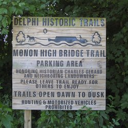
    The Monon High Bridge Trail is part of Delphi, Indiana's 10+ mile system of historic trails that…read morerun throughout the city that rests alongside the Wabash and Erie Canal. The trail became an infamous part of Indiana's crime history on Valentine's Day in 2017 when teenagers Abigail Williams and Liberty German were murdered on the trail after having gone there for an afternoon of hiking on an unseasonably warm February day in Indiana. I must admit that I hesitated to add the trail, a previously popular trail on Delphi's Eastside that seems to be mostly used at this point by those seeking some sort of closure in dealing with the crime and by other curious Hoosiers. For a smaller city, Delphi has a rather nicely developed trail system. Since the tragedy occurred in 2017, Delphi has been making tremendous strides in raising funds and working toward further enhancing the safety of its trails. As a longtime activist in the area of violence prevention, I've long been outspoken about violence involving children and the Delphi killings struck me particularly hard as it was right around the time I was doing one of my Tenderness Tour events. Over the past year, I'd wanted to try to wheel this trail, knowing that it wasn't quite as developed as I usually try to stick to, but it has never felt quite right given the tragedy and my overwhelming desire to not exploit those involved. Having done a recent event, however, I had the opportunity to visit Delphi and to wheel this trail without any publicity and with no commercial attachments. While I am not connected to Delphi, Abby, or Liberty, like many it felt very personal. The trail is a 1.5 mile trail accessible by the abandoned Monon Railroad and from County Road 300. There is some parking available, though I should say up front that neither the parking area not the actual trail would likely be considered wheelchair friendly. The parking area isn't paved - it's more natural dirt/gravel road with a gravel pathway to the actual trail that is actual gravel and not crushed stone. It's not an easy wheel. You can tell you're in the right place if you see a Centennial Stone dedicated to General Samuel Milroy There's a very clear Delphi Historic Trails sign also present. The trail features Indiana's second highest railroad creek crossing, a crossing that is currently blocked off largely related to the crime and issues with private property and planned renovations. When you visit the trail, you are immediately overwhelmed with the fact that the trail is relatively close to a highway and also a property that is on the National Register of Historic Places. While I was able to make my way up to the closed area in a wheelchair, it's pretty clear that the pending renovations and lack of utilization have allowed for some wear to exist on the trail that would likely be addressed more fully if the trail was more actively utilized. We ran into an elderly area couple on the trail while out there - they acknowledged it was their first time on the trail since the killings and they shared their insights about the town's ongoing inability to use the trail. It appears this is magnified because no one has been arrested for the killings. The trail itself is mostly natural, somewhat cleared yet definitely one that requires full attention to ensure safe passage. While the bridge itself was blocked off, it is well known the railroad crossing would not be wheelchair friendly even for a pretty extreme adventure guy like myself. The trail also offers access to the Mary I. Gerrard Nature Preserve, a 6-acre nature park that is right near the end of the trail where the kilings occurred. There's also a memorial to Abby and Liberty that is still presence, a simple yet powerful reminder of the tragedy. It feels weird to "rate" the Monon High Bridge Trail "as is." Yet, it's a trail that remains open to the public and is due to be renovated and upgraded with enhanced safety features. While it remains to be seen if the public will return to the trail, one hopes that the beautiful setting will once again be visited even if it must wait until someone is held accountable for the tragedy that occurred on the trail. The trail is open dusk to dawn. The trail itself does not wind around - once you reach the end, you'll turn around and return the same way. It should be obvious, but if you choose to visit the trail do so respectfully. Delphi is a city with very little crime and the tragedy that occurred on the Monon High Bridge Trail has truly shaken its soul. Please be respectful of anyone you see and the memorial markers that continue to be present toward the end of the trail. Ultimately, the trail is best for hikers and those without mobility concerns. Those in wheelchairs and those with other gait or walking concerns may want to stick to the paved trails closer to town.

    Photos
    Monon High Bridge Trail - The Freedom Bridge, over the Hoosier Heartland Highway

    The Freedom Bridge, over the Hoosier Heartland Highway

    Monon High Bridge Trail - Monon High Bridge Trail Marker

    Monon High Bridge Trail Marker

    Monon High Bridge Trail - 2nd highest railroad crossing in Indiana - end of trail, but currently blocked off.

    See all

    2nd highest railroad crossing in Indiana - end of trail, but currently blocked off.

    Big 4 Trail - The Big 4 trail signage. This is obviously the paved section.

    Big 4 Trail

    4.6(5 reviews)
    18.9 mi

    Easy path with residential, rural views. Go as far as you can/want & turn around to head back to…read moreyour vehicle. We did over 10 miles.

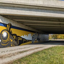
    The Big 4 Trail is a developing Indiana trail that currently extends 15.4 miles with a plan for it…read moreto eventually extend right around 50 miles. The current route includes three disconnected segments in Boone and Clinton counties. I was born in Lebanon and still find that I incorporate Boone County into a lot of my wheeling events. As I get older, I'm finding that I use a lot of trails rather than wheeling on streets. This is a rail-trail named after the "Big 4 Railroad" that existed in the area in the mid-19th century. President Lincoln traveled the route on the way to his inauguration. The Lebanon to Colfax section of the trail was previously known as the Farm Heritage Trail before becoming part of Big 4. Similarly, there's a section north of Thorntown that was known as the Keewasakee Trail. The section from Lebanon to Colfax is mostly rural and passes through Indiana hardwoods and over the scenic Sugar Creek on an iron bridge on the north section. There's a mural celebrating the Big 4 Trail and its railroad history can be seen under the I-65 overpass near the Lebanon trailhead. In 2020, the section north of Thorntown was extended to Colfax. There's also a parallel 4-mile equestrian trail that starts at Serum Plant Road. There's plans for more equestrian trails to be developed. This section is paved. The trail segment heading south towards Lebanon from Sarum Plant Road is currently not paved, with the City of Lebanon planning to begin renovation of the trail in 2023. There are also short sections in Whitestown and Zionsville. The Big 4 is a combo of urban and rural, though I always laugh a bit when I hear the "urban" part since we're talking Boone County urban as opposed to, say, Indy. So, it's more smaller city urban. I like this trail, though there are spots it's definitely more difficult for wheelchair users. Doing the entire trail is difficult since it's disconnected - I can do it, but I'm a pretty experienced trail user. I think most would find it difficult. Trail condition also varies from paved to crush stone to sections that aren't particularly well kept and can get debris. Thorntown to Colfax is really the best section and also has some great sights to see including a Carnegie library and the historic Rosenberger building. As I live on Indy's east side, this isn't my preferred trail. However, when I'm heading toward Boone County or when I need to train on a more difficult path I'll head to Big 4. In terms of hills, it's actually a fairly smooth trail. It's the terrain that can be difficult here. Overall, this is a solid 4-star trail and will likely only get better as development grows over the next few years.

    Photos
    Big 4 Trail - Lebanon has a rich basketball history. ABA Pacer Rick Mount was from here.

    Lebanon has a rich basketball history. ABA Pacer Rick Mount was from here.

    Big 4 Trail - The Big 4 Mural celebrating its rail history

    The Big 4 Mural celebrating its rail history

    Big 4 Trail - Cool bike repair station - a nice trail feature.

    See all

    Cool bike repair station - a nice trail feature.

    Industrial Heritage Trail - Park with decent restrooms

    Industrial Heritage Trail

    4.0(2 reviews)
    25.7 mi

    If you're going to have a really industrial heritage, it's really pretty cool to try to capitalize…read moreon that in a way that's good for the community. That's precisely what the city of Kokomo has done with the Industrial Heritage Trail, a just under six-mile rail-trail that links together historic industrial sites in Kokomo's history. The trail runs through downtown Kokomo while also connecting to the much larger Nickel Plate Trail and Kokomo's really cool Wildcat Creek Walk of Excellence. You'll catch such sites as: The Kokomo Rubber Company, which produced the first pneumatic rubber tire in the U.S. Haynes Automobile Company, which introduced America to the auto. Both Chrysler and Kokomo Opalescent Glass are near the trail (which also has a cool piece of public art). The trail includes historic markers and has places to rest along the trail. As I'm a wheelchair user, I can affirm the trail is wheelchair friendly. It's for the most part a level trail. It's also primarily an urban trail. The Nickel Plate Depot is the primary trailhead for the trail and you can find parking typically around it or along the streets. The Industrial Heritage Trail is not what I'd call a destination trail, though Kokomo has a nice enough system of trails that it would be worth spending the day in Kokomo to try them out. The Nickel Plate alone could easily be called a destination trail and is quite beautiful.

    The Industrial Heritage Trail is runs about 6 miles through Kokomo from north to south through…read moreKokomo's historic industrial corridor. There are a number of historic information signs along the trail talking about groundbreaking industry from Kokomo's past such as Kokomo Rubber Company who made the first inflatable tires and Haynes Automobile Company. The Industrial Heritage Trail connects to the Nickel Plate trail, so I used it to add another 6 miles to my ride. There's a lot of rail history along the route. There's a large depot that now has restaurants as well as some trackside equipment. There are a couple of nice parks and the trail runs right through downtown past the courthouse. It's a nice extension to the Nickel Plate.

    Photos
    Industrial Heritage Trail - Caboose along the trail

    Caboose along the trail

    Industrial Heritage Trail
    Industrial Heritage Trail - Bridge over Wildcat Creek

    See all

    Bridge over Wildcat Creek

    Walker Park And Nature Trail

    Walker Park And Nature Trail

    3.0(2 reviews)
    28.7 mi

    Well, this park is gone. They have torn it down and started putting up buildings. The only thing…read morethat remains is the nature trail. There is no easy parking available to access the trail. I had to park in the neighborhood (Walker Farms) that borders the park and walk over. It was about a quarter-mile walk. The nature trail is small, but well defined. Most of it is paved. You will find a few benches along the trail and the trail head borders a small pond. There is also a picnic table over there that overlooks the pond. The trail does not go too deep in the woods and you are never too far from the road. You will always be able to see houses and/or the road while you are on the trail, so you should not get lost. As I mentioned the park's parking lot and playground equipment are long gone, probably due to main Street park being so close. The construction has also affected parts of the trail as well. All you see are most of the trail and remnants of the park now such as a handicap parking sign or trash cans. I am not sure if there are plans to rebuild to park or not after the construction is done. So, as it stands today , the park does not have much value outside of visitors from the nearby neighborhoods walking the trail to get out and get a quick immersion in nature. This is definitely not a destination spot, nor a place I would recommend traveling to visit.

    This 11 acre park and nature trail is part of the Zionsville Park system and services the…read moresurrounding neighborhoods of Whitestown. The short nature trail has a hard surface but access is over grass. There is natural prairie surrounded by young trees. Maybe a good place to bird watch. Summer overgrowth of the trail left me feeling somewhat unsafe. The play structure is small with basic swings, slides and climbing structure. Not as fancy as the nearby Main Street Park. The local 4-H donated a small pavilion complete with tables and waste cans. The park features a large retention pond with paved sidewalks and benches on two sides. There are supplies for cleaning up after your pooch. Also, there is a nicely maintained field that can be used for soccer or football. There is parking for 16 cars. This is a good neighborhood park.

    Photos
    Walker Park And Nature Trail
    Walker Park And Nature Trail
    Walker Park And Nature Trail

    See all

    Bryan Woods Nature Preserve - parks - Updated September 2026

    Loading...
    Loading...
    Loading...