Monserate Mountain Preserve Photos


You might also consider


More like Monserate Mountain Preserve
Recommended Reviews - Monserate Mountain Preserve
Start your review...


Reviews With Photos


My hiking group and I took the Monserate Trail at Monserate Mountain, an out-and-back route with a steady incline leading to the peak. We navigated the trail using the AllTrails app, which is super handy, especially when exploring new hikes. The Monserate Trail spans 3.1 miles with a 1,158-foot elevation gain. Parking is available across the street from the trailhead. The views during the hike are truly stunning. We visited around 7 a.m. last Saturday, which was ideal since the weather was cool, and the fog blanketing the horizon added to the beauty of the mountains. Be sure to wear sturdy hiking shoes, wear sunscreen, and bring plenty of water, as it's rated a moderate trail. I've trekked here several times and have always enjoyed it. Happy hiking!


This review is for the Monserate Mountain Trail Loop which was a ~4 mile round trip that took ~2 hours to complete. A few areas of the trail were rocky and muddy. The first 1/3 of the trail was a steady incline to the peak. The view was limited at the peak due to the height of the shrubs. The remaining 2/3 were a mix of declines and inclines. Overall, there were some nice views to and away from the peak. The only thing I wasn't a huge fan of was the location as it was next to the freeway. Free parking on the side of the street. Short video of the hike for those interested: https://www.youtube.com/watch?v=HPzBCKGi2qc


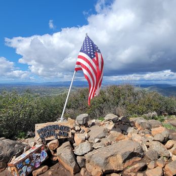
We did this hike last weekend and it will be a one and done I think for us. We don't live near Fallbrook and this was about 1 hr 15 min drive for us. I could see this as being a favorite for people who live in the area who are looking for a challenging workout since there are some pretty steep areas to challenge yourself and the loop is only about 4 miles total so it would be good as a 2 hour cardio/leg workout. Here are the main reasons I don't think I will be back in addition to the long drive for me: -crowded (I like more more secluded trails) -sound of the 15 fwy (I like not hearing the sounds of civilization) -homes/structures nearby (a new residential tract being built really close) -not much beauty or diversity to look at *I understand there are great views from the top but unfortunately the day we went it was drizzling and cloudy with no view to speak of We did this as the Tardigrade Tough 8 Challenge on Instagram and this is my least favorite of the 8. We got there around 7 am on a Saturday afternoon and easily found parking across from the trailhead...free parking. You cross the street and easily see the start of the trail which is steep really from the beginning and you take that straight up the mountain for the most part heading east. After about .7 miles we reached a fork and we went left to do the loop clockwise. This section is steep too and about a mile later (1.6 total) you will reach the peak with a US flag and a metal box with notebooks. We continued on the loop which is about 1.9 miles (3.6 total) to get back to the fork that leads back to the parking area Distance- 4.3 miles Elevation Gain- about 1,400 ft Duration- we completed it in a little under 2 hrs Difficulty- moderate (steep but it is not that long of a hike)


Really, I'm giving this hike 5 stars after it nearly killed me?! I had mentioned to my husband that I wanted to get back into hiking. After I have been doing hikes along the coastline, I was in for a surprise on this hike! This hike started off difficult for me! We started early, 9:30 but 15 minutes into the hike it was slowly warming up or and I started to heat up as well. It's probably because the hike from the get go had me instantly on an incline (I could be exaggerating) hike. The trail condition varies, they entail grooves some deeper than others, some smooth but sandy areas, definitely a lot of rocks, big and small and steep grades. We didn't take the loop trail. Fortunately it was clear enough for us to see quite a ways at the top. Just beware that not everyone abides by the leash rules, so if you have little ones on the hike be cautious. I just read a Yelper's review that she was bit while on a hike! Also, a lot of people don't pick up after their pets so watch your step. Do bring water, wear good shoes, sunglasses and sunscreen. I found that this hike was mostly steep, switch backs with little flat walks if any. Trek sticks could be your best friend on this hike. Although I did bring my best friend, my dog(s)! I don't know if it was a help or not, I know I was slowing my dog down for sure. At the top, the metal box with journal w/pen were there, but the book was full. The pet water bowl is there as well. I would like to try the hike again, but take the loop trail. The question is, with or without the dogs?


I've hiked this mountain twice now... The first was about 7 years ago?! It is a very rocky, STEEP uphill- from the start. I clocked in about 12,000 steps, burned about 600 calories, hiked for a total of 4.5 miles or so. It was an intense workout, I haven't hiked in a while, but it was good and was very rewarding. We completed the whole hike in just under 2 1/2 hours and we stopped along the way to drink water, catch our breath, take pictures and conversate at the top with a few other hikers. The loop is well worth doing as the views are pretty around the back of the mountain. Once you hit the fork- you can go right or left (up). The left will take you straight up the mountain peak (1.1 miles from this point) and the loop will take you around the mountain up to the top (1.7 miles). Definitely go around. Part of the loop trail is loosely paved but there are many times where the trail will ascend and descend. I could see trekking poles being useful on rocky portions of the trail but definitely not required. Bring plenty of water, go at a good pace, and enjoy the views!


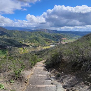
Great location to hike and do legs. It starts slow, then some stairs, well many many stairs, then a dirt path. It didn't tske long to arrive at the top of the mountain. The view is spectacular, breathtaking. You can see mountains and mountains of greenery and brown. Also, at the end it had a GeoCashing and a Box with a note pad inside. Write a little positive note and grab the flag for the trail completion. If you are around Fallbrook dont forget to stop here. Great experience.


6 months ago
Best Hike I've done in the Temecula Area! I have yet to do the longer trail. However this hike was unforgiving! So worth it! Definitely 25-30% incline. Be careful going back down. Make sure your shoes are tied. I forgot to bring something to help with the sun so don't forget that! Bring enough water! Very easy to navigate through. A very popular Preserve. One of my fav's read more




2 months ago
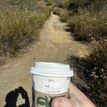
Came down from a hike at monserate with handfuls of trash. Someone even left their name on their litter. Shame on u Sol. read more


My hiking group and I took the Monserate Trail at Monserate Mountain, an out-and-back route with a steady incline leading to the peak. We navigated the trail using the AllTrails app, which is super handy, especially when exploring new hikes. The Monserate Trail spans 3.1 miles with a 1,158-foot elevation gain. Parking is available across the street from the trailhead. The views during the hike are truly stunning. We visited around 7 a.m. last Saturday, which was ideal since the weather was cool, and the fog blanketing the horizon added to the beauty of the mountains. Be sure to wear sturdy hiking shoes, wear sunscreen, and bring plenty of water, as it's rated a moderate trail. I've trekked here several times and have always enjoyed it. Happy hiking! read more


8 months ago

1 year ago

This review is for the Monserate Mountain Trail Loop which was a ~4 mile round trip that took ~2 hours to complete. A few areas of the trail were rocky and muddy. The first 1/3 of the trail was a steady incline to the peak. The view was limited at the peak due to the height of the shrubs. The remaining 2/3 were a mix of declines and inclines. Overall, there were some nice views to and away from the peak. The only thing I wasn't a huge fan of was the location as it was next to the freeway. Free parking on the side of the street. Short video of the hike for those interested: https://www.youtube.com/watch?v=HPzBCKGi2qc read more




1 year ago
Great trail! Had a fun time hiking this trail. No shade, recommends to hike during spring and winter time. Early morning during summer. read more


2 years ago
It's a beautiful hike east parking but it's tough if you're a beginner .. some parts pretty steep but some low straight lines .. it's about 4 miles up and back .. read more


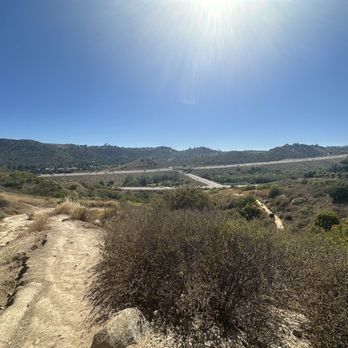
My nieces, my pup and I had a girls day and decided to hike Monserate Mountain. I've lived here for years and this was my first time hiking it. The trail is a bit rugged due to the weather but worth it. We had fun and a great workout! read more



3 years ago
This is a good hike but it's intense! The majority of this hike is up hill. Make sure you bring lots of water and sun protection! The views are great on clear days! read more


3 years ago
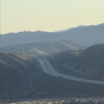
Great place to hike with awesome views of the I15 & I76 Corridor. Go at sunrise and sunset. read more


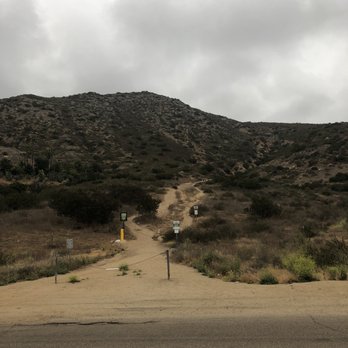
We did this hike last weekend and it will be a one and done I think for us. We don't live near Fallbrook and this was about 1 hr 15 min drive for us. I could see this as being a favorite for people who live in the area who are looking for a challenging workout since there are some pretty steep areas to challenge yourself and the loop is only about 4 miles total so it would be good as a 2 hour cardio/leg workout. Here are the main reasons I don't think I will be back in addition to the long drive for me: -crowded (I like more more secluded trails) -sound of the 15 fwy (I like not hearing the sounds of civilization) -homes/structures nearby (a new residential tract being built really close) -not much beauty or diversity to look at *I understand there are great views from the top but unfortunately the day we went it was drizzling and cloudy with no view to speak of We did this as the Tardigrade Tough 8 Challenge on Instagram and this is my least favorite of the 8. We got there around 7 am on a Saturday afternoon and easily found parking across from the trailhead...free parking. You cross the street and easily see the start of the trail which is steep really from the beginning and you take that straight up the mountain for the most part heading east. After about .7 miles we reached a fork and we went left to do the loop clockwise. This section is steep too and about a mile later (1.6 total) you will reach the peak with a US flag and a metal box with notebooks. We continued on the loop which is about 1.9 miles (3.6 total) to get back to the fork that leads back to the parking area Distance- 4.3 miles Elevation Gain- about 1,400 ft Duration- we completed it in a little under 2 hrs Difficulty- moderate (steep but it is not that long of a hike) read more





5 years ago

8 years ago
Really, I'm giving this hike 5 stars after it nearly killed me?! I had mentioned to my husband that I wanted to get back into hiking. After I have been doing hikes along the coastline, I was in for a surprise on this hike! This hike started off difficult for me! We started early, 9:30 but 15 minutes into the hike it was slowly warming up or and I started to heat up as well. It's probably because the hike from the get go had me instantly on an incline (I could be exaggerating) hike. The trail condition varies, they entail grooves some deeper than others, some smooth but sandy areas, definitely a lot of rocks, big and small and steep grades. We didn't take the loop trail. Fortunately it was clear enough for us to see quite a ways at the top. Just beware that not everyone abides by the leash rules, so if you have little ones on the hike be cautious. I just read a Yelper's review that she was bit while on a hike! Also, a lot of people don't pick up after their pets so watch your step. Do bring water, wear good shoes, sunglasses and sunscreen. I found that this hike was mostly steep, switch backs with little flat walks if any. Trek sticks could be your best friend on this hike. Although I did bring my best friend, my dog(s)! I don't know if it was a help or not, I know I was slowing my dog down for sure. At the top, the metal box with journal w/pen were there, but the book was full. The pet water bowl is there as well. I would like to try the hike again, but take the loop trail. The question is, with or without the dogs? read more


I've hiked this mountain twice now... The first was about 7 years ago?! It is a very rocky, STEEP uphill- from the start. I clocked in about 12,000 steps, burned about 600 calories, hiked for a total of 4.5 miles or so. It was an intense workout, I haven't hiked in a while, but it was good and was very rewarding. We completed the whole hike in just under 2 1/2 hours and we stopped along the way to drink water, catch our breath, take pictures and conversate at the top with a few other hikers. The loop is well worth doing as the views are pretty around the back of the mountain. Once you hit the fork- you can go right or left (up). The left will take you straight up the mountain peak (1.1 miles from this point) and the loop will take you around the mountain up to the top (1.7 miles). Definitely go around. Part of the loop trail is loosely paved but there are many times where the trail will ascend and descend. I could see trekking poles being useful on rocky portions of the trail but definitely not required. Bring plenty of water, go at a good pace, and enjoy the views! read more


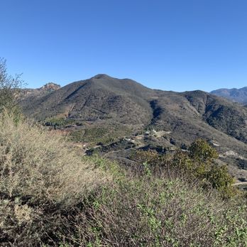
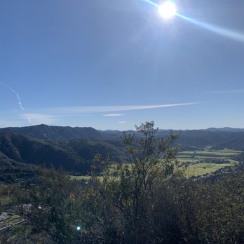


Great location to hike and do legs. It starts slow, then some stairs, well many many stairs, then a dirt path. It didn't tske long to arrive at the top of the mountain. The view is spectacular, breathtaking. You can see mountains and mountains of greenery and brown. Also, at the end it had a GeoCashing and a Box with a note pad inside. Write a little positive note and grab the flag for the trail completion. If you are around Fallbrook dont forget to stop here. Great experience. read more


7 years ago

5 years ago
Great hike this mountain is great for leg day lol love going in the afternoon to catch the sun set. read more


Aggressive hike that rewards you with great views of Fallbrook. This is not a particularly easy hike but it's completely doable if you give yourself plenty of breaks and water. We started and went right at the fork to go straight to the summit. There's a pretty intense ascension with lots of rubble and rocks in your way. This is the most popular direction of the loop trail because it gets you to the top the quickest and you can always go back down without finishing the loop. Tip - Be sure to look at a map to know where you'll have to hike up to get to the actual sign in box and flag. If you have enough energy I do recommend you continue the entire loop if you can. The views are great and the hike back to the fork is challenging. - To do the full hike it's over 4 miles and took 2.5 hours with many breaks. - Many dog walkers on the trail, if little dogs can hike it so can you. - This is a good training hike if you're looking to hike up the formidable El Cajon mountain. read more


3 years ago

3 years ago

7 years ago
Great trail. Good elevation gain going up with amazing views from the top. It's a loop starting at .75 miles in. We went left and continued the climb, right takes you down, where you hit a service road for the water tower. read more


10 years ago
Location: Right off the I-15 freeway. Park on Horse Ranch Creek Rd/ Ankey Rd. Distance: 3-4 miles (out-and-back OR loop) Difficulty: Moderate-Hard Elevation gain: ~1100ft This hike is easy to access and there seems to always be plenty of parking, but keep in mind there are no bathrooms nearby. We did this one on an overcast, muggy day at 11am when it was about 70 degrees. I can't imagine doing this one in the middle of the summer past that time though as there is absolutely no tree cover. Bring lots of sunscreen and a hat otherwise, because you're in for a relatively strenuous uphill climb. Hike starts off pretty moderate with plenty of switchbacks. As soon as you reach a fork in the trail (just before you hit 1 mile), you have the choice of going up an access road or off to the right on another trail. We opted to go up the access road and the inclines got pretty murderous until we reached the top 1 mile later. I might add that the very last stretch before you reach the peak is an ass kicker. We were taking constant breaks, but didn't feel like we were moving! Once at the top, you get views of North San Diego, but on the hazy day we went, it was difficult to see anything. There were also remnants of a brush fire and new growth bushes which made it difficult to view anything unless you stood on top of a rock. Our hike ended up being 3.2 miles round trip and we were pretty tired afterward. We came down the same way we came up. *I learned later that you could tack on another mile to this hike if you go on the loop trail. According to elevation maps, it also seems easier than the route up via the access road. We saw this trail at the fork when we went up the access road and on the left as we were coming down from the peak. We initially had no idea this trail made any connections to the mountain, but apparently it does.* Overall, it was a pretty rewarding hike especially since our early morning hike at Santa Margarita River seemed like a fail. However, I leave it with 4 stars because the views at the top weren't the best for the amount of work you put into getting there. read more
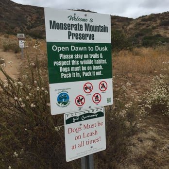


6 years ago
Great hike for a workout. The climb, if you go strait up, is 1.7 miles with 1118ft elevation. It took about 40 min of steady walking to get to the top. There is not much or rather NO shade and you may be out of the breeze at times as the trail winds up the mountainside. So, go when it's cool and or be well hydrated. There is a much longer loop which I will have to try in the future. read more

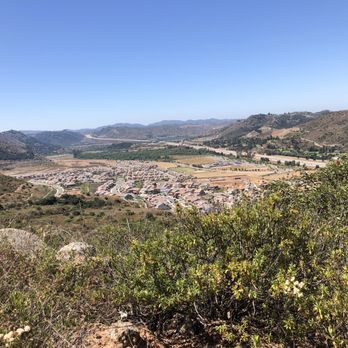


4 years ago

4 years ago
7 years ago
Very nice hike. 1.5 mile up hill so you can feel your legs working lol It was slippery going down since there was a lot of fog read more


5 years ago

5 years ago


6 years ago

8 years ago
I've done this hike plenty of times before and it still kicks my butt every time! I would say bring water and start early in the morning because if you try to do it mid day in 80+ weather you will contemplate falling off the mountain for a helicopter to get you instead of finishing. I brought my dog and she did a great job! She was super tired after but that was the goal! At the top there are dog bowls for water which is nice and a tin box that people leave their names,dates and memories in. Honestly I hate this hike but it's so good that it's always the one I recommend when asked about local hikes! read more

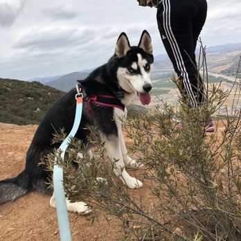


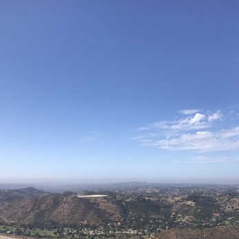
There's no shade, at all, anywhere! There are some really nice views of the Fallbrook area...and not much else. It was a hot day but not even close to the hottest. Take plenty of water! The loop trail by the water tower is not worth it, very steep ups and downs with very little change in view to make it worth it. read more
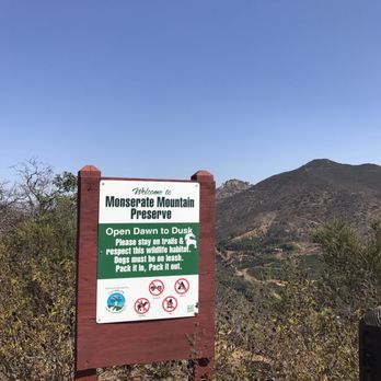



6 years ago


9 years ago
This is a great quick workout!! I finished in alil under 2hrs, its straight to the point if you want to get a good workout in a small amount of time. I took the route straight to the top, there is no shade at all. Its incline all the way up & pretty easy coming back down. I love that its close to home and when you are at top you get a 360 view. Saw people of all ages and lots of dogs,. Parking is alil limited so go the earliest possible so you beat the heat and get a good parking spot. read more

4 years ago
Page 1 of 2
More info about Monserate Mountain Preserve
243 Horse Ranch Creek Rd
Fallbrook, CA 92028
Directions
(760) 728-0889
Call Now
Hours
Outdoor Amenities
Other Amenities
From the Business
Ask the Community - Monserate Mountain Preserve
On average how long should it take?
Review Highlights - Monserate Mountain Preserve
You might also consider
























Why does Yelp recommend reviews?

Monserate Mountain Preserve - hiking - Updated July 2026
Best of Fallbrook
People found Monserate Mountain Preserve by searching for…
Hiking Trails in Fallbrook, CA
Places to Take Pictures in Fallbrook, CA
Off Road Trails in Fallbrook, CA
Stairs Workout in Fallbrook, CA
Secluded Spots in Fallbrook, CA
Walking Trails in Fallbrook, CA
Parks for Kids in Fallbrook, CA
Waterfall Hike in Fallbrook, CA
Dog Friendly Hiking Trails in Fallbrook, CA
River Swimming in Fallbrook, CA
Make Out Spot in Fallbrook, CA
Trending Searches in Fallbrook, CA
Blueberry Picking near Monserate Mountain Preserve
Boardwalk near Monserate Mountain Preserve
Caves near Monserate Mountain Preserve
Cliff Jumping near Monserate Mountain Preserve
Day Trips near Monserate Mountain Preserve
Dog Friendly Beaches near Monserate Mountain Preserve
Dog Friendly Trails near Monserate Mountain Preserve
Free Picnic Areas near Monserate Mountain Preserve
Free Things To Do With Kids near Monserate Mountain Preserve
Jet Ski Rental near Monserate Mountain Preserve
Kayak Rental near Monserate Mountain Preserve
Kids Activities Outdoor near Monserate Mountain Preserve
Off Road Trails near Monserate Mountain Preserve
Outdoor Activities near Monserate Mountain Preserve
Outdoor Basketball Courts near Monserate Mountain Preserve
Parks For Picnics near Monserate Mountain Preserve
Peach Picking near Monserate Mountain Preserve
Places To Swim near Monserate Mountain Preserve
Places To Walk Around near Monserate Mountain Preserve
Pool Day Pass near Monserate Mountain Preserve
Public Beaches near Monserate Mountain Preserve
Public Shower near Monserate Mountain Preserve
River Swimming near Monserate Mountain Preserve
River Tubing near Monserate Mountain Preserve
Rock Quarry near Monserate Mountain Preserve
Scenic Night View near Monserate Mountain Preserve
Scenic Overlook near Monserate Mountain Preserve
Secluded Spots near Monserate Mountain Preserve
Soccer Store near Monserate Mountain Preserve
Sunrise View near Monserate Mountain Preserve
Swimming Holes near Monserate Mountain Preserve
Swimming Lakes near Monserate Mountain Preserve
U Pick Farms near Monserate Mountain Preserve
Watch Sunset near Monserate Mountain Preserve
Water Parks For Kids near Monserate Mountain Preserve
Waterfalls And Swimming Holes near Monserate Mountain Preserve
Browse Nearby
BEST of Fallbrook, California Coffee near Monserate Mountain Preserve
BEST of Fallbrook, California Restaurants near Monserate Mountain Preserve
BEST of Fallbrook, California Things to Do near Monserate Mountain Preserve
BEST of Fallbrook, California Parks near Monserate Mountain Preserve
BEST of Fallbrook, California Breakfast near Monserate Mountain Preserve
BEST of Fallbrook, California Lakes near Monserate Mountain Preserve
BEST of Fallbrook, California Campgrounds near Monserate Mountain Preserve
Browse Brands
Related Searches in Fallbrook, CA
Affordable Kayak Rental Services in Fallbrook, California
Best Dog Hiking Trails Around Fallbrook, California
Best Fishing Locations and Guides in Fallbrook, California
Best Nature Trails for Hiking in Fallbrook, California
Best Off Leash Dog Parks in Fallbrook, California
Best Parks for Parties and Events in Fallbrook, California
Best Places for Horseback Riding in Fallbrook, California
Best Sightseeing Experiences Available in Fallbrook, California
Best Water Parks for Kids in Fallbrook, California
Check Out Great Playgrounds in Fallbrook, California
Check Out Off Road Trails in Fallbrook, California
Discover Baseball Fields Around Fallbrook, California
Discover Dog Friendly Trails to Explore in Fallbrook, California
Discover Easy Hiking Trails Near Fallbrook, California
Discover Fun Toddler Parks in Fallbrook, California for Your Little One
Discover Kid Friendly Hiking Trails in Fallbrook, California
Discover Popular Bike Trails in Fallbrook, California
Discover Popular Photo Spots in Fallbrook, California
Discover Soccer Fields in Fallbrook, California Near You
Discover Top Nature Parks to Visit in Fallbrook, California
Discover Top State Parks to Visit in Fallbrook, California
Discover Walking Parks in Fallbrook, California Near You
Discover a Hiking Trail in Fallbrook, California
Discover the Best Beaches in Fallbrook, California
Discover the Best Kids Park Spots in Fallbrook, California
Discover the Best Night Hike Trails in Fallbrook, California
Dog-Friendly Hikes With Dogs in Fallbrook, California
Enjoy Camping Adventures Around Fallbrook, California
Enjoy Kayaking Adventures in Fallbrook, California
Enjoy Off Leash Dog Hikes in Fallbrook, California
Enjoy Scenic Places to Walk in Fallbrook, California
Enjoy Tent Camping Spots Around Fallbrook, California
Enjoy a Beautiful Waterfall Hike in Fallbrook, California
Enjoy the Best Picnic Spots and Ideas in Fallbrook, California
Enjoy the Best Walking Path in Fallbrook, California
Enjoy the Best Walking Trails in Fallbrook, California
Explore Beautiful Parks and Green Spaces in Fallbrook, California
Explore Easy Hikes Perfect for All in Fallbrook, California
Explore Free Picnic Areas Around Fallbrook, California
Explore Fun Activities to Do in Fallbrook, California
Explore Parks With Pull Up Bars in Fallbrook, California
Explore Picnic Parks Near Fallbrook, California
Explore Popular Campgrounds Near Fallbrook, California
Explore Popular Dog Walking Trails in Fallbrook, California
Explore Popular Kids Parks Throughout Fallbrook, California
Explore Popular Picnic Areas Around Fallbrook, California
Explore Popular RV Parks Around Fallbrook, California
Browse Articles
People who viewed Monserate Mountain Preserve also viewed

Santa Margarita Preserve
68 reviews

Wilderness Gardens Preserve
21 reviews

Los Jilgueros Preserve
19 reviews

Tenaja Falls Trail Head
9 reviews

Hellhole Canyon County Preserve
22 reviews

Ridgeline Trailhead
15 reviews

Sykes Ranch Park
4 reviews

San Luis Rey Bike Trail
60 reviews

Copper Creek Falls Trail - Restricted Access
19 reviews

P Mountain
13 reviews