Mount San Gorgonio Photos


You might also consider


More like Mount San Gorgonio
Recommended Reviews - Mount San Gorgonio
Start your review...


Reviews With Photos
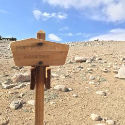

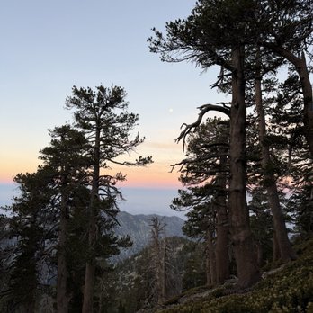
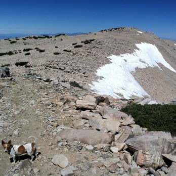
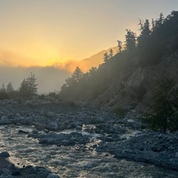
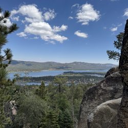
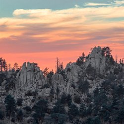
Wow, what a challenge, and a beautiful one at that. Ascending this will take you to the 18th most prominent peak in the US, but note that prominence is different than elevation. San Gorgonio is only the 29th highest peak - in California alone! Mount Whitney, 190 miles away, holds the top distinction for that. Apparently San Gorgonio is visible from Mount Whitney, so I only assume the reverse is also true if you know where to look! As you ascend, you will go through beautiful lush valleys that are just waking up. Keep ascending and you'll notice the trees starting to thin out, until you reach the final portion of the hike with zero trees, and only a few creative plants that have cleverly evolved to somehow eek out an existence this high up. Even near the top, you can find some little shrubs that you can use as a makeshift sun shelter if you need a quick break. From up at the top you here a panoramic 360 degree view of everything around you, with no obstructions except weather and haze. You can see Big Bear Lake, Salton Sea, and I've even been told that you can see Catalina Island! It's usually windy up here, so you'll want to pack a wind breaker or rain jacket. A day trip is doable but is a huge challenge. You should arrive at the trailhead as early as possible, preferably just before dawn. Carry a small pack if possible, with just the essentials such as water and food (and headlamp, just in case). I hiked here via Vivian Creek Trailhead and, even being slightly out of shape, was able to ascend and descend before sunset, with plenty of stops. Another option for a longer hike but more gradual ascent is the South Fork Trail, which looks like it may reopen soon (check beforehand). My parents used to hike the latter on long day trips. But for both trails it may be more enjoyable to camp overnight. My hike this year was a different story. I wanted to train carrying a heavy pack, so I loaded up with a bunch of photography gear as well as more food and water than I needed. I'm not used to carrying a bigger pack, and also started a bit late, about half an hour after sunrise. I had to take a lot more breaks, and the last switchbacks before the top were just brutal. But I made it - a few hours later than I expected based on my previous time. This also meant that I had to descend the mountain partly in the dark - but I was prepared and brought my headlamp! The night hiking was ok but monotonous - it's much more beautiful in the daylight! There was a positive aspect to this - the nearby Yucaipa Ridge is beautiful at sunset. I only had energy to take pics with my phone, but I will try to come back sometime! Pack some water, but even better - bring a small water filter and attach it to a bottle. There are several creeks that cross the path on the way. The last water is at High Creek Camp, so be sure to drink and fill up there. Also be sure to load up the map on your phone before you're out of reception on your hike! I find myself getting lost and off-trail around High Creek Camp (make sure you follow the path that crosses the water). I also get confused on the home stretch back to the car - I always misjudge how far the parking area is, and it's easy to miss the sign directing folks to parking. Doesn't help that Google Maps currently has the trailhead marker in the wrong spot! So be careful - try to download an offline version of the map!


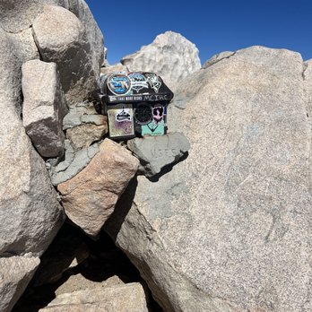
Hiked up this bad boy via Momyer-Alger creek and down Vivian creek. Basically a big loop because we walked the last 1.6 miles from the Vivian trail head back to my truck at Momyer. Supposedly the longest, hardest and least traveled trail to the summit. I would have to agree. This was a ball buster. At some sections of the trail I really had a hard time navigating where the trail was without my GPS. Parts of the trail were over grown making it hard to move forward confidently. The Momyer trailhead starts off of Valley of the falls dr right before the fire station on the left side. Finding the actual trail can be tricky. At the parking lot look north, directly across the creek and that's where the trail starts. Very easy to miss. First 3.7 miles are a bunch off switch backs, 1600 ft of gain and your first source of water. This is Alger creek. We decided to hike up to Saxton camp to set up our tent for the night, filter our water for the next day and get some rest. At this point we have hiked 7.6 miles. I would highly recommend to camp here to try and acclimate to the altitude. You are now at 8,560 ft and slightly feeling the effects of the altitude. If you don't like solitude this isn't the campsite for you. Shoot! This isn't the trail for you! At Saxton camp you are miles from anyone. The whole time we were heading up the summit, 13.2 miles we only saw 7 other hikers. The second day getting an early start is recommended. 16.2 miles left makes for a long day. The next 6 miles from Saxton camp were my favorite with beautiful panoramic views of the valley, Big Bear, and San Jacinto. This section will also be your last water source until High creek. So make sure to get some water before you summit. The San Gorgonio summit is 11,502 or.....well who cares? It's high! You will find a register box with all kinds of weird stuff in it. Sign the registry (if that's your thing) take your pictures, get some rest, hydrate and take it all in. You are at the highest point in SoCal and it feels good. Well kind of :) The way down Vivian creek trail we ran into several people still hiking up and has way more traffic. It is more of a beaten path if that is what you are comfortable with. The only reason we decided to head down Vivian was because it was the faster, shorter route and I had to work the next day. San Gorgonio via Momyer creek is not for the novice hiker. The hike including walking back to the trail head on the road was 23.6 miles. Give yourself 2-3 days to hike it so you can enjoy the experience Make sure to train, be prepared having the proper equipment and clothing. Do your research before attempting, setting waypoints, water sources and checking the weather conditions. Have fun and be safe!
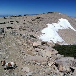

+ Elating experience. As the highest peak of SoCal at 11,500 ft, Mt San Gorgonio is a wonderful mountain to behold and bag. + Fantastic altitude training before your next 14er. - Lots of chipmunks at the summit seeking food. Zip up your backpacks! Watch your belongings while taking photos. + Couple large handheld signs for your summit photo ops. . The summit is very windy and cold. + Everyone I encountered on this trail was polite and supportive. I was on my own, so the morale support was very reassuring and uplifting. . Only 5 cars in the parking lot on a weekday. - No restrooms or trash can on this mountain. . It has just a few creeks. I wouldn't recommend filtering this water. Bring +3 L of water before you start this 18-mi day hike. . Some sections are well paved and marked, while others become divergent and unclear which way leads to the summit or back to the parking lot. Mt San Gorgonio approximate stats: Elevation gain: 5500 ft Distance: 18 miles Time: 10-11 hours Tips: . Ibuprofen is good for altitude sickness. . Check out HikingGuy's guide on San Gorgonio's trails to help maximize your preparation. . Wear moisture-wicking pants. The sleeves protect your legs from the sharp thorns of the bushy sections. read more
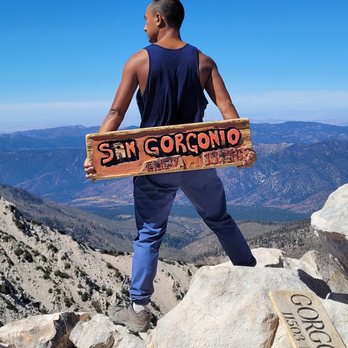

My first San G hike. For some reason, I was really intimidated by this one since it's the highest peak in SoCal. However, very doable. It took me about 7 hours hiking time discounting summit picture time. We started early at 6:30 and the weather was great with shade. However that changes as the sun becomes more prominent. About 3 miles to summit is full exposure. I hike with an umbrella and people are jealous... but seriously please bring plenty of water and covering. The summit is beautiful. There is a sign for photo op. The down was a bit slippery from the loose rock and gravel. I used poles for the down. Parking lot provided and an adventure pass is needed. Also need a permit to day hike Please come and create your own adventure. read more
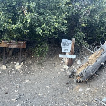

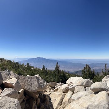


Rising 11, 503' above the smog, congestion and noise of LA, San Gorgonio peak, the tallest mountain in Southern California, is a challenge of a hike. I've climbed it twice and it was the 2nd time while traversing the downside karst trails that my knees gave out and I barely made it to the car park without help. Whew! That was a mo-fo. But a damn good mo-fo. And my trusty hiking stick was my tripod for the third leg I needed. "Old Grayback" has several trails but all will require a 5000' elevation gain. It is ranked 7th tallest in the 48 contiguous states. I've hiked it in one day when I was younger, something the Park Service doesn't recommend. They want you to take two days minimum which is what we did the second time, overnighting at the halfway camp. But many decide to start early in morning to make the 17.3 miles before dark. It's a strenuous hike so don't kid yourself. Generally speaking, Yelpers are eaters more than they are hikers, lovers rather than fighters (something to keep in mind as you wolf down that fat, juicy Mastro's ribeye with garlic mashed potatoes the night before). It is defined as "difficult" and it's a super prep hike before doing Mt Whitney or Half Dome. You'll need a Wilderness Permit, of course, and you can get one (free) very simply by stopping at the Mill Creek Ranger station or logging onto the Forest Service website. It is open May through September. Mill Creek Ranger Station Route 1, Box 264 Mentone, CA 92359 (909) 794-1123 From the summit, above tree line, you can see the desert out to Palm Springs on one side and the oceans off in the distance from the other. A truly epic vista yes, but you won't want to tarry long up there as darkness comes quick in the mountains. And you don't want to hike down in the dark. Tons of tips for the newbs: bring more water than you think you'll need, lots of sun-block and a hat, cheap sunglasses; you should know the basics. I don't recommend camping on top (windy & cold, barren), smoking is prohibited throughout the area, tell someone your hike plans and you're set. So gear up and be ready to enjoy something truly remarkable, something that very few Angelinos will ever see. From Wilderness.net (not just in the mountains...) "Leave No Trace The 7 principles listed below apply in the San Gorgonio Wilderness. Plan Ahead and Prepare Travel and Camp on Durable Surfaces Dispose of Waste Properly Leave What You Find Minimize Campfire Impacts Respect Wildlife Be Considerate of Other Visitors" I know another: "Take nothing but photographs, leave nothing but footprints, keep nothing but memories." P.S., this review resulted in gaining my 300th Fan! Thank you all. Spartans rule! P.P.S. I found a link on Yelp (http://www.yelp.com/writeareview/biz/KYfqi1wY65-d7GT8jX7Siw?return_url=%2Fuser_details%3Fuserid%3DsIz02nAyQIrDtFavxZtfTQ) where this hike is reviewed so I won't claim FTR but I linked it to the (correct) Wiki definition of the mountain. Apologies if I tread on their turf? read more


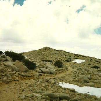
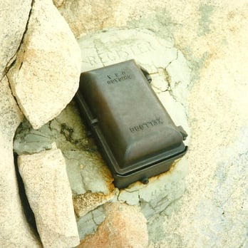


Wow, what a challenge, and a beautiful one at that. Ascending this will take you to the 18th most prominent peak in the US, but note that prominence is different than elevation. San Gorgonio is only the 29th highest peak - in California alone! Mount Whitney, 190 miles away, holds the top distinction for that. Apparently San Gorgonio is visible from Mount Whitney, so I only assume the reverse is also true if you know where to look! As you ascend, you will go through beautiful lush valleys that are just waking up. Keep ascending and you'll notice the trees starting to thin out, until you reach the final portion of the hike with zero trees, and only a few creative plants that have cleverly evolved to somehow eek out an existence this high up. Even near the top, you can find some little shrubs that you can use as a makeshift sun shelter if you need a quick break. From up at the top you here a panoramic 360 degree view of everything around you, with no obstructions except weather and haze. You can see Big Bear Lake, Salton Sea, and I've even been told that you can see Catalina Island! It's usually windy up here, so you'll want to pack a wind breaker or rain jacket. A day trip is doable but is a huge challenge. You should arrive at the trailhead as early as possible, preferably just before dawn. Carry a small pack if possible, with just the essentials such as water and food (and headlamp, just in case). I hiked here via Vivian Creek Trailhead and, even being slightly out of shape, was able to ascend and descend before sunset, with plenty of stops. Another option for a longer hike but more gradual ascent is the South Fork Trail, which looks like it may reopen soon (check beforehand). My parents used to hike the latter on long day trips. But for both trails it may be more enjoyable to camp overnight. My hike this year was a different story. I wanted to train carrying a heavy pack, so I loaded up with a bunch of photography gear as well as more food and water than I needed. I'm not used to carrying a bigger pack, and also started a bit late, about half an hour after sunrise. I had to take a lot more breaks, and the last switchbacks before the top were just brutal. But I made it - a few hours later than I expected based on my previous time. This also meant that I had to descend the mountain partly in the dark - but I was prepared and brought my headlamp! The night hiking was ok but monotonous - it's much more beautiful in the daylight! There was a positive aspect to this - the nearby Yucaipa Ridge is beautiful at sunset. I only had energy to take pics with my phone, but I will try to come back sometime! Pack some water, but even better - bring a small water filter and attach it to a bottle. There are several creeks that cross the path on the way. The last water is at High Creek Camp, so be sure to drink and fill up there. Also be sure to load up the map on your phone before you're out of reception on your hike! I find myself getting lost and off-trail around High Creek Camp (make sure you follow the path that crosses the water). I also get confused on the home stretch back to the car - I always misjudge how far the parking area is, and it's easy to miss the sign directing folks to parking. Doesn't help that Google Maps currently has the trailhead marker in the wrong spot! So be careful - try to download an offline version of the map! read more
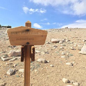


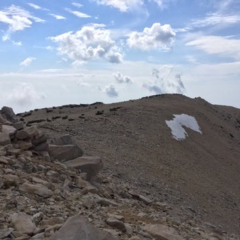


Hiked up this bad boy via Momyer-Alger creek and down Vivian creek. Basically a big loop because we walked the last 1.6 miles from the Vivian trail head back to my truck at Momyer. Supposedly the longest, hardest and least traveled trail to the summit. I would have to agree. This was a ball buster. At some sections of the trail I really had a hard time navigating where the trail was without my GPS. Parts of the trail were over grown making it hard to move forward confidently. The Momyer trailhead starts off of Valley of the falls dr right before the fire station on the left side. Finding the actual trail can be tricky. At the parking lot look north, directly across the creek and that's where the trail starts. Very easy to miss. First 3.7 miles are a bunch off switch backs, 1600 ft of gain and your first source of water. This is Alger creek. We decided to hike up to Saxton camp to set up our tent for the night, filter our water for the next day and get some rest. At this point we have hiked 7.6 miles. I would highly recommend to camp here to try and acclimate to the altitude. You are now at 8,560 ft and slightly feeling the effects of the altitude. If you don't like solitude this isn't the campsite for you. Shoot! This isn't the trail for you! At Saxton camp you are miles from anyone. The whole time we were heading up the summit, 13.2 miles we only saw 7 other hikers. The second day getting an early start is recommended. 16.2 miles left makes for a long day. The next 6 miles from Saxton camp were my favorite with beautiful panoramic views of the valley, Big Bear, and San Jacinto. This section will also be your last water source until High creek. So make sure to get some water before you summit. The San Gorgonio summit is 11,502 or.....well who cares? It's high! You will find a register box with all kinds of weird stuff in it. Sign the registry (if that's your thing) take your pictures, get some rest, hydrate and take it all in. You are at the highest point in SoCal and it feels good. Well kind of :) The way down Vivian creek trail we ran into several people still hiking up and has way more traffic. It is more of a beaten path if that is what you are comfortable with. The only reason we decided to head down Vivian was because it was the faster, shorter route and I had to work the next day. San Gorgonio via Momyer creek is not for the novice hiker. The hike including walking back to the trail head on the road was 23.6 miles. Give yourself 2-3 days to hike it so you can enjoy the experience Make sure to train, be prepared having the proper equipment and clothing. Do your research before attempting, setting waypoints, water sources and checking the weather conditions. Have fun and be safe! read more






18 years ago

15 years ago


More info about Mount San Gorgonio
San Bernardino Mountains, CA 92305
Directions
(909) 382-2882
Call Now
Hours
Outdoor Amenities
Ask the Community - Mount San Gorgonio
You might also consider



















Why does Yelp recommend reviews?

Mount San Gorgonio - hiking - Updated September 2026
Best of San Bernardino Mountains
People found Mount San Gorgonio by searching for…
Lakes in San Bernardino Mountains, CA
Parks in San Bernardino Mountains, CA
Campgrounds in San Bernardino Mountains, CA
Sunrise View in San Bernardino Mountains, CA
Hiking Trails in San Bernardino Mountains, CA
Scenic View in San Bernardino Mountains, CA
Waterfall Hike in San Bernardino Mountains, CA
Hiking With Kids in San Bernardino Mountains, CA
Tent Camping in San Bernardino Mountains, CA
National Parks in San Bernardino Mountains, CA
Night Hike in San Bernardino Mountains, CA
Scenic Overlook in San Bernardino Mountains, CA
Sunset View in San Bernardino Mountains, CA
Lookout Point in San Bernardino Mountains, CA
Walking Trails in San Bernardino Mountains, CA
Beautiful Views in San Bernardino Mountains, CA
Off Road Trails in San Bernardino Mountains, CA
Camping Sites in San Bernardino Mountains, CA
Lakes & Ponds in San Bernardino Mountains, CA
Scenic Places to Walk in San Bernardino Mountains, CA
Easy Hikes in San Bernardino Mountains, CA
Things to Do in San Bernardino Mountains, CA
Browse Nearby
BEST of San Bernardino Mountains, California Restaurants near Mount San Gorgonio
BEST of San Bernardino Mountains, California Lakes near Mount San Gorgonio
BEST of San Bernardino Mountains, California Things to Do near Mount San Gorgonio
BEST of San Bernardino Mountains, California Breakfast near Mount San Gorgonio
BEST of San Bernardino Mountains, California Rafting/Kayaking near Mount San Gorgonio
BEST of San Bernardino Mountains, California Sledding near Mount San Gorgonio
BEST of San Bernardino Mountains, California Pizza near Mount San Gorgonio
BEST of San Bernardino Mountains, California Campgrounds near Mount San Gorgonio


