San Bernardino Peak Photos


You might also consider


More like San Bernardino Peak
Recommended Reviews - San Bernardino Peak
Start your review...


Reviews With Photos


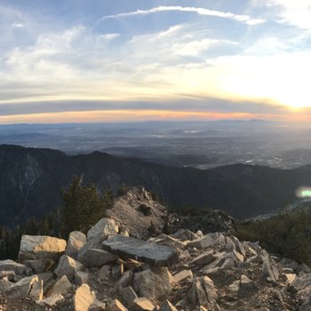
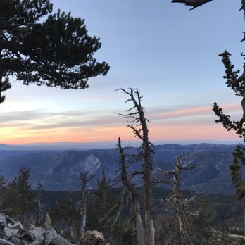
This review is for the San Bernardino peak hike It's a grueling 16 mike hike (8 miles one way) that has an elevation climb of 5,000 feet over 8 miles. but the views are beautiful. We went in early December. We started at 9:30am which was a bit late. Even though we stayed a night in the area, the altitude still took getting used to. Also, the hike in is ALL uphill so that was difficult too. I was feeling lightheaded and got winded very quickly. So starting early gives you plenty of time to adjust and take your time going up. The trail had a mix of weather. It was sunny and hot in some spots, cool and shady, windy, etc. I packed my winter ski jacket, a beanie, a dry fit long sleeved hiking shirt, inner leggings and my backpacking pants. I wore Only the dry fit long sleeve hiking shirt and camping pants initially bc the inner leggings were too hotu. But I'm glad for my beanie bc the winds made my head feel cold. After about 7 miles in I put on my winter jacket bc the winds were very strong and cold. We made it to the peak but didn't find the views as good as at the north facing peak which is a litttle ways before the peak and before the Washington monument. In hindsight, I would've saved the last tough 1.0ish miles and skipped the San Bernardino peak and just enjoy the view from the north facing peak. It has the same views as San Bernardino peak without the trees covering it. My fave part about the trip is that it's dog friendly and I saw multiple people with dogs off leash. Tip - it's courtesy to leash up your dog if you see people coming and let them pass. The way down was much easier initially, but my knees and feet started to feel the pressure of going downhill for 8 straight miles. trekking poles is a must for this hike! Also bring at least 4-5 liters of water and a headlamp. Start early so that you descend while its still light out. Beautiful but tough hike with beautiful views Also check out this very thorough and helpful review: https://hikingguy.com/hiking-trails/best-la-hikes/san-bernardino-peak-hike/
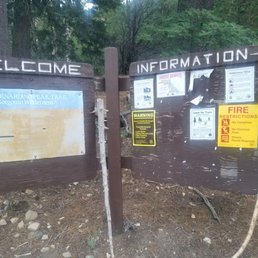

This was a BEAUTIFUL hike. As part of the Six Pack of Peaks Southern California Challenge, this one I enjoyed more than Mt. Baldy. Come prepared, it's a long one! Almost 17 miles round trip of a gradual climb to 10,649 ft at the summit, with close to 4,700 ft of elevation gain. You are in for a treat. Coming from SD, we left EARLY at 230 am, got to the trailhead around 515am and started at 530am. You do not need a permit, but it is highly recommended so the park can track the traffic and let them know that you are there. I got an annual Adventure parking pass. If you don't have one, you need to get a day parking pass from the visitor center. The road leading to the trailhead has some bumps and potholes. I would not drive your fancy luxury car here by the way. No porta-potties on the trail at all. Just lots of bushes (Hahaha joking, halfway though...) The climb is gradual, with at least 20 switchbacks (yes I counted). You need to bring at least 2-3L of water if not more, especially if it is hot. There is some intermittent shade from the trees which is nice. Bring a map, and be aware of your surroundings. Pretty much Hiking 101. The views leading up to the summit were superb. Pictures cannot do enough justice for this place. It does not account for the smells of the fresh flowers, trees, birds singing, quiet serenity.... Take your time if this is your first time. The average time to finish this hike is 8 hours, but my group took at least 10 hours. We took pictures everywhere, and literally stopped to smell the flowers. My favorite place was the Manzanita Flats! Lots of colors, it was a natural Bob Ross painting I was living inside. There was a broken wheelbarrow 4 miles in for an IG moment. There was a little snow on the trail this time, so I got to make angels woo hoo! There was a stream of snow water that was so cold and refreshing. I did not use a purifier prior to drinking it, but it tasted so good. It was a risk for sure, and I was "living my best life." I recommend bringing a purifier. I luckily did not get sick though. You can camp at the Limber Pine campground. I would do that on my next time here. The terrain was pretty kind on the feet and soft for the majority of the trek, but the last mile to the summit there is some scrambling involved. At the top, make sure to sign your name inside the ammo box,and take pictures with the sign. You will see constantly Mt. San Jacinto, San Gorgonio, Big Bear Lake, along the way. You may also stop by Washington's Monument and the bench that oversees the San Bernadino Mountain range. I really liked this journey alot. However, the altitude sickness is a real thing! Do not underestimate this. If you find yourself suffering symptoms, take a break and slow down. If it does not get better, cut your loss and descend back down, it is not worth it! Lack of oxygen over time kills brain cells, and unfortunately they do not regenerate. Properly prepare your body, equipment, and plan for a successful summit. Most of all, enjoy your adventure to the fullest!


This hike is about 16 miles with 4700' elevation gain/loss. It is not the most difficult hike, but it is challenging. The soft trail is mostly single file with few rocks under foot to start. As the trail progresses, so do the number of rocks. There is dappled shade but mostly exposed areas. As is mentioned before, the trail is a fairly gradual ascension. The steepest part is the very last 1/10 of a mile or less to get to the actual peak. Otherwise, the climb is more subtle than anticipated. But it still offers a good workout. The views along the entire trail are beautiful, and this includes the peak as well. At the peak, there is a registry to sign if you wish. parking - adventure pass required tip - if you want to make the overall hike a couple of miles longer, instead of turning right up the peak towards the end of the hike, continue straight onto East San Bernardino Peak


This is definitely a hidden GEM of a hike that I didn't even know about until just recently. Turns out, this trail is just as great as the more popular San Gorgonio and San Jacinto hikes. From this trail you get some great views of the other 5 peaks in the '6 Pack of Peaks': Mt Wilson, Mt Baldy, Cucamonga Peak, San Gorgonio and San Jacinto. The unusual thing is that these great views come from just below the San Bernardino summit. Most of the web sites claim this trail to be a 16 mile round trip to the 10,649 foot summit with an elevation gain of 4,700 feet. According to my cell phone Run Keeper app, it was a 16 miles; but my Garmin 450t GPS unit had it at 19.5 miles. This San Bernardino Trail that starts from Angelus Oaks is not a very difficult hike, but it did seem a lot longer than 16 miles! You need a wilderness permit for this hike. It's the same form as for San Gorgonio. http://www.sgwa.org/content/apply-wilderness-permit The trail is very easy to follow and is mostly a smooth dirt trail until the last mile or so. It starts off with the usual switchbacks up a gradual incline that is not that bad. Right from the start you get a great view of Mt Baldy's range. The beginning feels like San Gorgonio until you reach the beautiful Manzanita Springs of waist high to 6 foot bushes on each side of the narrow dirt path. Then you head into a huge meadow of Manzanita bushes. http://www.yelp.com/biz_photos/san-bernardino-peak-angelus-oaks-2?select=os4kSggEhR5xwFURviWPBQ&utm_campaign=www_photo_share_popup&utm_medium=copy_link&utm_source=(direct) My next favorite spot was reaching Limber Pine Bench at 5.8 miles as the curved trail was edged in rocks. It felt like a hiker's Red Carpet. In a quarter of a mile, I passed by the Limber Pine Springs water source that I wouldn't even let my dog drink from... maybe on a different day. The trail then takes a hard right to the south west before it eventually heads back to the east towards the summit. The next highlight was reaching a ridge at 7.2 miles / 10,180 feet with a great flat rock bench and a view of San Jacinto to the southeast. Within 2 tenths of a mile is the 1852 Washington's Monument; off the trail about 100 feet to the right and up the hill. If you miss it and see the Washington's Monument plaque first, just look back for the monument. http://www.yelp.com/biz_photos/san-bernardino-peak-angelus-oaks-2?select=61Ofsi3fGq10ezX1o5Vm0Q&utm_campaign=www_photo_share_popup&utm_medium=copy_link&utm_source=(direct) In a half mile past the monument, there will be a faint Y in the trail. Go to the right up the hill for about 0.1 mile to the summit. If you go straight at the Y, that will take you to the San Bernardino East Peak. On our hike, my pooch Sammy wore 3 different outfits. She started off wearing her water back pack. When we reached the section where there was no shade, I put her sunscreen vest that I designed for her on. I made it from patio sunscreen that I bought from Lowes. Then, on the way down when the temperature got hot, I put her swamp cooling vest on that I soaked in water and put in the refrigerator the night before. All to keep my girl safe on a hot day! We can't wait to hike this in the SNOW! TRAILHEAD DRIVING DIRECTIONS: It was 90 minute drive from Orange County, and there were many helpful road signs to the trailhead. (1) Click on this link: https://www.google.com/maps/dir//''/@34.1449554,-116.9739593,2666m/data=!3m1!1e3!4m6!4m5!1m0!1m3!2m2!1d-116.978562!2d34.146092 (2) You can use this address for Angelus Oaks Lodge. But just before the Lodge, turn right on the signed 1W07 dirt road. Stay to the right on the dirt road to the dead end trailhead parking lot. 36910 Angelus Oaks Lane, Angelus Oaks, Ca. 92305. (3) If you take the 10 Fwy, take Orange exit & head north. After 0.6 miles, turn right on 38/Lugonia Ave. From here, drive 19 miles, driving past the San Gorgonio turn off; 5 miles past the Valley of the Falls Drive turnoff you will turn right at Manzanita towards the fire station and then follow the signs.


Angelus Oaks to San Bernardino Peak - first of all, be ready for the parking situation. If you have to park as far as I did, you will add on an additional mile to your hike. My mustang is not equipped for off-roading so it was a smarter idea to opt out driving up the actual road to the trailhead parking. Once you reach the parking area you will see the start of the trailhead to your right hand side middle area - most likely it will be hidden because a vehicle is already blocking the pathway. Once you start be ready for one HELL OF an ADVENTURE!! It is simply magical the ENTIRE TIME!! The road never veers off making you feel lost, clearly marked, but it is a long journey to get to the top. Took me 9 hours to complete the 19 miles - I can suggest this - take YOUR BREAKS!!! Take a break when ever you can. The elevation will get to you once you pass the Manzanita Flats - Reaching the top is the most exhilarating part though - YOU GOT THIS!!! GOOD LUCK! In case you need some more details - check this site out. https://socalhiker.net/hiking-san-bernardino-peak-trail/


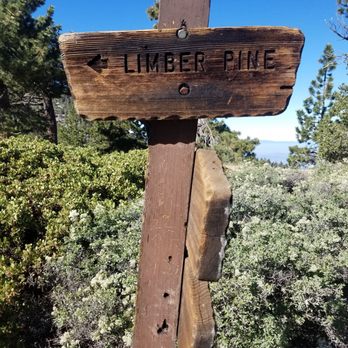
I would give this 3.5 stars. The San Bernardino Peak is one of the "Six Pack of Peaks" of southern California. Many hike these peaks to train for Mt. Whitney or John Muir Trail. It is located within the beautiful San Gorgonio Wilderness. Here are the hard numbers: Distance: 16.5 miles Time: roughly 10 hours Difficulty: Strenuous Elevation Gain: 4,702 feet Time to go: June-October Need a Pass: Yes! Adventure Pass is required. You can buy one at any outdoor retail stores like REI, Big 5, Sports Chalet, etc. $5 for a day pass, $30 for a year pass. Need a Permit: Yes and it's free! Day hike permit: http://sgwa.dreamhosters.com/wp-content/uploads/2016/06/Permit_Dayhike.pdf / Overnight permit: http://sgwa.dreamhosters.com/wp-content/uploads/2016/06/Permit_Overnight.pdf Although the numbers may look scary, what's great about this hike is that the elevation gain is gradual compared to the other peaks. If you were to do this for a dayhike, it will be a longgggg day for you. I recommend waking up early so you can be down by sunset. Or you can break this up into two days as a nice weekend backpacking trip. Trailhead: Finding the trailhead was a bit difficult. A big indicator to look for is the fire station. You want to go towards it. As you drive further in, you'll drive along a bumpy dirt road and will see signs for the trailhead. Eventually you'll come to a dirt parking lot and the message board. Experience: The first section gains elevation pretty quickly but eventually evens out and ascends gradually. Eventually the trail will open up and you'll get to see the beautiful lush greenery of the San Bernardino Forest. This part is the Manzanita Flats and you'll see a trail junction. Follow the signs for LIMBER PINES. As you continue further on the trail, eventually you'll come to switchbacks and the last section of the trail, you'll feel the elevation gain. You'll pass by Washington's Monument, and last 3/4 mile is a steep ascent to the top! Then you made it! Don't forget to sign your name in the registry which is in a tin box, held down by a chain. During this hike, I mostly enjoyed the part of the trail that opened up to the forest. There were so much greenery and with the clear skies, it looked so beautiful! We had the unfortunate experience and got caught in a short (thankfully) summer storm. It rained and even hailed! It lasted for about 15 mins. Remember to check the weather! When we checked it the day before, there was suppose to be zero chance of a storm, but weather changes so always be prepared! It was nice that the sky had some clouds though, helped with the heat. When we summited the mountain, it was anticlimatic for me and I was quite disappointed. The view wasn't that great as it was blocked by trees and I wasn't able to get a clear view of the scenery. FYI, You can see San Gorgonio from here. The hike back down felt like FOREVER. I think I forgot that this hike was super long but it seriously felt like the trail would never end. I was so over the hike by that point and just wanted to come down. We started at 8:30pm and made it back just before the sun set. Overall, I did enjoy the journey to the top since it was so beautiful but was let down by the view at the top. Plus the hike back down was not enjoyable at all. Still, it was a great experience and I'm glad I can at least say that I've done it. REMEMBER to get a full night's rest, a LIGHT breakfast, bring snacks and most importantly, at least 3L of water or more on a hot hot day. Leave no trace!


I was fortunate to cross this one off my list. We hiked it on Saturday (10/20/18). Getting there: for most people it is going to be quite a drive unless you live in this area (obviously) which I do not. It took me about an hour and a half to get there from the Long Beach area since there was no traffic on a Saturday morning at 5 am and about 2 hrs to get home; the dirt road to the trailhead is near the Angelus Oaks Fire Station...the road is narrow and quite bumpy but I saw small cars handle it fine going slowly; the parking lot area was not crowded that early but it was quite crowded when we finished at 2 pm...Adventure Pass is needed Trail- it is a pretty easy trail to follow and not get lost especially if you are using the ALL TRAILS app which is incredibly useful; the first 3 miles are steep but not too extreme (about 600-700 ft per mile) and then the trail flattens out a bit for the 4th mile and miles 5-8 are moderately steep with elevation gain of about 500-600 ft per mile; the scenery is beautiful and surprisingly green for what you may think San Bernardino to be like...lots of tall green trees and around the halfway part an open area with manzanita; beautiful views along the way in all directions of other nearby mountains, views of the Inland Empire, and a view of Big Bear Lake Peak- I've read complaints of people complaining of obstructed views at the peak due to tree coverage but I didn't really find the views lacking from up there; there were only a few people at the top while we were there and we had a good time talking to our fellow hikers, enjoyed a Stella Artois celebratory drink, and took our pictures with the wooden sign and added our hiking group sticker to the box at the top; there were some patches of snow and ice along the trail on the final mile to the peak but no special equipment but hiking poles were helpful My experience: I think we lucked out and had great conditions for our hike with temperatures in the 40's and 50's on a weekend when most cities at lower elevations were experiencing temps in the 80s and 90s; I've been hiking quite a bit in the last few years including longer and longer hikes and more hikes at higher altitudes so I think I was well-prepared to handle this hike without any major difficulties and I found this hike to be hard more for the pure length (my longest hike to date in terms of distance and San Jacinto has been my longest hike in terms of duration); I didn't experience any altitude issues and it wasn't windy or too frigid which I hear it can get this time of year Details: Distance- 16.2 miles (I think people who have recorded longer distances usually are tracking it on watches and I have noticed people who use that come up with inaccurate distances) Difficulty- Strenuous because of distance more than steep incline Duration- 7.5 hrs (4.5 up, 2.5 down, with a half hour at the top) Elevation Gain- 4,700 ft Peak Elevation- 10,649 *a hiking permit is no longer needed for this if you are doing a day hike read more
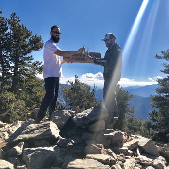


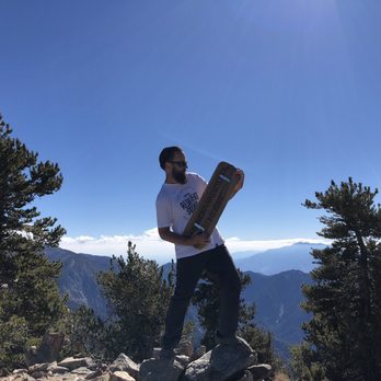
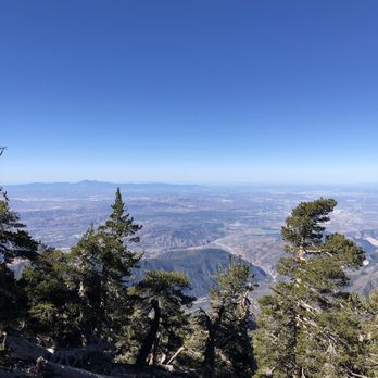
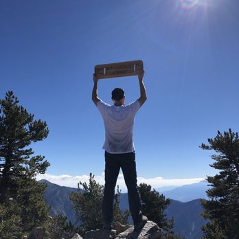


Hike number 5 for my SoCal Six Peak Challenge. Here was our experience on a Saturday morning. Directions: It's self-explanatory in the beginning but when it comes to parking you do have to drive maybe 1/4-1/2 a mile down a bumpy path and that's where the parking spot is at. Hiking Difficulty: Hard This is not a cute hike, I repeat, this is not a cute hike. It is a pretty lengthy hike (16 miles) with a few switchbacks and steady incline. There is one stream if you need to refresh on water. The thing that mainly gets to me was the duration of the hike. Overall: 4 Stars. Out of all the SoCal Six this would probably be on the bottom 3 of my favorites (This is coming from a non-hiker enthusiast). It does have a nice view as you are above the clouds and there are some nice monuments to see but my oh my, I am not about these hikes. Advice: * NO PERMIT REQUIRED, but do e-mail them to notify them that you are hiking * Come early to beat the hype (before 6am) * Hiking shoes are recommended * Make your own restroom read more


This hiking trail is awesome. It is the number four trail on the six pack of peaks. Distance is between 16.5-17 miles. I loved the experience. Now first things first you must obtain a permit. We obtained ours with the Mill Creek Ranger Station. Do this in advance since the station does have a quota. Your allowed to add up to 12 people per permit. Once you have been approved and receive your approved permit time to make the trip to the trailhead. Finding the trailhead can be difficult but follow the brown signs at mill creek ranger station. Passing the station you will pass three houses and another brown sign will appear go right and into the unpaved road to the trailhead. At the trailhead you will see the beginning of the trail. You must prepare for a long hard day of hiking. But, trust me it will be so rewarding. The trail gains elevation quickly my favorite part of the trail were the endless views. We saw Mount Baldy and Big Bear Lake! A great place to take a break is at mile 1.5 at the San Gorgonio Wilderness sign and at mile four. From here you begin your trek towards Limber Pines. Another chance for a break will be at Limber Pine campground at mile 5.7. This is a great spot to camp if your staying overnight or if there are a change of plans and you must stay overnight. Continue to follow the rock path. The uphill trek continues and at 7.5 miles you reach a super cool view with a stone bench. You must take a picture here! From here your next stop will be Washington's monument and lastly, the peak of San Bernardino at an elevation of 10,649 feet. A worthy trek but with proper preparation and enough water and food as well as warm clothing should the weather change. Do not forget to purchase your adventure pass! Now go!! read more


9 years ago
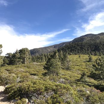
This review is for the San Bernardino peak hike It's a grueling 16 mike hike (8 miles one way) that has an elevation climb of 5,000 feet over 8 miles. but the views are beautiful. We went in early December. We started at 9:30am which was a bit late. Even though we stayed a night in the area, the altitude still took getting used to. Also, the hike in is ALL uphill so that was difficult too. I was feeling lightheaded and got winded very quickly. So starting early gives you plenty of time to adjust and take your time going up. The trail had a mix of weather. It was sunny and hot in some spots, cool and shady, windy, etc. I packed my winter ski jacket, a beanie, a dry fit long sleeved hiking shirt, inner leggings and my backpacking pants. I wore Only the dry fit long sleeve hiking shirt and camping pants initially bc the inner leggings were too hotu. But I'm glad for my beanie bc the winds made my head feel cold. After about 7 miles in I put on my winter jacket bc the winds were very strong and cold. We made it to the peak but didn't find the views as good as at the north facing peak which is a litttle ways before the peak and before the Washington monument. In hindsight, I would've saved the last tough 1.0ish miles and skipped the San Bernardino peak and just enjoy the view from the north facing peak. It has the same views as San Bernardino peak without the trees covering it. My fave part about the trip is that it's dog friendly and I saw multiple people with dogs off leash. Tip - it's courtesy to leash up your dog if you see people coming and let them pass. The way down was much easier initially, but my knees and feet started to feel the pressure of going downhill for 8 straight miles. trekking poles is a must for this hike! Also bring at least 4-5 liters of water and a headlamp. Start early so that you descend while its still light out. Beautiful but tough hike with beautiful views Also check out this very thorough and helpful review: https://hikingguy.com/hiking-trails/best-la-hikes/san-bernardino-peak-hike/ read more




7 years ago
This was a BEAUTIFUL hike. As part of the Six Pack of Peaks Southern California Challenge, this one I enjoyed more than Mt. Baldy. Come prepared, it's a long one! Almost 17 miles round trip of a gradual climb to 10,649 ft at the summit, with close to 4,700 ft of elevation gain. You are in for a treat. Coming from SD, we left EARLY at 230 am, got to the trailhead around 515am and started at 530am. You do not need a permit, but it is highly recommended so the park can track the traffic and let them know that you are there. I got an annual Adventure parking pass. If you don't have one, you need to get a day parking pass from the visitor center. The road leading to the trailhead has some bumps and potholes. I would not drive your fancy luxury car here by the way. No porta-potties on the trail at all. Just lots of bushes (Hahaha joking, halfway though...) The climb is gradual, with at least 20 switchbacks (yes I counted). You need to bring at least 2-3L of water if not more, especially if it is hot. There is some intermittent shade from the trees which is nice. Bring a map, and be aware of your surroundings. Pretty much Hiking 101. The views leading up to the summit were superb. Pictures cannot do enough justice for this place. It does not account for the smells of the fresh flowers, trees, birds singing, quiet serenity.... Take your time if this is your first time. The average time to finish this hike is 8 hours, but my group took at least 10 hours. We took pictures everywhere, and literally stopped to smell the flowers. My favorite place was the Manzanita Flats! Lots of colors, it was a natural Bob Ross painting I was living inside. There was a broken wheelbarrow 4 miles in for an IG moment. There was a little snow on the trail this time, so I got to make angels woo hoo! There was a stream of snow water that was so cold and refreshing. I did not use a purifier prior to drinking it, but it tasted so good. It was a risk for sure, and I was "living my best life." I recommend bringing a purifier. I luckily did not get sick though. You can camp at the Limber Pine campground. I would do that on my next time here. The terrain was pretty kind on the feet and soft for the majority of the trek, but the last mile to the summit there is some scrambling involved. At the top, make sure to sign your name inside the ammo box,and take pictures with the sign. You will see constantly Mt. San Jacinto, San Gorgonio, Big Bear Lake, along the way. You may also stop by Washington's Monument and the bench that oversees the San Bernadino Mountain range. I really liked this journey alot. However, the altitude sickness is a real thing! Do not underestimate this. If you find yourself suffering symptoms, take a break and slow down. If it does not get better, cut your loss and descend back down, it is not worth it! Lack of oxygen over time kills brain cells, and unfortunately they do not regenerate. Properly prepare your body, equipment, and plan for a successful summit. Most of all, enjoy your adventure to the fullest! read more




10 years ago
This hike is about 16 miles with 4700' elevation gain/loss. It is not the most difficult hike, but it is challenging. The soft trail is mostly single file with few rocks under foot to start. As the trail progresses, so do the number of rocks. There is dappled shade but mostly exposed areas. As is mentioned before, the trail is a fairly gradual ascension. The steepest part is the very last 1/10 of a mile or less to get to the actual peak. Otherwise, the climb is more subtle than anticipated. But it still offers a good workout. The views along the entire trail are beautiful, and this includes the peak as well. At the peak, there is a registry to sign if you wish. parking - adventure pass required tip - if you want to make the overall hike a couple of miles longer, instead of turning right up the peak towards the end of the hike, continue straight onto East San Bernardino Peak read more


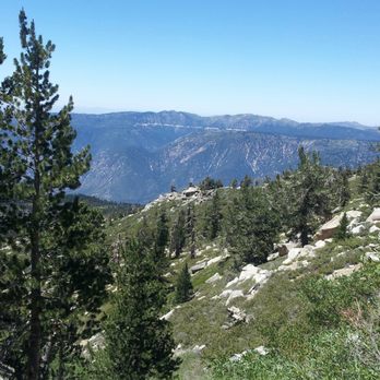


This is definitely a hidden GEM of a hike that I didn't even know about until just recently. Turns out, this trail is just as great as the more popular San Gorgonio and San Jacinto hikes. From this trail you get some great views of the other 5 peaks in the '6 Pack of Peaks': Mt Wilson, Mt Baldy, Cucamonga Peak, San Gorgonio and San Jacinto. The unusual thing is that these great views come from just below the San Bernardino summit. Most of the web sites claim this trail to be a 16 mile round trip to the 10,649 foot summit with an elevation gain of 4,700 feet. According to my cell phone Run Keeper app, it was a 16 miles; but my Garmin 450t GPS unit had it at 19.5 miles. This San Bernardino Trail that starts from Angelus Oaks is not a very difficult hike, but it did seem a lot longer than 16 miles! You need a wilderness permit for this hike. It's the same form as for San Gorgonio. http://www.sgwa.org/content/apply-wilderness-permit The trail is very easy to follow and is mostly a smooth dirt trail until the last mile or so. It starts off with the usual switchbacks up a gradual incline that is not that bad. Right from the start you get a great view of Mt Baldy's range. The beginning feels like San Gorgonio until you reach the beautiful Manzanita Springs of waist high to 6 foot bushes on each side of the narrow dirt path. Then you head into a huge meadow of Manzanita bushes. http://www.yelp.com/biz_photos/san-bernardino-peak-angelus-oaks-2?select=os4kSggEhR5xwFURviWPBQ&utm_campaign=www_photo_share_popup&utm_medium=copy_link&utm_source=(direct) My next favorite spot was reaching Limber Pine Bench at 5.8 miles as the curved trail was edged in rocks. It felt like a hiker's Red Carpet. In a quarter of a mile, I passed by the Limber Pine Springs water source that I wouldn't even let my dog drink from... maybe on a different day. The trail then takes a hard right to the south west before it eventually heads back to the east towards the summit. The next highlight was reaching a ridge at 7.2 miles / 10,180 feet with a great flat rock bench and a view of San Jacinto to the southeast. Within 2 tenths of a mile is the 1852 Washington's Monument; off the trail about 100 feet to the right and up the hill. If you miss it and see the Washington's Monument plaque first, just look back for the monument. http://www.yelp.com/biz_photos/san-bernardino-peak-angelus-oaks-2?select=61Ofsi3fGq10ezX1o5Vm0Q&utm_campaign=www_photo_share_popup&utm_medium=copy_link&utm_source=(direct) In a half mile past the monument, there will be a faint Y in the trail. Go to the right up the hill for about 0.1 mile to the summit. If you go straight at the Y, that will take you to the San Bernardino East Peak. On our hike, my pooch Sammy wore 3 different outfits. She started off wearing her water back pack. When we reached the section where there was no shade, I put her sunscreen vest that I designed for her on. I made it from patio sunscreen that I bought from Lowes. Then, on the way down when the temperature got hot, I put her swamp cooling vest on that I soaked in water and put in the refrigerator the night before. All to keep my girl safe on a hot day! We can't wait to hike this in the SNOW! TRAILHEAD DRIVING DIRECTIONS: It was 90 minute drive from Orange County, and there were many helpful road signs to the trailhead. (1) Click on this link: https://www.google.com/maps/dir//''/@34.1449554,-116.9739593,2666m/data=!3m1!1e3!4m6!4m5!1m0!1m3!2m2!1d-116.978562!2d34.146092 (2) You can use this address for Angelus Oaks Lodge. But just before the Lodge, turn right on the signed 1W07 dirt road. Stay to the right on the dirt road to the dead end trailhead parking lot. 36910 Angelus Oaks Lane, Angelus Oaks, Ca. 92305. (3) If you take the 10 Fwy, take Orange exit & head north. After 0.6 miles, turn right on 38/Lugonia Ave. From here, drive 19 miles, driving past the San Gorgonio turn off; 5 miles past the Valley of the Falls Drive turnoff you will turn right at Manzanita towards the fire station and then follow the signs. read more





9 years ago
Angelus Oaks to San Bernardino Peak - first of all, be ready for the parking situation. If you have to park as far as I did, you will add on an additional mile to your hike. My mustang is not equipped for off-roading so it was a smarter idea to opt out driving up the actual road to the trailhead parking. Once you reach the parking area you will see the start of the trailhead to your right hand side middle area - most likely it will be hidden because a vehicle is already blocking the pathway. Once you start be ready for one HELL OF an ADVENTURE!! It is simply magical the ENTIRE TIME!! The road never veers off making you feel lost, clearly marked, but it is a long journey to get to the top. Took me 9 hours to complete the 19 miles - I can suggest this - take YOUR BREAKS!!! Take a break when ever you can. The elevation will get to you once you pass the Manzanita Flats - Reaching the top is the most exhilarating part though - YOU GOT THIS!!! GOOD LUCK! In case you need some more details - check this site out. https://socalhiker.net/hiking-san-bernardino-peak-trail/ read more


I would give this 3.5 stars. The San Bernardino Peak is one of the "Six Pack of Peaks" of southern California. Many hike these peaks to train for Mt. Whitney or John Muir Trail. It is located within the beautiful San Gorgonio Wilderness. Here are the hard numbers: Distance: 16.5 miles Time: roughly 10 hours Difficulty: Strenuous Elevation Gain: 4,702 feet Time to go: June-October Need a Pass: Yes! Adventure Pass is required. You can buy one at any outdoor retail stores like REI, Big 5, Sports Chalet, etc. $5 for a day pass, $30 for a year pass. Need a Permit: Yes and it's free! Day hike permit: http://sgwa.dreamhosters.com/wp-content/uploads/2016/06/Permit_Dayhike.pdf / Overnight permit: http://sgwa.dreamhosters.com/wp-content/uploads/2016/06/Permit_Overnight.pdf Although the numbers may look scary, what's great about this hike is that the elevation gain is gradual compared to the other peaks. If you were to do this for a dayhike, it will be a longgggg day for you. I recommend waking up early so you can be down by sunset. Or you can break this up into two days as a nice weekend backpacking trip. Trailhead: Finding the trailhead was a bit difficult. A big indicator to look for is the fire station. You want to go towards it. As you drive further in, you'll drive along a bumpy dirt road and will see signs for the trailhead. Eventually you'll come to a dirt parking lot and the message board. Experience: The first section gains elevation pretty quickly but eventually evens out and ascends gradually. Eventually the trail will open up and you'll get to see the beautiful lush greenery of the San Bernardino Forest. This part is the Manzanita Flats and you'll see a trail junction. Follow the signs for LIMBER PINES. As you continue further on the trail, eventually you'll come to switchbacks and the last section of the trail, you'll feel the elevation gain. You'll pass by Washington's Monument, and last 3/4 mile is a steep ascent to the top! Then you made it! Don't forget to sign your name in the registry which is in a tin box, held down by a chain. During this hike, I mostly enjoyed the part of the trail that opened up to the forest. There were so much greenery and with the clear skies, it looked so beautiful! We had the unfortunate experience and got caught in a short (thankfully) summer storm. It rained and even hailed! It lasted for about 15 mins. Remember to check the weather! When we checked it the day before, there was suppose to be zero chance of a storm, but weather changes so always be prepared! It was nice that the sky had some clouds though, helped with the heat. When we summited the mountain, it was anticlimatic for me and I was quite disappointed. The view wasn't that great as it was blocked by trees and I wasn't able to get a clear view of the scenery. FYI, You can see San Gorgonio from here. The hike back down felt like FOREVER. I think I forgot that this hike was super long but it seriously felt like the trail would never end. I was so over the hike by that point and just wanted to come down. We started at 8:30pm and made it back just before the sun set. Overall, I did enjoy the journey to the top since it was so beautiful but was let down by the view at the top. Plus the hike back down was not enjoyable at all. Still, it was a great experience and I'm glad I can at least say that I've done it. REMEMBER to get a full night's rest, a LIGHT breakfast, bring snacks and most importantly, at least 3L of water or more on a hot hot day. Leave no trace! read more





10 years ago
Like another review stated, this trail truly is a gem and I was not really aware it existed even though I look at it nearly every day on my drive home from work. Then I got a book, "Call of the Mountains," by Ann and Farley Olander and they devoted several pages and pictures to describing San Bernardino Peak and the history of Washington Monument. I was truly intrigued to discover that as far back as 1852 a survey team used San Bernardino Peak as the intial point for Baseline Ave. and all survey points that would follow from it in the Inland Empire. We started around 1:00 p.m. and arrived at Limber Pine Bench around 7:00 p.m. and set up our tent. By dusk we were able to see Baseline Ave directly below and notice how completely straight it is outlined by city lights. Camping at 9320' we were woken up several times during the night by gusts of wind shaking us, despite being behind a 2-3' wall of rocks piled on top of each other, and others naturally there. I got a lot of great pictures of the sunset behind Cucamonga Peak and Mt. San Antonio. In the morning, we left our gear behind and hiked up to San Bernardino Peak. There was still some snow and Limber Pine Springs had plenty of fresh water. When we made it to San Bernardino Peak, I didn't realize it was the peak because a trail goes up and another goes on to San Bernardino East Peak. I thought someone was cutting the trail and continued onto San Bernardino East Peak, only to return on the way back and check out the top of San Bernardino and the Washington Monument. There were considerably more people on Saturday than on Friday, and I enjoyed meeting and greeting with people who love the trail as much as I do. read more


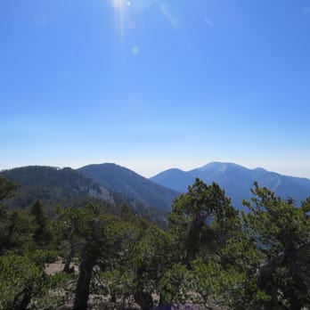


9 years ago
9 years ago
More info about San Bernardino Peak
Ask the Community - San Bernardino Peak
Review Highlights - San Bernardino Peak
You might also consider





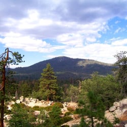

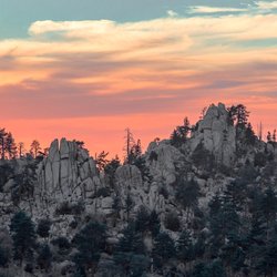


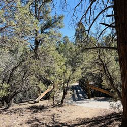


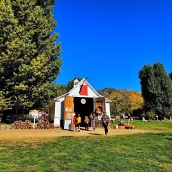


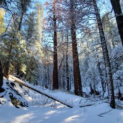

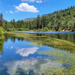


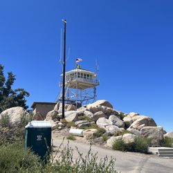


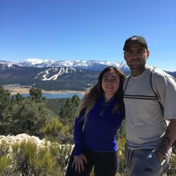
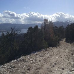

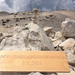

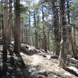
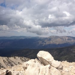
San Bernardino Peak - hiking - Updated August 2026
Best of Angelus Oaks
People found San Bernardino Peak by searching for…
Photo Spots in Angelus Oaks, CA
Scenic Views in Angelus Oaks, CA
Beautiful Views in Angelus Oaks, CA
Sunrise View in Angelus Oaks, CA
Places to Take Pictures in Angelus Oaks, CA
Scenic Drive in Angelus Oaks, CA
Sunset View in Angelus Oaks, CA
Campgrounds in Angelus Oaks, CA
Hiking Trails With Waterfalls in Angelus Oaks, CA
Watch Sunset in Angelus Oaks, CA
Scenic Spots in Angelus Oaks, CA
Star Gazing in Angelus Oaks, CA
Secret Spots in Angelus Oaks, CA
Things to Do in Angelus Oaks, CA
Fishing Spots in Angelus Oaks, CA
Night Hiking in Angelus Oaks, CA
Tent Camping in Angelus Oaks, CA
Night View in Angelus Oaks, CA
Dog Friendly Hiking Trails in Angelus Oaks, CA
Off Road Trails in Angelus Oaks, CA
Browse Nearby
BEST of Angelus Oaks, California Restaurants near San Bernardino Peak
BEST of Angelus Oaks, California Coffee near San Bernardino Peak
BEST of Angelus Oaks, California Breakfast near San Bernardino Peak
BEST of Angelus Oaks, California Things to Do near San Bernardino Peak
BEST of Angelus Oaks, California Campgrounds near San Bernardino Peak
BEST of Angelus Oaks, California Shopping near San Bernardino Peak
BEST of Angelus Oaks, California Snow Tubing near San Bernardino Peak
BEST of Angelus Oaks, California Ski Resorts near San Bernardino Peak
Browse Brands
Browse Articles
People who viewed San Bernardino Peak also viewed

Zanja Peak Trail Head
8 reviews

Carriage Trail
2 reviews

Hulda Crooks Park
57 reviews

Orange Blossom Trail
5 reviews

San Gorgonio South Fork Trail
3 reviews

Momyer Creek Trail to San Bernardino East Peak
6 reviews

Heart Rock
202 reviews

Big Falls
78 reviews

Oak Glen Preserve and Southern California Montane Botanic Garden
63 reviews

Box Springs Mountain Reserve
60 reviews