Mount Wanda Photos


You might also consider


More like Mount Wanda
Recommended Reviews - Mount Wanda
Start your review...


Reviews With Photos


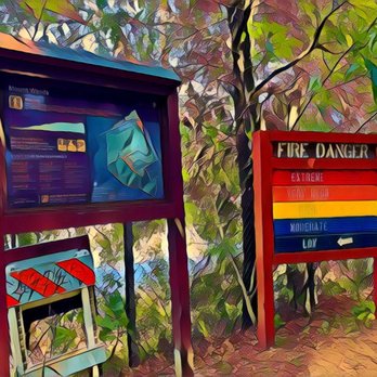
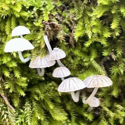
The sign at the start of the Mt Wanda trail says it is about a mile and 650 feet of that has a 13% grade. If you make it to the top you will be rewarded with a panoramic view. Dogs and bikes are allowed to enjoy the trail. I went on a guided walk it was a wet day and it was an effort for me to hike. I did not make it to the top on this walk. It was nice to see a few flowers and fungus along the trail which was what I really was interested in. I have added reaching the top to my list of goals.
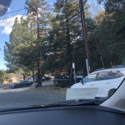

Always a very peaceful " hike "when you're walking here. Right off the freeway off exit 9 in downtown! It's a pretty short trail when you're heading in and you turn right. It takes you out right by the backroads to a place you can park on the street next to this colorful tunnel. I'll update pictures when I go back :)! I usually see older people here never usually family's with their kids, maybe since they are just hiking and kids don't think it's fun LOL. Dogs and adults love it here , never any dog poop around either so very considerate surrounding citizens. This specific day I posted the parking lot, it was the most packed I've ever seen it. NO parking spots unless someone was leaving. You have a path to go up to the train tracks but it's very illegal to walk the train tracks so I NEVER head up the path. The path to the tracks are VERY steep and VERY unstable/ unsafe. I WOULD NOT recommend heading up there unless you potentially want to get hurt or worse in trouble with the cops for walking somewhere you're not supposed to be. Moral of the story I'm telling you for you to stay away and stay safe. You want to be able to go back home tonight. I've only seen a couple the other day walk the train tracks for the first time in my whole life & don't know if they made it out okay, a train was coming a little bit after we saw them. So it's safe to say it's not safe. The path to the right is much longer and I'm not quite sure how far it actually goes! Go have a look for yourself and enjoy !! Also many doggos walk with their owners ( leashed of course ). I hope to see your fluffy hound haha! Once again I will update more pictures when I return! Thanks for reading hope this helps !
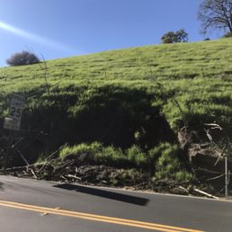

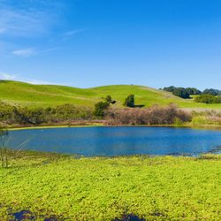
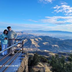
Gorgeous, gorgeous, gorgeous! Awesome views of the beautiful rolling hills in the backwoods of Martinez! Mount Wanda, named after John Muir's eldest daughter, is a small mountain located in the Martinez hills. It is said that John Muir often walked this mountain with his daughters. It is a fairly small mountain that can be accessed through the John Muir Nature trail which is a loop that stretches 2.4 miles long and reaches an elevation of 580 feet. The trail is fairly easy and a great trail to help beginning hikers build their stamina. I found out about this trail while visiting the John Muir National Historic site, and decided to check it out one day. The trail begins just off of highway 4 on Alhambra avenue. There's a small parking lot located right near the entrance but it did fill up really quickly while I was there. The main trail is a dirt trail that begins to narrow after about the first mile in. This trail starts off with a gradual steady incline that will lead all the way up to the top of the mountain. There is a cross section where you can access another nature trail that will loop you back to the parking lot. On this trail, you must be careful as there are several areas of thick mud and many active beehives that are present. When you reach the top of the mountain, there's a cute little bench where you can take pictures or rest before you make your way back down. If you're afraid of bugs, you might not want to stay there for very long. At the peak, you will notice the beautiful view of the Benicia bridge and all of the rolling hills in the distance. Coming back down the mountain, you will notice another man made path on the left side. Stay on he main path and do NOT veer off to this left! I made this mistake and got lost and it was scary as hell! I might be exaggerating, but I believe that I saw a baby mountain lion in the brush when I got lost. The brush was thick and my feet got stuck in the mud several times. Had to crawl through barbed wire to get out... yeah it was not fun! If you start to see high brush and you are going down hill, turn around! Don't make the silly mistake that I did! Aside from me veering off and getting lost, I really enjoyed hiking this mountain. The loop to the top is fairly easy and a great hike to take your kids or your dog on! The hike should take no longer than an hour but it took me 2 hours since I got lost. I went around 3 pm, which probably wasn't the best time because it got pretty warm! I would suggest going early to beat the heat. The people on the trail were very friendly and most seemed like locals of the area. Overall, this is a great hike for just about anyone!


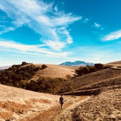
What a wonderful hike, scenic, picturesque, not too strenuous, good exercise and historical. I went on the full moon hike that the John Muir Historical Site puts on every time there is a full moon. Lucky me, it just happened to fall on the summer solstice and the full moon was the Strawberry Moon, a rare occurrence. The hike was a bit difficult for me, I did get winded and had to stop a few times, but I am out of shape. It's a pretty simple hike for more experienced hikers, it does get a little steeper en route to the summit, but there is also a side path that will add 15 minutes to your hike to the summit. The rangers call it the nature path, it goes through the oak trees, the path is a bit narrower too. There seemed to be two groups that went on the hike, the one I was a part of was guided by the rangers and a smaller group that came on their own. For me, the hike was really picturesque I was able to take a lot of pictures with the sun setting, and then of the strawberry moon rising over Mt. Diablo, it was really beautiful. Bringing a flashlight, a light jacket, some snacks, and definitely some water would be a healthy idea. I wasn't as prepared as I would have preferred, but then this hike wasn't very well planned for me. I do recommend this hike to anyone and everyone who wants to experience seeing the full moon rise, and hear history from the rangers. It really is a nice hike. I'm looking forward to going back.


Awesome hiking spot! Beautiful views and usually a nice breeze even on hot days. The view from the top is incredible. Several different routes so you never get bored. Good parking. Lots of mosquitos in the evening so if you go to catch the sunset, you'll want bug spray. Great exercise too when you're sick of the gym!


Now that I'm such a seasoned hiker (tongue firmly in cheek), I can say with some temerity that I found this mile-long trail a bit, shall we say, short. I don't mind short trails, but I had to fill up my daily step requirement elsewhere and headed over to Briones for that purpose. That's not to say this trail wasn't worthwhile. It most definitely was as the 13% grade wasn't insurmountable. It allowed nice views of the Carquinez Strait and Mount Diablo at the top. The circuitous trails were surrounded by various oak trees and wildflowers. I made an attempt at following the riding trail that goes through a gamey tunnel under the highway, but it made a dramatic climb which deflated my unearned self-image of a seasoned hiker. Regardless you can see why John Muir took pleasure in taking his daughters with him through these hills. Wanda was the name of his eldest daughter. The trailhead is directly to your right at the Alhambra Avenue exit off Hwy 4. RELATED - Up for a hike? Here's a collection of trails I've walked and reviewed: https://bit.ly/2OrC8nU read more



When the dog and I need a good hike that isn't too far from home and we can do in a reasonable amount of time, we come to Mt. Wanda. My man and I are hiking here every other weekend at least. The dog loves it. We recently did the Full Moon Hike that is put on by the Rangers. The kids tagged along. Its free and one of the few times you're allowed on the Mt. during the night. The kids had a wonderful time meandering around in the dark. It was fun to be out of our element with flashlights. The moon was beautiful. The only negative is ticks. We went hiking on Thanksgiving morning with our dog and proceeded to pull seven ticks off our dog. The most yet. Wear bug spray and make sure that your dog is properly protected. Morning, noon or night this is a great hike to take. read more


3 years ago
It's very easy to missed the parking entrance here, but not overcrowded and nice trails for climbing! will come back for different seasons! read more


The sign at the start of the Mt Wanda trail says it is about a mile and 650 feet of that has a 13% grade. If you make it to the top you will be rewarded with a panoramic view. Dogs and bikes are allowed to enjoy the trail. I went on a guided walk it was a wet day and it was an effort for me to hike. I did not make it to the top on this walk. It was nice to see a few flowers and fungus along the trail which was what I really was interested in. I have added reaching the top to my list of goals. read more


4 years ago
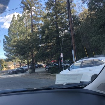
Always a very peaceful " hike "when you're walking here. Right off the freeway off exit 9 in downtown! It's a pretty short trail when you're heading in and you turn right. It takes you out right by the backroads to a place you can park on the street next to this colorful tunnel. I'll update pictures when I go back :)! I usually see older people here never usually family's with their kids, maybe since they are just hiking and kids don't think it's fun LOL. Dogs and adults love it here , never any dog poop around either so very considerate surrounding citizens. This specific day I posted the parking lot, it was the most packed I've ever seen it. NO parking spots unless someone was leaving. You have a path to go up to the train tracks but it's very illegal to walk the train tracks so I NEVER head up the path. The path to the tracks are VERY steep and VERY unstable/ unsafe. I WOULD NOT recommend heading up there unless you potentially want to get hurt or worse in trouble with the cops for walking somewhere you're not supposed to be. Moral of the story I'm telling you for you to stay away and stay safe. You want to be able to go back home tonight. I've only seen a couple the other day walk the train tracks for the first time in my whole life & don't know if they made it out okay, a train was coming a little bit after we saw them. So it's safe to say it's not safe. The path to the right is much longer and I'm not quite sure how far it actually goes! Go have a look for yourself and enjoy !! Also many doggos walk with their owners ( leashed of course ). I hope to see your fluffy hound haha! Once again I will update more pictures when I return! Thanks for reading hope this helps ! read more


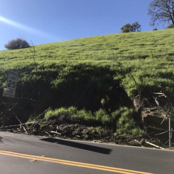
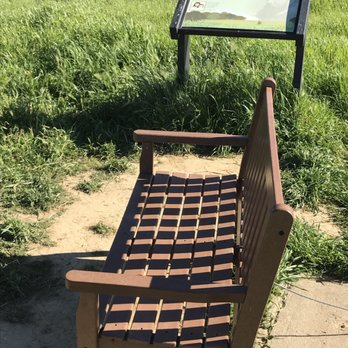
Gorgeous, gorgeous, gorgeous! Awesome views of the beautiful rolling hills in the backwoods of Martinez! Mount Wanda, named after John Muir's eldest daughter, is a small mountain located in the Martinez hills. It is said that John Muir often walked this mountain with his daughters. It is a fairly small mountain that can be accessed through the John Muir Nature trail which is a loop that stretches 2.4 miles long and reaches an elevation of 580 feet. The trail is fairly easy and a great trail to help beginning hikers build their stamina. I found out about this trail while visiting the John Muir National Historic site, and decided to check it out one day. The trail begins just off of highway 4 on Alhambra avenue. There's a small parking lot located right near the entrance but it did fill up really quickly while I was there. The main trail is a dirt trail that begins to narrow after about the first mile in. This trail starts off with a gradual steady incline that will lead all the way up to the top of the mountain. There is a cross section where you can access another nature trail that will loop you back to the parking lot. On this trail, you must be careful as there are several areas of thick mud and many active beehives that are present. When you reach the top of the mountain, there's a cute little bench where you can take pictures or rest before you make your way back down. If you're afraid of bugs, you might not want to stay there for very long. At the peak, you will notice the beautiful view of the Benicia bridge and all of the rolling hills in the distance. Coming back down the mountain, you will notice another man made path on the left side. Stay on he main path and do NOT veer off to this left! I made this mistake and got lost and it was scary as hell! I might be exaggerating, but I believe that I saw a baby mountain lion in the brush when I got lost. The brush was thick and my feet got stuck in the mud several times. Had to crawl through barbed wire to get out... yeah it was not fun! If you start to see high brush and you are going down hill, turn around! Don't make the silly mistake that I did! Aside from me veering off and getting lost, I really enjoyed hiking this mountain. The loop to the top is fairly easy and a great hike to take your kids or your dog on! The hike should take no longer than an hour but it took me 2 hours since I got lost. I went around 3 pm, which probably wasn't the best time because it got pretty warm! I would suggest going early to beat the heat. The people on the trail were very friendly and most seemed like locals of the area. Overall, this is a great hike for just about anyone! read more




2 years ago


6 years ago

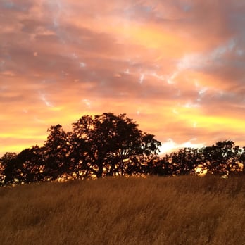
What a wonderful hike, scenic, picturesque, not too strenuous, good exercise and historical. I went on the full moon hike that the John Muir Historical Site puts on every time there is a full moon. Lucky me, it just happened to fall on the summer solstice and the full moon was the Strawberry Moon, a rare occurrence. The hike was a bit difficult for me, I did get winded and had to stop a few times, but I am out of shape. It's a pretty simple hike for more experienced hikers, it does get a little steeper en route to the summit, but there is also a side path that will add 15 minutes to your hike to the summit. The rangers call it the nature path, it goes through the oak trees, the path is a bit narrower too. There seemed to be two groups that went on the hike, the one I was a part of was guided by the rangers and a smaller group that came on their own. For me, the hike was really picturesque I was able to take a lot of pictures with the sun setting, and then of the strawberry moon rising over Mt. Diablo, it was really beautiful. Bringing a flashlight, a light jacket, some snacks, and definitely some water would be a healthy idea. I wasn't as prepared as I would have preferred, but then this hike wasn't very well planned for me. I do recommend this hike to anyone and everyone who wants to experience seeing the full moon rise, and hear history from the rangers. It really is a nice hike. I'm looking forward to going back. read more




6 years ago
6 years ago

Awesome hiking spot! Beautiful views and usually a nice breeze even on hot days. The view from the top is incredible. Several different routes so you never get bored. Good parking. Lots of mosquitos in the evening so if you go to catch the sunset, you'll want bug spray. Great exercise too when you're sick of the gym! read more


11 years ago
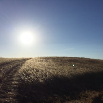
It's a moderately intense 1.0mi hike to the summit. I found out about this after my sister invited the family out to the monthly Super Moon hike! Our guides were enthusiastic and gave short history lessons about John Muir and his family. In the end, the guides give kids Oreos so they can take a bite out of the cookie to match our view of the moon. There is also a stellar view of the hills and Mt. Diablo. read more




6 years ago

9 years ago
8 years ago
8 years ago
9 years ago
More info about Mount Wanda
Ask the Community - Mount Wanda
Review Highlights - Mount Wanda
You might also consider




















Why does Yelp recommend reviews?
1 review that is not currently recommended
The reviews below are not factored into the business's overall star rating.

2 years ago
Mount Wanda - hiking - Updated August 2026
Best of Martinez
People found Mount Wanda by searching for…
Fun Things to Do in Martinez, CA
Beautiful Views in Martinez, CA
Places to Take Pictures in Martinez, CA
Walking Trails in Martinez, CA
Abandoned Places in Martinez, CA
Waterfall Hike in Martinez, CA
Off Leash Dog Hiking Trails in Martinez, CA
Secluded Spots in Martinez, CA
Trending Searches in Martinez, CA
Barbershop For Men near Mount Wanda
Cliff Jumping near Mount Wanda
Consignment Shops near Mount Wanda
Cruising Spots near Mount Wanda
Dog Friendly Things To Do near Mount Wanda
Elementary Schools near Mount Wanda
Eyebrow Threading near Mount Wanda
Fire Departments near Mount Wanda
Flower Fields near Mount Wanda
Hair Braiding near Mount Wanda
Historic Restaurants near Mount Wanda
Lookout Points near Mount Wanda
Places To Take Pictures near Mount Wanda
Public Golf Courses near Mount Wanda
Running Trails near Mount Wanda
Scenic Night View near Mount Wanda
Scenic Overlook near Mount Wanda
Secluded Spots near Mount Wanda
Sports Card Shops near Mount Wanda
Swimming Holes near Mount Wanda
Things To Do This Weekend near Mount Wanda
Trading Card Shops near Mount Wanda
Browse Nearby
BEST of Martinez, California Restaurants near Mount Wanda
BEST of Martinez, California Coffee near Mount Wanda
BEST of Martinez, California Things to Do near Mount Wanda
BEST of Martinez, California Photo Spots near Mount Wanda
BEST of Martinez, California Parks near Mount Wanda
BEST of Martinez, California Breakfast near Mount Wanda
BEST of Martinez, California Campgrounds near Mount Wanda
Browse Brands
Related Searches in Martinez, CA
Best Dog Hiking Trails Around Martinez, California
Best Fishing Locations and Guides in Martinez, California
Best Lookout Points to Visit in Martinez, California
Best Nature Trails for Hiking in Martinez, California
Best Observation Deck Views in Martinez, California
Best Places for Horseback Riding in Martinez, California
Best Sightseeing Experiences Available in Martinez, California
Book Engaging Historical Tours in Martinez, California
Book a Mansion Tour in Martinez, California
Check Out Off Road Trails in Martinez, California
Discover Charming Historic Homes in Martinez, California
Discover Dog Friendly Trails to Explore in Martinez, California
Discover Easy Hiking Trails Near Martinez, California
Discover Famous Monuments in Martinez, California
Discover Historic Sites and Places in Martinez, California
Discover Kid Friendly Hiking Trails in Martinez, California
Discover Popular Bike Trails in Martinez, California
Discover Popular Landmarks in Martinez, California
Discover Popular Photo Spots in Martinez, California
Discover Scenic Mountain Bike Trails Near Martinez, California
Discover Stunning Skyline View Spots in Martinez, California
Discover Top Points of Interest in Martinez, California
Discover Top Scenic Spots to Visit in Martinez, California
Discover Walking Parks in Martinez, California Near You
Discover a Hiking Trail in Martinez, California
Discover the Best Military Museum in Martinez, California
Discover the Best Night Hike Trails in Martinez, California
Dog-Friendly Hikes With Dogs in Martinez, California
Enjoy Camping Adventures Around Martinez, California
Enjoy Kayaking Adventures in Martinez, California
Enjoy Off Leash Dog Hikes in Martinez, California
Enjoy Scenic Places to Walk in Martinez, California
Enjoy a Beautiful Waterfall Hike in Martinez, California
Enjoy the Best Night View Spots in Martinez, California
Enjoy the Best Walking Path in Martinez, California
Enjoy the Best Walking Trails in Martinez, California
Explore Beautiful Botanical Gardens in Martinez, California
Explore Beautiful Castles and Landmarks in Martinez, California
Explore Beautiful Parks and Green Spaces in Martinez, California
Explore Children's Museums Near Martinez, California
Explore Easy Hikes Perfect for All in Martinez, California
Explore Famous Historical Landmarks in Martinez, California
Explore Fun Activities to Do in Martinez, California
Explore Popular Campgrounds Near Martinez, California
Explore Popular Dog Walking Trails in Martinez, California
Explore Popular Scenic Drives Around Martinez, California
Explore Popular Scenic Overlook Points in Martinez, California


