1. Mt Ashwabay Ski & Recreation Area

1. Mt Ashwabay Ski & Recreation Area

0

Bayfield, WI

Cancel

Open app

Search

Mt Ashwabay Ski & Recreation Area

3.5 (2 reviews)

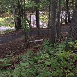
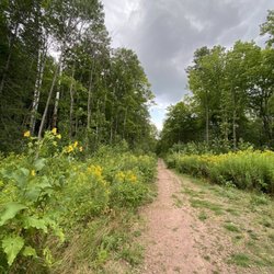
Mt Ashwabay Ski & Recreation Area Photos

You might also consider

More like Mt Ashwabay Ski & Recreation Area

Recommended Reviews - Mt Ashwabay Ski & Recreation Area

Your trust is our priority, so businesses can't pay to alter or remove their reviews. Learn more about reviews.
Yelp app icon
Browse more easily on the app
Review Feed Illustration

7 years ago

Helpful 0
Thanks 0
Love this 0
Oh no 0

10 years ago

Helpful 1
Thanks 0
Love this 0
Oh no 0

Ask the Community - Mt Ashwabay Ski & Recreation Area

Verify this business for free

Get access to customer & competitor insights.

Verify this business

Copper Falls State Park

Copper Falls State Park

4.4(33 reviews)
30.8 mi

Copper Falls State Park is often ranked among Wisconsin's top state parks, and it's easy to see…read morewhy. Located in the Northwoods of northern Wisconsin, the park's highlight is the Doughboy Trail, a well-developed two-mile loop that offers excellent views of both Copper Falls and Brownstone Falls. The trail is easy to follow, well-maintained, and includes several scenic overlooks. Because of its distance--several hours from cities like Madison--I recommend combining a visit with other Northwoods attractions. A great option is to stop here while exploring the Apostle Islands or the Bayfield area. Once inside the park, follow the main road past the ranger station until it ends at the parking lot, where you'll find restrooms and the Doughboy Trailhead. This is a beautiful park and well worth the stop, especially if you plan it alongside other northern Wisconsin adventures.

As we traveled north, we stopped at several state parks, and Copper Falls stood out as one of the…read moreprettiest--often noted in reviews for having the highest waterfall in the area. We were able to park easily and walk a short, fairly easy loop to reach the falls. The view of the waterfall was beautiful, though the trail itself isn't very shaded. Thankfully, the weather was mild during our visit, which made for a pleasant stop. Parking was plentiful, and the park overall felt accessible and well maintained. A worthwhile stop for an hour or so if you're exploring northern Wisconsin.

Photos
Copper Falls State Park
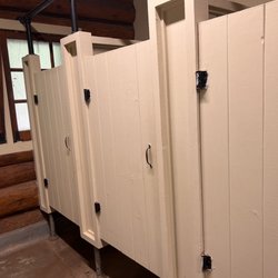
Copper Falls State Park - Rustic (but clean) restrooms

Rustic (but clean) restrooms

Copper Falls State Park

See all

Tettegouche State Park

Tettegouche State Park

4.9(34 reviews)
41.3 mi

Cart-in campsites are normally great and well taken care of, especially campsite H…read more We scooped up a campsite(H) and reserved it early on. We get to the site after pushing a full cart(with a messed up wheel) to find a dozen fallen trees that haven't been clean up, and a bunch of dry old rotting brush on the site, and the fire pit is needing to be cleaned out(its full) Site needs maintenance, bad, was really looking forward to our stay, and now just kinda disappointed.

Tettegouche State Park yes what a worthwhile place to come for a visit! Tettegouche is located…read morealong North Shore Scenic Drive running up and down the Minnesota coast. For me...the star attraction is the hike to HIGH FALLS!!! You can never have enough waterfalls and these High Falls were fantastic! I highly recommend everyone make the trek to High Falls and take some time to appreciate the beautiful backdrop. First off, Tettegouche SP is sort of a hidden little park. When I arrived here, the parking lot was small and it appeared that I fortunately got the last available spot. I visited back in June around 9am and the park and trailhead had filled up. I read at the entrance sign that the trail to High Falls was 1.5 miles each way taking roughly 2 hours. I was able to arrive at High Falls in a little over 1 hour each way with a quick pace. I found the hike to be relatively difficult especially starting out and towards the end. Leaving the trailhead I did have to climb up and over some rocks and cliff areas that I wasn't expecting to be so rugged. I'd say the elevation along the way was pretty elevated at times. When you do arrive near High Falls, there's a sign that states you have to step down 83 stairs to the base. But not to fret...it's all worth it. Upon making it to High Falls, I found the setting to be spectacular! It was a sunny, brisk and pleasant morning for the start of summer. Also, there was zero wind. I was able to climb on the rocks for some great looking photos of this 63 foot tall waterfall along the banks of the Baptism River. High Falls splashed down the cliffside and is sort of divided, making the appearance you're gazing out upon two unique looking waterfalls. Really, in total, it was a beautiful scene. If you don't mind taking your shoes off you can certainly step onto the waters for closer views up to High Falls. You can cross the river for different perspectives. I was really impressed with the surroundings at High Falls. There wasn't a cloud in the sky and as I always point out...I got fortunate with the sun being at my back and allowing for picturesque photo opportunities. On the side next to the trail you can climb safely up to the falls. For me, I was content getting a panoramic view from the riverside area. I simply took a seat on the rocks and had High Falls in plain clear sight for one grand magical moment. I hung out for 45 minutes. Eventually it filled up with hikers. For the time I was there though, I was appreciative for looking at such a pretty waterfall. Also at these High Falls, there was a sign for the Two Step Falls Access. I tried to decipher where this access lead towards but unfortunately I never discovered anything worthwhile. For those wanting more out of their time here you can connect to the Superior Hiking Trail. There were signs for it. Another worthwhile spot was Shovel Point. According to the entrance sign, if you follow the cliff line trail to Shovel Point, you're afforded views of the world's largest freshwater lake. Finally, you can also hike to Tettegouche Camp where you can reserve a cabin in advance and stay overnight in nature. Or it's mentioned that you can simply picnic in the lodge or canoe Mic Mac Lake. My experience here at Tettegouche State Park was fulfilling. Getting the chance to hike to High Falls for fantastic photo chances was memorable. I left feeling satisfied and grateful for taking a few hours out of my summer morning to visit. I highly recommend stopping here during your travels along North Shore Scenic Drive. I've become a waterfall enthusiast and believe if you make the 1.5 mile trek each way, you will not be disappointed with the sights and surroundings of this 5 star attraction.

Photos
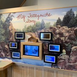
Tettegouche State Park
Tettegouche State Park - North shore 2019

See all

North shore 2019

Meyers Beach- Bayfield Sea Caves

Meyers Beach- Bayfield Sea Caves

4.8(4 reviews)
11.2 mi

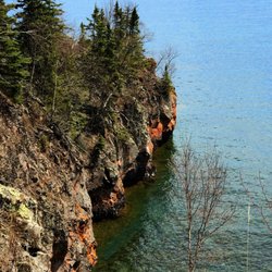
We hiked the Lakeshore Trail from the Meyers Beach parking lot. (National Park Service. $5 parking…read morefee; $2.50 if you have a Senior Pass or Access Pass. May, 2023). As noted by others, this is a launch point for kayaks to launch for views of the sea caves and cliffs. We were at this location twice in late May, 2023, and national park Rangers were there on both days (Wednesday, Friday) ensuring that kayakers were prepared for the rough and cold waters, and to provide guidance to hikers. There are clean vault toilets at the location. Regarding the Lakeshore Hike, we did about 2.2 miles of the hike, returning on the same trail to make it about 4.4 miles roundtrip. The trail continues to a campground site (I believe NPS reservations are required) but we didn't go that far. The first 1.8 miles are largely inland, without views of Lake Superior. Of this segment, the first 0.7 miles are almost completely on a double plank boardwalk that goes over swampy land in parts. It requires some stepping up and down on planks, following terrain changes. After you cross a service road at 0.7 miles, the trail alternates between plank boards and regular trails. As you approach the crevasse at 1.8 miles, there are quite a few ascents and descents wherein you go down to a stream-bed and then back up. Some of these are steep but have logs to help with footing. The stream crossings all had sturdy boards or bridges to cross. At 1.8 miles, you reach the crevasse area with views of Lake Superior. Take a look on both sides to see sea caves and the deep crevasse. There are benches here too so it made a great lunch spot. Be careful not to get too close to the edges. It's a long way down! Beyond the crevasse, walk another 0.4 miles to the "basin". This stretch is relatively easy (flat) walking with spectacular views. My husband, who has been hiking in the Himalayas recently, found the entire trail to be easy. For me, I'd characterize it as moderately challenging. On the positive side, there is very little elevation change, so I wasn't huffing and puffing. However, I have balance issues, so I didn't particularly like the footing for the ascents/descents to the stream beds nor all of the roots on the trail. Some of the steps up and down, even on the boardwalk, were also a bit too high for my short legs! Having walked with hiking poles and an occasional hand from my husband helped. Finally, remember bug spray. The mosquitoes are active. 4-star rating overall instead of 5 due to distance required to walk to get views of the sea caves and mosquitoes. 5 stars for the Park Service.

You have to come check out the sea caves on the shoreline of Lake Superior. Meyers beach is the…read morelaunching point for kayaks. It's also the location for the hiking trail. The views from the water are beautiful! I highly recommend the water instead of the walking trail. There are multiple vendors you can rent kayaks and wet suits from. You can even take a guided tour. We personally, have our own kayaks and decided to do our own trip. The DNR do sit at the beach and give you the whole spiel on safety and risks. It is recommended to use sea kayaks due to the rough waters of Lake Superior. We have used normal lake kayaks and used good judgement on the water/ weather conditions. Both times were just fine on the normal kayaks. Just be careful. The waters are freezing all year-round and if you do go overboard near the caves there's no good spot to pull off. Check out my pics of the stunning caves!

Photos
Meyers Beach- Bayfield Sea Caves

See all

Interstate Falls

Interstate Falls

4.0(1 review)
39.1 mi

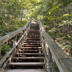
Called Interstate Falls because it's directly on the MI/WI border, this spot is only about a 10…read moreminute drive from Ironwood, MI, and only about a 10 minute hike from the parking lot. We saw lot of fun fungi on our hike in and spotted some folks foraging some of the mushrooms and even overheard them saying that they had found some chanterelles. It was an easy hike in on the main path, or you can switch it up to some more tretcherous terrain slightly closer to the falls along the stream (hiking poles recommended if you do so, especiallyif it's been raining recently). It appears that they recently redid all of the steps down to the main waterfall, but there are probably the equivalent of a 3 or 4 story building worth of stairs, which definitely winded a member of our party experiencing some health issues. The falls themselves are about about 15 feet high and there are some miini waterfalls along the a lot of the path on your way in as well. Beware: Google Maps may send you the wrong way. Based on a sign on someone's driveway on the route that Google told us to take that says it's private property, I gather that Google regularly tries to route folks through what it thinks is a public road but is clearly private property. I feel like this happens pretty regularly and that's that Google maps also seems to be unaware of unaware of incredibly major road construction projects. Its vexing to say the least. These lousy directions cost us about 15 minutes, so be sure to double check your route and enter from the MI side, not the WI one.

Photos
Interstate Falls
Interstate Falls
Interstate Falls

See all

Mt Ashwabay Ski & Recreation Area - skiresorts - Updated July 2026
Loading...
Loading...
Loading...