Cancel

    Open app

    Search

    North Baldface

    4.0 (1 review)

    North Baldface Photos

    Recommended Reviews - North Baldface

    Your trust is our priority, so businesses can't pay to alter or remove their reviews. Learn more about reviews.
    Yelp app icon
    Browse more easily on the app
    Review Feed Illustration
    Photo of Kaori M.
    269
    1738
    1482

    7 years ago

    Helpful 3
    Thanks 0
    Love this 4
    Oh no 0

    Verify this business for free

    People searched for Hiking 195 times last month within 15 miles of this business.

    Verify this business

    Black Cap Trail

    Black Cap Trail

    5.0(6 reviews)
    11.8 km

    The elevation gain is less than 600 feet, but if feels like a nice, steady workout. I'm not in…read morethe greatest shape and I thought it was pretty easy and quick. I was to the top in about 35-40 min. The trail is actually pleasant even without the views. At the top, the reward is huge, really nice views in an alpine area. Plenty of space to spread out up top, so you can space out. Lots of kids and dogs, but people that day were all respectful and pleasant. There is still cell phone coverage at the top (I use AT&T.)

    Black Cap Trail is a relatively easy hike with a huge reward at the end. The views from the top…read moreare just spectacular. Take Hurricane Mountain Road off of Route 16 near the Intervale Scenic Vista. The Parking lot will be on the right near the summit of the road. Warning - this road is steep and winding! The trail is well marked and is approximately one mile in each direction. It is a slow, gradual climb with a lot of tree roots in the beginning that eventually give way to scattered rocks and then to all rock on the summit. If you are not an experienced hiker or do not have the proper gear (I fall into both of these categories) I would not attempt this when the ground is wet as it can be slippery on a good day. It's a good hike Spring through Fall, but hiking it in the Fall is by far my favorite. The view of the changing colors from the top is amazing.

    Photos
    Black Cap Trail - Trail down from Black Cap

    Trail down from Black Cap

    Black Cap Trail - It starts out fairly flat....

    It starts out fairly flat....

    Black Cap Trail

    See all

    Diana's Baths - Rock stack

    Diana's Baths

    4.6(127 reviews)
    16.7 km

    Parking instructions here were very unclear. What we initially believed were parking spaces turned…read moreout to be a line of cars waiting to park, with no visible signage where we entered. When we noticed an opening, we asked nearby drivers if we could squeeze in, and they had no issue with it. As we were parking, an employee approached us in a very aggressive and unprofessional manner and told us we could not park there. We apologized and explained that we were not from the area and had not seen any signs. We were told that the rule was "well known to locals" and that a sign existed at the front of the line--more than 25 cars ahead, making it impossible for us to see. Despite the surrounding drivers having no objection, the employee demanded we leave and became increasingly hostile when we asked questions or requested a manager. At that point, the interaction escalated unnecessarily, and we decided it wasn't worth the confrontation and left. I've never experienced such a level of rudeness from a staff member over an honest misunderstanding. Clear signage and more professional communication would have avoided the entire situation. Someone even yelled out "stop being a parking nazi". I would have otherwise liked to review the venue itself, but we were unable to do so as we never made it inside.

    Diana's Bath is a natural pool with some small waterfalls. The walk from the parking lot is about…read more.6 miles one way, it's a quick and easy hike to reach this gorgeous spot. There is a parking lot and we were able to find parking but I'm sure it gets full at peak times. We enjoyed the hike and the waterfalls. It was in late May so there were quite a few people there. It's a peaceful spot to relax, sit in the pool, and just enjoy nature. I'm glad my family and I got to visit during this trip!

    Photos
    Diana's Baths - Waterfall

    Waterfall

    Diana's Baths - Waterfall

    Waterfall

    Diana's Baths

    See all

    Sabattus Mountain - Trail

    Sabattus Mountain

    5.0(2 reviews)
    13.1 km

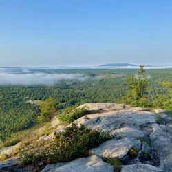
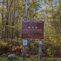
    I feel the need to preface all of my nature reviews with this: being 90% forested and having around…read more3,500 miles of coastline, Maine has a tremendous amount of spaces, walkways, paths, and trails of all kinds and of all levels. There's something for everyone. What I'm reviewing is how a spot compares to similar outdoor spots in my personal opinion. Being in nature - and remembering to carry in, carry out - is always five stars! :) Parking? Yes. Loop trail? Yes. Well marked signs? Yes. Element of surprise? Yes. This is the first time I've been at a trail where I've seen trail volunteers! There were a dozen or so folks midway up the trail working on maintenance and drainage, and they were all so friendly. Thanks for taking care of this pretty little climb, Greater Lovell Land Trust folks! This is a shorter trail, 1.4 miles, that leads up to the 1,253 foot Sabattus Mountain. The trail will bring you through mixed growth forest and some moderately difficult sections of exposed ledge. As you approach the summit, it actually becomes less steep and rooty. The expansive overlook along the cliffs offer near panoramic views of Keyes Pond, Kezar Lake, and - in the distance - Pleasant Mountain and the Whites. Take a seat on the rocks, or - if you're lucky! - the memorial bench for a picnic. Exceptional birdwatching from here too. Please stay on the trail, know that this area is open to hunting during firearms season. (Coming in summer? There's *lots* of wasps/yellow jackets because of the increase of goldenrod here [so I was told].)

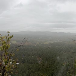
    I have to say that this was my favorite hike of all time!! First I would like to mention that this…read moreis definitely a moderate trail! It's very steep but also decently short! I was lucky enough to get to the top before it started raining today, but lucky it was not a slippery hike down either. Some of the Cons of this hike goes as follows: * The roots were everywhere along the trail which may be difficult for children and is definitely no where near handicap accessible * The only other review for this mountain here on Yelp mentioned how buggy it was 6 months ago from today, May 24, 2023, and it still was extreme. We tried as much bug spray as anyone could humanly handle and I still got bit up quite a bit * Without the proper preparation like prior experience and or stretching/warming up beforehand, it definitely leaves you strained and very tired * For AT&T customers (at least) there is absolutely no service until you get pretty far up the mountain, this included most of the ride to the parking area and the area itself Despite all of these things all of the Pros make up for it These include: * Amazing Scenic Views * How short the trail actually is * The stunning raw quartz at the top * The amount of Wildlife * The amazing photo opportunities If you're either experienced or up for a little bit of a challenge I 100% recommend this trail! (P.s. playing some of my favorite songs while walking definitely added to the experience)

    Photos
    Sabattus Mountain
    Sabattus Mountain - Trail

    Trail

    Sabattus Mountain

    See all

    Jockey Cap Trail - A random tree has grown out of the rocks!

    Jockey Cap Trail

    4.5(2 reviews)
    16.4 km

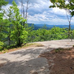
    To me, a perfect trail is one that: not a lot of people know about, is hidden in plain sight, has…read moresome challenging parts (it's good to feel the heart pumping! ... but my legs don't need to quiver in fatigue with every step; does that make sense?), and offers an impressive reward by way of view at the top. Jockey Cap Trail is all of that. A former ski hill in the 30's (it boasts of having had the first rope tow in Maine), Jockey Cap is now a trail system (unfortunately, many of the off-branches of the two main routes up lead to dead-ends). Tucked right behind a country store off Route 302 in Fryeburg, you'll find a dirt trail that first leads into the woods to Molly Locket's cave. Here's your Robert Frost moment: from here, the trail splits to the left and right. The former offers a gradual climb, the latter is much more steep. Regardless of which you choose, both are only about a quarter mile long. At the top are breathtaking views of forest, lakes, valleys, and mountain ranges. There's also a bronze silhouette allowing climbers to line up which mountain is which. It's a short climb, but if you're in the area, it's worth it - especially in spring and autumn when the colors are on opposite ends of the spectrum of impressive and the tourists are at a minimum. I would say it's kid-friendly if your kids are active and love the outdoors; as a side note, while brief in length, I would still say this leads more towards "hike" then "nature walk".

    Fun short hike with nice views at the top. Not enough parking. Trail not well marked but you can…read morefigure it out. Use all trails.

    Photos
    Jockey Cap Trail - The cave at Jockey Cap Trail!

    The cave at Jockey Cap Trail!

    Jockey Cap Trail
    Jockey Cap Trail - From the top of Jockey Cap Trail.

    See all

    From the top of Jockey Cap Trail.

    North Baldface - hiking - Updated May 2026

    Loading...
    Loading...
    Loading...