Cancel

    Open app

    Search

    Otter Lake Provincial Park

    5.0 (2 reviews)

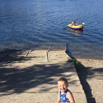
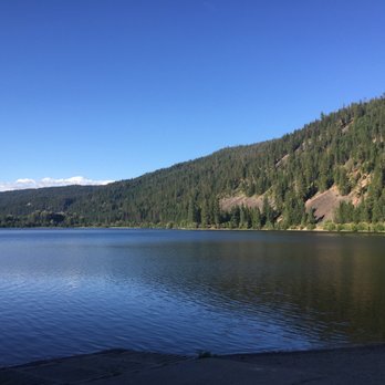
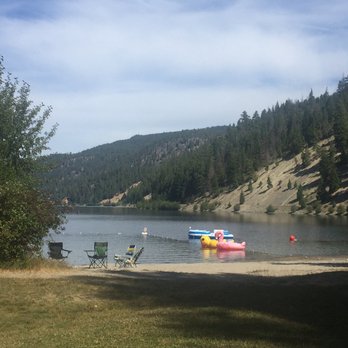
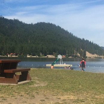
    Otter Lake Provincial Park Photos

    More like Otter Lake Provincial Park

    Recommended Reviews - Otter Lake Provincial Park

    Your trust is our priority, so businesses can't pay to alter or remove their reviews. Learn more about reviews.
    Yelp app icon
    Browse more easily on the app
    Review Feed Illustration

    9 years ago

    Helpful 0
    Thanks 0
    Love this 0
    Oh no 0

    11 years ago

    Helpful 0
    Thanks 0
    Love this 0
    Oh no 0

    Verify this business for free

    Get access to customer & competitor insights.

    Verify this business

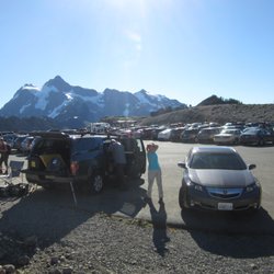
    Ptarmigan Ridge - Parking lot.

    Ptarmigan Ridge

    5.0(2 reviews)
    115.1 km

    A Northwest Forest Pass or America the Beautiful Pass is required. Day passes are available near…read morethe bathrooms. This hiking area is heavily populated with rangers so do yourself a favor and purchase the day pass if needed. The parking lot has about 160 spaces and every single space was taken by the time we completed our hike. This is area draws large crowds. There are several trail-heads that can be accessed from this parking area. The views are amazing! This hike can be anywhere from 4 miles to 9 miles round-trip. The choice is yours to decide how far to hike. Ptarmigan Ridge is considered "intermediate." As always, listen to your body and know your own limitations. The terrain is rocky and narrow at times. Due to the high altitude, expect snow no matter what the season. There is minimal shade on this hike so be sure to wear a hat and sunscreen. If you have hiking poles, it's a good idea to pack them. Poles come in handy when crossing large patches of snow. Pack plenty of water! This whole hike is above-timberline. Lots of alpine trees, meadows, snow patches and wildflowers. During the day of our hike many people witnessed mountain goats in the meadows. Unfortunately, we did not spot a single mountain goat. Bummer! Overall, if you have time for only one hike in the Mount Baker area, make it this one. The views are incredible, the hike is achievable, and the wildflower medley is stunning. As always, if you pack it in, be sure to pack it out.

    With sweeping views and wonderful vistas, everyone should try this trail. I have lead those from…read morethe city (who were not the hiking types) and the trail is easy enough for about a mile/mile and a half to soak up the views and get a taste of what this area has to offer. You will still need solid walking shoes as the trail is covered in gravel and rocks with a large portion of the trail extending from a slope. The best time to visit is in August through early October, but preferably August since the snow will be completely gone from the trails and the days will be warm and sunny. You may see Pikas, largish rodents that live in the hills. You can hear them chirping and they are cute little suckers. Bears have been spotted in the early season, since they are waking up from their winter slumber. I have camped overnight on this trail during this time and you are required to keep food up and away from your tent site. But I have never had issues in the past years that I have camped here.

    Photos
    Ptarmigan Ridge - Hiking poles come in handy when crossing this steep snow patch.

    Hiking poles come in handy when crossing this steep snow patch.

    Ptarmigan Ridge - Trail information.

    Trail information.

    Ptarmigan Ridge - Above timber-line.

    See all

    Above timber-line.

    Slesse Memorial Trail - About half an hour into our hike.

    Slesse Memorial Trail

    3.0(1 review)
    86.1 km

    In 1956, Trans-Canada Air Lines Flight 810 crashed on Mount Slesse, located in Chilliwack, killing…read moreall 62 people aboard. I had never heard about this crash, one of the worst aviation disasters, or of Mount Slesse, until my friend invited me to go hiking on the Slesse Memorial Trail with a Meetup group yesterday. I'm not a novice hiker -- I have gone on my fair share of hikes over the years and have done a few this summer -- but I am definitely not an expert hiker; the majority of the hikes I have done are three to four hours, with the longest being around six hours. Reading the description of the hike, I knew it would be a challenge, and I was a little nervous that it would be above my skill level, but I decided to give it a try. While there were about 20 people in the Meetup group all together, we hiked in small groups, and I hiked with my friend in a group of six. Unfortunately we got off to a late start for various reasons, including hiking up a very rocky and difficult path for about 20 minutes before we realized we took the wrong path and were walking up an ATV/access road, and not actually hiking along the trail, which took up about 45 minutes of our time. By the time we started hiking the Slesse Memorial Trail, it was 12:15pm. The initial half an hour or so of the trail was fairly easy, especially compared to walking up that rocky path, but the trail gradually became more and more challenging, and I would definitely rate it as "difficult". There were lots of roots, rocks, and logs to scramble over, as well as a small rock face we had to climb up. The trail was quite narrow at many points (sometimes with a steep drop on one side -- don't attempt this hike if you're afraid of heights!), as well as muddy. While I enjoy a challenge, it was beyond my skill level, and there were a couple of points at which I was debating whether or not to stop and wait for the group to pick me up on the way back (I had a book to read, so I would have been fine waiting for a few hours). However, I continued on, but when we got to about 90% of the way up, I had to give up -- my left knee was throbbing, the terrain was just too difficult for me, and I was afraid that I would seriously injure myself -- the last 10% was known to be even more challenging than what we had already experienced, and I did not feel confident that I would be able to climb back down (assuming I was even able to climb up in the first place). So I left my group and joined another Meetup member for my slow, three hour descent down. (It should not have taken that long to get back to the beginning of the trail head, but my knees were killing me -- I managed to whack my right knee against a log), and my legs were utterly fatigued. I was so slow that two minutes after I got to the bottom, my group, who had continued to the top, where they had spent about 20 minutes, arrived. While it was disappointing that I had to turn back when I was so close to the top (where there is a piece of the propeller from the crash, "the Propeller Cairn"), it was the right call to make due to the challenging terrain, and I would have slowed down the group so much that we would have been hiking back in the dark. Including the 45 minute hike up the rocky trail, we had hiked from 11:30am to 7pm, for a total of 7.5 hours. Despite not being able to complete the hike, I still managed to get some great exercise and take in some amazing views. [Yelp collections: Hiking]

    Photos
    Slesse Memorial Trail
    Slesse Memorial Trail
    Slesse Memorial Trail

    See all

    Otter Lake Provincial Park - hiking - Updated August 2026

    Loading...
    Loading...
    Loading...