I've been here several times, in most cases just to get out of the car, stretch my legs, and look…read moreat the scenic view of the Skagit River, and on one occasion at night, to enjoy a fantastic view of the night sky.
One down-side is the absence of toilets. When I was here for astronomy a few years ago, there were portable toilets, but apparently those aren't in the budget during the pandemic. Maybe they'll be back some day.
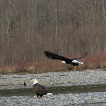
If you're a bird watcher, you may have been here to see the summer birds -- American black swift, Vaux's swift, osprey, spotted sandpiper, Bullock's oriole, and lazuli bunting. Or maybe you've been here for the winter birds -- the bald eagles that are this place's namesake, common goldeneye, Barrow's goldeneye, merganser, and American dipper. (I confess that I'm not much of a birder, but since this place is noted for bird watching, it seems appropriate to give some bird details.) The GPS coordinates point to an interpretive sign about the birds and the Skagit Wild & Scenic River System.
If you're a hobby astronomer (as I am), this place is a pretty sweet spot. There are no lights around, except headlights from vehicles on the highway, and it's possible to find spots where one can hide from the headlights. The sky is nice and dark, because there are no nearby population centers, and mountains block most of the light pollution from more distant cities. Astronomical "seeing" (atmospheric stability) can be very good. The mountains don't obscure the horizon much; the southern horizon is particularly clear. It's easy to find spots to see the sky without trees in the way. Access is very easy, as a highway rest area.
On the other hand, it's not perfect for astronomy. For viewing in some directions, the headlights can be more of a challenge. The altitude is low, and being next to the river can mean fog. The same remoteness that mean dark skies also mean it's quite a trip from where most people live. And the toilets are gone, for now at least.
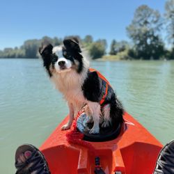
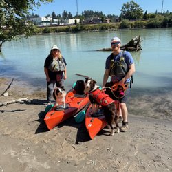
My most recent visit was late August, in the year of the pandemic. It was a daytime stop, to get up and stretch our legs. My boy and I walked along the riverfront to the west end of the area. Just west of the area there's a short road from the highway almost to the river, along the dry creekbed of Sutter Creek. It looks like it was once a boat launch, but as of 2020 it was washed out. The washed out road still makes a good way to get to the edge of the river, where there's a gravel shore that looks like salmon heaven.
Years ago, my wife and I stopped here for astronomy, and it was great. We enjoyed the very dark sky, and wished we had room to pack the telescope. That's a fond memory.
It's not clear what this little park's official name is, or whether it even has one.
- According to text on the Mount Baker Snoqualmie National Forest information sign, it's the "Skagit River Bald Eagle Natural Area".
- According to the Skagit Audubon Society, it's the "Skagit River Bald Eagle Area".
- According to the road sign, it's "Roadside Park - Mile 100".
- According to Google Maps, it's "Rest Area, at Sutter Creek".
- According to Google Plus Code, it's "FFV5+Q8 Rockport, Washington".
- The GPS coordinates are 48.49438° N 121.541625° W.
I'm not sure whether any of those are official, but "Skagit River Roadside Park" describes it accurately, and combines the names on the forest service sign and the highway department sign.
Although the address listed is in Concrete, it's closer to Rockport. It has two entrances, one directly across the highway from Conrad Road, the other about 250 yards east of there. Note where the pin on the map is located.