Palomarin Trailhead Photos


You might also consider

More like Palomarin Trailhead
Recommended Reviews - Palomarin Trailhead
Start your review...


Reviews With Photos


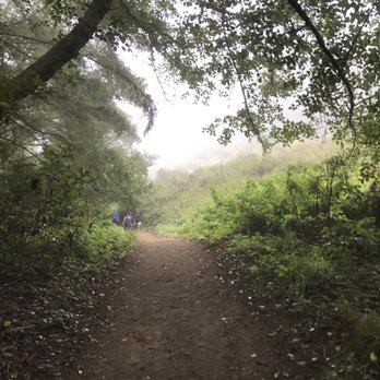
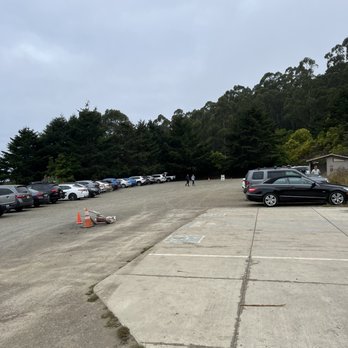
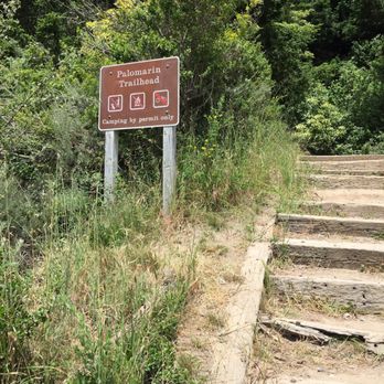
This is what life is truly all about; exploring nature's beauty and all that it has to offer. The Palomarin trail to Alamere Falls is one of those coveted beauties that will make you wish that it was all yours. The drive down Mesa Road to the trailhead will be rough. The roads are badly degraded and covered in potholes. Just when you think that you may have turned into a road leading to nowhere, you'll reach a dead end with a parking lot and probably tons of other parked vehicles depending on the time of day that you arrive. The Palomarin trail begins right near the parking lot. There are a set of steps with a trail marker near the start. Restrooms are only located in the parking lot, so make sure you go before you begin your hike. There are several different connector trails that you can take, with the most popular one leading down to Alamere Falls. If you are planning on hiking to the falls, you should be prepared to hike a little over 8 miles in total roundtrip. Make sure you bring lots of water and snacks as this hike will probably take at least a few hours to complete roundtrip. In the summer, there are parts of the trail that are unshaded, so it's easy to get dehydrated if you don't have enough water. The hike itself is pretty easy. The incline is gradual and you will gain tons of elevation, but the main trail isn't steep at all. The views on the way up the trail are spectacular! You'll be greeted by the most beautiful views of Bass Lake and the Marin coastline. When you are close to the halfway point, you'll pass by an arrow made of rocks on the ground (not sure if it's still there, but the actual trail marker is badly degraded). This is the Alamere Falls trail. Make sure you are paying attention because it is super easy to pass up. It's about 3.5-4 miles in and will be located on your left hand side amongst the brush. The Alamere Falls trail is about a half mile long and isn't well maintained. The trail is narrow and filled with poison ivy. I would recommend wearing long sleeves at least for this portion, especially if you are allergic. Once you get closer to the falls, you'll have to scale down some very steep rocks. This is probably the most difficult part of the hike. Upper body strength will really play a major roll here as you will have to depend on your hands and legs to help you get down safely. Hiking shoes or sturdy tennis shoes are highly recommended. The first steep rock climb down will take you to the first 3 Falls. The second even steeper rock climb will take you to the biggest waterfall and will lead you right onto Palomarin Beach. And that will be your reward! Soaking in the gorgeous views of Alamere Falls and the secluded Palomarin Beach. This is by far one of the most enjoyable hikes that I've ever done in Marin! And the stunning views of Alamere Falls makes it all worth while.
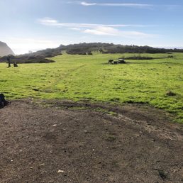

This is possibly my favorite hiking trail. It's challenging but not bad, all the hills are rolling ups and downs rather than long steep stretches. The beach gets pretty cold and windy (not surprising for Northern California) so pack some layers. I've seen both a mountain lion and a fox on the trail different times that I've hiked. Weekends can get obnoxiously crowded, so definitely go midweek if possible!


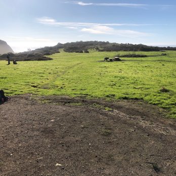
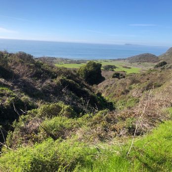
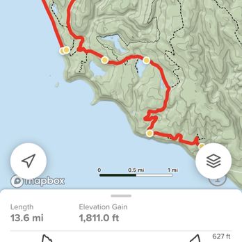
What a beautiful hike along the Point Reyes coastline. Waterfalls to the ocean are rare as it is in California, especially with climate change and drought. So, this is a must on any one's hiking list in Cali. The one in Big Sur is cool, but not accessible, Alamere falls is, just be ready for a moderate hike along the coastline. No redwoods here, more reminiscent of the far north Cali, or Oregon or maybe San Juan island, lots of fir trees. Unfortunately, like most of the Bay Area, poison oak is definitely present. Pretty moderate trail throughout, for some reason it seemed more uphill coming back, as it's a there and back trail. If I do it again, I'll probably take the beach route again to the falls, the take the trail above the falls, back to the coast trail. Be aware! It's 7 miles in, just to get to the falls. This is a very popular trail, so come early, parking fills up fast and by the time I was done was stretching down the road. Lots of amazing views of the coast line, extending up to Bodega bay and down Point Reyes. Lots of fishing boats up n down the coast. The beach was nice, it's a trek to the falls, once you get to the beach, but you can see it on the distance. Quite a few good views of the farallon islands, even with the high fog most the morning. Definitely a worth while hike to do, just remember, it's going to be 13-14 mile hike. The views and lakes and waterfalls were all pretty amazing. Definitely a hike ya want to do, in the Bay Area. Even though there was lots of cars in the parking lot, the trails weren't crowded. Everyone seemed to be enjoying the day and hike. So... Always willing to go the extra mile, happy hiking, God bless, and cheers!


Took this trail to hike to Alamere falls! It's super chill and the breeze was nice, since we were walking mostly along the coast. Be sure to wear longs sleeves and long pants because there are lots of plant things poking at you at various points in the hike. Also, people have told me that there's poison ivy here, so be careful!
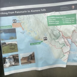

Best hike in the Bay Area. No dogs. We started at 9:15AM at the trailhead and got back at 4pm. We also spent about 1.5 hours enjoying the scenery and lunch at the beach.


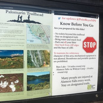
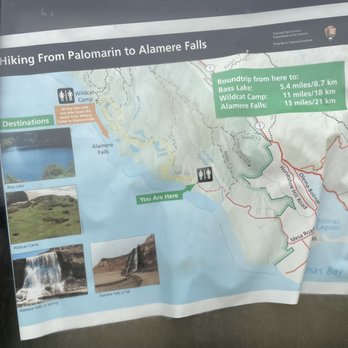
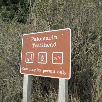
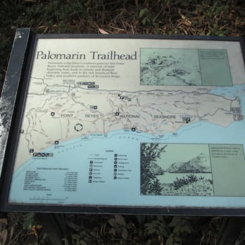
Initial Tips: 1. Pack lots of water/ pack some snacks for hike if you are going to the falls 2. The road to the parking lot is very rocky, make sure your car has the proper tires as it it quite rough and my tires were damaged quite a lot from the rough unpaved roads. 3. Bring long sleeves and do not wear shorts as there is a lot of poison oak, it is even displayed at the trailhead stairways leading to the start of the trail. 4. Bring a camelpack or a small backpack as traversing down the cliff with a bulky backpack is troublesome. 5. Check the weather as roads leading to the trailhead my be flooded or a heavy rain/storm may cause some of the trails to be flooded/muddy. Overview: I would give this 3 to 3.5 stars due to the fact that getting to the trailhead is quite a bit of work (from a driving standpoint). The drive to this trailhead is rough on your car and also rough on the driver as there are a lot of twists and turns (be sure you have sufficient sleep and eat a good breakfast!). The GPS signal is quite weak to non-existent. I would recommend not relying on just your phone's GPS as service is limited (So either rely on your Car's GPS navigation or pack a portable one). While driving on the rocky road, be sure to drive on the side as there are a lot of pot holes on the ground (pot holes have sharp rocks!). Parking: There is a small parking lot prior to getting to the main parking lot at the trailhead. If you are there after 9am or 10am, it is best to just park at the small parking lot and walk towards the main trailhead parking lot. It takes about 5 to 10 mins to walk. A lot of people park on the side of the road if parking is full but their car's suspensions are leaning towards the side of the road and that is bad on your car! At the trailhead, be sure to take a picture of the trail map. There is a bathroom at the trailhead and also a recycling/trash can. Be sure to empty your trash at this trashcan on your way back from a hike. No matter which hike you decide to do, getting to this trailhead has its struggles, but the hike and scenery will be worth it! So persevere!


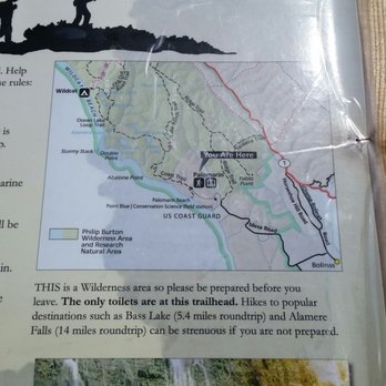
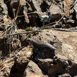
This is the hike to make if you enjoy hiking, and beaching it up along the coast. Ive made this hike/journey twice now, both in the heat/light of all gods, and now in the winter time under clouds that spit rain at us periodically, through mud, and eventually darkness as we made it back to the car. This is what Id call an intermediate hike. The Palomarin trail is in the Point Reyes peninsula area and is about a 12 mile hike there and back depending on what trails you take. The drive up to the trail is scenic, a bit tedious with all the bikers on the narrow roads, its easy to miss and there is almost no reception whatsoever in the area. This is not a hike for those that really just like to walk. You will use your leg muscles, breathing techniques on the inclines if youre like me and enjoy eating and drinking while hiking :) the trail takes you in and out of the woods, along the cliffs and through what appears to be a marsh like area. Most people hike here to see the bad ass waterfalls that come from high up somewhere that the water never seems to end. There are actually several waterfalls that fall into one another leading down to the beach and running into the ocean. The end result of the hike if you choose is Wildcat beach...the beach is bad ass during the summer time with extra smooth/clean sand and it looks and feels endless. We just visited this december and there was a high surf advisory and the beach was washed out! We still enjoyed the hike and it was still bad ass. There is of course the great clean smell of ocean meets forest and sand. There were alot of salamanders out on the trail when I went during the rainy season so beware. Ive seen so many different animals here from lizzards, deer, wild cats, and most recently what appeared be be a small fox. Do it and enjoy it! 5 cheers for the Palomarin Trail!!!!! I will the trail again in 2016.


We did the Alamere Falls hike, via Palomarin. I believe it is just shy of about 8 miles, not at ALL a hard hike. The BEAUTY of this hike is hard to put in words, so you do need to take photos. My camera gave up, just as we reached our elevation destination, then it was down to the beach and taking in some lunch. I am part of an active hiking club, and this gem is one of my favorites (gets your legs ready for the bigger hikes that are closer to 20 miles RT.) I will be training for a half marathon this fall, so THIS trek is on my to-do list (scheduled) for TWO trips before my 1/2 marathon. My HUBBY is NOT a hiker, and I sure the heck wouldn't expect someone to do stuff they don't like to do (who does that?) THIS hike is so much fun for our group, it takes me an hour to debrief my better half when I return. LOVE THIS HIKE!


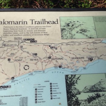
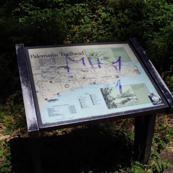
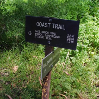
Scenery: Forest, Coast, Lake, Beach, Waterfall Difficulty: Easy Distance: 4.2 miles one way Elevation Gain: Duration: 8.4 miles round trip Route Type: Out & Back Good for Kids: Palomarin Trail: Yes Coast Trail: Yes Alamere Trail: Would not recommend for little kids (lots of poison oak, steep climb down to the falls) Strollers: Some parts of the trail yes, but would not recommend Bikes: No Dogs: No Parking Fee: Tip: Directions on Yelp are correct. This Trailhead will lead you to Alamere Falls. After a few minutes of walking on the trail, you will see an information map and then a sign. Do not make a left towards the Palomarin Beach Trail. Continue to go straight towards the Coast Trail. You will then pass a picnic table and will see amazing views of the coastline. Soon after, you will reach the first of two wooden bridges. The first bridge is out in the open with the hills as its backdrop. The second bridge is covered with shade from the trees above it. Continue hiking and you will eventually reach a trail surrounded with trees that it looks as if you are walking through a tunnel, trying to reach the light at the end. Next, you will continue on a rocky trail and then come upon a split. Do not go towards the Lake Ranch Trail. Stay on the Coast Trail. You will soon pass Bass Lake and the wooden Portable Water container to your right. There is also a fallen tree on the trail, who knows how long that has been there? Watch where you step because we saw lots of horse poop too. You will then see another sign that says Coast Trail, continue on with the trail. Next, you will see the second lake, Pelican Lake. Eventually, you will come across another sign. It's easy to miss so be on the lookout. It will be on your left side. Alamere Falls Trail. Yay! We made it and now it's the home stretch!! This is a jungle like narrow trail full of poison oak so take caution. Finally, you hear the falls and you see the ocean. Relax and take a deep breath because this is not the end of your adventure. You will need to climb down a short climb on rocks. I used both my hands and feet to feel more stable. When you reach the bottom, you will see small waterfalls leading to the main waterfall. To get to the mail waterfall, you will need to continue the adventure and climb down yet another short and very steep climb on rocks. The rocks here are loose and crumbly like. I scraped my leg because I slipped so be careful! LASTLY, we reached the end of our adventure. We both sat on the beach and enjoyed the view. I felt at peace as I sat there trying to let it all sink in. It's not everyday I get to see this beautiful waterfall tumbling over a cliff, it's waters racing towards the ocean.


Beautiful seaside views off of Point Reyes' southern shores and the trail to get to Alamere Falls. Don't forget to stop by Bolinas, the quirky, artsy, hippie community on your way to/from this trail. The trail, at least the parts that we hiked, were not very difficult and the views were spectacular. It is unfortunate that you cannot take mountain bikes on these trails, as it would be great for bikes. I went here with my six-year-old son, but was unable to make it to Alamere falls due to my son's fatigue. Oh well. I look forward to returning and visiting the falls in the future. The trail starts at the Palomarin Trailhead. The whole hike is pretty flat so it is an easy hike. The first part of the Hike is high along cliffs that drop down to the ocean. After about a mile the Trail will cut inland passing two small lakes (Bass Lake and Pelican Lake). Bass Lake has a trail leading down to so taking a swim here is a option, while Pelican Lake does not have a trail leading to it. This is one of the nicest parts of the trip as it is wooded and rich with vegetation. After 3.6 miles you will reach the Alamere Falls Trail. This trail is very poorly maintained so it will probably be a little overgrown. Watch out for Poison Oak as there is some along the trail. After a short time on that trail you will reach a series of small but awesome waterfalls. If you go towards the right while facing the ocean along the cliff you will see a very steep area with lots of lose rocks you can climb down to the beach and see the lower fall which is my favorite part of the trip. Be very careful when climbing down. Tips: Forks in the road: 1) Shortly after two miles into the trip is the first fork in the road make sure to stay left. 2) Around 3.6 miles will be the second major fork in the trail splitting three ways. Take the trail straight towards Alamere Falls.


Awesome, except on the hottest weekends, when you might find more peace and quiet in areas of Point Reyes. Previously, this trailhead featured two main attractions: - Bass Lake's Ropeswing - Alamere Falls However, the ropeswing is no more, since the ~70 foot tall tree supporting it fell into the lake, taking part of bluff with it. Alamere falls are pretty and have beach access, but the trailhead there and back is a single in and out path, so the only variety is from the changing light around sunset. Don't get me wrong, the sunsets here are beautiful, but they're beautiful anywhere in Point Reyes and if you're looking for more of an adventure maze to explore, this trailhead isn't it. Bass Lake is still swimmable, but it's less fun without the rope swing.


This is such a lovely place for a beginner hike. 4.2 miles each way and it takes about 3 hours + the amount of time you choose to spend at the beach. Getting here is a bit tricky. You drive through Marin on CA1. Pass the Bolinas's marshes. You will see the Olemas-Bolinas intersection. Go straight and then turn left on Horsetrack Trail. Note: this left turn is easy to miss, so keep a look out for this after the marshes on your left. Drive about 3 miles on this road and you find a stop sign at a T-junction of Mesa Rd. Take a right here. Keep driving on this road till changes to a dirt trail. This then ends in a dead end and that is the Palomarin trail head. There are trash cans and restrooms right at the start. The restrooms can be given a miss unless it is really necessary :P. This hike is pretty level. It has short climbs and dips along the sea and through the forests. Take the Wild Cat trail which will take you down to the Alamere falls. You will hike past 2 lakes - Bass lake and then quickly followed by the Pelican lake. After the Pelican lake the trail gets really narrow and you need to hike through a lot of wild foliage. Keep a lookout for a sign that reads Alamere falls to your left. This path has poison oak on the right side (lookout for those oily slick leaves). You then have a scramble down to get to the top of a 3 tiered falls on the Alamere creek. And then one more scramble over loose gravel and rocks down to the beach to see the falls join the sea. You then go back the way you came in. So the climb up the scramble is a lot easier than the climb down. The view from the beach is breathtaking....


This hike has it all. Sure it is tough to get to. 45 min out of the city through curling roads and sometimes silly Stinson Beach traffic. However, once you're beyond SB it is smooth sailing. The dirt road for the last mile is a wonderful transition from your old world and a day of relaxation. There usually is plenty of parking too! The bathrooms are infinitely better than Muir Beach. The trail has several off shoots but I like the long one to Alemeria Falls. It is the perfect distance (about 5.5 miles out). The route offers everchanging scenery to make the hour + trip out so enjoyable. You are treated to eucalytpus forests, stark coast paths, firs, dense covered paths, several beautiful swimable lakes, coastal brush, and lastly, waterfalls into the ocean. Add to that I've seen deer, seals, snakes and numerous birds. Pack a lunch or a snack for a small stop at the end. Remember that its 1 hour + and about 30 minutes driving before reaching the throngs of people in Stinson Beach. I've made that mistake before and was about to eat my fist. All in all. Its about 11 miles and takes 2 hours 45 minutes of hiking. There is some very minor rock climbing at the end only if you want to head down tho the beach for the best view of the waterfall. It is quite a find and even when the parking lot is full you'll have plenty of solitary time out and about.


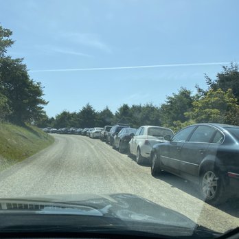
We decided to go up to Alamere Falls this Saturday morning. Parking lot was not that full yet at 8am, maybe about 8-10 cars. There are lots of parking at this trail but by afternoon, good luck!! I would definitely come here super early to beat the crowd like we did! The road going here is very zigzag roads and some may get sick. Also, the road is very narrow and lots of loose gravel and lots of potholes so drive with caution. The trails are very well maintained. Lots of people traffic though. We got there early so there was barely anyone there but by the time we started going back, I stopped counting after a hundred people! Very popular trail as everyone wanted to go to Alamere Beach Waterfalls! We didn't go to the campgrounds as it was too far. Just going to Alamere Falls and back was already over eight miles! Alamere trails is another different review! I really enjoyed this trail as it goes along the coast and see the ocean views! Just beware there is a lot of poison oak! I saw a lot along the trail! It's part shade so wear a hat. Some parts of the trails goes up and down and lots of loose rocks so you can sleep. I would rate this trail moderate to hard as it's a long trail! Good workout!! I totally enjoyed this trail but recommend to come really early if you come on the weekend!! [31st R] read more


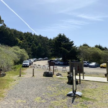
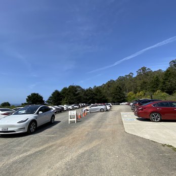


Can I go back to last Thursday when I hiked this trail?! I couldn't have asked for better weather, sunny, light breeze, mid-70s, and best of all, pretty empty! I'm not sure how anyone can find this place because there are no marked signs or paved roads to get to the parking lot or base of the trail. As a passenger, I was oblivious to driving directions. I must say that all the twists and turns left me a bit car-sick and thankfully that quickly passed. There are about 4 restroom stalls in the parking lot that stunk badly. Now onto the positive aspects of Palomarin. Many reviewers have mentioned that this trail to the falls is about 8 miles round-trip. I think I finished in about 4.5 hours with stops here and there at a leisurely pace. I bet the sunset would have been beautiful, but I left around 6:30pm. What I love about this hike is that there's a little of everything in terms of views and things to see. I saw the ocean, a lake, a fox, waterfalls, nature, and fresh air. I wonder if the waterfalls are always flowing, even a few years ago during the drought... A great pit-stop before coming to Palomarin is to stop in Stinson Beach for lunch or dinner. I'm glad lunch was eaten before the hike. Next time I'll bring snacks. Luckily I had brought lots of water. Still having Palomarin withdraws... #53/2018 read more
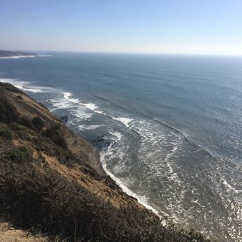


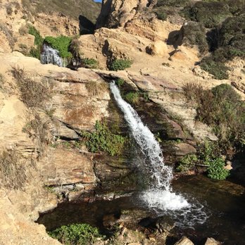


This is what life is truly all about; exploring nature's beauty and all that it has to offer. The Palomarin trail to Alamere Falls is one of those coveted beauties that will make you wish that it was all yours. The drive down Mesa Road to the trailhead will be rough. The roads are badly degraded and covered in potholes. Just when you think that you may have turned into a road leading to nowhere, you'll reach a dead end with a parking lot and probably tons of other parked vehicles depending on the time of day that you arrive. The Palomarin trail begins right near the parking lot. There are a set of steps with a trail marker near the start. Restrooms are only located in the parking lot, so make sure you go before you begin your hike. There are several different connector trails that you can take, with the most popular one leading down to Alamere Falls. If you are planning on hiking to the falls, you should be prepared to hike a little over 8 miles in total roundtrip. Make sure you bring lots of water and snacks as this hike will probably take at least a few hours to complete roundtrip. In the summer, there are parts of the trail that are unshaded, so it's easy to get dehydrated if you don't have enough water. The hike itself is pretty easy. The incline is gradual and you will gain tons of elevation, but the main trail isn't steep at all. The views on the way up the trail are spectacular! You'll be greeted by the most beautiful views of Bass Lake and the Marin coastline. When you are close to the halfway point, you'll pass by an arrow made of rocks on the ground (not sure if it's still there, but the actual trail marker is badly degraded). This is the Alamere Falls trail. Make sure you are paying attention because it is super easy to pass up. It's about 3.5-4 miles in and will be located on your left hand side amongst the brush. The Alamere Falls trail is about a half mile long and isn't well maintained. The trail is narrow and filled with poison ivy. I would recommend wearing long sleeves at least for this portion, especially if you are allergic. Once you get closer to the falls, you'll have to scale down some very steep rocks. This is probably the most difficult part of the hike. Upper body strength will really play a major roll here as you will have to depend on your hands and legs to help you get down safely. Hiking shoes or sturdy tennis shoes are highly recommended. The first steep rock climb down will take you to the first 3 Falls. The second even steeper rock climb will take you to the biggest waterfall and will lead you right onto Palomarin Beach. And that will be your reward! Soaking in the gorgeous views of Alamere Falls and the secluded Palomarin Beach. This is by far one of the most enjoyable hikes that I've ever done in Marin! And the stunning views of Alamere Falls makes it all worth while. read more




6 years ago
This is possibly my favorite hiking trail. It's challenging but not bad, all the hills are rolling ups and downs rather than long steep stretches. The beach gets pretty cold and windy (not surprising for Northern California) so pack some layers. I've seen both a mountain lion and a fox on the trail different times that I've hiked. Weekends can get obnoxiously crowded, so definitely go midweek if possible! read more


What a beautiful hike along the Point Reyes coastline. Waterfalls to the ocean are rare as it is in California, especially with climate change and drought. So, this is a must on any one's hiking list in Cali. The one in Big Sur is cool, but not accessible, Alamere falls is, just be ready for a moderate hike along the coastline. No redwoods here, more reminiscent of the far north Cali, or Oregon or maybe San Juan island, lots of fir trees. Unfortunately, like most of the Bay Area, poison oak is definitely present. Pretty moderate trail throughout, for some reason it seemed more uphill coming back, as it's a there and back trail. If I do it again, I'll probably take the beach route again to the falls, the take the trail above the falls, back to the coast trail. Be aware! It's 7 miles in, just to get to the falls. This is a very popular trail, so come early, parking fills up fast and by the time I was done was stretching down the road. Lots of amazing views of the coast line, extending up to Bodega bay and down Point Reyes. Lots of fishing boats up n down the coast. The beach was nice, it's a trek to the falls, once you get to the beach, but you can see it on the distance. Quite a few good views of the farallon islands, even with the high fog most the morning. Definitely a worth while hike to do, just remember, it's going to be 13-14 mile hike. The views and lakes and waterfalls were all pretty amazing. Definitely a hike ya want to do, in the Bay Area. Even though there was lots of cars in the parking lot, the trails weren't crowded. Everyone seemed to be enjoying the day and hike. So... Always willing to go the extra mile, happy hiking, God bless, and cheers! read more




8 years ago
Took this trail to hike to Alamere falls! It's super chill and the breeze was nice, since we were walking mostly along the coast. Be sure to wear longs sleeves and long pants because there are lots of plant things poking at you at various points in the hike. Also, people have told me that there's poison ivy here, so be careful! read more






10 years ago
Initial Tips: 1. Pack lots of water/ pack some snacks for hike if you are going to the falls 2. The road to the parking lot is very rocky, make sure your car has the proper tires as it it quite rough and my tires were damaged quite a lot from the rough unpaved roads. 3. Bring long sleeves and do not wear shorts as there is a lot of poison oak, it is even displayed at the trailhead stairways leading to the start of the trail. 4. Bring a camelpack or a small backpack as traversing down the cliff with a bulky backpack is troublesome. 5. Check the weather as roads leading to the trailhead my be flooded or a heavy rain/storm may cause some of the trails to be flooded/muddy. Overview: I would give this 3 to 3.5 stars due to the fact that getting to the trailhead is quite a bit of work (from a driving standpoint). The drive to this trailhead is rough on your car and also rough on the driver as there are a lot of twists and turns (be sure you have sufficient sleep and eat a good breakfast!). The GPS signal is quite weak to non-existent. I would recommend not relying on just your phone's GPS as service is limited (So either rely on your Car's GPS navigation or pack a portable one). While driving on the rocky road, be sure to drive on the side as there are a lot of pot holes on the ground (pot holes have sharp rocks!). Parking: There is a small parking lot prior to getting to the main parking lot at the trailhead. If you are there after 9am or 10am, it is best to just park at the small parking lot and walk towards the main trailhead parking lot. It takes about 5 to 10 mins to walk. A lot of people park on the side of the road if parking is full but their car's suspensions are leaning towards the side of the road and that is bad on your car! At the trailhead, be sure to take a picture of the trail map. There is a bathroom at the trailhead and also a recycling/trash can. Be sure to empty your trash at this trashcan on your way back from a hike. No matter which hike you decide to do, getting to this trailhead has its struggles, but the hike and scenery will be worth it! So persevere! read more




This is the hike to make if you enjoy hiking, and beaching it up along the coast. Ive made this hike/journey twice now, both in the heat/light of all gods, and now in the winter time under clouds that spit rain at us periodically, through mud, and eventually darkness as we made it back to the car. This is what Id call an intermediate hike. The Palomarin trail is in the Point Reyes peninsula area and is about a 12 mile hike there and back depending on what trails you take. The drive up to the trail is scenic, a bit tedious with all the bikers on the narrow roads, its easy to miss and there is almost no reception whatsoever in the area. This is not a hike for those that really just like to walk. You will use your leg muscles, breathing techniques on the inclines if youre like me and enjoy eating and drinking while hiking :) the trail takes you in and out of the woods, along the cliffs and through what appears to be a marsh like area. Most people hike here to see the bad ass waterfalls that come from high up somewhere that the water never seems to end. There are actually several waterfalls that fall into one another leading down to the beach and running into the ocean. The end result of the hike if you choose is Wildcat beach...the beach is bad ass during the summer time with extra smooth/clean sand and it looks and feels endless. We just visited this december and there was a high surf advisory and the beach was washed out! We still enjoyed the hike and it was still bad ass. There is of course the great clean smell of ocean meets forest and sand. There were alot of salamanders out on the trail when I went during the rainy season so beware. Ive seen so many different animals here from lizzards, deer, wild cats, and most recently what appeared be be a small fox. Do it and enjoy it! 5 cheers for the Palomarin Trail!!!!! I will the trail again in 2016. read more


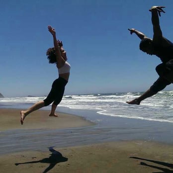


We did the Alamere Falls hike, via Palomarin. I believe it is just shy of about 8 miles, not at ALL a hard hike. The BEAUTY of this hike is hard to put in words, so you do need to take photos. My camera gave up, just as we reached our elevation destination, then it was down to the beach and taking in some lunch. I am part of an active hiking club, and this gem is one of my favorites (gets your legs ready for the bigger hikes that are closer to 20 miles RT.) I will be training for a half marathon this fall, so THIS trek is on my to-do list (scheduled) for TWO trips before my 1/2 marathon. My HUBBY is NOT a hiker, and I sure the heck wouldn't expect someone to do stuff they don't like to do (who does that?) THIS hike is so much fun for our group, it takes me an hour to debrief my better half when I return. LOVE THIS HIKE! read more




12 years ago
Scenery: Forest, Coast, Lake, Beach, Waterfall Difficulty: Easy Distance: 4.2 miles one way Elevation Gain: Duration: 8.4 miles round trip Route Type: Out & Back Good for Kids: Palomarin Trail: Yes Coast Trail: Yes Alamere Trail: Would not recommend for little kids (lots of poison oak, steep climb down to the falls) Strollers: Some parts of the trail yes, but would not recommend Bikes: No Dogs: No Parking Fee: Tip: Directions on Yelp are correct. This Trailhead will lead you to Alamere Falls. After a few minutes of walking on the trail, you will see an information map and then a sign. Do not make a left towards the Palomarin Beach Trail. Continue to go straight towards the Coast Trail. You will then pass a picnic table and will see amazing views of the coastline. Soon after, you will reach the first of two wooden bridges. The first bridge is out in the open with the hills as its backdrop. The second bridge is covered with shade from the trees above it. Continue hiking and you will eventually reach a trail surrounded with trees that it looks as if you are walking through a tunnel, trying to reach the light at the end. Next, you will continue on a rocky trail and then come upon a split. Do not go towards the Lake Ranch Trail. Stay on the Coast Trail. You will soon pass Bass Lake and the wooden Portable Water container to your right. There is also a fallen tree on the trail, who knows how long that has been there? Watch where you step because we saw lots of horse poop too. You will then see another sign that says Coast Trail, continue on with the trail. Next, you will see the second lake, Pelican Lake. Eventually, you will come across another sign. It's easy to miss so be on the lookout. It will be on your left side. Alamere Falls Trail. Yay! We made it and now it's the home stretch!! This is a jungle like narrow trail full of poison oak so take caution. Finally, you hear the falls and you see the ocean. Relax and take a deep breath because this is not the end of your adventure. You will need to climb down a short climb on rocks. I used both my hands and feet to feel more stable. When you reach the bottom, you will see small waterfalls leading to the main waterfall. To get to the mail waterfall, you will need to continue the adventure and climb down yet another short and very steep climb on rocks. The rocks here are loose and crumbly like. I scraped my leg because I slipped so be careful! LASTLY, we reached the end of our adventure. We both sat on the beach and enjoyed the view. I felt at peace as I sat there trying to let it all sink in. It's not everyday I get to see this beautiful waterfall tumbling over a cliff, it's waters racing towards the ocean. read more



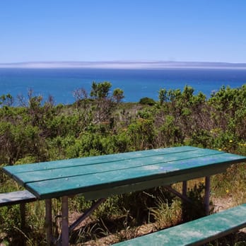

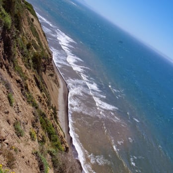


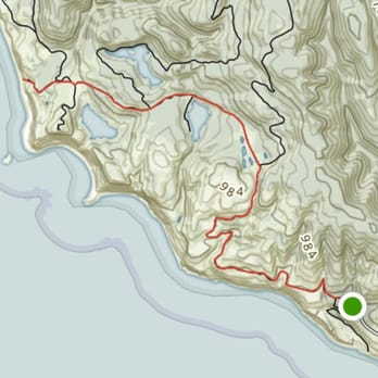
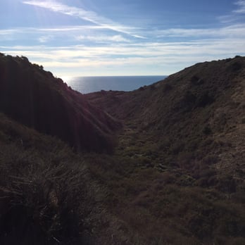
Beautiful seaside views off of Point Reyes' southern shores and the trail to get to Alamere Falls. Don't forget to stop by Bolinas, the quirky, artsy, hippie community on your way to/from this trail. The trail, at least the parts that we hiked, were not very difficult and the views were spectacular. It is unfortunate that you cannot take mountain bikes on these trails, as it would be great for bikes. I went here with my six-year-old son, but was unable to make it to Alamere falls due to my son's fatigue. Oh well. I look forward to returning and visiting the falls in the future. The trail starts at the Palomarin Trailhead. The whole hike is pretty flat so it is an easy hike. The first part of the Hike is high along cliffs that drop down to the ocean. After about a mile the Trail will cut inland passing two small lakes (Bass Lake and Pelican Lake). Bass Lake has a trail leading down to so taking a swim here is a option, while Pelican Lake does not have a trail leading to it. This is one of the nicest parts of the trip as it is wooded and rich with vegetation. After 3.6 miles you will reach the Alamere Falls Trail. This trail is very poorly maintained so it will probably be a little overgrown. Watch out for Poison Oak as there is some along the trail. After a short time on that trail you will reach a series of small but awesome waterfalls. If you go towards the right while facing the ocean along the cliff you will see a very steep area with lots of lose rocks you can climb down to the beach and see the lower fall which is my favorite part of the trip. Be very careful when climbing down. Tips: Forks in the road: 1) Shortly after two miles into the trip is the first fork in the road make sure to stay left. 2) Around 3.6 miles will be the second major fork in the trail splitting three ways. Take the trail straight towards Alamere Falls. read more





9 years ago
Awesome, except on the hottest weekends, when you might find more peace and quiet in areas of Point Reyes. Previously, this trailhead featured two main attractions: - Bass Lake's Ropeswing - Alamere Falls However, the ropeswing is no more, since the ~70 foot tall tree supporting it fell into the lake, taking part of bluff with it. Alamere falls are pretty and have beach access, but the trailhead there and back is a single in and out path, so the only variety is from the changing light around sunset. Don't get me wrong, the sunsets here are beautiful, but they're beautiful anywhere in Point Reyes and if you're looking for more of an adventure maze to explore, this trailhead isn't it. Bass Lake is still swimmable, but it's less fun without the rope swing. read more


12 years ago
This is such a lovely place for a beginner hike. 4.2 miles each way and it takes about 3 hours + the amount of time you choose to spend at the beach. Getting here is a bit tricky. You drive through Marin on CA1. Pass the Bolinas's marshes. You will see the Olemas-Bolinas intersection. Go straight and then turn left on Horsetrack Trail. Note: this left turn is easy to miss, so keep a look out for this after the marshes on your left. Drive about 3 miles on this road and you find a stop sign at a T-junction of Mesa Rd. Take a right here. Keep driving on this road till changes to a dirt trail. This then ends in a dead end and that is the Palomarin trail head. There are trash cans and restrooms right at the start. The restrooms can be given a miss unless it is really necessary :P. This hike is pretty level. It has short climbs and dips along the sea and through the forests. Take the Wild Cat trail which will take you down to the Alamere falls. You will hike past 2 lakes - Bass lake and then quickly followed by the Pelican lake. After the Pelican lake the trail gets really narrow and you need to hike through a lot of wild foliage. Keep a lookout for a sign that reads Alamere falls to your left. This path has poison oak on the right side (lookout for those oily slick leaves). You then have a scramble down to get to the top of a 3 tiered falls on the Alamere creek. And then one more scramble over loose gravel and rocks down to the beach to see the falls join the sea. You then go back the way you came in. So the climb up the scramble is a lot easier than the climb down. The view from the beach is breathtaking.... read more


This hike has it all. Sure it is tough to get to. 45 min out of the city through curling roads and sometimes silly Stinson Beach traffic. However, once you're beyond SB it is smooth sailing. The dirt road for the last mile is a wonderful transition from your old world and a day of relaxation. There usually is plenty of parking too! The bathrooms are infinitely better than Muir Beach. The trail has several off shoots but I like the long one to Alemeria Falls. It is the perfect distance (about 5.5 miles out). The route offers everchanging scenery to make the hour + trip out so enjoyable. You are treated to eucalytpus forests, stark coast paths, firs, dense covered paths, several beautiful swimable lakes, coastal brush, and lastly, waterfalls into the ocean. Add to that I've seen deer, seals, snakes and numerous birds. Pack a lunch or a snack for a small stop at the end. Remember that its 1 hour + and about 30 minutes driving before reaching the throngs of people in Stinson Beach. I've made that mistake before and was about to eat my fist. All in all. Its about 11 miles and takes 2 hours 45 minutes of hiking. There is some very minor rock climbing at the end only if you want to head down tho the beach for the best view of the waterfall. It is quite a find and even when the parking lot is full you'll have plenty of solitary time out and about. read more


15 years ago
If you like a good mix of eagle-eye coastal views and forest surroundings, then you'll like Palomarin. The trail is mostly dirt-packed, with varying degrees of rockiness. It gets crazy uneven at times, so it's a job for your toughest hiking shoes. At this time of year, if you want to get down to Alamere Falls and back before sunset, it's best to arrive at the Palomarin trail head no later than 1 PM. At a little under 4 miles each way, the total hike time is around 4 hours. A few annoyances to be aware of: you'll bump into quite a few hikers (loud and chatty ones, too), especially on the weekend. Maybe an equestrian or two. (Animal droppings, including horse poop, is a common sight.) Also, the buzzing of gnats and flies is pretty much constant. If none of those are big issues for you, then you're good to go! You'll find the start of the trail at the very end of Mesa Road, where you'll find a sizable parking lot. It has bathrooms but no potable water, as far as I could tell. (Note: Mesa is an unpaved gravel road, but there are worn tire tracks that you can follow to minimize its adverse effect on your car.) After you climb the steps at the trail head, just keep following the main trail (Coast trail). Along the way, you'll see signs for Lake Ranch trail, Alamere Falls trail, etc. If you're planning on going down to the beach to get the full view of Alamere Falls, please be ultra-careful. The path (which is less of a path and more of a death trap) that leads from the cliff to the beach is basically a steep-angled pile of slippery rock shards. I count myself lucky that I managed not to fall and break my neck. Basically, on your way down, stay in a low crouch so you can shuffle-slide more safely using your feet and butt. And on your way back up, stay towards the right since the jagged, flaking rock wall is the only thing that can (barely) provide handholds, with which you can haul yourself up inch by inch. Also, try keeping your body pitched forwards and close to the rocks. For more nitty-gritty details on Palomarin, including how to navigate your way to and around Alamere Falls, follow this review: http://www.bahiker.com/northbayhikes/palomarin.html read more




6 years ago

14 years ago
Wooo!!! What a view! This place is not just any ordinary forest hike. If you're a fan of the ocean and like viewing it from higher elevations. This is the trail to endure. The pacific overlook is simply amazing. The hike is not as strenuous as you may think. There is no rocks to climb up or down unless you are going to see the waterfall. Bring food, fruit, and water! Stay hydrated and go early. This hike is pretty long as you have to walk around the mountain side and a lake before reaching any destination. The reward awaits as you reach Alamere Falls. Trust me, your jaw will drop! read more


This is a nice hiking trail in Bolinas, Marin County. There's a decent sized parking lot. This trail starts off with views of Pacific Ocean. There's view of the ocean along the way. There's Bass Lake where you can take a swim. This hike will lead you to Alamere Falls. I really enjoyed this hike. read more


13 years ago
same place as this http://www.yelp.com/biz/alamere-falls-bolinas directions from SF: http://goo.gl/maps/JS6Wp estimate at least 1 hour drive. 90% of the time on the 1 is smooth smooth road 10% is dirt/gravel. 75% is windy road 25% is easy and managable guide/review: if you do not hike often this is at a moderate difficulty. lots of up and downs so be prepared to hike some hills, 4.2 mile 1 way, 8.4 miles round trip. The trail itself, lots of shade and wonderful coastal breeze, 2 lakes and estimate at least 3 hours to hike to, play, and return. CLIMBING INVOLVED AT THE WATERFALL. yes i said it, once you reach the falls, you will need to CLIMB rocks to get down to the beach. climb is not strenous but can be tricky do to slippery/broken rocks. there are 3 waterfalls, 2 pools. bring a camera wow factor is very high Guide: trailhead http://is.gd/KV9Jhi hike about 500 ft to the map http://is.gd/XN9iiI hike 2.2 miles in and meet the sign http://is.gd/gFrEIZ continue hiking and get to the 3.1 mile sign http://is.gd/Wpp1oJ once you reach here, that is a total of 3.8 miles. http://is.gd/onOMtY then 1st waterfall at the top which you need to kinda climb too http://is.gd/GPZN4s then you walk around the plateau area to see the 2nd waterfall http://is.gd/9fFqQQ if you are to face this waterfall, behind you would be the ocean and the top of the main fall now if you are facing the ocean, go to your right and you have to start climbing down this to get to the beach http://is.gd/2QGN0E once down you can run over to the waterfall http://is.gd/aj9SzL read more


13 miles of the beautiful West Coast :) Recommend to start hike early to avoid the high tide and difficulty with parking later on during the day! I would say this is one of my favorite hikes in the West Coast. The coastal view is breathtaking and there is a gorgeous waterfall waiting at the end of the hike. I watched the prettiest sunset on the hike back. Tips: - Get to hike by 10am AT THE LATEST. There is a parking lot at the beginning of the Palomarin Trail but it was full by 10am. People who got there later had to park along the paved road, some as far as 2 miles away from the start of the trail. - Be careful of poison oaks!!! They are all along the trail; consider wearing long pants - 2.5-3 miles into the hike, you'll see a sign for Alamere Falls Trail/unmaintained trail. That'll lead you directly to Alamere Fall (saving about 1.5-2 miles of hike), but the hike is very vertical and dangerous; - If you decide to continue on the Palomarin trail, you'll come across a fork for the Coast Trail or the Ocean Lake Loop. Ocean Lake Loop is more scenic but has more elevation changes; Coast Trail is less scenic but easier to hike; they are both about the same distance; - Ocean Lake Loop and Coast Trail both will take you to beach. From there it's another 1 mile walk to the Alamere waterfall. The tide on the beach gets close to the cliff around 2pm (in February) and walking across the beach during high tide becomes REALLY DANGEROUS because the strong wave can SWEEP YOU AWAY. This is why it's important to get to the camp ground by around 12pm; - Bring at least 2 liters of water; 1 liter each way; - Sunset on the way back (on Palomarin trail) is one of the most beautiful things to see; - You get no signals anywhere near the area; - If you come on a warm day you can swim in the Bass Lake! read more



We did this hike yesterday. We were a group of five and did this hike starting at 10:30 am on a Thursday we finished our hike at 3:15 pm. We spent a good amount of time on the beach to eat something and enjoy the view. On our Garmin Vivosmart band said we hiked 10.6 miles to and from the parking lot. For hikes around the Bay Area this so far has been the most scenic one yet throughout the whole thing. Especially because at the end you see amazing waterfalls. Somethings to really consider before doing this hike, it's not as easy as it seems if you are not a conditioned hiker: 1) Weather: A) First the amount of water that you may see cascading down, it depends on how dry it has been B) If it's too wet it may not be the safest walking on the trail because of loose rocks and uneven pathways. I can imagine the pathways getting muddy therefore making the inclines/declines slippery. Most importantly it may not be safe to climb down/up the rocky wall to reach the waterfall on the beach. Not only are you dealing with height but also, the side of the cliff is rock that breaks up into shards of rock C) If it's a sunny day make sure to bring lots of water and snacks/food there is no place to get these things 2) Make sure you know where you are going exactly, for the drive as well as where to go on the trail. There is NO CELL SITE SERVICE. 3) Shoes: Wear shoes that have grip, hiking or trail shoes. Please do not just wear vans or chucks. Throughout the hike without the grip on your shoes you can easily slip on the loose rocks on the pathways but most importantly you'll have a tough time getting stability and a good foothold on the climb up and down the cliff. 4) Poison Oak/Ivy: Wear or pack long sleeves and pants. Some of us wore pants, pants over shorts, or convertible pants. We just packed a light long sleeve sweater so we can put it on when we needed it. You definitely need it on the pathway before reaching the area where you need to climb down to the falls. You have to pass through a narrow trail surrounded by brush, brush which includes poison oak/ivy. We seen a lot of people who didn't care much about getting itchy so they wore hardly anything to protect themselves. Just remember: Leaves of 3, LET IT BE. Poison Oak tends to be an imitator and copies the plants next to it, so it can take on the characteristics of the surrounding plants. 5) Scaling the Wall to the beach: Coming from someone who is 5'2'' and hiking with others that are 5'9'' to 6' tall. I had a harder time. Unless, you are used to scaling rock walls you'll have no problem. Coming down, I definitely felt more comfortable knowing that my husband was there to stop me from falling. Since they all have longer legs, they were able to reach down to the ground between ledges to get a proper footing. I had to get on my butt, reach down with my leg and take a short hop down. That's why it was nice to have my husband waiting at the edge of each ledge to stop me from falling down further. Also, remember that you are also trying to hold on to loose rock all over the place. As for coming up, I was happy that it was not just my husband and I. It helped that our cousin was giving me a hand at the top of each ledge to hoist me up as I was making sure my footing was stable and my other hand was helping push up. My husband stayed on the edge of the ledge again so I wouldn't fall backwards. Once again my shorter legs was a disadvantage. 6) Be prepared: Bring plenty of water and snacks/food. There is no place to get these items nearby 7) Be aware: Not sure if this happens all the time but watch out for falling tree branches. Thank goodness no one in our party or anyone behind us got hurt. As we were walking and just as we past a tree over our heads an old branch just fell off and landed a few feet behind us on the trail. You are in nature and things happen, just be mindful of the animals, plants, insects all around you. 8) Expect on the weekends that the trail can get really busy. With some parts being narrower than others you'd definitely have to wait to let others pass for safety. Directions for the Trail: -Stay on the Coastal Trail all the way until you see the signage saying Alamere Falls Trail & Unmaintained Trail (the photo I have attached) Restrooms: They have the true meaning to a honey bucket! Not even sure why people would even use honey which I think of as being pleasant to describe something as nasty as an outhouse! There are two shared bathroom stalls with permanent holes in the ground with toilet type fixtures above it with toilet seats. The only thing that is there, so I hold my breath and go as fast as I can!!! Definitely use at your own risk. Since we came during the week it was somewhat decent. read more


17 years ago


15 years ago


13 years ago


18 years ago

7 years ago

10 years ago

15 years ago
Page 1 of 2
More info about Palomarin Trailhead
Mesa Rd
Bolinas, CA 94924
Directions
(415) 464-5100
Call Now
Hours
Indoor Amenities
Outdoor Amenities
Other Amenities
Ask the Community - Palomarin Trailhead
Review Highlights - Palomarin Trailhead














Why does Yelp recommend reviews?


Palomarin Trailhead - parks - Updated August 2026
Best of Bolinas
People found Palomarin Trailhead by searching for…
Trending Searches in Bolinas, CA
Barbershop For Men near Palomarin Trailhead
Bike Shop near Palomarin Trailhead
Bird Sanctuary near Palomarin Trailhead
Boardwalk near Palomarin Trailhead
Casinos near Palomarin Trailhead
Cliff Jumping near Palomarin Trailhead
Consignment Shops near Palomarin Trailhead
Cruising Spots near Palomarin Trailhead
Dog Friendly Beaches near Palomarin Trailhead
Dog Friendly Things To Do near Palomarin Trailhead
Ear Piercing near Palomarin Trailhead
Elementary Schools near Palomarin Trailhead
Eyebrow Threading near Palomarin Trailhead
Fishing Spots near Palomarin Trailhead
Flower Fields near Palomarin Trailhead
Fun Things To Do With Kids near Palomarin Trailhead
Hair Braiding near Palomarin Trailhead
Kids Haircut near Palomarin Trailhead
Lakes near Palomarin Trailhead
Outdoor Activities near Palomarin Trailhead
Parks near Palomarin Trailhead
Parks With Shade near Palomarin Trailhead
Pedicure near Palomarin Trailhead
Picnic Areas near Palomarin Trailhead
Playgrounds near Palomarin Trailhead
Public Golf Courses near Palomarin Trailhead
Public Pools near Palomarin Trailhead
Public Running Track near Palomarin Trailhead
Public Tennis Courts near Palomarin Trailhead
Rock Quarry near Palomarin Trailhead
Scenic Night View near Palomarin Trailhead
Scenic Overlook near Palomarin Trailhead
Sunrise View near Palomarin Trailhead
Swimming Holes near Palomarin Trailhead
Trading Card Shops near Palomarin Trailhead
Uniforms near Palomarin Trailhead
Used Furniture Stores near Palomarin Trailhead
Browse Nearby
Browse Brands
Related Searches in Bolinas, CA
Affordable Kayak Rental Services in Bolinas, California
Best Dog Hiking Trails Around Bolinas, California
Best Fishing Locations and Guides in Bolinas, California
Best Nature Trails for Hiking in Bolinas, California
Best Off Leash Dog Parks in Bolinas, California
Best Parks for Parties and Events in Bolinas, California
Best Places for Horseback Riding in Bolinas, California
Best Sightseeing Experiences Available in Bolinas, California
Best Water Parks for Kids in Bolinas, California
Check Out Great Playgrounds in Bolinas, California
Check Out Off Road Trails in Bolinas, California
Discover Baseball Fields Around Bolinas, California
Discover Dog Friendly Trails to Explore in Bolinas, California
Discover Easy Hiking Trails Near Bolinas, California
Discover Fun Toddler Parks in Bolinas, California for Your Little One
Discover Kid Friendly Hiking Trails in Bolinas, California
Discover Popular Bike Trails in Bolinas, California
Discover Popular Photo Spots in Bolinas, California
Discover Soccer Fields in Bolinas, California Near You
Discover Top Nature Parks to Visit in Bolinas, California
Discover Top State Parks to Visit in Bolinas, California
Discover Walking Parks in Bolinas, California Near You
Discover a Hiking Trail in Bolinas, California
Discover the Best Beaches in Bolinas, California
Discover the Best Kids Park Spots in Bolinas, California
Discover the Best Night Hike Trails in Bolinas, California
Dog-Friendly Hikes With Dogs in Bolinas, California
Enjoy Camping Adventures Around Bolinas, California
Enjoy Kayaking Adventures in Bolinas, California
Enjoy Off Leash Dog Hikes in Bolinas, California
Enjoy a Beautiful Waterfall Hike in Bolinas, California
Enjoy the Best Picnic Spots and Ideas in Bolinas, California
Enjoy the Best Walking Path in Bolinas, California
Enjoy the Best Walking Trails in Bolinas, California
Explore Beautiful Parks and Green Spaces in Bolinas, California
Explore Easy Hikes Perfect for All in Bolinas, California
Explore Free Picnic Areas Around Bolinas, California
Explore Fun Activities to Do in Bolinas, California
Explore Parks With Pull Up Bars in Bolinas, California
Explore Picnic Parks Near Bolinas, California
Explore Popular Campgrounds Near Bolinas, California
Explore Popular Dog Walking Trails in Bolinas, California
Explore Popular Kids Parks Throughout Bolinas, California
Explore Popular Picnic Areas Around Bolinas, California
Explore Popular RV Parks Around Bolinas, California
Explore Scenic Lakes to Visit in Bolinas, California
Explore Top Dog Parks in Bolinas, California Near You
Explore Top Water Parks in Bolinas, California Today


