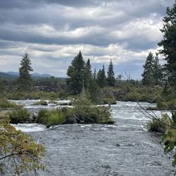
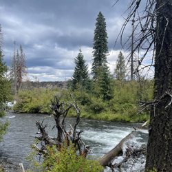
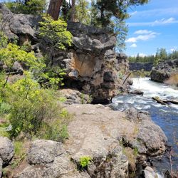
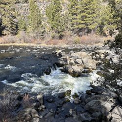
Phil's Trailhead Photos


You might also consider

More like Phil's Trailhead
Recommended Reviews - Phil's Trailhead
Start your review...


Reviews With Photos
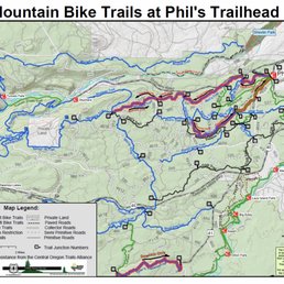

This trailhead leads to a massive network of mountain bike trails that is only five minutes outside of Bend. The facility now has a paved parking lot with restrooms which is new. The skill levels of the trails range from beginner to advanced. I am not going to review each trail on this review but give you an overview of what your options for biking are from this trailhead. The Green (beginner) trails you will find are Kents Trail, KGB Trail, Marvin's Garden Trail, Deschutes River Trail, Larsen Trail, and the Swampy Lakes Trail. The Blue (moderate) trails you will find are Bens Trail, Kents Trail, Storm King Trail, Skyliner Trail, Whoops Trail, Swede Loop Trail, South Fork Trail, Grand Slam Trail, ELV Trail, MTB trail, and Grand Slam. The Black (advanced) trails are the Voodoo Trail, Phil's Trail, and the COD Trail. As you can see there are a large number of trails here to choose from. So Be sure to research for heading out. May favorite loops here are traveling up Bens Trail, up and down the Whoops Trail, and down Phil's Trail. Or up Marvin's Garden Trail, over to KGB Trail, and Down Phil's Trail. These trails are considered multi-use, for biking and hiking. But it's important to note that they are primarily used for biking. So if you are looking for a great trail to hike or jog, you may want to consider other trials when biking is most popular here in the spring and fall. If you don't you may encounter some conflict and near misses out on the trials as people tend to haul some serious but on these trails. There are a few etiquettes out here that many people may not be aware of that are important to take note. Some trails are directional while most are two-way trails. So keep a map with you before heading out to avoid a wreck. Typically the uphill rider has the right of way. So if you see someone struggling uphill just hop over to the side and let them keep their momentum going. If the trail is getting too muddy, you may want to turn your bike around to avoid creating ruts on the trail. We have sensitive dirt out here that is hard to maintain. If someone it right behind you get out and let them pass. These are just a few. If you follow them you should have a pleasant experience. Otherwise, you may encounter some conflict with others out on the trial. Here are a few links to help you understand the rules and social norms for this area. It is worth reading them over to make sure you don't get any tickets and have a smooth experience. Deschutes National Forest https://www.fs.usda.gov/Internet/FSE_DOCUMENTS/stelprd3794824.pdf Central Oregon Trail Alliance (trail directory) http://cotamtb.com/trails/


2 years ago
An absolutely amazing set of bike trails. We rented bikes at Pine mountain sports and brought them here. There were tons of beginners trails that were very well-maintained. I really liked that there were lots of one-way sections, as a beginner it was nice to know that no one was going to come around a corner right into my bike. There is also a ton of signage so I always knew where I was and how to get back to the main parking lot. I can't recommend checking this place out enough!!!! read more


Phil's mountain bike area got me back on a bike after a 4-year sabbatical due to a nasty crash and shoulder surgery and I am so thankful. The network of trails has something to offer everyone from beginner to advanced rider. The blue trails, in particular, are fun and flowy with just enough technical to give you a little challenge and help you advance. I haven't begun to take a deep dive into all the trails but right now my favorite ride at the moment is Marvin's Garden to KGB to the chicken to Kents (blue) to Kents (green). You can grab tons more info at a few more resources online: Deschutes National Forest https://www.fs.usda.gov/Internet/FSE_DOCUMENTS/stelprd3794824.pdf Central Oregon Trail Alliance (trail directory) http://cotamtb.com/trails/ read more


9 years ago
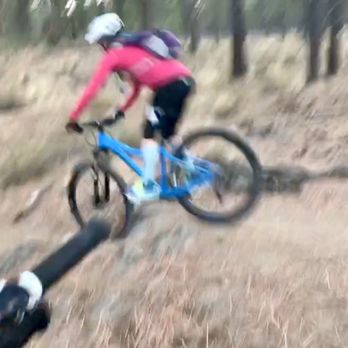
This trailhead leads to a massive network of mountain bike trails that is only five minutes outside of Bend. The facility now has a paved parking lot with restrooms which is new. The skill levels of the trails range from beginner to advanced. I am not going to review each trail on this review but give you an overview of what your options for biking are from this trailhead. The Green (beginner) trails you will find are Kents Trail, KGB Trail, Marvin's Garden Trail, Deschutes River Trail, Larsen Trail, and the Swampy Lakes Trail. The Blue (moderate) trails you will find are Bens Trail, Kents Trail, Storm King Trail, Skyliner Trail, Whoops Trail, Swede Loop Trail, South Fork Trail, Grand Slam Trail, ELV Trail, MTB trail, and Grand Slam. The Black (advanced) trails are the Voodoo Trail, Phil's Trail, and the COD Trail. As you can see there are a large number of trails here to choose from. So Be sure to research for heading out. May favorite loops here are traveling up Bens Trail, up and down the Whoops Trail, and down Phil's Trail. Or up Marvin's Garden Trail, over to KGB Trail, and Down Phil's Trail. These trails are considered multi-use, for biking and hiking. But it's important to note that they are primarily used for biking. So if you are looking for a great trail to hike or jog, you may want to consider other trials when biking is most popular here in the spring and fall. If you don't you may encounter some conflict and near misses out on the trials as people tend to haul some serious but on these trails. There are a few etiquettes out here that many people may not be aware of that are important to take note. Some trails are directional while most are two-way trails. So keep a map with you before heading out to avoid a wreck. Typically the uphill rider has the right of way. So if you see someone struggling uphill just hop over to the side and let them keep their momentum going. If the trail is getting too muddy, you may want to turn your bike around to avoid creating ruts on the trail. We have sensitive dirt out here that is hard to maintain. If someone it right behind you get out and let them pass. These are just a few. If you follow them you should have a pleasant experience. Otherwise, you may encounter some conflict with others out on the trial. Here are a few links to help you understand the rules and social norms for this area. It is worth reading them over to make sure you don't get any tickets and have a smooth experience. Deschutes National Forest https://www.fs.usda.gov/Internet/FSE_DOCUMENTS/stelprd3794824.pdf Central Oregon Trail Alliance (trail directory) http://cotamtb.com/trails/ read more



9 years ago
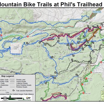
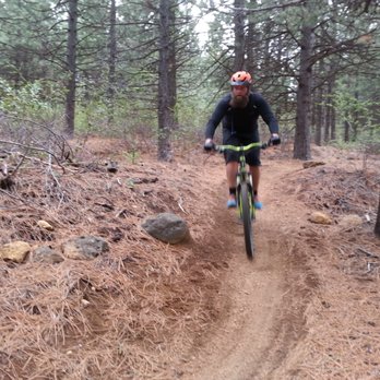
Great variety of trails and skill levels! Phils trail is a great beginner downhill track. There are plenty of other bikers in the summer to help with a flat tire or assist with first aid or water if needed while riding. read more

More info about Phil's Trailhead
Phil's Trailhead
Bend, OR 97701
Directions
Hours
Outdoor Amenities


















Why does Yelp recommend reviews?
1 review that is not currently recommended
The reviews below are not factored into the business's overall star rating.

9 years ago
Phil's Trailhead - mountainbiking - Updated August 2026
Best of Bend
People found Phil's Trailhead by searching for…
Trending Searches in Bend, OR
Barbershop For Men near Phil's Trailhead
Beautiful Views near Phil's Trailhead
Bike Shop near Phil's Trailhead
Cliff Jumping near Phil's Trailhead
Consignment Shops near Phil's Trailhead
Dog Friendly Trails near Phil's Trailhead
Ear Piercing near Phil's Trailhead
Elementary Schools near Phil's Trailhead
Eyebrow Threading near Phil's Trailhead
Flower Fields near Phil's Trailhead
Hair Braiding near Phil's Trailhead
Kids Haircut near Phil's Trailhead
Night Hike near Phil's Trailhead
Off Road Trails near Phil's Trailhead
Outdoor Activities near Phil's Trailhead
Pedicure near Phil's Trailhead
Picnic Areas near Phil's Trailhead
Picnic Spots near Phil's Trailhead
Preschools near Phil's Trailhead
Public Golf Courses near Phil's Trailhead
River Swimming near Phil's Trailhead
Rock Quarry near Phil's Trailhead
Running Trails near Phil's Trailhead
Scenic Overlook near Phil's Trailhead
Sports Card Shops near Phil's Trailhead
Sunrise View near Phil's Trailhead
Swimming Holes near Phil's Trailhead
Trading Card Shops near Phil's Trailhead
Uniforms near Phil's Trailhead
Used Furniture Stores near Phil's Trailhead
Browse Nearby
Browse Brands
Related Searches in Bend, OR
Affordable Bike Repair Services in Bend, Oregon
Affordable Cheap Bike Tune Up Services in Bend, Oregon
Affordable Kayak Rental Services in Bend, Oregon
Affordable Mobile Bike Repair in Bend, Oregon
Best Dirt Bike Riding Spots in Bend, Oregon
Best Dog Hiking Trails Around Bend, Oregon
Best Electric Bike Rental Services in Bend, Oregon
Best Fishing Locations and Guides in Bend, Oregon
Best Places for Horseback Riding in Bend, Oregon
Best Sightseeing Experiences Available in Bend, Oregon
Best Sledding Spots and Fun in Bend, Oregon
Best Waterfalls and Swimming Holes in Bend, Oregon
Check Out Off Road Trails in Bend, Oregon
Discover Dog Friendly Trails to Explore in Bend, Oregon
Discover Lakes & Ponds to Explore in Bend, Oregon
Discover Popular Bike Tours in Bend, Oregon
Discover Scenic Bike Paths in Bend, Oregon
Discover Scenic Mountain Bike Trails Near Bend, Oregon
Discover the Best Night Hike Trails in Bend, Oregon
Dog-Friendly Hikes With Dogs in Bend, Oregon
Enjoy Camping Adventures Around Bend, Oregon
Enjoy Hiking Adventures in Bend, Oregon
Enjoy Kayaking Adventures in Bend, Oregon
Enjoy Off Leash Dog Hikes in Bend, Oregon
Enjoy Tent Camping Spots Around Bend, Oregon
Enjoy Water Activities and Fun in Bend, Oregon
Enjoy the Best Tubing Experiences in Bend, Oregon
Enjoy the Best Walking Path in Bend, Oregon
Enjoy the Best Walking Trails in Bend, Oregon
Exciting Snow Tubing Experiences in Bend, Oregon
Experience Thrilling White Water Rafting in Bend, Oregon
Explore BMX Bike Shops Near Bend, Oregon
Explore Beautiful Parks and Green Spaces in Bend, Oregon
Explore Bike Rentals Throughout Bend, Oregon
Explore Easy Hikes Perfect for All in Bend, Oregon
Explore Electric Bikes Available in Bend, Oregon
Explore Fun Activities to Do in Bend, Oregon
Explore Mountain Bike Rentals Available in Bend, Oregon
Explore Popular Campgrounds Near Bend, Oregon
Explore Popular Scenic Views Near Bend, Oregon
Explore Scenic Lakes to Visit in Bend, Oregon
Explore Top Dog Parks in Bend, Oregon Near You
Explore Top Water Parks in Bend, Oregon Today
Explore the Best Beach Spots in Bend, Oregon
Explore the Best Rock Climbing Areas in Bend, Oregon


