Pleasanton Ridge Regional Park Photos


You might also consider


More like Pleasanton Ridge Regional Park
Recommended Reviews - Pleasanton Ridge Regional Park
Start your review...


Reviews With Photos


Pleasanton Ridge Encompassing 11,614 acres, Pleasanton Ridge Park is one of the largest parks within the East Bay Regional Parks system. It is west of I-680 ranging from Pleasanton to Sunol with trails for hiking, biking and horseback riding in undeveloped open space with great views from the ridgetops. There are three starting points with drinking water and restroom facilities, Castleridge Trailhead with on-street parking, Foothill and Tyler Ranch Staging Areas with parking lots. Our hiking group have hiked from all three trailhead/staging areas and trails are different at each. From Castleridge, the trails had more trees and provided shade from the sun. We saw newts on the trail during our hike. From Foothill, the trails are mostly in the open with no trees. From Tyler Ranch, there were no trees and you were always exposed to the sun. Castleridge and Foothill has an initial climb to about 1,000 ft to the ridgeline trails. From Tyler Ranch, the hike is the steepest in the Park as you reach 2,200 ft to Sunol Peak. The most challenging of the three. A nice large park in the Regional Park system with varying types of hikes based on your starting point.


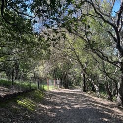
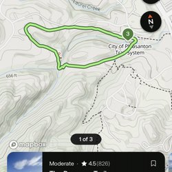
Embarked on a wonderful 8 mile loop hike through this park, and it was such a beautiful little jaunt. This park has a lot of versatility when it comes to the trails. Lots of inclines and steepish hills for those looking for a challenge, and some flatter paths for those who want more of a leisurely hike. It has a mix of shady trails that run through small groves and tons of exposed trails that meander through rolling hills. The viewpoints are pretty sick here too. Whether you prefer city or hillside views, you'll be able to enjoy both at this park. I hiked the Courdet-Shady Creek-Bay Leaf-Ridgeline trail loop and started on the Courdet trail at the Castleridge staging area. Parking is quite limited here. In fact, I arrived really late (around 10 am) and had to park in the nearby residential neighborhood across the street because there was no other parking. Don't be like me; get here earlier if you can. The Courdet trail starts off completely exposed and gradually inclines for the first half mile. After that, the inclines really start to pick up speed. What's nice is that this trail becomes shady as you get higher up. And the higher you get, the better the views are of the city. Once you reach the top of the Courdet trail, you'll reach a trail split where you can go off of on a few other different trails. I connected to the Shady Creek trail which runs alongside Sinbad Creek. Just like its' name, it's completely shaded. It was also super green and full of beautiful ferns. This was my favorite trail to hike in the park. From there, I connected to the Bay Leaf trail which has a mix of both shaded and exposed paths. This trail has some wonderful views of the rolling hills, and it also inclines back up the hill. And finally, I connected to the Ridgeline trail which looped me back to Courdet. The Ridgeline trail was wide, flat, and seemed to be the most popular trail while I was there. There were quite a few mountain bikers but they were courteous for the most part. I hiked this trail in late winter which was perfect because it was super green and the weather was cool. Not sure if I'd attempt this hike in the summer since many of the trails are exposed, but for a wintertime hike, it's perfect. I'd say the park was moderately trafficked, but more so on the popular trails (Ridgeline and Courdet). The Castleridge staging area seems to be easier to get to, so maybe that's why it's more popular than the other staging areas. This was an excellent day hike that had a great mix of trails and terrains. I would love to come back to explore more trails in a different staging area next time.


This is a great hike a breezy comfortable October afternoon. On a blazing hot day, you might have some trouble under the direct sunlight. If you intend on following a particular route you will definitely need a GPS enabled map. This collection of trails resembles a freeway interchange. One minor mistake in merging and you will be on the other side of the park. Signs say watch out for mountain lions, but thankfully I didn't see any. I did see a deer that I would say had definitely seen people before. I'm a geology buff, and there isn't really much easy to access material written on the geology of this area. There are a few interesting outcrops of alternating beds of sandstone / mudstone and shale. There isn't a designated parking lot, but I found plenty of roadside parking. This is definitely one of those places where you do not want to leave anything visible in your car.


Again, my reviews are for the parents that want to trek in strollers. We parked at the Foothill staging area and hit the Thermalito trail. This is not a paved trip so it will be bumpy and dusty. Our Target GT City Go double stroller did just fine. This would probably be a poor trail to hit if it rained a bit ago. It can get sunny and challenging during the incline but I enjoyed that. Remember to bring a hat, sunscreen, and water. There is a huge gravel parking lot so that's a plus. The pathways are actually wide so there is plenty of space to share with bikers and other folks on foot. All in all, we will return


Perfect for short hikes with family on weekends. Parking is easy and the trails are well marked, so I've gone often with friends and family. It takes about 30 minutes to get to the top, then you can walk along the ridge as long as you wish. I love the views of the TriValley to the NorthEast, Sunol to the south and Del Valle lake to the Southeast. On weekends, there are folks on bikes and horses, and many people walk their dogs off-leash. It's easy to lose yourself in the beautiful surroundings, so please be aware of those around you. There are many picnic tables and lots of shady spots with logs you can rest on, just watch out for rattlesnakes sunning themselves before you get too comfortable. We usually take water, a couple of energy bars and fruit in a backpack - just enough for a little energy boost. Can't wait to get back up there next weekend!


Beautiful park! Really enjoyed my time here. The beginning of the hike was a bit strenuous, but evened out after about a mile or so. From the main parking lot, you have a few paths you can choose from, which ultimately take you in a circle. I did see some kids doing this hike (although, they do have more energy), so it's a family-friendly hike. On the way out, had to stop in the middle of the road for turkeys to cross (so exciting!), and passed a llama farm! Excited to come back.


I've been here about three times now. I was actually pleasantly surprised with how nice and strenuous this hike was! Mind you, I did no research on the intensity, I didn't look on All Trails. All I did was a google search of the closet hiking trails near me. I went in with no expectations. After living in the Contra Costa county my entire life I've come to find that really scenic, green hikes are a little farther out of the way and requires a bit of a drive. So going into this hike, I figured this area would be the same. If anything I was expecting brown grass and mostly flat lands. No. This trail starts you off on a pretty steep incline. Which I personally like. I'm not here for an easy walk, I got my boots on so I'm hoping to break a sweat. We didn't have a map, we just kept going. Until mile 3 we asked a lady where she suggests turning back. We reached a pretty high elevation and beautiful rolling hills. We ended up doing about 6 miles and roughly 900 calories burned. Hell of a way to spend a Saturday if ya ask me. We've returned to do the same trail about two more times. I expect this trail to definitely be a regular for us as it's only a 10 minute drive from our new place. Side note: only complaint is the intense mountain bikers who think they own the trail. I ran for my life when someone yelled at me to move from behind me, literally missing me about 3 inches...


I hate to write a review about the Ridge because I don't want anyone to know about our hidden gem in the East Bay. I've been hiking and biking the Ridge for the past 19 years that I've been in NoCal. The hills are moderate and will tighten up those gluteal muscles!


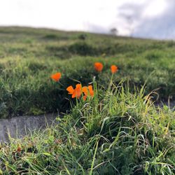
Lovely slice of nature I didn't know existed until a friend suggested we meet at the Ridge. Not much shade making it a hot hike (bring sunscreen)! We started around 6pm and the park was still flooded with families and fellow hikers despite the parking lot being half full. To avoid humans we walked down less trodden path and only ran into a few folks on our way up. During rainy months I'd bet this park is even more lovely with a carpet of green.
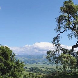

This place is amazing!! Today was my first day hiking this trail -- the location is excellent and close to home, so I was surprised I never actually wandered around this park before. It's so beautiful! There is a lot of uphill so you are guaranteed a good quad workout lol. Happy cows do roam the trails freely, and sometimes block paths, but they are easy going animals and will eventually mooooo-ve out of the way. The area makes it easy to go off the trail as well. Closer to the top, you're greeted with a beautiful view of the tri-valley! I definitely recommend this as a good date hike or a hike to bring kids on. It's a pretty good workout but it's not too difficult to do. Can't wait to come back!
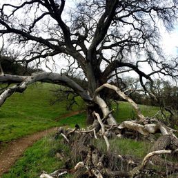

Cool place to hike, deep in the 925 hills. I've only hiked the southern half thus far, so only the stretch that goes from Sunol to Castlewood. The northern part goes from Castlewood to almost Stoneridge Mall in Pleasanton. The hills go straight up, then lots of north/south routes. The Ridge Trail parallels I-680, so the view of the highway and the town of Pleasanton is always in view. If you want to get away from view of hustle and bustle, you have to go more inland to the Thermalito Trail. This is where I'll gravitate towards. Cool Digs: Lots of old oak and lots of olive trees. Lots of olive trees are in groves. The main trails are wide. So you have to share with mountain bikers. Rolling hills so there is always a climb to be had. Climbs also = VIEWS Tips: If you parked on the Foothill lot, you have to be diligent on when to start descending back. There's only a couple of spots to get you back on the trail back. Look for Oak Trail. If you find yourself descending on the back Thermalito Trail, you'll end up in the town of Sunol. So now I just park in the town of Sunol and enter through the Thermalito trail. This way when I'm done, I can grab a lunch or refreshments right in town. This entrance is completely unmarked, no signs telling you where to go, so it has a secret feel to it, which I like. The climbs here start right off the bat. There is no warm up area. Climb first, descend later. You have to want this, to have a good time here. I don't think I would choose to hike here if it were over 70 degrees. Lack of shade with my body temp up from the climb, would make this brutal on direct sun days. But on dry temperate days, it is perfect. I can get a serious work out here.
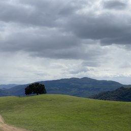

Nice hiking trails. There's different trails throughout park. You got to see and smell the nice mother nature and also some cow shit. You can see cows really close up, so this place is great for family hiking. Good amount of parking space. So far I have been able to find parking on 4 different times when I went.


Wow! What a beautiful time (Jan 2022) of the year to go on a hike in this park! The hills are a vibrant green and the weather is perfect. It took us about 35 minutes to get here from San Jose on the weekend with no traffic. The drive there is nice and once you exit, the drive to the park is a beautiful scenic path. There parking lot is free and has plenty of parking available. Although I could see if getting full from time to time. We did not have an issue this time. The trail we did was Oak Tree Trail to Ridgeline Trail to Olive Grove Trail to Thermalito Trail back to Ridgeline Trail and out to Woodland Trail. All in all the hike was about a 6.9 mile loop. The elevation gain was 1,479 and it took us about 2.5 hours to complete. On these trails, we encountered cows, birds, few coyotes out in the distant fields. You should be careful with the cows as they are fast runner and can charge towards you. We did encounter them walking on the trails at some point and running towards a watering hole so keep an eye out and respect their space. The trails were not very populated at all and most of the time we were alone on it, especially after the 3 mile mark. There is not very much shade on this trail which is why I would say winter and early spring season is the best time to go. There were more shady parts on the second half of the loop. Also on the second half of the hike back, there is a water fountain if you need to re-hydrate and fill up your bottles. The trail is open to bicycles and we did encounter a few but you really have to be fit to maneuver the hills on a bike.
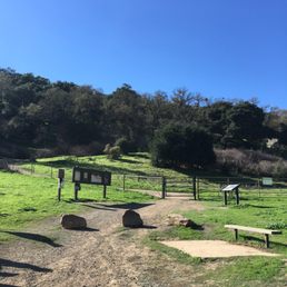

Beautiful park in Pleasanton with over 20 hiking loops/trails according to the hiking app. No shortage of inclines so you're sure to get a good workout in no matter which path you choose. There is plenty of parking and clean restrooms and the trails are marked along the way. read more


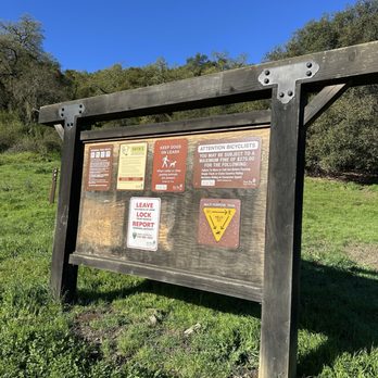


Pleasanton Ridge Encompassing 11,614 acres, Pleasanton Ridge Park is one of the largest parks within the East Bay Regional Parks system. It is west of I-680 ranging from Pleasanton to Sunol with trails for hiking, biking and horseback riding in undeveloped open space with great views from the ridgetops. There are three starting points with drinking water and restroom facilities, Castleridge Trailhead with on-street parking, Foothill and Tyler Ranch Staging Areas with parking lots. Our hiking group have hiked from all three trailhead/staging areas and trails are different at each. From Castleridge, the trails had more trees and provided shade from the sun. We saw newts on the trail during our hike. From Foothill, the trails are mostly in the open with no trees. From Tyler Ranch, there were no trees and you were always exposed to the sun. Castleridge and Foothill has an initial climb to about 1,000 ft to the ridgeline trails. From Tyler Ranch, the hike is the steepest in the Park as you reach 2,200 ft to Sunol Peak. The most challenging of the three. A nice large park in the Regional Park system with varying types of hikes based on your starting point. read more


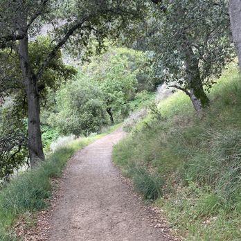


8 months ago

Embarked on a wonderful 8 mile loop hike through this park, and it was such a beautiful little jaunt. This park has a lot of versatility when it comes to the trails. Lots of inclines and steepish hills for those looking for a challenge, and some flatter paths for those who want more of a leisurely hike. It has a mix of shady trails that run through small groves and tons of exposed trails that meander through rolling hills. The viewpoints are pretty sick here too. Whether you prefer city or hillside views, you'll be able to enjoy both at this park. I hiked the Courdet-Shady Creek-Bay Leaf-Ridgeline trail loop and started on the Courdet trail at the Castleridge staging area. Parking is quite limited here. In fact, I arrived really late (around 10 am) and had to park in the nearby residential neighborhood across the street because there was no other parking. Don't be like me; get here earlier if you can. The Courdet trail starts off completely exposed and gradually inclines for the first half mile. After that, the inclines really start to pick up speed. What's nice is that this trail becomes shady as you get higher up. And the higher you get, the better the views are of the city. Once you reach the top of the Courdet trail, you'll reach a trail split where you can go off of on a few other different trails. I connected to the Shady Creek trail which runs alongside Sinbad Creek. Just like its' name, it's completely shaded. It was also super green and full of beautiful ferns. This was my favorite trail to hike in the park. From there, I connected to the Bay Leaf trail which has a mix of both shaded and exposed paths. This trail has some wonderful views of the rolling hills, and it also inclines back up the hill. And finally, I connected to the Ridgeline trail which looped me back to Courdet. The Ridgeline trail was wide, flat, and seemed to be the most popular trail while I was there. There were quite a few mountain bikers but they were courteous for the most part. I hiked this trail in late winter which was perfect because it was super green and the weather was cool. Not sure if I'd attempt this hike in the summer since many of the trails are exposed, but for a wintertime hike, it's perfect. I'd say the park was moderately trafficked, but more so on the popular trails (Ridgeline and Courdet). The Castleridge staging area seems to be easier to get to, so maybe that's why it's more popular than the other staging areas. This was an excellent day hike that had a great mix of trails and terrains. I would love to come back to explore more trails in a different staging area next time. read more

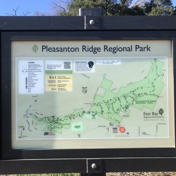

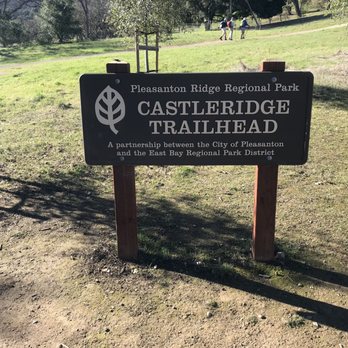


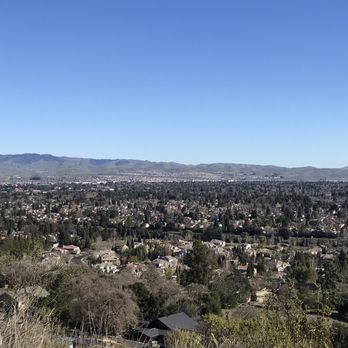


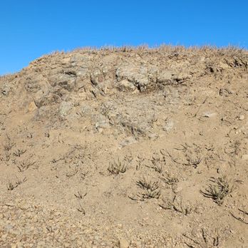
This is a great hike a breezy comfortable October afternoon. On a blazing hot day, you might have some trouble under the direct sunlight. If you intend on following a particular route you will definitely need a GPS enabled map. This collection of trails resembles a freeway interchange. One minor mistake in merging and you will be on the other side of the park. Signs say watch out for mountain lions, but thankfully I didn't see any. I did see a deer that I would say had definitely seen people before. I'm a geology buff, and there isn't really much easy to access material written on the geology of this area. There are a few interesting outcrops of alternating beds of sandstone / mudstone and shale. There isn't a designated parking lot, but I found plenty of roadside parking. This is definitely one of those places where you do not want to leave anything visible in your car. read more
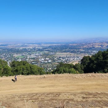


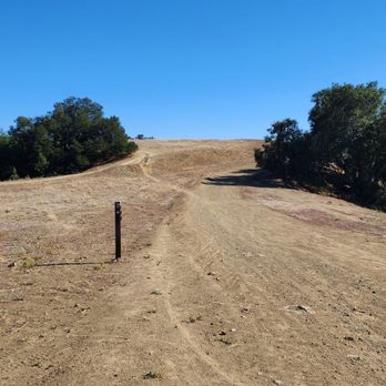



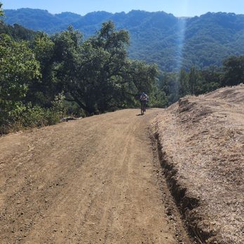

Again, my reviews are for the parents that want to trek in strollers. We parked at the Foothill staging area and hit the Thermalito trail. This is not a paved trip so it will be bumpy and dusty. Our Target GT City Go double stroller did just fine. This would probably be a poor trail to hit if it rained a bit ago. It can get sunny and challenging during the incline but I enjoyed that. Remember to bring a hat, sunscreen, and water. There is a huge gravel parking lot so that's a plus. The pathways are actually wide so there is plenty of space to share with bikers and other folks on foot. All in all, we will return read more


Perfect for short hikes with family on weekends. Parking is easy and the trails are well marked, so I've gone often with friends and family. It takes about 30 minutes to get to the top, then you can walk along the ridge as long as you wish. I love the views of the TriValley to the NorthEast, Sunol to the south and Del Valle lake to the Southeast. On weekends, there are folks on bikes and horses, and many people walk their dogs off-leash. It's easy to lose yourself in the beautiful surroundings, so please be aware of those around you. There are many picnic tables and lots of shady spots with logs you can rest on, just watch out for rattlesnakes sunning themselves before you get too comfortable. We usually take water, a couple of energy bars and fruit in a backpack - just enough for a little energy boost. Can't wait to get back up there next weekend! read more


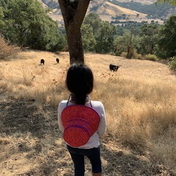


Beautiful park! Really enjoyed my time here. The beginning of the hike was a bit strenuous, but evened out after about a mile or so. From the main parking lot, you have a few paths you can choose from, which ultimately take you in a circle. I did see some kids doing this hike (although, they do have more energy), so it's a family-friendly hike. On the way out, had to stop in the middle of the road for turkeys to cross (so exciting!), and passed a llama farm! Excited to come back. read more



5 years ago


6 years ago
I've been here about three times now. I was actually pleasantly surprised with how nice and strenuous this hike was! Mind you, I did no research on the intensity, I didn't look on All Trails. All I did was a google search of the closet hiking trails near me. I went in with no expectations. After living in the Contra Costa county my entire life I've come to find that really scenic, green hikes are a little farther out of the way and requires a bit of a drive. So going into this hike, I figured this area would be the same. If anything I was expecting brown grass and mostly flat lands. No. This trail starts you off on a pretty steep incline. Which I personally like. I'm not here for an easy walk, I got my boots on so I'm hoping to break a sweat. We didn't have a map, we just kept going. Until mile 3 we asked a lady where she suggests turning back. We reached a pretty high elevation and beautiful rolling hills. We ended up doing about 6 miles and roughly 900 calories burned. Hell of a way to spend a Saturday if ya ask me. We've returned to do the same trail about two more times. I expect this trail to definitely be a regular for us as it's only a 10 minute drive from our new place. Side note: only complaint is the intense mountain bikers who think they own the trail. I ran for my life when someone yelled at me to move from behind me, literally missing me about 3 inches... read more


6 years ago
I hate to write a review about the Ridge because I don't want anyone to know about our hidden gem in the East Bay. I've been hiking and biking the Ridge for the past 19 years that I've been in NoCal. The hills are moderate and will tighten up those gluteal muscles! read more


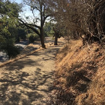

Lovely slice of nature I didn't know existed until a friend suggested we meet at the Ridge. Not much shade making it a hot hike (bring sunscreen)! We started around 6pm and the park was still flooded with families and fellow hikers despite the parking lot being half full. To avoid humans we walked down less trodden path and only ran into a few folks on our way up. During rainy months I'd bet this park is even more lovely with a carpet of green. read more


3 years ago


6 years ago

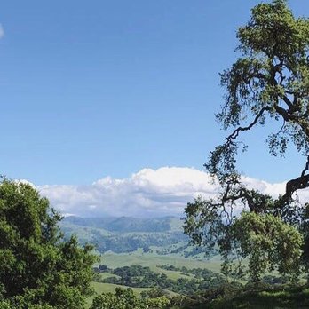
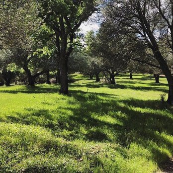
This place is amazing!! Today was my first day hiking this trail -- the location is excellent and close to home, so I was surprised I never actually wandered around this park before. It's so beautiful! There is a lot of uphill so you are guaranteed a good quad workout lol. Happy cows do roam the trails freely, and sometimes block paths, but they are easy going animals and will eventually mooooo-ve out of the way. The area makes it easy to go off the trail as well. Closer to the top, you're greeted with a beautiful view of the tri-valley! I definitely recommend this as a good date hike or a hike to bring kids on. It's a pretty good workout but it's not too difficult to do. Can't wait to come back! read more


7 years ago
Cool place to hike, deep in the 925 hills. I've only hiked the southern half thus far, so only the stretch that goes from Sunol to Castlewood. The northern part goes from Castlewood to almost Stoneridge Mall in Pleasanton. The hills go straight up, then lots of north/south routes. The Ridge Trail parallels I-680, so the view of the highway and the town of Pleasanton is always in view. If you want to get away from view of hustle and bustle, you have to go more inland to the Thermalito Trail. This is where I'll gravitate towards. Cool Digs: Lots of old oak and lots of olive trees. Lots of olive trees are in groves. The main trails are wide. So you have to share with mountain bikers. Rolling hills so there is always a climb to be had. Climbs also = VIEWS Tips: If you parked on the Foothill lot, you have to be diligent on when to start descending back. There's only a couple of spots to get you back on the trail back. Look for Oak Trail. If you find yourself descending on the back Thermalito Trail, you'll end up in the town of Sunol. So now I just park in the town of Sunol and enter through the Thermalito trail. This way when I'm done, I can grab a lunch or refreshments right in town. This entrance is completely unmarked, no signs telling you where to go, so it has a secret feel to it, which I like. The climbs here start right off the bat. There is no warm up area. Climb first, descend later. You have to want this, to have a good time here. I don't think I would choose to hike here if it were over 70 degrees. Lack of shade with my body temp up from the climb, would make this brutal on direct sun days. But on dry temperate days, it is perfect. I can get a serious work out here. read more
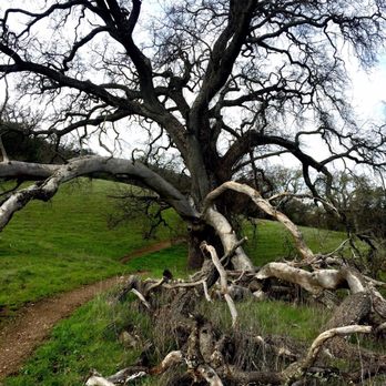
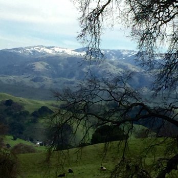
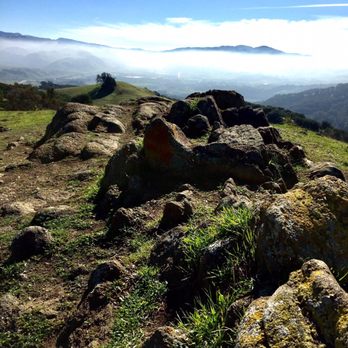


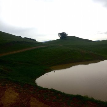


Nice hiking trails. There's different trails throughout park. You got to see and smell the nice mother nature and also some cow shit. You can see cows really close up, so this place is great for family hiking. Good amount of parking space. So far I have been able to find parking on 4 different times when I went. read more
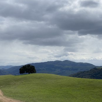


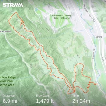
Wow! What a beautiful time (Jan 2022) of the year to go on a hike in this park! The hills are a vibrant green and the weather is perfect. It took us about 35 minutes to get here from San Jose on the weekend with no traffic. The drive there is nice and once you exit, the drive to the park is a beautiful scenic path. There parking lot is free and has plenty of parking available. Although I could see if getting full from time to time. We did not have an issue this time. The trail we did was Oak Tree Trail to Ridgeline Trail to Olive Grove Trail to Thermalito Trail back to Ridgeline Trail and out to Woodland Trail. All in all the hike was about a 6.9 mile loop. The elevation gain was 1,479 and it took us about 2.5 hours to complete. On these trails, we encountered cows, birds, few coyotes out in the distant fields. You should be careful with the cows as they are fast runner and can charge towards you. We did encounter them walking on the trails at some point and running towards a watering hole so keep an eye out and respect their space. The trails were not very populated at all and most of the time we were alone on it, especially after the 3 mile mark. There is not very much shade on this trail which is why I would say winter and early spring season is the best time to go. There were more shady parts on the second half of the loop. Also on the second half of the hike back, there is a water fountain if you need to re-hydrate and fill up your bottles. The trail is open to bicycles and we did encounter a few but you really have to be fit to maneuver the hills on a bike. read more




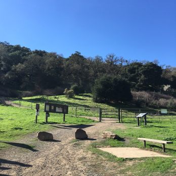
Pleasanton Ridge is an awesome park for a leisurely hike. The staging area has plenty of free parking, a water fountain, restrooms, and wooden benches. Like Las Trampas in San Ramon, the Pleasanton Ridge area is characterized by lots of rolling hills, lots of green, trees, and some very nice views once you climb high enough. In addition, Pleasanton Ridge gets bonus points for me since: 1. Trails are well-maintained, wide, and has much less cow and horse manure than Las Trampas. They have cows here too, but usually far from the trails. 2. Lots of places to rest with shade along with picnic-style benches. 3. For some reason, it seems less dusty on the trails compared to Las Trampas. 4. Water fountains scattered throughout the trails. We took the main trail up to the fork. We elected to go left on the Woodland Trail, which tends to be steeper but shorter. We kept going until we hit the Ridgeline Trail near the top of the ridge, and then turned around to go back down. The Oak Tree trail was a longer, but less steep trail leading back to the parking lot. Definitely recommend coming here for a weekend hike. Watch out for mountain bikers zooming downhill on the trails and that occasional snake on the edge of the trail. read more




5 years ago
One of my favorite hiking places! A beautiful park to go to especially after it rains! The rolling hills are so green and fluffy! There are so many cows along the hiking trail, there were 3 cows in the middle of the hiking trail and was literally within 3 feet of them as I was walking by! The beginning of the hike is a mildly steep incline, but flattens out/rolling hills after about 1 mile. I've been here several times, and will come again. There are also many MANY paths to take - perfect for COVID time if you're worried about bumping into a lot of people/crowds. Parking lot is very big! read more
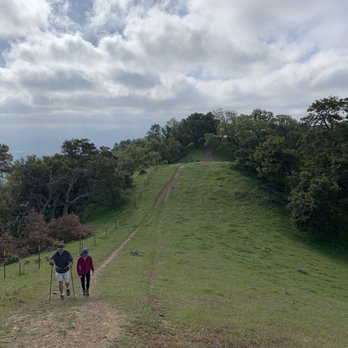


I've been to this park many times. It's a long skinny Park running from north to south. There are several entrances along the way but it's still a long hike to get to the North part of the park. However just recently the East Bay Parks is opened up a new Trailhead called The Castle Ridge Trailhead. This makes it a lot easier to get to the northern portions of the park. I tried it today and it is a well-maintained well done Trail. At the trailhead there is a big restroom as well as lots of parking spaces and a drinking fountain. Well done! read more


8 years ago
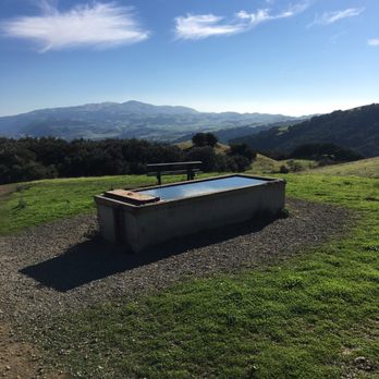
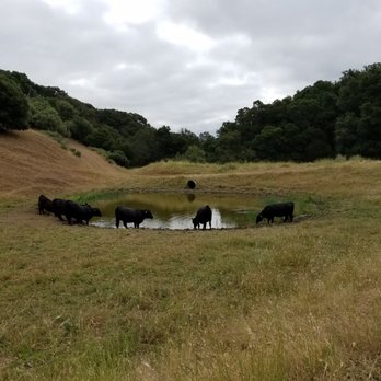
Pleasanton Ridge Regional Park is truly one of my favorite outdoor spaces in Tri-Valley. At the main Foothill staging area, parking is plentiful. The restroom is clean. It's wonderful that another access point into the park is now open to the public. The new Castleridge trailhead offers parking, restroom and water fountain. I like the fact that there are many connector trails with which you can customize your route and go on a different loop every time you come. The trails are well-maintained. Sometimes, I like to head down into the town of Sunol via Thermalito Trail for a lunch break. The Olive Grove was a park within a park. I enjoy walking among these trees which provide great shade and a sense of serenity. There are cows roaming on the hills at times. Just stay out of their way. The Ridgeline Trail goes parallel to Hwy 680 and makes available an expansive view of the city of Pleasanton and beyond. Many people have hiked on this trail but have you ever looked into the water trough here? There are fish in there. How they got there in the first place is a mystery to me. Pleasanton Ridge Regional Park is so easy to get to and never feels crowded. It's a gem! read more


6 years ago

4 years ago

9 years ago
The hike is great and allows dogs! You start off at one parking lot- which is very easily reachable through Google Maps! It's one of the few hikes I've been to that has reception! The parking lots has ample parking so that was not an issue either. The hike has a few hills but nothing is that extreme. There's lots of dogs around and trails. We ended up walking around 5.5 miles, not quite sure which trails we hiked but it's quite easily navigable. Overall, there were some super sunny spots but also shady spots sporadically throughout. Great hike! read more



9 years ago
Another great discovery courtesy of the 2017 East Bay Regional Parks Trails Challenge: http://www.ebparks.org/trailschallenge Pleasanton Ridge has been on my list of parks to try in the East Bay for quite some time and I finally made it here with a friend on a sunny Sunday morning. Arriving at the Foothill Staging Area around 9, the lot was filling up but not entirely full just yet. The featured hike in this year's Trails Challenge is the Woodland Trail to Oak Tree Trail, Sycamore Grove to Meadow Pond Trail and then towards the Ridgeline and Thermalito trails for a full loop back to Woodland. The guide specified 6.03 miles and 1372 feet of elevation gain. Although that doesn't sound like a huge climb, this is "net" gain meaning we went up and down quite a bit on the Ridgeline trail and some of the hills were a bit steep. It's not as challenging as some trails on Las Trampas but harder than my recent hike at Brushy Peak. Coming in March is an ideal time (provided you've let the ground dry out a bit) due to the lush green hills, wildflowers and cooler air. Most of the trails are wide open without shade so wear sunscreen and dress in layers to peel off as the day gets warmer. I really enjoyed the varied terrain this featured loop took us on. We passed bucolic ponds & meadows, docile cattle herds, Olive Tree groves and rocky hillsides in the distance. It was peaceful earlier in the day but towards the later part of the hike, the last stretch back to the lot on the Woodland Trail was quite bottlenecked. Come early and use common sense etiquette on the trails as you share them with bikers and families with small children (we saw quite a few young hikers with their parents on the easier trail sections.) The trail markers and signage are easy to follow, but my friend and I had missed the turn off for Thermalito trail when we got distracted making a wide berth around a group of cows. We ended up taking the Ridgeline trail further than we meant to and added an extra 2 miles to our total hike. That turned a planned 6 mile trek to about 8 but we still did the whole hike in 3.5 hours. Lovely park and I would definitely come back in the spring or cooler weather. 2017 East Bay Regional Parks District Trails Challenge Hike #3 Miles hike on featured hike: 8 Total Miles Hiked on Challenge: 18.08 read more


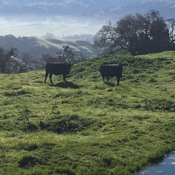


7 years ago
We did the shady creek trail to ridgeline trail loop, which was about 9 miles. It was apparently a modestly used trail. We took the shady creek side to climb up, and there were few slippery slopes near the beginning of the trail on the shady creek side, but the rest was easy with a lot of shade. Overall it was a good hike and we enjoyed it. read more
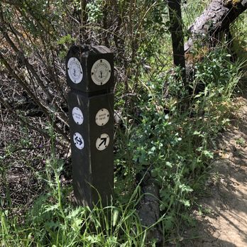


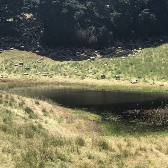


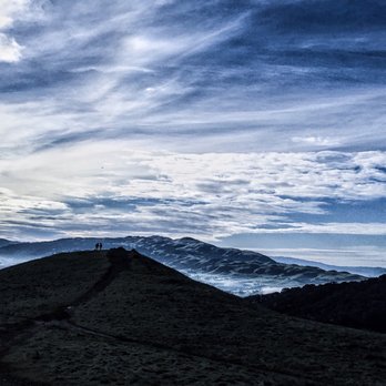
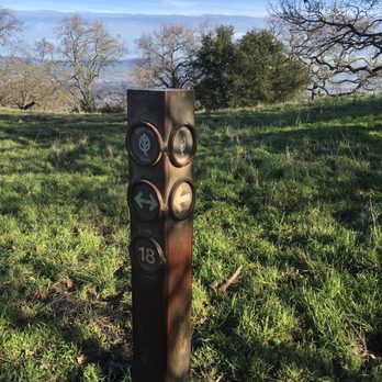
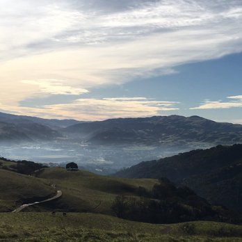
What's not to love? 1. Free parking. 2. Cow sightings close up & personal. 3. A quick getaway niche less than 30 minutes away with glimpses of 680 every now & then. 4. Rainy winter hikes give an Ireland/rom-com 'Leap Year' kind of environment. 5. There's a standalone tree that seriously looks like the one from 'The Ring'. 6. You can make your hike as difficult and as long as you'd like it to be. It's all up to you! 7. Not hard on the knees. 8. Wide trails allow for pet, bike, and run-friendly conditions. Just over 5K in acres, Pleasanton Ridge Reserve Park overlooks Pleasanton & Livermore Valley. From the Foothill Staging Area-Oak Tree Trail-Ridgeline Trail returning on Thermalito Trail-Olive Grove Trail-Oak Tree Trail-Woodland trail, you're able to tackle Pleasanton Ridge in a little over 6 miles round trip in 2.5-3 hours. The trails and posts make excursion ridiculously easy to navigate. If you prefer a switch back ascend over a gradual and lengthy incline, Woodland trail is your calling. If not, Oak Tree trail gets you to the same starting point (5) for Ridgeline trail as Woodland does. Should you want to venture out further, pass (19) towards Main Ridge, loop back on the Sunol Ridge side, and end at Pleasanton Ridge. I'd rate this park between easy & moderate. Oh yeah, watch out for cow dung-they're hard to miss but they're kind of all over the place! read more
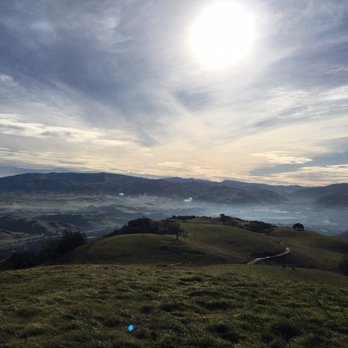



7 years ago
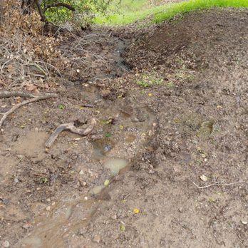
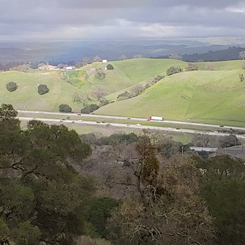
I've been going to Pleasanton Ridge on/off depending on weather. I recently went hiking here thinking all the rain water/mud receeded however I was very wrong!! lol When I realized how BAD the main trail was thing were too late for me to turn back around to hike back down. Instead, I kept hiking up hoping to cut across the midpoint then hike back down the other path hoping the trail there were more solid and stable. I ran into these 2 college guy's which one slipped on a muddy/wet slope as he and his friend climbed up. They asked, "How's the trail coming up from the main way?" I said, "Oh, you don't want to go down that way. lol Basically, I experienced LOTS of mud, wet and my shoes got wet." I asked them, "How was the trail coming up on this one?" Just as I expected, the trail that loop around in 3-4 were solid except I later learned there was a broken tree that fell right between the walking path. As I tried to figure out how to get around this broken tree with my daughter in her jogging stroller because hiking trail was wet, but also steep these 2 guy's (different guy's from before) and their 2 dogs showed up from behind me. As I watched the first guy walked past me with his dog I sort of felt helpless so when the 2nd guy walked past me with his dog I asked, "When you just walked through there did you feel that path felt slippery or too steep?" I said, "I've been trying to figure out how to get down because the guy's I ran into earlier forgot to mention about a broken/fallen tree here. lol The guy I spoke to mentioned the slope was both so he offered to help me and I gratefully accepted!! I still think the two friends and their dogs were meant to be there at the right time and place. The guy I spoke to had offered to push my jogging stroller down to a more solid ground while I held onto my daughter. I thanked both friend's profusely. Of course when I told my husband hours later he felt embarrassed. I know he want me to be more independent and NOT depend on strangers help, but I honestly didn't expect the ridge to be so muddy and wet. I say this is because before my actual hike with my daughter and her jogging stroller we did visit 2 days prior and we walked around which the main trail was dry and solid at the time. Between then and the second time must have rained in between. I wasn't aware how bad it was until thing were a bit too late. I've been to the ridge so many times I think this time around (just few week ago) was just pure bad timing!! I do appreciate those two strangers lending my daughter and I some help. :) My daughter and I haven't been to the Ridge since last week or so. We will wait until April to go back. I used to hike the Ridge with my son when he was younger and we would hike up to the Oak trees as we layed out our picnic blanket and ate subway sandwiches as we enjoyed the beautiful view. hehe Now he prefers to stay home and play Xbox. *shrugs* My girl and I will be back. - Plenty of parking even if it look overly crowded on weekend - Bathroom - Picnic Tables - Provides trail maps and information read more





9 years ago
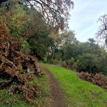
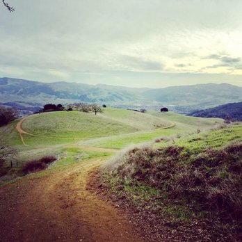
Awesome spot for hiking! We did the 6 mile loop..some spots are a bit of a steep incline but all worth it with the view from the top! read more



6 years ago
The main trails start off with a semi-tough uphill hike. But once you get to the top, the views are amazing! This is a great place to get a good hike in with the family. A great place for photos too! If you are bringing a dog, be careful of some free range cows throughout the ridge. read more


12 years ago


18 years ago
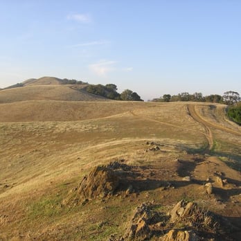
Just when you think you've reached the top, there's another hill to climb. Pleasanton Ridge is located among Castlewood Country Club's golf courses and luxury homes. If you don't already live here you'll probably feel like you're wearing a potato sack. Getting to the park can be a little confusing if you don't have a map. There's a sign out on the main road indicating the park, yet you'll come to an intersection with no further direction. Hint: Make a left before the Castlewood neighborhood. Parking is one part gated, one part non-gated, all parts free. If you park in the gated section be aware that they close at 5 PM. There's also street parking. There are several trails to take yet they mostly intertwine with each other toward one solid direction. The climb is an inclined one. The higher you go, the steeper it gets. Hills will turn into dipping rolling terrain. There's almost no end in sight. If you take your bike you will have fun going down but may regret going up in the first place. If you take on the challenge you will be rewarded with a high altitude perspective. Witnessing the tiny moving traffic and the hazy vista is truly beautiful. Shade is uncommon so pack your sun tan. There are a couple of motionless pools of water that feel bacteria ridden. I spotted a couple of deer, a lot of ground squirrels, and small birds. Olive trees were common in the area as well. Lastly, be wary of big religious group praying near the parking lot. There was a group of 60+ caucasians praying in a nearby field. I had no problem with this but they blocked my car as well as others. At least this gave me the chance to interrupt a 'holy' gathering. Why didn't they just park in the street? ____ A good place to work on your "buns of steel". Some areas look witch infested or like parts of 'The Hills Have Eyes'. Stay on the main path and it won't be that scary. read more


Page 1 of 3
More info about Pleasanton Ridge Regional Park
Foothill Rd
Pleasanton, CA 94588
Directions
(925) 862-2963
Call Now
Visit Website
http://www.ebparks.org/parks/pleasanton
Hours
Indoor Amenities
Outdoor Amenities
Ask the Community - Pleasanton Ridge Regional Park
Is there a place to have bbq in the park?
Anyone know if the park is still open to hike?
Yes. Just went this past weekend (Jan 2022)
Has anyone really seen any tarantulas there?
No, I have not seen turantulas in this park. I have explored this park on only two occasions. Sunol park is very close to Pleasanton Ridge Regional Park, and so if you want info on turantulas at Pleasanton Ridge, you are likely to get much more…
Review Highlights - Pleasanton Ridge Regional Park
You might also consider























Why does Yelp recommend reviews?


Pleasanton Ridge Regional Park - parks - Updated August 2026
Best of Pleasanton
People found Pleasanton Ridge Regional Park by searching for…
Hiking Trails in Pleasanton, CA
Beautiful Views in Pleasanton, CA
Places to Take Pictures in Pleasanton, CA
Scenic Drive in Pleasanton, CA
Swimming Holes in Pleasanton, CA
Watch Sunset in Pleasanton, CA
Fishing Spots in Pleasanton, CA
Public Running Track in Pleasanton, CA
Picnic Areas in Pleasanton, CA
Walking Trails in Pleasanton, CA
Secret Spots in Pleasanton, CA
Sunrise View in Pleasanton, CA
Redwood Trees in Pleasanton, CA
Secluded Spots in Pleasanton, CA
Trending Searches in Pleasanton, CA
Baseball Card Shop near Pleasanton Ridge Regional Park
Bird Sanctuary near Pleasanton Ridge Regional Park
Blueberry Picking near Pleasanton Ridge Regional Park
Cinema near Pleasanton Ridge Regional Park
Cliff Jumping near Pleasanton Ridge Regional Park
Cruising Spots near Pleasanton Ridge Regional Park
Dog Friendly Beaches near Pleasanton Ridge Regional Park
Dog Friendly Things To Do near Pleasanton Ridge Regional Park
Fishing Spots near Pleasanton Ridge Regional Park
Flower Fields near Pleasanton Ridge Regional Park
Fun Things To Do With Kids near Pleasanton Ridge Regional Park
Indoor Dog Park near Pleasanton Ridge Regional Park
Kids Haircut near Pleasanton Ridge Regional Park
Lakes near Pleasanton Ridge Regional Park
Movie Theatre near Pleasanton Ridge Regional Park
Parks near Pleasanton Ridge Regional Park
Peach Picking near Pleasanton Ridge Regional Park
Picnic Areas near Pleasanton Ridge Regional Park
Playgrounds near Pleasanton Ridge Regional Park
Public Beaches near Pleasanton Ridge Regional Park
Public Running Track near Pleasanton Ridge Regional Park
Rock Quarry near Pleasanton Ridge Regional Park
Scenic Drive near Pleasanton Ridge Regional Park
Scenic Night View near Pleasanton Ridge Regional Park
Shopping Malls near Pleasanton Ridge Regional Park
Souvenir Shops near Pleasanton Ridge Regional Park
Sports Card Shops near Pleasanton Ridge Regional Park
Sunrise View near Pleasanton Ridge Regional Park
Swimming Holes near Pleasanton Ridge Regional Park
Things To Do On A Rainy Day near Pleasanton Ridge Regional Park
Trading Card Shops near Pleasanton Ridge Regional Park
Uniforms near Pleasanton Ridge Regional Park
Used Book Stores near Pleasanton Ridge Regional Park
Browse Articles
Browse Nearby
BEST of Pleasanton, California Coffee near Pleasanton Ridge Regional Park
BEST of Pleasanton, California Restaurants near Pleasanton Ridge Regional Park
BEST of Pleasanton, California Things to Do near Pleasanton Ridge Regional Park
BEST of Pleasanton, California Playgrounds near Pleasanton Ridge Regional Park
BEST of Pleasanton, California Breakfast near Pleasanton Ridge Regional Park
BEST of Pleasanton, California Picnic Areas near Pleasanton Ridge Regional Park
BEST of Pleasanton, California Campgrounds near Pleasanton Ridge Regional Park
BEST of Pleasanton, California Restroom near Pleasanton Ridge Regional Park
BEST of Pleasanton, California Motel near Pleasanton Ridge Regional Park
Browse Brands
Related Searches in Pleasanton, CA
Best Dog Hiking Trails Around Pleasanton, California
Best Fishing Locations and Guides in Pleasanton, California
Best Nature Trails for Hiking in Pleasanton, California
Best Off Leash Dog Parks in Pleasanton, California
Best Parks for Parties and Events in Pleasanton, California
Best Places for Horseback Riding in Pleasanton, California
Best Sightseeing Experiences Available in Pleasanton, California
Best Water Parks for Kids in Pleasanton, California
Check Out Great Playgrounds in Pleasanton, California
Check Out Off Road Trails in Pleasanton, California
Discover Baseball Fields Around Pleasanton, California
Discover Dog Friendly Trails to Explore in Pleasanton, California
Discover Easy Hiking Trails Near Pleasanton, California
Discover Fun Toddler Parks in Pleasanton, California for Your Little One
Discover Kid Friendly Hiking Trails in Pleasanton, California
Discover Lakes & Ponds to Explore in Pleasanton, California
Discover Popular Bike Trails in Pleasanton, California
Discover Popular Photo Spots in Pleasanton, California
Discover Scenic Mountain Bike Trails Near Pleasanton, California
Discover Soccer Fields in Pleasanton, California Near You
Discover Top Nature Parks to Visit in Pleasanton, California
Discover Top State Parks to Visit in Pleasanton, California
Discover Walking Parks in Pleasanton, California Near You
Discover a Hiking Trail in Pleasanton, California
Discover the Best Beaches in Pleasanton, California
Discover the Best Kids Park Spots in Pleasanton, California
Discover the Best Night Hike Trails in Pleasanton, California
Dog-Friendly Hikes With Dogs in Pleasanton, California
Enjoy Camping Adventures Around Pleasanton, California
Enjoy Kayaking Adventures in Pleasanton, California
Enjoy Off Leash Dog Hikes in Pleasanton, California
Enjoy Scenic Places to Walk in Pleasanton, California
Enjoy a Beautiful Waterfall Hike in Pleasanton, California
Enjoy the Best Picnic Spots and Ideas in Pleasanton, California
Enjoy the Best Walking Path in Pleasanton, California
Enjoy the Best Walking Trails in Pleasanton, California
Explore Beautiful Parks and Green Spaces in Pleasanton, California
Explore Easy Hikes Perfect for All in Pleasanton, California
Explore Free Picnic Areas Around Pleasanton, California
Explore Fun Activities to Do in Pleasanton, California
Explore Parks With Pull Up Bars in Pleasanton, California
Explore Picnic Parks Near Pleasanton, California
Explore Popular Campgrounds Near Pleasanton, California
Explore Popular Dog Walking Trails in Pleasanton, California
Explore Popular Kids Parks Throughout Pleasanton, California
Explore Popular Picnic Areas Around Pleasanton, California
Explore Popular RV Parks Around Pleasanton, California
People who viewed Pleasanton Ridge Regional Park also viewed

Martin Canyon Creek Trail
51 reviews

Preserve Trail
21 reviews

Summit View Trails
15 reviews

Bishop Ranch Regional Preserve
33 reviews

Tassajara Ridge Staging Area
17 reviews

Sycamore Grove Park
92 reviews

Moller Ranch Trails
3 reviews

Callippe Preserve Trail
6 reviews

Brushy Peak Regional Preserve
70 reviews

Centennial Trail
4 reviews