Point Isabel Regional Shoreline Photos


You might also consider


More like Point Isabel Regional Shoreline
Recommended Reviews - Point Isabel Regional Shoreline
Start your review...


Reviews With Photos


We really like bringing our dog to Point Isabelle, especially when some of the other local places are too busy or crowded. There is lots of parking and it is a great place to take a walk with or without your pup. You get the cool breeze of the bay, plenty on benches and even some shady spots you can plonk down on. There is a snack bar or it's right near Costco if you need something heftier. They have bathrooms for you and potty bags for your 4-legged babies. There are pups to meet and paths to walk and views to take in. What more could you ask for.


What a great place to take your pup for a nice morning stroll. Many dogs go off leash and I do the same for my pup. She has such a great time meeting other dogs and just strolling around sniffing all the different scents. Doggy bags are place all over and there is a water stop at the end of the first stretch. I often stop by for coffeee at the start of the trail. Just in case your doggy jumps into the stream and gets dirty, there is also a convenient doggy wash. Great stroll spot, it usually takes me about an hour.


When Adele sang about "Chasing Pavements", she worried if she should give up instead because if it leads nowhere, it could be a waste of time. At least that's what I was hearing through my Air Pods, when I was walking the paved trail at Point Isabel. It's just past the Costco on Central Avenue where most of the car traffic goes because after all, who doesn't need a gallon of Red Vines and a 36-pack of Muscle Milk? Oh wait, I do need that. However, in my eternal search for trails to trod, this landed on my radar after I walked the Albany Bulb and wondered what laid due north (review: http://bit.ly/2x2hWR2). When I arrived at the circular parking lot, I immediately set on what was quite a dogapalooza with dropping bags available at dispensers along the way. It's well maintained though the view toward the south is sad. It's first the Costco warehouse and then the U.S. Postal Service Bulk Center, but in the other side is the bay. There's a detour you can take into a grassy area where a lot of the canines romp, but my allergies acted up. That's when I made a beeline to the Bay Trail and followed the shoreline until I started seeing suburbs. That's when I turned around and headed back to get my Red Vines and Muscle Milk. RELATED - Up for a hike? Here's a list of local trails I've tried and reviewed: http://bit.ly/2OsCCsK


We very much enjoyed this trail. We were able to see and be near water, nature, and yet have trails for walking. There were separate trails for dogs vs no dogs/ bikes, etc. And we had a nice view the entire time we were walking. There was parking, along with a place for dogs to clean up after a fun day at the dog park. We saw many different birds and felt the calmness of having water nearby when getting in a relaxing walk. My criteria for this type of place typically involves that I am able to have space to walk safely, feeling like nature is nearby, and not feeling unsafe or over crowded. So the shoreline really did fit the bill for me. So many cute dogs, too. I was definitely in my happy place.


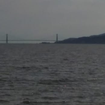
There's no place in California that will ever equal the beauty and friendliness of this dog park. I don't know how many acres it is but it's huge and all the dogs are off leash and they all get along. I rarely ever see a dog fight. There's access to the water for the swimming dogs, there's access to mud for the mudders and there is a group of canals that they've incorporated paths so I can do walk around and see the wildlife. The view from here of San Francisco the Bay Bridge, the Golden Gate Bridge you cannot believe it until you're sitting right here looking at it. I love this place and I always plan to have time just to relax before I go back to the car. Needless to say since it is a dog park, the dog comes with us and she's always very happy to have an adventure with us. read more


We've been Hera handful of times and this park/open area is nice for runners and dog walkers alike. If you start at the parking lot with the Cafe, and walk on the pathway across to the bridge and then the point with the single table/look out, it's .90mi. Since it's by the shore, it's usually pretty windy here, so layer up. Dogs also g in the water, so be aware of the open access to the water. There's 2 sets of restrooms, one by the Cafe/grooming area and another by the bridge. We're definitely coming back here with our puppies. read more

3 years ago
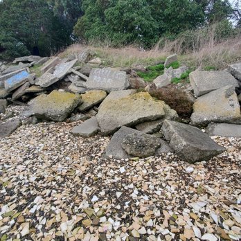
Mainly a dog park for locals, I was most intrigued by the pieces of ceramic dishes scattered throughout what is known as TEPCO beach (located closer to Central Avenue), named after the Technical Porcelain and Chinaware Company, a historical site where pottery rejects from the former El Cerrito factory were dumped. Most shards were tinted in green from being covered in algae due to the high tide. But we found tiny crabs and clam shells mixed in the the rubble, as well as a few people collecting pieces of broken tile and ceramics on higher and dryer ground. It was cool to explore for a little while and learn a bit of history at the same time. Not to mention, the wonderful, peaceful views and atmosphere. The park (including the dog area) was not crowded at all, just a few pups and their humans roaming around minding their own business. And easy to find parking in the lot the day after Christmas. A nice stop on a sunny winter afternoon. read more


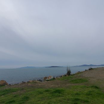



We really like bringing our dog to Point Isabelle, especially when some of the other local places are too busy or crowded. There is lots of parking and it is a great place to take a walk with or without your pup. You get the cool breeze of the bay, plenty on benches and even some shady spots you can plonk down on. There is a snack bar or it's right near Costco if you need something heftier. They have bathrooms for you and potty bags for your 4-legged babies. There are pups to meet and paths to walk and views to take in. What more could you ask for. read more


What a great place to take your pup for a nice morning stroll. Many dogs go off leash and I do the same for my pup. She has such a great time meeting other dogs and just strolling around sniffing all the different scents. Doggy bags are place all over and there is a water stop at the end of the first stretch. I often stop by for coffeee at the start of the trail. Just in case your doggy jumps into the stream and gets dirty, there is also a convenient doggy wash. Great stroll spot, it usually takes me about an hour. read more


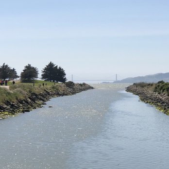
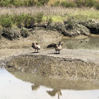
When Adele sang about "Chasing Pavements", she worried if she should give up instead because if it leads nowhere, it could be a waste of time. At least that's what I was hearing through my Air Pods, when I was walking the paved trail at Point Isabel. It's just past the Costco on Central Avenue where most of the car traffic goes because after all, who doesn't need a gallon of Red Vines and a 36-pack of Muscle Milk? Oh wait, I do need that. However, in my eternal search for trails to trod, this landed on my radar after I walked the Albany Bulb and wondered what laid due north (review: http://bit.ly/2x2hWR2). When I arrived at the circular parking lot, I immediately set on what was quite a dogapalooza with dropping bags available at dispensers along the way. It's well maintained though the view toward the south is sad. It's first the Costco warehouse and then the U.S. Postal Service Bulk Center, but in the other side is the bay. There's a detour you can take into a grassy area where a lot of the canines romp, but my allergies acted up. That's when I made a beeline to the Bay Trail and followed the shoreline until I started seeing suburbs. That's when I turned around and headed back to get my Red Vines and Muscle Milk. RELATED - Up for a hike? Here's a list of local trails I've tried and reviewed: http://bit.ly/2OsCCsK read more






7 years ago

We very much enjoyed this trail. We were able to see and be near water, nature, and yet have trails for walking. There were separate trails for dogs vs no dogs/ bikes, etc. And we had a nice view the entire time we were walking. There was parking, along with a place for dogs to clean up after a fun day at the dog park. We saw many different birds and felt the calmness of having water nearby when getting in a relaxing walk. My criteria for this type of place typically involves that I am able to have space to walk safely, feeling like nature is nearby, and not feeling unsafe or over crowded. So the shoreline really did fit the bill for me. So many cute dogs, too. I was definitely in my happy place. read more


Breathtakingly beautiful.. If you have a , you must bring them to Doggie Paradise.. Where the doggies mingle, swim, and sun themselves.. There s great trails and open space for you and your fury friend to kick it!! read more




7 years ago

10 years ago


11 years ago

11 years ago
More info about Point Isabel Regional Shoreline
Ask the Community - Point Isabel Regional Shoreline
Review Highlights - Point Isabel Regional Shoreline
You might also consider





















Why does Yelp recommend reviews?
1 review that is not currently recommended
The reviews below are not factored into the business's overall star rating.

10 years ago
Point Isabel Regional Shoreline - parks - Updated August 2026
Best of Richmond
People found Point Isabel Regional Shoreline by searching for…
Trending Searches in Richmond, CA
Antiques near Point Isabel Regional Shoreline
Barbershop For Men near Point Isabel Regional Shoreline
Bike Shop near Point Isabel Regional Shoreline
Bird Sanctuary near Point Isabel Regional Shoreline
Cliff Jumping near Point Isabel Regional Shoreline
Consignment Shops near Point Isabel Regional Shoreline
Cruising Spots near Point Isabel Regional Shoreline
Dog Friendly Beaches near Point Isabel Regional Shoreline
Dog Friendly Things To Do near Point Isabel Regional Shoreline
Ear Piercing near Point Isabel Regional Shoreline
Eyebrow Threading near Point Isabel Regional Shoreline
Fishing Spots near Point Isabel Regional Shoreline
Flower Fields near Point Isabel Regional Shoreline
Hair Braiding near Point Isabel Regional Shoreline
Kids Haircut near Point Isabel Regional Shoreline
Lakes near Point Isabel Regional Shoreline
Mini Golf near Point Isabel Regional Shoreline
Parks near Point Isabel Regional Shoreline
Pedicure near Point Isabel Regional Shoreline
Permanent Makeup near Point Isabel Regional Shoreline
Picnic Areas near Point Isabel Regional Shoreline
Playgrounds near Point Isabel Regional Shoreline
Public Golf Courses near Point Isabel Regional Shoreline
Public Pools near Point Isabel Regional Shoreline
Public Running Track near Point Isabel Regional Shoreline
Rock Quarry near Point Isabel Regional Shoreline
Scenic Night View near Point Isabel Regional Shoreline
Scenic Overlook near Point Isabel Regional Shoreline
Sunrise View near Point Isabel Regional Shoreline
Swimming Holes near Point Isabel Regional Shoreline
Things To Do With Kids near Point Isabel Regional Shoreline
Trading Card Shops near Point Isabel Regional Shoreline
Used Furniture Stores near Point Isabel Regional Shoreline
Volleyball Courts near Point Isabel Regional Shoreline
Browse Nearby
BEST of Richmond, California Coffee near Point Isabel Regional Shoreline
BEST of Richmond, California Restaurants near Point Isabel Regional Shoreline
BEST of Richmond, California Things to Do near Point Isabel Regional Shoreline
BEST of Richmond, California Breakfast near Point Isabel Regional Shoreline
BEST of Richmond, California Playgrounds near Point Isabel Regional Shoreline
BEST of Richmond, California Picnic Areas near Point Isabel Regional Shoreline
BEST of Richmond, California Star Gazing near Point Isabel Regional Shoreline
BEST of Richmond, California Campgrounds near Point Isabel Regional Shoreline
BEST of Richmond, California Natural Hot Springs near Point Isabel Regional Shoreline
Browse Brands
Related Searches in Richmond, CA
Adventure With River Rafting in Richmond, California
Affordable Canoe Rental Options in Richmond, California
Affordable Kayak Rental Services in Richmond, California
Affordable Paddle Board Rental in Richmond, California
Best Boat Launch Spots in Richmond, California
Best Dog Hiking Trails Around Richmond, California
Best Fishing Locations and Guides in Richmond, California
Best Kayak Rentals for Your Trip in Richmond, California
Best Nature Trails for Hiking in Richmond, California
Best Off Leash Dog Parks in Richmond, California
Best Paddleboard Rentals to Try in Richmond, California
Best Parks for Parties and Events in Richmond, California
Best Places for Horseback Riding in Richmond, California
Best Sightseeing Experiences Available in Richmond, California
Best Water Parks for Kids in Richmond, California
Best Waterfalls and Swimming Holes in Richmond, California
Boat Services and Rentals Available in Richmond, California
Book Exciting Whitewater Rafting Adventures in Richmond, California
Book Kayak Lessons for All Levels in Richmond, California
Check Out Great Playgrounds in Richmond, California
Check Out Off Road Trails in Richmond, California
Discover Baseball Fields Around Richmond, California
Discover Dog Friendly Trails to Explore in Richmond, California
Discover Easy Hiking Trails Near Richmond, California
Discover Fun Toddler Parks in Richmond, California for Your Little One
Discover Kid Friendly Hiking Trails in Richmond, California
Discover Lakes & Ponds to Explore in Richmond, California
Discover Popular Bike Trails in Richmond, California
Discover Popular Photo Spots in Richmond, California
Discover Scenic Mountain Bike Trails Near Richmond, California
Discover Soccer Fields in Richmond, California Near You
Discover Top Boat Rides in Richmond, California
Discover Top Boat Tours in Richmond, California for All Ages
Discover Top Nature Parks to Visit in Richmond, California
Discover Top State Parks to Visit in Richmond, California
Discover Walking Parks in Richmond, California Near You
Discover a Hiking Trail in Richmond, California
Discover the Best Beaches in Richmond, California
Discover the Best Kayak Tour Options in Richmond, California
Discover the Best Kids Park Spots in Richmond, California
Discover the Best Night Hike Trails in Richmond, California
Dog-Friendly Hikes With Dogs in Richmond, California
Enjoy Camping Adventures Around Richmond, California
Enjoy Kayaking Adventures in Richmond, California
Enjoy Lazy River Tubing in Richmond, California
Enjoy Off Leash Dog Hikes in Richmond, California
Enjoy River Tubing Adventures in Richmond, California


