Poly Canyon Trail Photos


You might also consider


More like Poly Canyon Trail
Recommended Reviews - Poly Canyon Trail
Start your review...


Reviews With Photos


Super cute, short and sweet hiking trail located on campus! It's about 1 mile (2 miles RT) from the start of the trail head to the Architectural Graveyard. Pop in and look around; there is a lot of interesting structures and on the day we went, there were some horses hanging out. There isn't much shade but also not much incline either so totally doable for most people. The address tries to make you drive on the fire road/trail which is totally wrong... so come during the weekend, park in lot H4 and walk to the yellow "gates". Don't waste your time driving around like I did. Enjoy!


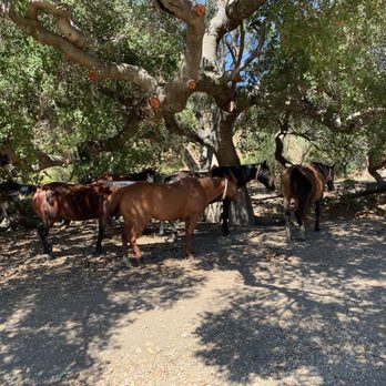
Dragged my girls and dog on this interesting looking hike on vacation on a whim. Parking garage not that close-$6. Does take some time to get to architectural artifacts. But once there greeted my enormous piles of horse poo, then saw many horses cavorting about under the shade of a large tree. One horse in particular took a liking to our golden retriever, much to his alarm since he's never seen a horse before! Unplanned highlight of our central coast trip really.


We went on this fun, easy hike on a Saturday morning with our family and dog. The unique structures are fun to see and there was a mountain bike race going on which we watched for about 1/2 hour. It's real nice back here - wish we had more time to spend just walking around.


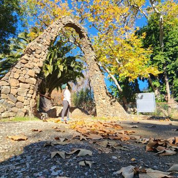
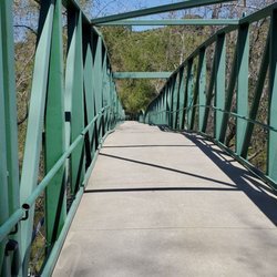
Visiting SLO and my wife heard about this trail. I checked online on how to access...unfortunately the article was from 5 years ago and seemed to be outdated. Make sure you have plenty of time as there is quite a bit to see. We had a little over an hour and weren't able to see everything. We parked at the parking village drive parking garage, which was $10. There are 2 trails that head to the entrance arch shown in the picture..the first we ran across connected to the living quarters as was a narrow trail in the grass leading to the woods. This is a tad more challenging as the other trail is a gravel road with a slight incline and this route is a small path through the woods ( incline, decline, over branches and roots, etc). After about 14 mins it connects the gravel travel. To access from the gravel trail start from the parking garage opposite of the parking garage entrance there is a sidewalk path leading to a bridge, cross the bridge and you'll be on your way. Immediately, we saw some horses wandering around and crossing us on the trail. They were calm and a pleasant surprise. I won't post much of our photos, but there are lots of interesting structures that gave me a burning man feel. Lots of graffiti too, not sure if that is welcome or just vandalism. This was a nice change of pace trail and I would recommend. read more

5 years ago

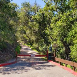
Logistics: - If you're coming on a weekday, make sure to buy a parking permit from the information booth for $5. You can park at the closest lot which is R1 to the trail head. - If you're coming on a weekend, it's free parking and the H1 staff parking is the closest parking lot to the trail head. - If you just want to the architectural graveyard hike, at the fork, hike to the left and you'll get a cool walk around the structures - Trail head is a fire road with a gate, open for pedestrians. This was a fun trail and since SF and I only wanted to see the graveyard, the hike altogether was about 4 miles with some detours. It's not very shaded when you're on the fire road but at the graveyard, you get some shade coverage. Pretty cool hike to go on if you're in SLO for the weekend! read more


6 years ago
Super cute, short and sweet hiking trail located on campus! It's about 1 mile (2 miles RT) from the start of the trail head to the Architectural Graveyard. Pop in and look around; there is a lot of interesting structures and on the day we went, there were some horses hanging out. There isn't much shade but also not much incline either so totally doable for most people. The address tries to make you drive on the fire road/trail which is totally wrong... so come during the weekend, park in lot H4 and walk to the yellow "gates". Don't waste your time driving around like I did. Enjoy! read more


4 years ago
Dragged my girls and dog on this interesting looking hike on vacation on a whim. Parking garage not that close-$6. Does take some time to get to architectural artifacts. But once there greeted my enormous piles of horse poo, then saw many horses cavorting about under the shade of a large tree. One horse in particular took a liking to our golden retriever, much to his alarm since he's never seen a horse before! Unplanned highlight of our central coast trip really. read more


5 years ago
We went on this fun, easy hike on a Saturday morning with our family and dog. The unique structures are fun to see and there was a mountain bike race going on which we watched for about 1/2 hour. It's real nice back here - wish we had more time to spend just walking around. read more


3 years ago


8 years ago


7 years ago

12 years ago
Very nice hiking trail that I was glad to be told about. Starts right next to Cal Poly's Canyon Village. You go just above the river on a pretty wide and well maintained dirt road for about 1-2 miles then get to the architectural graveyard; that's what someone told me it was called, and there are maybe 15 or so interesting monuments/student projects there. Neat little hike, also can ride your mountain bike up too. read more


10 years ago
9 years ago
11 years ago
More info about Poly Canyon Trail
Poly Canyon Rd
San Luis Obispo, CA 93405
Directions
Hours
Outdoor Amenities
Ask the Community - Poly Canyon Trail
Review Highlights - Poly Canyon Trail





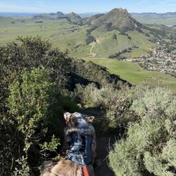



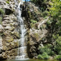
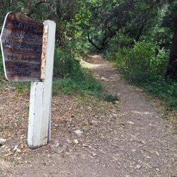




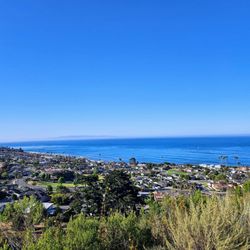











Poly Canyon Trail - hiking - Updated September 2026
Best of San Luis Obispo
People found Poly Canyon Trail by searching for…
Things to Do With Kids in San Luis Obispo, CA
Free Parking in San Luis Obispo, CA
Hiking Trails in San Luis Obispo, CA
Scenic View in San Luis Obispo, CA
Running Trails in San Luis Obispo, CA
Watch Sunset in San Luis Obispo, CA
Dog Friendly Hiking Trails in San Luis Obispo, CA
Off Road Trails in San Luis Obispo, CA
Easy Hikes in San Luis Obispo, CA
Waterfall Hike in San Luis Obispo, CA
Walking Trails in San Luis Obispo, CA
Playgrounds in San Luis Obispo, CA
Parks for Kids in San Luis Obispo, CA
Mountain Biking in San Luis Obispo, CA
Hiking With Kids in San Luis Obispo, CA
Sunset View in San Luis Obispo, CA
Shaded Hike in San Luis Obispo, CA
Scenic Drive in San Luis Obispo, CA
River Walk in San Luis Obispo, CA
Trending Searches in San Luis Obispo, CA
Apple Orchards near Poly Canyon Trail
Apple Picking near Poly Canyon Trail
Archery near Poly Canyon Trail
Barbershop near Poly Canyon Trail
Beautiful Views near Poly Canyon Trail
Blow Dry Bar near Poly Canyon Trail
Corn Maze near Poly Canyon Trail
Dog Friendly Things To Do near Poly Canyon Trail
Dog Swimming near Poly Canyon Trail
Eyelash Extensions near Poly Canyon Trail
Haunted Houses near Poly Canyon Trail
Hidden Gems near Poly Canyon Trail
Hiking Trails near Poly Canyon Trail
Kids Birthday Party near Poly Canyon Trail
Makeup Artists near Poly Canyon Trail
Night View near Poly Canyon Trail
Off Road Trails near Poly Canyon Trail
Outdoor Activities near Poly Canyon Trail
Photo Spots near Poly Canyon Trail
Picnic Areas near Poly Canyon Trail
Places To Take Pictures near Poly Canyon Trail
Private Schools near Poly Canyon Trail
Public Shower near Poly Canyon Trail
Pumpkin Patches near Poly Canyon Trail
Rock Quarry near Poly Canyon Trail
Romantic Activities near Poly Canyon Trail
Scenic Drive near Poly Canyon Trail
Scenic Night View near Poly Canyon Trail
Browse Articles
Browse Nearby
BEST of San Luis Obispo, California Coffee near Poly Canyon Trail
BEST of San Luis Obispo, California Restaurants near Poly Canyon Trail
BEST of San Luis Obispo, California Things to Do near Poly Canyon Trail
BEST of San Luis Obispo, California Breakfast near Poly Canyon Trail
BEST of San Luis Obispo, California Walking Trails near Poly Canyon Trail
BEST of San Luis Obispo, California Parks near Poly Canyon Trail
BEST of San Luis Obispo, California Campgrounds near Poly Canyon Trail
BEST of San Luis Obispo, California Lodging near Poly Canyon Trail
BEST of San Luis Obispo, California Motel near Poly Canyon Trail
Browse Brands
Related Searches in San Luis Obispo, CA
Affordable Canoe Rental Options in San Luis Obispo, California
Affordable Kayak Rental Services in San Luis Obispo, California
Best Dog Hiking Trails Around San Luis Obispo, California
Best Fishing Locations and Guides in San Luis Obispo, California
Best Fun Things to Do in San Luis Obispo, California
Best Places for Horseback Riding in San Luis Obispo, California
Best Places for Stunning Views in San Luis Obispo, California
Best Sightseeing Experiences Available in San Luis Obispo, California
Best Waterfalls and Swimming Holes in San Luis Obispo, California
Best Wood Fired Pizza Available in San Luis Obispo, California
Discover Beautiful Garden Spots in San Luis Obispo, California
Discover Dog Friendly Trails to Explore in San Luis Obispo, California
Discover Easy Hiking Trails Near San Luis Obispo, California
Discover Farm to Table Restaurants in San Luis Obispo, California
Discover Historic Sites and Places in San Luis Obispo, California
Discover Kid Friendly Hiking Trails in San Luis Obispo, California
Discover Popular Bike Trails in San Luis Obispo, California
Discover Popular Landmarks in San Luis Obispo, California
Discover Romantic Activities to Enjoy in San Luis Obispo, California
Discover Scenic Mountain Bike Trails Near San Luis Obispo, California
Discover Top Festivals Happening in San Luis Obispo, California
Discover Top Points of Interest in San Luis Obispo, California
Discover a Hiking Trail in San Luis Obispo, California
Discover a Library Near You in San Luis Obispo, California
Discover the Best Beaches in San Luis Obispo, California
Discover the Best Caves to Explore in San Luis Obispo, California
Discover the Best Dinosaur Park Experiences in San Luis Obispo, California
Discover the Best Night Hike Trails in San Luis Obispo, California
Dog-Friendly Hikes With Dogs in San Luis Obispo, California
Enjoy Authentic Oxtail Soup Near San Luis Obispo, California
Enjoy Camping Adventures Around San Luis Obispo, California
Enjoy Exciting Mountain Biking Adventures in San Luis Obispo, California
Enjoy Kayaking Adventures in San Luis Obispo, California
Enjoy Off Leash Dog Hikes in San Luis Obispo, California
Enjoy Tent Camping Spots Around San Luis Obispo, California
Enjoy a Beautiful Waterfall Hike in San Luis Obispo, California
Enjoy the Best Picnic Spots and Ideas in San Luis Obispo, California
Enjoy the Best Walking Trails in San Luis Obispo, California
Enjoy the Scenic Boardwalk Attractions in San Luis Obispo, California
Experience Stunning Sunset Views in San Luis Obispo, California
Explore Beautiful Botanical Gardens in San Luis Obispo, California
Explore Beautiful Parks and Green Spaces in San Luis Obispo, California
Explore Easy Hikes Perfect for All in San Luis Obispo, California
Explore Free Things to Do Around San Luis Obispo, California
Explore Fun Activities to Do in San Luis Obispo, California
Explore Landmarks & Historical Buildings in San Luis Obispo, California
Explore Popular Campgrounds Near San Luis Obispo, California
Explore Popular View Points Around San Luis Obispo, California
Explore Secret Spots Worth Visiting in San Luis Obispo, California


