Cerro San Luis Trail Photos


You might also consider


More like Cerro San Luis Trail
Recommended Reviews - Cerro San Luis Trail
Start your review...


Reviews With Photos


Beautiful view. Dog-friendly trail, but a lot of people are NOT good about keeping their dogs on leash. Parking lot is good size. Not much shade on the trail so bring a hat!


My husband and I arrived in San Luis Obispo for an evening stop on our road trip across some of California and decided to take in a hike from the Charles A and Mary R Maino Open Space along the Cerro San Luis Trail. Did we get confused and possibly lost (lots of overlapping trails not well marked)? Yes. Was it absolutely stunningly gorgeous? Yes. I wish I lived near this trail - I would keep at it until I knew the trails. It was worth getting a little lost (we were never really lost since we were so uphill from the parking that we always knew which direction our car was parked in) to take in these gorgeous views. I highly recommend taking a hike here. The views are exceptional! (FYI: Google Maps took us to the highway and then said we were there but we took the next exit and the parking was pretty easy to find.)


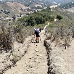
It's steep! I'll need to hike it a couple more times before I bike it! But I'll be back with my bike!


Did this hike and started at the Lemon Grove Trailhead. The signage wasn't so great and the trails tend to split a lot the further you go up. I'd recommend downloading the AllTrails app so that you can use the GPS.


This is a great path for morning trail runs! Cerro has two different trail types depending on what you want to do. The most popular is the "M" trail or mountain trail. If you follow this loop it will lead you to the concrete, white "M" on Cerro San Luis. This trail is uphill, but nothing too steep. To reach the "M" it almost exactly one mile uphill. It is a short beautiful jaunt up the mountain. The best part of this trail is it is a loop, so you never have to retrace your steps. The path down is absolutely beautiful as well, weaving in and out of oak trees. I adore the forest feel of the walk down the mountain especially early in the morning. I love to start my day with this mini hike! The other trail is the lemon grove or if you are on the mountain, you'll see tiny images of cartoon lemons showing you which way to go. This is a popular path with trail runners (like me!) who want a challenge. This path goes up and down tiny hills around the bottom and middle mountain. It leads you through a lemon grove, hence the name. There are a few little paths you can take around the lemon grove, so there is plenty to explore and you have the ability to make it a long or short run depending on how you are feeling. On occasion, you will run into a mountain biker, so make sure your headphones aren't too loud so you can hear them coming to get out of the way. Both trails are well-maintained, but still watch your step (particularly if you are running!) as there are a good amount of rocks. This is one of my favorite trail runs. I always recommend it to my fellow trail runners!


Perfect trail for our last day in SLO. We did the "M" trail which takes you up and you get to see the big "M" that's cemented into the mountain. It's a loop trail so it brings you up and back down with some areas of shade. It took us about an hour and 15 to get through the whole loop going at a leisurely pace. Just watch out for mountain bikers and/or runners. Great view of SLO. Plenty of parking if you get there early and no bathrooms, at least that I could see.


Love this hike - The Lemon Grove Loop trail is great if you just want a quick trail run, while the hike to the summit is a must if you're looking for a ~2 hour hike with sweeping 360 views of the entire city of SLO. Big, wide trails that are shared with mountain bikers (who are few and far between and attach bells to their bikes to warn hikers). The hike can be strenuous if you head out mid-day - be sure to bring water and wear sunscreen, as the trail doesn't see much tree cover. In the late afternoon, there's a refreshing amount of breeze coming in from the ocean. It's about 4 miles round-trip, and took less than 2 hours (we did the trail to the "M," too). This is a great diversion from Bishop's Peak and offers a wider view of the Madonna/Broad part of SLO. The cage at the top stores the generator used for the Christmas tree that tops the mountain in December; it is not some kind of medieval torture device. Hike on. ;-)
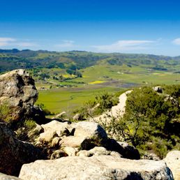

One of my favorite places to hike in SLO County. It's heavily trafficked, but for a good reason. Sweeping views of the city, the distant Pacific on the horizon, calm breezes, multiple trails, and spectacular beauty in a convenient location. Popular access points are the parking lot just off the Marsh St exit and from the dog park at Laguna Park. There are several trails the wind all around the mountain, so you can easily get a 360 degree view of San Luis Obispo. The top offers panoramic views, but you can also go to the Mission Prep "M." With the multiple approaches, you can climb up steeper trails, or meander gently to the top by taking the Lemon Grove Loop.


Get there early so you're not battling for a parking spot! This is usually mistakenly called Madonna Mountain, but don't be fooled by the "M". I would suggest taking the lemon grove trail to the M trail, then wandering your way to the top! The trail offers views of downtown SLO, Laguna lake, Bishops Peak, and so much more! Pro tip: check out this trail in December to see the Christmas tree on top!


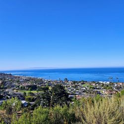
Fantastic hike with gorgeous views of San Luis Obispo and the surrounding area, including a clear view of the Pacific Ocean. I came here late morning on a weekday and the trail wasn't very busy except from a couple of runners and mountain bikers. There are multiple trails and shortcuts but the main trail wil lead you to the summit that will give you a 360 view of the valley. Just stunning. I suggest to hike clockwise to maximize your views. Take plenty of water, slather on sunscreen and bring a snack. There are benches along the way where you can rest and take in the view. It is awesome. A perfect hike for novice hikers and experienced ones.


WONDERFUL HIKE. I did the 6 mile Perimeter loop and absolutely loved it. The view was unreal especially when it started to sprinkle a little bit! It really looked like a rainforest. I'm a beginner hiker and was able to do this; however, the two uphills was a little rough. Hike to the top to see a view of SLO! read more


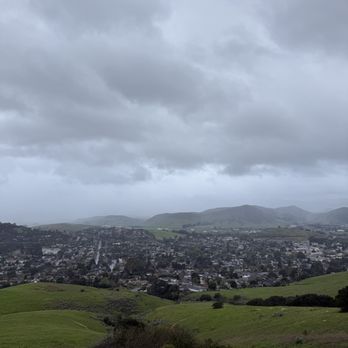


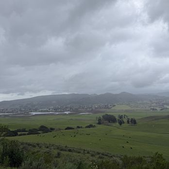
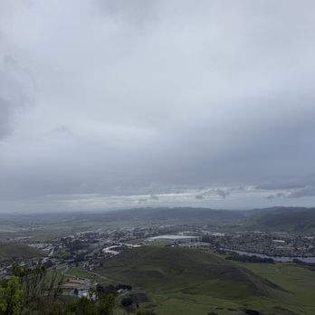


My family and I hiked this trail, The Lemon Grove Loop Trail, during our SLO visit. I initially wanted to hike Bishop Peak, but after looking at the AllTrails app, it appeared that the Bishop Peak hike had a "hard" rating. One of my family members is not a huge hiker so we decided to find a more moderate hike. I'd rate this hike a 3.75/5 on the difficulty scale. We started the hike ~2PM on a Sunday and it wasn't busy at all. We completed the 4-mile hike in ~2 hours. You gain quite a bit of elevation during the hike as my Apple Watch recorded that I had climbed 1,000+ feet. It was sunny for 95% of the trail. There are some steep descent areas so wear proper shoes with adequate traction. There is a designated parking lot. Note, Google Maps initially tried to route us through Private Property by the Madonna Inn. Don't follow that route. read more


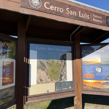


1 year ago
Beautiful view. Dog-friendly trail, but a lot of people are NOT good about keeping their dogs on leash. Parking lot is good size. Not much shade on the trail so bring a hat! read more

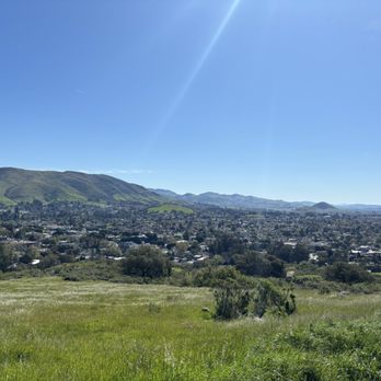

My husband and I arrived in San Luis Obispo for an evening stop on our road trip across some of California and decided to take in a hike from the Charles A and Mary R Maino Open Space along the Cerro San Luis Trail. Did we get confused and possibly lost (lots of overlapping trails not well marked)? Yes. Was it absolutely stunningly gorgeous? Yes. I wish I lived near this trail - I would keep at it until I knew the trails. It was worth getting a little lost (we were never really lost since we were so uphill from the parking that we always knew which direction our car was parked in) to take in these gorgeous views. I highly recommend taking a hike here. The views are exceptional! (FYI: Google Maps took us to the highway and then said we were there but we took the next exit and the parking was pretty easy to find.) read more

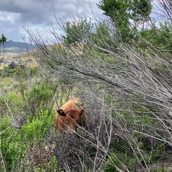


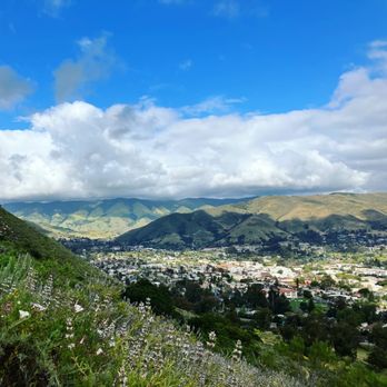
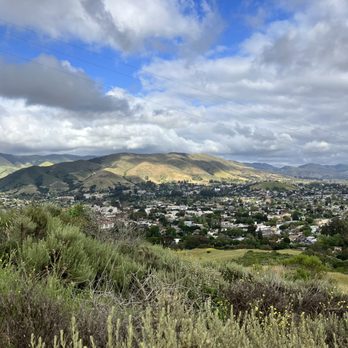
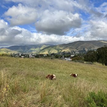

2 years ago
It's steep! I'll need to hike it a couple more times before I bike it! But I'll be back with my bike! read more

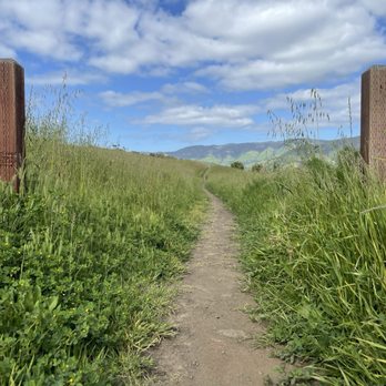

4 years ago
Did this hike and started at the Lemon Grove Trailhead. The signage wasn't so great and the trails tend to split a lot the further you go up. I'd recommend downloading the AllTrails app so that you can use the GPS. read more


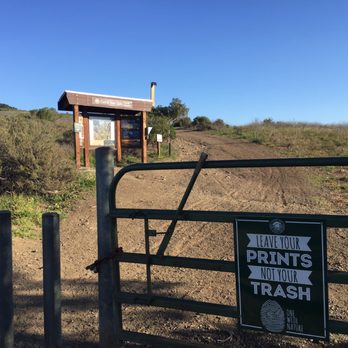


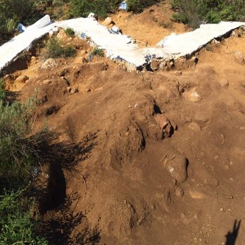

This is a great path for morning trail runs! Cerro has two different trail types depending on what you want to do. The most popular is the "M" trail or mountain trail. If you follow this loop it will lead you to the concrete, white "M" on Cerro San Luis. This trail is uphill, but nothing too steep. To reach the "M" it almost exactly one mile uphill. It is a short beautiful jaunt up the mountain. The best part of this trail is it is a loop, so you never have to retrace your steps. The path down is absolutely beautiful as well, weaving in and out of oak trees. I adore the forest feel of the walk down the mountain especially early in the morning. I love to start my day with this mini hike! The other trail is the lemon grove or if you are on the mountain, you'll see tiny images of cartoon lemons showing you which way to go. This is a popular path with trail runners (like me!) who want a challenge. This path goes up and down tiny hills around the bottom and middle mountain. It leads you through a lemon grove, hence the name. There are a few little paths you can take around the lemon grove, so there is plenty to explore and you have the ability to make it a long or short run depending on how you are feeling. On occasion, you will run into a mountain biker, so make sure your headphones aren't too loud so you can hear them coming to get out of the way. Both trails are well-maintained, but still watch your step (particularly if you are running!) as there are a good amount of rocks. This is one of my favorite trail runs. I always recommend it to my fellow trail runners! read more


Perfect trail for our last day in SLO. We did the "M" trail which takes you up and you get to see the big "M" that's cemented into the mountain. It's a loop trail so it brings you up and back down with some areas of shade. It took us about an hour and 15 to get through the whole loop going at a leisurely pace. Just watch out for mountain bikers and/or runners. Great view of SLO. Plenty of parking if you get there early and no bathrooms, at least that I could see. read more


3 years ago

6 years ago

Love this hike - The Lemon Grove Loop trail is great if you just want a quick trail run, while the hike to the summit is a must if you're looking for a ~2 hour hike with sweeping 360 views of the entire city of SLO. Big, wide trails that are shared with mountain bikers (who are few and far between and attach bells to their bikes to warn hikers). The hike can be strenuous if you head out mid-day - be sure to bring water and wear sunscreen, as the trail doesn't see much tree cover. In the late afternoon, there's a refreshing amount of breeze coming in from the ocean. It's about 4 miles round-trip, and took less than 2 hours (we did the trail to the "M," too). This is a great diversion from Bishop's Peak and offers a wider view of the Madonna/Broad part of SLO. The cage at the top stores the generator used for the Christmas tree that tops the mountain in December; it is not some kind of medieval torture device. Hike on. ;-) read more


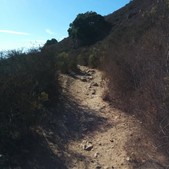
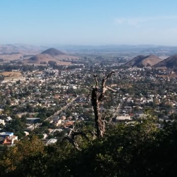



One of my favorite places to hike in SLO County. It's heavily trafficked, but for a good reason. Sweeping views of the city, the distant Pacific on the horizon, calm breezes, multiple trails, and spectacular beauty in a convenient location. Popular access points are the parking lot just off the Marsh St exit and from the dog park at Laguna Park. There are several trails the wind all around the mountain, so you can easily get a 360 degree view of San Luis Obispo. The top offers panoramic views, but you can also go to the Mission Prep "M." With the multiple approaches, you can climb up steeper trails, or meander gently to the top by taking the Lemon Grove Loop. read more


Get there early so you're not battling for a parking spot! This is usually mistakenly called Madonna Mountain, but don't be fooled by the "M". I would suggest taking the lemon grove trail to the M trail, then wandering your way to the top! The trail offers views of downtown SLO, Laguna lake, Bishops Peak, and so much more! Pro tip: check out this trail in December to see the Christmas tree on top! read more


Fantastic hike with gorgeous views of San Luis Obispo and the surrounding area, including a clear view of the Pacific Ocean. I came here late morning on a weekday and the trail wasn't very busy except from a couple of runners and mountain bikers. There are multiple trails and shortcuts but the main trail wil lead you to the summit that will give you a 360 view of the valley. Just stunning. I suggest to hike clockwise to maximize your views. Take plenty of water, slather on sunscreen and bring a snack. There are benches along the way where you can rest and take in the view. It is awesome. A perfect hike for novice hikers and experienced ones. read more


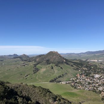

I think I've reviewed Madonna Mountain and I should probably let someone know these are the same place, but I feel like there is a select group of people who know what this place is really called and it's fun to see which group you fall into. Personally, I call it both, ha! But this is my favorite mountain to hike, the secret is not to hike the main route straight up but to find some of the winding trails that take you on a longer route and give you a better workout, and provide better views and terrain variety. Either way, it's a great view at the top, the paths are super wide and this can be made to be as easy or grueling as you want, another bonus. The people I see here are always friendly and parking, unless it's at peak time (Sunday afternoon) is easy to get to and use from the Marsh on ramp side. No complaints, I love this spot. read more


7 years ago

8 years ago

5 years ago


11 years ago


10 years ago
Great view from the top, just don't get lost coming down like I did. It's happened to me three times. There's multiple ways to get down, which will end in different locations. There's Laguna Lake, the entrance near the freeway entrance, several over Chorro, and I believe Foothill. I ended up at Madonna Inn once. It you walk up the road, that winds halfway around the peak, the incline isn't that steep and has great views city, lake, Bishops Peak and Ocean. read more

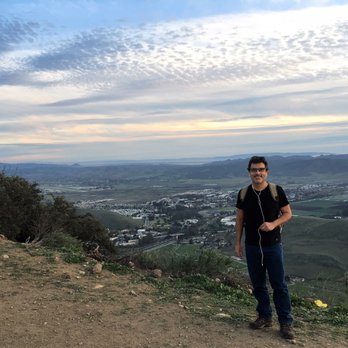


10 years ago
This trail is great for beginners to moderates in terms of hiking. Nice views of SLO from all around. Reviews of nature from here are stunning. Bring some sunblock, water, and a great love for outdoors. read more


11 years ago

8 years ago


11 years ago

10 years ago
More info about Cerro San Luis Trail
1183 Fernandez Rd
San Luis Obispo, CA 93401
Directions
Hours
Outdoor Amenities
Ask the Community - Cerro San Luis Trail
Review Highlights - Cerro San Luis Trail
You might also consider



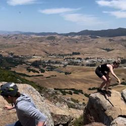
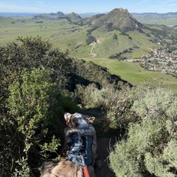



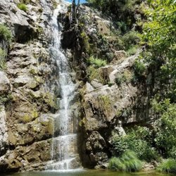
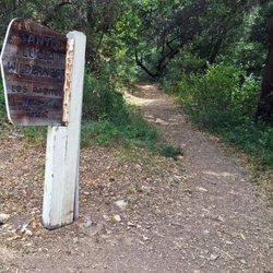




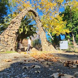




















Cerro San Luis Trail - hiking - Updated August 2026
Best of San Luis Obispo
People found Cerro San Luis Trail by searching for…
Things to Do in San Luis Obispo, CA
Hiking Trails in San Luis Obispo, CA
Walking Trails in San Luis Obispo, CA
Waterfall Hike in San Luis Obispo, CA
Dog Friendly Hiking Trails in San Luis Obispo, CA
View Points in San Luis Obispo, CA
Off Road Trails in San Luis Obispo, CA
Scenic View in San Luis Obispo, CA
Running Trails in San Luis Obispo, CA
Electric Bikes in San Luis Obispo, CA
Dog Friendly Things to Do in San Luis Obispo, CA
Secret Spots in San Luis Obispo, CA
Natural Hot Springs in San Luis Obispo, CA
Night View in San Luis Obispo, CA
Stroller Friendly Hikes in San Luis Obispo, CA
Scenic Drive in San Luis Obispo, CA
Fun Things to Do for a Birthday in San Luis Obispo, CA
Easy Hikes in San Luis Obispo, CA
Hiking Groups in San Luis Obispo, CA
Running Routes in San Luis Obispo, CA
Trending Searches in San Luis Obispo, CA
Baseball Card Shop near Cerro San Luis Trail
Beautiful Views near Cerro San Luis Trail
Bird Sanctuary near Cerro San Luis Trail
Blueberry Picking near Cerro San Luis Trail
Cinema near Cerro San Luis Trail
Cliff Jumping near Cerro San Luis Trail
Cruising Spots near Cerro San Luis Trail
Dog Friendly Things To Do near Cerro San Luis Trail
Flower Fields near Cerro San Luis Trail
Kids Haircut near Cerro San Luis Trail
Lakes near Cerro San Luis Trail
Lookout Points near Cerro San Luis Trail
Movie Theatre near Cerro San Luis Trail
Night Hike near Cerro San Luis Trail
Off Road Trails near Cerro San Luis Trail
Outdoor Activities near Cerro San Luis Trail
Parks near Cerro San Luis Trail
Peach Picking near Cerro San Luis Trail
Picnic Areas near Cerro San Luis Trail
Picnic Spots near Cerro San Luis Trail
River Swimming near Cerro San Luis Trail
Rock Quarry near Cerro San Luis Trail
Scenic Drive near Cerro San Luis Trail
Scenic Night View near Cerro San Luis Trail
Scenic Overlook near Cerro San Luis Trail
Shopping Malls near Cerro San Luis Trail
Souvenir Shops near Cerro San Luis Trail
Sports Card Shops near Cerro San Luis Trail
Sunrise View near Cerro San Luis Trail
Swimming Holes near Cerro San Luis Trail
Things To Do On A Rainy Day near Cerro San Luis Trail
Trading Card Shops near Cerro San Luis Trail
Uniforms near Cerro San Luis Trail
Used Book Stores near Cerro San Luis Trail
Watch Sunset near Cerro San Luis Trail
Browse Nearby
BEST of San Luis Obispo, California Coffee near Cerro San Luis Trail
BEST of San Luis Obispo, California Restaurants near Cerro San Luis Trail
BEST of San Luis Obispo, California Things to Do near Cerro San Luis Trail
BEST of San Luis Obispo, California Breakfast near Cerro San Luis Trail
BEST of San Luis Obispo, California Walking Trails near Cerro San Luis Trail
BEST of San Luis Obispo, California Parks near Cerro San Luis Trail
BEST of San Luis Obispo, California Caves near Cerro San Luis Trail
BEST of San Luis Obispo, California Campgrounds near Cerro San Luis Trail
BEST of San Luis Obispo, California Sightseeing near Cerro San Luis Trail
Browse Brands
Related Searches in San Luis Obispo, CA
Affordable Bike Repair Services in San Luis Obispo, California
Affordable Bike Tune Up Services in San Luis Obispo, California
Affordable Canoe Rental Options in San Luis Obispo, California
Affordable Electric Scooter Rental in San Luis Obispo, California
Affordable Kayak Rental Services in San Luis Obispo, California
Best Dirt Bike Riding Spots in San Luis Obispo, California
Best Dog Hiking Trails Around San Luis Obispo, California
Best Electric Bike Rental Services in San Luis Obispo, California
Best Fishing Locations and Guides in San Luis Obispo, California
Best Places for Horseback Riding in San Luis Obispo, California
Best Sightseeing Experiences Available in San Luis Obispo, California
Best Sledding Spots and Fun in San Luis Obispo, California
Best Used Bikes for Sale Near San Luis Obispo, California
Best Waterfalls and Swimming Holes in San Luis Obispo, California
Check Out Off Road Trails in San Luis Obispo, California
Convenient Bike Sharing Programs in San Luis Obispo, California
Discover Dog Friendly Trails to Explore in San Luis Obispo, California
Discover Easy Hiking Trails Near San Luis Obispo, California
Discover Kid Friendly Hiking Trails in San Luis Obispo, California
Discover Popular Bike Tours in San Luis Obispo, California
Discover Popular Bike Trails in San Luis Obispo, California
Discover Scenic Mountain Bike Trails Near San Luis Obispo, California
Discover a Hiking Trail in San Luis Obispo, California
Discover the Best Night Hike Trails in San Luis Obispo, California
Dog-Friendly Hikes With Dogs in San Luis Obispo, California
Enjoy Biking Adventures Around San Luis Obispo, California
Enjoy Camping Adventures Around San Luis Obispo, California
Enjoy Exciting Mountain Biking Adventures in San Luis Obispo, California
Enjoy Hiking Adventures in San Luis Obispo, California
Enjoy Kayaking Adventures in San Luis Obispo, California
Enjoy Off Leash Dog Hikes in San Luis Obispo, California
Enjoy Scenic Dirt Bike Trails Around San Luis Obispo, California
Enjoy Tent Camping Spots Around San Luis Obispo, California
Enjoy a Beautiful Waterfall Hike in San Luis Obispo, California
Enjoy the Best Picnic Spots and Ideas in San Luis Obispo, California
Enjoy the Best Walking Trails in San Luis Obispo, California
Explore BMX Bike Shops Near San Luis Obispo, California
Explore Beautiful Parks and Green Spaces in San Luis Obispo, California
Explore Bike Rentals Throughout San Luis Obispo, California
Explore Easy Hikes Perfect for All in San Luis Obispo, California
Explore Electric Bikes Available in San Luis Obispo, California
Explore Fun Activities to Do in San Luis Obispo, California
Explore Popular Campgrounds Near San Luis Obispo, California
Explore Popular Scenic Overlook Points in San Luis Obispo, California
Explore Top Dog Parks in San Luis Obispo, California Near You
Explore the Best Beach Spots in San Luis Obispo, California
Explore the Best Rock Climbing Areas in San Luis Obispo, California
Family Friendly Hiking With Kids in San Luis Obispo, California


