Bob Jones Trail Photos


You might also consider


More like Bob Jones Trail
Recommended Reviews - Bob Jones Trail
Start your review...


Reviews With Photos
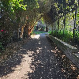

Nice easy paved trail. We have ridden our bikes and there is plenty of room to pass walkers and families. Trail is nicely maintained and clean. Plenty of things to do around the trail area, so be sure and take some time to shop around Avila Beach or cool off by the ocean.


Did the Bob Jones Bike Trail and it was a really nice, easy ride. There were a few people walking but nothing crowded. We started around noon from Sycamore Mineral Springs Spa and Resort and made it to Avila Beach in about 20-25 minutes, going slow just to enjoy the ride. Weather was good and the trail felt safe since you're not riding next to cars like on a regular road. Definitely recommend it if you're in town. Only reason that I don't give it a 5 is because I've done bike trails in Lake Tahoe and some of those are nicer.
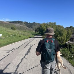

Great trail if you are looking for something easy with kids! The trail is paved so you can also bring or rent bikes. You'll walk right past the Avila Golf Course and straight to the beach! I highly recommend if you're looking for something easier than the other local hikes
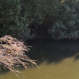

Drive slow, or you will miss the entrace and parking lot. We turned around and parked in the gravel lot. Their is a big sign notify you of trail parking. Parking is free. Easy trail, flat paved road and beautiful scenery. High recommend.


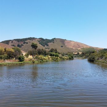
Beautiful trail within walking distance of Avila Beach. We enjoyed the open green space, estuary with numerous birds, pedestrian bridges. We witnessed a majestic eagle perched on a tree. Watch out for bikes!


I'm an avid walker and everywhere I go on vacation ... I have to fit in a walk /hike! This trail was nice!! A bit Over 5 miles! Great walk to stretch my legs after a 2.5 hour drive from SoCal! They even have a little trailer where you can buy a drink.


So for me when I read a review what I really want to know is if the person writing the review will actually go back and do business at this particular location again. Really that's all that matters right? It's either yes I can't wait to come back or no this place is not for me so what's my answer? The answer is ABSOLUTELY YES!! Awesome trail from the city to the beach. If you plan on visiting Avila Beach I would recommend that you consider a nice walk to the beach.
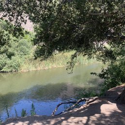

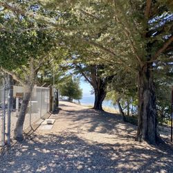
We stopped to ride our E-Bikes along the Bob Jones Trail on our way to Paso Robles & what a surprise it was!!! The paved, tree-lined trail is absolutely breath taking and so enjoyable to ride!! This trail takes you along the San Luis Obispo Creek and also through a beautiful golf course!! We rode to Avila Beach, stopping at Pier Front for a beer & an appetizer (delicious)!! On our ride back we stopped at The Secret Garden (nestled away within the trail)... what a fun place to relax, eat a little something & play a game of corn hole!! Its a really cool spot to check out!!! HIGHLY recommend this trail if you're visiting or passing thru!!!


We walked the trail for only a few miles. We didn't make it all the way to Avila beach because the trail which was shady at first, seemed to have more spots of pure sun once we got to the golf course. We were able to see the Steelhead trout in the stream so that was nice to see. I also could not help but laugh that there was the Sycamore Spa's Secret garden as a pit stop where you could buy alcohol during your walk/bike ride. I think I actually would have enjoyed this trail more on bike. So if you are thinking of giving it a go, I would recommend bikes.


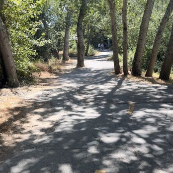
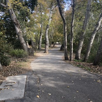
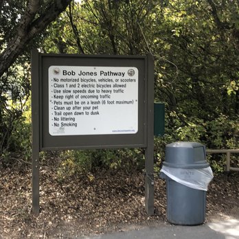
This is a fantastic trail if you are looking for an easy paved walk. I learned about Bob Jones from the signs on the trail. He sounds like a pretty terrific man, anybody that's an environmental pioneer gets a thumbs up in my book. There's so much lush foliage to see as you are walking on this trail, and there are streams and creeks that run along side it as well. It's really just so beautiful. You can take this from the city to the sea, as the sign says. Or you can take it to other trails, which is what I did. I took it to the Sycamore crest Trail which gives you fantastic views of Avila Beach and Avila Valley. The only downside of this is that it is heavily trafficked with people, cyclists, strollers, etc. unless if you get there early enough. But obviously it's going to be heavily trafficked as it really is a terrific walking trail. I'd recommend going mid week, early in the morning.


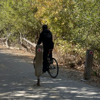
We love Bob Jones Trail. We try to walk it a couple times a month. It's usually busy with bikes, electric bikes, walkers, and runners. It's a great flat surface. Once you past the neighborhood, it opens up to a much larger road where there is plenty of space for everyone. Sometimes it gets a little tight in areas. You also need to pay attention and listen for bikers. Not all of the riders let you know they are behind you and ready to pass. Overall, this is one of the best trails around. It's definitely family friendly. It has a playground halfway. The trail leads to Avila beach and you can't beat the weather.


I enjoy frequenting this trail once or twice a month. Most people are courteous of others. Lots of bikes, scooters, and skaters along the trail. Haven't had a negative experience to date.


Great place. The trails are very easy and well marked. This is a wonderful place to observe birds, animals and plants. My Merlin app identified several interesting and unique birds there


Looked up things to do in Avila Beach and discovered the Bob Jones Trail, glad I did. After staying many times on short getaways in Avila Beach, this was a first. We were staying at the Sycamore Mineral Springs and the trail was just steps away. The path was easy, but as we got towards the end going at a slight incline, and in the full afternoon sun, we looped back to a nice shady spot next to the stream for a respite. We then ventured back to the cafe next to the trail and enjoyed some live music and pizza. read more


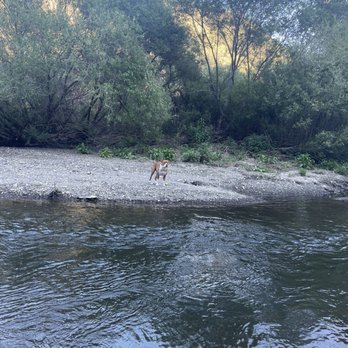
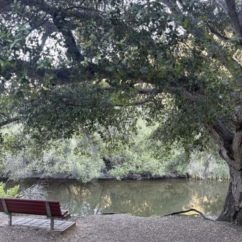

We decided to bring our bikes to take the Bob Jones Trail! We ended up parking along Avila Beach drive where the trail met the golf course and there was a spot to exit to the road. The trail did continue down to the beach, but we didn't want that whole distance for the time we had that day. There were some neat secret spots! A playground with swings, a spot for snacks... So cool! Many families were out and about when we were there, and everyone was respectful of the shared space. read more


Nice easy paved trail. We have ridden our bikes and there is plenty of room to pass walkers and families. Trail is nicely maintained and clean. Plenty of things to do around the trail area, so be sure and take some time to shop around Avila Beach or cool off by the ocean. read more
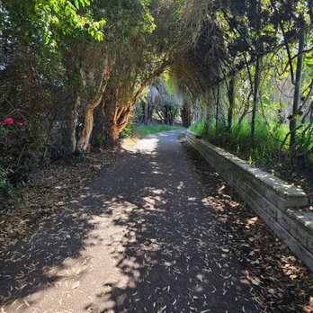


Did the Bob Jones Bike Trail and it was a really nice, easy ride. There were a few people walking but nothing crowded. We started around noon from Sycamore Mineral Springs Spa and Resort and made it to Avila Beach in about 20-25 minutes, going slow just to enjoy the ride. Weather was good and the trail felt safe since you're not riding next to cars like on a regular road. Definitely recommend it if you're in town. Only reason that I don't give it a 5 is because I've done bike trails in Lake Tahoe and some of those are nicer. read more


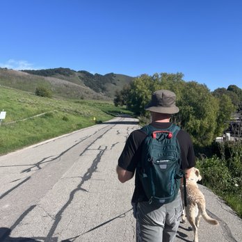
Great trail if you are looking for something easy with kids! The trail is paved so you can also bring or rent bikes. You'll walk right past the Avila Golf Course and straight to the beach! I highly recommend if you're looking for something easier than the other local hikes read more

2 years ago
Drive slow, or you will miss the entrace and parking lot. We turned around and parked in the gravel lot. Their is a big sign notify you of trail parking. Parking is free. Easy trail, flat paved road and beautiful scenery. High recommend. read more
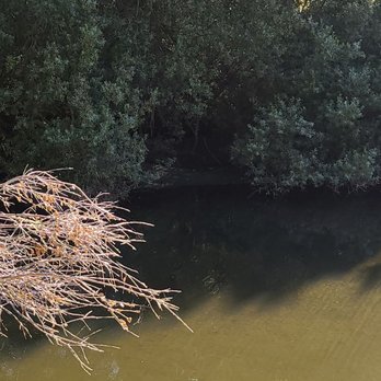


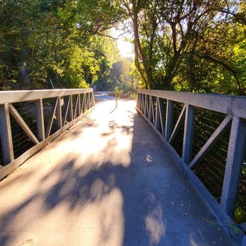


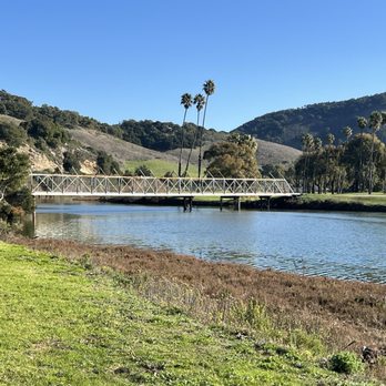

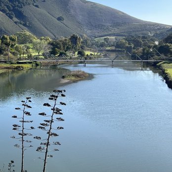
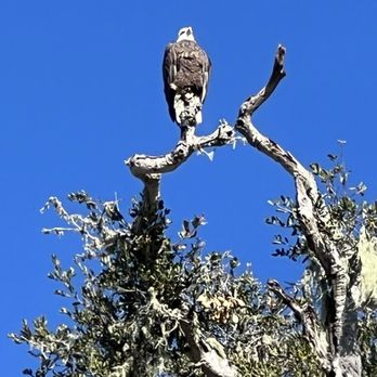


I'm an avid walker and everywhere I go on vacation ... I have to fit in a walk /hike! This trail was nice!! A bit Over 5 miles! Great walk to stretch my legs after a 2.5 hour drive from SoCal! They even have a little trailer where you can buy a drink. read more

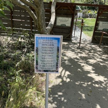
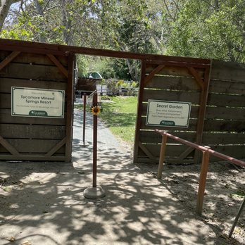
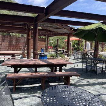

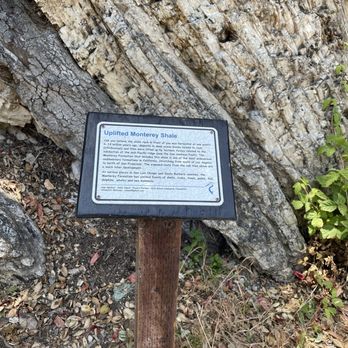


So for me when I read a review what I really want to know is if the person writing the review will actually go back and do business at this particular location again. Really that's all that matters right? It's either yes I can't wait to come back or no this place is not for me so what's my answer? The answer is ABSOLUTELY YES!! Awesome trail from the city to the beach. If you plan on visiting Avila Beach I would recommend that you consider a nice walk to the beach. read more

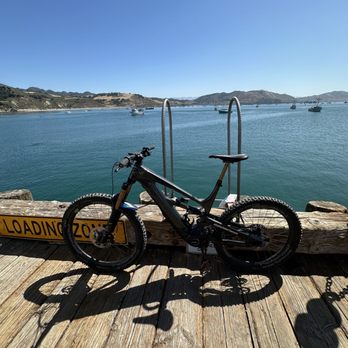


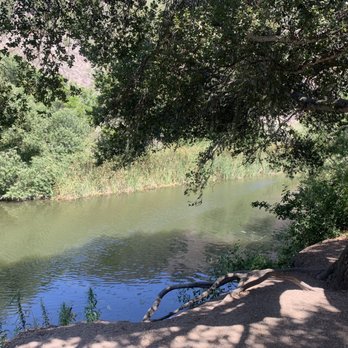
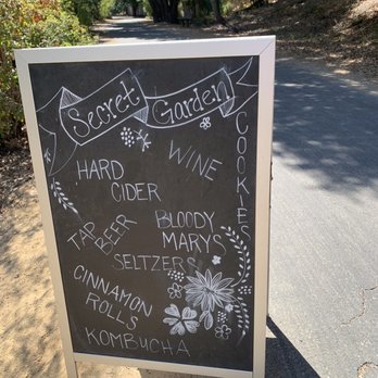
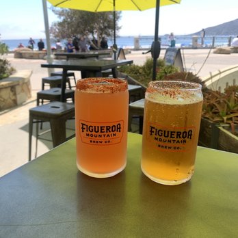
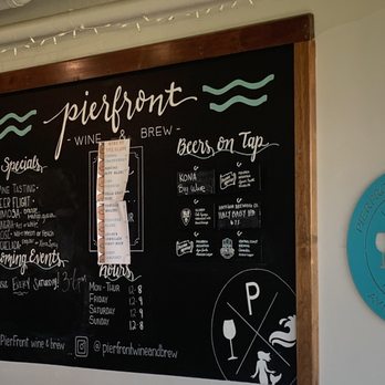
We stopped to ride our E-Bikes along the Bob Jones Trail on our way to Paso Robles & what a surprise it was!!! The paved, tree-lined trail is absolutely breath taking and so enjoyable to ride!! This trail takes you along the San Luis Obispo Creek and also through a beautiful golf course!! We rode to Avila Beach, stopping at Pier Front for a beer & an appetizer (delicious)!! On our ride back we stopped at The Secret Garden (nestled away within the trail)... what a fun place to relax, eat a little something & play a game of corn hole!! Its a really cool spot to check out!!! HIGHLY recommend this trail if you're visiting or passing thru!!! read more




1 year ago

We walked the trail for only a few miles. We didn't make it all the way to Avila beach because the trail which was shady at first, seemed to have more spots of pure sun once we got to the golf course. We were able to see the Steelhead trout in the stream so that was nice to see. I also could not help but laugh that there was the Sycamore Spa's Secret garden as a pit stop where you could buy alcohol during your walk/bike ride. I think I actually would have enjoyed this trail more on bike. So if you are thinking of giving it a go, I would recommend bikes. read more


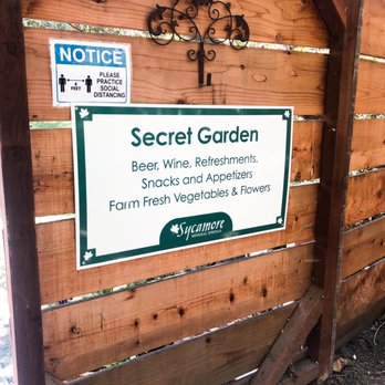

This is a fantastic trail if you are looking for an easy paved walk. I learned about Bob Jones from the signs on the trail. He sounds like a pretty terrific man, anybody that's an environmental pioneer gets a thumbs up in my book. There's so much lush foliage to see as you are walking on this trail, and there are streams and creeks that run along side it as well. It's really just so beautiful. You can take this from the city to the sea, as the sign says. Or you can take it to other trails, which is what I did. I took it to the Sycamore crest Trail which gives you fantastic views of Avila Beach and Avila Valley. The only downside of this is that it is heavily trafficked with people, cyclists, strollers, etc. unless if you get there early enough. But obviously it's going to be heavily trafficked as it really is a terrific walking trail. I'd recommend going mid week, early in the morning. read more

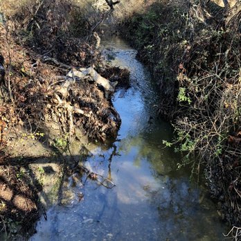


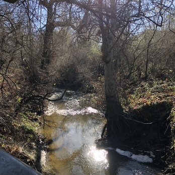


We love Bob Jones Trail. We try to walk it a couple times a month. It's usually busy with bikes, electric bikes, walkers, and runners. It's a great flat surface. Once you past the neighborhood, it opens up to a much larger road where there is plenty of space for everyone. Sometimes it gets a little tight in areas. You also need to pay attention and listen for bikers. Not all of the riders let you know they are behind you and ready to pass. Overall, this is one of the best trails around. It's definitely family friendly. It has a playground halfway. The trail leads to Avila beach and you can't beat the weather. read more


2 years ago
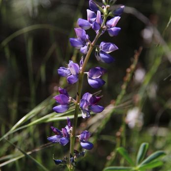
I enjoy frequenting this trail once or twice a month. Most people are courteous of others. Lots of bikes, scooters, and skaters along the trail. Haven't had a negative experience to date. read more




2 years ago

3 years ago
Great place. The trails are very easy and well marked. This is a wonderful place to observe birds, animals and plants. My Merlin app identified several interesting and unique birds there read more


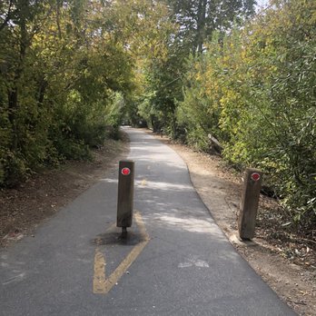
Wonderful trail to walk and bike on. Free parking lot across from trail entrance. Restroom available in parking lot. Bring your hand sanitizer- no hand washing station. Only 1 unisex restroom which is spacious and clean. Trail is paved and lined for biking. The trail is tree lined and luscious. There are sporadic signs along trail with info on Bob Jones as well as the various plants along trail. There's a creek that runs slo g side the trail. About mid way on trail there is a lovely garden area spot that offers snacks as well as beer and other beverages. Tables for relaxing while enjoying your snack/drink. Trail has benches to rest on and plenty of trash cans for pet waste bags etc. Wonderful walk as well as bike riding trail that the entire family can enjoy. Highly recommend. read more


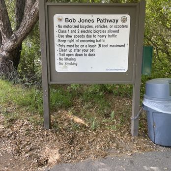


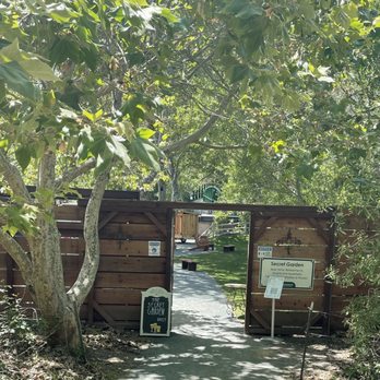

This is truly a wonderful trail and I wish I lived closer. It is very scenic with a lot of greenery and interesting foliage. We routinely stopped to admire a rock formation or a tree or a vista. Highly recommend it if you are in the area. read more


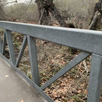
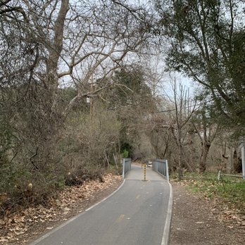


Sooo beautiful! Nice paved walking/bike route that wraps around a golf course, along lots of shaded trees and a couple of places to stop and get a drink and snack! We rented electric bikes and has a blast...a definite highlight of our trip to Avila Beach! read more

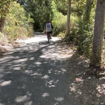

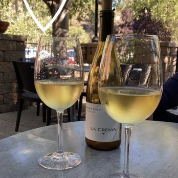


A fun family-friendly trail (walking and bike trail) that's not very stressful. To start from the parking lot to the beach is about a six mile commitment but don't worry it's mostly flat. There are portions where you'll be walking through an oak forest, a golf course, and even through a condo and resort community. The Bob Jones Trail is billed as a bike path, but I'd say there were more walkers than bikers. So don't worry if you're bikeless. Tips - Have a picnic on one of the many tables at Pirate Park right next to the beach.. There's also a bathroom in that park too. - Not a lot of smiles on this trail. One of the least friendly trails I've been on. Not sure if it's because of all the tourists or what. - Restroom in the parking lot. read more




3 years ago

4 years ago

While staying in Pismo we decided to take our fur baby for a nice stroll at Bobs trail. The parking lot is located across the street from the trail. There's also a restroom located at the entrance of the lot. The trail was a bit narrow when passing others (groups of more than 3). But the trail is very easy and great for families, pets, cyclist, skaters, etc. I believe the trail continues to the beach but we stopped shortly after passing a health club. read more


8 years ago
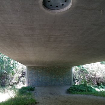
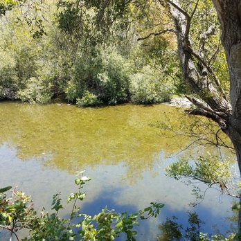
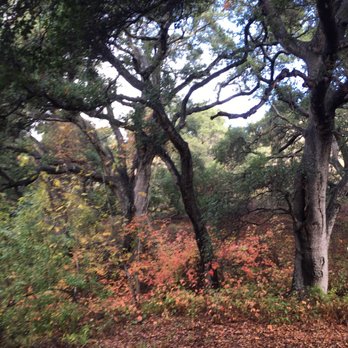
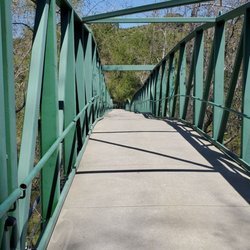
Wow-it's been 7 years since I've been on this trail and revisiting this weekend reminded me how amazing and what a local gem it is. Some has changed in the last several years-last time when I came at 7:45 am, I was the only car in the lot. This time around, there were at least 10 or more other cars. The trail was more bustling but not overly crowded. Parking lot near the trailhead on Ontario road seems to have gotten bigger and there is also now a pit toilet at the start of the trail. I forgot what a scenic walk this is. At the start you've got oaks, fall foliage and lush greenery on both sides. Once you get past the first mile or so, the trail widens as you walk along a creek, then the golf course and eventually the bridges that go over the estuary before it terminates at Avila Beach. This time I made it all the way to the beach and pier, where the trail terminates (across the street from the Central Coast Aquarium.) It's about 5 miles round trip and took me under 2 hours. So many people were out enjoying the trail, even on a drizzly day. This is a short and sweet and scenic paved path. Easy to walk or bike and plenty of nature to enjoy along the way. Definitely will make a point to walk this trail anytime I'm in town. read more


3 years ago


5 years ago


4 years ago

4 years ago
Beautiful trail very easy to walk, can be a little busy on the weekends but most people walking the trail are very kind! Lots for families, couples, and seniors frequent this trail. read more

Page 1 of 4
More info about Bob Jones Trail
7000 Ontario Rd
San Luis Obispo, CA 93405
Directions
(805) 544-9096
Call Now
Hours
Indoor Amenities
Outdoor Amenities
Other Amenities
From the Business
Ask the Community - Bob Jones Trail
What is the name of the hideaway bar on the trail,?
I believe it's The Secret Garden
Review Highlights - Bob Jones Trail
You might also consider






























Why does Yelp recommend reviews?


Bob Jones Trail - hiking - Updated August 2026
Best of San Luis Obispo
People found Bob Jones Trail by searching for…
Hot Springs in San Luis Obispo, CA
Things to Do in San Luis Obispo, CA
Beaches in San Luis Obispo, CA
Hiking Trails in San Luis Obispo, CA
Secret Spots in San Luis Obispo, CA
Flower Fields in San Luis Obispo, CA
Dog Friendly Beaches in San Luis Obispo, CA
Walking Trails in San Luis Obispo, CA
Scenic View in San Luis Obispo, CA
Running Trails in San Luis Obispo, CA
Off Road Trails in San Luis Obispo, CA
Fishing in San Luis Obispo, CA
Picnic Areas in San Luis Obispo, CA
Dog Friendly Hiking Trails in San Luis Obispo, CA
Photo Spots in San Luis Obispo, CA
Playgrounds in San Luis Obispo, CA
Stroller Friendly Hikes in San Luis Obispo, CA
Bike Paths in San Luis Obispo, CA
Fall Colors in San Luis Obispo, CA
Jogging Trails in San Luis Obispo, CA
Trending Searches in San Luis Obispo, CA
Barbershop For Men near Bob Jones Trail
Bike Shop near Bob Jones Trail
Bird Sanctuary near Bob Jones Trail
Cliff Jumping near Bob Jones Trail
Consignment Shops near Bob Jones Trail
Cruising Spots near Bob Jones Trail
Dog Friendly Things To Do near Bob Jones Trail
Ear Piercing near Bob Jones Trail
Eyebrow Threading near Bob Jones Trail
Flower Fields near Bob Jones Trail
Kids Haircut near Bob Jones Trail
Mini Golf near Bob Jones Trail
Permanent Makeup near Bob Jones Trail
Picnic Areas near Bob Jones Trail
Preschools near Bob Jones Trail
Public Golf Courses near Bob Jones Trail
Public Pools near Bob Jones Trail
Rock Quarry near Bob Jones Trail
Scenic Night View near Bob Jones Trail
Scenic Overlook near Bob Jones Trail
Sunrise View near Bob Jones Trail
Swimming Holes near Bob Jones Trail
Trading Card Shops near Bob Jones Trail
Used Furniture Stores near Bob Jones Trail
Browse Articles
Browse Nearby
BEST of San Luis Obispo, California Coffee near Bob Jones Trail
BEST of San Luis Obispo, California Restaurants near Bob Jones Trail
BEST of San Luis Obispo, California Things to Do near Bob Jones Trail
BEST of San Luis Obispo, California Walking Trails near Bob Jones Trail
BEST of San Luis Obispo, California Parks near Bob Jones Trail
BEST of San Luis Obispo, California Breakfast near Bob Jones Trail
BEST of San Luis Obispo, California Campgrounds near Bob Jones Trail
BEST of San Luis Obispo, California Caves near Bob Jones Trail
BEST of San Luis Obispo, California Lodging near Bob Jones Trail
Browse Brands
Related Searches in San Luis Obispo, CA
Affordable Canoe Rental Options in San Luis Obispo, California
Affordable Kayak Rental Services in San Luis Obispo, California
Best Dog Hiking Trails Around San Luis Obispo, California
Best Fishing Locations and Guides in San Luis Obispo, California
Best Places for Horseback Riding in San Luis Obispo, California
Best Sightseeing Experiences Available in San Luis Obispo, California
Best Waterfalls and Swimming Holes in San Luis Obispo, California
Discover Dog Friendly Trails to Explore in San Luis Obispo, California
Discover Easy Hiking Trails Near San Luis Obispo, California
Discover Kid Friendly Hiking Trails in San Luis Obispo, California
Discover Popular Bike Trails in San Luis Obispo, California
Discover Scenic Mountain Bike Trails Near San Luis Obispo, California
Discover a Hiking Trail in San Luis Obispo, California
Discover the Best Night Hike Trails in San Luis Obispo, California
Dog-Friendly Hikes With Dogs in San Luis Obispo, California
Enjoy Camping Adventures Around San Luis Obispo, California
Enjoy Exciting Mountain Biking Adventures in San Luis Obispo, California
Enjoy Kayaking Adventures in San Luis Obispo, California
Enjoy Off Leash Dog Hikes in San Luis Obispo, California
Enjoy Tent Camping Spots Around San Luis Obispo, California
Enjoy a Beautiful Waterfall Hike in San Luis Obispo, California
Enjoy the Best Picnic Spots and Ideas in San Luis Obispo, California
Enjoy the Best Walking Trails in San Luis Obispo, California
Explore Beautiful Parks and Green Spaces in San Luis Obispo, California
Explore Easy Hikes Perfect for All in San Luis Obispo, California
Explore Fun Activities to Do in San Luis Obispo, California
Explore Popular Campgrounds Near San Luis Obispo, California
Explore Top Dog Parks in San Luis Obispo, California Near You
Explore the Best Beach Spots in San Luis Obispo, California
Family Friendly Hiking With Kids in San Luis Obispo, California
Find Fun Kids Activities Outdoor in San Luis Obispo, California
Find Parks and Recreation Activities in San Luis Obispo, California
Find Popular Ziplining Spots Around San Luis Obispo, California
Find the Best Playgrounds to Visit in San Luis Obispo, California
Hiking Trails With Waterfalls in San Luis Obispo, California
Off Leash Dog Hiking Trails in San Luis Obispo, California
Picnic Areas With BBQ Pits Available in San Luis Obispo, California
Popular Outdoor Activities to Try in San Luis Obispo, California
Popular Picnic Spots to Visit in San Luis Obispo, California
Safe River Swimming Areas in San Luis Obispo, California
Safe and Fun Parks for Kids in San Luis Obispo, California
Top Hiking Trails to Explore in San Luis Obispo, California
Top Playgrounds for Kids to Enjoy in San Luis Obispo, California
Top Running Trails to Explore in San Luis Obispo, California
Top Swimming Spots and Pools in San Luis Obispo, California
Top Things to Do With Kids in San Luis Obispo, California
Top-Rated Camping Sites in San Luis Obispo, California
Walk Dog Friendly Hiking Trails in San Luis Obispo, California


